Red Mountain
Friends: Only God!Location: Red Mountain
Elevation gain: 0m = 0m
- Elevation gain: 3000 feet
- Miles: 6 round trip
- Total time: 5 hours round trip
Jake and I planned to climb Mt. St. Helens today but due to unforeseen circumstances he had to stay up all night. I was thinking of something else to do, and I knew that Kris needed the car around noon. The idea of colouirs on the north side of Lane Peak had me excited, but since the road to Paradise might not open until some horribly late hour, I should save that for later. I really wanted to climb Chair Peak, but I wasn't going to attempt it alone. So, I decided to climb Red Mountain, which I'd heard has a long steep snow slope that is fun in good conditions. (does everyone have such an involved, tedious story about how they ended up here or there in the wilds?)
Guye Peak from the Northeast
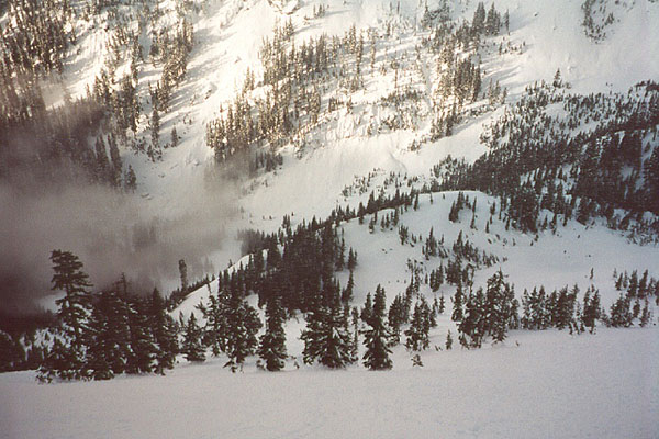
Parking at the deserted Summit ski area, I marched up a hard packed trail in the pre-dawn, alone with my thoughts. It was a little warmer than I would have liked - there was no frozen crust over the snow, and the valley was fogged in for the duration of my visit. I had brought two ice tools, which was definitely overkill for this climb. Without being able to see through the fog, I had to chose among diverging packed trail by intuition. It was easy following the trail in the level (and very pretty in the morning) Commonwealth Basin, but I knew I'd have to climb more steeply to get to the lake below Red Mountain. I chose a leftward branch, then a right branch. But the right branch descended then climbed a gully that disappeared into the fog. I decided to stick with the left branch because it felt "right." But the tracks were made before the last snowfall, so I had to begin working for my summit here! I meandered up a steep ridge, then crossed an avalanche slope to the left, hurrying to the trees on the other side. Snowshoes were a necessity here. Finally, the tracks became ski and snowboard descent paths, so I continued up a fairly open slope peppered with avalanche debris. I was constantly checking the stability of the snow, and never found anything to be nervous about, until near the summit.
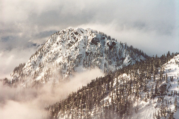
Along in here, I still wasn't sure if I was climbing Red Mountain, or had mistakenly gone too far west to the slopes of Lundin Peak. The clouds would lift occasionally to reveal a craggy mountain that I didn't think could be Red. Also, Cave Ridge and Guye Peak looked really close, and that seemed wrong. It was only as I made my way slowly higher, and got more distant glimpses, that I knew I was in the right place. Finally I could see Lundin and the little basin below it. There were several inches of snow over a firm crust, and as the slopes topped 40 degrees in angle, I took off my snowshoes and left them by a tree. It was easier to kick steps, and I connected the tree "dots" as the ridge became steeper and more defined. My favorite part of the climb was a 50 degree section that felt very exposed, and when I had a great view of Lundin and Snoqualmie Peaks. The slopes on either side of me looked very steep and desolate. I guess it would look the same if someone was over there looking at me. Wow...
Saddle and pond below summit
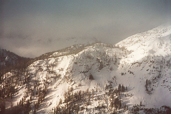
Cave Ridge and Snoqualmie Mountain
The wind increased, and lots of snow blew onto the ridge from the east. I realized this could present an avalanche problem. The slope was composed of wind-packed snow, apparently brought here by this same process. It was stable, but I didn't want to linger too long on the summit. I traversed to avoid some rock outcrops, and soon stood on the summit in a maelstrom of wind, cloud and snow. The summit has a huge cornice of snow hanging over the north slopes, and it is important not to venture onto this. I got as close as I dared and turned around. Getting down to an area protected by the wind was almost comical. My glasses became a hindrance as I carefully down-climbed. Now facing into the wind, particles of ice and snow would get behind the lenses and fog them up. I finally took them off. Still, I went by feel for a while, knowing where I was only by having previous ice ax placements inches from my face so I could see them. The rest of the trip down to the snowshoes, then the valley bottom was uneventful, although the skies cleared further. There was a good view of the slopes of Kendall Mountain. On the way back down the valley, I spied a great looking ice climb, not yet fully formed, and still running water. It was protected by the usual avalanche danger, as evidenced by broken chunks at the base of the climb. I said hello to many snowshoers out with their dogs, and marveled at the crowds on the ski slopes near the car.
This is a very enjoyable climb, but don't bother going in unless you are pretty sure snow conditions are good. Even with good snow, there is plenty of uncertainty about avalanche danger on this mountain.