Fasul Valley Deathmarch
Friends: JosefLocation: Darmstädter Hütte
Elevation gain: 0m = 0m
Josef and I wanted to go climbing, and supposedly had a decent forecast. I was eager to explore the Verwall Range, south of St. Anton, which is a famous ski resort in Austria. I had naively picked out the Kuchen Spitze which has a Grade VI 20 pitch north face climb. Sounds awesome! In reality, there are only a couple of grade VI pitches, mostly it's easier.
But Josef pointed out how incredibly cold and snowy it would be. Still trying to be ambitious, I proposed the mountain next door, Patteriol, via it's Grade IV northeast ridge. Okay, 25 pitches, but about half of them really shouldn't be called "pitches" at all (just grade II scrambling). All of this wrangling was rendered moot though when we drove into heavy rain falling in St. Anton!
So we decided to go on a hike instead. I have a 50,000 scale map of the area, and I picked out a nice looking loop hike. It looked long and exciting. We pulled all the climbing gear out of our packs. Then I forgot to bring the sandwich I bought at a gas station.
We drove up a road from St. Anton about 4 kilometers, then rode our bikes from the Verwall See to the Konstanzer Hut (1688 m). Man, biking up steep hills is HARD! At least it quit raining right when we started pedaling.
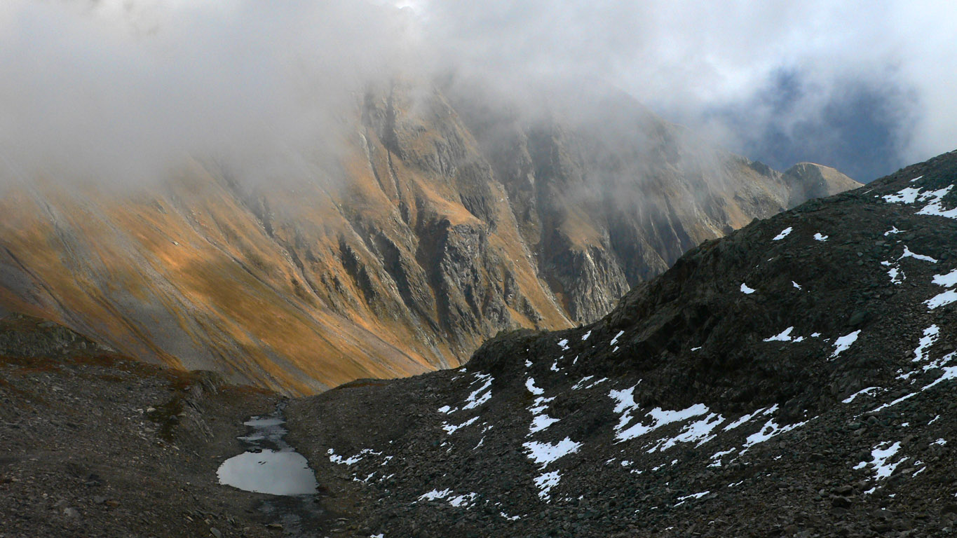
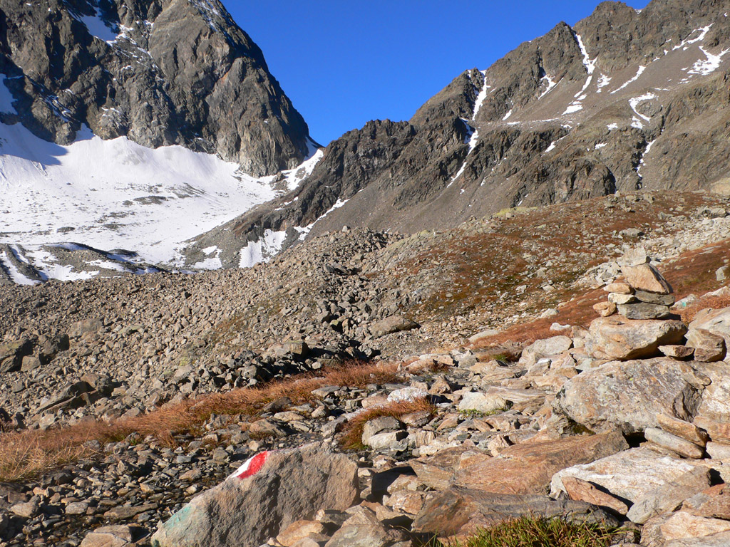
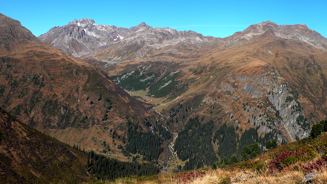
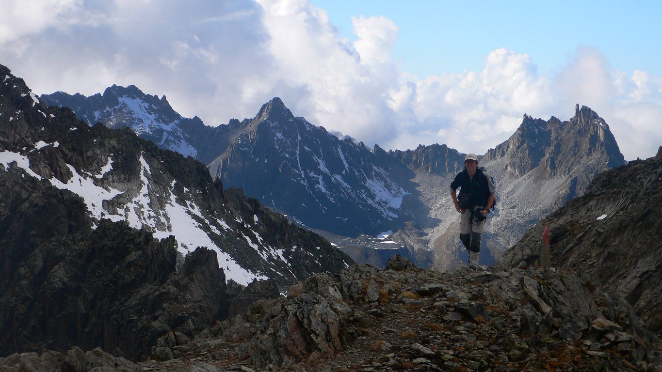
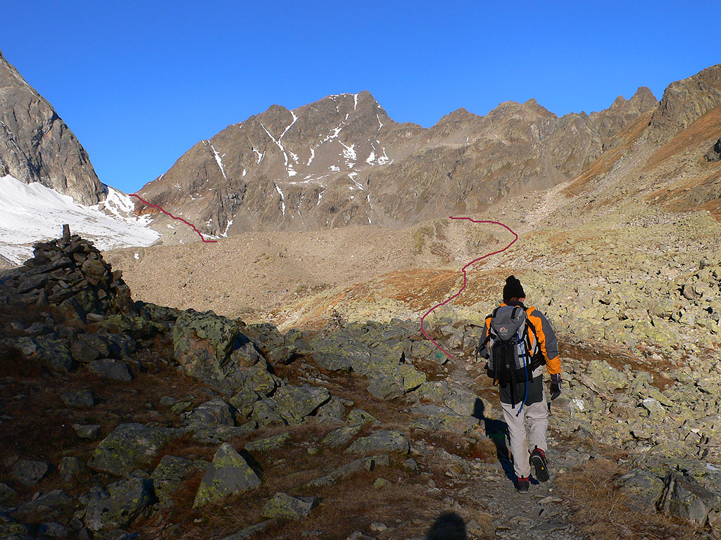
We walked south along the Fasul River for several long miles, continually hoping the clouds would open up. Sometimes we'd get a local view of golden heather slopes which were just beautiful. I griped about all my problems at work and Josef was a good sport for my ranting! None of this helped our motivation to put one foot in front of the other, but when we reached the Schafbichljoch (2635 m) near the head of the valley we were happy we kept going. We'd gained about 1100 meters of elevation at this point, and were happy that now we could start heading back north on the other side of the mountains that make up the eastern half of the Fasul Valley.
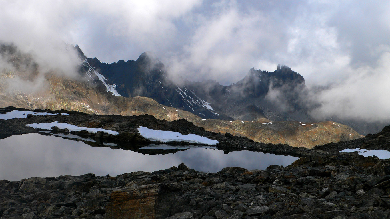
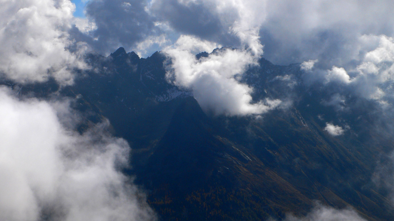
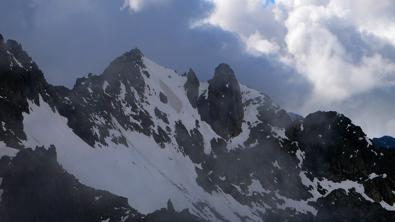
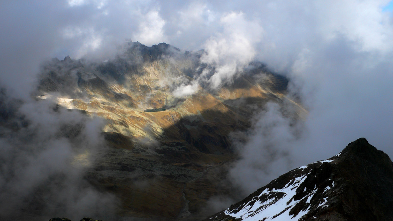
We followed a side trail past a pretty tarn below the Grauer Kopf. We'd only seen a few patches of snow to this elevation, but north and east sides proved to be much snowier. I was starting to feel like it would be a monster day by the time we got back to the bikes, so I declined Josef's idea of continuing on the crest to the Karkopf, climbing at least three peaks on the way. So we split up with detailed plans for meeting again. I bombed down through 2 feet of fresh snow to eventually reach trail again. I was not really dressed for this! No gaitors, and old tennis shoes, which were in fact visibly falling apart! Oh well, my socks are warm. I got mysterious cloudy views from the Matnaljoch (2656 m), with big snowy peaks to the south.
Down in a huge rocky basin I heard a hoot. Josef was standing on the crest far above!
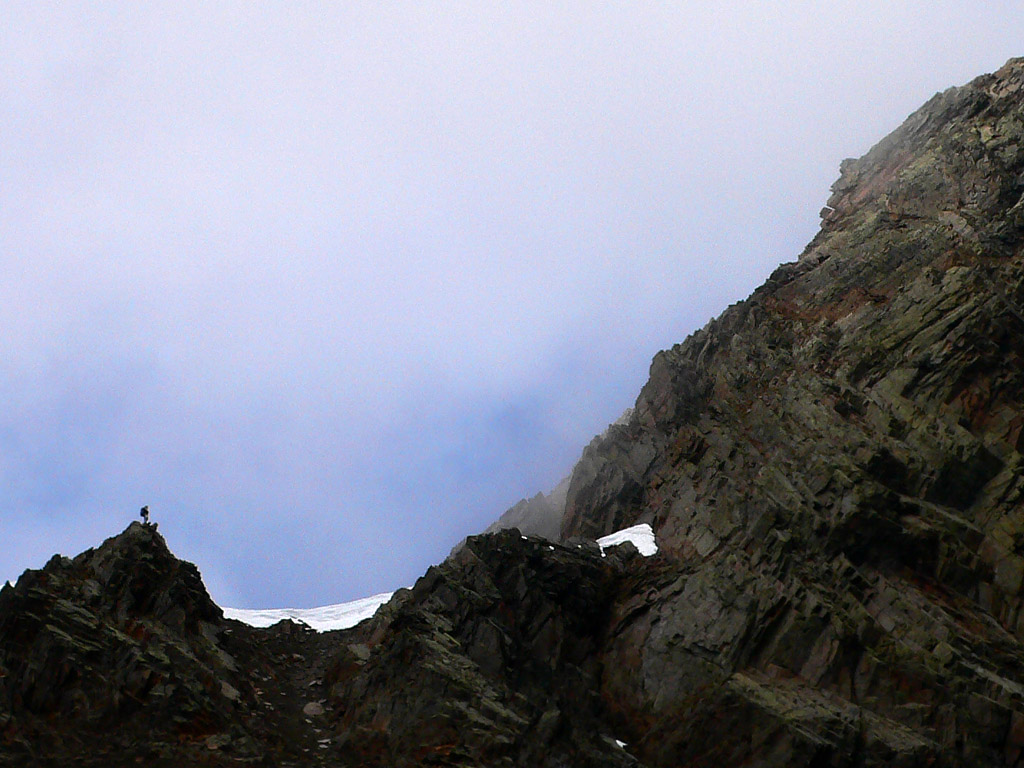
I took a picture and wished him well. Then I bent to my tiring task of climbing about 300 meters up to a pass. As I neared the top, Josef called from below. He gave up on the crest ascent, because of sketchy, snowy, icy terrain, and an endless series of peaks to climb. At the pass by the Karkopf, we faced the sobering fact that we still had a long was to go to reach the Darmstaedter Hut, and then from there we'd still have to climb 400 meters and descend 1000 to reach the bikes. It was already almost 3 pm, after more than 6 hours of non-stop travel, and darkness would come by 7. We were also scheduled to cross two glaciers according to the map. I didn't take them all that seriously though...yet!
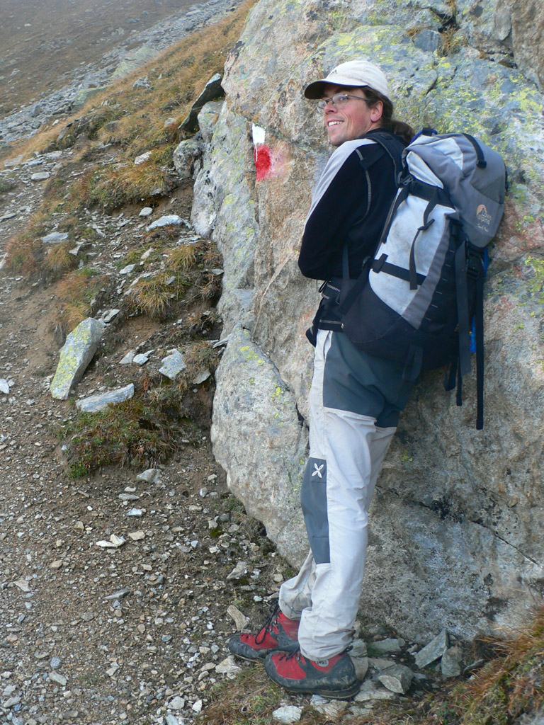
Down into the broad valley below the Kuechel Spitze, first on deep and wet snow. Later, we lost the trail and spent an annoying hour climbing up and down without the trail to get back on track. Finally we saw it below us further south, and could downclimb a steep gully to reach it. It's hard to believe you can lose a trail in Austria...they are so well marked! (usually).
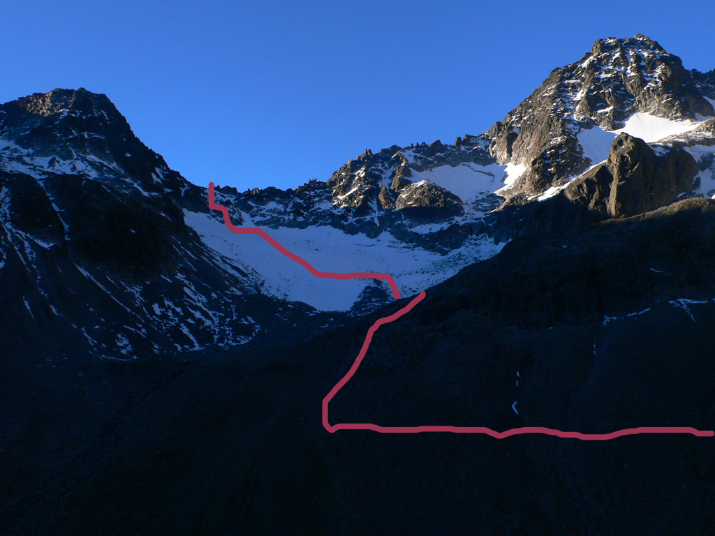
Another 250 meter ascent to the Rautejoechle, this one taken very slow to conserve energy. Now we were in thick fog, after a long, cold day with only occasional sunbreaks. We started down on rocks, then snow, then (gulp) real glacier. We were stomping along when we saw an open crevasse on the right. Then on the left there was a kind of bergschrund below us...we'd have to guess where a snowbridge was thick enough to let us cross! Oddly enough, on the last bit of rock above the glacier, a spray-painted arrow ordered us to go left, right into the bergschrund (or above it). But it looked dangerous. So we went almost straight down, where the ice seemed nearest to rock.
Now, in the fog, we had to guess which way to get to the Hut. Remembering the arrow, we trended left. Suddenly, we noticed a long depression in the snow just below us, going about 100 feet in both directions. We were on the glacier at one of the worst possible times: when fresh snow covers the crevasses. In winter and spring, they would be so thick there are no worries. In summer and early fall they are completely open and easy to avoid. We moved around it, then very carefully crossed. Josef's foot went too deep in one place, and I didn't like the hint of darkness I saw beneath. We continued finding these depressions and crabbing carefully across several more times, aiming for an area of the glacier covered by rocks, and breathing a big sigh of relief when we got there!
This really impacted our thoughts for crossing the second glacier going up to the Kuchenjoch pass. Darkness, fog, deceptively covered crevasses...what a horrible combination for tired hikers with no equipment other than their wits! We started to think about staying overnight at the Darmstaedter Hut if there was an open winter room.
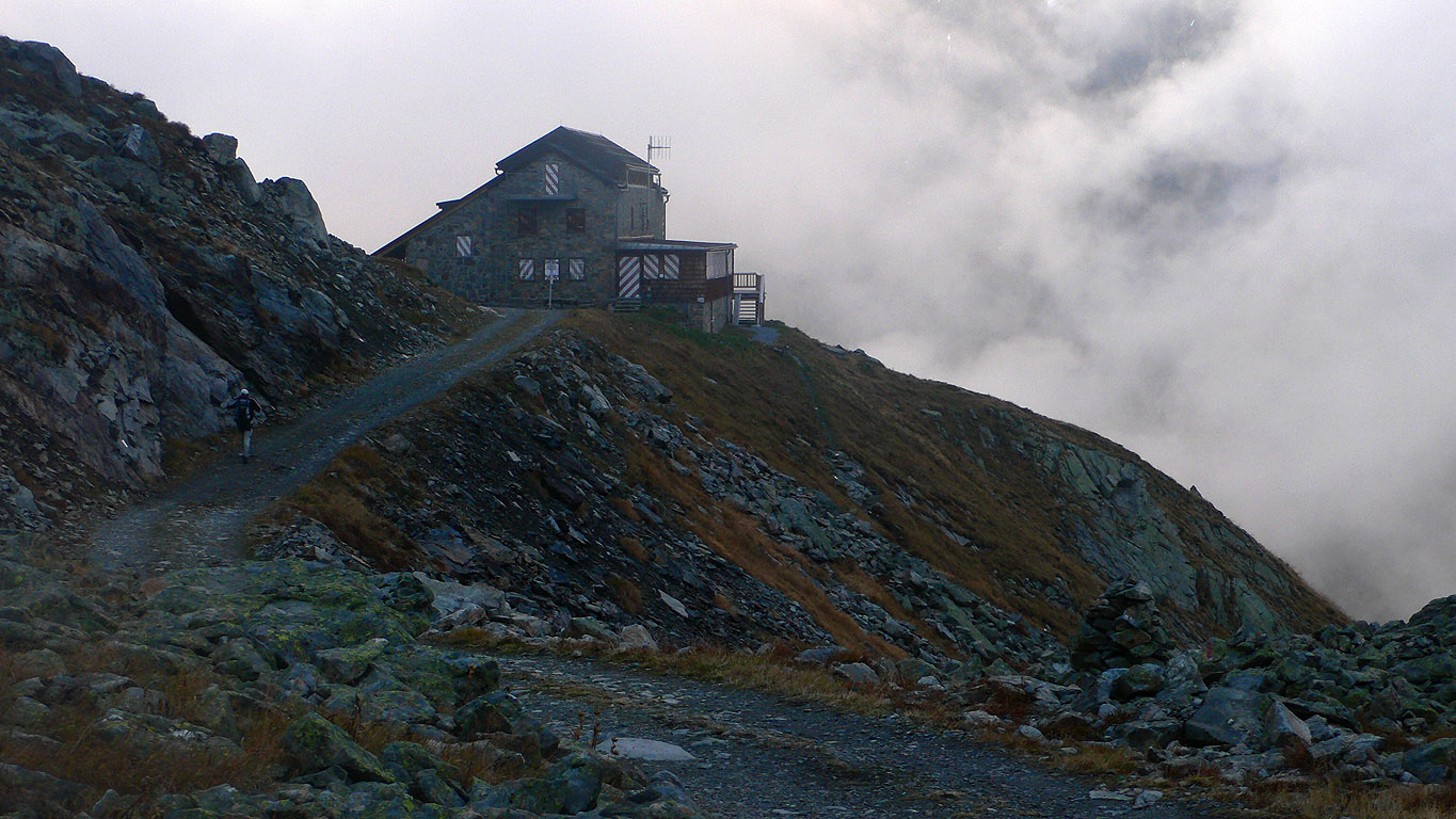
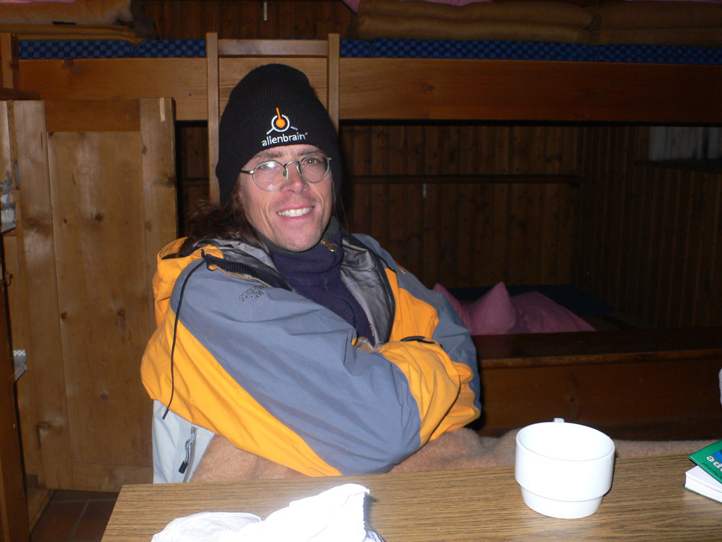
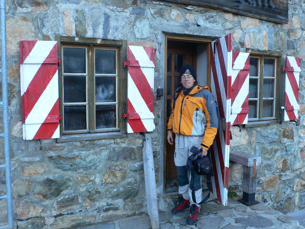
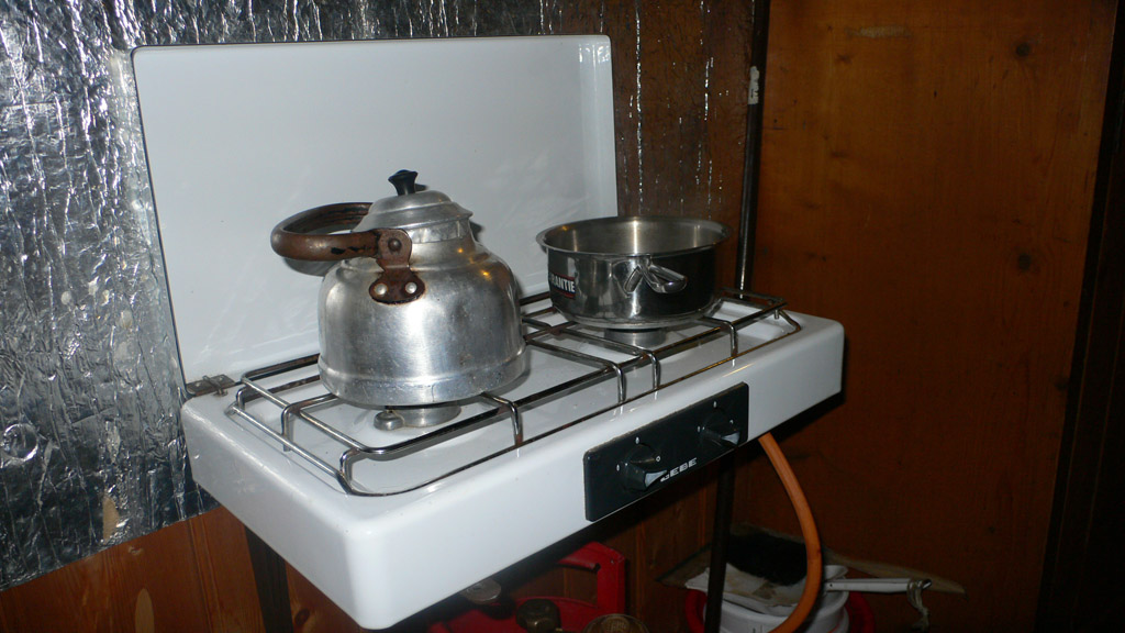
After a longish, tiring descent we reached the hut at 2384 meters. The fog had lifted a bit and we had some local mountain views. Josef found that the winter room was open, with plenty of blankets, pillows. Also a propane stove!
Already we sorely missed my sandwich left in the car. Josef had to start splitting his food with me. At the hut we talked a few minutes about pressing on, but it was far enough after 6 pm, that we thought we'd be up on the glacier in darkness. No need to pile a 4th danger onto the ones we'd already signed up for, so we gathered water from a creek and set to enjoying our stove. We called Daniel, Kris and Angie. Daniel because he and I were hoping to do a hike or climb the next day. Darn, no chance now! He told us we should have great weather the next day.
The alpine club asks for a 9 euro donation per person to stay in the hut. It was pretty wonderful. It got very cold outside once the sun went down, but we were quite cozy. My socks were soaking wet, and I made a major campaign of getting them dried by morning, with a combination of hanging over the stove, wrapping them around a hot water bottle at night, and finally putting them on my feet when still damp to get some drying action from my body heat.
Josef gave me a 2-square-inch 1/2 sandwich for dinner. I organized the evening activities. Tea at 7, photo viewings at 7:30, dinner at 8:00, more tea, then bed at 9:00. And when I say "tea" I mean hot water with a little bit of salt in it. I was kind of amazed at how good we felt despite running on very little food all day. As long as we didn't think about a big dinner, we were okay!
After studying the map some more, and talking of other things, we went to bed. Josef had to stay up until 10 to call Angie, but I was already asleep then. All the hot water hydrated me pretty well, so I had to get up twice to take a leak. The promised good weather finally arrived in the night, with clear black skies, twinkling with stars. I shivered so violently when I went out that the stars were shaking!
Morning came, and after some hot water, salt, two tiny squares of chocolate and a 1/2 apple we were on our way. Josef additionally ate his two cherry tomatoes, but I saved mine for our high point, 400 meters above.
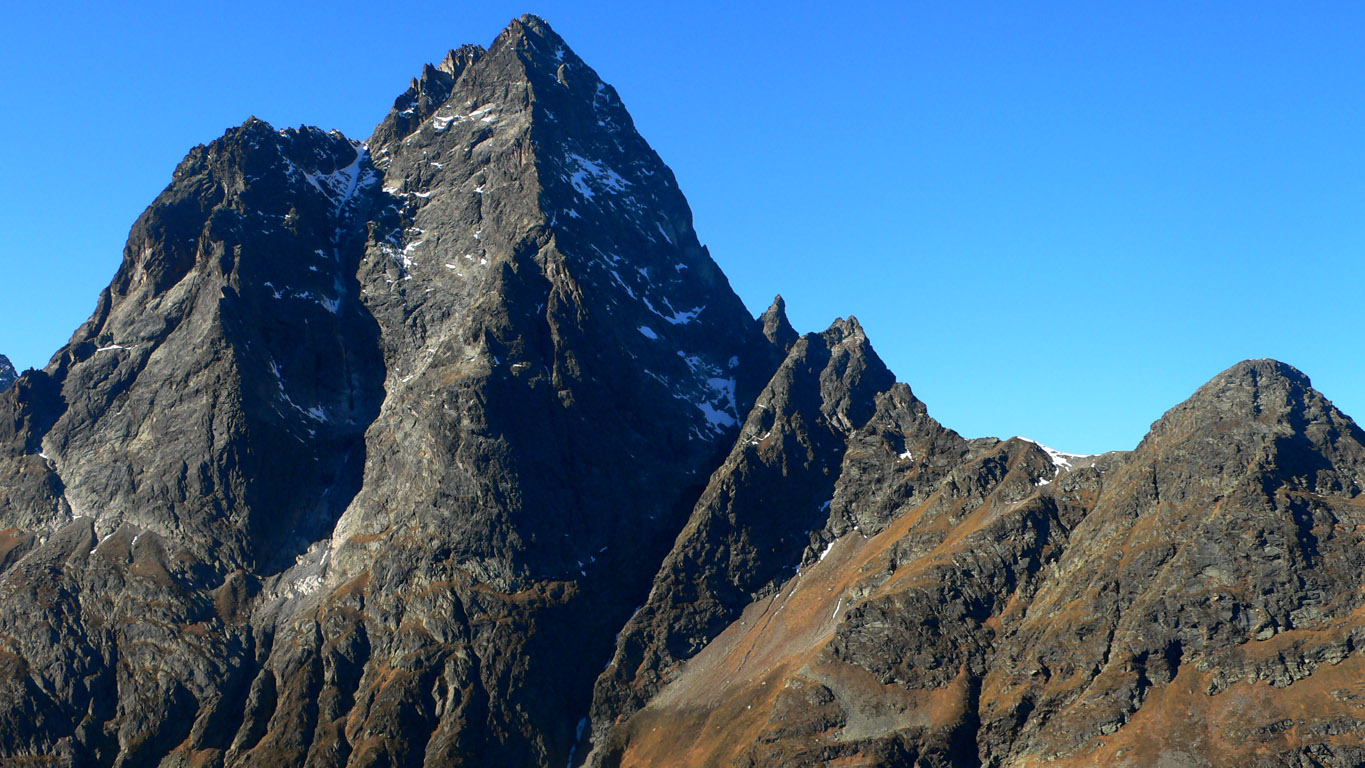
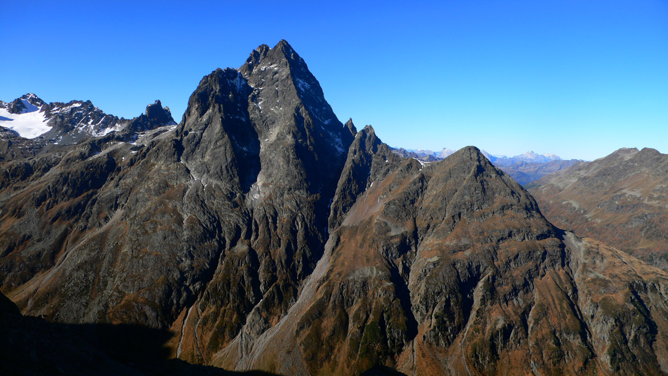
We enjoyed the great views, especially of the snowy glacier we came down, and the imposing north face of the Kuchen Spitze...home of the long Grade VI climb I had raved about. It did look snowy and cold!
Eventually we realized that if there was once a glacier on part of this trail, it was gone now. Josef saw evidence of a trail re-route further up the slope, though it was hardly necessary. "We could have come up this in the dark," he said. Yep it's true, but we didn't know that then. At least now we got to enjoy the scenery. After a short "via ferrata" section on a cliff, we reached the pass to be blown away by an "in your face" view of the northeast ridge of Patteriol. It looked wonderful. Indeed, if we had started fresh today we could have done it, because there was very little snow for some reason (contrast with the Kuchen Spitze). A long, 25 pitch rock climb, it reminded me a bit of Mount Goode in Washington. The peak dominates all others in a wide radius.
We can't wait to climb it next summer then!
A long and beautiful hike down alpine slopes followed. I tried to prolong the enjoyable feeling by stopping a few minutes by a babbling brook and scanning the countryside for more hikes. The Alps are so huge! And the vast slopes above timberline just invite wandering. In a little more than an hour we'd made the 1000 meter descent to the bikes. Here we were shocked to see people for the first time! A gentleman farmer sweeping his barn, and two kids who rode their bikes up to the Hut.
We sped down the road, reaching the car after 20 minutes. A good lunch in St. Anton, and we headed home. Thanks to Josef for being game for such an "underspecified" adventure, and for sharing half his food!
I think we should name this hike the "Fasul Deathmarch". The elevation gain and loss, is over 2500 meters. Kilometers? Who knows...many!
If we'd had more daylight, or known that the glacier below the Kuchenjoch is non-existent, then we could have finished it in a day. But it worked out great and we saw some amazing new country.
More pictures: