Short Reports 2012
Friends: Josef, Georg, Denver, Danno, Kris, Rowan, ElijahLocation: Gilfert, Buchstein, Wank, Wörner, Hafelekar, Uber Bike, Black Mountain Palo Alto, Mission Peak, Aiplspitz, Wallberg, Setzberg, Burschlwand, Hochstaufen, Les Deux Alpes, Hohe Salve
Elevation gain: 0m = 0m
Gilfert ski
December 31, 2012
Josef and I drove to Weer and then Innerst in the Tuxer Alps for a bit of exercise. We skinned along a path exactly the wrong way for the first half hour, then realized our mistake and came back to the car. Reset! Trying again, we followed tracks up a road then across a meadow into fairly thick and steep forest. After about 300 meters we could see the summit and it's cross. "We still have 900 meters to climb!" said Josef. I thought he was joking, but sadly he wasn't. For a couple of old out of shape guys that 900 meters drug on forever. At least the sun was out with a crisp and clear view north into the Karwendel Mountains behind us. On top we admired other Tuxer and Zillertal summits. We headed down, finding protected powder stashes though it was mostly skied out. We lingered and stopped often to discuss the state of the world. It was great to get out with Josef, we haven't been on a trip together in like a year!
Buchstein, "Man oder Memmel" (8-/A0)
November 25, 2012
Georg and I had a few hours on Sunday. We hiked up to the Buchstein and climbed "Man oder Memmel" (roughly, "are you a man or a wimp?"). It was my first time on rock since August, wow! The first pitch was a tough wake up call, but I eventually enjoyed myself (6+). Georg took the 7- and 8- pitches. Hilarity ensued when he placed a bad cam on the 8- to try and protect the crux, and it pulled out when he rested on it. Finally he got through, good job! I pulled on everything I could find in here...standing on slings, etc.! Another deceptively tricky 6+ pitch with some dangerous loose rock, then a final grade 5 scramble to the top. We enjoyed the view for a while, then tagged the Rossstein on the hike out, finding another way down from that peak on a southwest ridge (grade II).
Wank
November, 2012
A quick hike up der Wank on a Sunday morning. Very nice weather!
Hafelekar
November, 2012
I hiked from downtown Innsbruck (the parking lot for the futuristic train that can take you up to Hungerburg. I thought I'd get a feeling for what it was like for Hermann Buhl as a kid, hiking up here from town every chance he got. At 1800 meters elevation gain and loss, it sure felt like a long way! Enjoyed some good pipe smoke at the Bodensteinalm on the descent, and good conversation with some Innsbruckers. They told me about bears in the local mountains (really!).
Bike riding around Santa Rosa
October, 2012
My brother runs a neat bike rental shop, uber-bike.com, and he took me for a few hours on high-end bikes around the hills of Santa Rosa. I had a lot of trouble with the technical "lock-in" foot pedals at times, but it was a lot of fun!
Black Mountain, Mountain View, CA
October, 2012
A great after work trail run up this peak, starting from the Rhus Ridge trail parking lot, and getting on the Black Mountain Trail. I had a terrible headlamp, not good enough for the nerve-wracking descent...constantly afraid I'd run into a tree in the dark forests! I really had to go on faith a lot. About 700 meters up and down.
Mission Peak, Fremont, CA
October 2012
Hiked up Horse Heaven Trail to Mission Peak (trail link here). 670 meters up/down. 1 hour up, 40 minutes down.
Aiplspitz
mid-August, 2012
Before a big trip I wanted to get in a little bit of hiking conditioning. I found the Aiplspitz across the street from the Wendelstein and decided to head up that on the spur of the moment. Offering about 950 meters elevation gain/loss, there was a nice hike up a road to a meadow offering cheese for sale. I bought some for a friend. The final scramble to the summit was entertaining, I had to use my hands a bit.
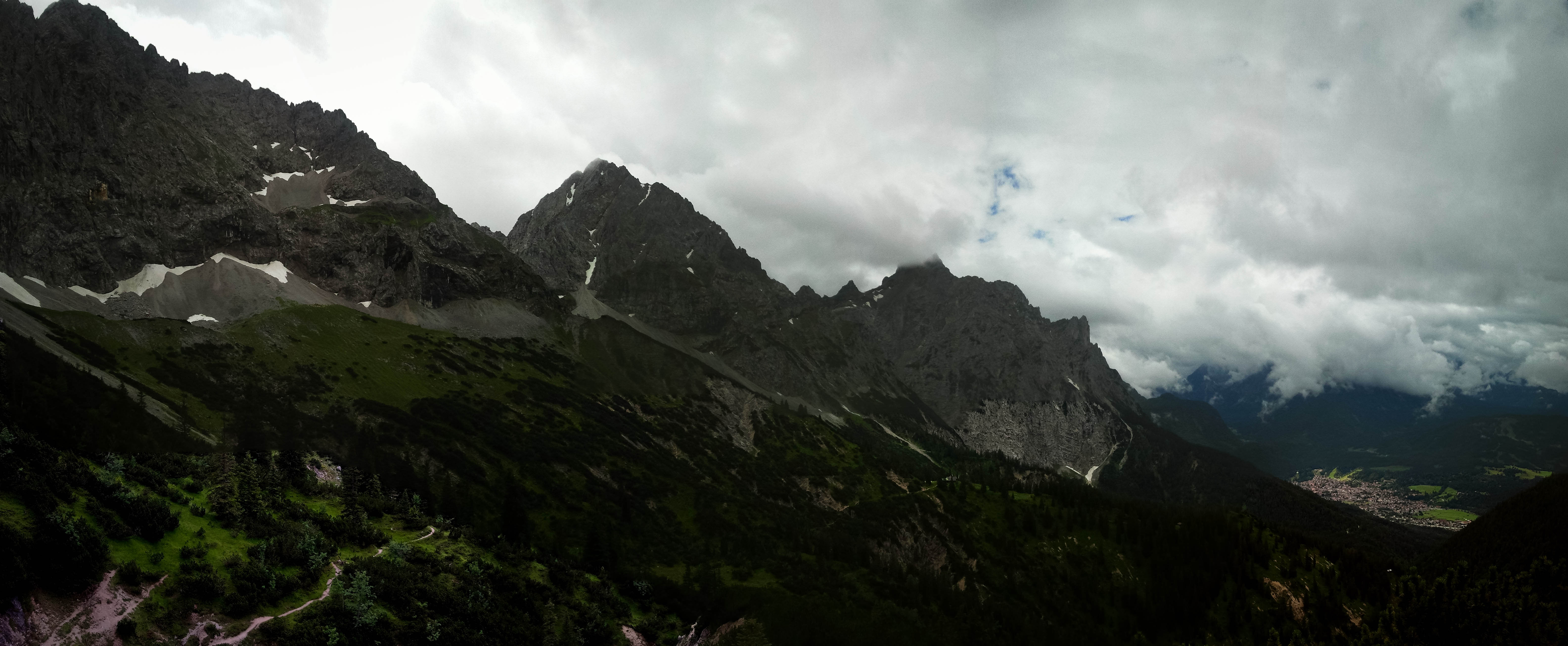
Wörner
July 15, 2012
I got out for a hike, despite a terrible weather forecast. I was actually surprisingly lucky! I decided to hike up Wörner, a peak in my hiking guidebook I'd always admired for the panoramic photo from the summit. Realizing at the last minute that the hike would involve a long, hateful ascent up a dirt road, I decided to lengthen the tour a little bit by parking near the Karwendelbahn station in Mittenwald and beginning my journey from there. Eventually I reached the valley of the great scree-filled Dammkar in a light rain. From there, I continued to the Hochlandhütte where I was momentarily alarmed because it looked closed. I'd brought no food, depending entirely on the ability to purchase some coffee and cake at the hut! How is that for the 10 essentials?!?
After coffee, I continued to the Wörnersattel in improving weather. I saw plenty of blue sky, and a herd of goats near the saddle. From here, the final 500 meters to the summit is a very enjoyable scramble route, with much use of hands and a little bit of route-finding. A few sections were low 4th-class, and I passed a couple of belay pitons in this area. The last bit is on the ridge crest, and soon I stood on the summit, with a great view in two directions (the other two blocked by cloud). What an excellent hike!
On the way down I admired a violent storm far in the distance over Scharnitz. It was approaching rapidly! The air had the smell of rain, and suddenly it was on me. My half-broken umbrella helped considerably though, and soon I was ordering another cake and coffee in the Hochlandhütte. When the rain stopped, I ventured out, and onto new terrain, taking the most straightforward way down to the valley. At first on a nice and steep trail, and later on the hated road.
1800 meters up and down from the Karwendelbahn parking lot. A wonderful hike!
Wallberg and Setzberg
May 5, 2012
Morning hike on a day when the rain held off. Really nice time. I took new routes on the way up, wandering up an old ski descent, then cutting cross country up a steep forested rib. I re-emerged on the road, then dived back into the forest. After Wallberg I had some apfelstruedel and cappucino at the restaurant. Then I hiked over to climb Setzberg, kicking steps in my tennis shoes for the last 150 meters of snow. A nice walk down that included some new off-trail variants. Pretty soon I won't use any trails on this hike! 1200 meters up/down, couple of hours.
Burschlwand
April 28, 2012
Georg and I went to the Burschlwand. I felt weak as it was the first outside climb of the year for me (how sad!!). But we got on some hard stuff, for sure! The roof pitch was amazing, just to follow and "french free" my way through the hardest parts. Thanks to Georg for a great day.
| Name | Pitch | UIAA rating | length (m) | leader | notes | YDS Rating |
| Oberlaender HG Tour | 1 | 6- | 20 | Georg | Pretty tough for the first three clips! (felt harder) | 5.9 |
| Oberlaender HG Tour | 2 | 5 | 30 | Michael | 5.7/5.8 | |
| Oberlaender HG Tour | 3 | 7 | 30 | Georg | Very nice pitch | 5.10d |
| Oberlaender HG Tour | 4 | 5+ | 25 | Michael | 5.8 | |
| sir scheich josef sahib peppler | 5 | 7 | 30 | Georg | Felt like 7+ for 2 clips. A sign at the belay said it was "Pegasus," but maybe it said "Peppler" | 5.10d |
| sir scheich josef sahib peppler | 6 | 6 | 25 | Michael | Rested on rope…tired! | 5.10a |
| Peacemaker | 1 | 6+ | 23 | Georg | 5.10b | |
| Peacemaker | 2 | 6- | 27 | Michael | 5.9 | |
| Peacemaker | 3 | 7- | 30 | Georg | Michael led first 5 clips, gave up! | 5.10c |
| Peacemaker | 4 | 4 | 20 | Michael | 5.6 | |
| Peacemaker | 5 | 8- or 7-/A0 | 35 | Georg | The tour-de-force. 1 point of aid used on lead, 3-4 on follow! | 5.11b or 5.10c/A0 |
| Peacemaker | 6 | 6 | 20 | Michael | 5.10a | |
| Gelbe Kante | 1 | 7- | 24 | Georg | Good lead, felt harder. Much sadness and aiding on first half of pitch on follow. | 5.10c |
| Gelbe Kante | 2 | 6 | 30 | Michael | Redeeming pitch. Michael recovered some climbing dignity. | 5.10a |
| Via Claudia Augusta | 3 | 6 | 35 | Georg | Really nice pitch! Sustained at the grade. Similar to it's neighbor on the left, Donna Delores P3. | 5.10a |
| Via Claudia Augusta | 4 | 6 | 17 | Michael | 5.10a | |
| Pegasus | 6 | 5+ | 20 | Georg | We are tired now. | 5.8 |
Hochstaufen
April 4, 2012
Hiked up Hochstaufen, mainly because I'd hardly done any hikes over the Salzburg area and was looking for something new. Foolishly, I wore tennis shoes and didn't bring an ice axe. The "Jaeger Steig" trail I used to reach the summit featured many, many snowy traverses on the south face of the mountain. On the summit I wrung cups of water out of my socks. It would have been a lot better to have proper boots. But the weather was nice and the views were great. I took an easier trail down, but still dealt with long snow traverses. Eventually I did some boot glissading and sitting glissades to lose lots of elevation.
Downhill skiing, Les Deux Alpes
March 31, 2012
Great trip with folks from work as a "Team Event." It was great to be back in the Haute Alpes! We skied everything under the Jandri Express lift, did a turn up on the easy run on the glacier, did many runs down from Lac Noir. On the way out (I had to leave early, shortly after lunch), I skied the black Bellecombes run which was excellent if a bit icy. Then, against everyone's advice, I skied down to the valley actually finding an excellent black run called Valentin that took me all the way down. Nobody belives me, they all think the valley run is icy and full of rocks. The funny thing was that it was by far the best skiing, go figure.
Downhill Skiing, Wilder Kaiser
March 17, 2012
Again with the boys. Kind of a short day but fun. Again, skied to the valley.
Downhill Skiing, Wilder Kaiser
March 10, 2012
With the boys and Danno and his family. Wow, breakthrough day for the kids. Lots of help from Danno and Vincent. We skied down to the valley (about 1000 meters descent!). No problem for the boys, I was impressed.
Downhill Skiing, Wilder Kaiser
March 3, 2012
Kris, the boys and I. Bad weather, but we had a good time, especially in the afternoon when the sun came out.