Peakbagging in Switzerland
Friends: Only God!Location: Obersee, Eggstöcke, Ortstock, Grisset
Elevation gain: 5500m = 900m + 1500m + 1600m + 1500m
Thursday
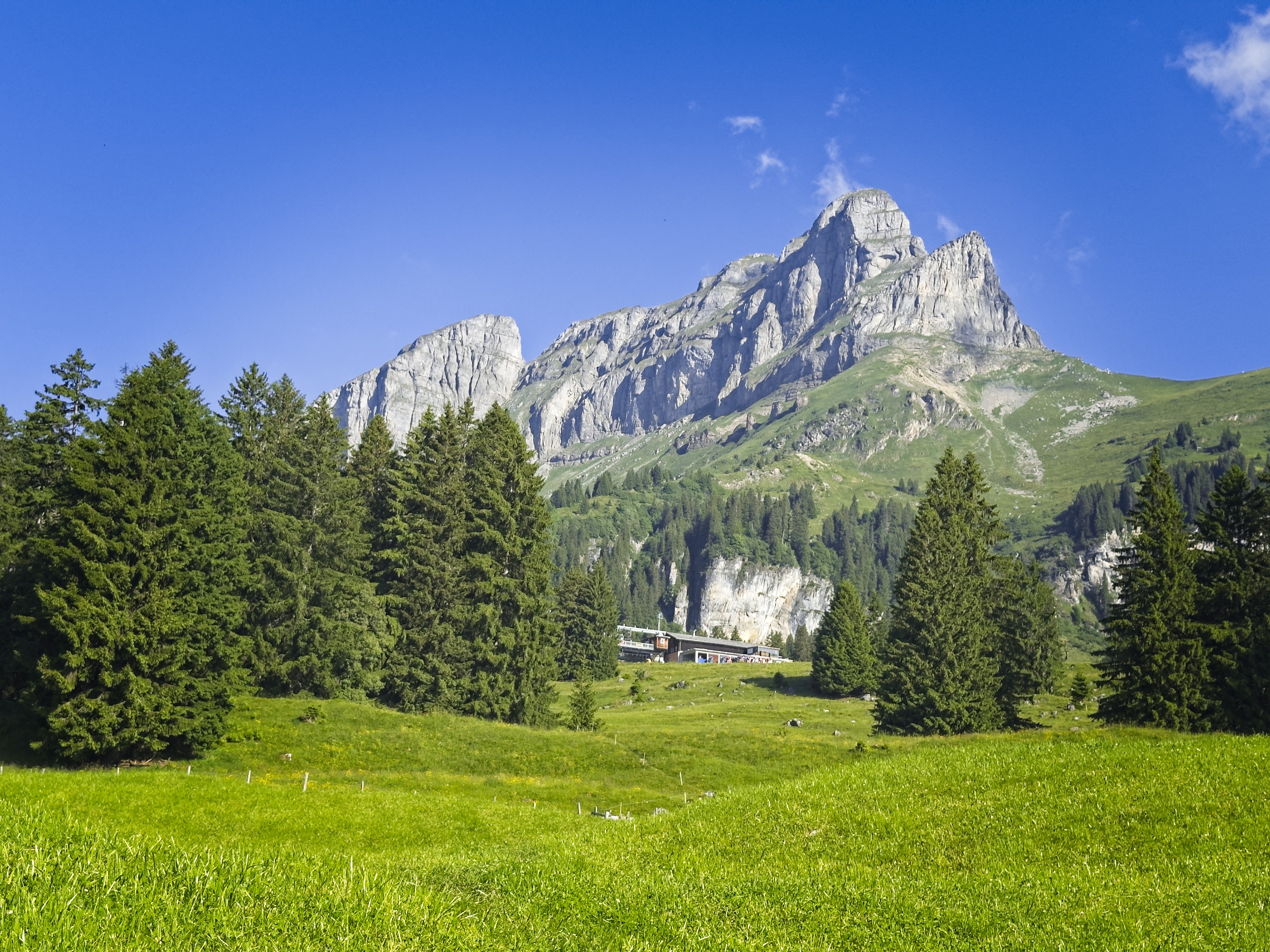
After sleeping in Mantra nearby, I decided to scramble up a peak I could see from the parking lot called Rautispitz via a route called the Troosweg. I only got a few minutes of trail, then it was scrambling up a gully on latschen game trails and scree slopes. Then a long traverse to the base of the wall.
Here I started running into trouble. I'd found a GPS track and was following it, failing to pay adequate attention to the route description for large mountain features. I should have been far to the right, where the route goes up a mixture of rock and heather benches. But the GPS track somehow led me up rock climbing terrain. I soloed two pitches of grade III or III+, getting nervous, and seeing no way that any route could possibly lead through the vertical walls directly above. But I kept looking at the GPS and I was on track. Then, on a ledge, I looked again, and the GPS track was way far off to the right!
On Rautispitz, just finishing an ugly latschen battle!
Heather slopes leading down to a house and a trail
The Troosweg is in the cliffs on the right
What?
I had to escape from my dead end, then traverse about 300 meters off to the right. I wondered why the app had seemed to mislead me so much. It must have something to do with zooming in too much and the app fails to find an accurate position. Lesson learned: don't try to use a GPS for micro-features, especially in steep terrain.
Anyway, I went over to the "right" place, but after the adventure thus far I was feeling cautious. Supposedly the route had some old cables on it, not very trustworthy but at least they show the line to follow. At the base of a cliff I saw a bramble of wire cables. Maybe they were removed in the years since these reports on hikr.org had been made? Anyway, it seemed sketchy so I bailed, even though I think I was standing at the right place to continue.
I decided to go straight down scree slopes to reach a little farm with a trail leading to the west and the main trail. This was another hour of off-trail travel. I connected to the main trail, then headed back to the car.
I guess I'll try again later. I drove to Linthal and took the train up to Braunwald for the next days. A nice raclette dinner at the Adrenalin Hotel.
Friday
I wanted to do the Braunwalder Klettersteig today. I was walking at 9, which is actually too late in the heat. I resolved to skip breakfast the next two days so I could gain elevation in the cool morning. Working my way up, I reached the Gumen lift station, bought an Iced Tea drink, then walked up to the klettersteig at the east ridge of the Eggstock summits. There were a few people on the route, but not many despite the good weather. I started up, enjoying the pleasant climbing. I'd decided to climb the easier route right on the ridge because it seemed more scenic than the harder one, buried off in a corner on the south side of the ridge.
On the Mittlerer Eggstock there was a neat bivouac building. After a brief descent from the little parkland meadow on that summit, I finished the route with the hardest climbing (via ferrata "grade 5") to the summit of the Hinterer Eggstock. Really nice!
Braunwald view down to Linthal
The Eggstock summits
The start of the via ferrata
Here you can see the bivouac hut on the Mittlerer Eggstock
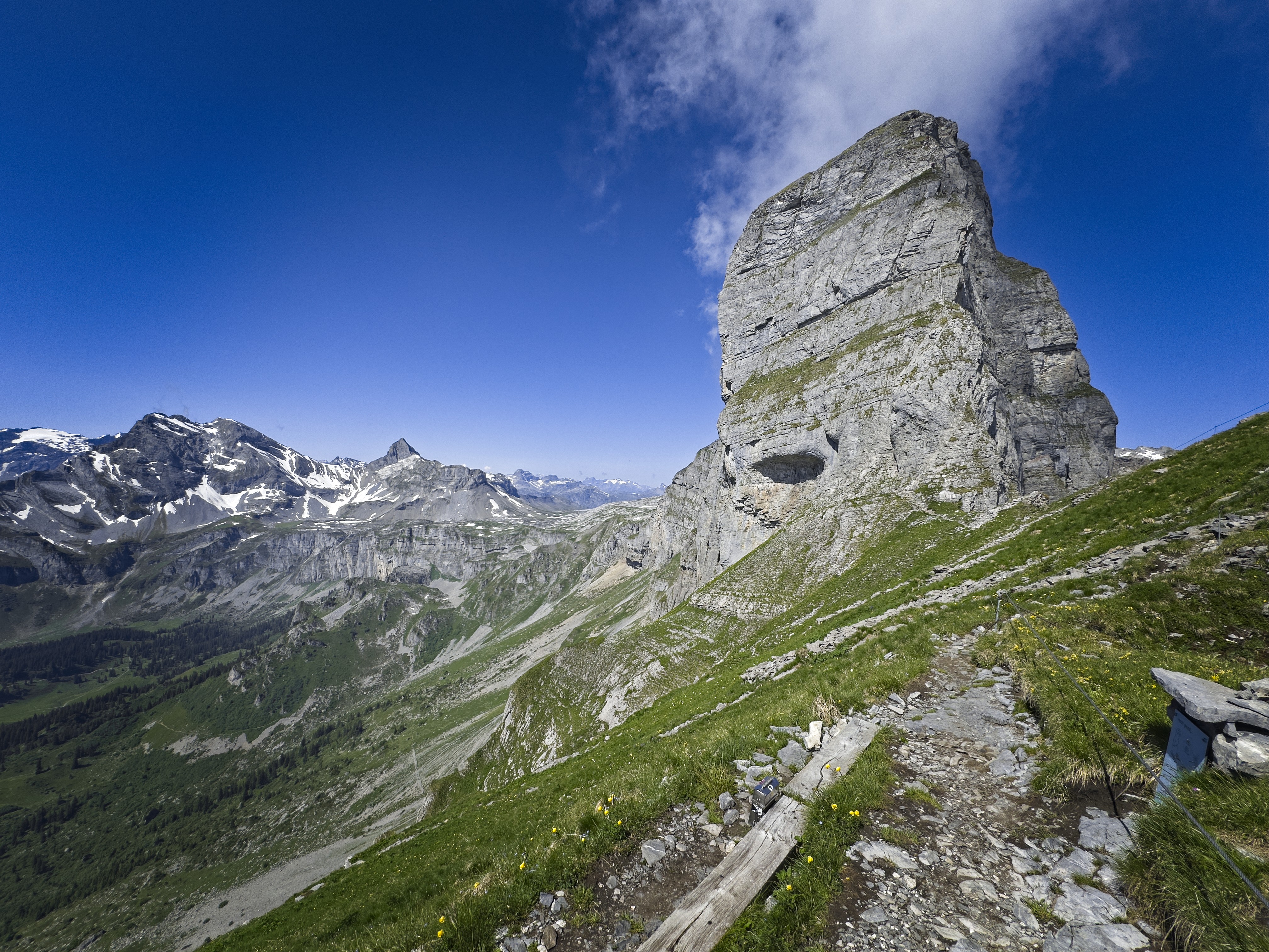
From this summit, the Ortstock off to the south is very impressive. I borrowed some binoculars from some Italian guys, and tried to determine if there were steps kicked into the snowfield which gains the northwest ridge of that peak. I couldn't tell. It looked steep and snowy. But if I could reach the Furggele Pass, then the last 300 meters to the summit along the ridge looked to be clear.
I headed down and had some ice cream and a cigar at the Ortstockhütte, a great place with nice staff. They said they like this time before the high tourist season begins. I asked if they had any reports of a climb of the Ortstock, and the nice woman there said that the snow had been a problem for some people who tried. After having missed my summit Thursday, I didn't want to head up there and possibly have to turn around because my shoes weren't good enough. But as the day went on and I saw the different ways the Ortstock dominates the Braunwald valley, I knew I had to try and climb it.
A nice dinner at the Adrenalin hotel.
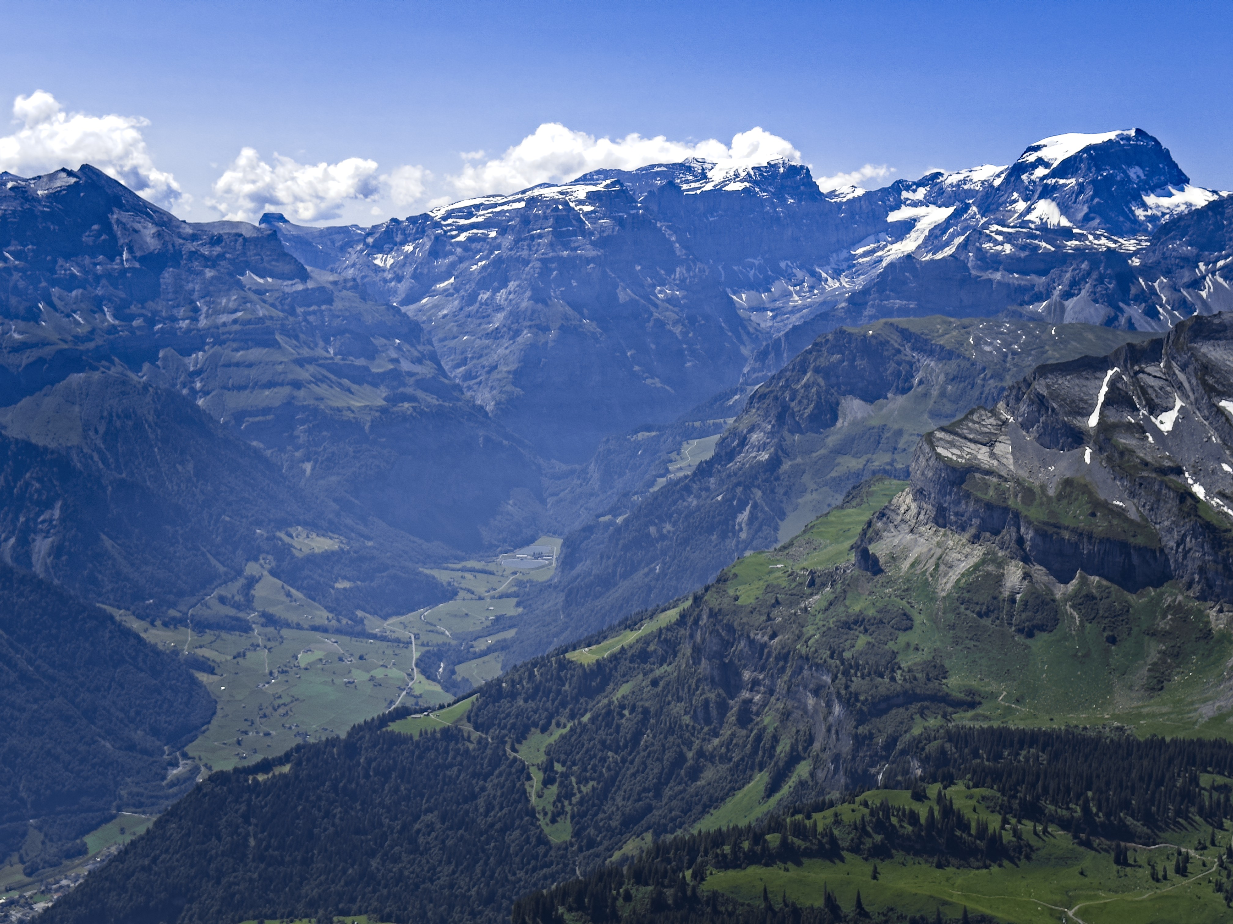
The Linthal valley, with Tödi on the right
The Mittlerer Eggstock from the last section of the via ferrata
The Ortstock in the early evening
Saturday
It was time to climb the Ortstock, even with my worries of inadequate shoes! If I'm turned around, oh well.
It was great to start early. I thought about my walk through here on the Via Alpina in 2017. What a peaceful and incredible journey. I will repeat it.
View from Bärentritt
The final snowfield to the corniced ridge crest
Near the Ortstock summit
Steeply up along a waterfall to a place called Ober Stafel. then up through cliffs to a place called Bärentritt. Here was a beautiful flat meadow and a burbling stream, with the Ortstock above. Asking God for a bit of help, chiefly, for good judgment on my part to prevent me from climbing up snow slopes I shouldn't in inadequate shoes, I started up. Soon I was crossing snowfields, but they were okay. The steepest parts were snowfield. Later, I avoided snowfields for scree, making use of small dimples in the scree indicating others had done the same. Before I knew it, I was at the final slope! It remained suspenseful to the very end. The last difficulty was crossing the steep snowfield a few meters beneath a cornice. I enlarged old tracks, carefully dealing with a deep hole or moat by building good tracks around it, then alighted on a rocky slope where a few more careful moves got me to the summit of the pass.
Yes!
Now the way was clear to the summit, although steep. Soon I stood on top admiring the views to Tödi and other mountains of the Klausenpass region. On the way down, a woman was trying to get her big white fluffy dog to climb a rock wall which had a chain for assistance. I got under the dog and tried to lift him up but he was certain he didn't want to do it!
I left her conversing and pleading with her dog and continued down. She had come to the pass from the south side, and I saw a whole line of people doing that. I had been the only person coming from the north today.
I found a better way to avoid crossing the snowfield under the cornice, then had to commit to stomping down the snowfield. This worked well, thanks to the action of the sun. It was around 11 am. I could now usually choose snow and didn't have to strictly avoid it.
Most of the way down I looked back to see 4 or 5 people coming down my way as well. Later I meditated in the meadow but never saw these people passing by though I heard their voices.
A view northwest from the summit
Thanks Ortstock!
Cliffs below the Bärentritt
Storm approaches
I liked this little house in Braunwald
Pesto lunch and good music
The valley was slowly filling with clouds. As I came back to town it started to rain. I sat at a restaurant by an older lady who said her father had been a hunter and mountain guide -- he'd climbed Tödi 200 times! She said she'd been on the Ortstock 20 years before, but liked the mountains better from the valley. Nearby, a table of older men sang beautiful alpine melodies. I had pesto and beer, watching clouds appear and burn off around my mountain.
Later I had a cigar near the hotel under a shelter while thunder and lightning flashed around me. What a wonderful day!
Sunday
Todays plan was to climb Grisset. Again, I started early. This time I had breakfast at the Gumen lift station, then traversed over. At Ober Boden I started traveling a little north of west over heather and boulderfields with slight descends on a generally ascending line. Eventually snowfields made it easier, and I was standing on the final moraine above an old glacier between Grisset and Bös Fulen.
The Ortstockhütte drowsing beneath its namesake peak
I kicked steps up a steeper snowfield, then scrambled up to a ridge crest, having to do some real (II+?) climbing moves to get there. From this point I could follow scree slopes on a vague face, or keep climbing up heather and rock. I chose the latter, though at times scree and rotten rock added challenges. Soon enough I was on top enjoying the view.
The Grisset summit in the background
The view along the ridge to Bös Fulen
Going down was harder. I opted for the scree, but gosh, it was unpleasant! It really took me a while to make the many decisions about which way to weave. Finally I was at the top of the rock climb, which I carefully reversed. Getting down the snowfield was probably the most difficult part of the day. I ended up kicking many steps and facing in to downclimb. Occasionally I would traverse, but the snow was both slick and a bit too hard underneath to feel like I could arrest if I slipped. Tired out, I reached hiking terrain, then marched back towards the trails 2 kilometers away. This time I took a different route because I wanted to visit a place called Bützi, which I did and it was nice.
The ugly scree descent
On the Grisset summit
Looking north...
Some of the terrain to climb down to the steep snowfield
The snowfield and initial climb on Grisset
I went back to Gumen, ate some food, and took the lift down from there. It was enough!
I thank God and the mountains for a good time. Barbara was with me in spirit and we chatted often. This was a gift, too.