Borah Peak and Mount Breitenbach
Friends: SeanLocation: Borah Peak, Mount Breitenbach
Elevation gain: 3086m = 1686m + 1400m
Friday, May 8: Borah Peak with Sean
Here is a little video of the day:
Sean drove up to the trailhead at 6, where I was camped. After a few minutes we were walking, and enjoying ourselves very much. We had similar ideas about the promise and peril of America, with many reasons to be hopeful. Sean has climbed Borah several times, and been all over Idaho's mountains. Happily talking of this and that, we soon found ourselves on the broad lower-angle ridge at about 10,500 feet. We got crampons on somewhere in here, and crunched across snowfields. It was about 8:30.
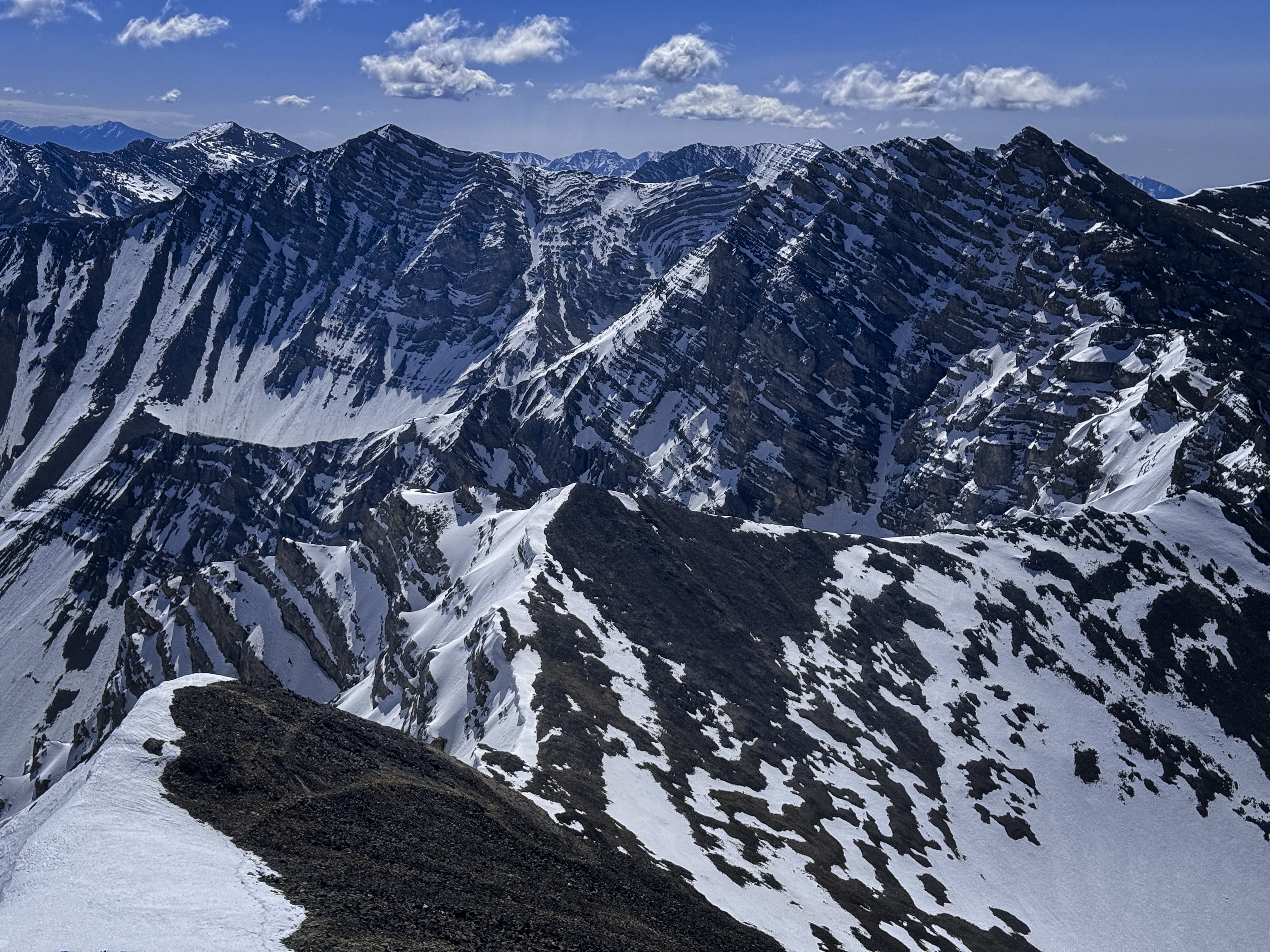
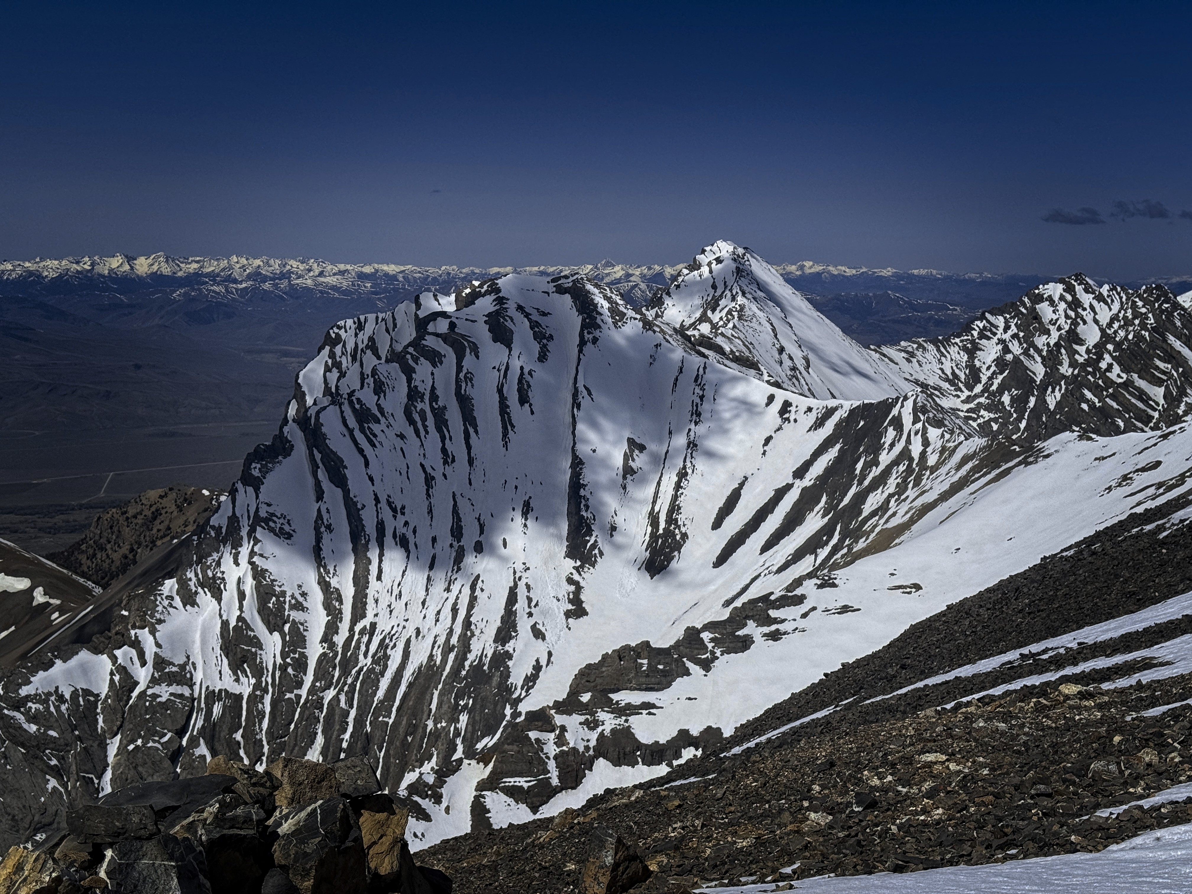
Looking across to the beautiful Peak 11367
I believe this is Mt. Idaho
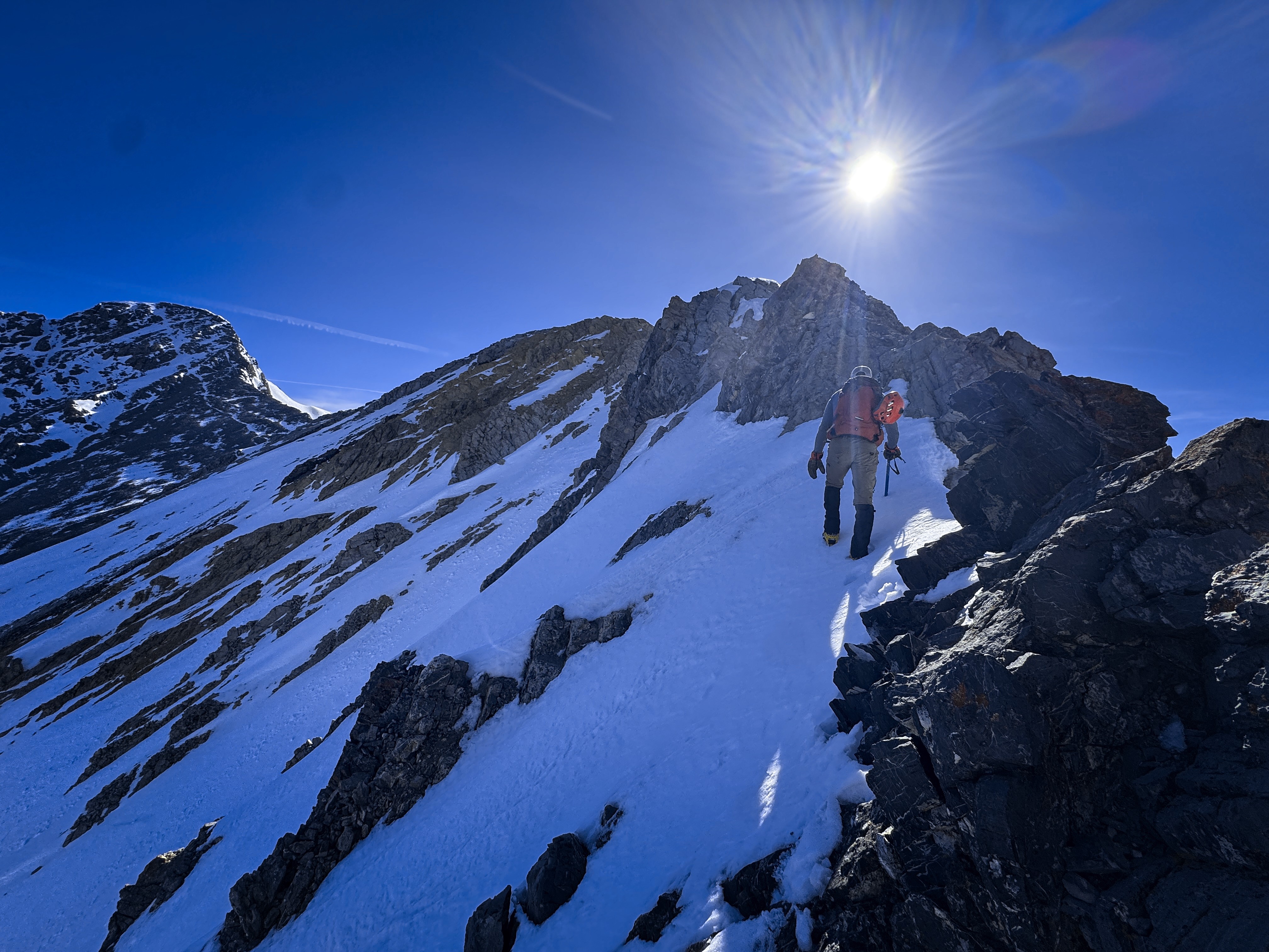
Sean coming up where the ridge starts to involve some scrambling
Sun and snow!
Soon we were enjoying some real scrambling on the crest. Sean had tried the mountain in winter at least once, and had some wisdom on that. Soon we came to the impressive notch with a little blue fixed rope to aid the climb down into it. Beyond, there was a trail leading out on the left side of the ridge to gradually traverse up to the saddle below the summit massif. Sean recommmended going up and over, expressing concern about snow conditions. So we did this. In fact, the scrambling to the summit of Chicken-Out-Ridge was very fine. It reminded me of different mountain ranges, perhaps the Tetons. Soon we were traversing ond descending slightly over to the saddle.
Looking back to Sean on the ridge
A similar shot
Looking to Borah. Sean emphasized staying on the ridge
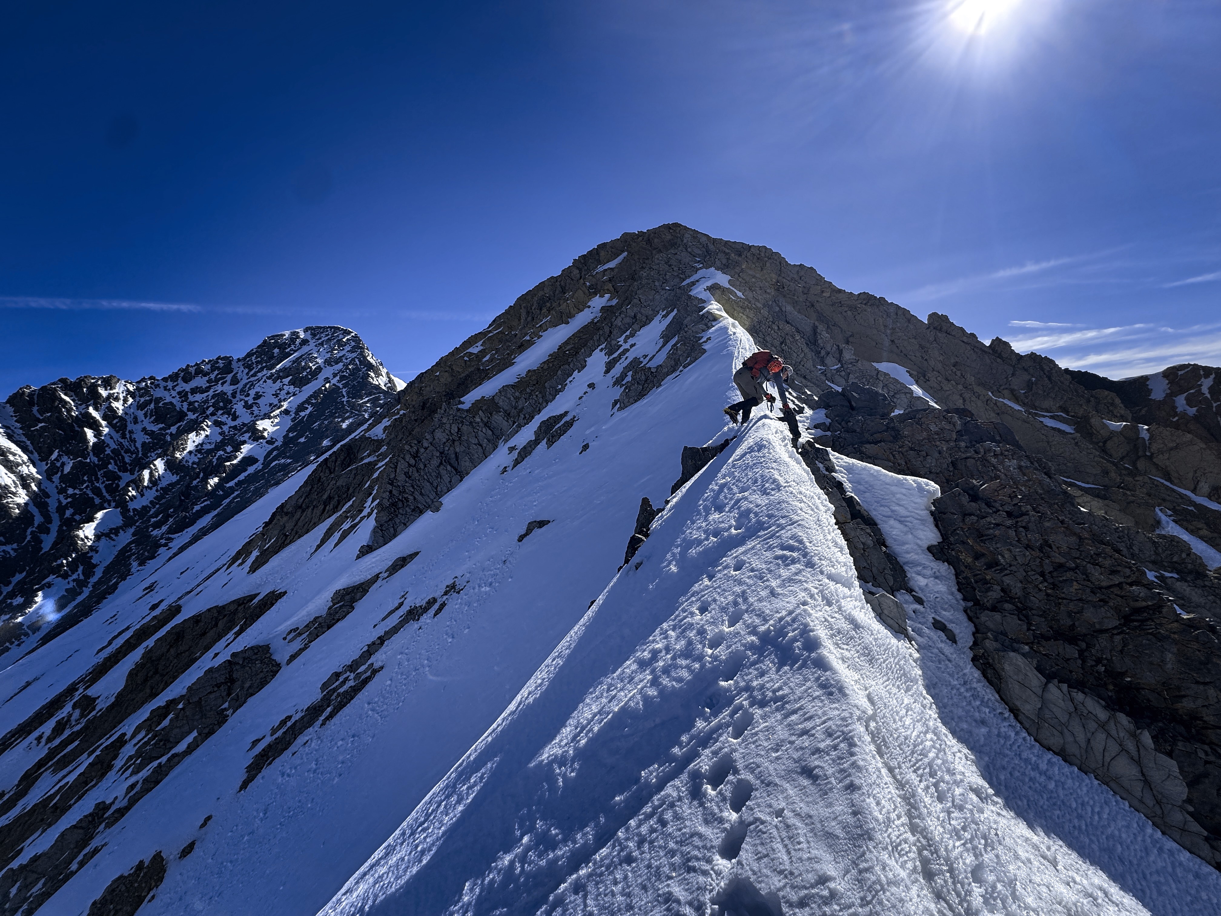
On the knife edge, pretty psyched!
Heading into steeper ground
No tracks at this point...
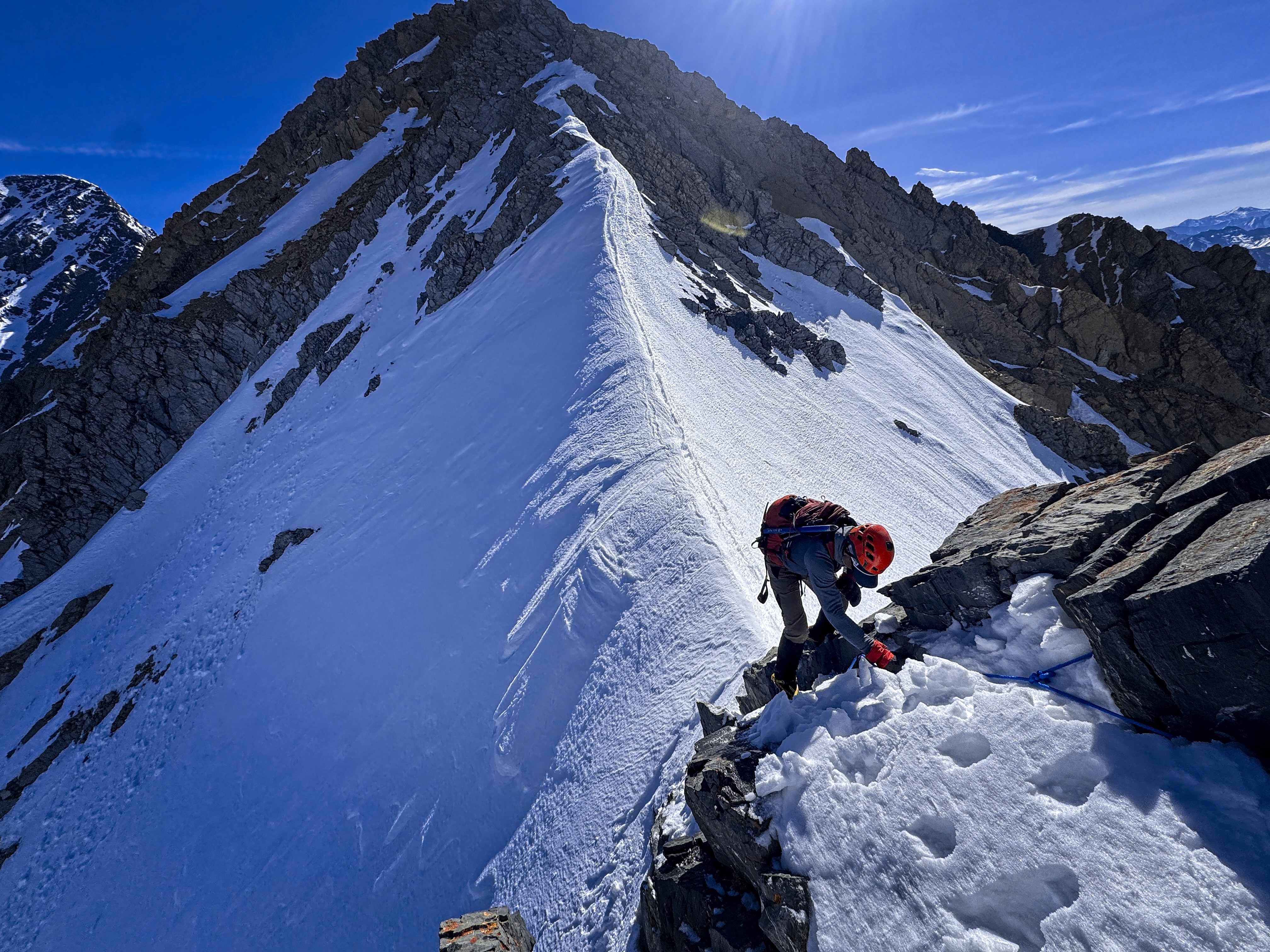
Sean at the ridge step. There was a blue fixed rope here
Heading to the summit massif
I was surprised at the remaining effort to the top. I was feeling the altitude in here. Looking at it, I thought it would be something like the summit block on Saddle Mountain, but it was easily twice as large. Scale in these peaks is difficult to judge!
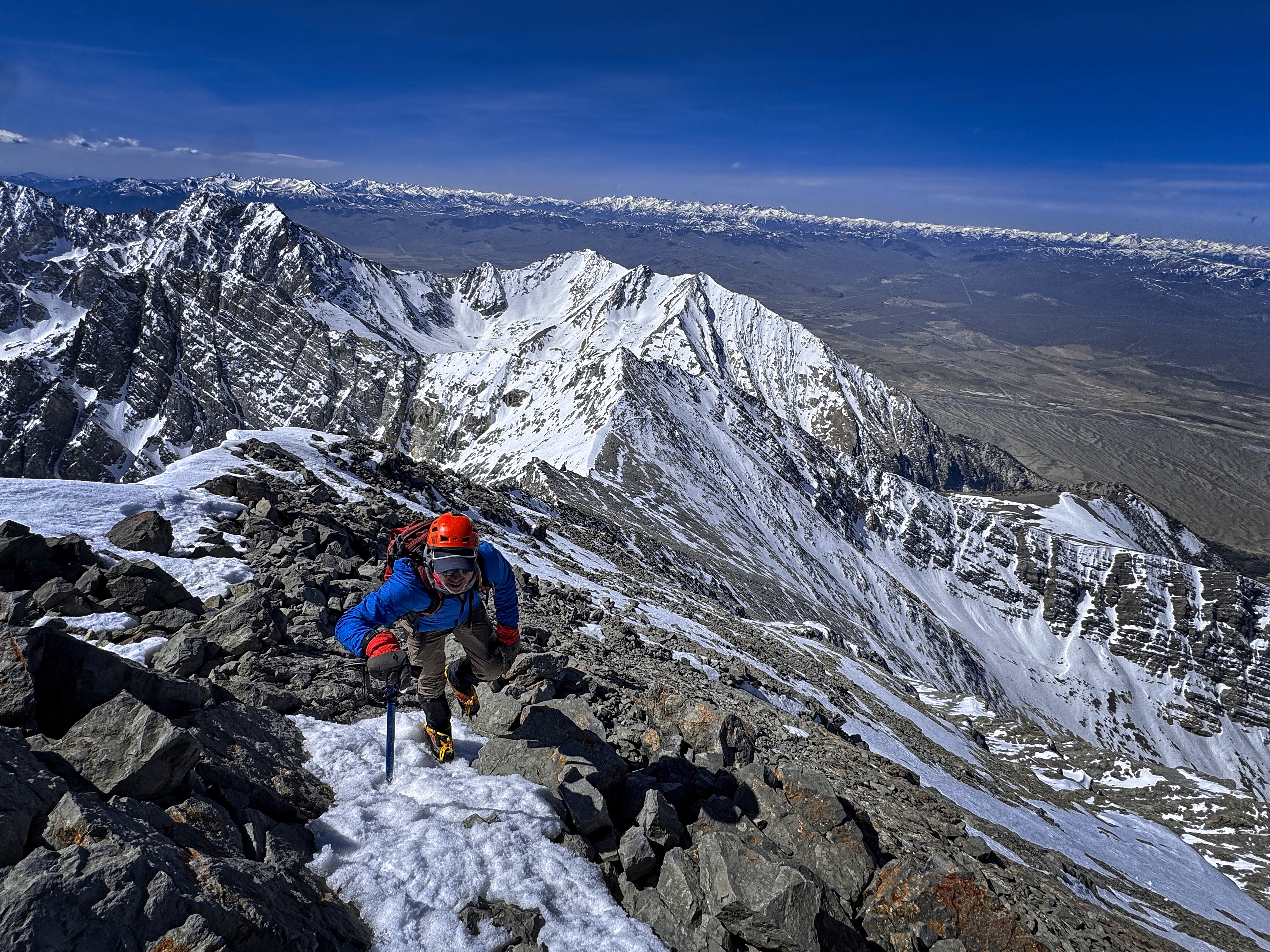
But this became part of the fun. We chose roughly the highest slanting ledge system below the ridge crest, and our way became less distinct in the final 400 feet or so. We made decisions about crossing slopes, moving strategically from one eagle eyrie to the next. Then we'd head straight up or a bit back on a switchback for a while. Rinse and repeat, then we emerged at the summit. Very cool!
Really interesting routefinding in here, either climbing or traversing
Michael nears the summit
Looking back...
Good cramponing across snowfields
Last steps!
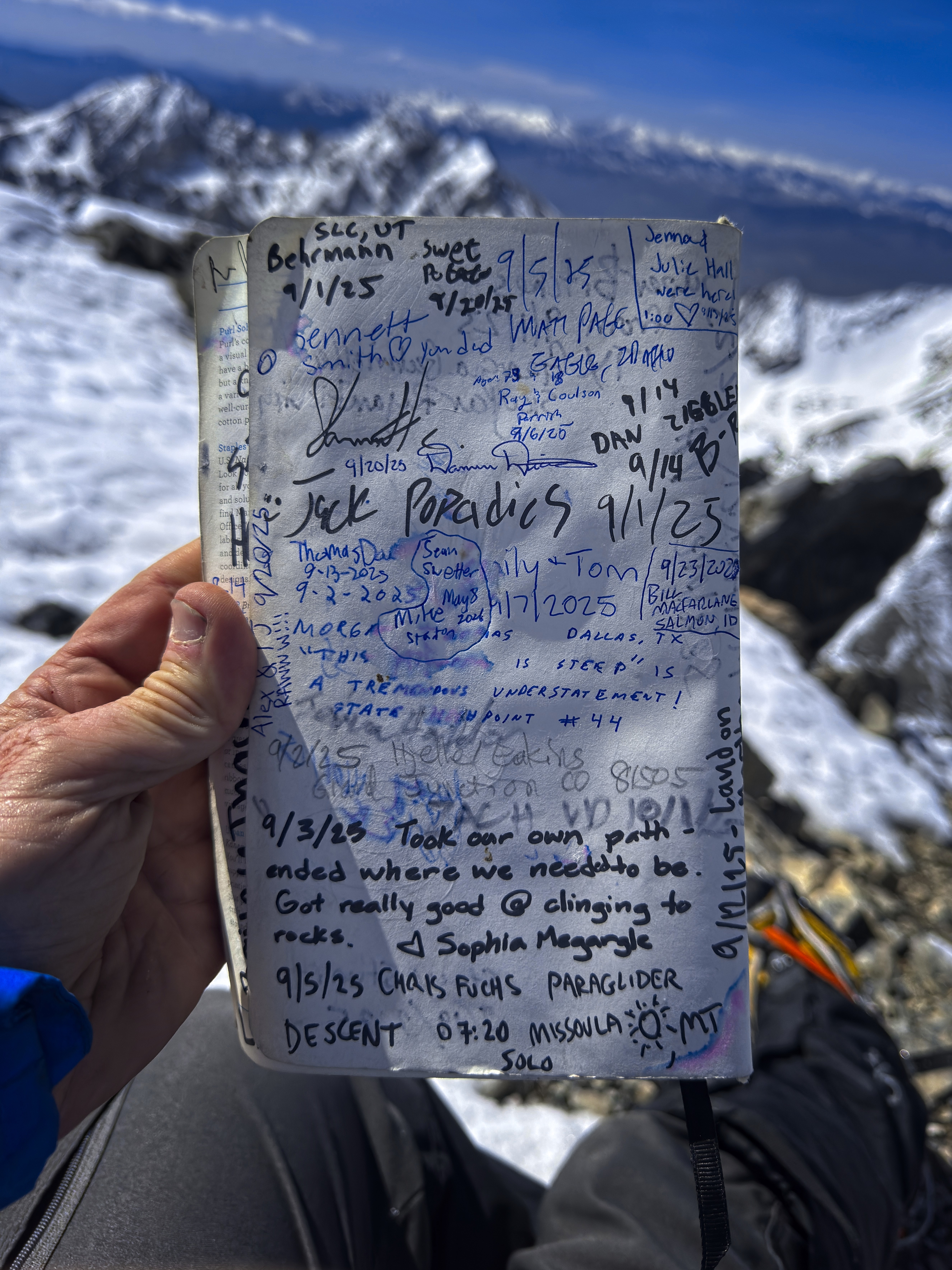
The summit register. We are in there somewhere, lol
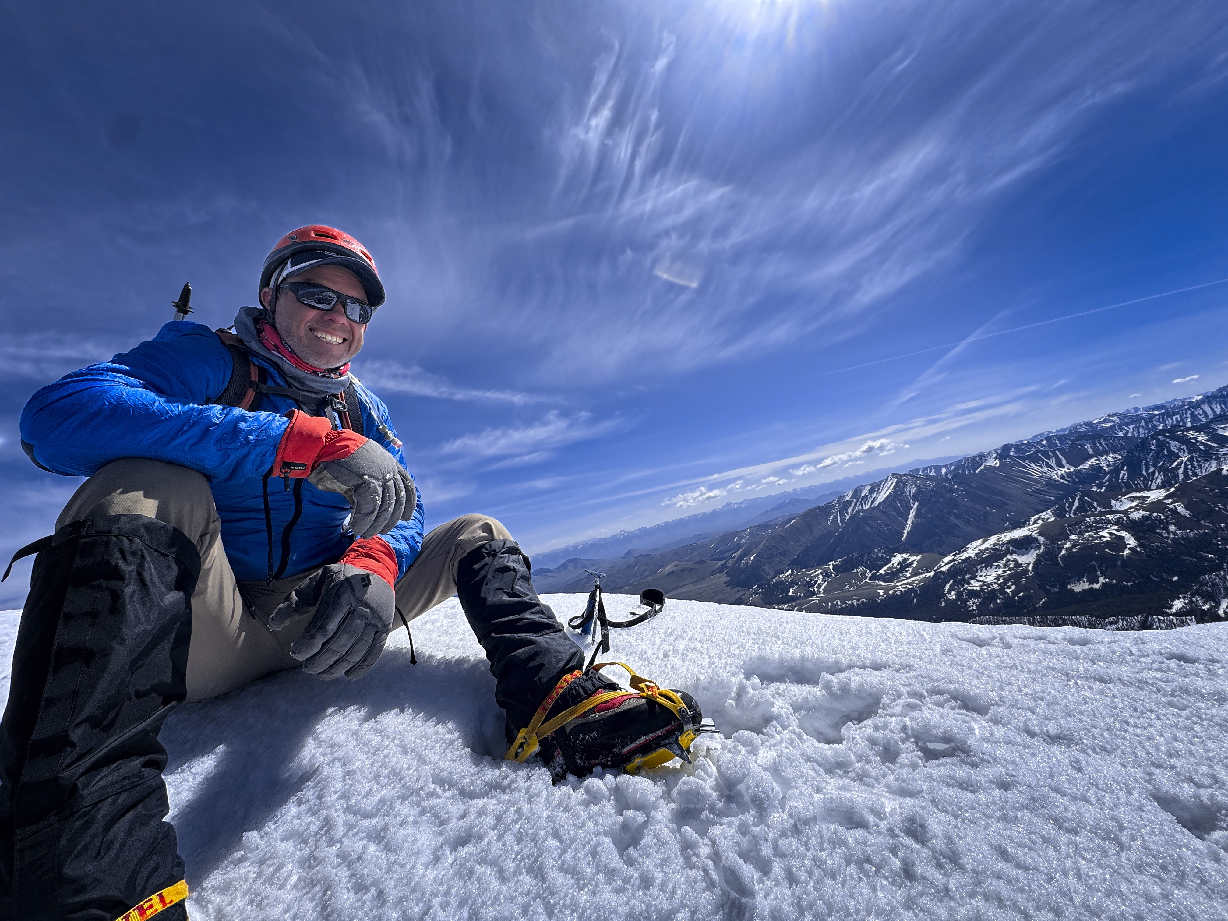
Sean on top!
We basically retraced our steps, abandoning a plan to follow what seemed like tracks down a steeper snowfield -- it was just a bit too steep to seem like a good idea standing above it.
At the saddle we saw some boot-heel tracks heading down into the valley on the north side of Chicken-Out. It looked really snowy down there, with big snowslopes above you as you moved down-valley. I didn't have a read on whether the slopes were dangerous at this time, but I knew I wouldn't want to be there in mid-winter!
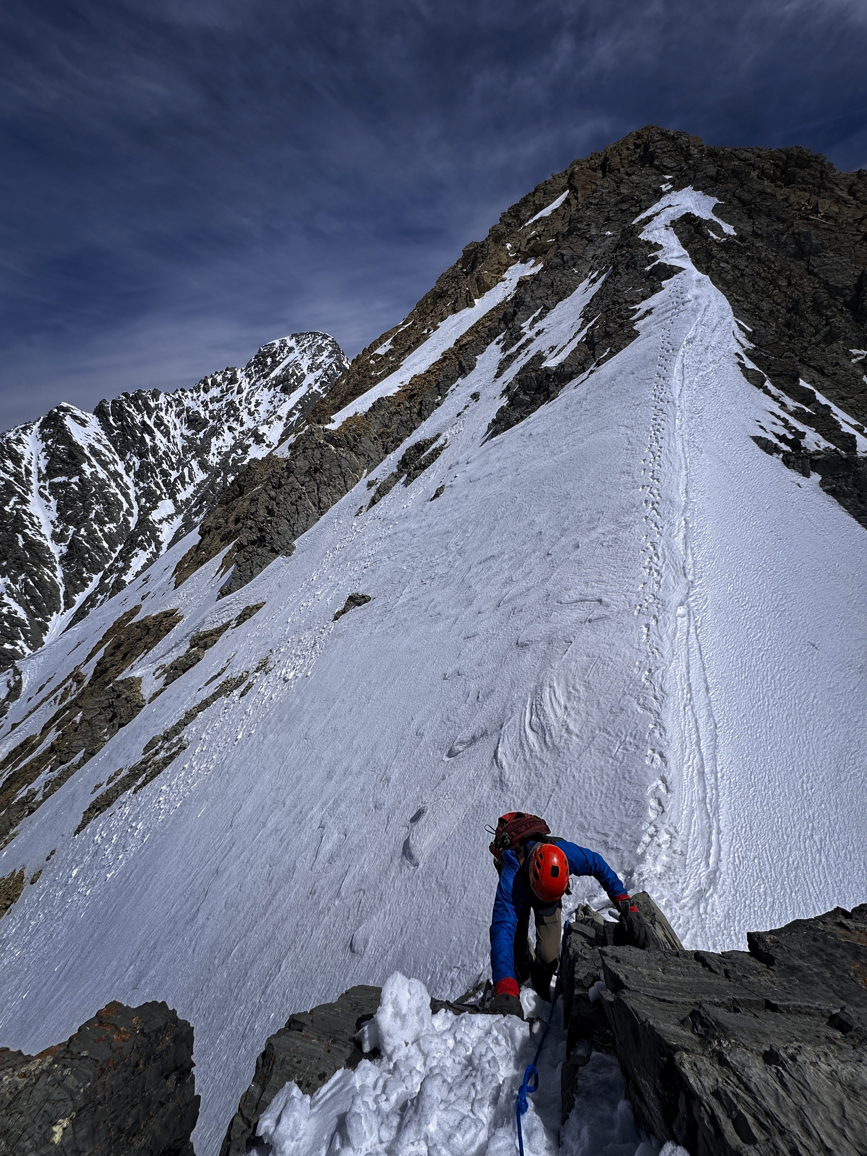
The short climb to the top of Chicken-Out-Ridge was a bit tiring, then we had to be careful descending rock in crampons, or moving delicately around towers. The snow was a bit worse, but still held crampon points in steep areas pretty well.
On the way back...
More giants to the south...
Negotiating a step
A bit of steep snow
Soon enough, we were back to the broad ridge. I switched back to tennis shoes somewhere in the rather masochistic steep descent from the ridge, marked by slippery snowfields in the sun.
Amazingly, we met a couple doing a scouting hike for their planned climb later in the summer just a bit before the trailhead. They were excited to return.
Big thanks to Sean for joining me! I learned a lot and made a new friend. His adventures on Kilimanjaro and even cruise ships of all things, sounded like a blast. Everyone you meet is a whole planet of adventure, it seems!
Saturday, May 9: Mount Breitenbach
I slept at the White Pine Knob campground in Mackey. A nice shady spot and a shower really hit the spot! A beer and incredible nachos at L7 was dinner. Fantastic little town. I decided I'd climb Breitenbach in the morning.
I made some coffee, ate some oatmeal, and coaxed the stiff old-feller body into the driver's seat and drove back north. I picked the most likely road to the trailhead, and headed up. I couldn't find detailed driving directions to the Pete Creek trailhead, so I just assumed all the roads would work. Near the top, I ended up choosing a road that stayed on the right (east) side of the creek, because the left side was brushier, wetter, and it seemed the road was worse because of it. I parked at the top of the road by a firepit and began walking in tennis shoes.
The trip up Pete Creek was good, though it had tricky sections. Especially higher, when rock by the creek was covered in ice and I had to cross time after time. Eventually I got above the vegetation zone but had a new problem. Huge, steep snowfields coated the right hillside, often down to the water and partly across it. But the left side was steep and unpleasant for traversing. I switched to boots and slowed down, concerned above falling through a snowbridge. Happily, I soon reached a wider spot along the creek floor and got away from this "deadly 'V'" situation where ice, snow, water and rotten walls came together.
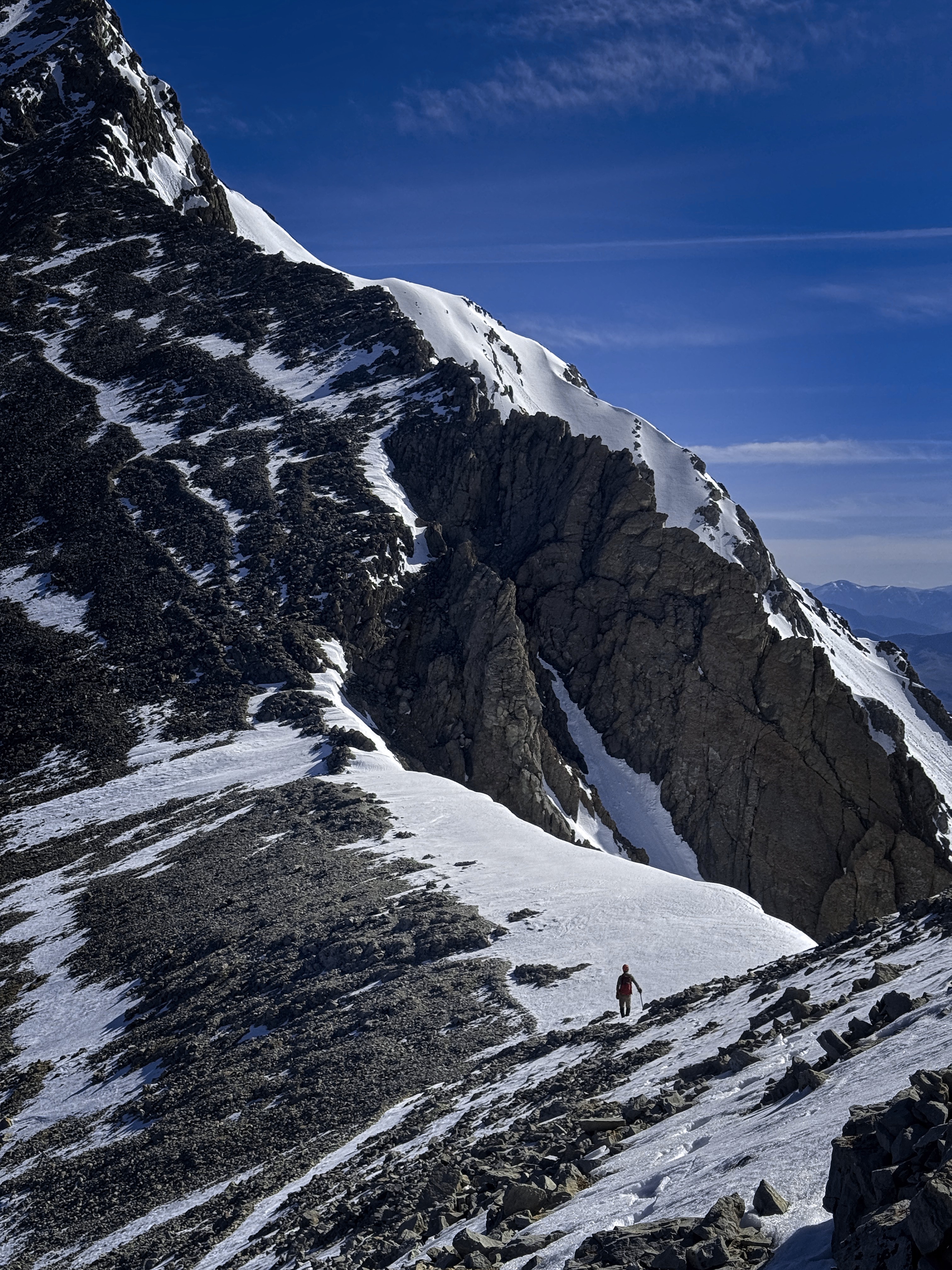
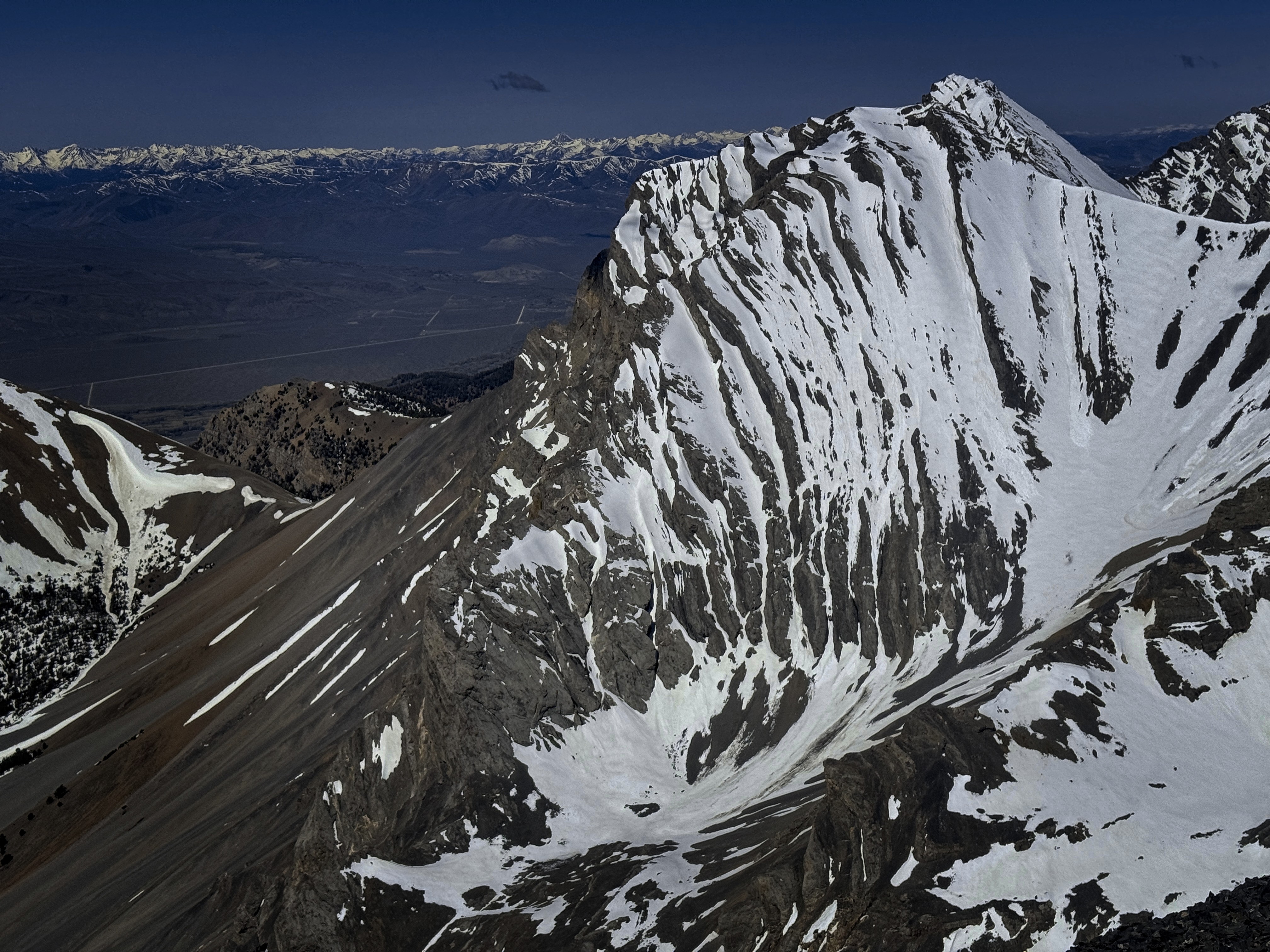
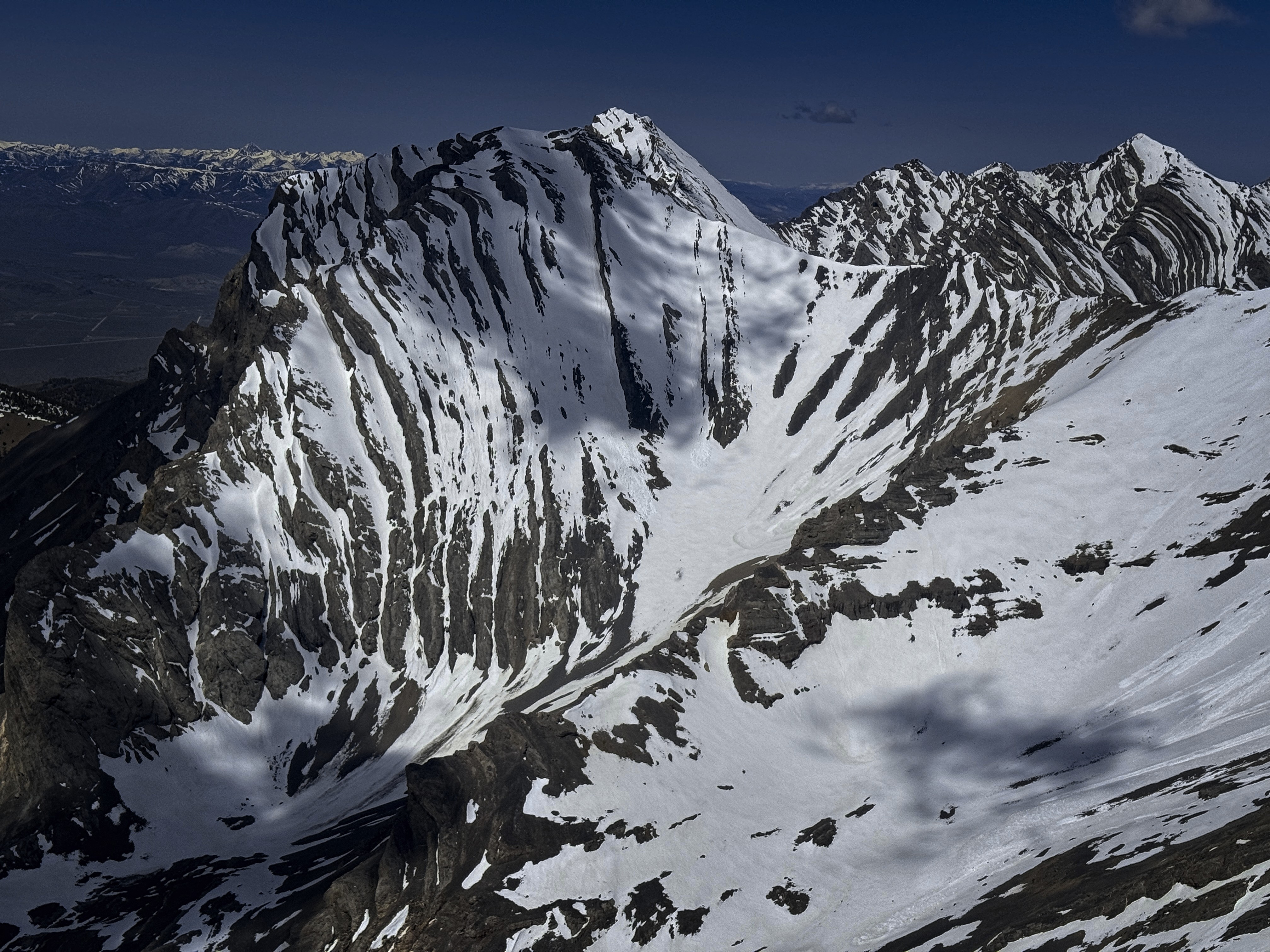
A bowl on the north side of Lost River Mountain
A look at Peak 11467
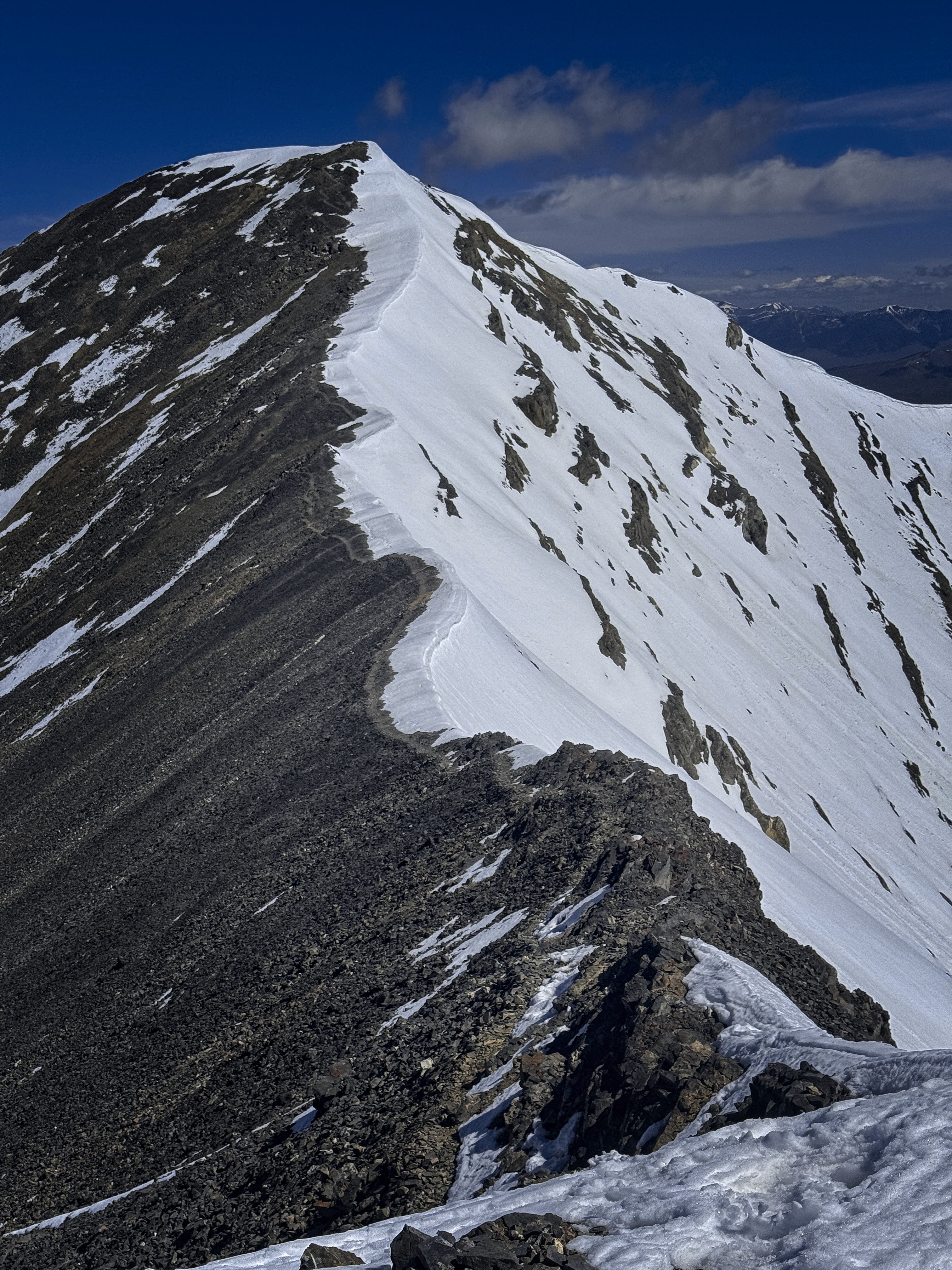
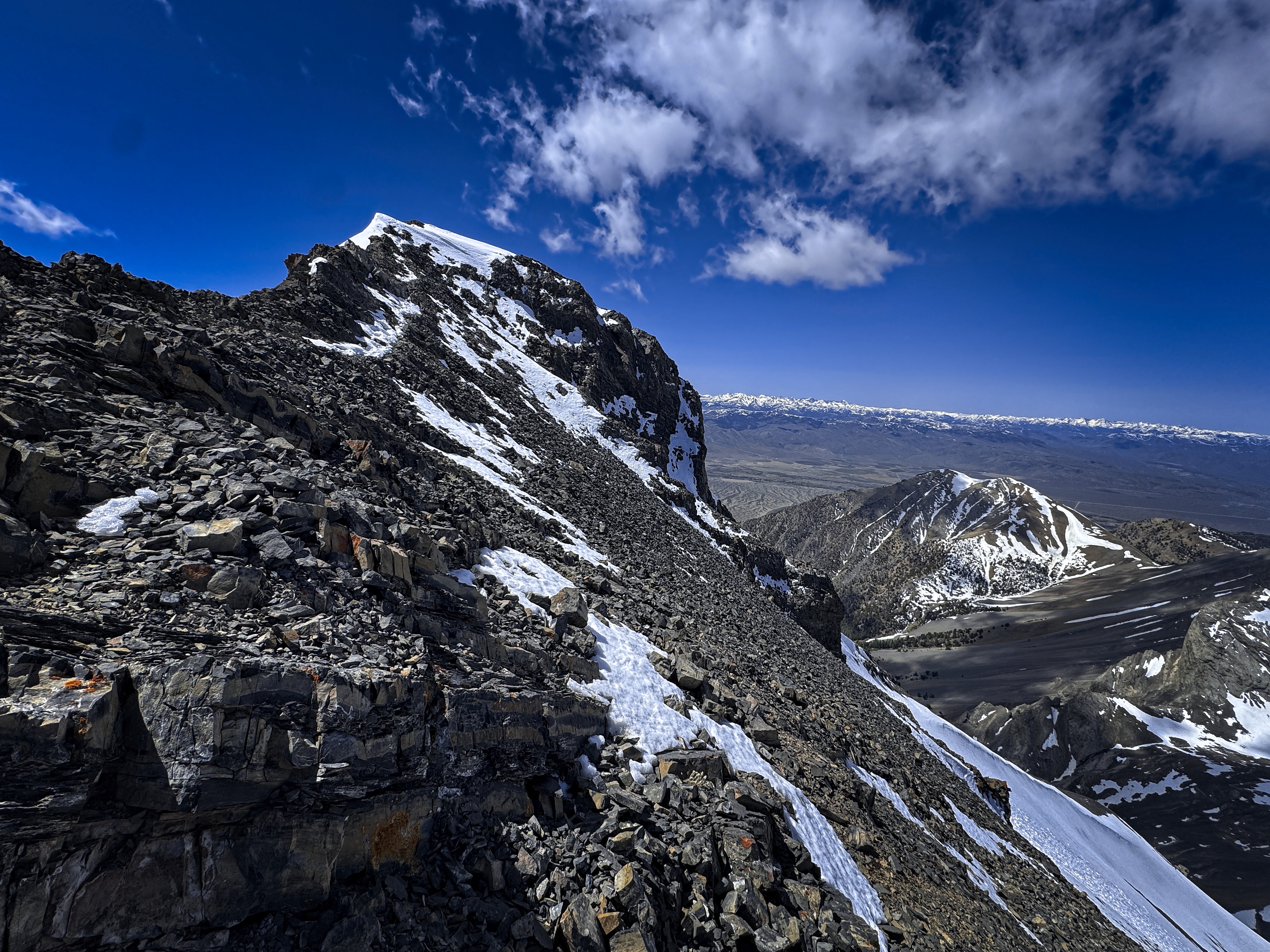
Screes to the summit ridge
Dramatic cornices on the north side of the ridge
Above this, about 800 feet of talus-slope climbing to reach snow. From here, I could crampon up thousands of feet, making minimal moves to connect snowfields. I saw the occasional ski track from the Missola guys a week before. In an upper basin, I stayed further left in snow, then traversed right, and met their descending tracks in the final bowl before the crest.
At the crest, I followed a scree trail, though stuck to snow when I could get it. The views had become incredible.
On the false summit, I descended to the north, using my hands a little bit on a rocky, snowy trail just below the crest. Up again and down, then the final slope appeared. The summit felt like a lonely outcrop into a high and forbidden world. I only wished I could see the north face better, which I read was impressive. Views to Donaldson dominated, with Borah Peak in the far distance.
A view from the first of 2 false summits to the true summit
Looking back down the ridge, with impressive north walls behind
Donaldson Peak, with distinctive "bread loaf" stacked ledges
Last slope to the top
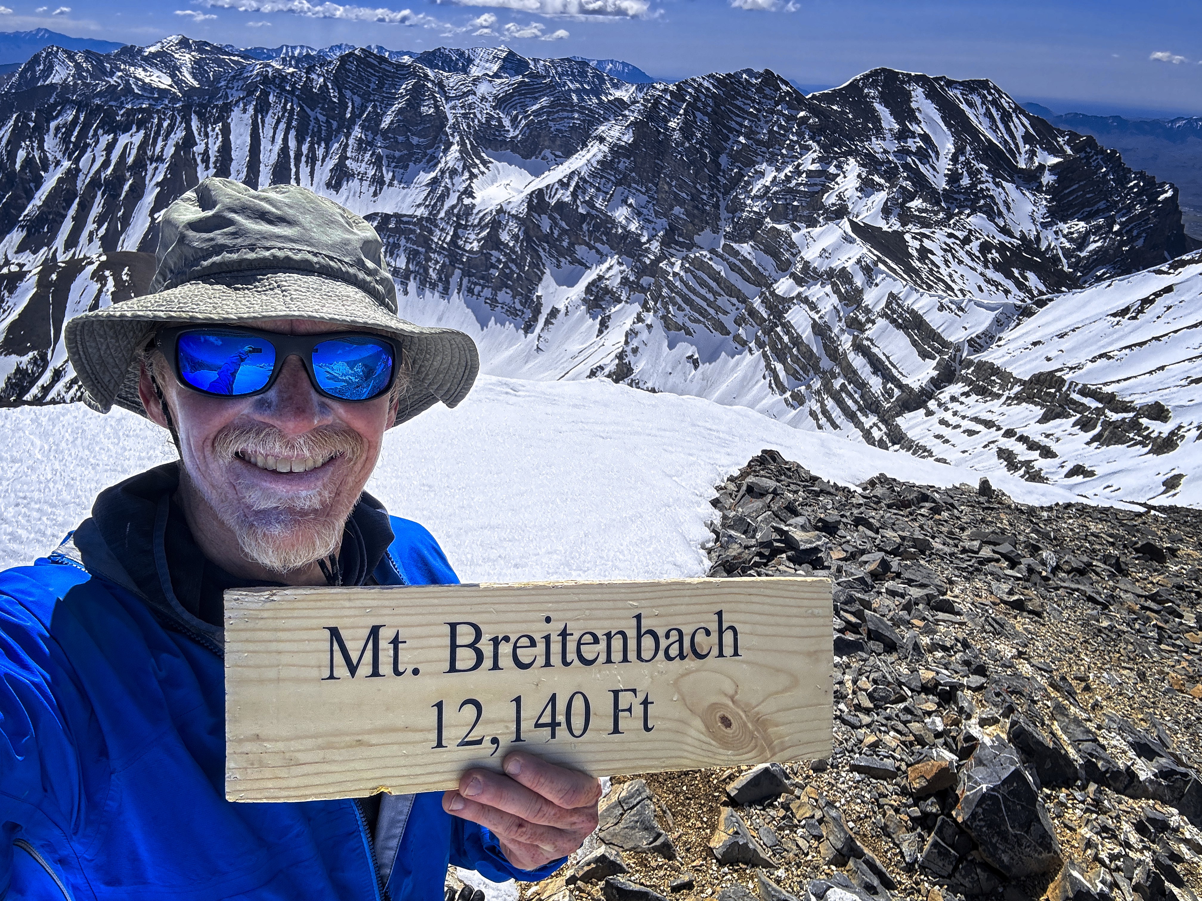
Me, with somewhat overapplied sunscreen
On the way down I was constantly struck by the view of cornice and cliff on the north side of the ridge connecting to Lost River Mountain. Though soon I was occupied with the long snowfield descent. I followed hunch and talisman to avoid punching through deeply, though it happened occasionally. Finally, legs tired, I reached the end of the snow and settled in for a less-than-pleasant talus descent.
At one point I found a trail that looked like it would offer scree-skiing, but the underfooting was unpleasantly frozen, and all I got for my trouble was an off-balance recovery, stumbling through hard little pebbles over smooth "Oil of Olay"-colored frozen faces.
Haha...I don't know why that term, half-remembered from TV commercials in the 1980s comes up. Maybe the unforgiving rock reminded me of the bland, fashionable faces of models, then the color sealed the deal. To be alone all day out here is to rummage in the cupboards of the mind!
I felt rather bruised and punished as Pete Creek wore on and on. Switching to tennis shoes helped, as well as occasionally looking up and around. This kind of terrain is usually easier on descent because you remember the little turns left and right which caused problems on the way up. That was partly true today. And I was genuinely surprised when I reached the truck. Oh! Already? Cool!
A beer and a cigar, whose smoke swirled with the memories of two great mountain days. I trundled down to the flats, well-pleased, and thankful for all the things.
Attractive summit novelty sign #1
Attractive summit novelty sign #2
Looking down to the north
Closeup of same
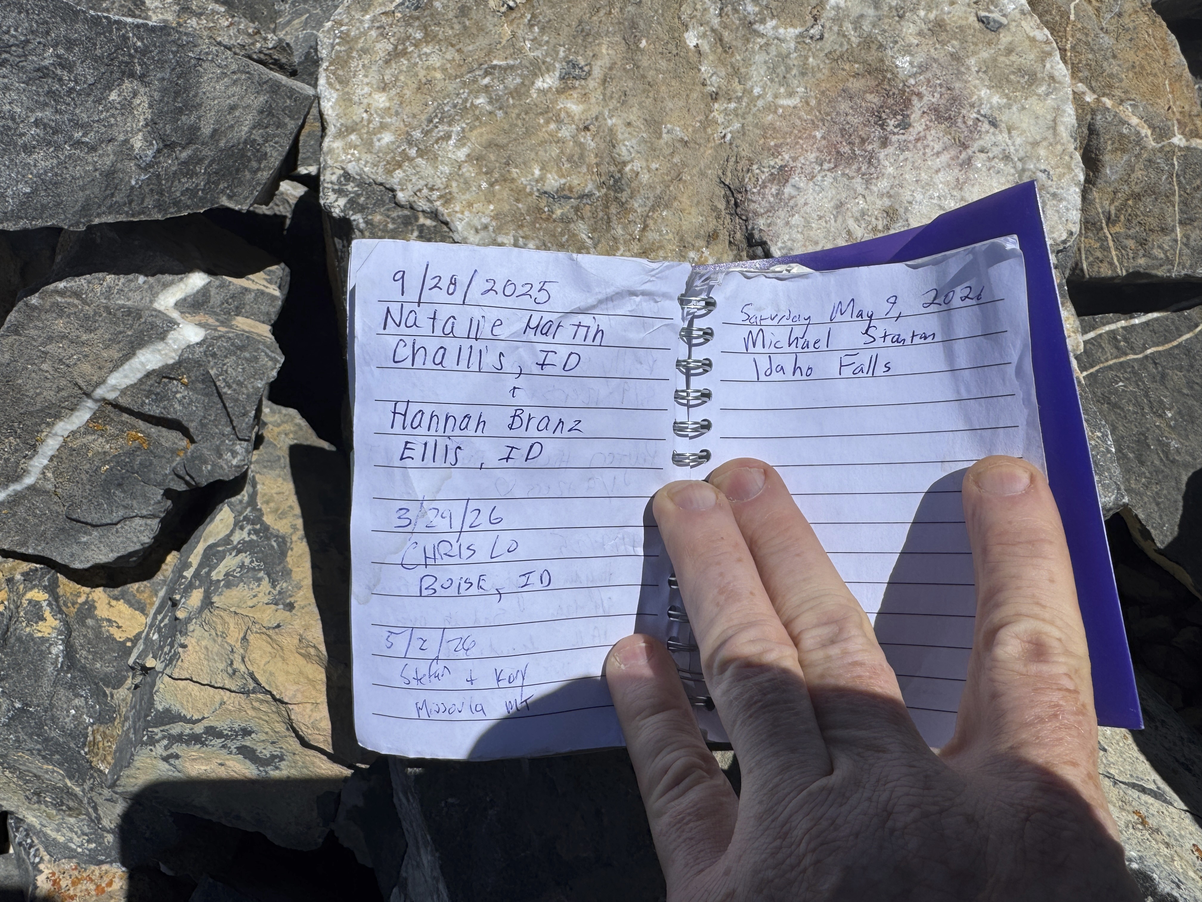
Summit register
Donaldson again, now in doubtful mood
Watching the clouds across Donaldson was mesmerizing
The only place I had to touch hands to rock!
Back down in the canyon
A view of Breitenbach and Lost River Mountain from the dirt road