Short Reports 2006
Friends: Daniel, Danno, Riki, Josef, Angie, KrisLocation: Olomana Peak, Schellschlicht, Kramerspitz, Hochplatte, Große Klammspitz, Risserkogel, Zwölferkopf, Guffertspitze, Alpspitze, Roßstein, Buchstein, Hoher Fricken, Wank, Setzberg, Breitenstein, Hirschberg
Elevation gain: 0m = 0m
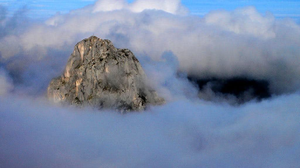
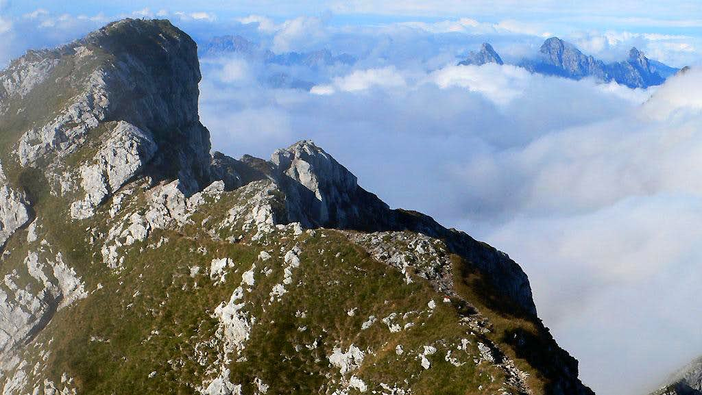
Olomana Scramble
December 26, 2006
Rode a rusty bike from the parents house out there, and had to leave it at the country club gate. Through rain up into fog to the first summit. Down and up to the second, boy are the rocks slippery when wet! Fairly new ropes are installed to get down from the second summit to the third. After bonking my head on a tree I headed up the third summit, which felt like a real alpine climb! The clouds parted slightly, revealing an imposing ridge. Later, the clouds lifted even more, showing how far down the ground was! Despite the weather, it was a lot of fun.
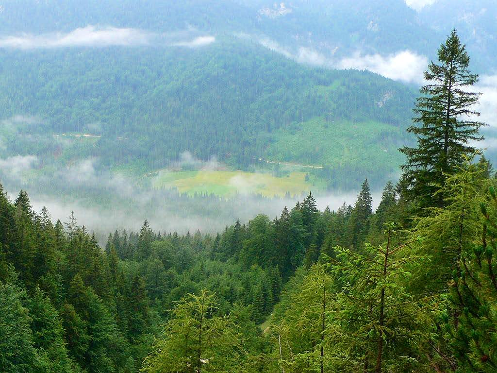
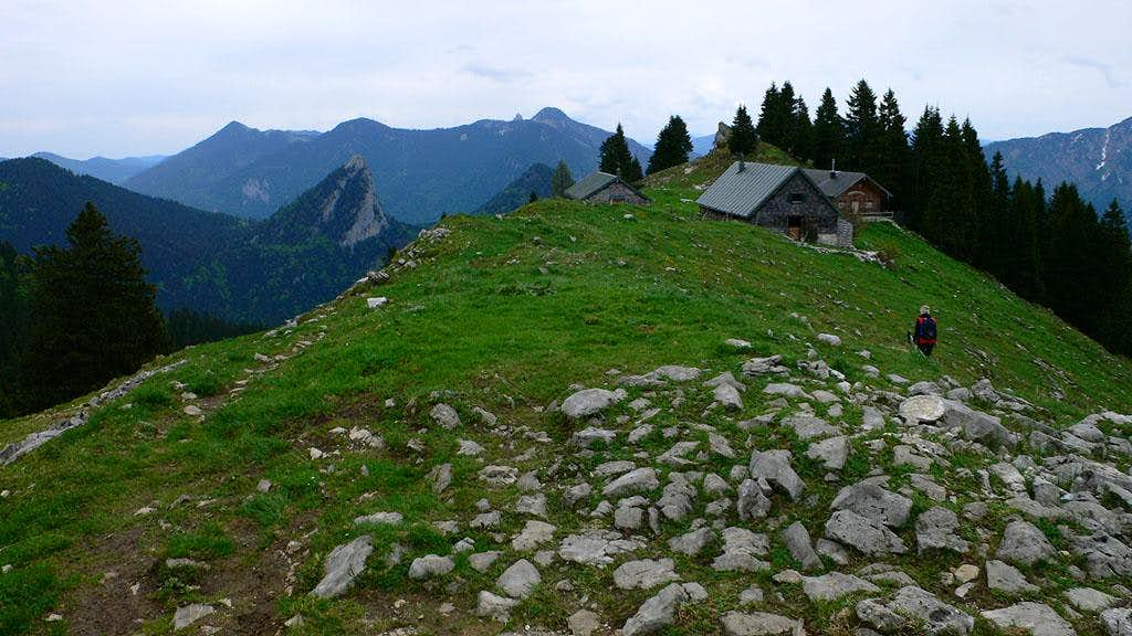
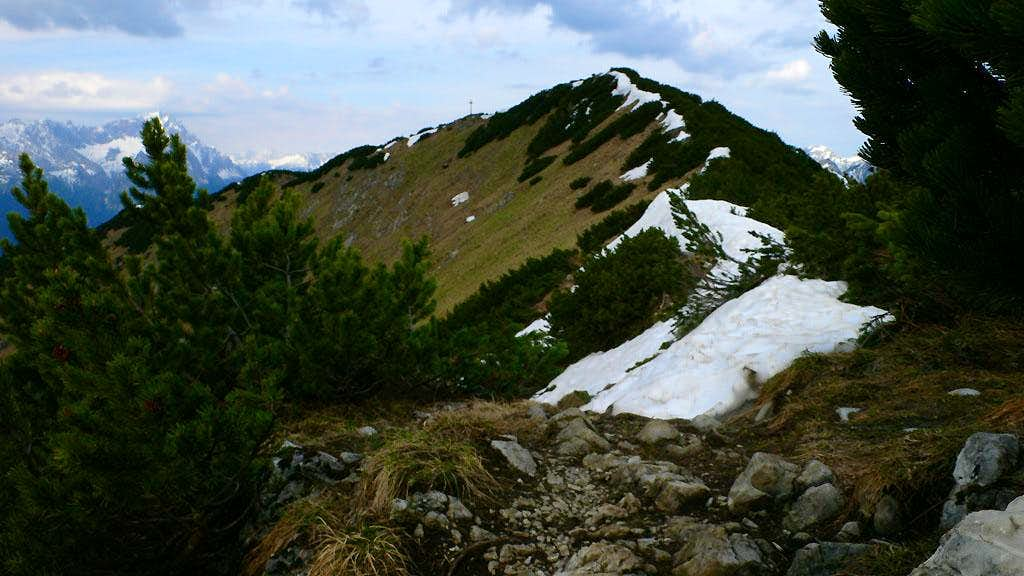
Schellschlicht hike
December 2, 2006
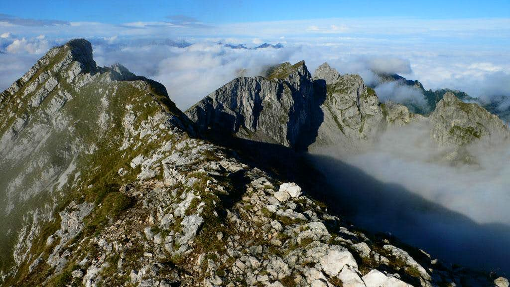
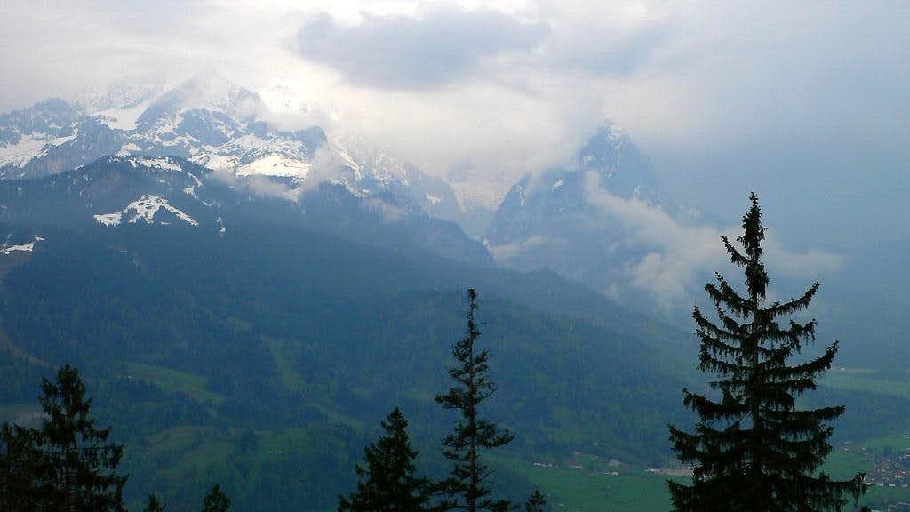
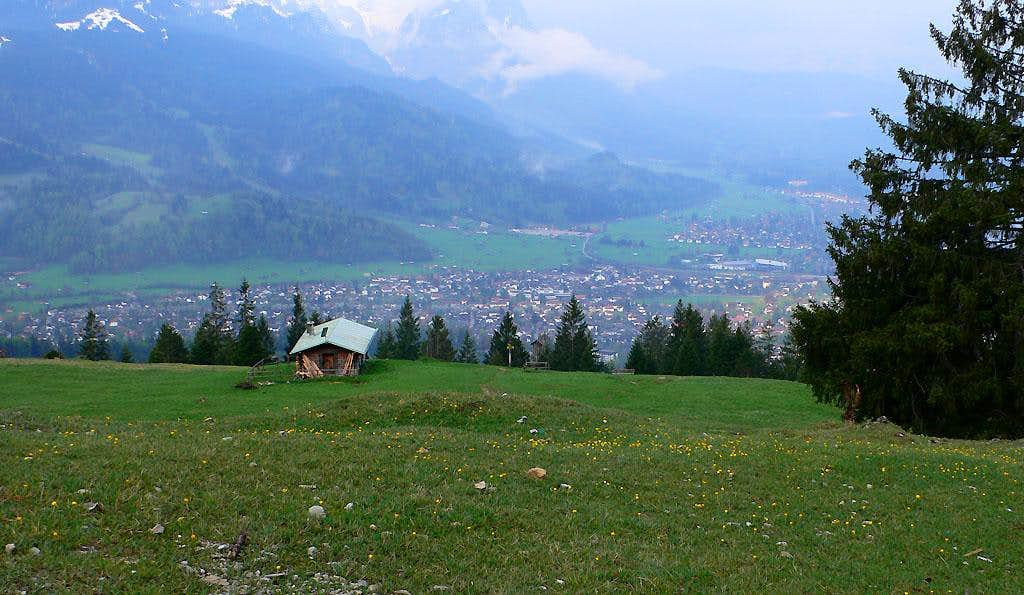
With a great weather forecast, I headed up for probably the last "hike" this year before heavy snow. Another Ammergau exploration was on my mind. I love this little range with it's solitude and wilderness feel. Why are there so few lifts and other paraphanelia here? Well, it was a royal hunting preserve for hundreds of years, and the valleys and slopes are not good for farming.
I walked the road from Griesen, then took the trail up the Southwest Ridge in many short switchbacks. Finally I reached the Diensthütte, then the way opened up on a spectacular ridge. There was a little ladder in the rock at one point. The sunrise was beautiful though the wind was strong. On the summit I especially admired the Geierköpfe to the west, and Daniel to the south, which looked very alpine for a front-range mountain. What a cool summit!
The hike down the Southeast Ridge was very steep, and I didn't get to do all the trail running I was hoping for. Treacherous scree, or tight rooty corners required dainty footwork. There were also some really steep dropoffs right along the trail, only wide enough for one foot at times. They don't fool around over here! Back to the car at 10:45, having met about 5 people hiking up as I descended. I have pictures over here in a Summitpost Mountain Page.
Kramerspitz hike
October 14, 2006
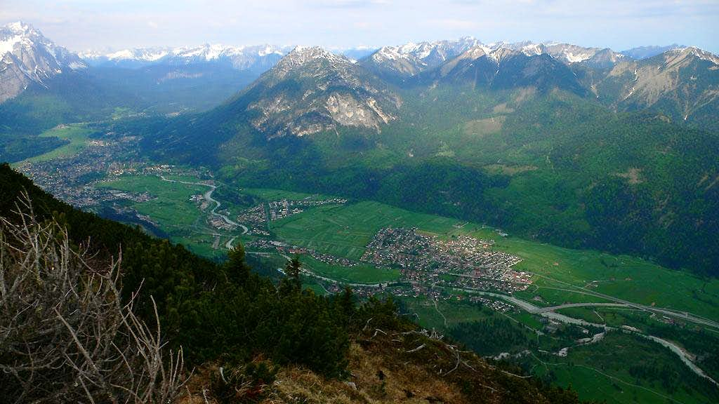
I wanted to get some exercise, so despite a bad forecast I headed out towards Garmisch. I found an approximate place to park on the west side of town to hike up an initially confusing welter of roads and trails to reach the Kramerspitz. It was good exercise in the mist. After about 1300 meters (4300 feet) of uphill hiking, I was on the summit, and it started to rain hard! I could barely see the Zugspitze across the valley through a murky haze of clouds. I went down a different way, heading for the Stepbergalm. When I got there I was soaked and half-frozen. The hut was closed for the season, so I stood under the awning a few minutes, then resumed running down the "Steig über Gelbes Gwänd", which was a mistake, I meant to take the "Kreuzweg", which would get me back to the car with less flat walking on the valley floor. I didn't realize my mistake and was frustrated with how long and flat Garmisch seemed to be once down! At the car, I turned up the heat to thaw my cold limbs. 4 hours round trip. My heart rate monitor calculated 3000 calories burned :-). I wish I'd had nicer views to show for the effort!
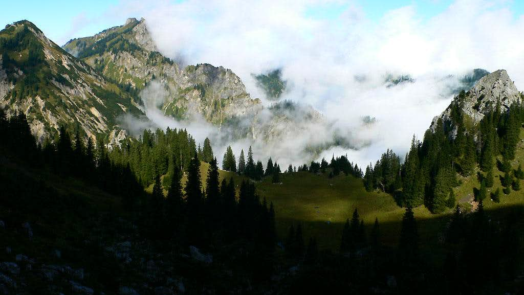
Hochplatte hike
September 17, 2006
Daniel could go for a quick hike Sunday morning. We left Munich around 6:20 and drove to the Ammergau alps, just near the Austrian border. We thought it would be rainy, but above low clouds we could see the peaks in sunshine - yes!! We had a great time hiking up, talking about Seattle, politics and all kinds of things. Shortly after reaching the ridge crest, we were in sunshine, with a dramatic "cloud sea" below us. We followed a neat narrow ridge to the summit of Hochplatte, then descended to climb another summit (Krähe) on the same ridge. Geiselstein was peeking out of the clouds from time to time. That summit has some great multipitch rock climbs that I can't wait to visit.
As we came down from the ridges to a pass where we'd turn back to the south in order to loop back to our car, we saw our first people of the day. A large and friendly group. They immediately offered us a drink of schnapps from their flask. I couldn't turn them down of course! I believe it was Williams (Grappa). With a hearty thanks, we jogged and walked down to the car, and had a good plate of Kaiserschmarm at the restaurant where we parked the car. Delish!!
Geiselstein in clouds
From the summit of Hochplatte
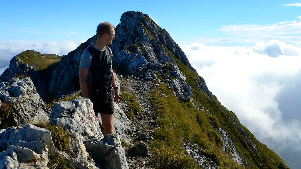
Daniel on the ridge
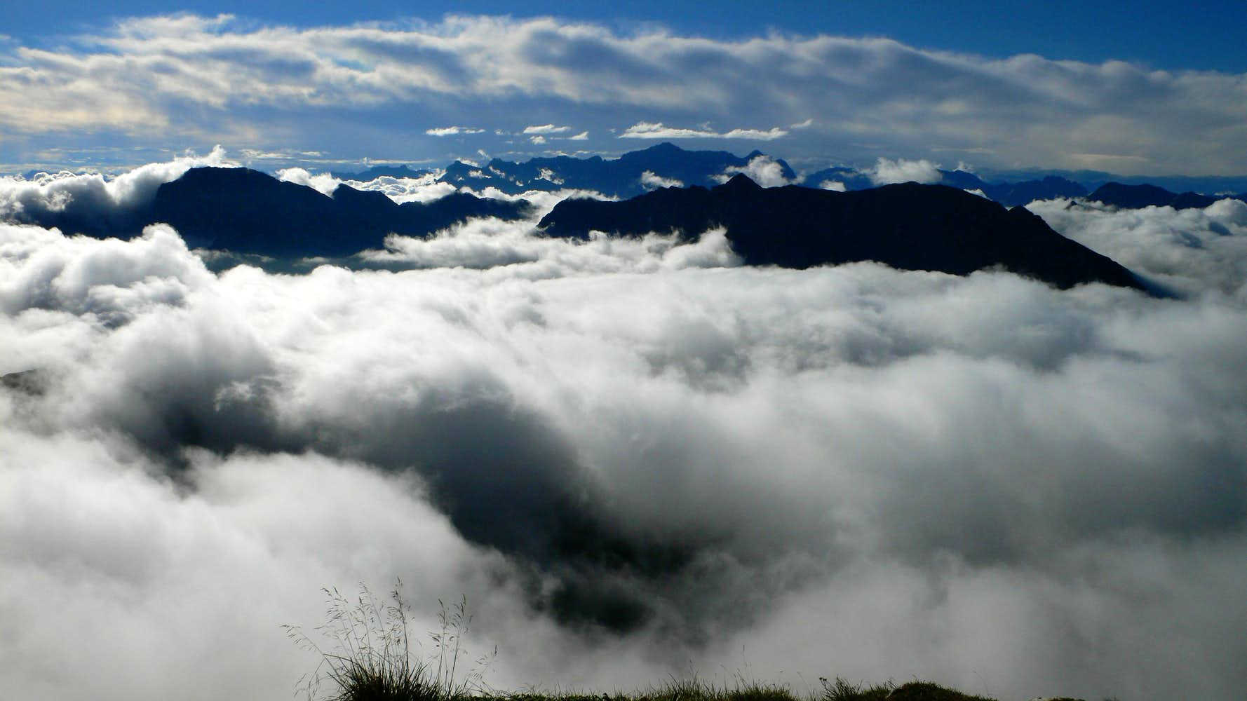
Clouds below
More views...
A little vale
Linderhof hike
August 15, 2006
I hiked up a road above the Linderhof castle to reach the ridge crest and a hut. Then a muddy hike up the Brannenkopf showed great views of the Große Klammspitz. What a cool technical ridge top I was on! Unfortunately, it looked too fragile to climb ethically. There was grass growing on extremely steep smooth slopes, and the passage of a climber would be visible. There was also a question of adequate anchors. Back down to the hut, and then a jog along trail on the south side of the ridge to reach switchbacks below the Große Klammspitz. Fun scrambling gained the peak and I could really admire the surrounding peaks from this high point (almost 2000 meters). The Ammergau Alps are really beautiful!
Now I traveled the ridge crest down to the west, sometimes using my hands and being very careful on the steep trail. Two more small summits were gained, then I followed the most slippery, muddy trail I've ever seen (well, maybe the Tiger Mountain Cable Line trail during a rainstorm) down to a saddle, signed as part of the "Via Alpina" trans-Alp trail. From here I walked and jogged down to a road, on which I twisted my foot rather painfully. I had to walk slowly out the rest of the way. Car to car time: 4:30. This is a really special place, I liked it a lot! Sorry, no pictures on this better-than-expected day (I thought I'd be in rain).
Risserkogel hiking
July, 2006
On a rainy Saturday I needed some exercise, so I hiked through light rain up a trail on the south side of the Risserkogel peak south of Tegernsee. Quite pleasant, despite the rain, and some really interesting steep grassy hills all around me. I reached a hut at a meadow, stocked by goats and a few people. At that moment, the rain started coming down really hard. I looked at my watch, and saw I was out of time. I headed down.
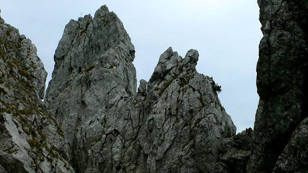
Zwölferkopf recon
July, 2006
I had a few hours one Sunday morning to check out the start of a climb on the Zwölferspitze which rises above Garmisch. I hiked up through forest to a long steep trail in scree to reach old snow below the ridge. One couloir went left, another right. I was searching for the start of the rock climbing, but made a mistake and roughly followed the couloir on the right. Continually, there were little plaques embedded in the side of the mountain, and I thought "ah that must be the start of the route." But no, they were markers for when someone had died. Many were very old. After more scrambling, I realized my route would reach a saddle, with still a long ways to the top. So I descended carefully. I met and warned another party heading up, but they roped up and seemed to be making the same error I did. Oh well, they had the full day to puzzle it out. I meanwhile hastened away.
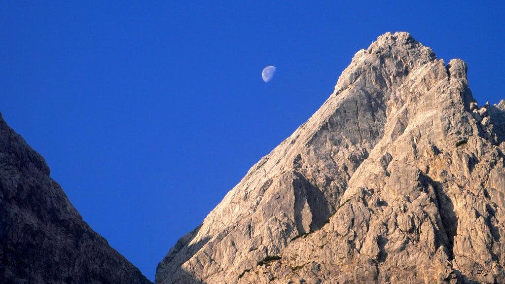
The Zwölferkopf from the Mittagscharte...with moon. July 2006.
Some fellows looking for the start of the Northeast Ridge rock climb. I could
tell them it's not to the right, but they went over there anyway. :D. July,
2006.
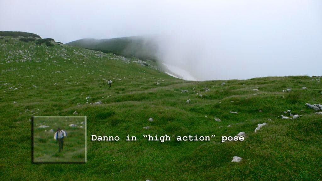
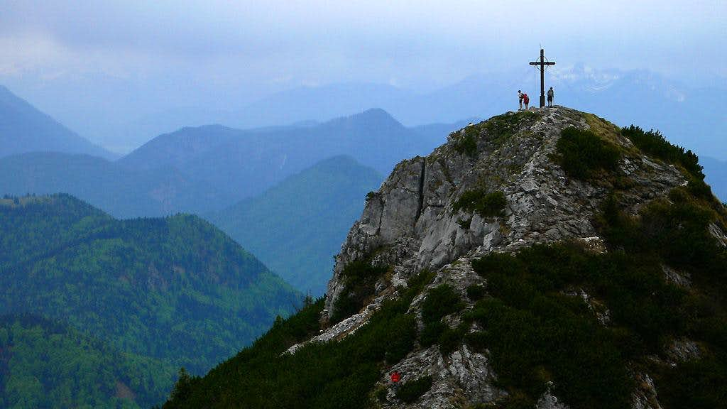
Guffertspitze
July 8, 2006
Danno and I wanted to go for a rock climb this morning, but heavy clouds persuaded us to go for a hike instead. I'd seen the impressive Guffertspitze earlier from Buchstein, and thought it would make a great morning trip. So, we headed up in fog and clouds for some exercise. Apparently the mountain isn't too crowded because there are no huts or restaurants along the way or on the summit. The climb is over 1000 meters, and via pretty steep trail. Dan and I had a great time talking about all kinds of things. One of our best ideas was to build a new software process model around the ideas and language of Bertold Brecht. Keep an eye out on Slashdot!
Near the summit the route followed a nice thin ridge, with what must have been spectacular views into the Rofan mountains to the south. We also enjoyed the "Scottish Highlands" character of the rocky barrens below the summit block. Going down a different way, over the Guffertstein, we found the necessary uphill climb a little annoying, but then a broad meadow and a herd of Gämse cheered us up. Then the knee-pounding descent reminded us that alas we are frail! Good exercise, but we'll have to return for bigger views.
The town of Steinberg, below the Guffertspitze.
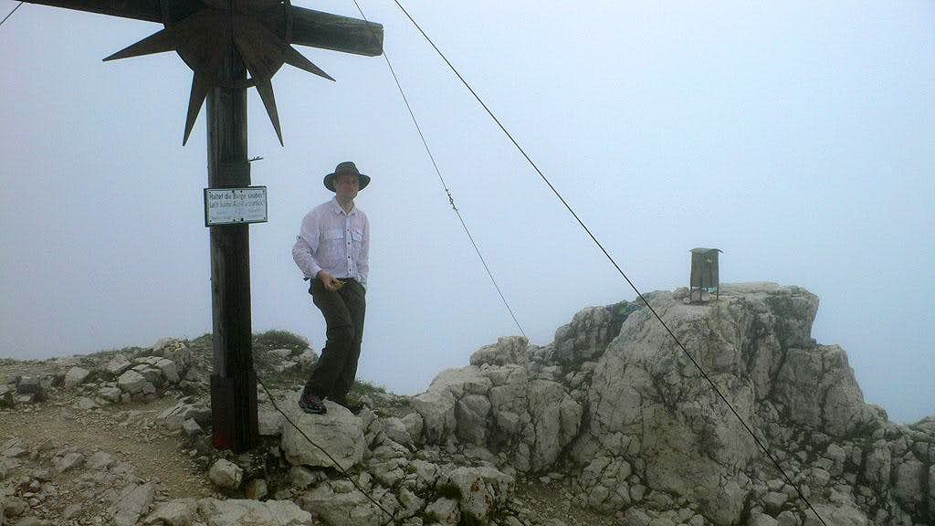
The cross, Danno, and a cute little tin box for the summit register. July, 2006.
Cavorting in a broad meadow on the Guffertspitze. July, 2006.
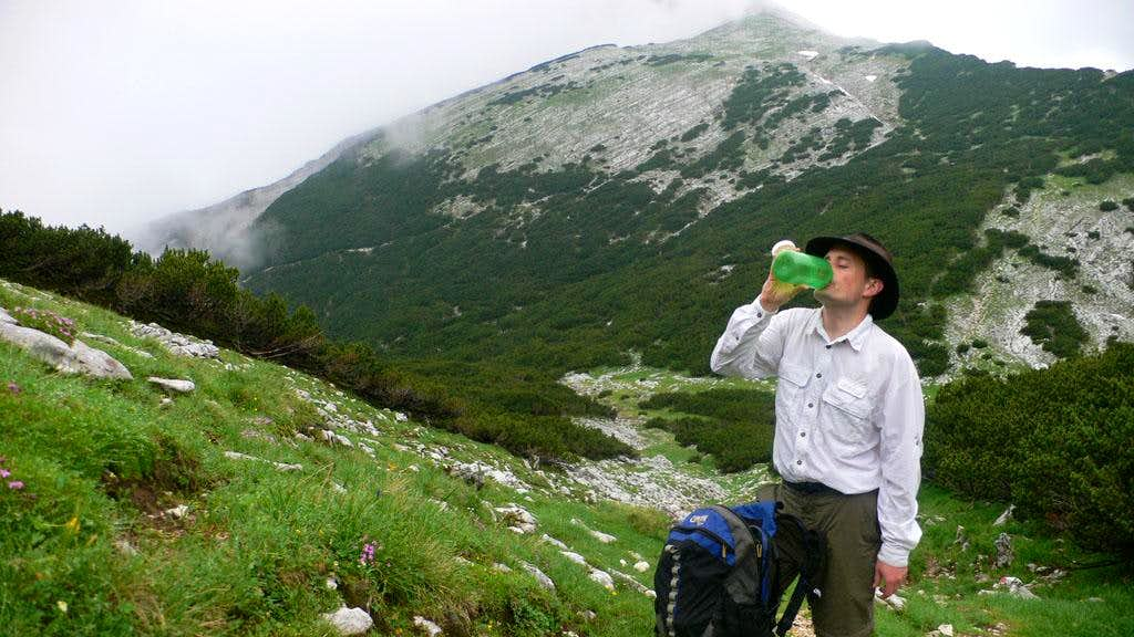
Danno quaffs some cool, clear water on the Guffertspitze. July, 2006.
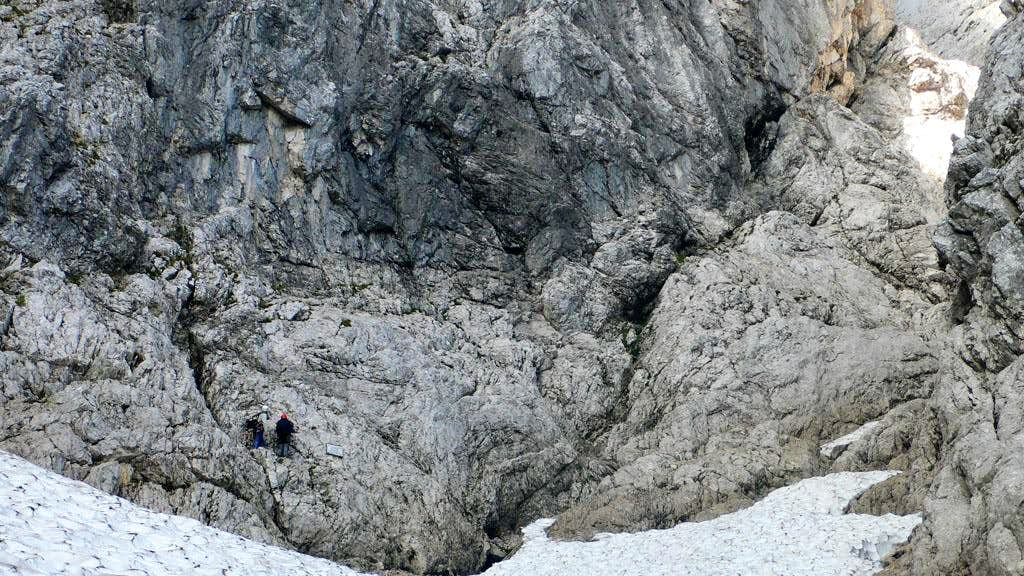
Alpspitze Ferrata
June 16, 2006
Timing:Parked car at "Hunter Trail" trailhead at 6:15 am, on summit of Alpspitze at 9:00 am, back to car via a modified normal route down from Alpspitze, then walked the road to the saddle and ran down the Hunter's Trail. Reached car at 10:30 am.
For months I've wanted to hike up the Alpspitze in the Wetterstein Range. I decided that by getting up early I could do it in a half-day. Since I was starting long before the lifts open, I'd have to do the hike completely unassisted, alas! I drove up on a road to a trailhead that saved me about 300 meters of elevation gain.
I just took a rain jacket, a liter of water, crampons and ice ax. I'd seen pictures of the ferrata, and it seemed very easy, so I left the "big guns" (harness, special ferrata gear) in the car. I thought I had an apple to eat on the summit, but I left it in the car. As the only food for the whole trip, man did it taste good on the way home...
I hiked up the good, steep hunter's trail to a saddle, then turned right to follow steep meadows up to the top of the Alpspitzebahn. I wished I could take it home, but my car was partway up the mountainside so it wouldn't work.
The weather was iffy. I had driven through a rainstorm in the pre-alps, and only continued somewhat glumly towards Garmisch because I thought a hike in the wet trees might be good for exercise. However, the storm had disappated, though more clouds were building again. I thought I'd go until the weather told me I should turn around. Promptly it thundered. Hmm.
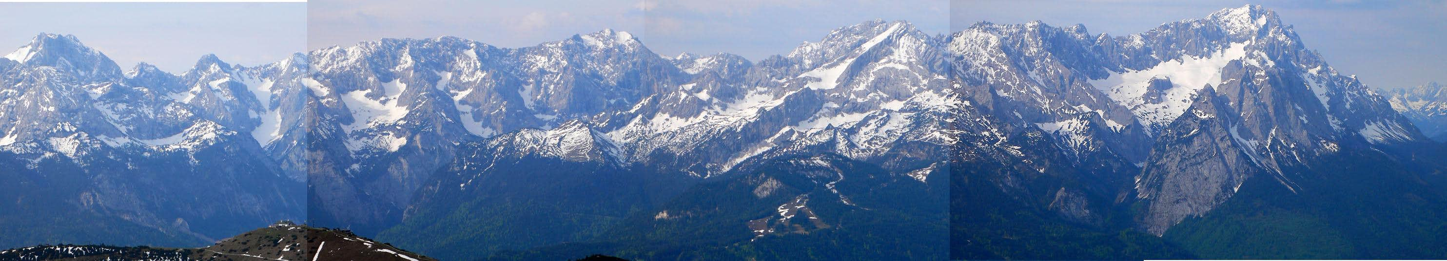
Let me just go a bit farther. Now I walked on snow and took a wrong turn to a high pass with a trail leading down to the Höllental. Very scenic detour! I got back on the trail (now snow covered), and pretty soon there were signs. I climbed up some old tracks in snow, and started the "iron climbing." This particular route is very fond of heavy-duty iron steps. A dark gray cloud behind the Alpspitze occasionally grumbled, but it wasn't coming closer. I went in and out of sun patches, sometimes in snow, sometimes on rock. The various iron gee-gaws were most helpful on the snow, which was sometimes icy and treacherous. Beginning to feel the altitude, I reached the ridge crest and got a stunning view of the Zugspitze and Höllental at my feet. Now I traversed a cliff on the west side of the summit, and soon stood on top.
There was a cross, a table, a bible (New Testament) and a very impressive log book. I admired the Jubiläumsgrat to the Zugspitze, and can't wait to have-a-go at it. The menacing cloud that bedeviled my thoughts on the ascent had vanished. It seemed like it would be a nice day here! Too bad I couldn't stick around.
I followed tracks down snow for several hundred feet, and was led onto a scenic ridge crest with occasional via-ferrata protection. More boot skiing and running down snowfields led to a choice between a cliff and a gentle trail going around a corner. Signs indicated they went to the same place, so I went down the cliff for a fun "mini-via-ferrata". Eventually the cable was lost in snow, so I carefully plunge-stepped down, linking snowfields with bits of exposed rock. 2 parties were starting up, and I said hello.
An easy walk back to the saddle followed (I was sorely tempted to buy a Spetzi at a hut beside the road), then a tiring jog/hike down the hunter's trail to the car.
I'm proud to make a first aqaintance with this beautiful mountain!
Roßstein and Buchstein
May 25, 2006
Timing: Left house at 10:45, traffic was heavy. Parked car at trailhead at 12:00 pm, on summit of Buchstein at 1:15, and Roßstein at 1:30. Back at car at 2:15. Battery dead! After jump, left parking lot at 2:30, home at 3:30.
Bad weather for the weekend depressed me, forcing cancellation of a fun plan. Also the kids got sick with a high fever, cancelling the secondary plan to take a family trip to Italy. Darn! So, I figured I should at least get some exercise, so I picked a likely looking peak nearby: The Buchstein. The trail wastes no time, climbing up through forest in many tight switchbacks. With my late start I was amazed at all the people on the trail . I passed everyone I saw. I don't think I was mister speedy or anything, but I found it strange how much clothing everyone was wearing. I mean, folks hiking up in blue jeans, wearing a sweater and then a "Gore-Tex" jacket over that. Huh? I think you'd have to hike very slowly to avoid overheating. I don't think I saw anyone else dressed as I was in a short-sleeve shirt.
Once above the trees, I was impressed by the neat rock climbs on the Roßstein and Buchstein. I saw a few parties climbing and envied them! Still, the trail is fairly exciting, because it goes up a steep flank of the Roßstein and you need to use your hands on nice (but polished) rock. The way was also "protected" with a cable, but it wasn't necessary to touch. I followed the trail along the side of the peak to the charming Tegernseer Hütte. How neat, the way it is perched on the edge of a cliff! It was very crowded - I might have gotten an apfelstruedel but the line snaked out the door. Instead I walked behind the house to begin the scramble up the Buchstein. This was really fun, kind of like "The Haystack" on Mount Si back in Washington. Happily there were no cables snaking along the way. The rock was very polished, and if the holds weren't so positive and rounded that would have been a little bit unnerving. This scramble also looks much steeper than it is - it looks vertical from a distance. I saw a man gingerly going down and I honestly thought he was on 5th class terrain (maybe III+/IV-), but it's more like II+, or 3rd/4th class.
Then I headed down to the hut and back up to tag Roßstein, which had great views to the south. An uneventful descent to the car followed, after some more wistful looks at the climbing parties, undeterred by a few drops of rain.
On the way down from the Sonnberg Alm, on the trail to the Roßstein.
There are some 1 and 2 pitch climbs on this little tower shortly below the
summit of Roßstein. Indeed, the whole area abounds in nice looking rock climbs.
Some people were top roping a steep slab just out of sight on the left.
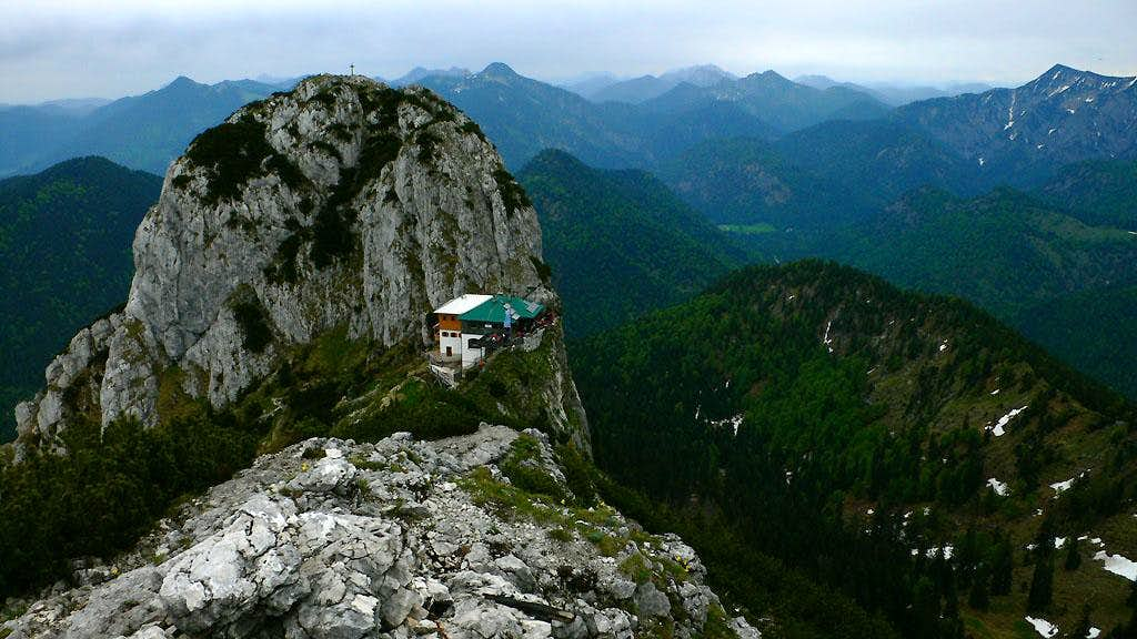
Looking north on the Buchstein and the lovely Tegernseehütte at it's base.
Photo taken from the summit of Roßstein, late May 2006. A funny note
(September, 2007): A friend of mine met his girlfriend at this hut...she works
there. Lately, he disappears every Friday night to hike/bike up in the dark,
and comes back Monday morning after a screaming bike ride down at 6 am.
Currently, they have a 1/2 meter of snow around the hut.
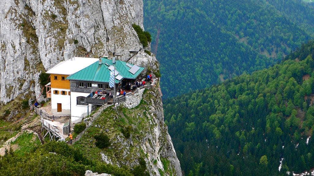
A close up of the Tegernseer Hütte, from the summit of Roßstein. The "trail" to
climb Buchstein goes directly up the intimidating-looking crack behind the
house. It's not as steep as it looks, happily.
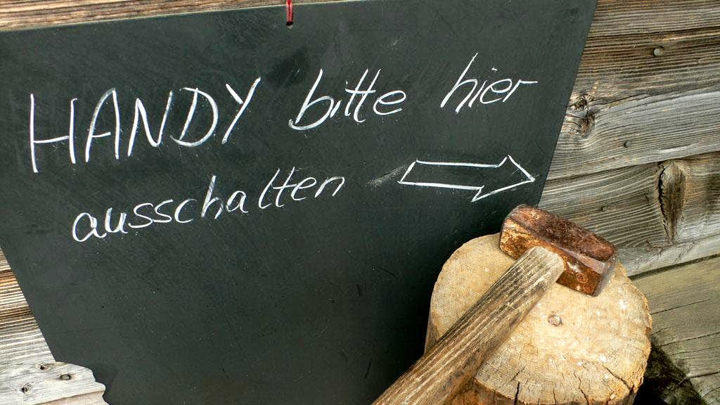
The warden of the Tegernseer Hütte apparently has strong feelings about cell
phones! "Please disable/destroy your cell phone here." (Although it's not a
mountain picture, I submit it because it is part of the mountain experience in
Europe, where huts abound and everyone has to be a little polite to keep a
feeling of wilderness. It is a commentary on contemporary mores, and/or a
humorous reflection on the trials and travails of being a hut warden in the
mountains.) :-D.
From the summit of Buchstein, the Roßstein is easily seen and must be hiked. :-).
Hoher Fricken
May 18, 2006
A morning hike to the summit of Hoher Fricken. I parked just outside of Oberau, and followed a nice path by a golf course. Then it turned up off the valley floor on a steep narrow forest road, and soon because a steep trail. They really know how to make their trails steep around here! I continued up in many switchbacks, crossing the occasional stream gully, and even using hands on a rock step here and there. Eventually I reached a pleasant bowl with bands of snow. Kicking steps up the snowfields slowed me down a bit, and I wondered if I should go for the summit or turn around. Suddenly I was at a saddle with an amazing view of the Wetterstein Range! Then I looked at the relatively narrow ridge leading to the summit. "Oh I need me summat!" I said aloud. It was a slow 15 minutes to get there from the saddle due to snow on the ridge top. But it was so worth it! The view of Farchant, the Zugspitze and other snowy peaks was fantastic (actually, "gigantisch" :-)). It took 2:15 to here, and I felt so good that I decided to go down a different way: via a steep trail to Farchant. Farchant and Oberau looked so close from up there. "I won't mind the flat walk between them," I thought.
Boy was this trail steep, and often snowcovered for the first 300 meters down. I came to puzzling drop offs and small ascents where I paused and scanned the map closely. Sometimes I had to grab onto Latschen and lower myself down steep crumbly slopes. "This is like the Cascades," I mused. Later I came to a road, followed it the direction that looked down then got nervous when it started climbing. So I went back the other way, wasting about 30 minutes following the road to it's end on a logging landing. I did see an enormous, frightening ant bed over there.
From road, I was back to trail after a while, and finally on the flats of Farchant. Boy was I tired! Too tired to run more than a few minutes at a time on the road back to Oberau. Mostly I enjoyed the little forest interpretive center as I sauntered along. There would be a bench with the sign "Wildschule" (wild school), or another bench with a great view stating "Garmischer Apotheke" (Pharmacy for residents of Garmisch). I reached the car at 10:30, so the trip down took just as long as the trip up (2:15).
This trip is a little long for a morning hike, but if you return the same way, you could cram it in. It was about 4000 feet elevation gain/loss. Some pictures to come.
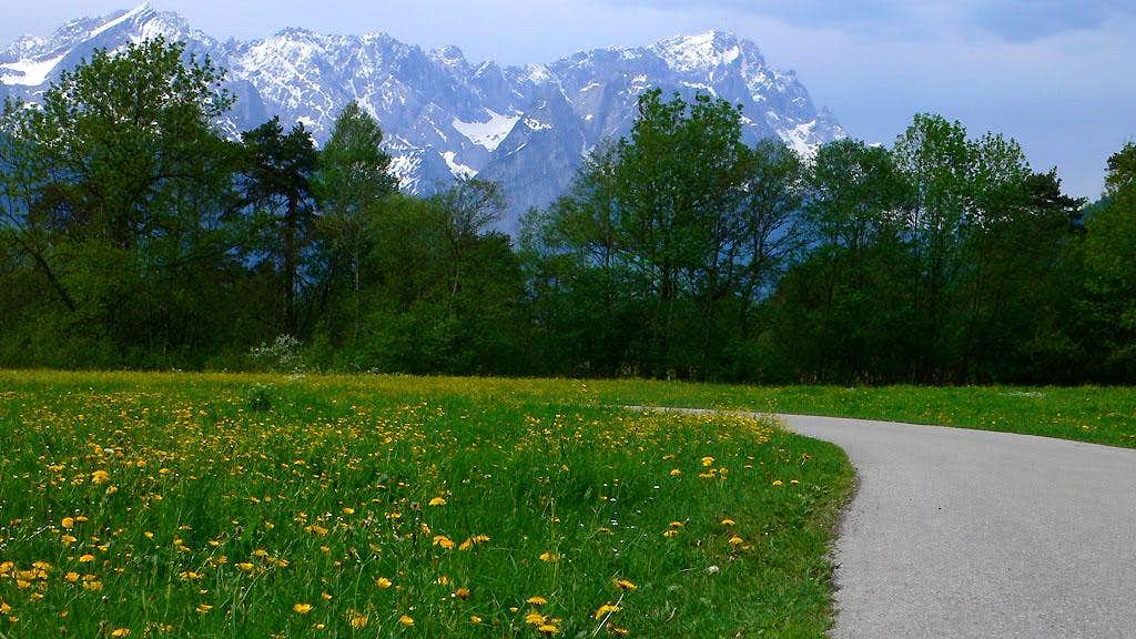
The hike to the summit of Hoher Fricken via the Oberausteig passes through some
lovely meadows on the valley floor. The mountain in the background is the
Zugspitze.
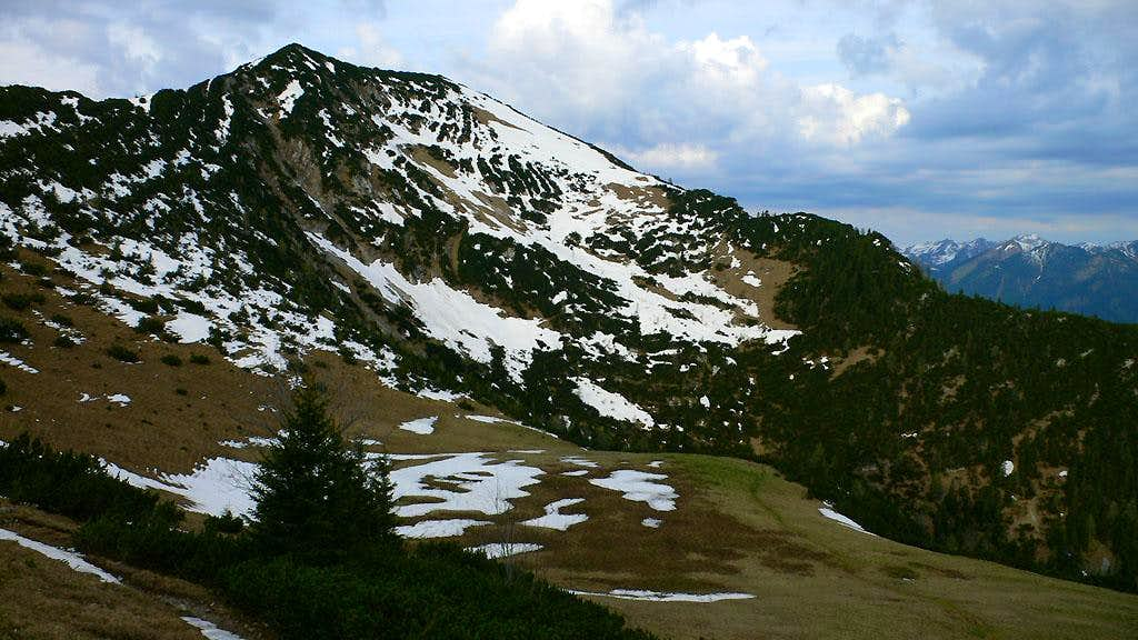
The Hoher Fricken seen from the basin ("Kessel") just to the north.
This nice ridge leads to the summit of Hoher Fricken.
Here is the town of Farchant from the summit of Hoher Fricken. The larger town
of Garmisch-Paternkirchen can be partially seen on the left.

Wank
May 6, 2006
I had to try out my exciting new digital camera (a Panasonic LX1) so I got up early for a hike up "Wank," a view peak for the Garmisch-Partenkirchen area. I parked my car at a secret trailhead where my friends Mat and Ari live, and saw that they were still sleeping. "I'll catch them on the way back," I thought. Despite clear skies in Munich, it was raining here! At least the first part is in the trees. The trail has been rebuilt around a massive mudslide from last year. I passed a hut that serves good cakes in the afternoon, and continued up meadows to the upper half of the trail. The views increased, but were still rainy and hazy. Finally I reached the summit and admired the constrained localized views. So much for getting a smashing overview of the Wetterstein Range pic for Gangolf's page. I contented myself with some trailside shots on the way down. 2.5 hours round trip, ~1100 meters elevation gain/loss. Back near the car I dropped in for tea and cookies at my friends house. This could become a habit!
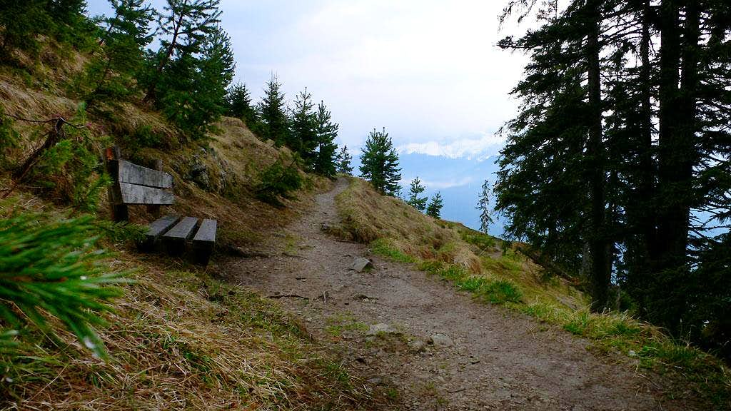
Little benches appear on the trail now and then. May, 2006.
The Wetterstein Range in clouds. Taken from Wank, May 2006.
A nice meadow on the way down from a morning hike of Wank.
Setzberg Hike
April 21, 2006
Now that I (proudly) own a car, I could make a Dawn Patrol trip from Munich before work. After several days of procrastination or laziness about getting up early, I lucked out and made my move on a beautiful blue sky day. I drove to the Tegernsee intent on a hiking trail up the mountain that dominates the south shore of the lake: Wallberg. I brought gaitors and ski poles, having no idea how much snow would still be lying around. Happily, the steep and wide trail from the Wallbergbahn was mostly snowfree. The trail contoured up and around the western side of the mountain, crossing a ski area path. At a junction, I opted to stay on the contouring trail rather than ascend a steep snowy path. I continued to a hut and then a snowy meadow. Now the trail ascended in short switchbacks up through pleasant boulder gardens in the forest. Soon I was back in an open area, traversing a hillside with expansive views to reach the upper station of the Wallbergbahn and a few other buildings.
Here I made a mistake, following tracks in the snow steeply up Setzberg. Only at the top did I realize the error, as I looked back at the summit with nearly the same elevation behind me. I enjoyed the rugged mountains to the south and ate an apple. Such a beautiful place!
After a few minutes a fellow came up. His name is Martin and he is an avid trail runner. He pointed out many mountains, having climbed, skied, or hiked them all. We went down together, me working hard to keep up with a blistering pace! Martin led us on a shortcut down steep half-forgotten trails, and skipping and running down snowfields. I think we were back at the cars in 30 minutes. Great to meet a new "friend o' the mountains" :-).
Breitenstein skiing, March, 2006
The weather was terrible, but Riki, Josef and Angie were able to get out for a morning of skiing. We drove to the Spitzstein and began skinning up in a light snowfall. It snowed on and off all day, and views were held to a minimum. But it was pleasant skiing up a mix of open slopes and forest paths. Eventually we came to a kind of tough section with tight switchbacks in the trees. I broke trail from here to the summit, getting a good extra workout. I was a little worried about an icy section below a high pass, and the final ski to the summit was a little nervy due to a big drop off on the left. Several times we heard the boom of avalanches or maybe just slabs collapsing. One, heard from the summit, was really dramatic and powerful. We were happy that our route was safe from such dangers. We skied down, having lots of fun in fresh powdery snow. Of course, I spent a fair bit of time buried in the snow too. The trip was marred only by terrible traffic jams on the way home. Ugh. Had we been able to see anything here is an example view from the website clasohm.com.
Hirschberg skiing, February 19, 2006
Our neighbors Ricki and her husband Arne are new parents. Ricki is also into backcountry skiing, but hadn't gone in a long time. So we arranged for a Sunday morning "Dawn Patrol." Ricki has a car which made it possible! She and I left town at 5:30 am, and were hiking up along a ski area below Hirschberg, a mountain of the Bavarian pre-alps near the Tengernsee. Icy conditions caused our skins to slip a bit, but after a great ski up we were on the summit at ten minutes to nine. The air was very clear, with great views of the Zugspitz, the Karwendel Mountains and even (I think) the Grossglockner far in the distance.
The ski down was kind of hard for me. First, I skied right into some kind of hole on the slope on the schluss down from the gentle summit. I got a facefull of cold snow and lost a ski temporarily. Later, there was a steep slope which Ricki skied down masterfully. I was intimidated by it, so I tried to go an easier way, but ended up having to make kick turns on an icy chopped up slope. Finally I could traverse over to the lower part of her slope and it was better. The trip down was really just a matter of minutes. Even though we stayed on the summit for 30 minutes, we were down by 10 am, and home at 11. Really fun!
Lenggries skiing, February 15, 2006
I took the day off and we got a baby sitter so that Kris and I could go skiing together for the day. It was tons of fun...it definitely sped by too fast! Kris had learned so much in her lessons, we could go down all kinds of red (blue in the U.S.) runs together. She found a few things difficult, like skiing on roads that populate this small ski area, and the narrowness of some of the runs. But overall she was teaching me how to ski better. We had a nice lunch, and then had the great fortune to run into Kris's friend Vivian from the ski class. She was there with her friend from Birmingham, England. We talked on the train home. It was a great day!
Spitzstein skiing, February 12, 2006
A fun backcountry ski morning with Josef and Angie. Again, fun skiing, beautiful sunny views and a great quick trip up and speeding down!
Lenggries skiing, January 28, 2006
Another very short trip to Lenggries. This one wasn't as fun because there were big crowds and long lines. Oh well.
Lenggries skiing, January 21, 2006
Kris was out of town this weekend on a ski lesson. I couldn't let her have all the fun, so thanks to a very nice babysitter for the boys I was able to hop on the train to the Lenggries ski area. It was my first time to go to an official ski area in Germany, and I learned a fair bit. First off, I was ecstatic about the price and convenience. At the train station I purchased a combination train-and-ski-lift ticket for 33 Euros (like 38 dollars now?). It covered the hour long train journey there and back, and also my lift ticket for the whole day. That was a pretty darn good deal I thought. I read "All the President's Men" on the train, nearing the exciting end. What a tedious but instructive story.
In Lenggries, I hopped on a bus for 10 minutes to reach the Brauneck cabin lift. It was neat to see mountains again after two weeks. At the top, I started skiing, pretty delighted by conditions and my not-completely-forgotten small reserve of skill. I had watched a video the night before by a ski expert named Lito Tejada-Flores, and it really paid off. I explored different lifts, having to get used to the German-style rope tow which is strange but good. I conversed in broken German with a twenty-something guy who worried where the United States was heading politically. This is a standard conversation!
Anyway, the skiing was really fun, although the moguls were pretty severe on steeper slopes because it hasn't snowed in several (gorgeous) days. The upper mountain was in a thick cloud, but at the middle level I saw pretty blue and white surrounding peaks. These are the Bavarian Pre-Alps, so they were mostly forested, with little limestone outcrops. I skied for about 3 hours then headed for home. I met some Americans on the bus who knew about our Avid.com office near Boston. Crazy. They were in town for 2 days, and were amazed how easy it was to suddenly decide to go skiing. Of course they were wearing slacks and had leather driving gloves, not having planned for it.
Gröbner Hals, January 7, 2006
I decided to try a "Dawn Patrol" kind of trip here in Munich, which seems really odd to folks. Of course it seemed odd to folks back in Seattle too, but makes perfect sense for the busy dad on the go: a chance to get out and breath the mountain air, and be back home in time for city errands or playing with the kids!
I picked an easy ski tour to a pass called the Gröbner Hals. It is near a very pretty mountain lake called the Achensee, and a town at it's north side called Achenkirch. I escaped the perpetual fog over Munich and was parked at the Kinderhotel at the base of the route after an hour and twenty minutes of driving. I began skinning up a very flat valley at sunrise, admiring the snowy peaks at the end. Eventually I realized I was on the wrong side of the river, following a groomed cross-country ski path that would surely end, while I wanted a road that switchbacked up the other side of the valley. I took off my skis and toiled across a creek, only getting my boots wet. I decided to walk a while on the other side until it got steep again.
When this happened I ran into some equipment trouble. I tried three times to put my skis back on, but one or the other kept falling off. I eventually figured out what happened: during the walk, compacted snow froze into ice deep in the metal binding holes of my boots. My superficial cleanings weren't enough. Without a good sharp tool (like a nail) to clean the holes, I finally had to take off my boots and breath on them to melt the ice. Argh, in total this cost 30 minutes of precious time! Oh well, it was something I had to learn sometime.
Skinning up a road, I admired some waterfall ice on the other side of the valley. They were very short, looked like 20 meter high routes. Soon I broke out of the trees into open slopes of the upper valley. Admiring the peaks on both sides, I came to three farm buildings, closed up tight for the winter. Another 30 minutes of climbing brought me to the Gröbner Hals, where a stunning view of the Karwendel mountains awaited me. They have no glaciers, but especially in the area around the Eng valley, they are tortured, black and dramatic. I wish I brought my camera! The mountains were extremely quiet all around, and the blue sky and warm sun were restorative.
Now it was time to ski down. Unfortunately, the steepest part of the ski was right from the top, and I wished I could get kind of "warmed up" on something easier. Naturally, I fell after one turn, and to add insult to injury, a ski came off and slid 100 feet down the hill, past the interesting steep section! As I waded down the slope I cursed for effect. Oh well, I still had plenty of challenges ahead. Because the snow hadn't had much time to be warmed by the sun, there was still an upper crust which, to my dismay, made it harder to turn. So I pretty much "survived" my way down, not enjoying it as much as I'd hoped (considering that it's a very easy route!). Lower, I took a wrong turn and left the road. Falling somewhere along the way, I saw I was committed to a more advanced ski descent. Still, it looked possible, so I kept going, only falling once when I skied into the skirts of a tree. Later I reached a hut in the forest, then after another hundred feet of shaky skiing I found the road again. Now I could just stand and coast the remaining two miles (roughly?) to the car.
Cool, I'll have to get a lot of these ski tours under my belt, happy to be starting now!