Into the Ebersberger Forst
Friends: Only God!Location: Ebersberger Forst
Elevation gain: 400m = 400m
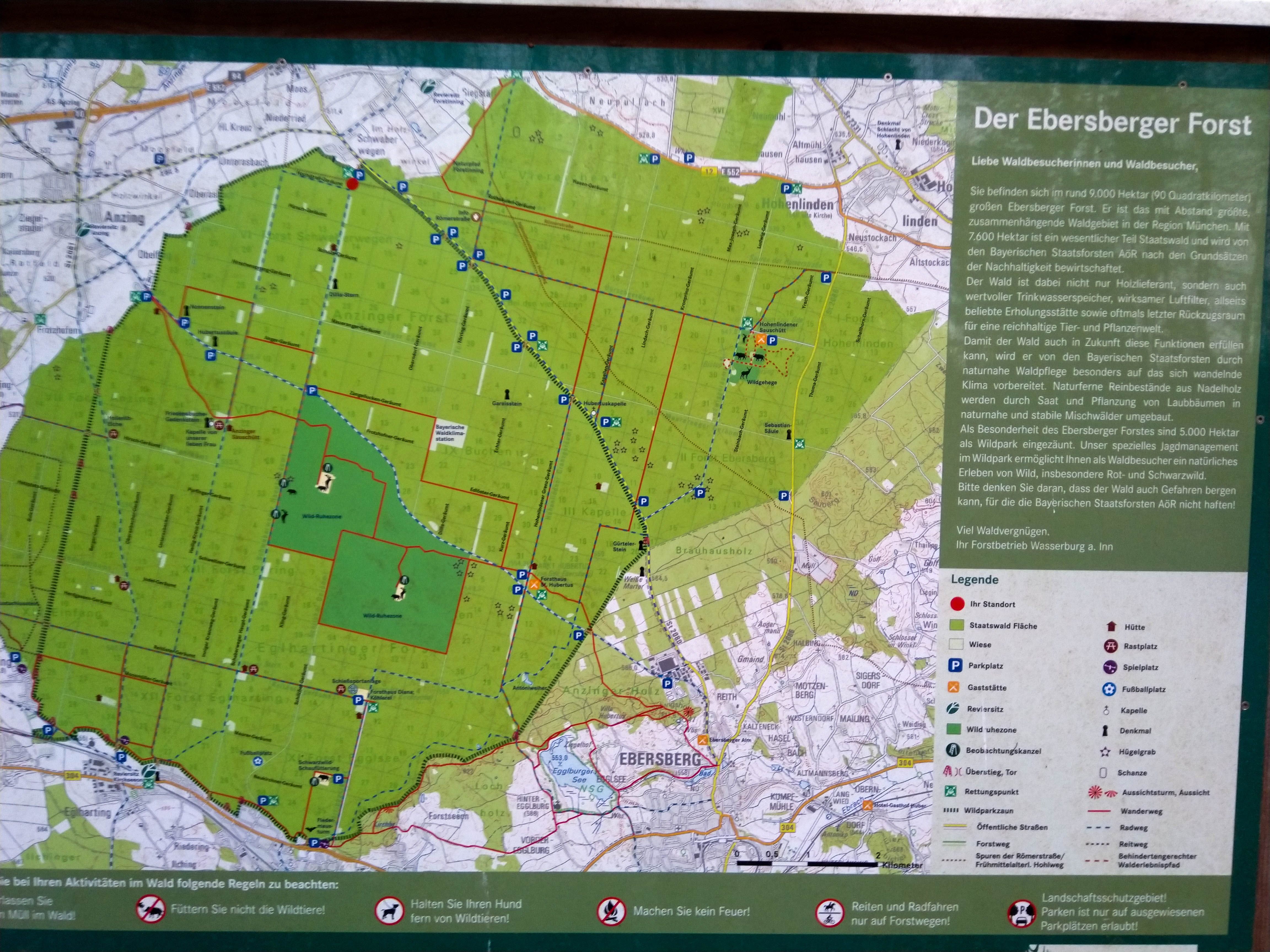
Since moving out of the city I'd wanted to walk through the local forest, which impressed me very much. I've since learned it's the largest forest in the flat-lands of Germany (wikipedia). 90 square kilometers without any homes, 77 square kilometers of which belongs to the state. Here is an interesting note:
Dies zeigt sich auch sprachlich in den lokalen Bezeichnungen für die Landkreisbewohner süd-östlich („Innerhoizer“) und nordwestlich des Forstes („Draußerhoizer“), jeweils aus Sicht der Kreisstadt Ebersberg.
This makes sense to me...now having walked through to the broad, crisp view of mountains from the heights above Ebersberg. They are "inside," nestled between the forest and mountains to the south. How strange, these Draußerhoizer must have seemed. Now of course, with cars, such interesting distinctions tend to be forgotten.
I was inclined to be upset at the grid-pattern of roads through the forest, but I suppose it gets a pass due to antiquity alone. Below is a map from 1866, and things are exactly the same (wikipedia link):

Typical parking lot sign
In fact the Geräumte paths were made in the middle of the 18th century. This makes sense: science, and it's vision of solving complexity through subdivision was taking it's grip on minds. I experience the grid as a kind of violence. I should have sympathy though. Nature then was bigger, and threatened to overwhelm. If you feel that way, you might take comfort in a grid that pins down the untamed in place.
There is even a ghost story - the "weisse Frau" who long haunted the road between Markt Schwaben and Ebersberg. Drivers would notice a light in the little Hubertus Kapelle on the side of the road. If they stopped it would again be dark, or, worse, they may see her. I'm sure someone came for her in the end, though.
I set out immediately crestfallen because I found that my trusty old compass was broken. Drat! My goal was to follow a bearing across the forest ignoring the roads. However, I rode my bike to the local sporting goods store, and believe it or not they still had a compass, that archaic and forgotten device. Actually they had two. Now only one - so hurry!
I made the 5 kilometer bike ride to the parking lot at Schwaberwegen. Using my map, I composed a bearing of slightly more south than east, making for the Forsthaus St. Hubertus, and then to the Ludwighöhe beyond. I dialed this into the compass, and resolved to check my progress after an hours walk by checking the gps in my phone. Yes, I'm a bit of a baby, but one with aspirations!
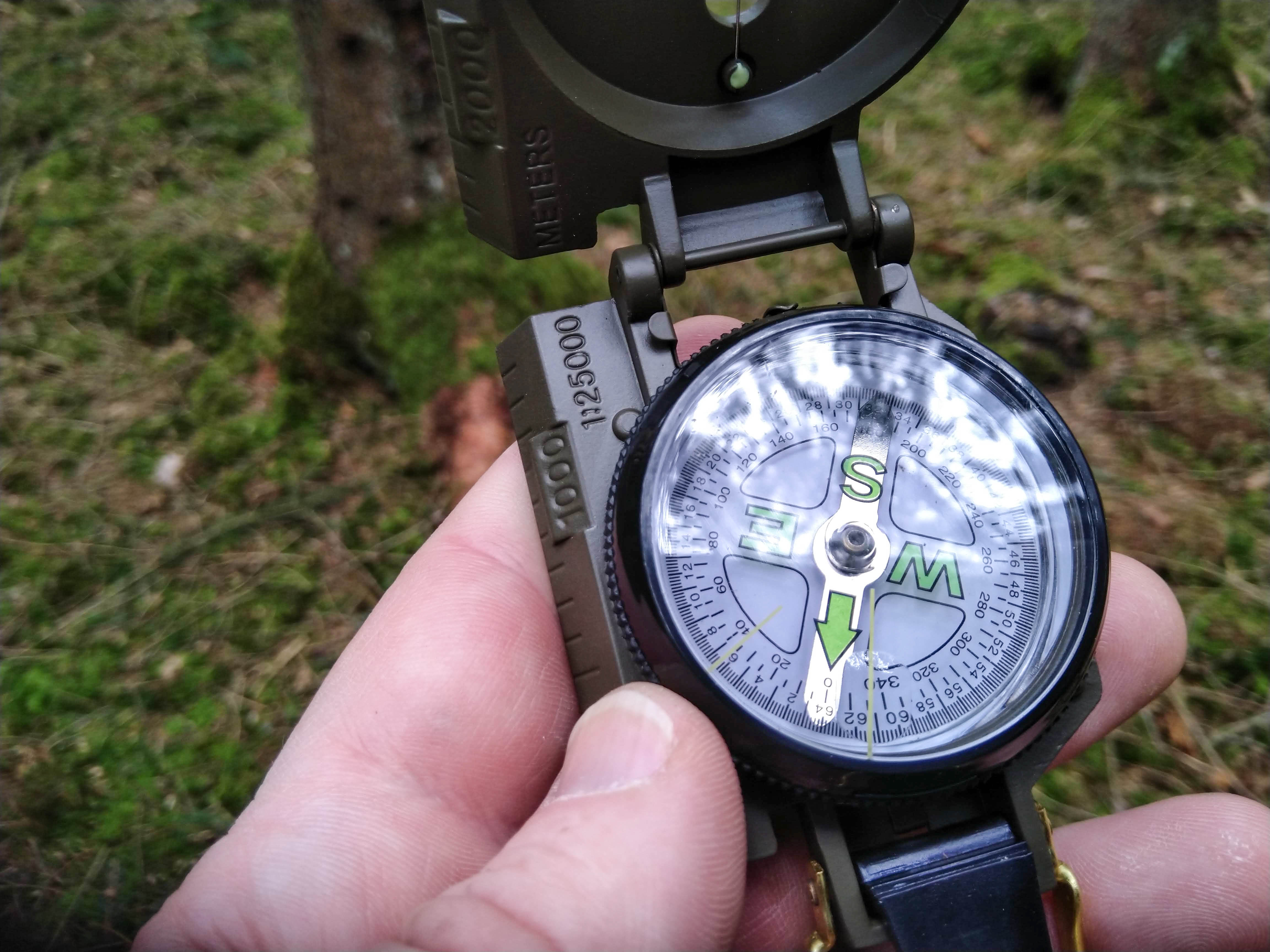
My bearing for 2 hours
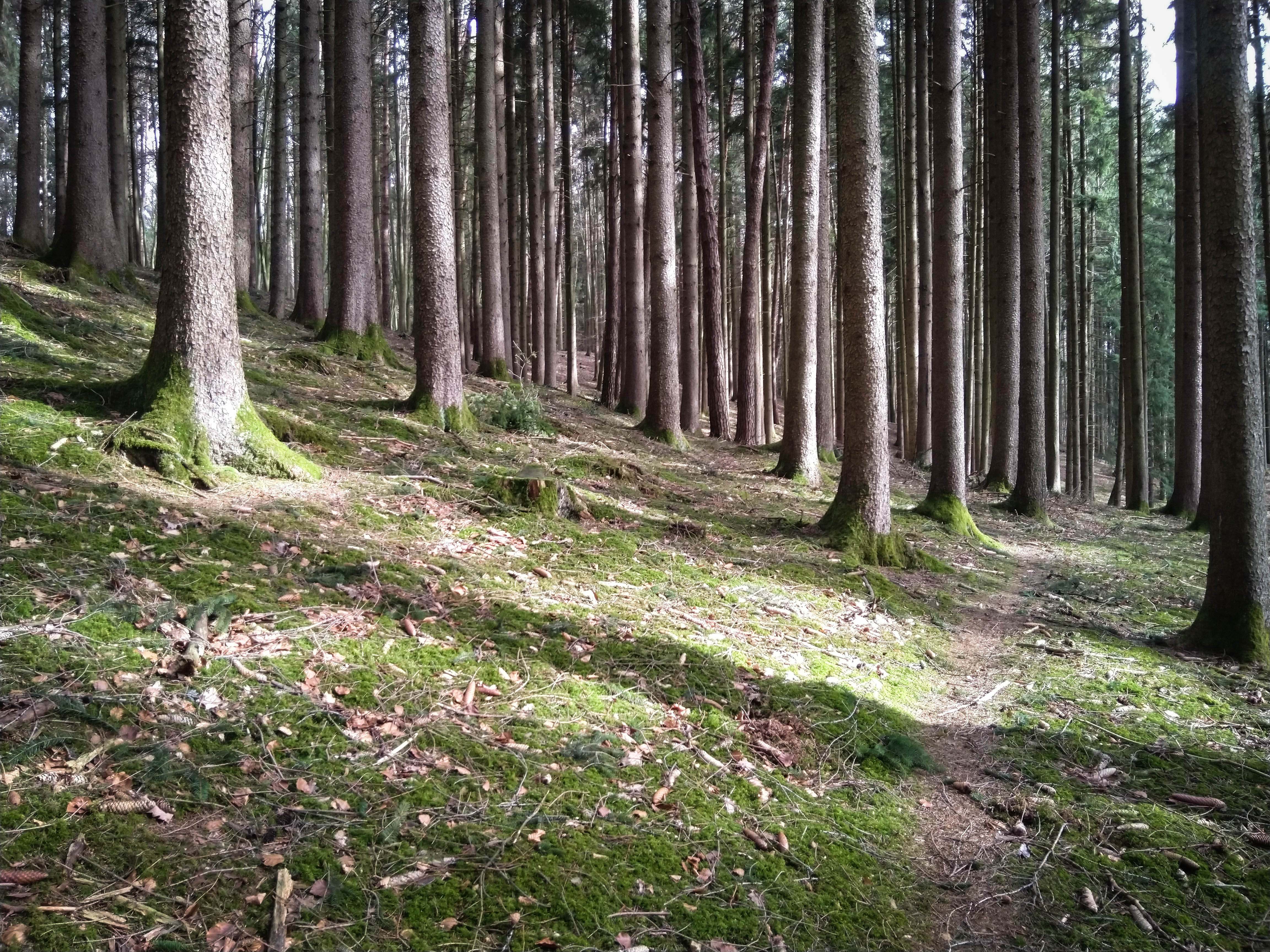
For the first half hour I was not enjoying the forest floor very much. Continually bent forward under branches, in and out of brushy copses, with a never-ending series of bulldozer tracks, brambles, sticks. Through "trackless" forest I wanted to go, but the whole place appeared to have been the playground of demons with power machinery for 50 years. I guess that's pretty much the truth? I grimaced -- never before had the term "working forest" seemed so much like the term "working girl." Behind each muddy track I saw the ill-formed desires of people surrounding the forest. "WANT!" they screamed, and so some poor schlub started up his diesel-fueled device and extracted some shareholder value from the nearby forest. Sigh.
However, the forest is big enough to suffer without being wholly beaten. Eventually I came to taller trees, with moss on the ground. I could walk tall again and see further. Travel by compass is easier when you can navigate by a sight in the middle or far distance. I practiced my ability to hold a clear mental vision, losing sight of the oddly leaning tree or snowpatch that was my next destination, and remaking it in my mind with slightly different angles and lighting...how it might look when I arrive 40 seconds later. I was continually watched by hunter stands, "thrones" for the lords of the forest. As for people there was, of course, no one.
Trail in the south

Finally on a trail
I checked my phone after an hour, and was about where I expected to be. Cool! In the next hour I just missed a large clearing on the west side, and turned out to be due west of the Forsthaus by probably 15 minutes. I adjusted my bearing to move more eastward, then came to beautiful hills in the forest. At some point a collection of wild boars silently fled my approach to the west. At the end of 2.5 hours, I was in the hilly southern part of the forest near the Egglburger See. I turned on the gps to track the rest of the day, and really enjoyed this southern upland. As usual, hills protect nature from human interference.
I ate my lunch at a "meditation bench" just below the Ludwigshöhe. The view of mountains was fantastic. The Wilder Kaiser Range in particular looked great from here.
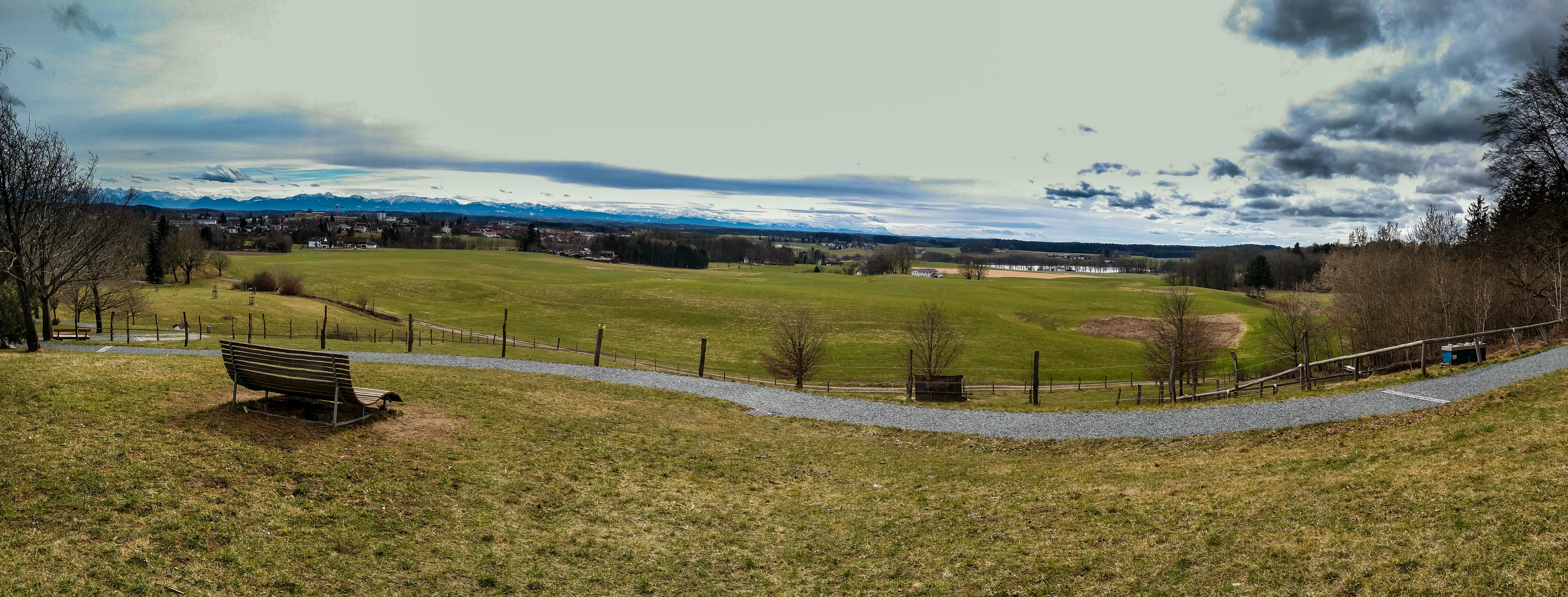
My lunch spot
I went up the lookout tower, my legs tired from the long walk. I followed a hikers trail (well marked) to the Forsthaus Hubertus 5 kilometers distant -- this was very enjoyable. I'd like to run this trail later. The Haus was in it's "winter sleep" according to a sign posted near the door.
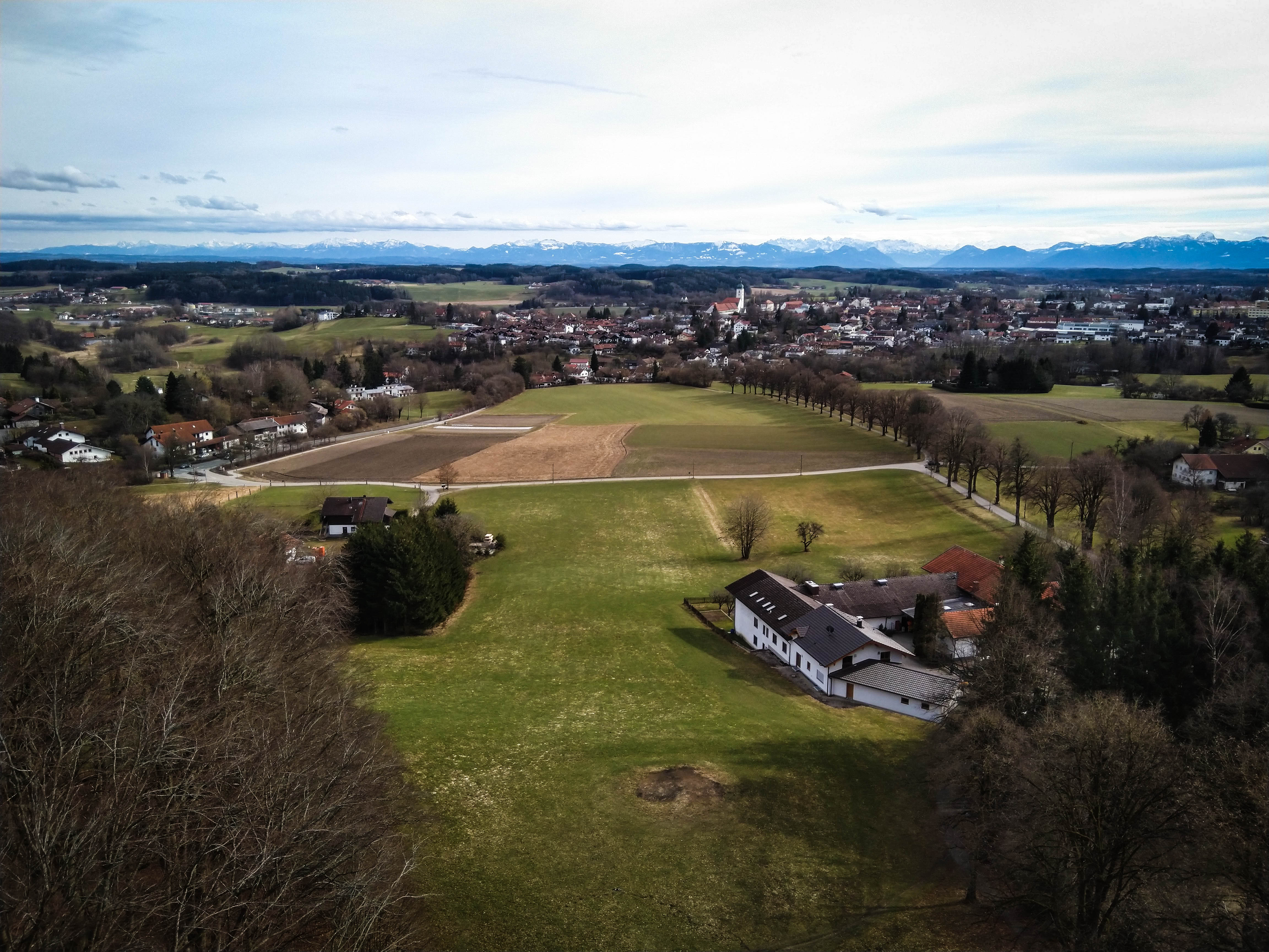
Looking south from the Aussichtsturm.
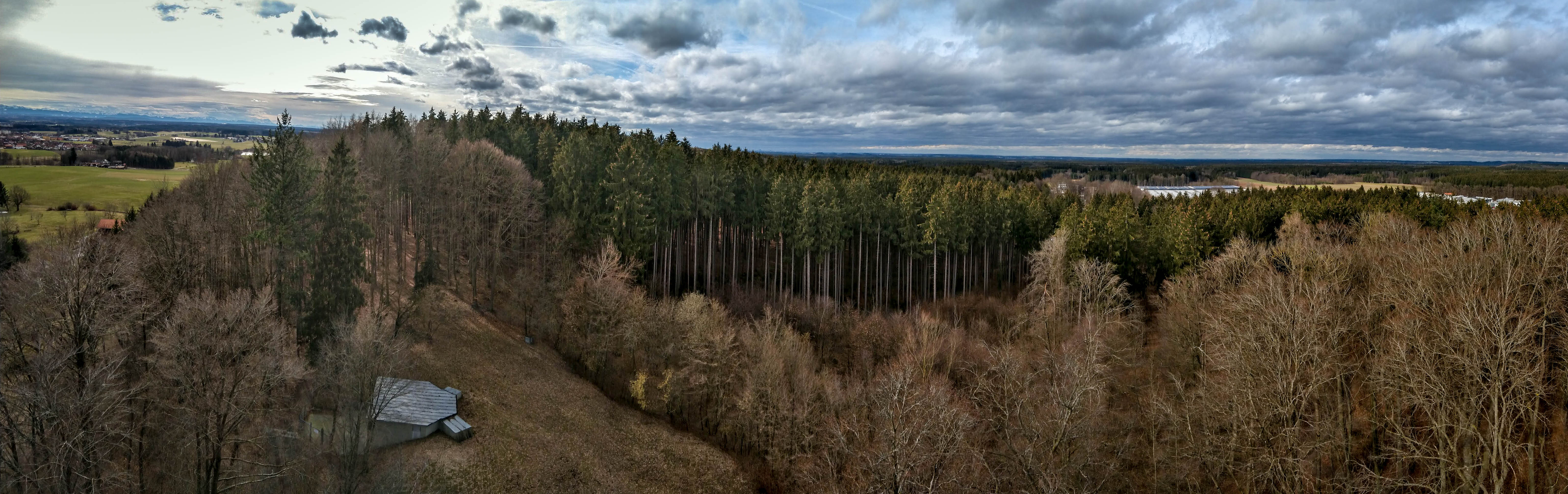
Looking northwest into the forest
From here I went due west into a special wildlife reserve. The trail was still asthetically pleasing, and deep glimpses into forest mystery were always possible. I listened to "Humidity," Robert Rich's ode to organic growth on faraway planets. Or maybe on lonely biological outcroppings deep within -- hard to tell!
Finally though I had to pay the piper for the long and fascinating walk with the traversal of 4 kilometers of deadly-boring straight road on tired legs. Back to my bike, then riding home as the rain began.
It was about 25 kilometers of walking through the forest, 10 kilometers on the bike. Elevation gain about 400 meters overall. I started walking at 11 am, and was on the return journey at about 2:30. I reached my bike at 5 pm.