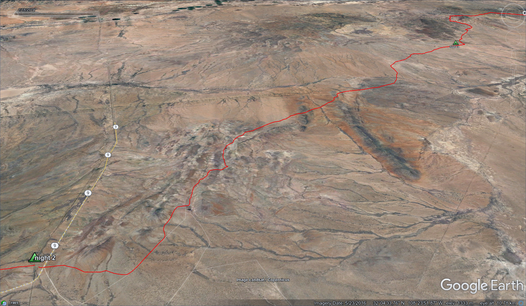
CDT - Mexican Border to Lordsburg
Friends: SlimLocation: Lordsburg, CDT Camp Three, CDT Camp Two, CDT Camp One, CDT Mexican Border
Elevation gain: 1697m = 368m + 618m + 340m + 371m
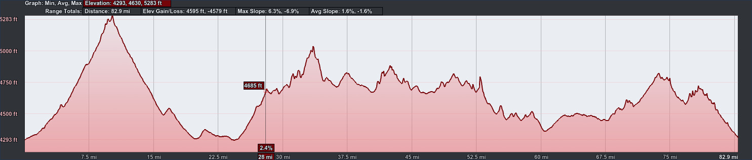
83 miles, 4595 feet elevation gain.
The text below refers to the same events as the blog entries "end of day three" and "84 miles down," though with more focus on the landscape.
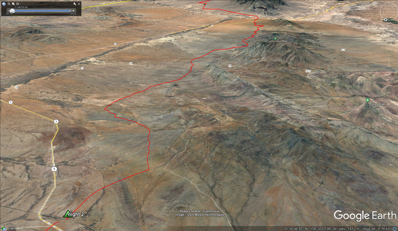
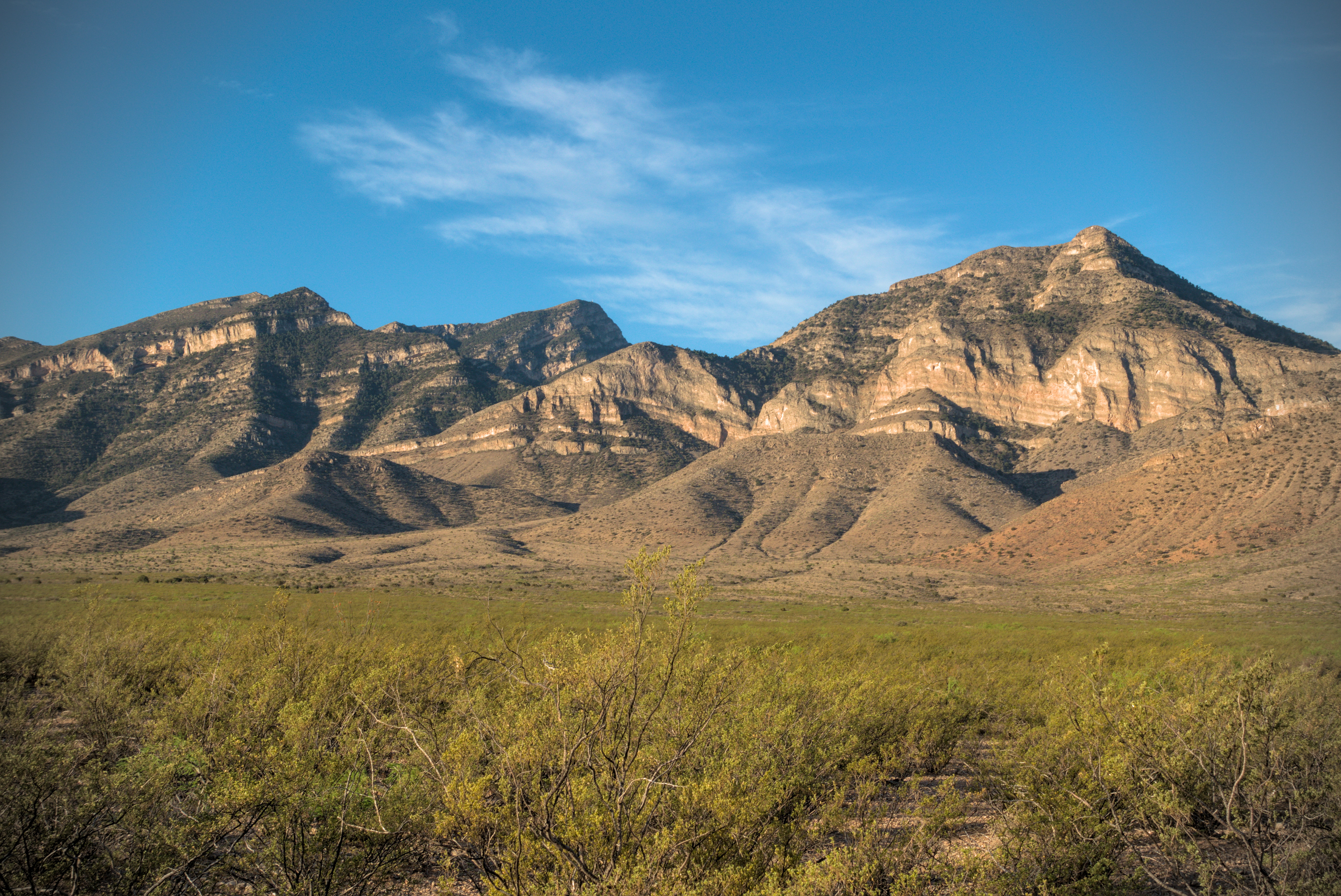
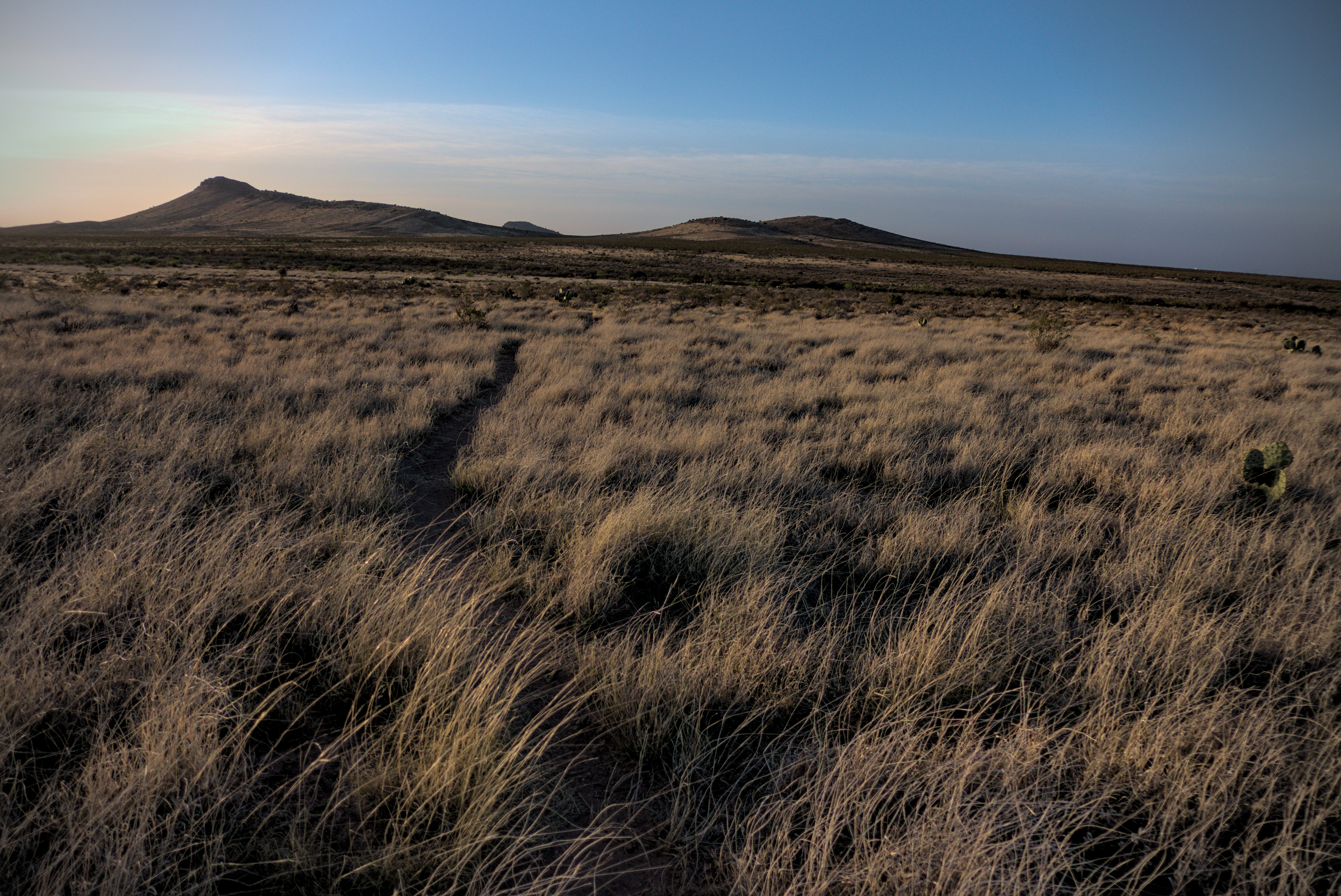
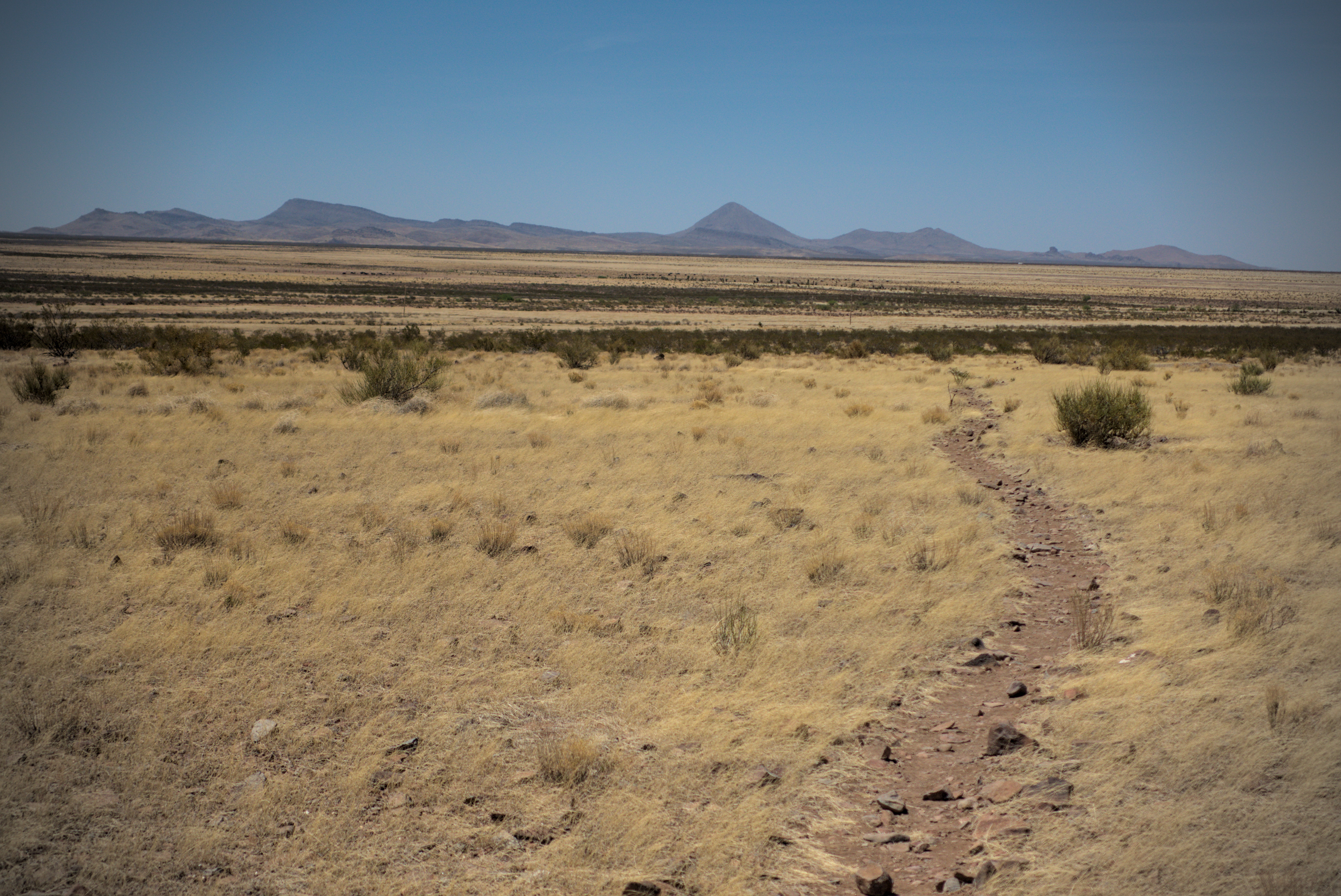
April 21st, day 1 - 17 miles
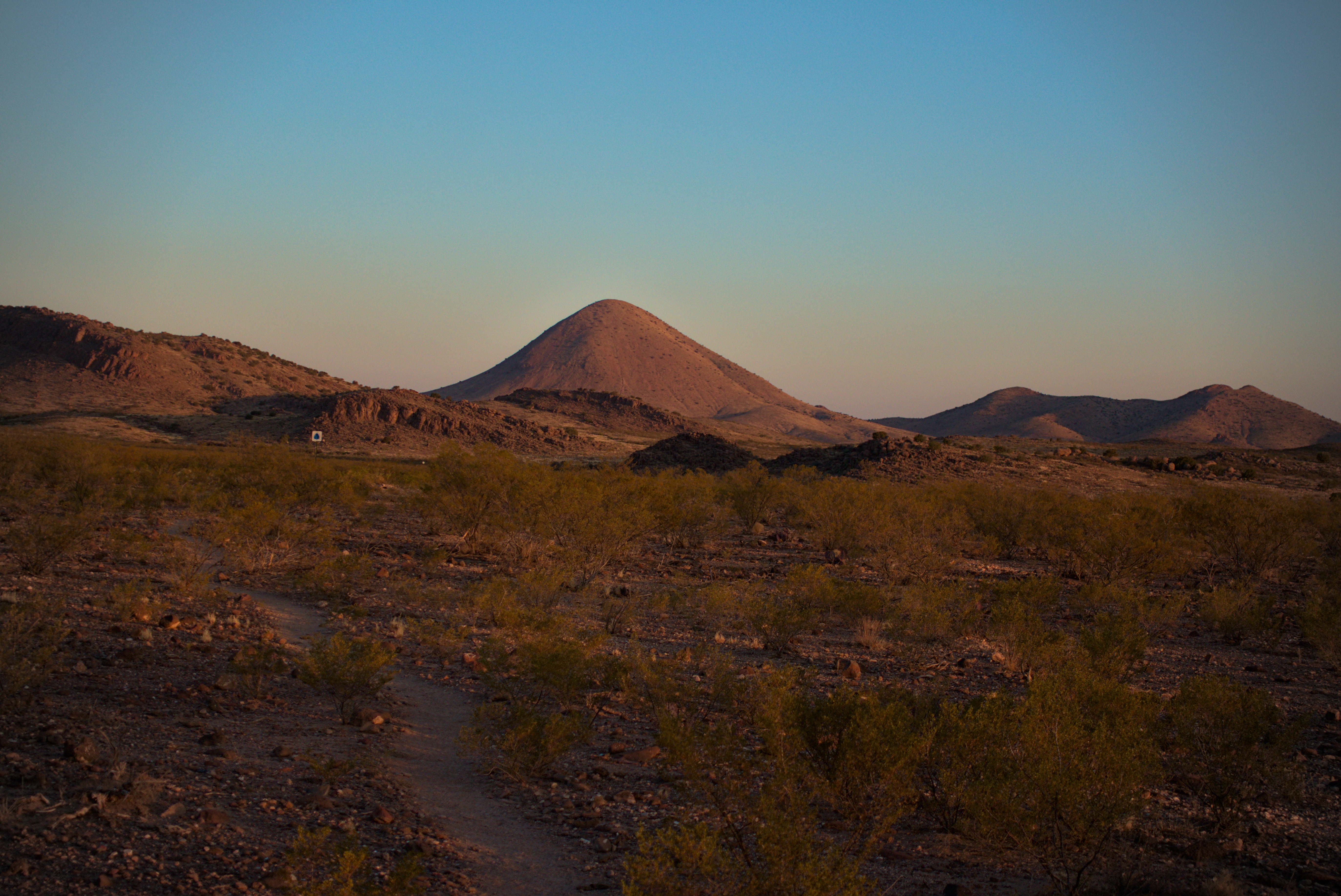
The walk from the border, briefly into the mountains then out to a camp
under Big Hatchet Peak.
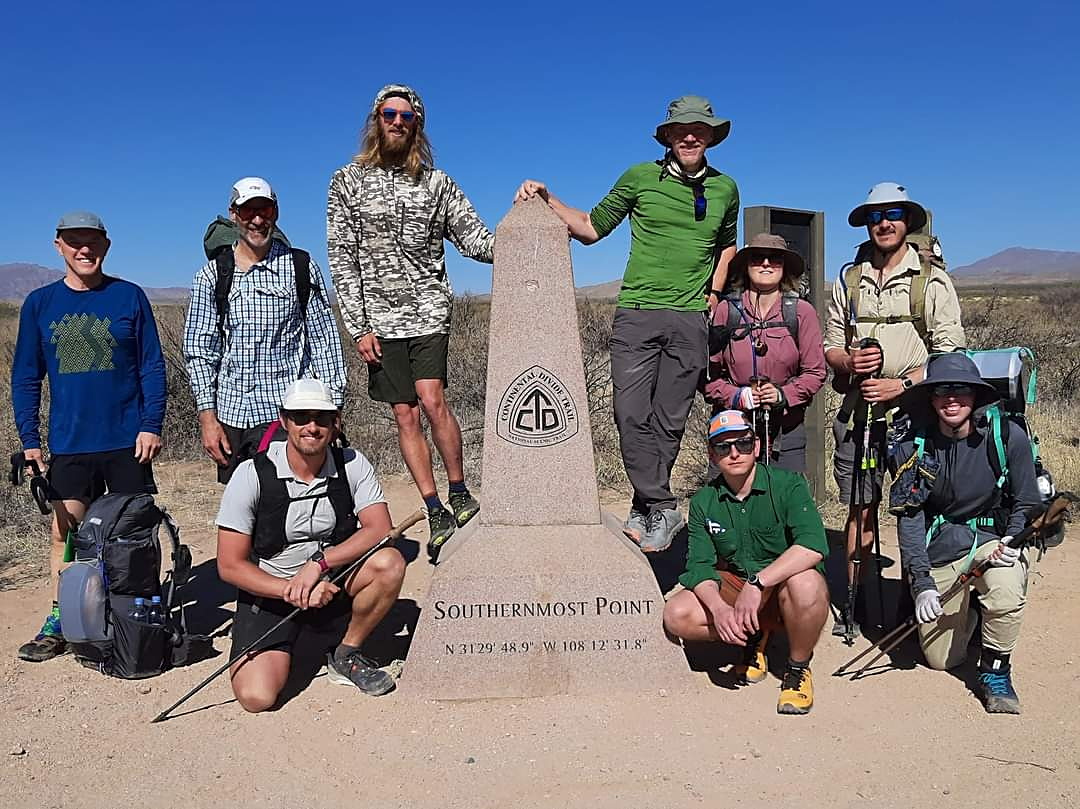
Lemonhope and I straddle the monument. Slim and Brainstorm are grinning
on the left, along with Michael from England.
On my left are Ruiboos and Brock, Bass, the chef from Portland, and
Bad Noodle, she of the heroic bear cannister carry.
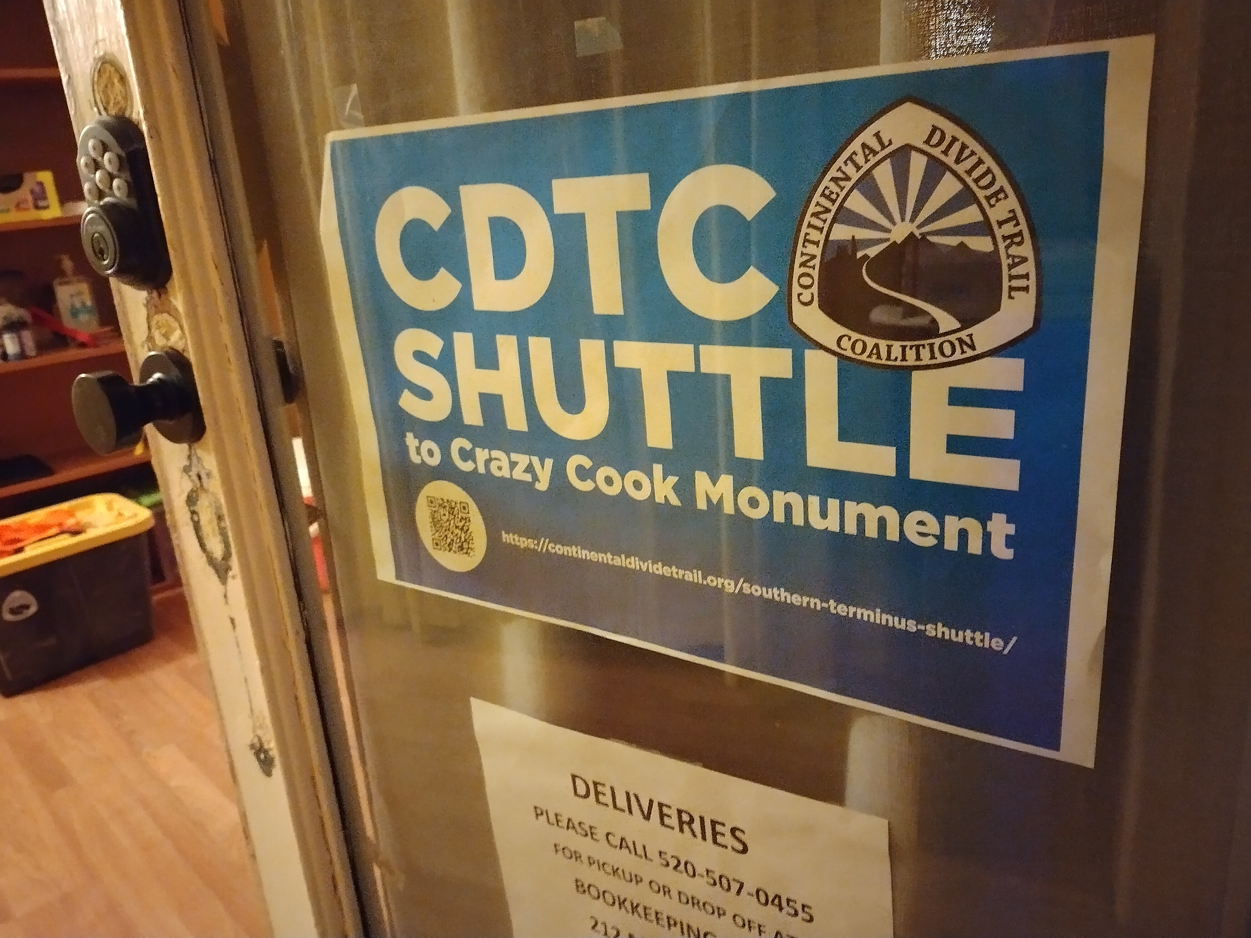
Welcome to the headquarters of the CDTC.
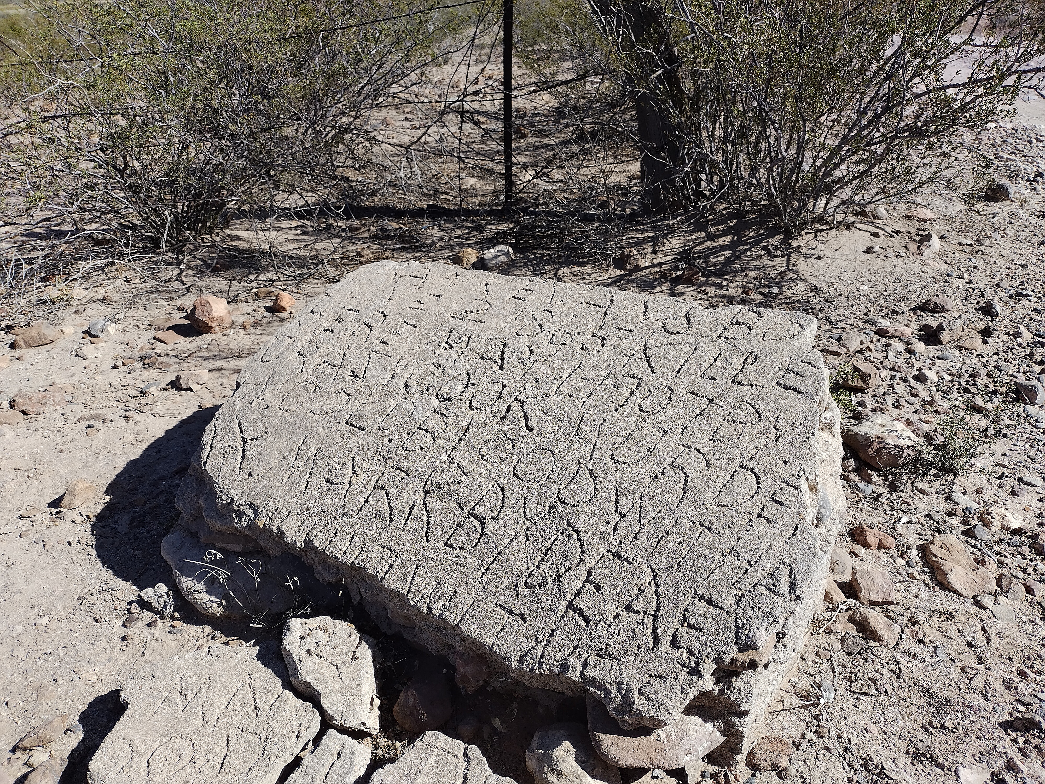
The original monument at the border, about 50 meters away from the
current one. It describes a cook who went insane and murdered a young man.
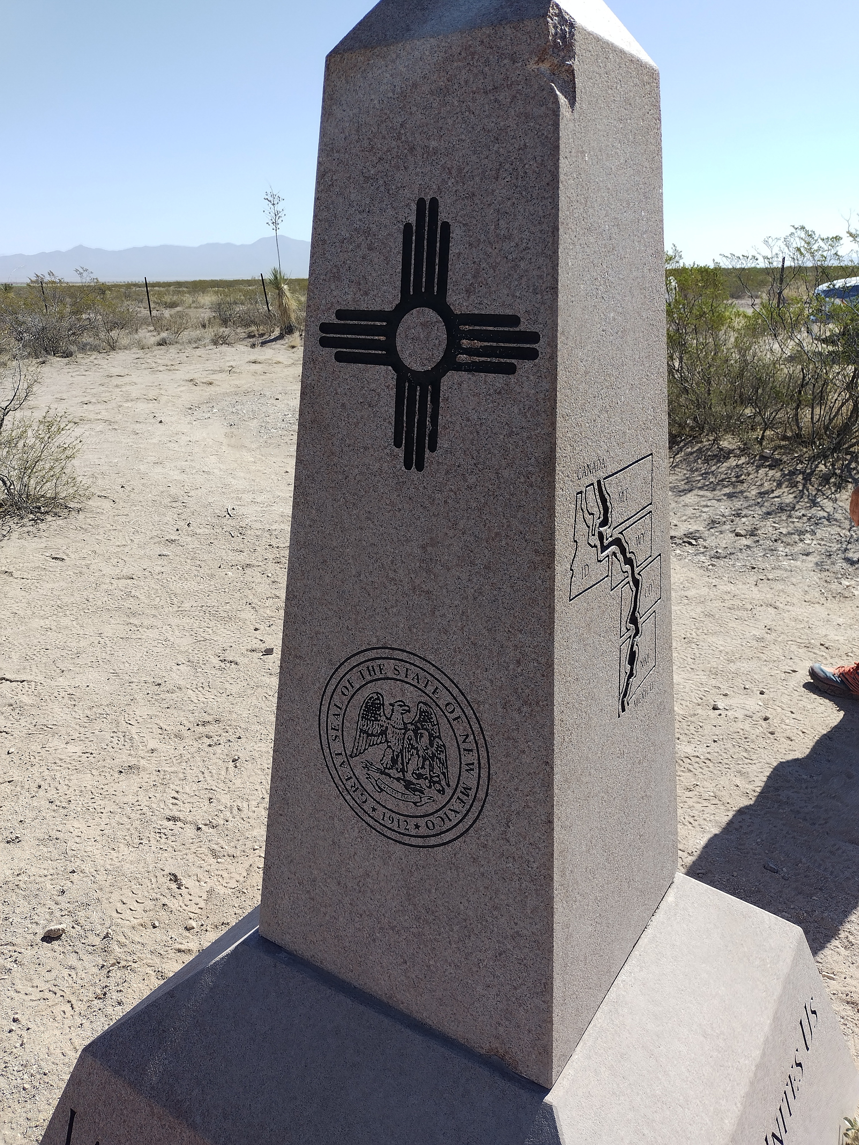
The monument, with the symbol of New Mexico. The fence behind it is the
border to Mexico.
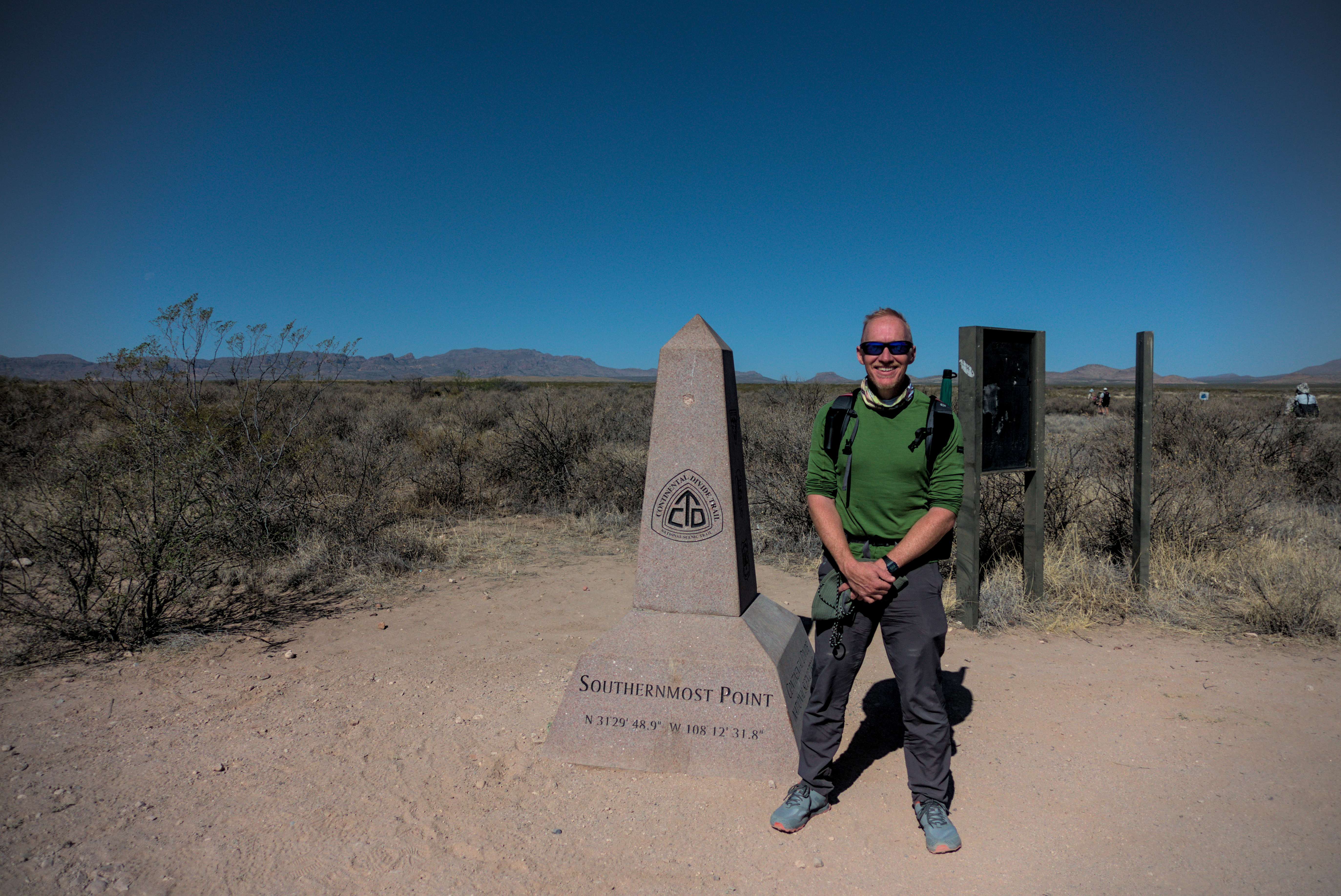
Me, happy to start (with my whimsical umbrella).
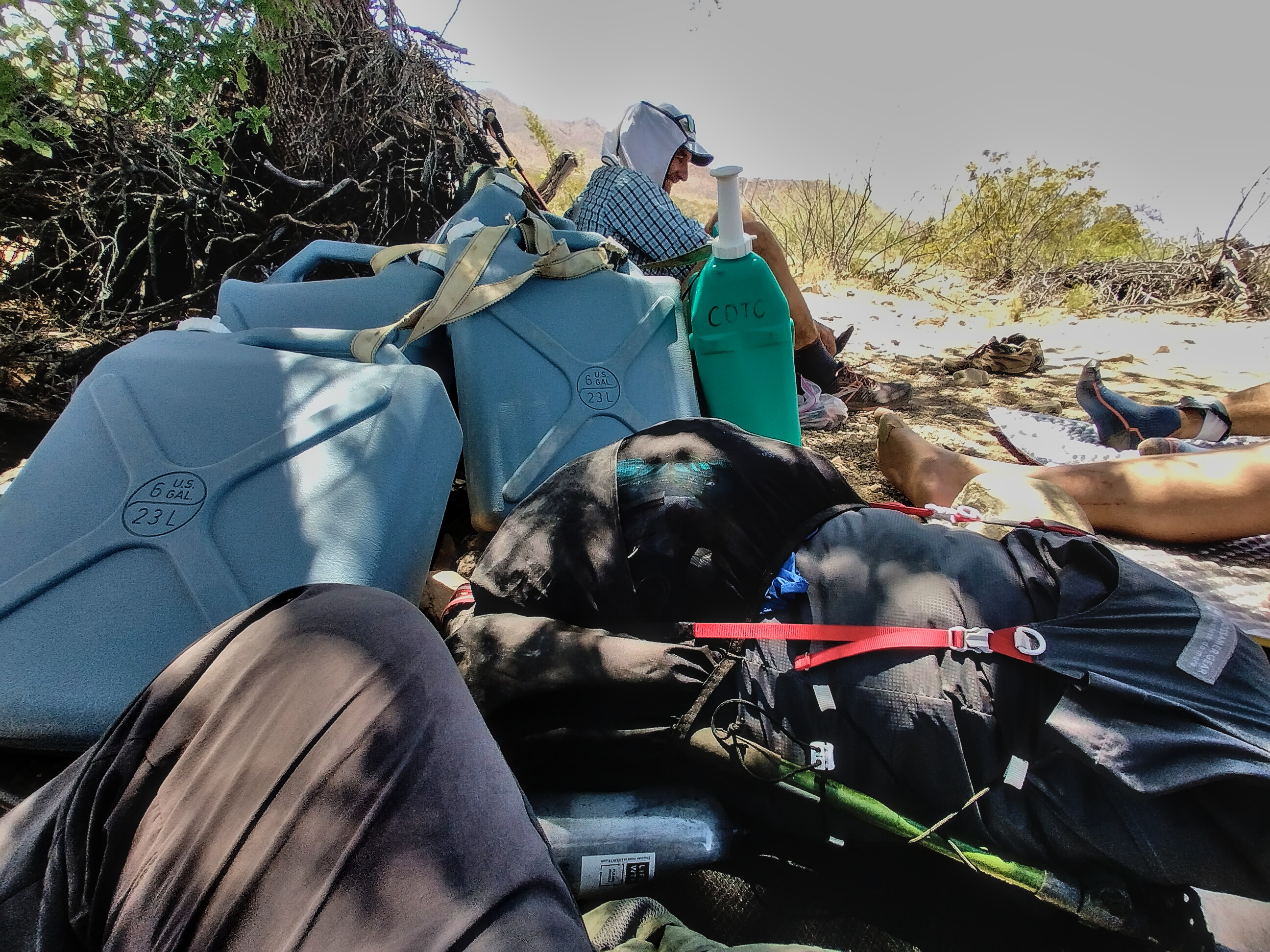
It was finally time to begin. I walked from the hotel to our meeting place at the CDT trail organization headquarters. We put our packs in black garbage bags to protect them from the dirt on the 2+ hour drive to the border. We got information on the water cache points, making sure we could find them in our apps or GPS. We had 5 caches for the 82 mile stretch (on average then, 16.4 miles between caches).
In the truck cab I sat next to Slim, a very tall fella. He was a software engineer from Boston and we talked about computers a while. He turned out to be an important person to me on my trip, even though the last time I saw him was at a diner in Chama. We hiked near each other or together until Silver City, but then his long legs carried him far away! Also, his willingness to go without rest days in town, but I'll get to all that.
At the border, it was a jolly if somewhat surreal scene gathered around the monument. I ducked under the fence into Mexico just to say I had. The idea that you'll reach far, cold Canada at the end of all this is thrilling, and truly makes the hot desert worthwhile, because you are savoring the expected contrast to unfold.
Lordsburg and environs seemed like a blasted place. A decaying metal sign hung high over the hotel. It seems nothing survives the eternal wind out here. All works of man fail. Where is that more clear than the desert?
We took some pictures and well, started walking. I was with a young woman for a while who carried an awkward bear cannister on top of her pack. She said she wanted to get used to it. Me, I planned to buy one in central Wyoming, more than halfway through the hike!
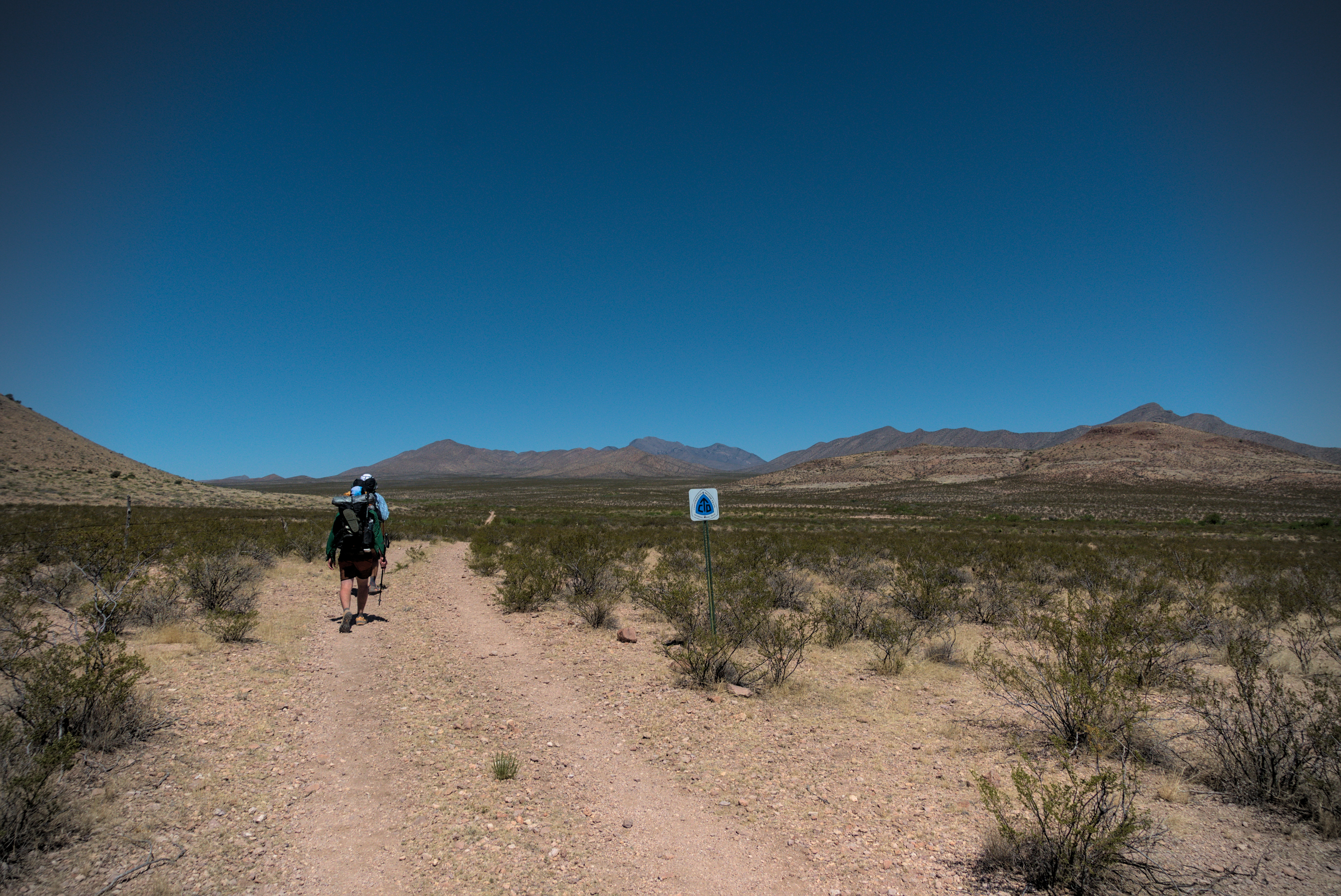
But she was quirky and upbeat. I relished the thought that we were all oddballs out here. There was no trail, just signs every quarter mile or so that I'd keep vaguely in front of me. The Big Hatchet Mountains were ahead. It was good to be on the way!
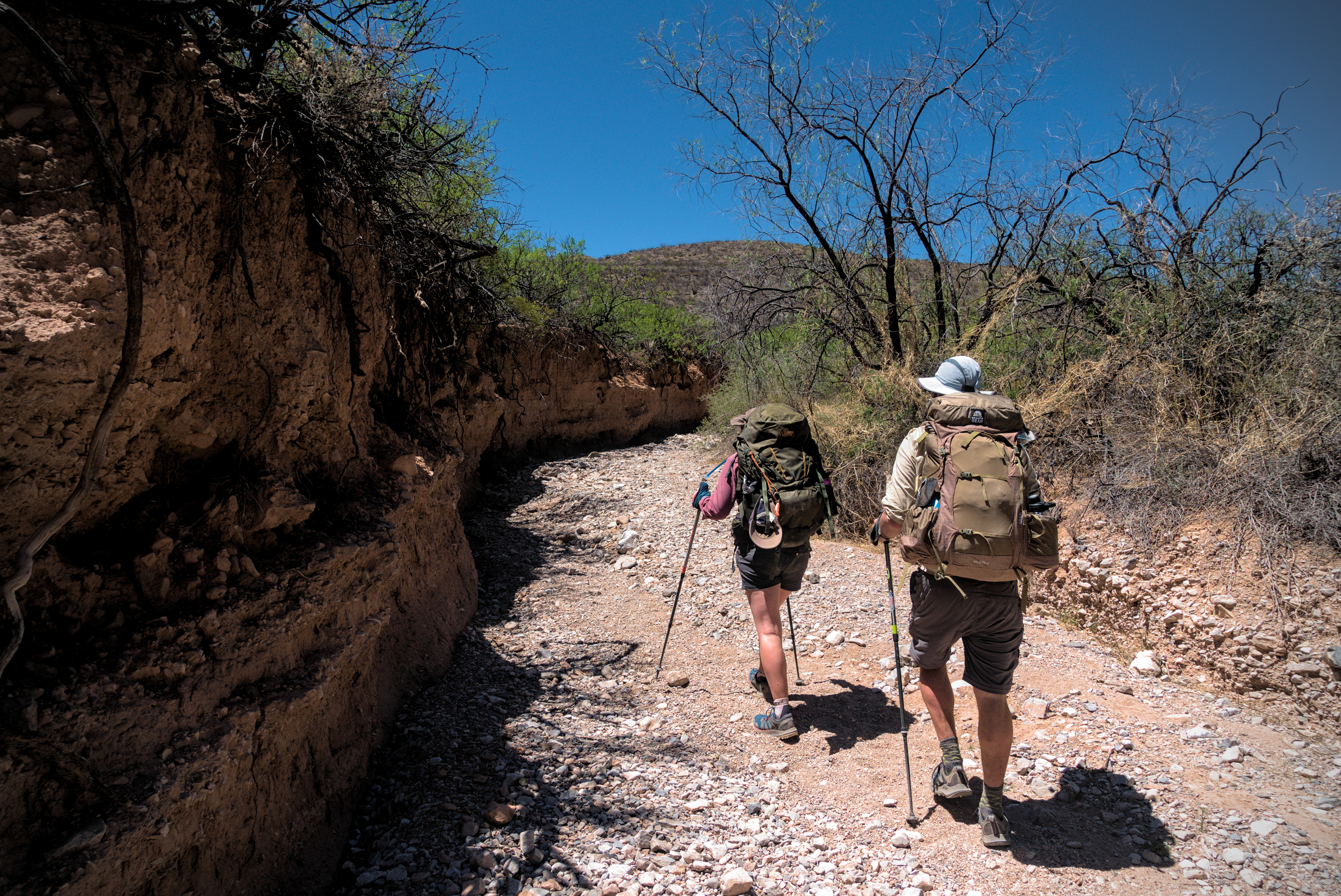
Pretty soon, a fact of desert life reared its head: there is one trail going into a wash, and a half dozen climbing out the other side. If I got off track, it was always because I exited a wash poorly.
These washes become very important. Slightly depressed areas filled with sand, snaking on their winding ways across the hardpan. They could be from one foot to five feet down, often with a steep drop. Cactus and other spiny plants had to be avoided. We were alert for rattlesnakes, and I didn't listen to music.
I walked with Slim for a while, then he took a break in a shaded wash with a couple of great girls named Go Go and Blueberry. The general idea was to acquire any piece of shade possible...crouching under low shrubs, ideally with the shaded, crumbling wall of a wash behind you. The girls said they were going to stay there for hours and avoid the heat of the day. I sympathized with that, but just couldn't make myself do it. I walked on with an english couple who encouraged me to choose my own trail name.
Slim followed by another fellow heading into the mountains.
The english honeymooners, Brock and Ruiboos make their way through a wash in the afternoon heat.
Embolded, I chose Sputnik. "Head in the clouds, and a large head at that," would be my motto, I chuckled. This name suited me well.
The heat did become oppressive as the afternoon wore on, and we were climbing on a mixture of dirt roads and exhausting sand traps in washes.
In here I met another guy important to my trip, Lemonhope, though he called himself Caveman at that point, his name from a hike of the PCT a year or more before. He was enjoying the luxurious shade of the first and only tree of that whole day, roughly at the high point in the Big Hatchet Mountains (aka Sheridan Canyon). He looked truly happy there. I should have stopped, but I pushed on to the first water cache, perhaps not believing it would be there until I saw it. This was a couple miles downhill from the high point. I sat with a guy named Curtis and tried to erect my tarp against the shade, but the wind revealed my non-existent tarping skills. I would get better as time went on, but for this whole first week, I abandoned any attempt to use it!
Indeed, water was there, so I saw with some others and drank up.
One thing hard about the desert is it's hard to sit down. Everything is spiny and hurts. I used my ground cloth and the back panel of my pack to sit on. With the white, tough ground cloud and the pad, I could sit and take off my shoes. Shade was a luxury. I did have my umbrella, and yes, sometimes I just had to sit under it in the blinding sun. The main thing was to get the shoes and socks off pretty often. Many people had blister problems, and I wasn't immune, though I was in better shape than most. The combination of sweat, hot temperatures and coarse sand all rubbing together for hours on feet that aren't toughened up was just murder. So I stopped often and always removed my socks, even though the Injinji "Toe-socks" that I had were tough to get on and off because each toe has its own little "sock."
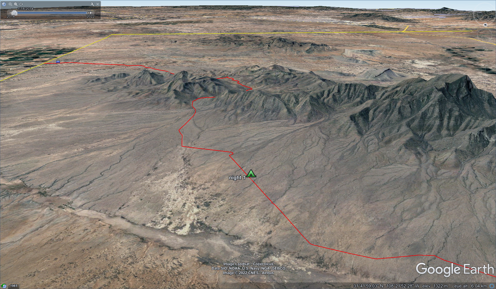
I was tired, but looking forward to an evening walk along a road. We'd been told that from this road, it was possible to walk down into a broad valley with a ranch in case of emergency (the Hatchet Ranch). I walked into the evening with Big Hatchet Peak on my left, and a vague sense of that valley on my right. After a certain point I was well and truly alone. I didn't see anyone again until mid-morning of the next day, though a truck drove by in the night. I just unrolled my sleeping back in a little sandy area on the side of the road. It was windy, and I ate some grains of sand as I munched my dinner (probably cous-cous with olive oil and taco seasoning).
I was here. I was doing this thing. Wow.

My camp, with mysterious mountains off to the north.
Lights under the peak in the evening. They must have been hiker headlamps,
as there is a trail option closer to the peak whereas I chose the road.
Goodnight!
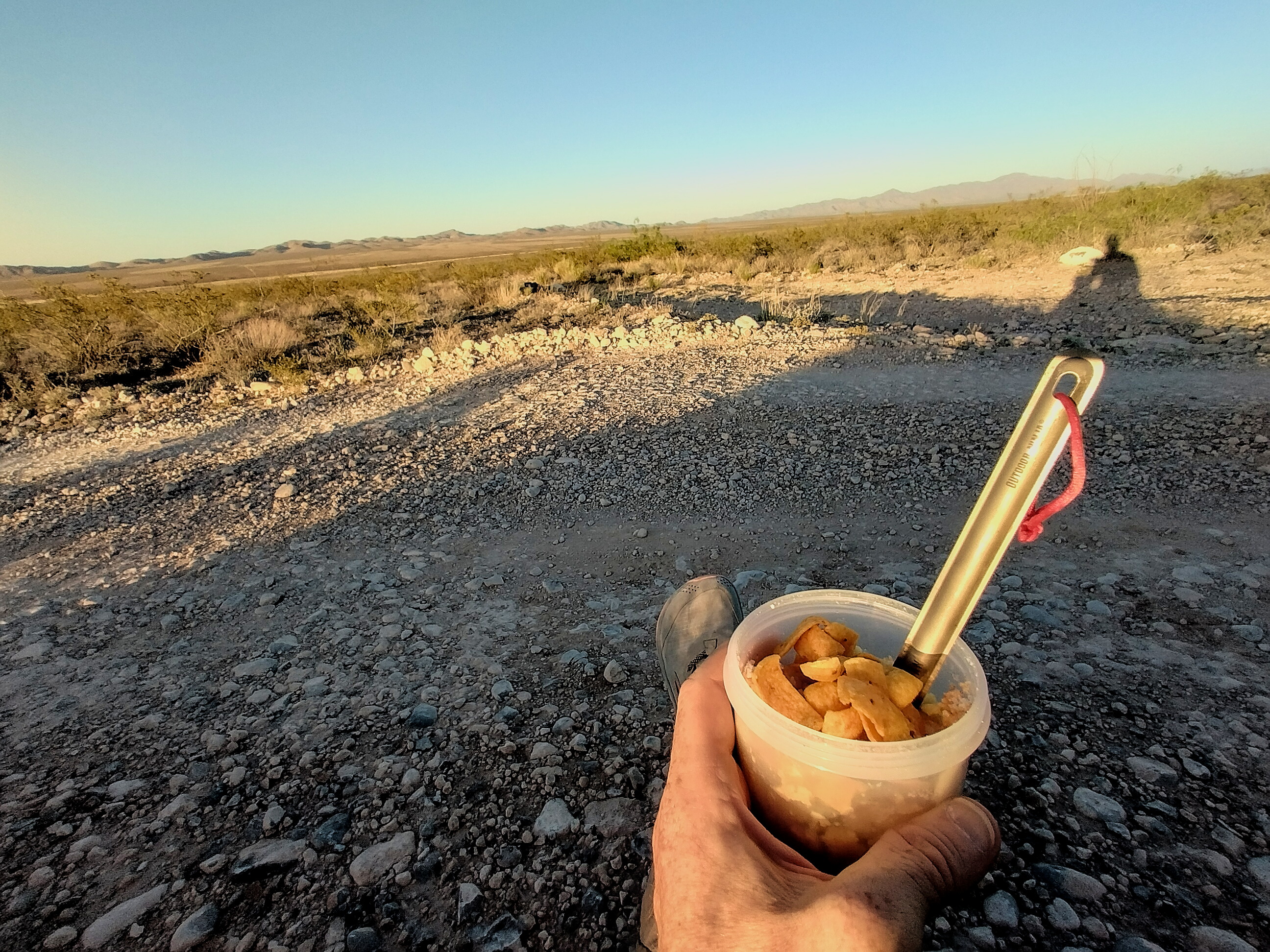
Dinner! Fritos and dehydrated refried beans.
April 22st, day 2 - 27 miles
A really long and varied day, with beauty, heat and brutal wind.
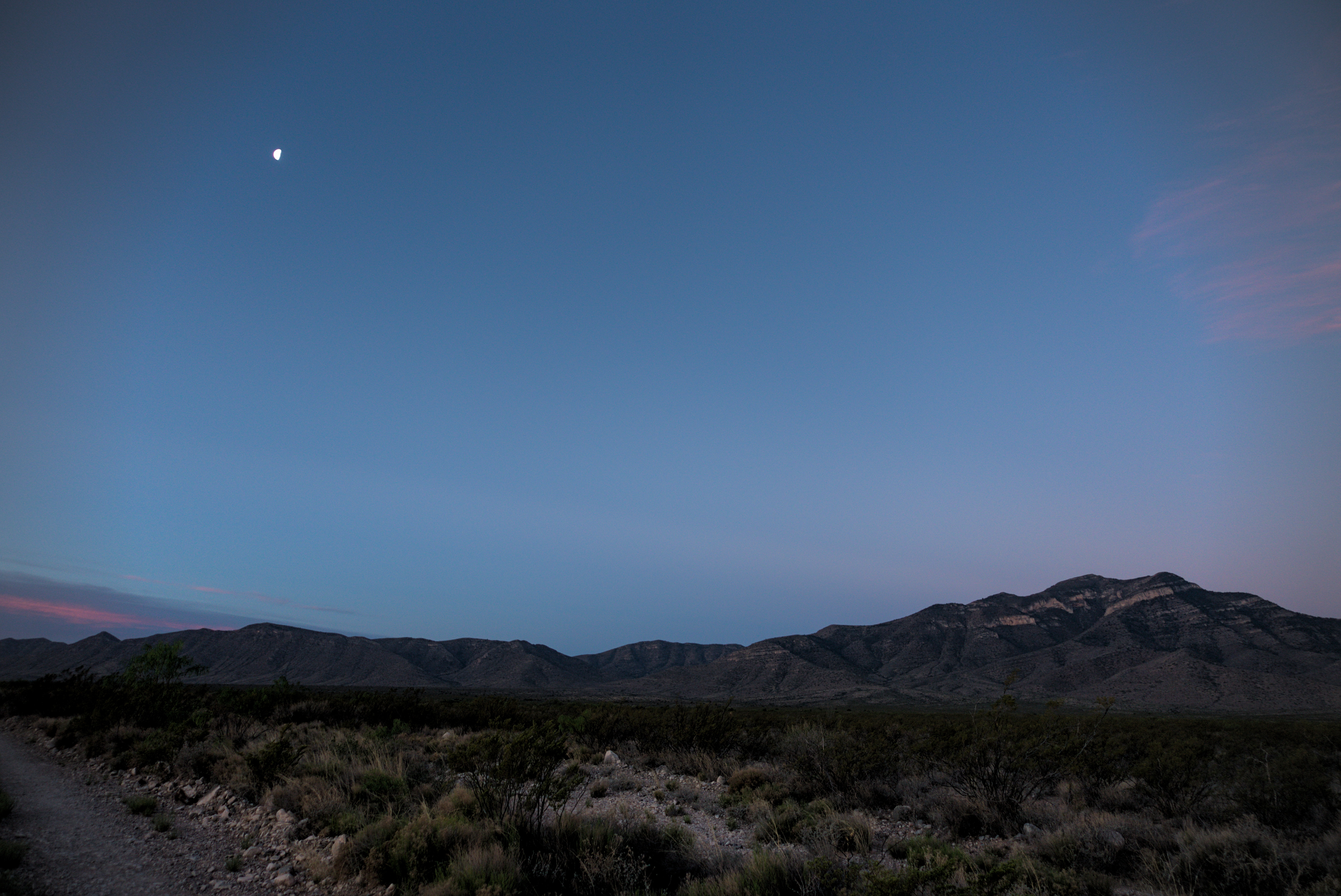
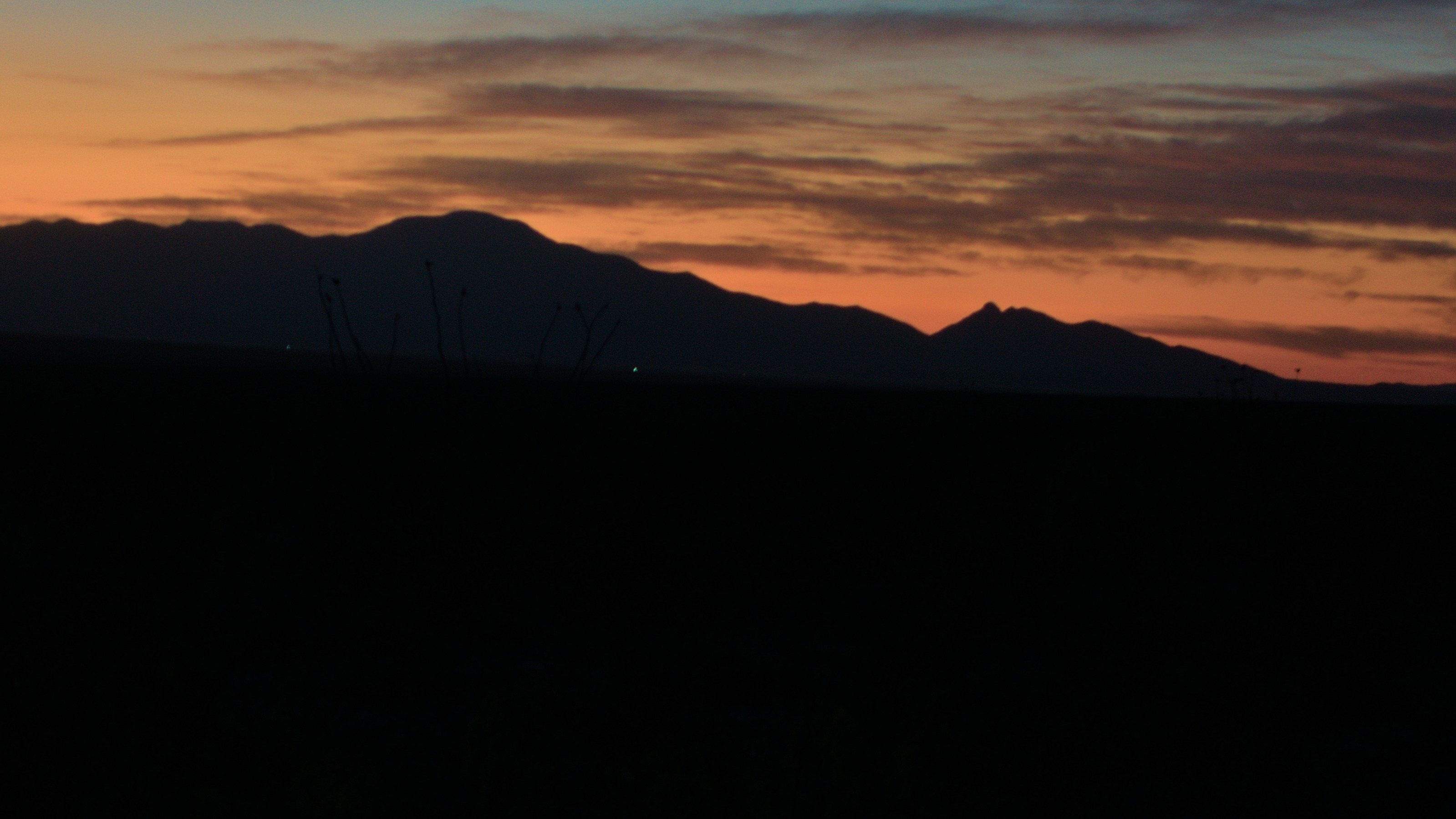
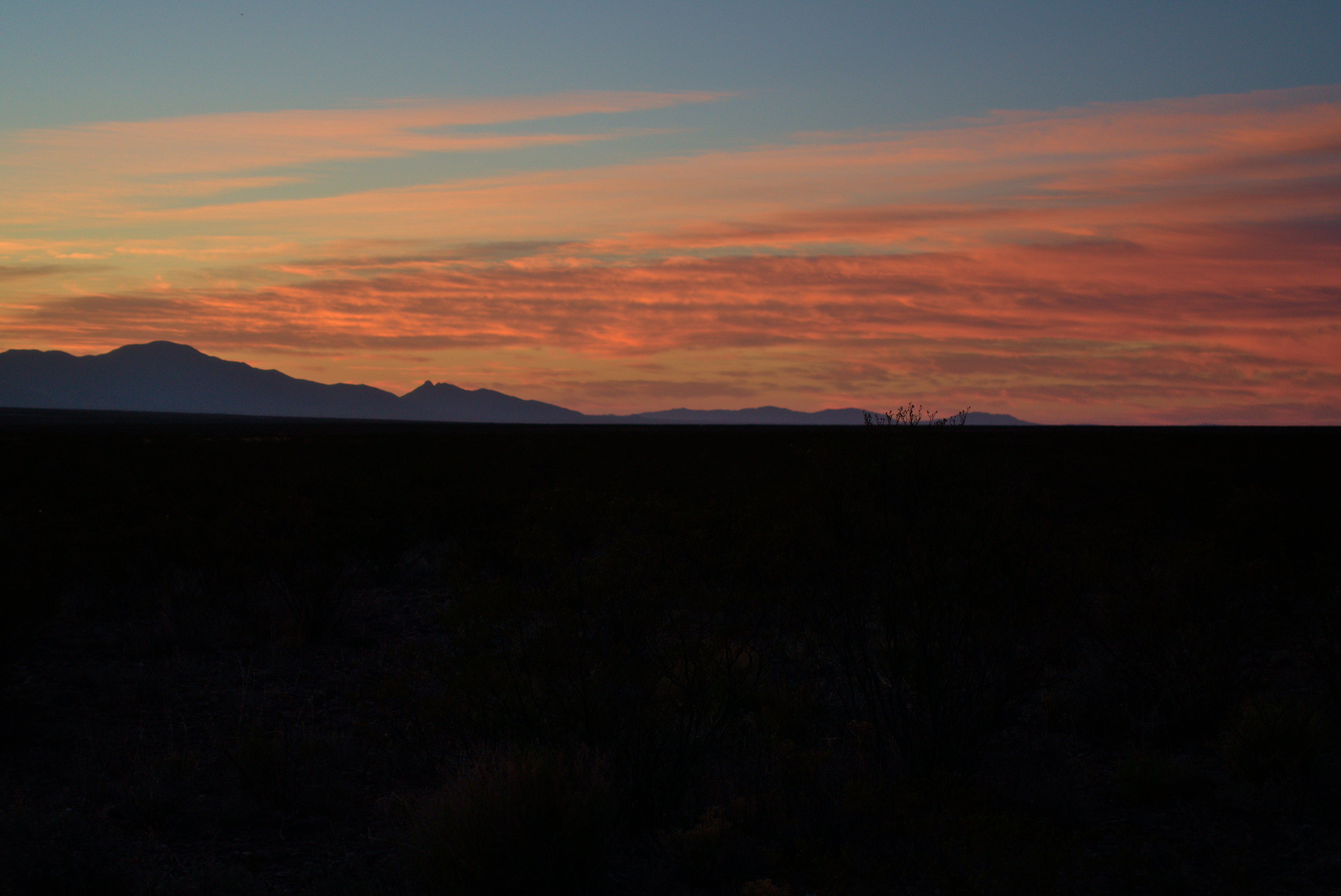
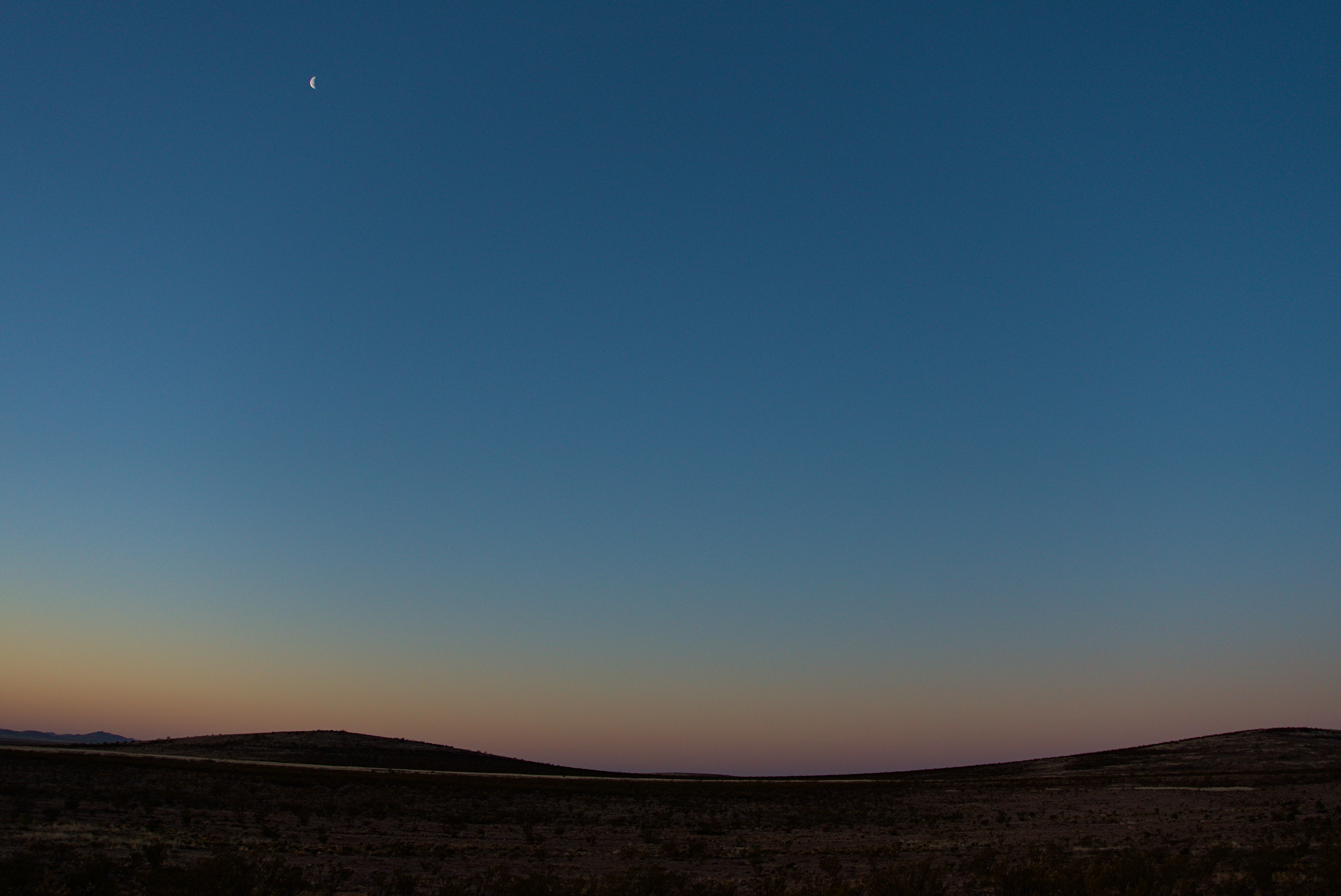
A beautiful morning with moon.
The day began with a long walk on a road, but a beautiful one because of the morning sun on the flanks of the mountains on my left. It was cool, clean and clear. I was happy to be off the road and following the posts through the desert before the first trucks came, dropping off new starters. After a couple of miles in and out of washes I reached highway 81, crossed it, and continued on trail slightly uphill now. I walked with Go Go and Blueberry for a while, making light conversation about all kinds of things. I saw white border patrol trucks patrolling the highway now below and off to the right.
I was moving along the east side of the divide crest, here going south to north and culminating at Hachita Peak. I'd walk under that in the afternoon as wind became somewhat oppressive.
I walked with Slim for a while near the high point of the day. He missed his kids, and made time to call and text them when he got onto a hill where there was signal. I was happy for him.
The Big Hatchet Mountains are quite alluring.
My job is to reach those mountains, the Little Hatchet Mountains, then skirt
them on the right side, generally north and west.
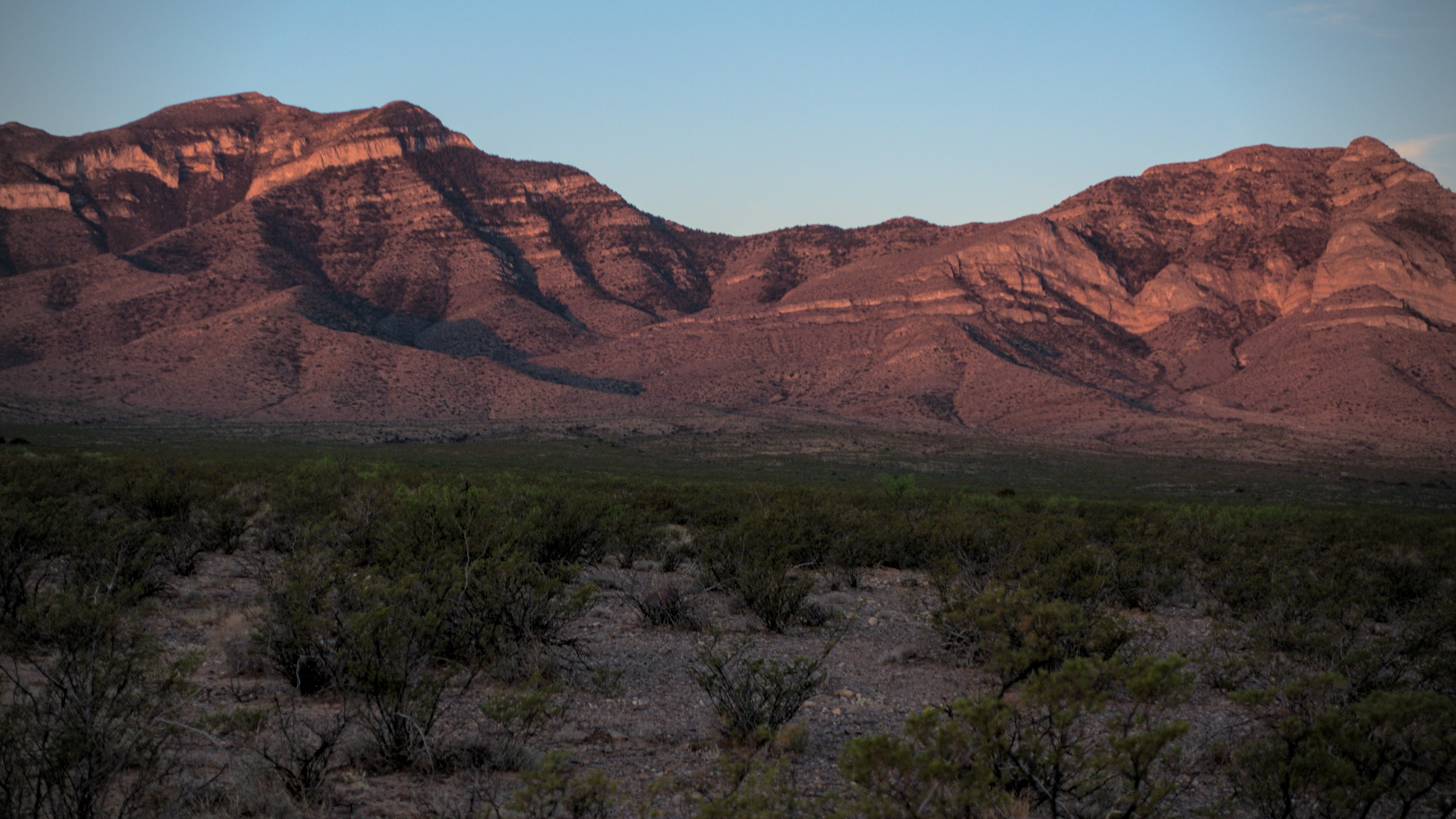
Last look at the cliffs of Big Hatchet Peak.
Slim tanks up at the cache provided by the owner of the Hachita Store.
I hiked down from the high point and into a hot wind and blowing sand, keeping my eyes open for a windmill where there should be some water. Slim joined me, and together we fought through the sandstorm to reach the windmill and a handful of trees. Cows milled around the water spigot, also guarded by bees. Sitting with his face swaddled in a shirt was a fantastic character who went by the name of Tall Son. He was easily as tall as Slim. We told him that off away from the cows, the sandstorm wasn't nearly so bad. Over the wind I shouted my theory that the cows milling around this water source made the sand and dust much worse here.
Later we reached a special cache set up by the owner of a small store in Hachita. Cold drinks! That was fantastic. Here I met Leftovers for the first time, who would become a steady companion for much of Colorado. He was agog at my light pack.
Continuing on, as the wind mounted in ferocity, I walked with a trim young man named Curtis right on the divide, which was a dramatic place to be in the early evening light. I had to constantly turn slightly sideways to avoid the brunt of the wind, and my memory is a mix of crisp landscapes with long shadows, and filtered waves of sand and blue sky. My feet were aching, and I would have stopped if there was any shelter. My hope was that on reaching highway 9 there would be some scrubby bushes that gave some protection.
The beginning of months of learning to recognize people by their footprints!
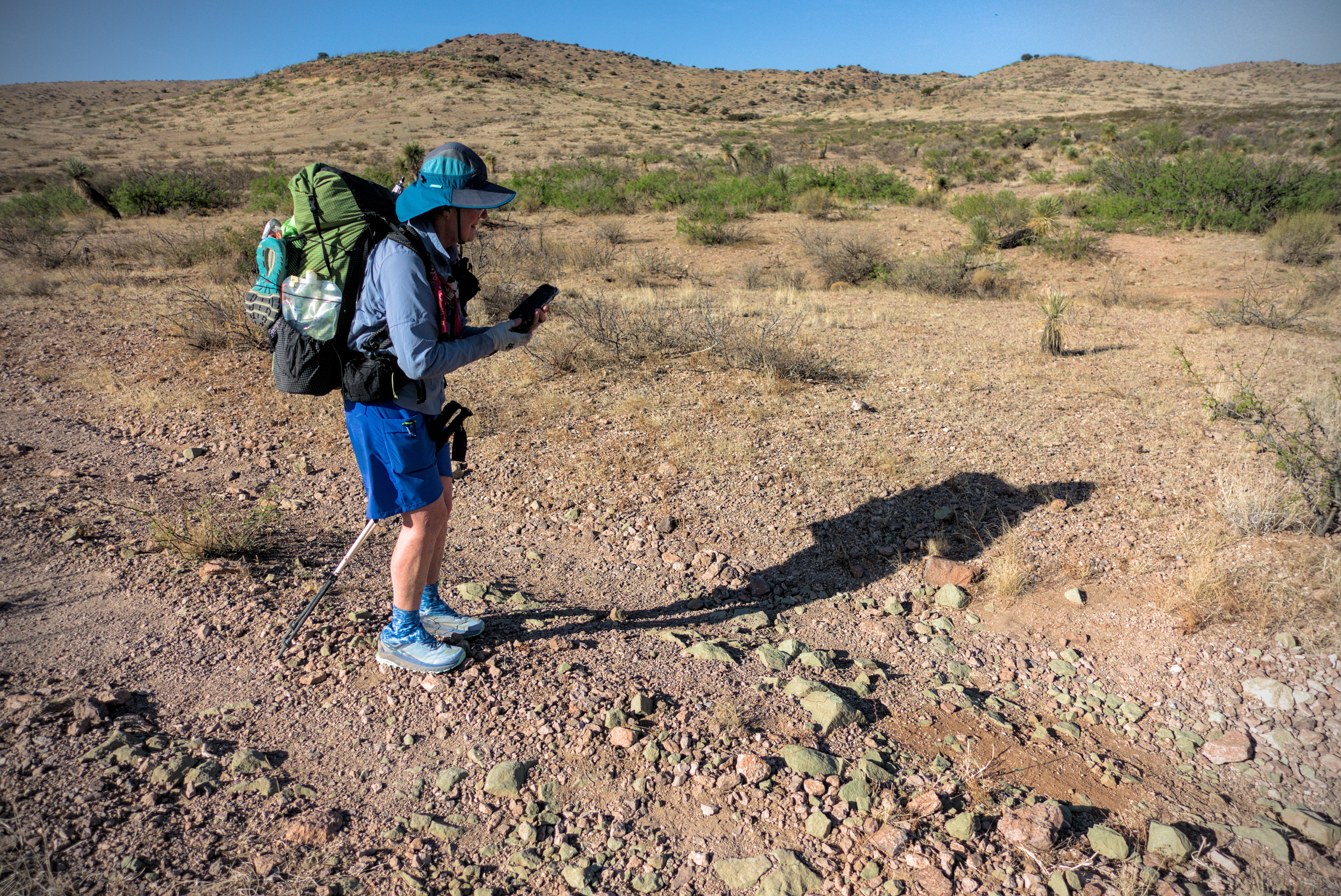
I'm really hot and thirsty at this point, and the windmill in the distance
should have water.
Indeed, just before dark, we reached the road with it's water cache. Slim, Brainstorm and others were there. We all found places to unroll the sleeping bags in the sand. Still, the wind was so bad that sometimes my sleeping bag would fill with air and try to lift up. At least it wasn't really cold.
Some people "evacuated" to the store at Hachita, and later I read on Facebook that this evening's storm was quite severe...sending several hikers off the trail. Wow...
The last steps to the road and a camp with shelter from the wind.
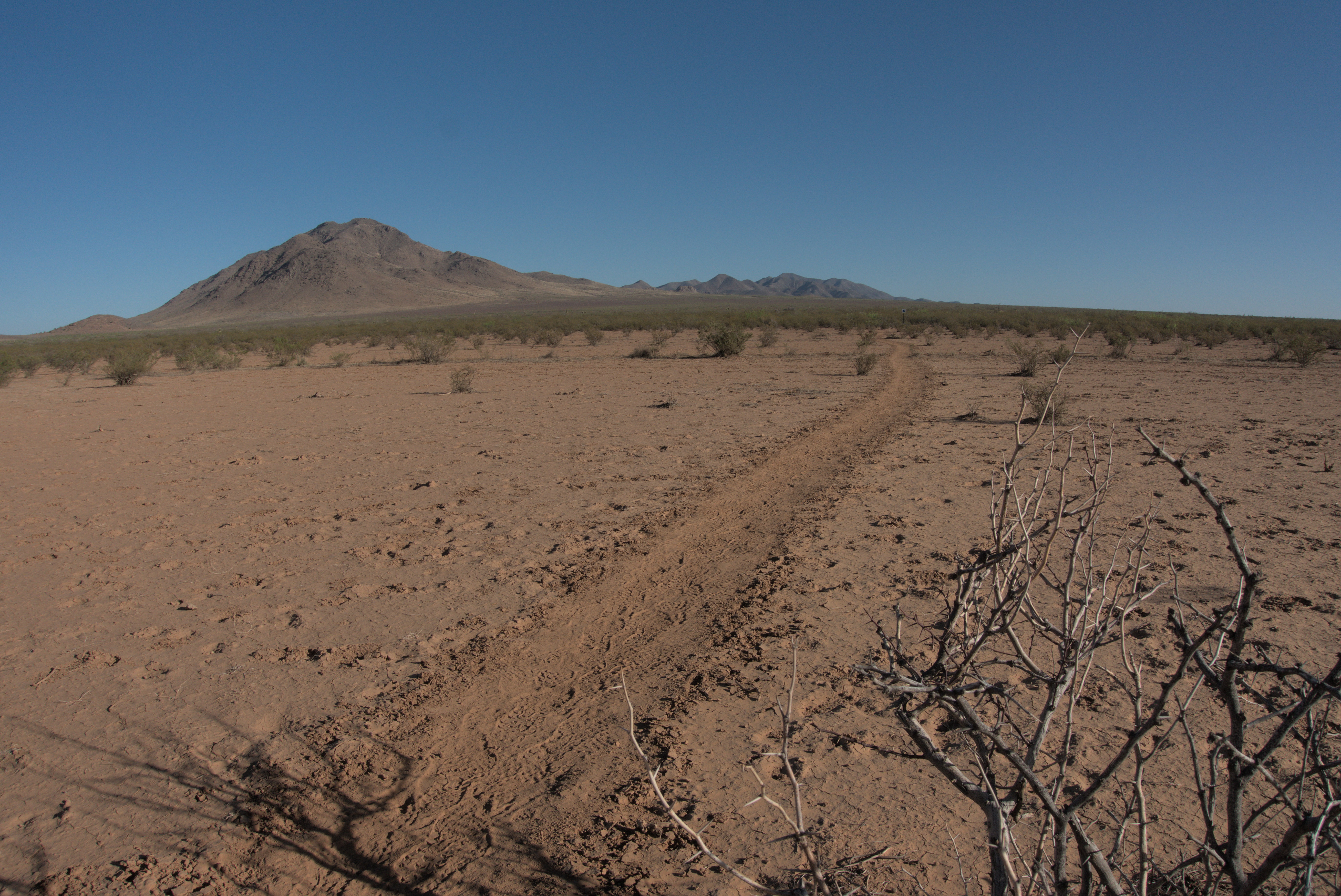
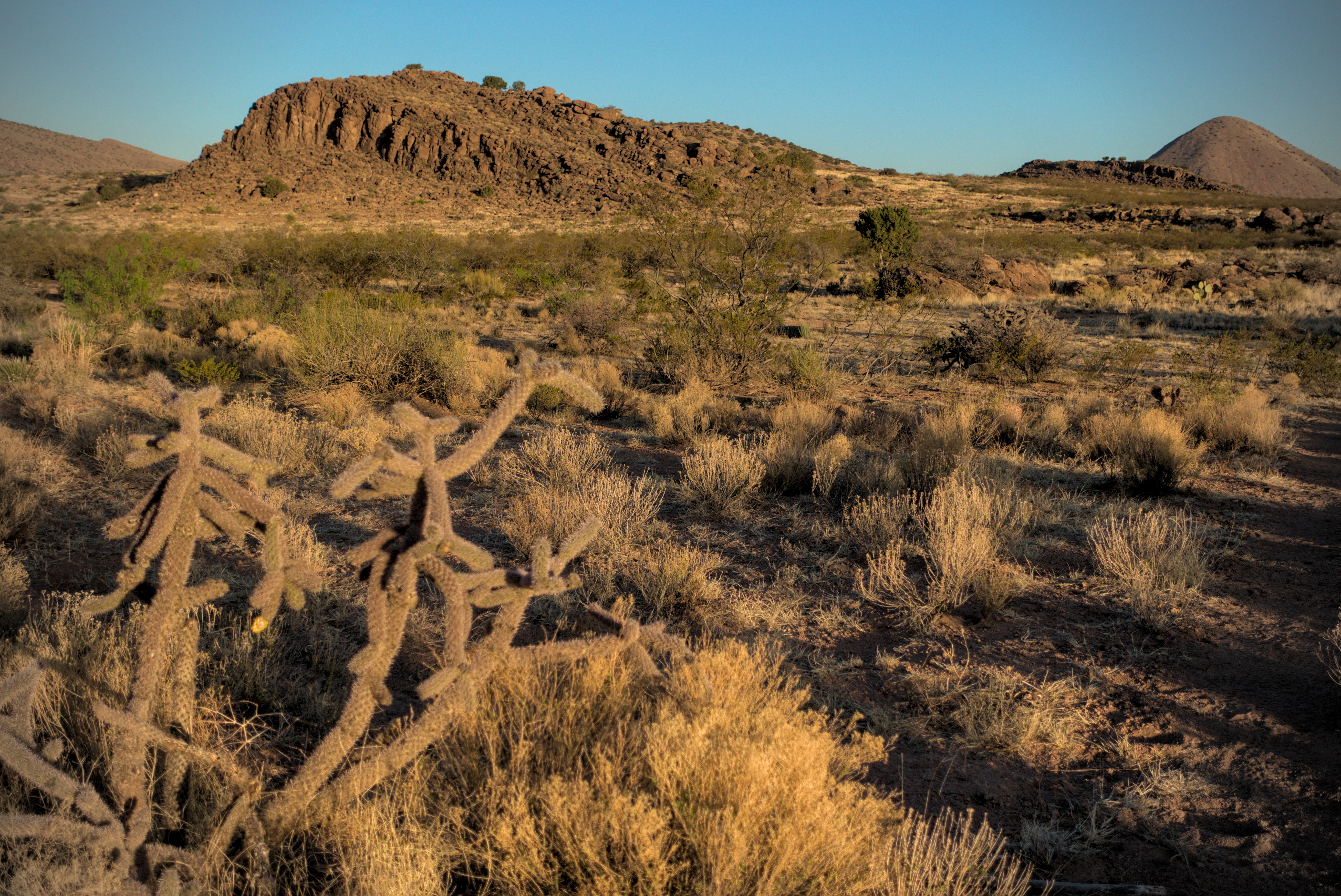
April 23st, day 3 - 21 miles
A journey northwest through the scrubby Coyote Hills ending in attractive grasslands.
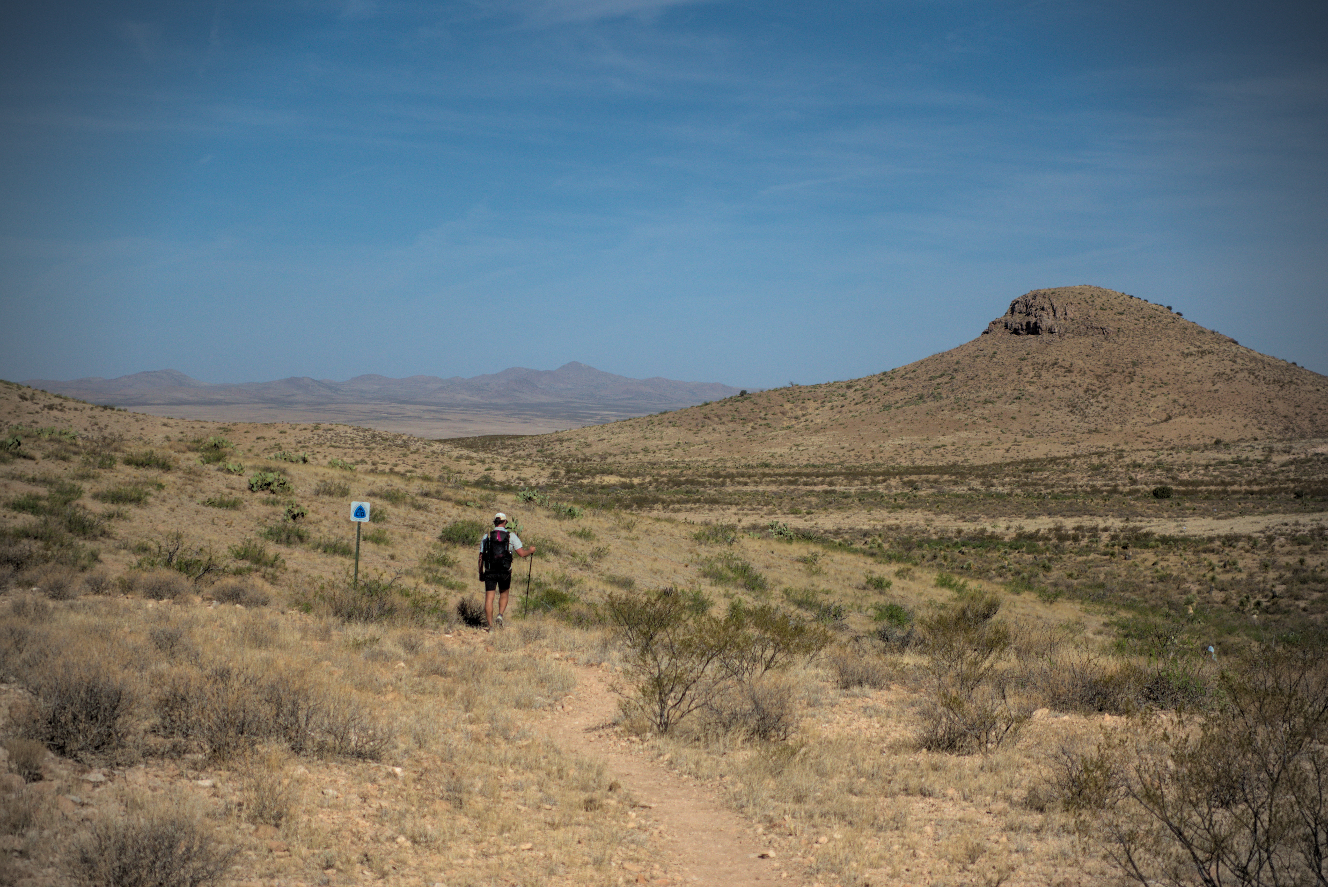
Zooming in, you can see Slim and a CDT trail sign. This stretch became
interesting because I couldn't see a mountain on any side of me...just a
huge flat plain for a while.
Looking back to the Big Hatchet Mountains and the border on their left side.
Boy, was I stiff and sore in the morning.
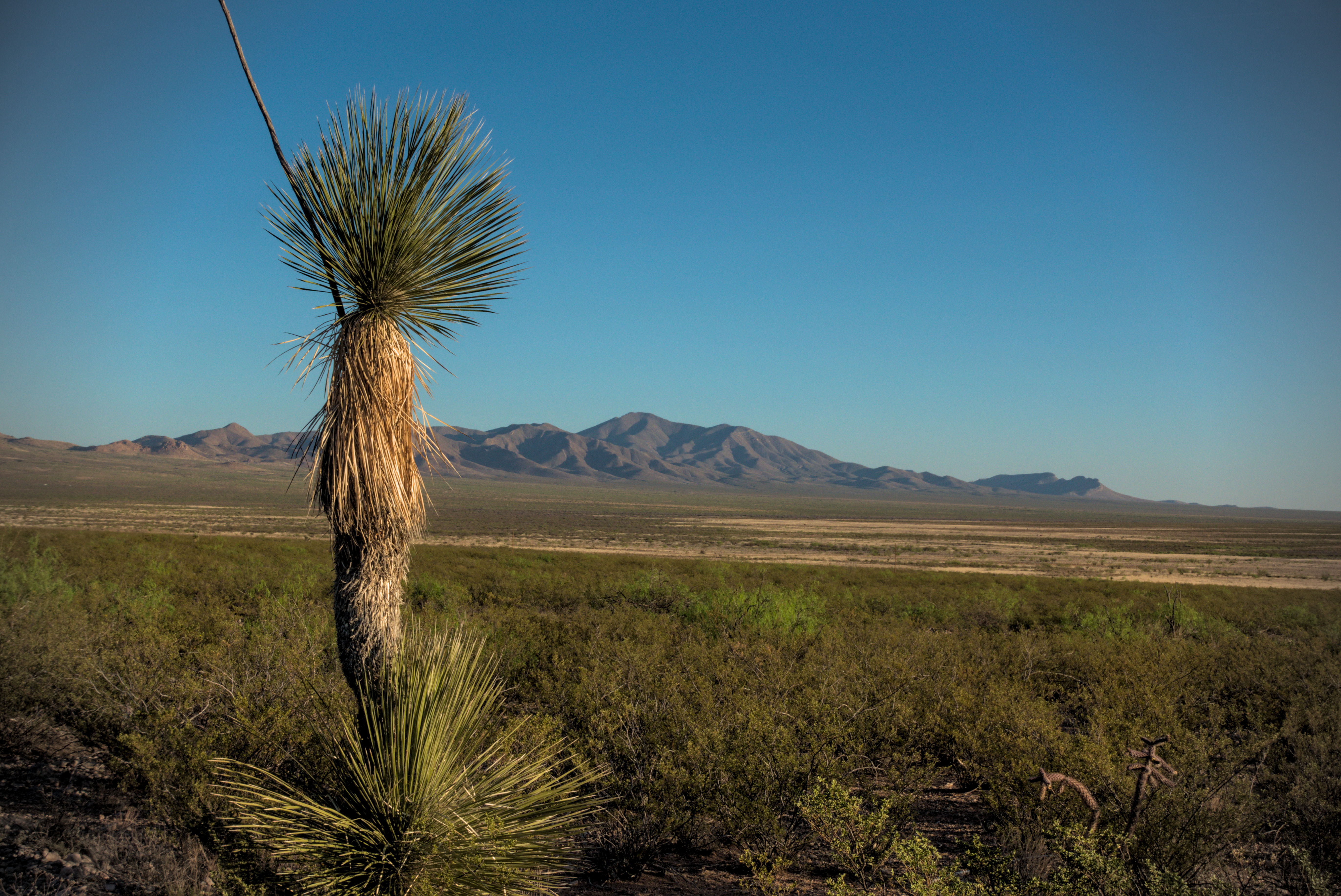
I moved slowly out, though I quickly became excited by how much space was around me. All the local mountains had receded over the horizons, so I felt myself to be in a limitless flat land. "It doesn't get any flatter than this!" I thought, and enjoyed the contrast with the visions in my head of high mountains to come. It's all part of that joy of starting at the REAL start...not driving up into the mountains to start hiking in them, but WALKING to them from some very remote point.
The gradient of the land was relentless...tilting up or down in vast sheets. But until you get some distance on it, it isn't easy to see.
Bluejay, what a delight she was!
Here I met a very interesting person, Bluejay. She and I immediately hit it off. She was lost in comtemplation of the desert floor, just realizing at that moment that it was indeed a forest, just as much so as the forests in North Carolina where she lives. She'd hiked the Appalachain Trail, and planned to section hike the CDT to Pie Town.
I enjoyed talking with her so much...that kind of philosophical / spiritual discussion I like so much. I was in fact so excited to have a discussion partner who can walk that walk that I became overly boisterous with insistent questioning why, if Bluejay feels "spirit" all around her, why can't she name that spirit "God?" She had her reasons and they are certainly okay for her. I pressed because I see this question as one that at least a couple of generations of Americans are deeply conflicted about. If you are willing to use the word "God" then that brings a whole set of cultural codings. Whereas if you prefer the word "Spirit" or "Nature" then there is another set.
My great joy would be if those divided Americans could hold God together. The "Spirit" people can't do it though, because they feel that the God-holders are holding a "small thing," made small by bigotry, misogyny, racism, etc. And the "God" people feel that the Spirit-holders are trying to enjoy the sweet sunlight of God's love without honoring the source of that love, risking a kind of "cafeteria spirituality" which devolves into doing whatever you want.
Sadly, trying to bridge that gap just offends everybody involved. Nobody feels correctly described by my little sketch above, because it has no nuance. It sounds dismissive, I know. I present myself as a "God-holder," but really, I'm a "spirit guy" who only recently saw the wisdom of going ahead and using the word God. Even the word Him.
So I guess I was trying to evangelize. Bluejay saw through that and had none of it! Life is often this way...you meet a friend, and in the joy of discovered friendship, you rush on to seek total union of thought, forgetting that this would obliterate all reason to know another.
Others are our teachers. They should always come with mystery mingled with love, and their arrivals, their words and their departures should always be celebrated with respectful love.
Anyway, Bluejay and I later had dinner in Silver City and continued our conversation fruitfully. Just a super cool lady, and she gave me a great gift with her cheerful and strong presence.
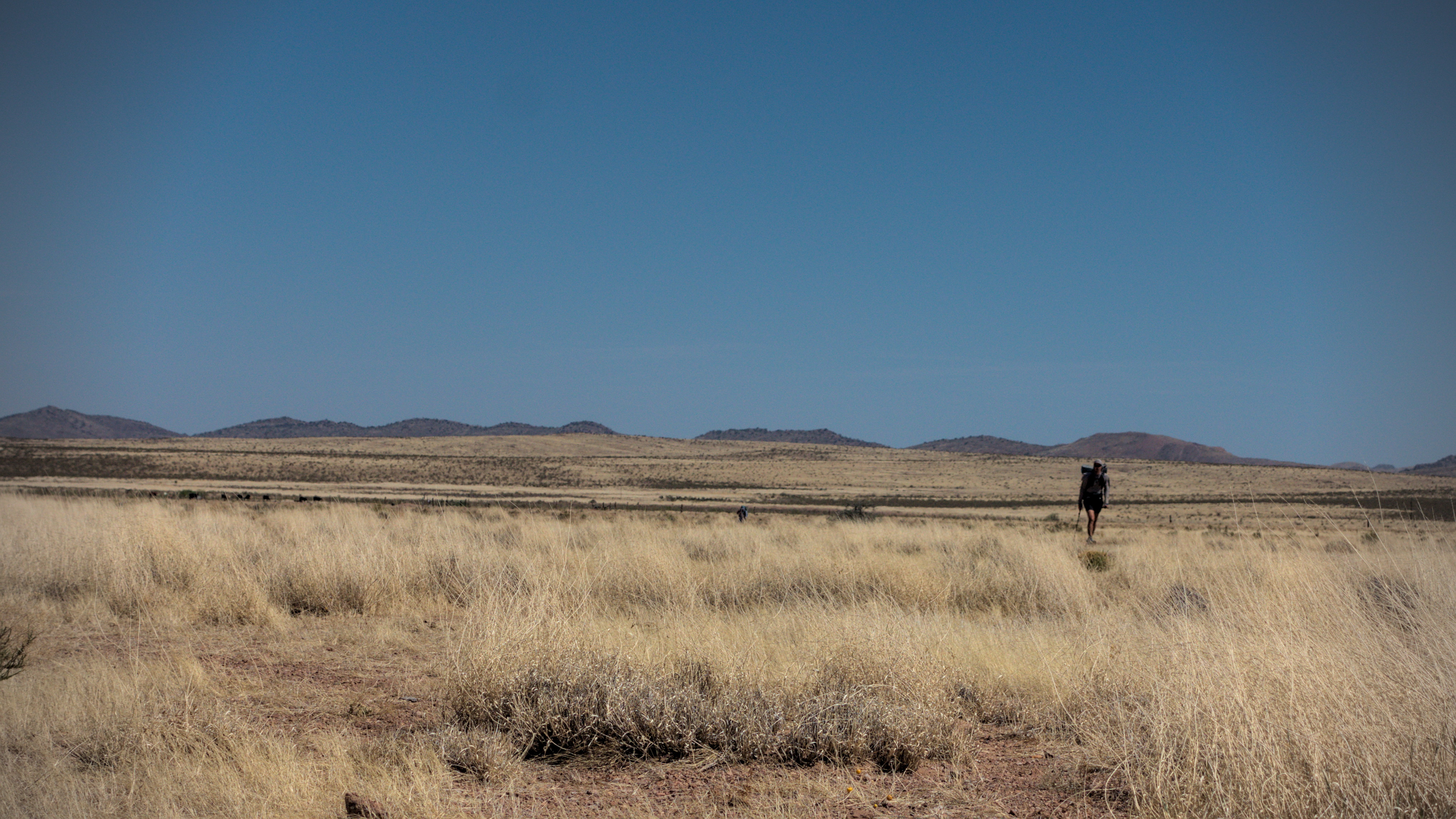
Brainstorm descends from the divide pass in the Coyote Hills.
We crossed a road. I met Apple, locally famous for the trail magic he does every year. He was driving a hiker with an injured ankle out to Hachita. He told me that I'd find his tent a mile up the trail, and should help myself to soft drinks. Amazing!
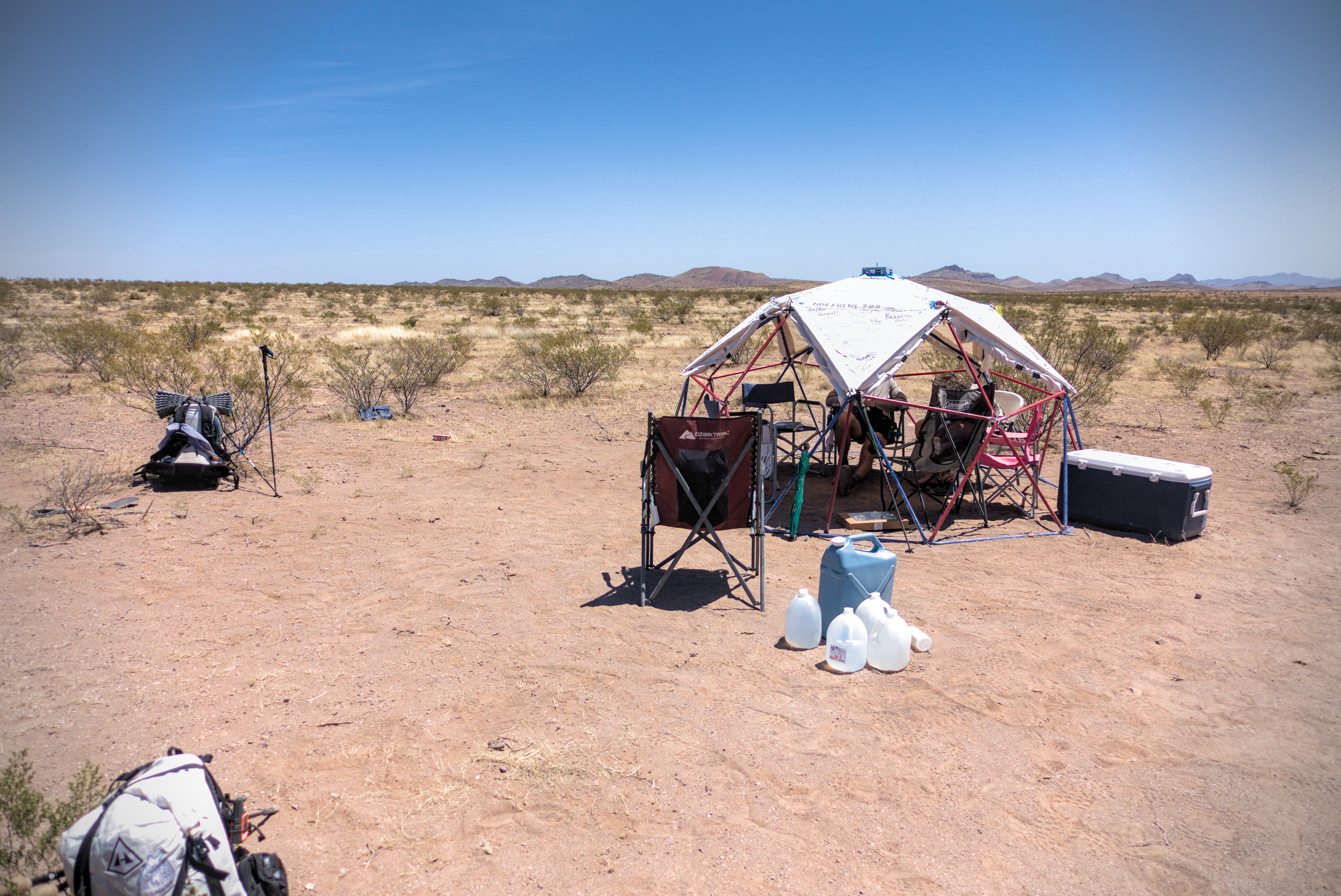
Apple's geodesic dome tent of hospitality!
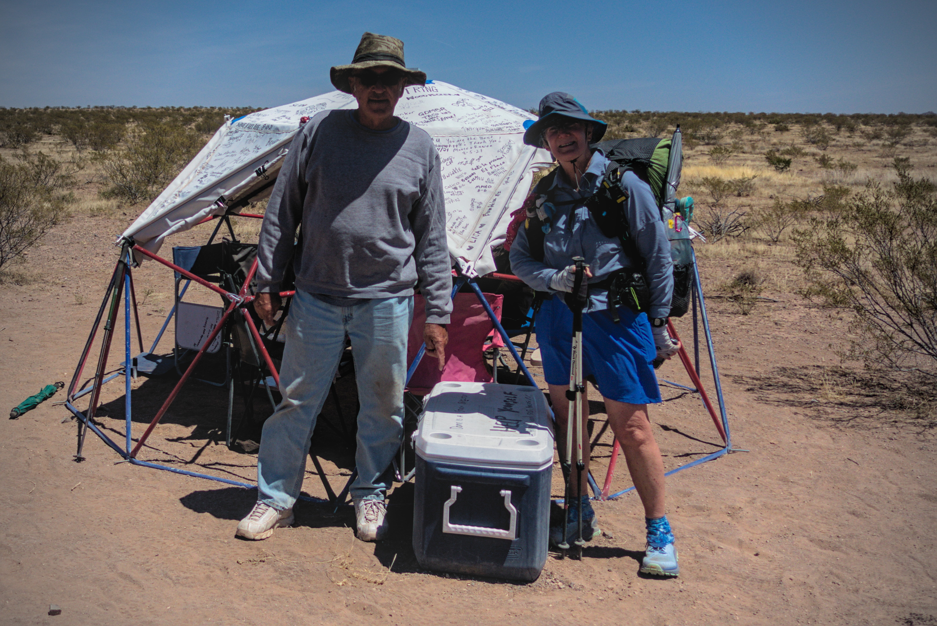
Bluejay and our great benefactor, Apple!
I got there and sat with Detour, Lemonhope and others (maybe Slim?). Bluejay arrived just as I was leaving and I got a picture of her with Apple. The doughnuts were insanely good.
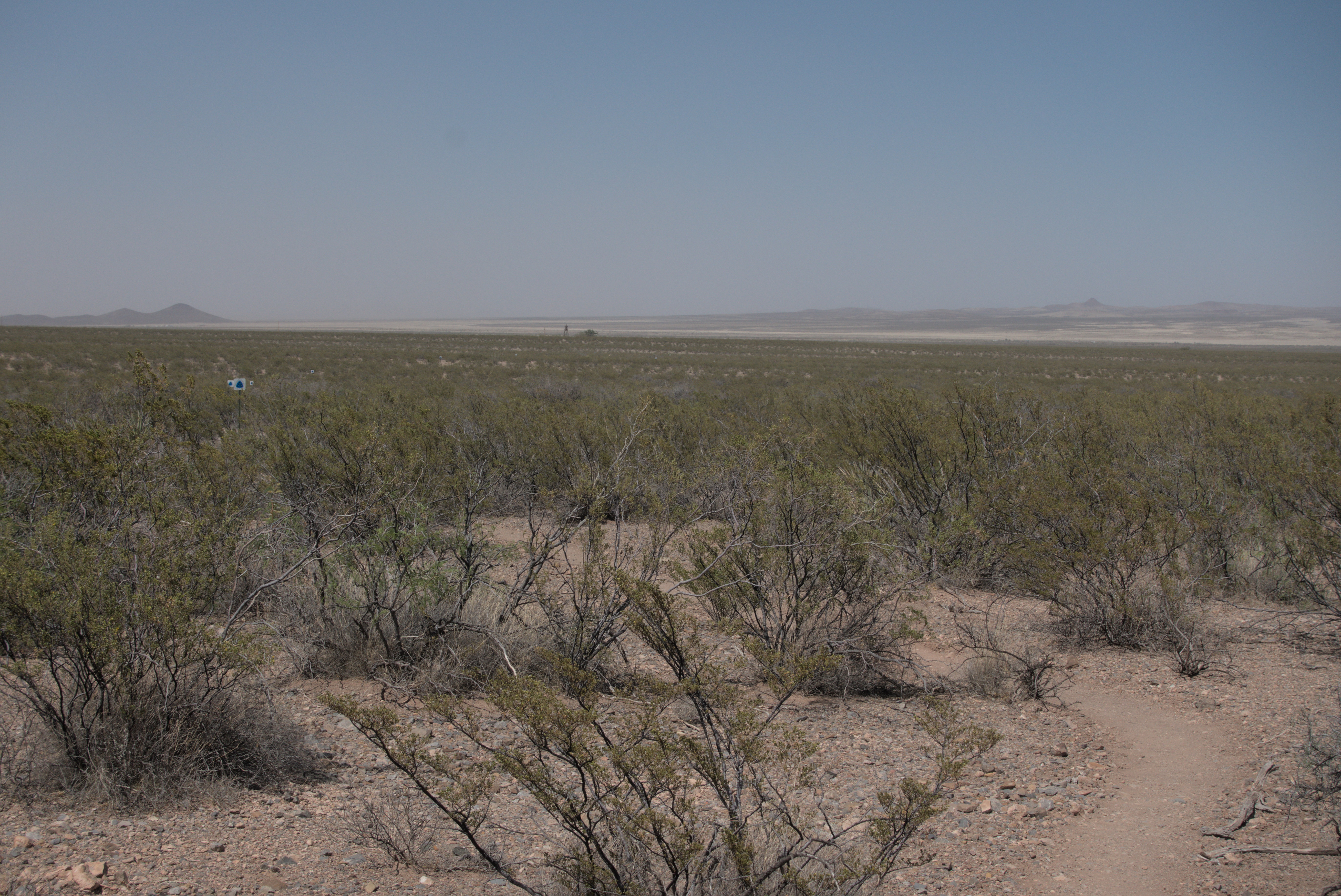
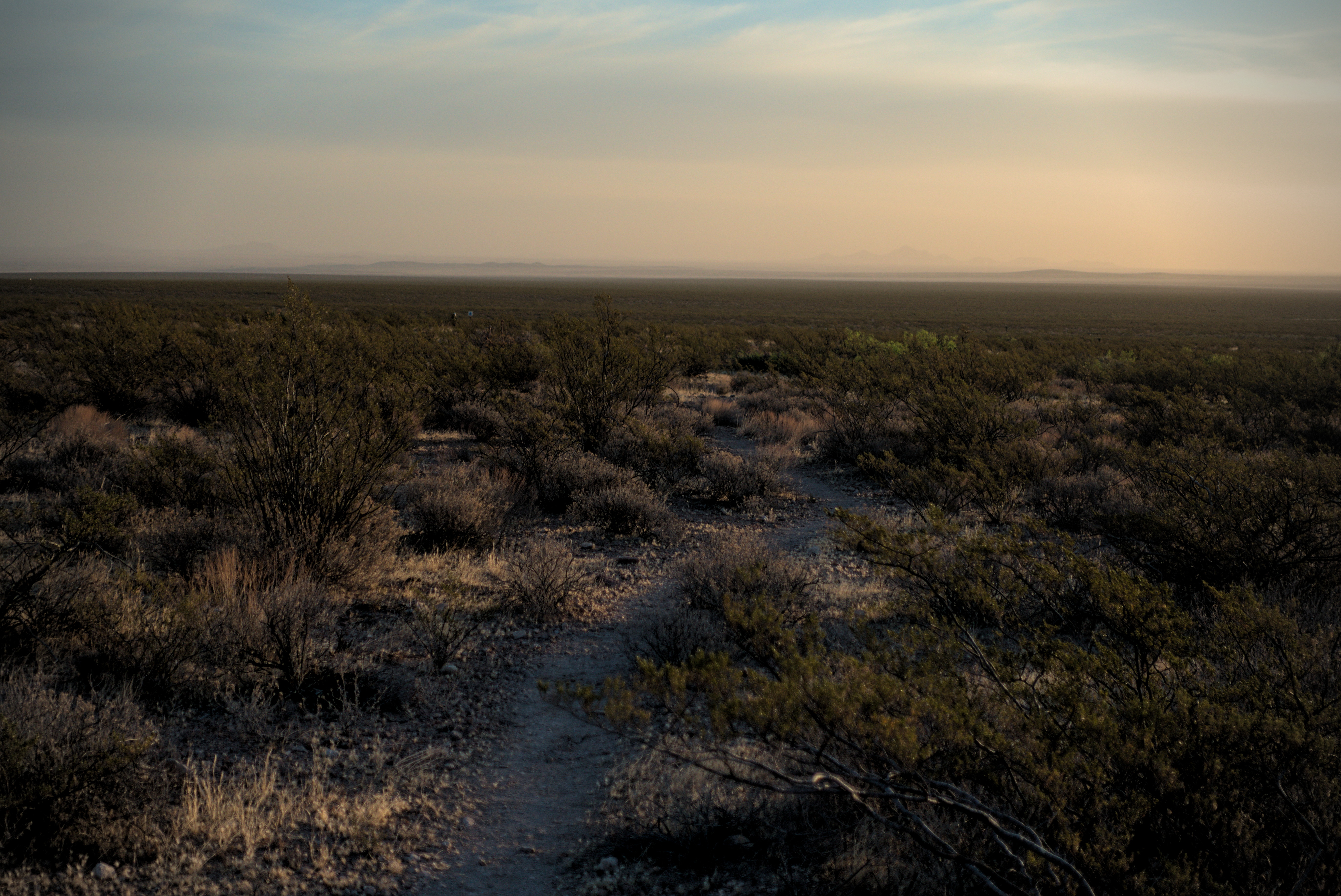
Into the grasslands...
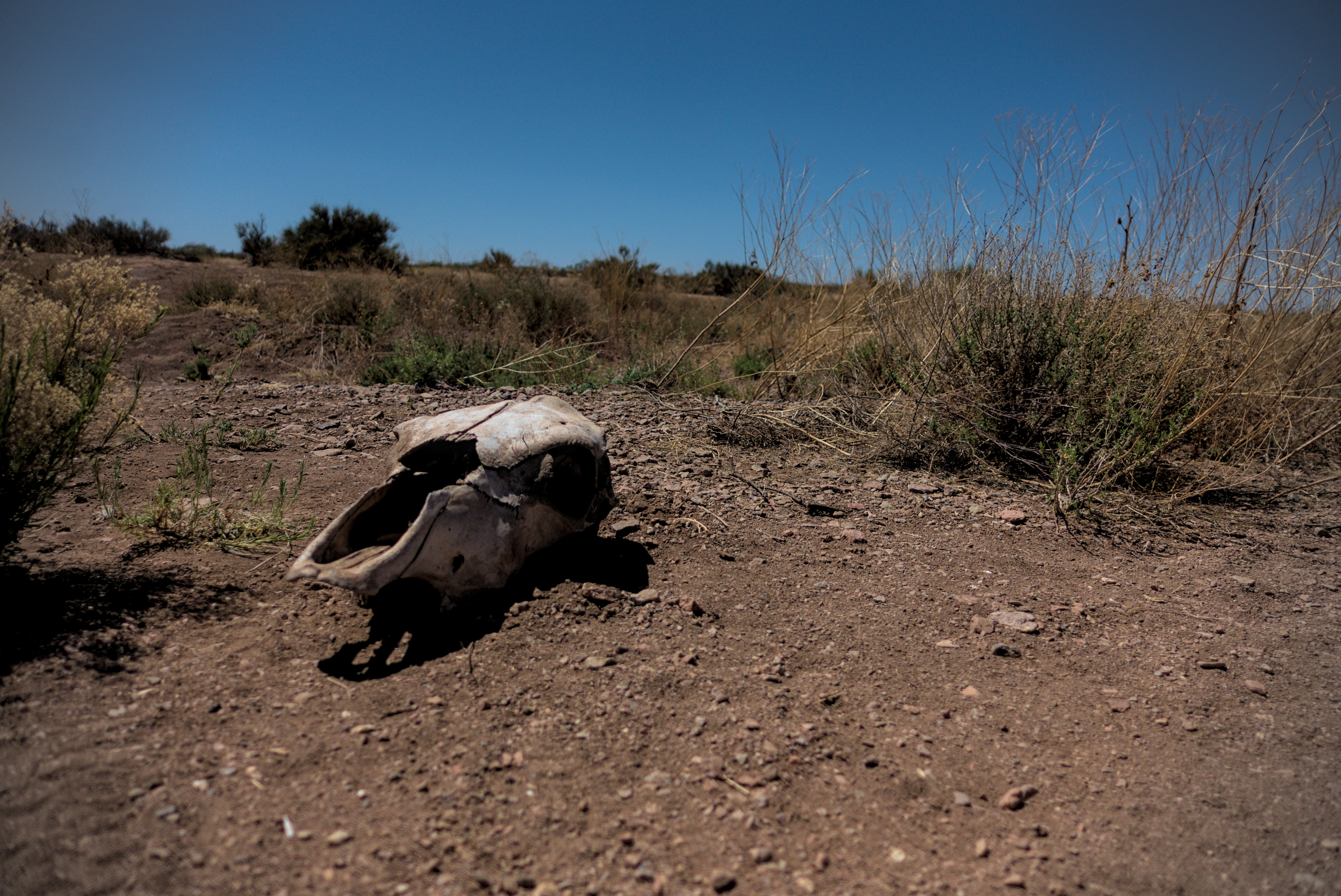
The obligatory cow skull.
Tall Son approaches, and I think Blue Jay is behind him ("watch out for that
limp," she said. "It'll give you hip problems.").
I entered extensive grasslands in the afternoon that were rather beautiful. I saw Tall Son in here, and Bluejay caught up with me. She said she keeps a bottle of whiskey for evenings at camp. What a good idea! I wouldn't follow up on that until well into Colorado, prompted by a taste of Mishaps cinnamon whiskey, but I was happy when I did.
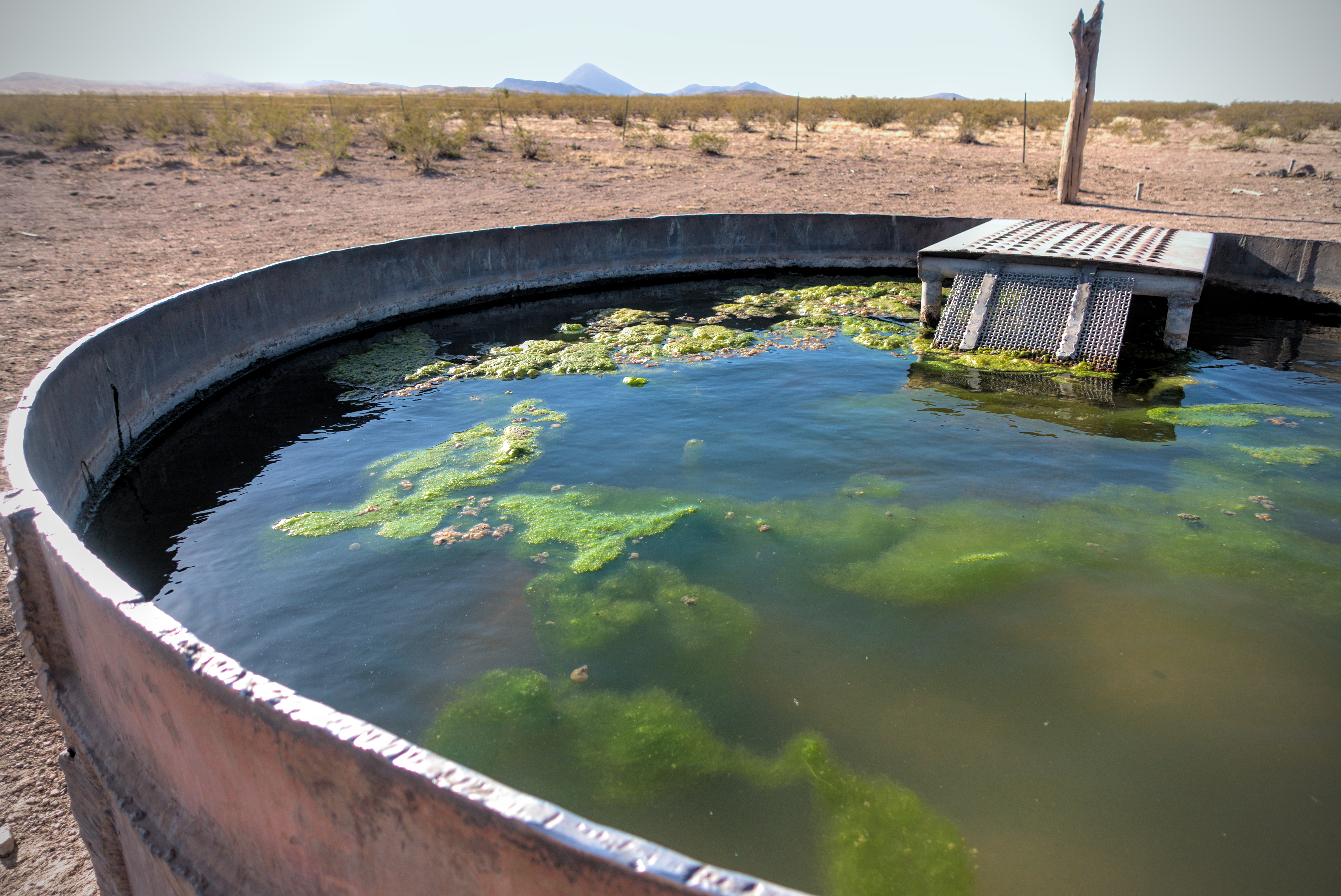
My first "icky" water source, Williams Tank.
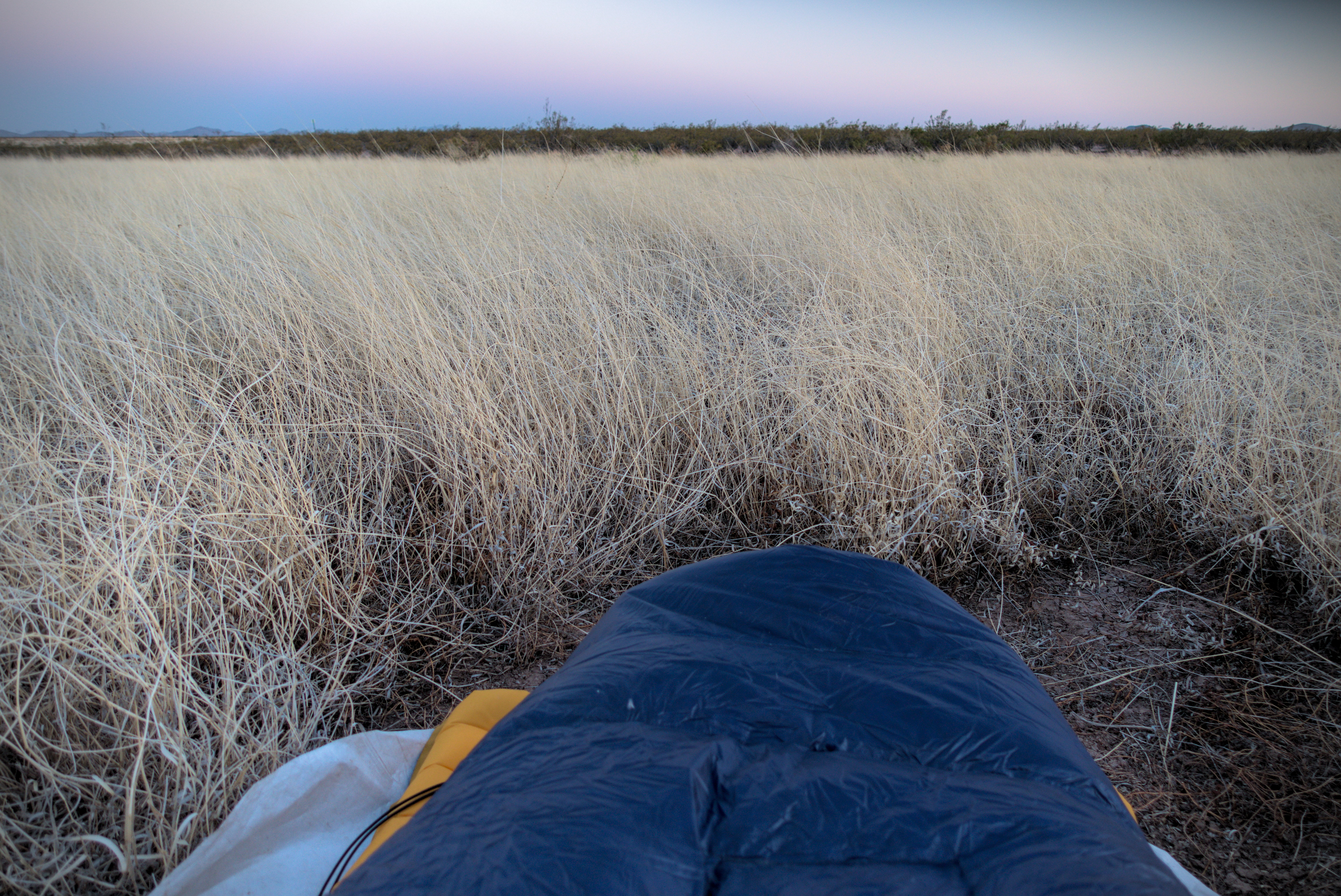
Lovely grassland camp.
Goodnight!
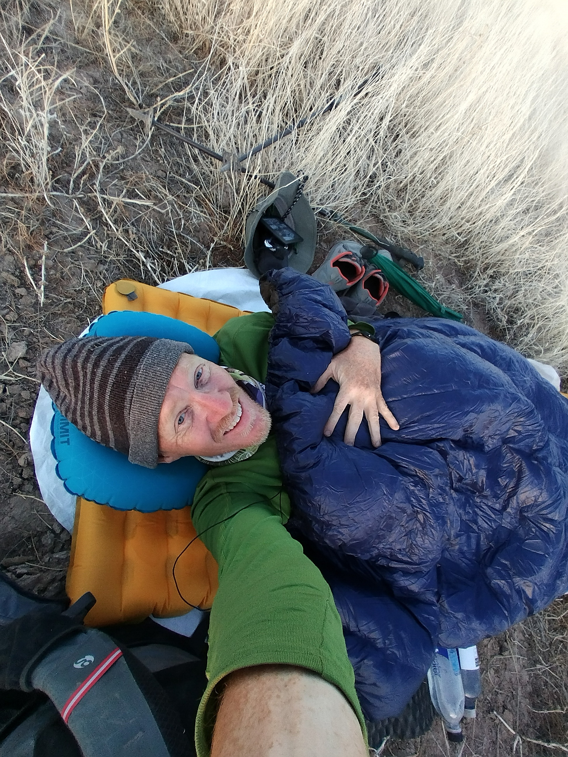
At days end my feet were just aching. I walked a bit into the grass and set up camp. This was probably an error, because I got a leak in my sleeping pad that I was never able to fix. It was a very slow leak, taking about 3 hours to flatten.
In the dark I heard voices and saw lights. It was Go Go and Blueberry doing their nighttime hiking thing. Their energy was just so different from my own!
April 24st, day 4 - 17 miles
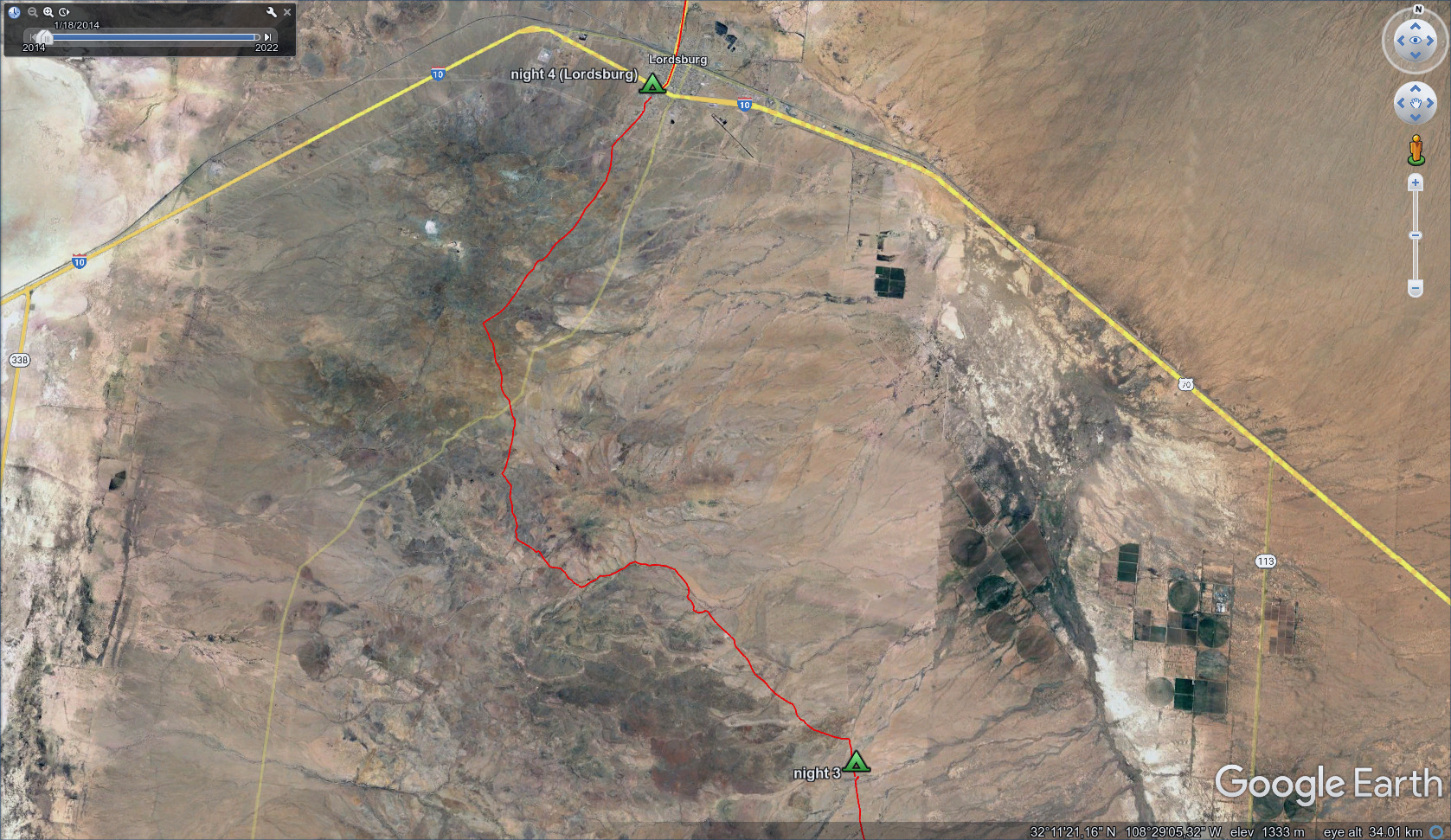
A short day, though exhausting in the ups and downs before town.
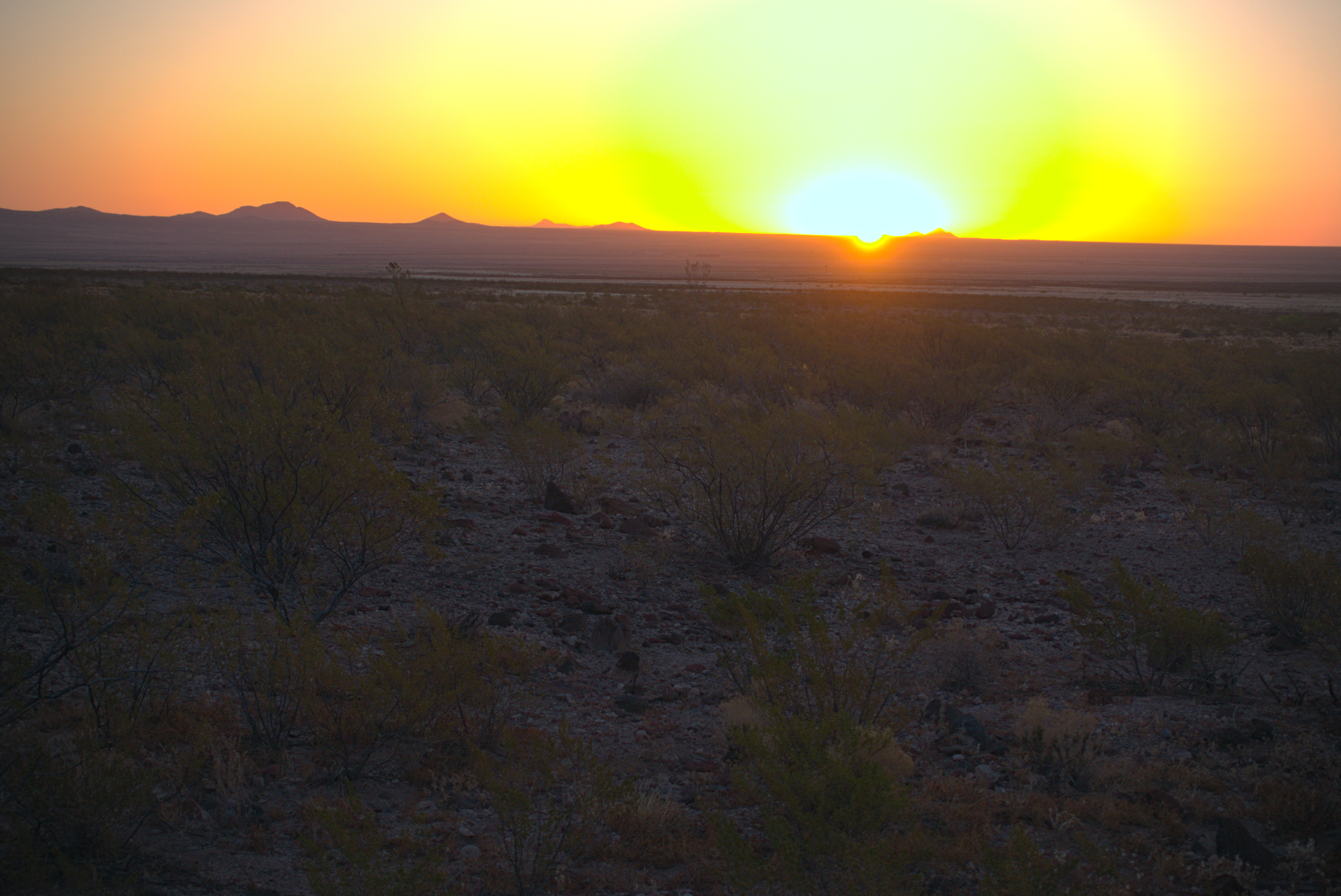
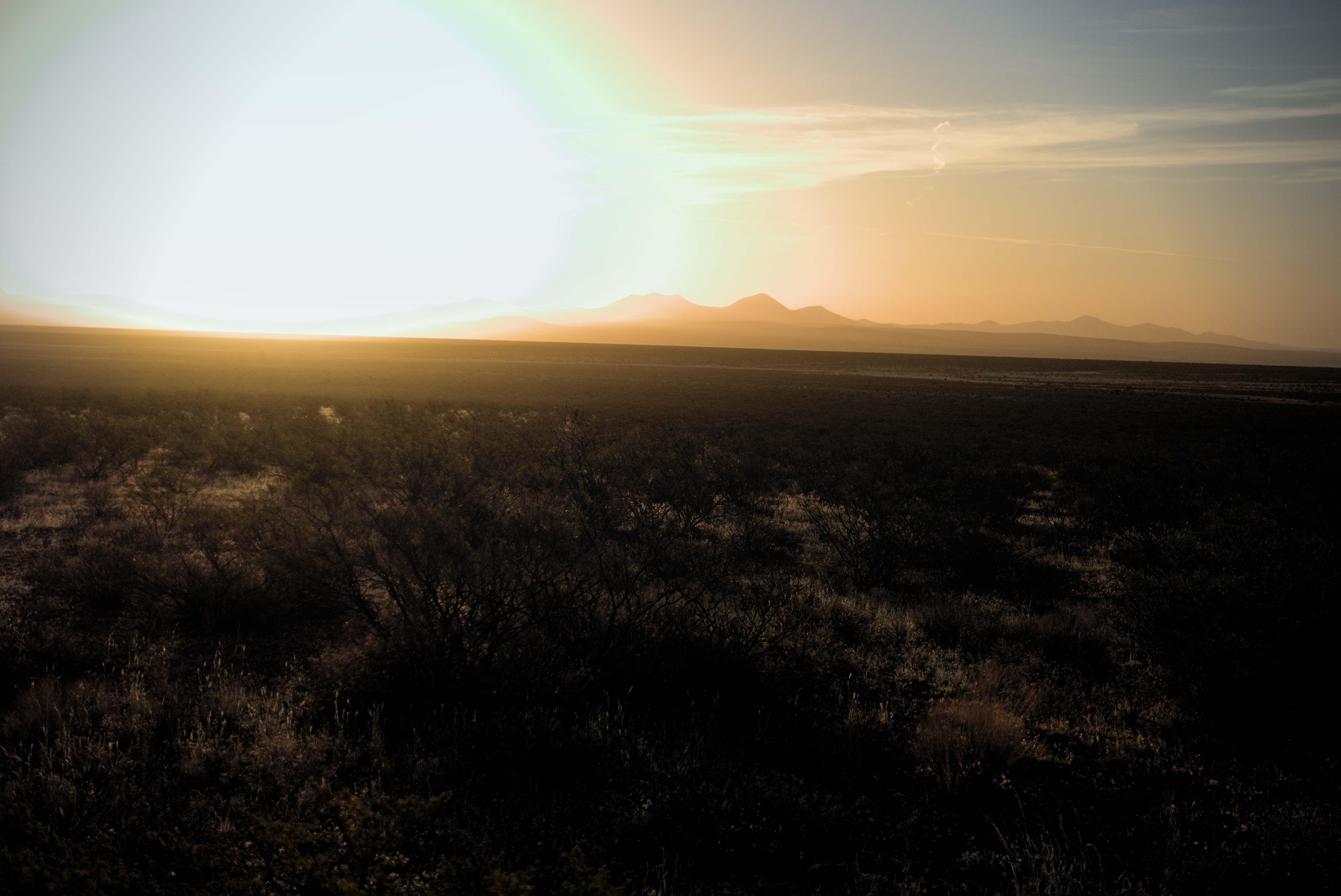
Looking behind me to sunrise.
Moon and low hills.
Pyramid Peak. I would go around it on the left, then head off to the right.
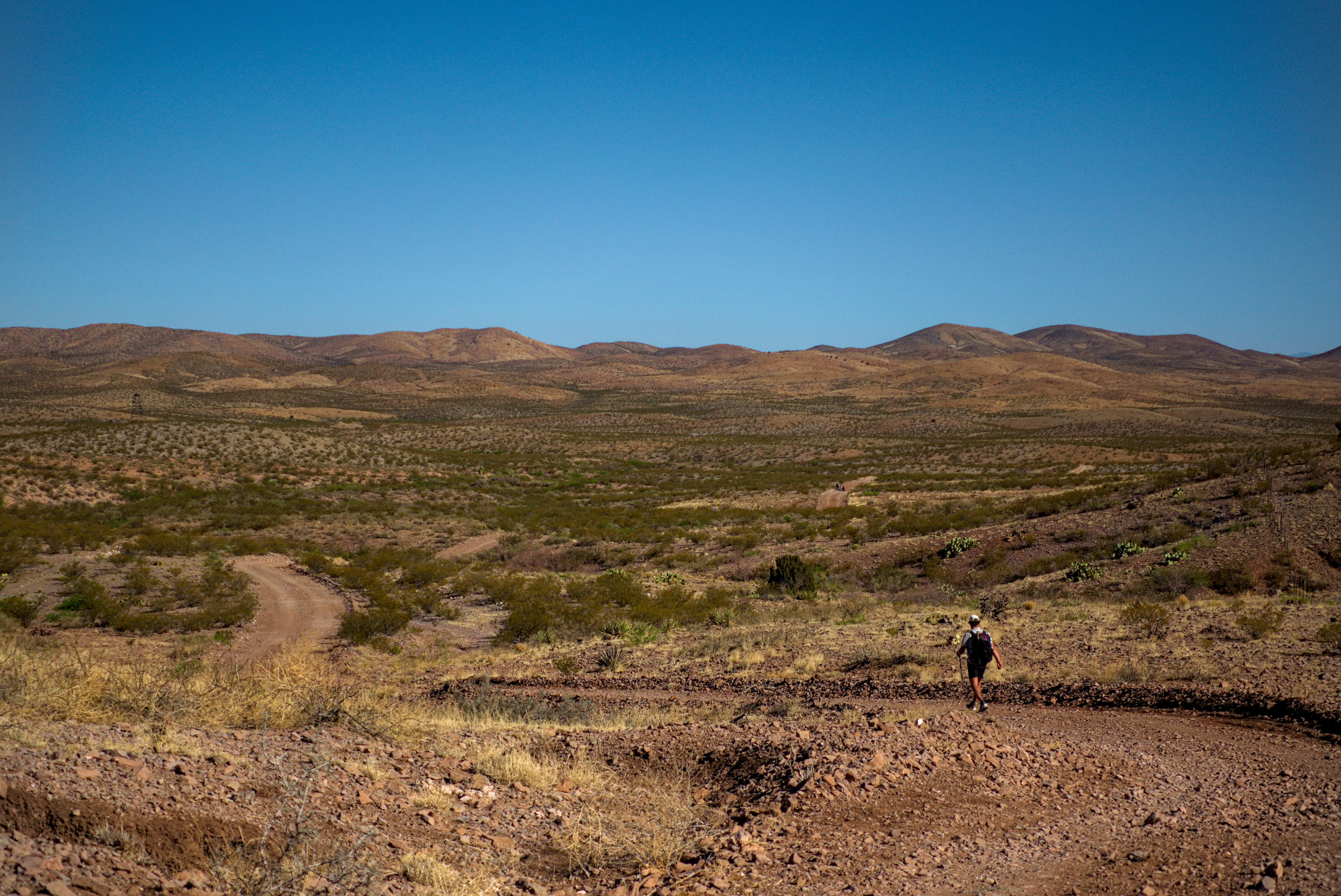
A day in the Pyramid Mountains, first climbing with interest into Rockhouse Canyon, which boasted of trees. It was nice to sit under one and look out at the landscape from shade.
I rounded Pyramid Peak and headed down a few miles to a junction with Animas Road and a water cache. I chatted with Go Go and Blueberry here, signing the logbook. From this point, the trail godes back up into mountains on the left side of the road, and then, hilariously makes a straight line down towards Lordsburg going steeply up and down draws, canyons and washes. It was just like a survey line across broken country. Funny but tiring, too!
Mile after mile like this, going by Aberdeen Peak, about 800 feet above Lordsburg. I saw a train go through the town, it looked like a little toy.
Morningtime cactus.
Brainstorm descending to Lordsburg.
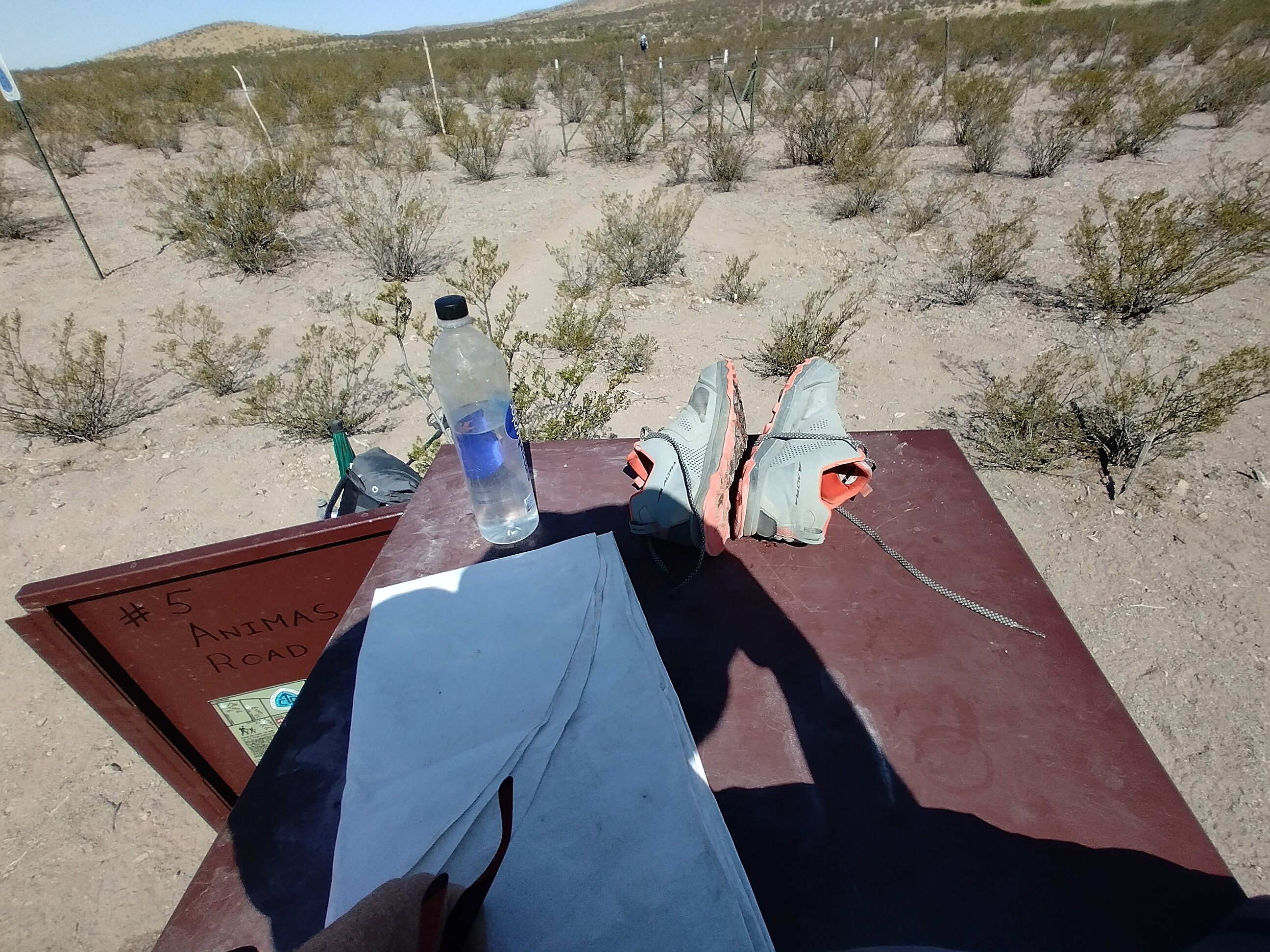
I'm sitting on the Animas Road Water Cache, resting my feet.
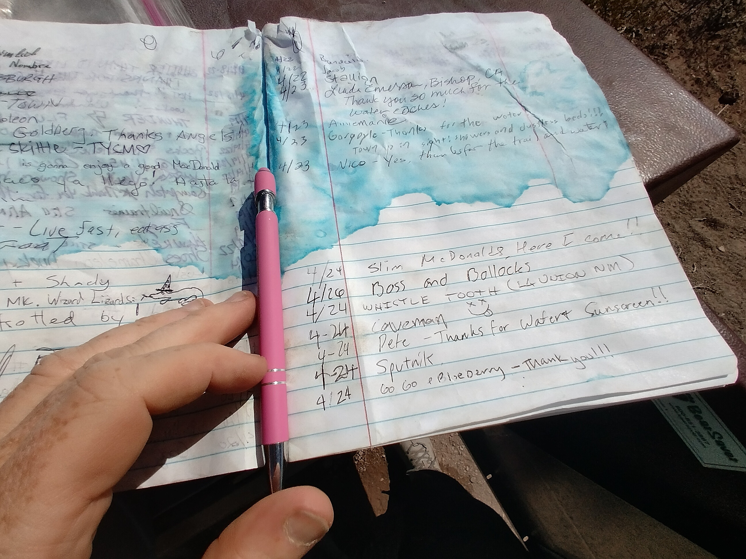
The Logbook. Interesting to see Gargoyle a day ahead of me. I wouldn't get to
know him until Colorado.
I walked straight to the Econo Lodge and checked in, though it took well over an hour to get a room ready. I hobbled across the interstate to get food supplies for the stretch to Silver City. My original plan was for a rest day, but nobody among my little group planned to do that, so I said "okay, I'll keep moving too!"
I set the alarm for early and went to sleep. Finally, I'd be moving north of Lordsburg!
To go on to days 5 and after, click here.