CDT - Dubois to Atlantic City
Friends: CoryLocation: Dubois, Union Pass Trailhead, CDT Night 130, CDT Night 131, CDT Night 132, Elkhart Trailhead, Pinedale, CDT Night 135, CDT Night 136, CDT Night 137, CDT Night 138, Atlantic City
Elevation gain: 7646m = 0m + 984m + 630m + 1006m + 555m + 0m + 1021m + 924m + 1141m + 745m + 640m
To go back to days 128 and before, click here.
154 miles, 25,100 feet elevation gain in total.
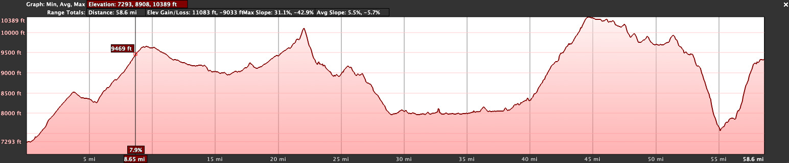
62 miles and 10,415 feet elevation gain to the hitch to Pinedale.
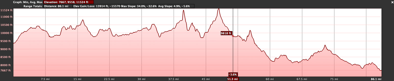
92 miles and 14,670 feet elevation gain to the settlement of Atlantic City.
The text below refers to the same events as the blog entries:
There was a full-on hiker bubble in Dubois. People heading north and people heading south. We set up shop at the Cowboy Cafe, meeting some people we knew and seeing a lot more (hikers) we didn't know. It was tough to find a place to stay for the night but we finally succeeded. We'd get that full zero day I wanted, so we'd be in town two nights.
We met Swede and Whitney, the two Swedish fellows that Cory had gotten to know during his stretch in the Bob a month or so ago. We ate dinner together...a big burger, pie and beer, the perfect hiker meal. These two had some great video footage of the mud we'd walked through and I got their email addresses to ask for it later (still on my todo list!).
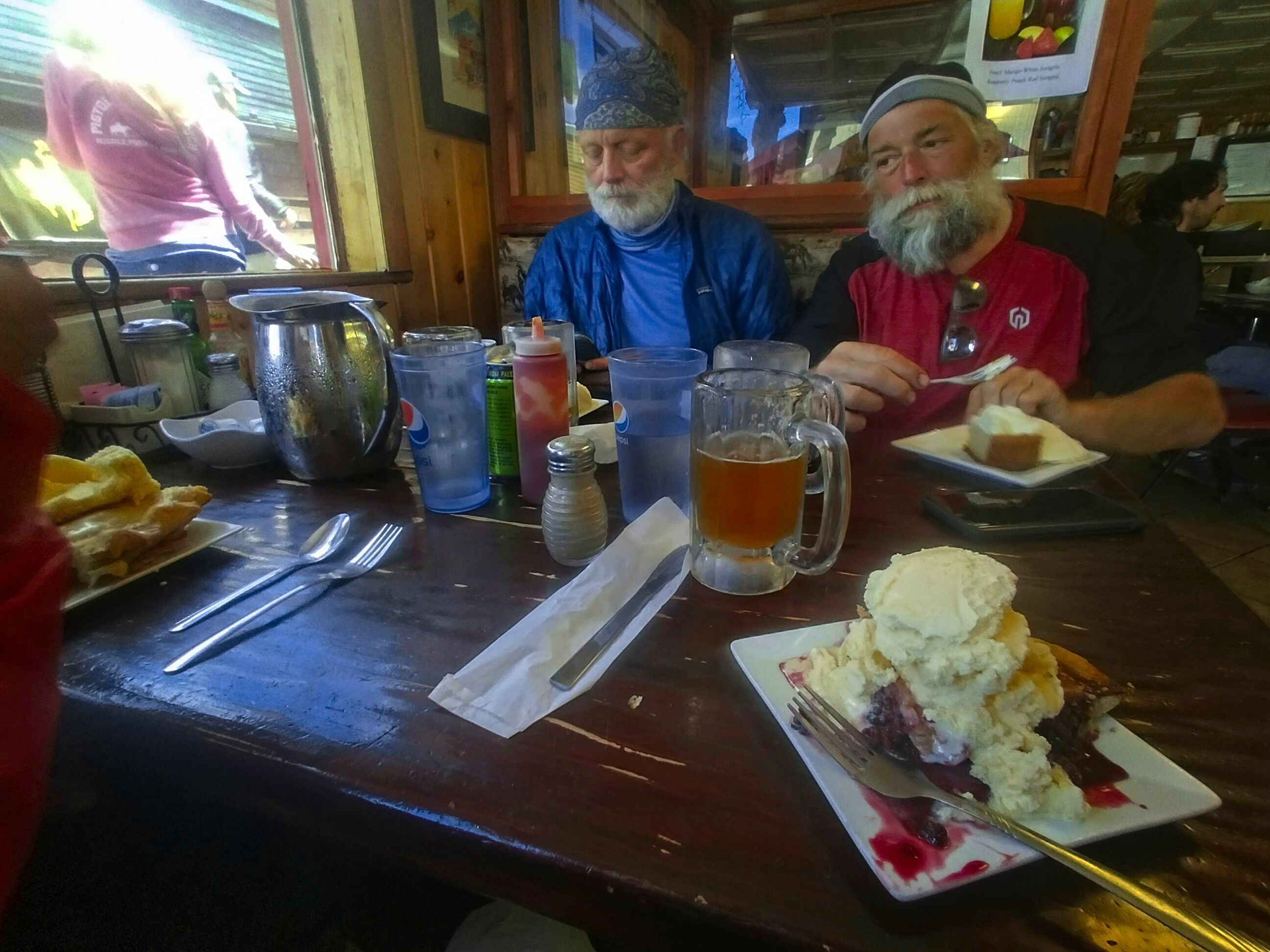
Burger, beer, pie. The trifecta of delight! Whitney (from Sweden) and Cory.
I bought some cigars at the gift shop next door (the Water Sheel Gifts and Books shop). The owner was a really nice lady. She said that the church was allowing hikers to sleep on cots for free. Oh, if only we hadn't already paid hundreds of dollars for a room! Ach...but still, the phone number she gave me for that turned out to be helpful when we left town.
August 8, Day 129
Nothing to do but sleep in and go shopping, and even that didn't take long because we had our resupply box from the Benchmark Ranch. Cory was amazing though, he went out and got breakfast for us both, and I sat up in bed watching tv and eating the breakfast burrito he brought back. Delicious!
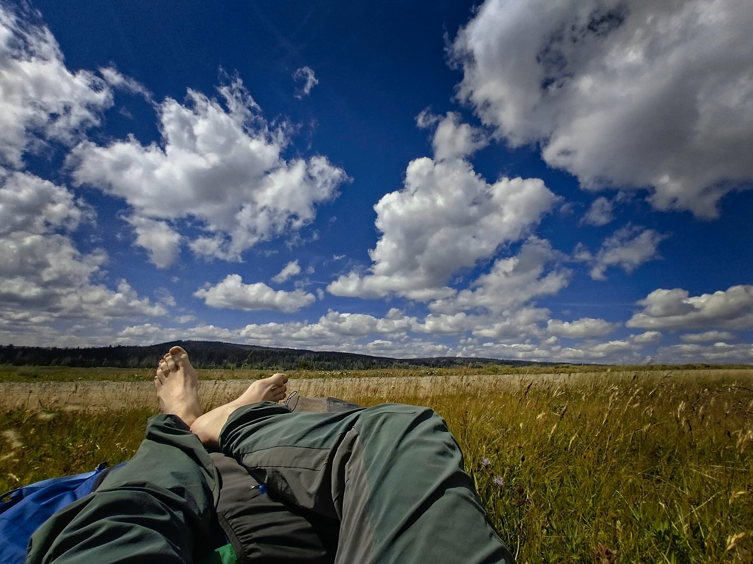
The hours just speed by on rest days like this. You catch up on conversations with your people far away...you edit pictures...you eat and take care of laundry. It's over far too soon.
We had to wait awhile to get back into the Cowboy Cafe. Finally we got in and shared a table with a nice couple and their grandson. We had a great chat with these folks.
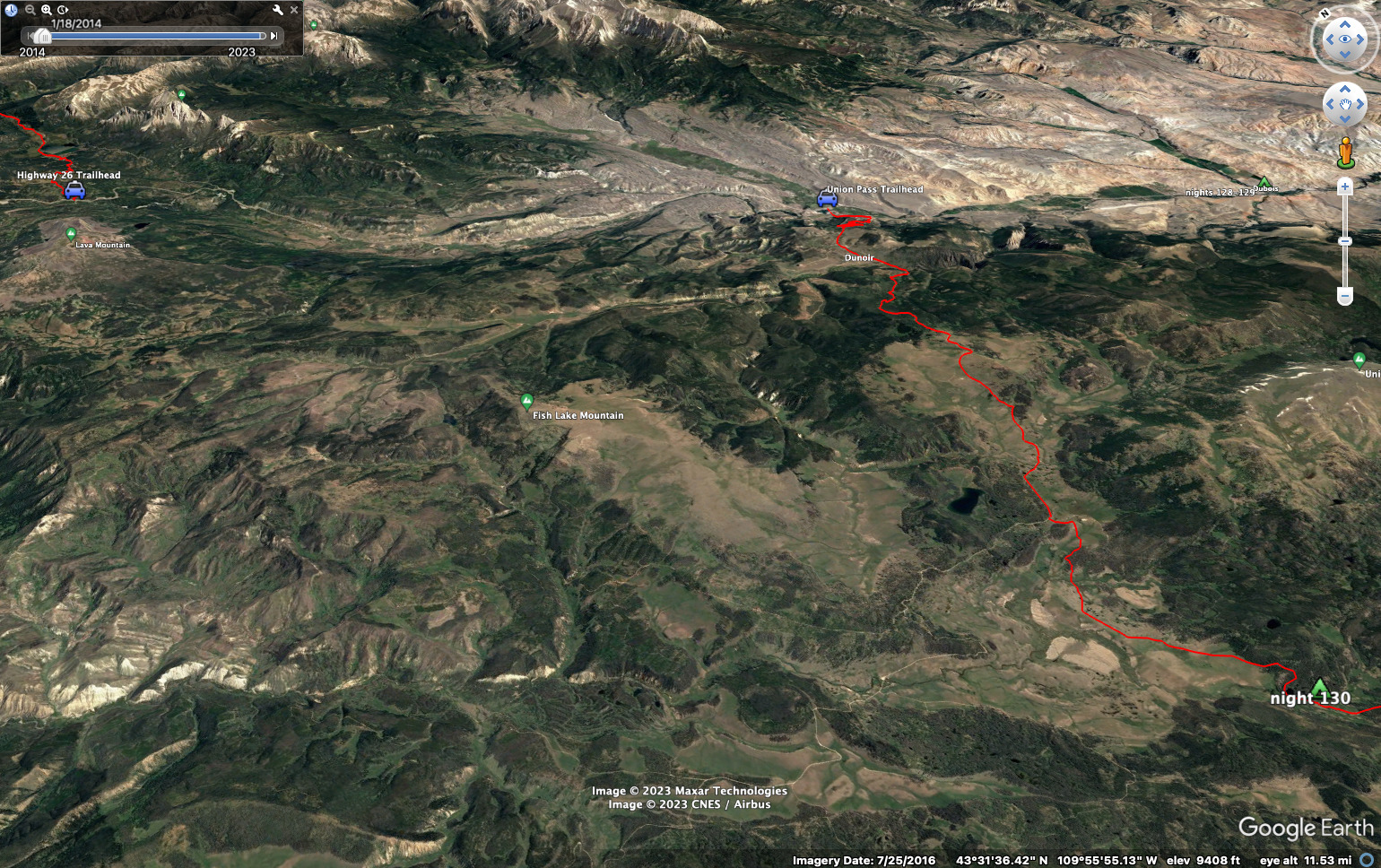
Took a beer home somehow, watched part of a movie, and planned to get up fairly early to hitch out of town. We'd return to the trail at a turn-off on the main road with a dirt road that climbs up to Union Pass. The idea here was to avoid the aggressive grizzly bear stalking people at the pass. Another surveyor had been charged a bit south of the pass (right on the CDT trail) and had some injuries. Between that and the grizzly roaming the road right on the highway, it was easy to accept avoiding the area.
However! It did save almost 20 miles of walking, and I've got a bit of guilt about that. But I guess I'll live (a sad and broken life).
August 9, Day 130
19.6 miles, 2335 feet elevation gain.
We had trouble hitching a ride out of town. I suggested we go into a restaurant for breakfast and strike up conversation with people!
This...didn't work so well. We'd crossed some kind of culture divide by moving to the west side of town. We were in the Village Cafe, full of older working folks who didn't particularly take well to the idea of grown men hiking across a country, by the atmosphere in the place. Well, shucks. So that was a wasted trip, but we did get more coffee in us and some eggs and bacon, which never hurts. I sympathized with these folks. So many of "our number" are weed-smokin' dope-totin' types from big cities, wearin' all their pride-themed clothing. Depressing evidence of hedonistic cultural rot, we seem to be. Meanwhile these folks get up early and work hard until health problems finally stop them. We're the winners. They are not.
It is unfair. And the worst thing about it is, the winners look down on the losers. Of course, this categorization is also false. What makes someone a winner, when they won't ever hold a grandchild, because they believe humans are a cancerous growth and we need to depopulate the planet? The joke will be on them, in the end. But anyhow, in the moment, people have the right to express their disapproval. Me and Cory were tolerated in this place, but not welcomed. Fair enough!
Back out on the street, we called the church and one of the ladies there sent her husband to get us. This nice fella drove us up to Union Pass road about 10 miles west of town. That was super helpful. Thank you sir!
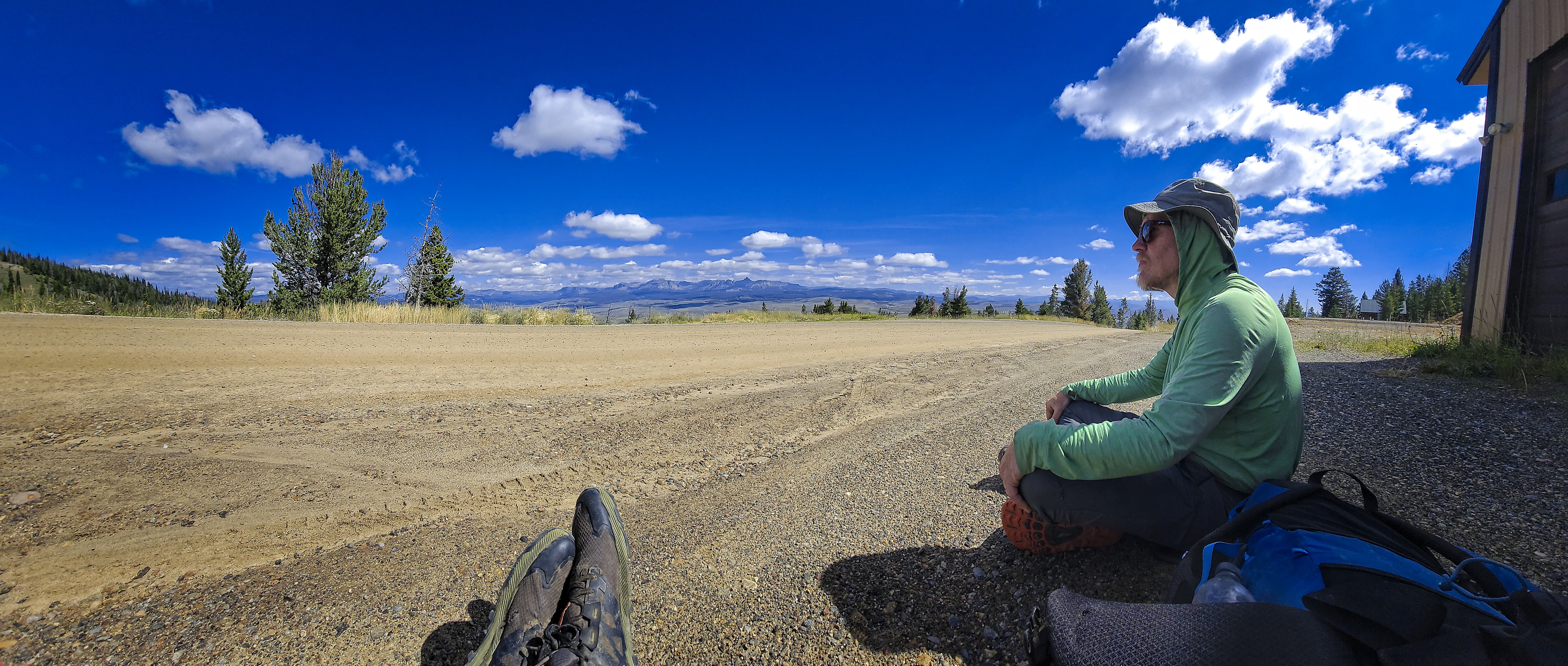
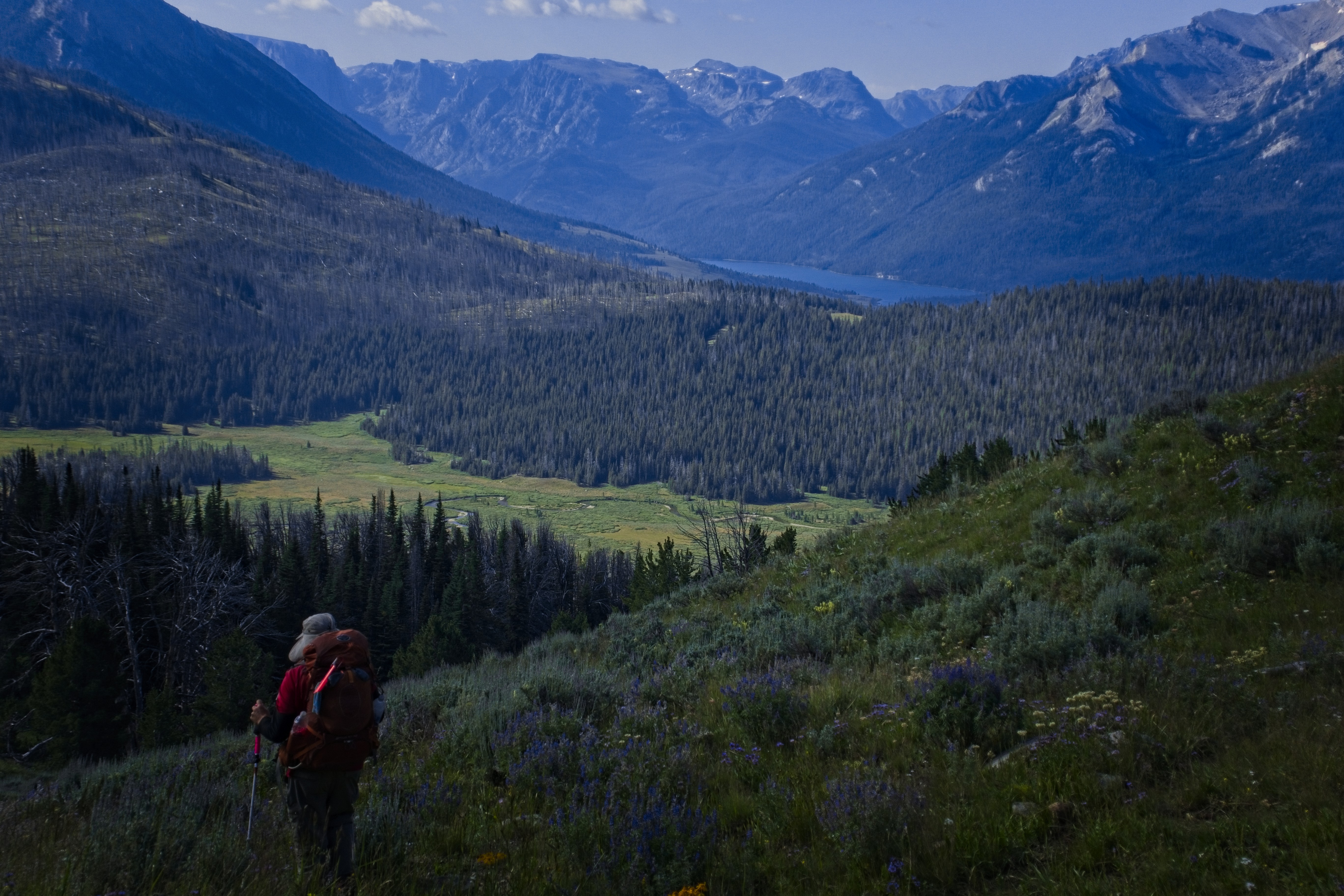
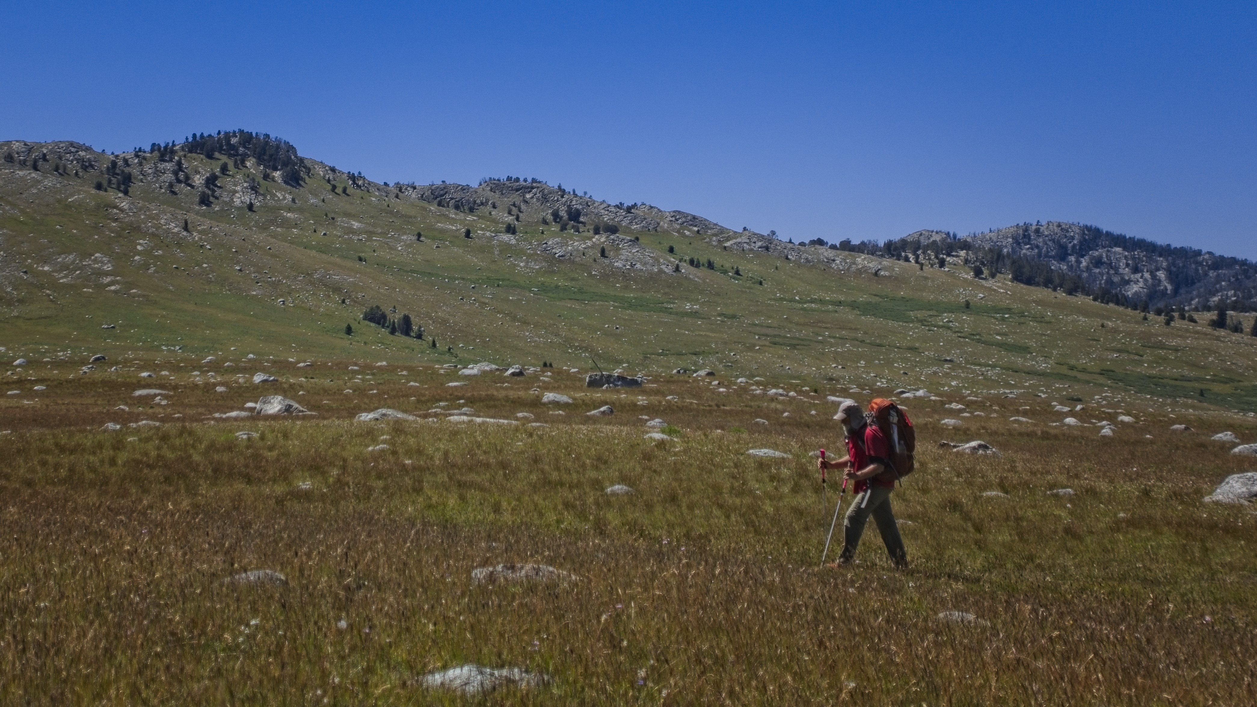
Michael resting near the small settlement of Du Noir.
We hiked up the road, happy for the good weather. Memories of rain and mud won't soon depart!
We met Heather and Mike at a little AWD vehicle rental place, and bought some snacks, eating them out front. I think I had a Twix Bar and Reese's Peanut Butter Cups. Mike and I were talking about AI (artificial intelligence), and we found ourselves disagreeing on each particular subtopic. We traced it back to a fundamental worldview difference, which was interesting. I think the world is an expression coming out of a Creator in which we participate meaningfully (though certainly not with full understanding). He denies that claim, so his view on AI ends up in a very different place. I think, in fact, that AI is an expression of a worldview that would simply be uninteresting in other eras. I'm not interested in it in this era, but I'm an anachronism (or a forerunner (or both)).
We walked for pleasant hours, at one point me and Heather had a long conversation. We could faintly see the Tetons in the distance.
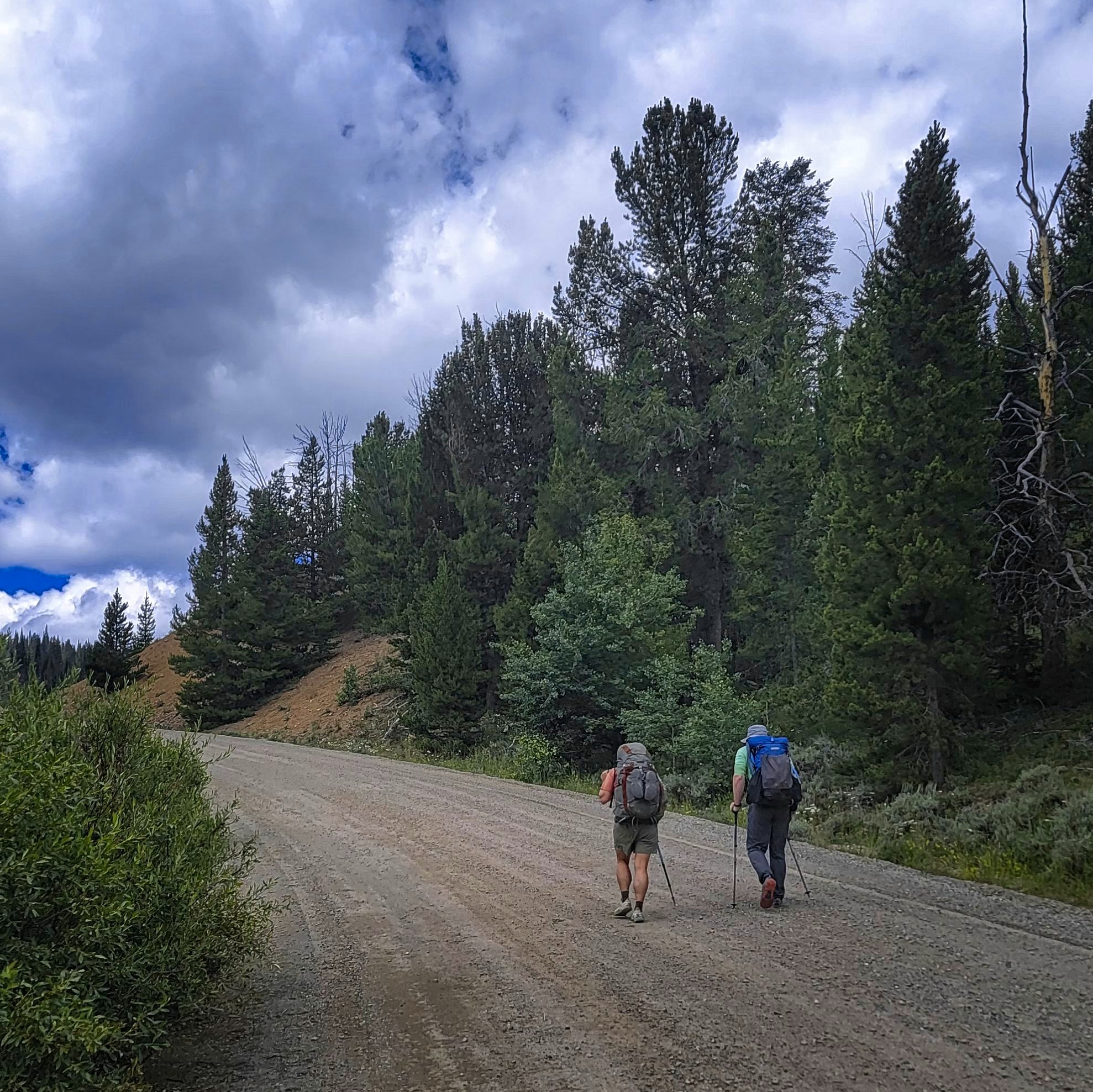
Heather and Michael walking and talking about her work experience.
Looking over towards the Tetons.
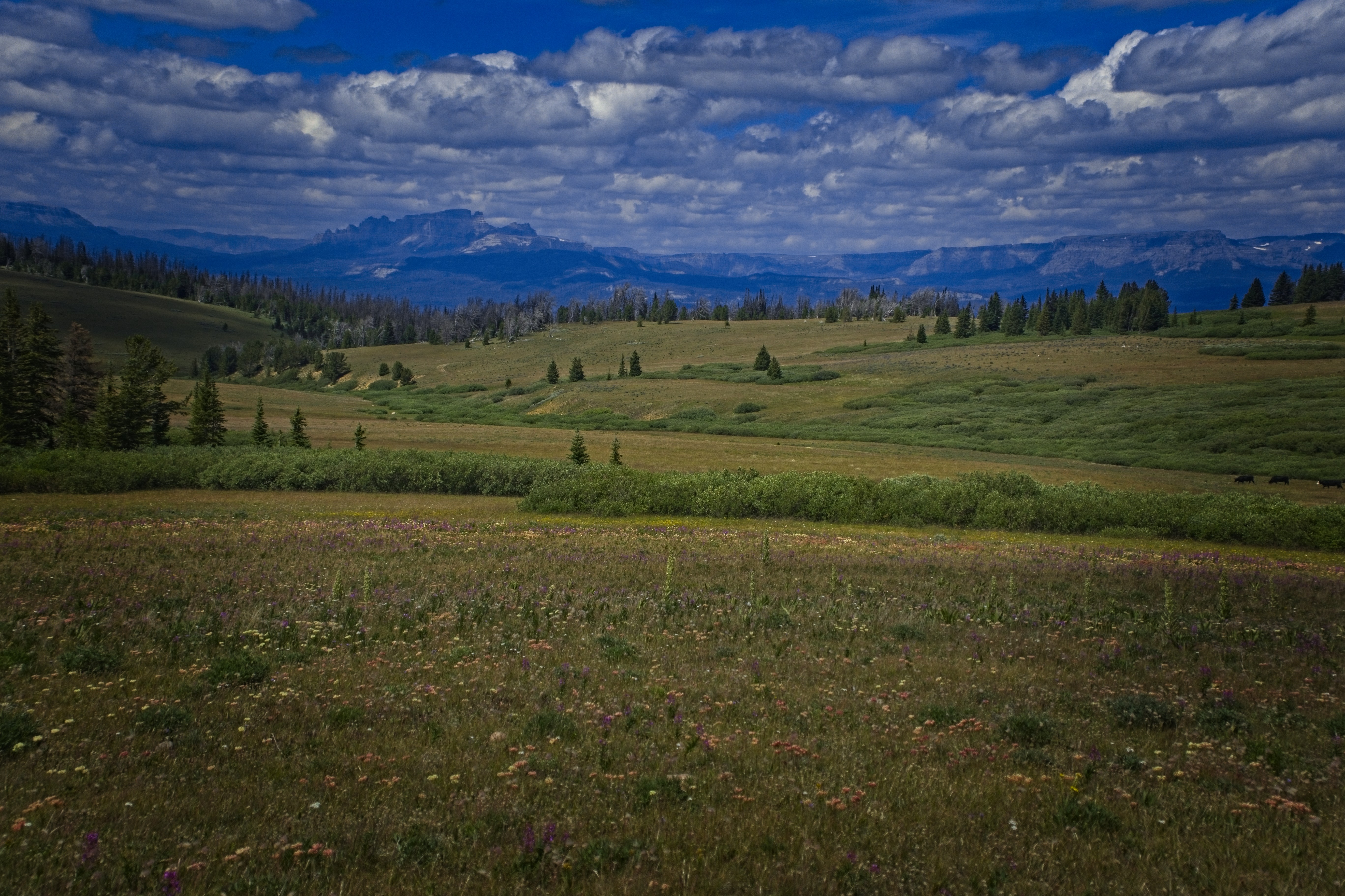
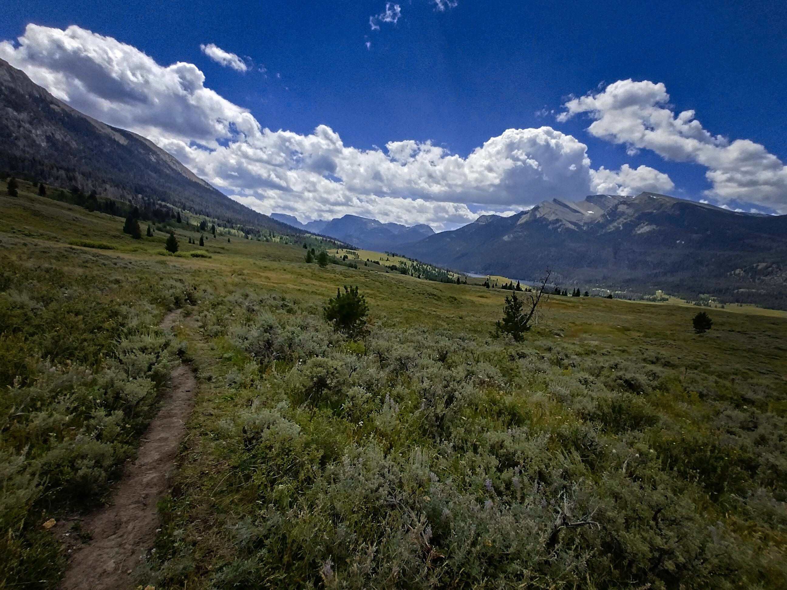
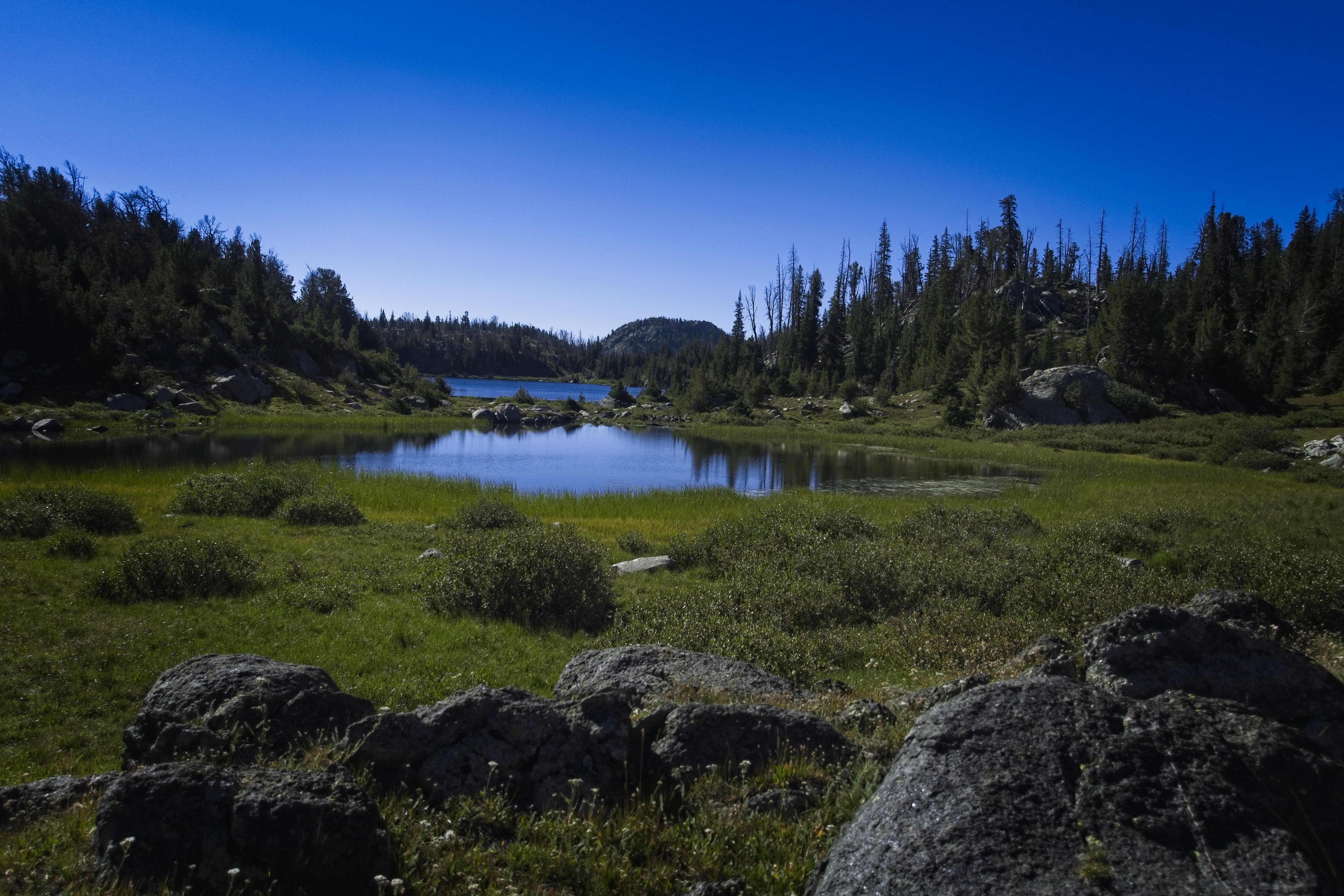
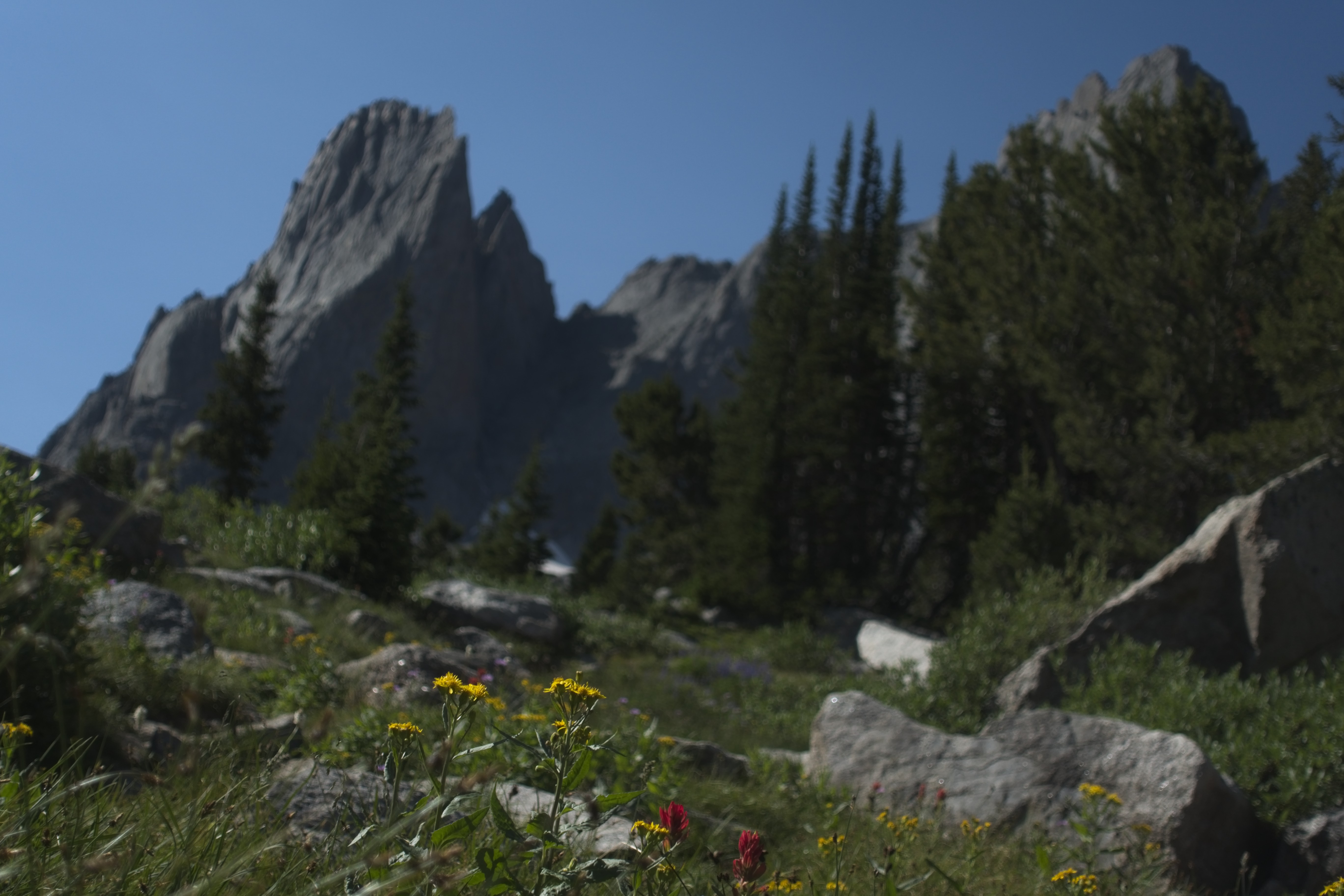
Resting in gorgeous pre-Winds country.
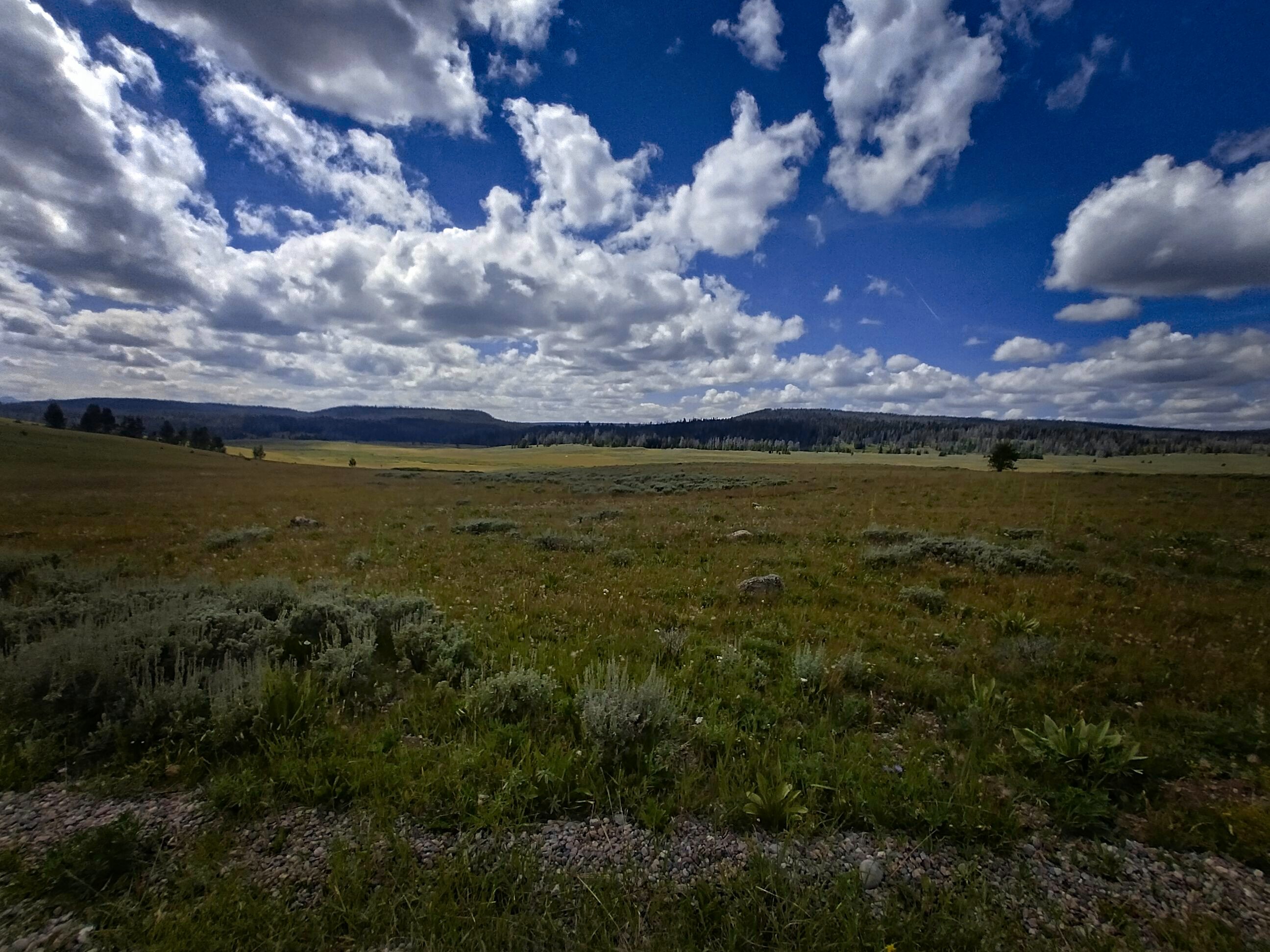
Beautiful open country here...
We were treated to incredible trail magic! A guy named Tripod drove his truck out to the red-line of the CDT right at Union Pass. We met some folks we knew there hanging out and dug in to the hot food Tripod served up! Spaghetti...!
Fantastic. I got to have two dinners today. We talked of this and that, then I was the first to leave, knowing that I wouldn't make my miles if I sat around too long. Cory caught me after an hour in a zone of cow fields and young forests. The place I wanted to camp was occupied by a neat older fella who was backpacking his way through the Wind Rivers. We moved on and found a flat spot in a sloping field. The cows were a bit unhappy because we were blocking the way they wanted to cross the river. But they did find a way around. It was interesting that they really wanted to avoid us. During the evening, a calf and it's mother carried on a long conversation on two sides of the river.
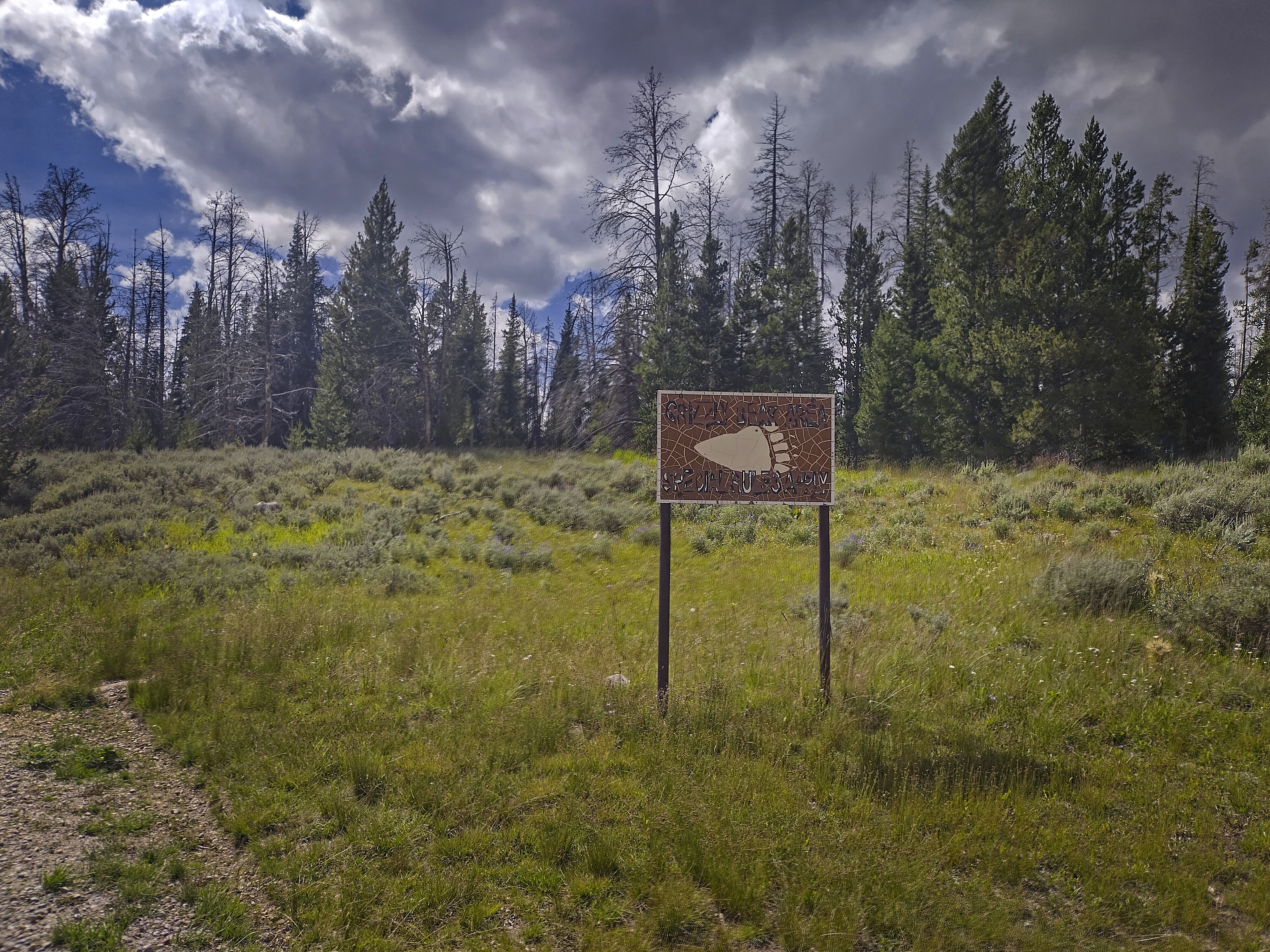
Bears are around.
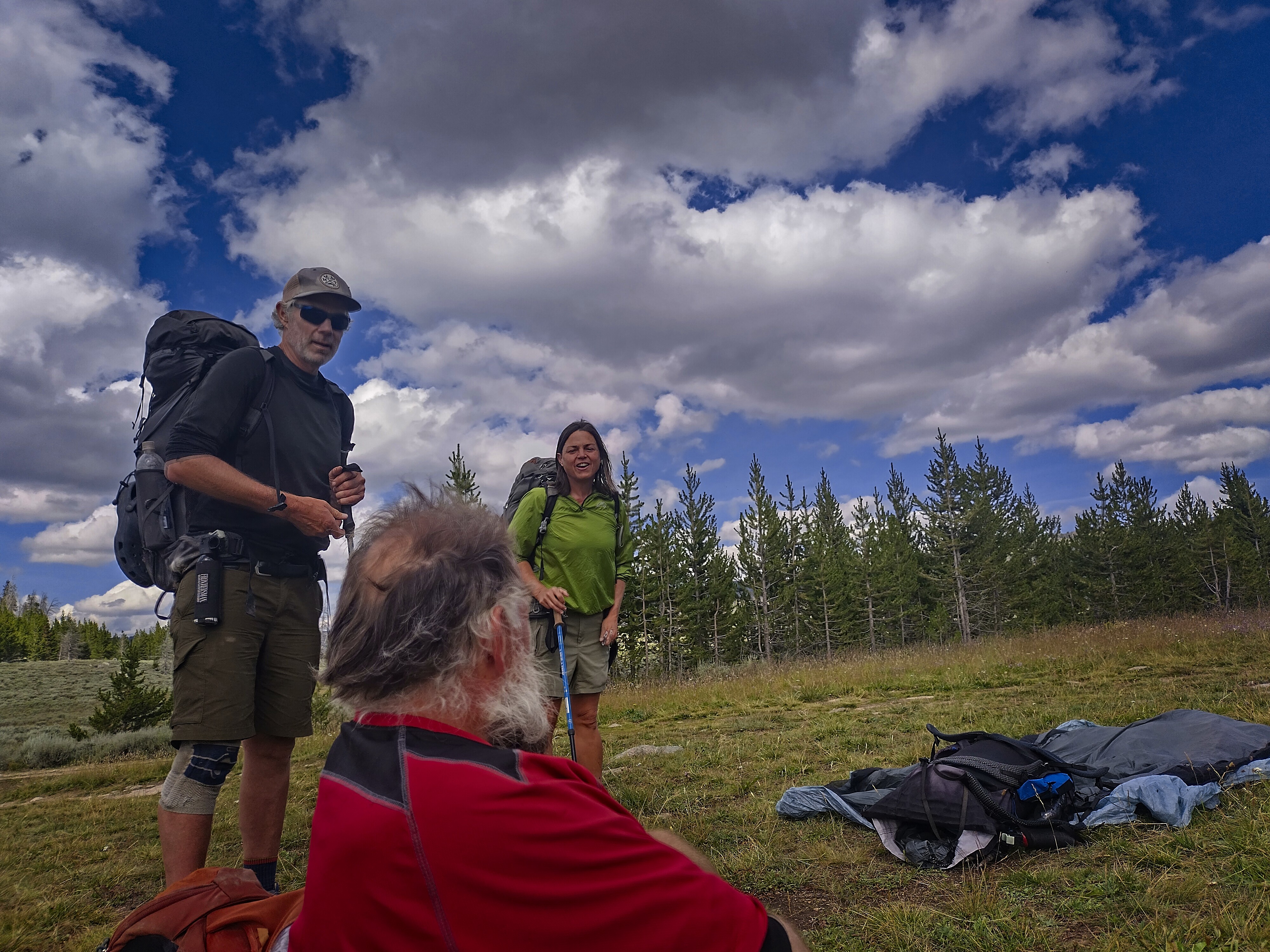
Mike and Heather, with Cory sitting. It was the last time we saw them!
Trail magic courtesy of Tripod, facing away and tending the stove.
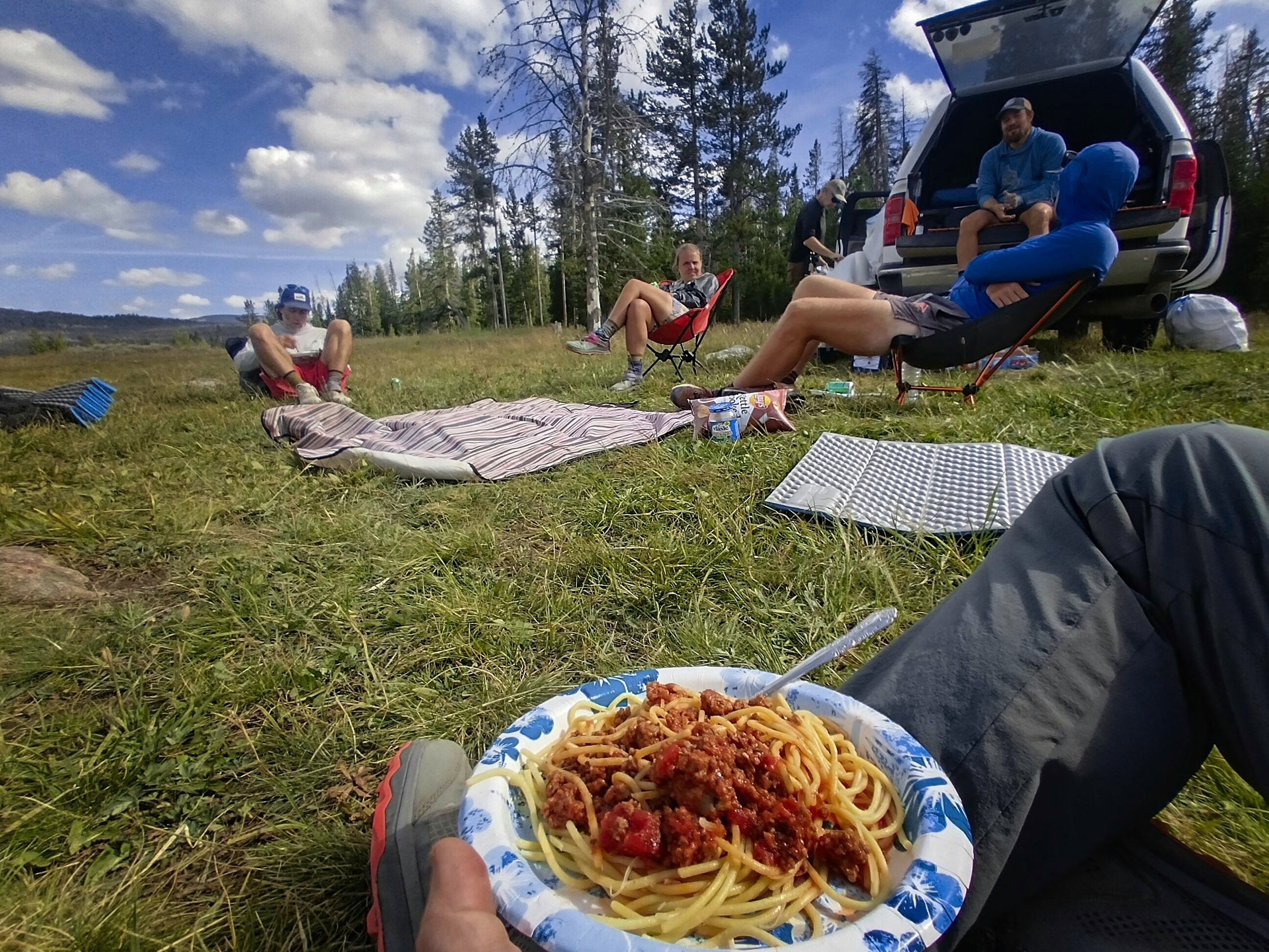
Look what Tripod made for us! A great early dinner.
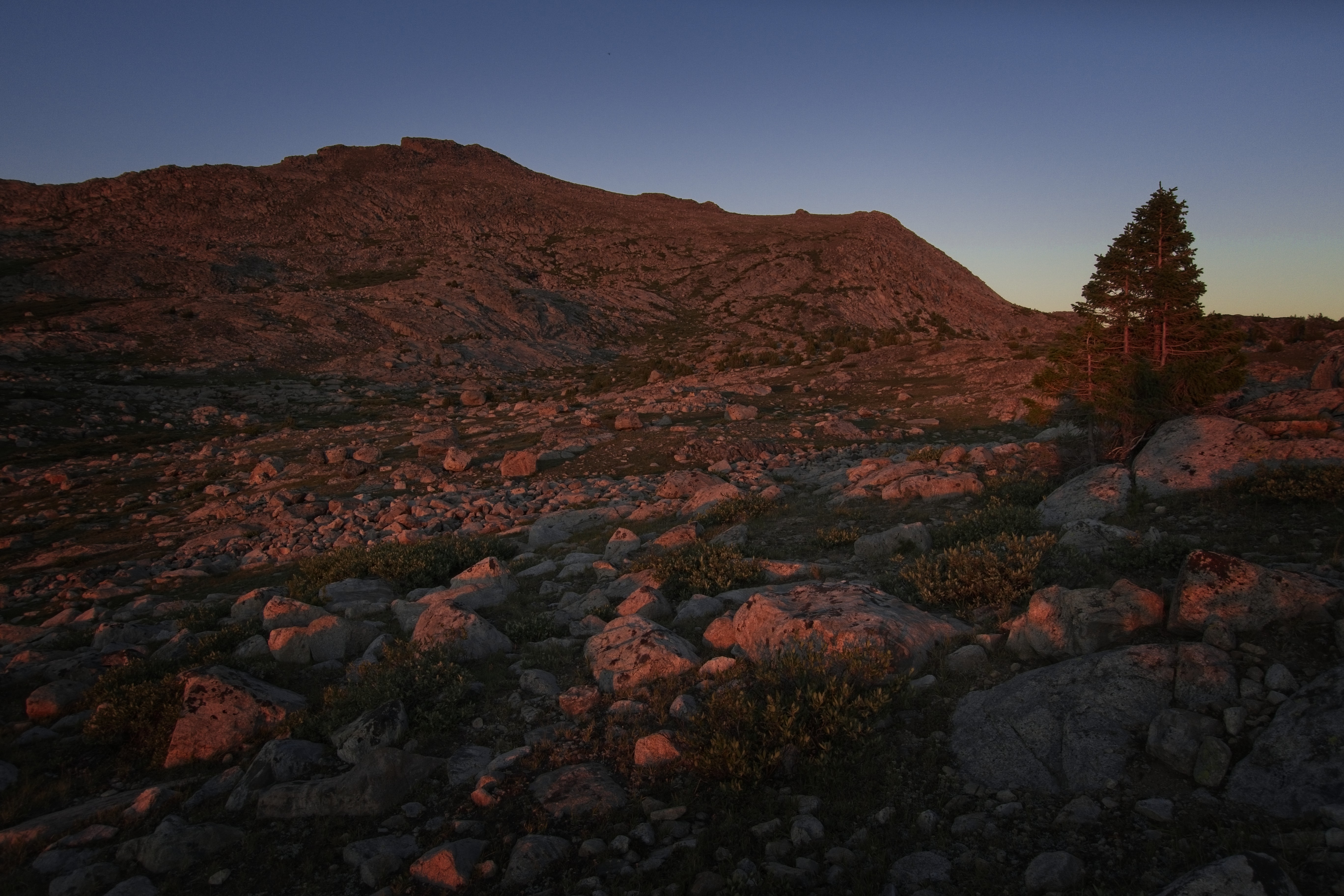
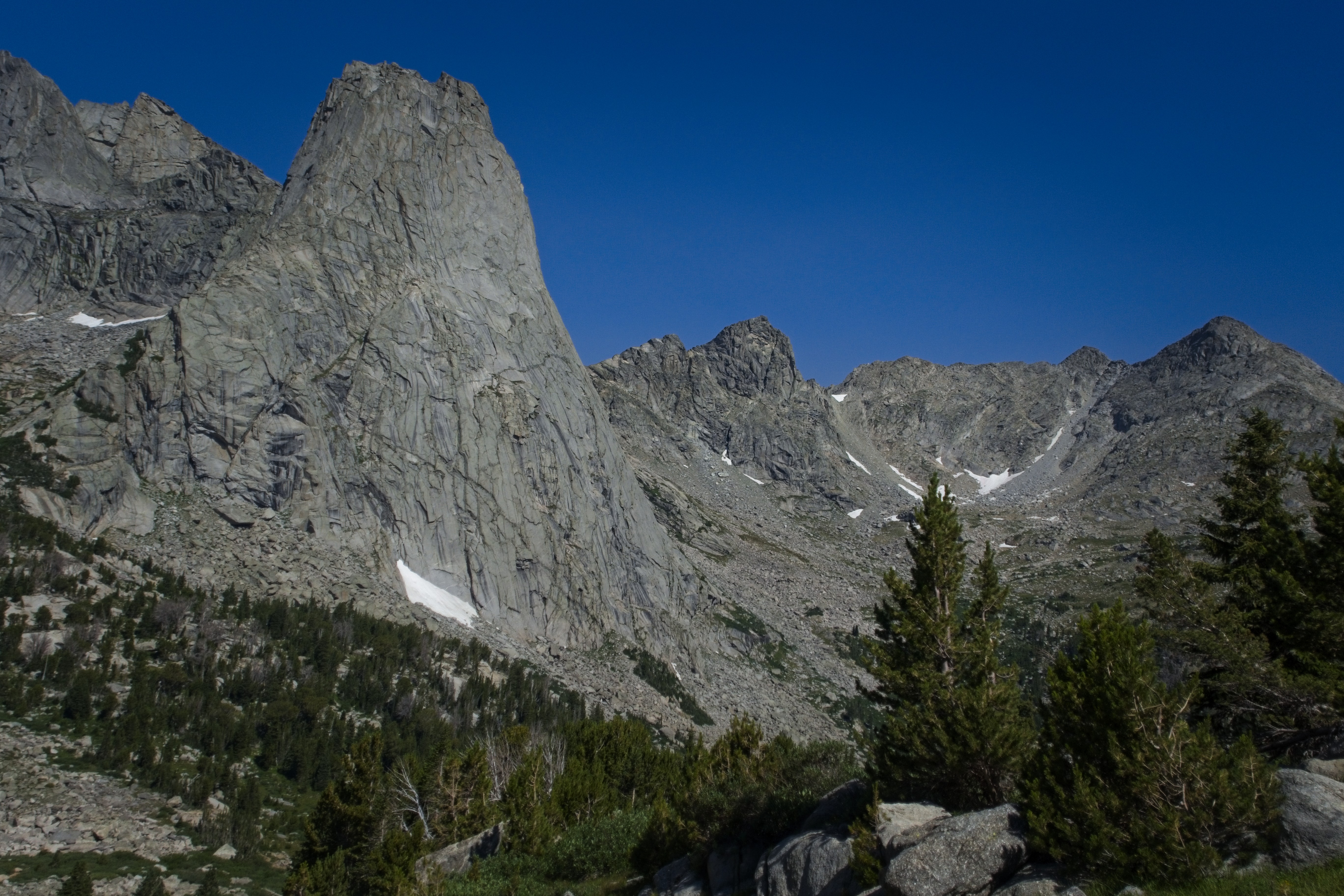
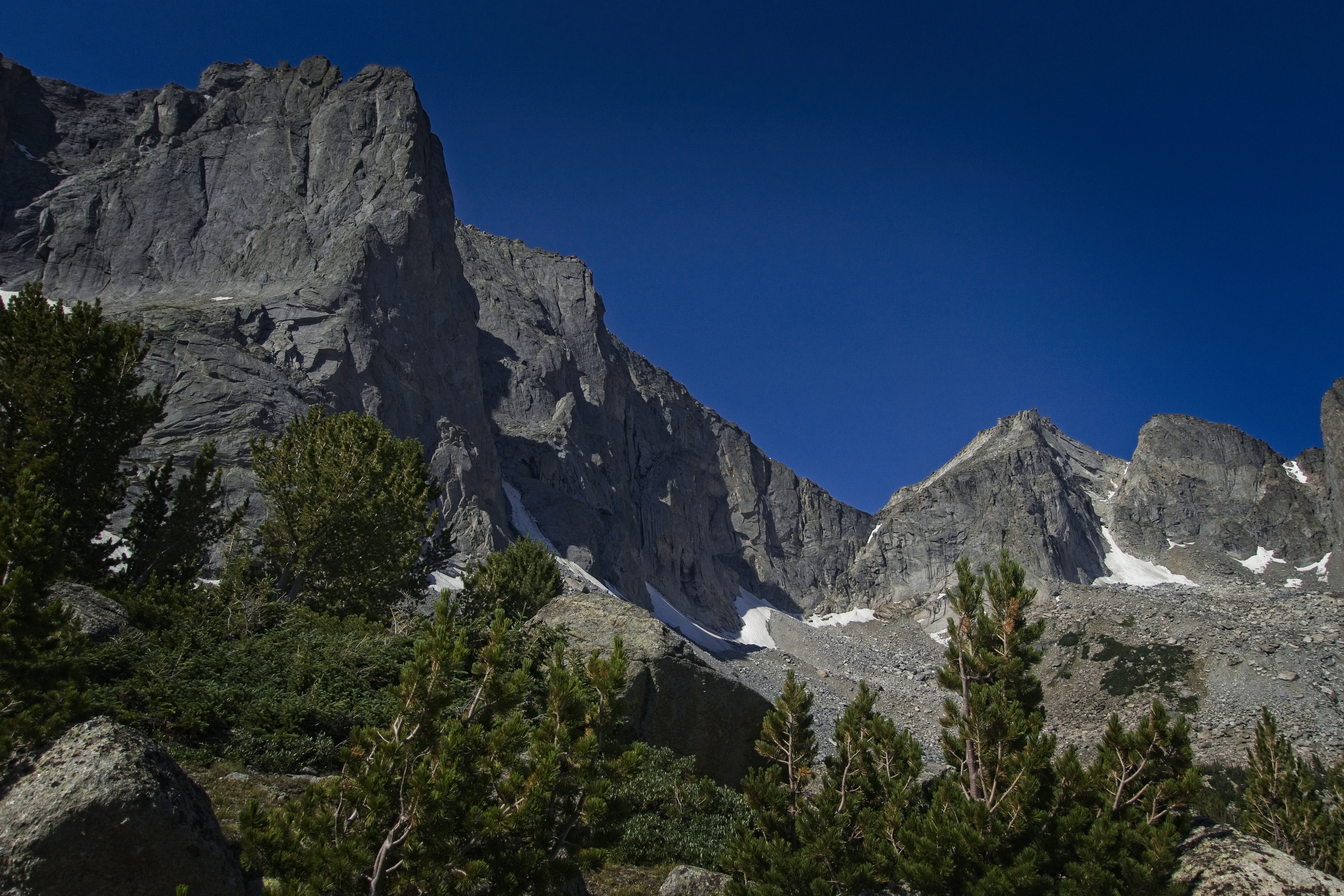
Terrain near camp. I'm not quite sure what these mountains are.
Folks trying not to get wet.
Again, folks.
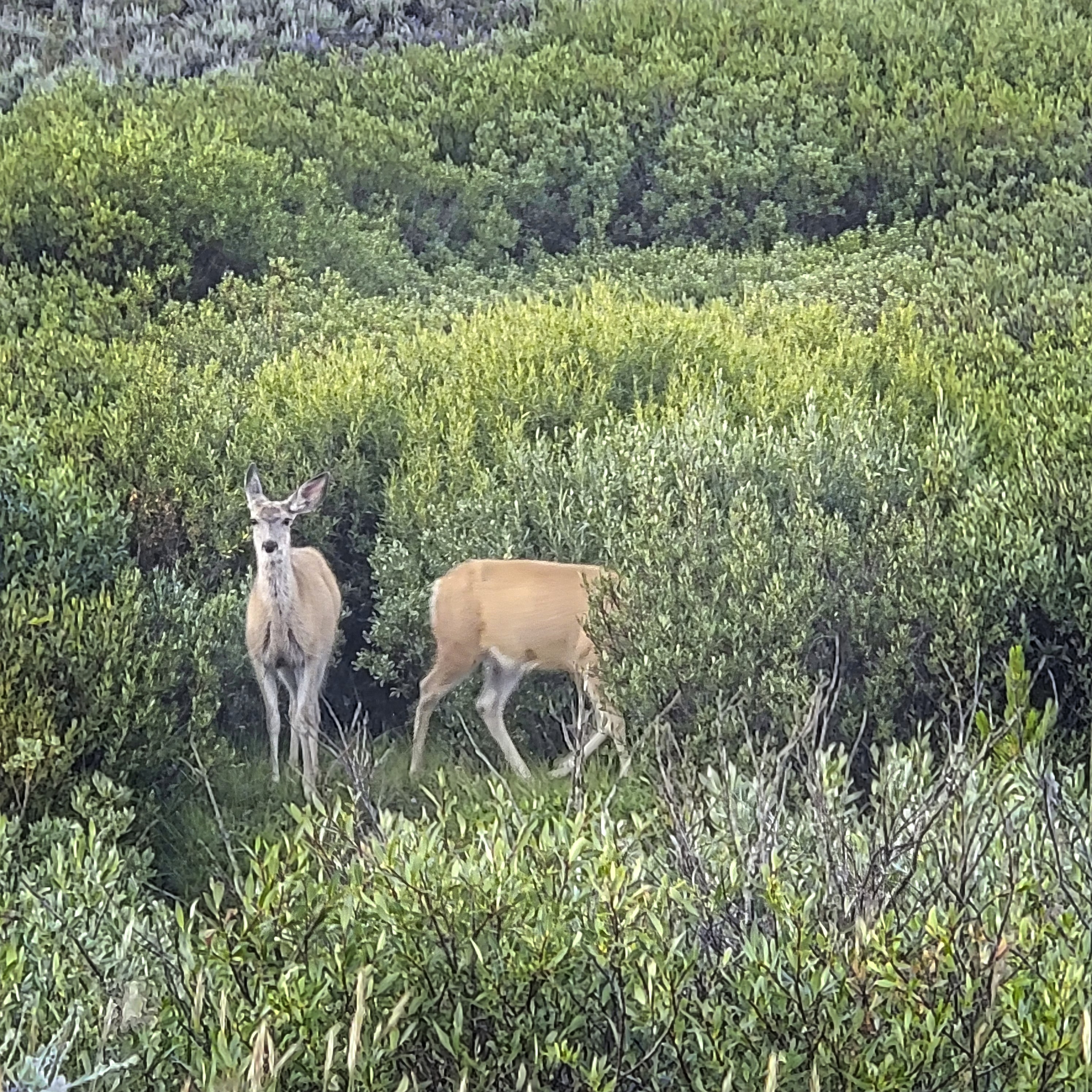
Deer at camp, peeved that we are in their meadow.
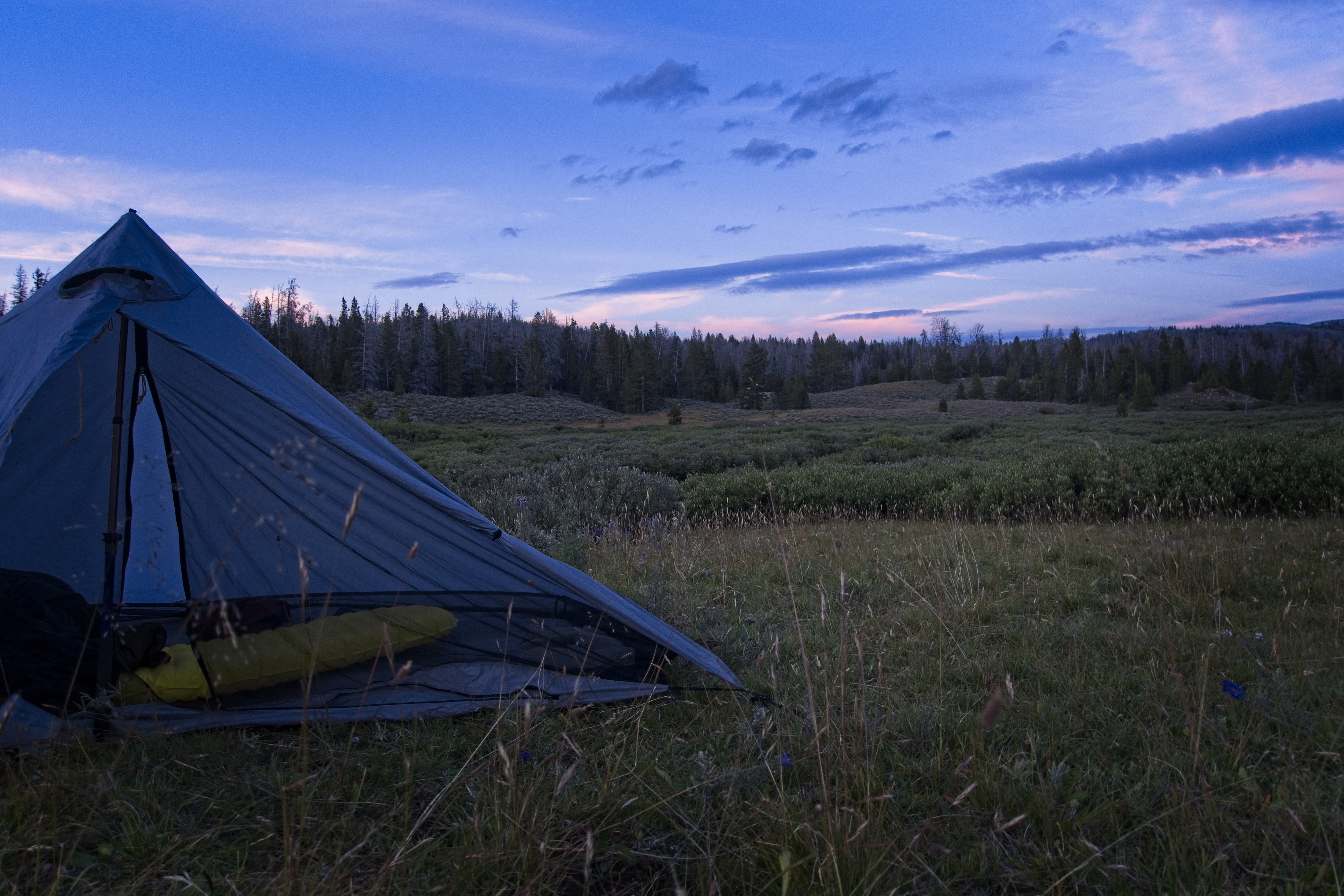
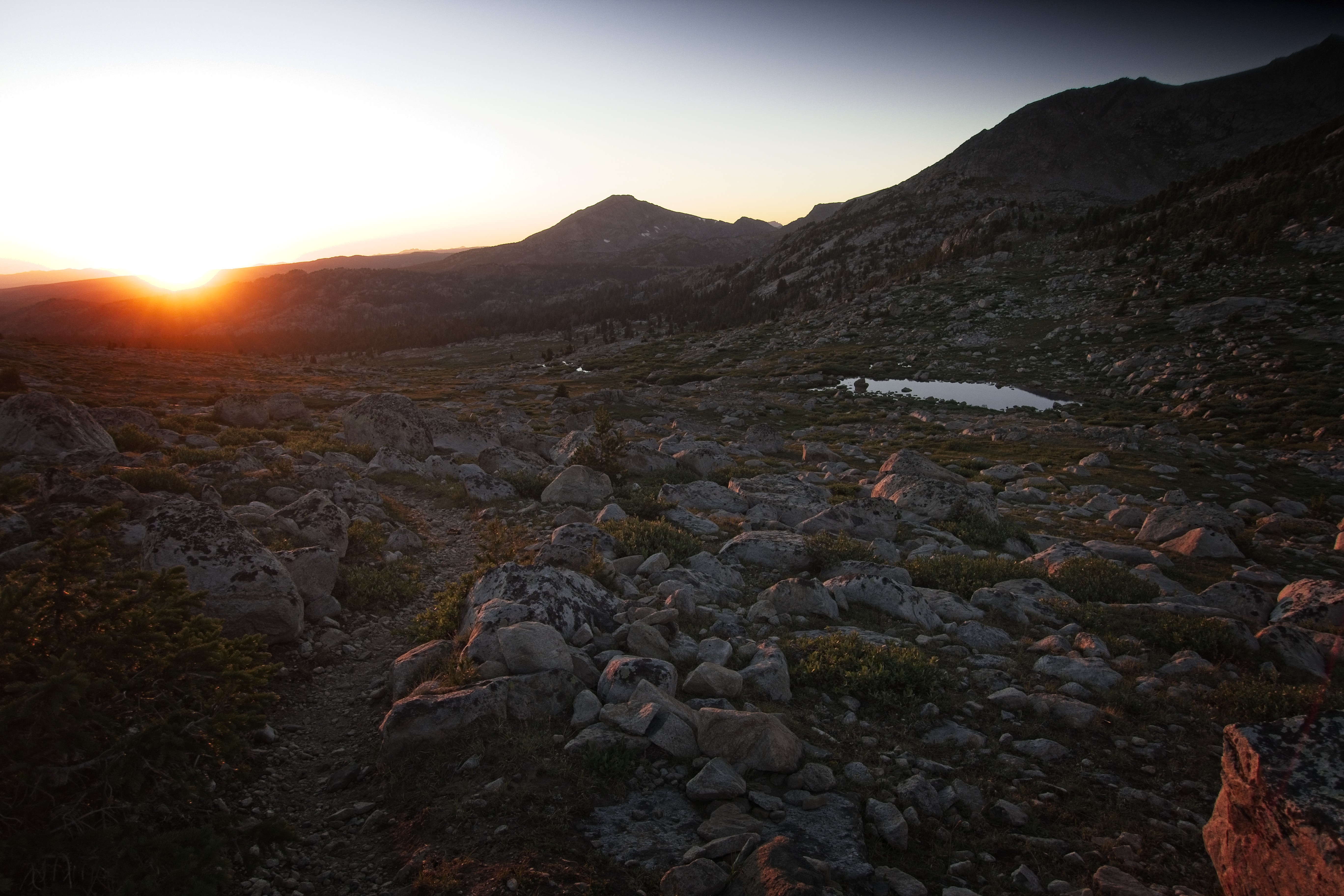
My tent at dusk.
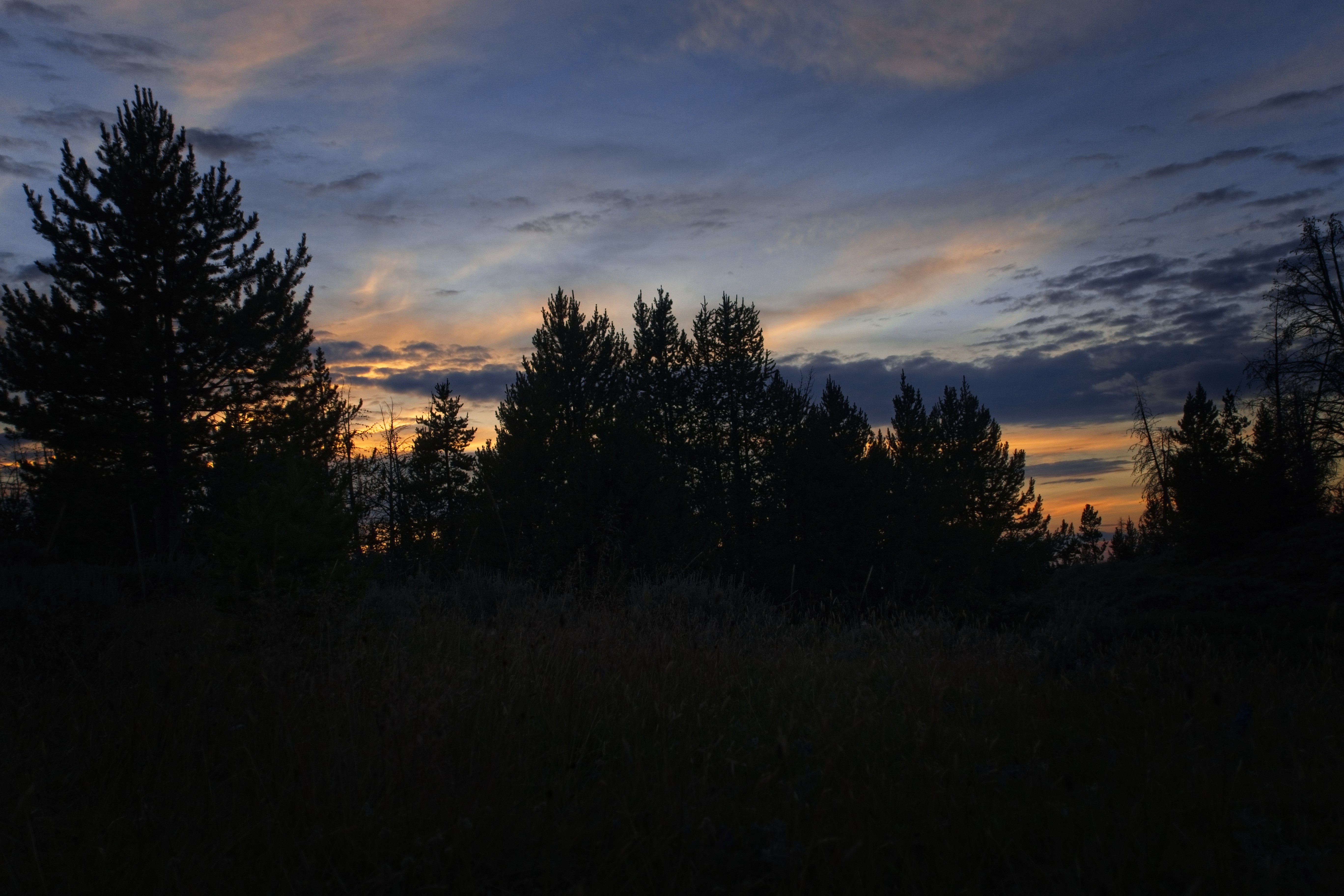
The sun goes down...
August 10, Day 131
19.1 miles, 2070 feet elevation gain.
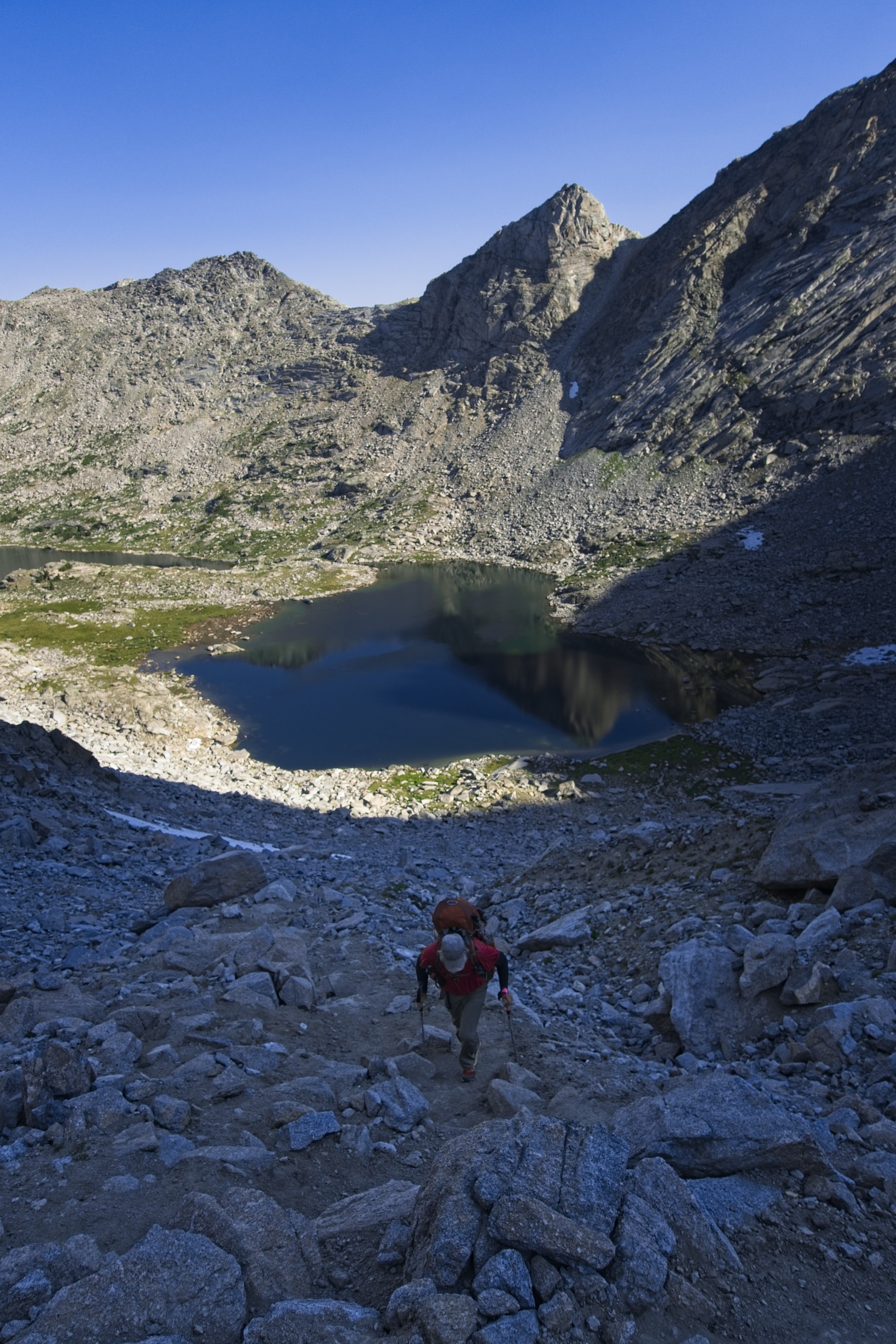
Cory having crossed Gunsight Pass.
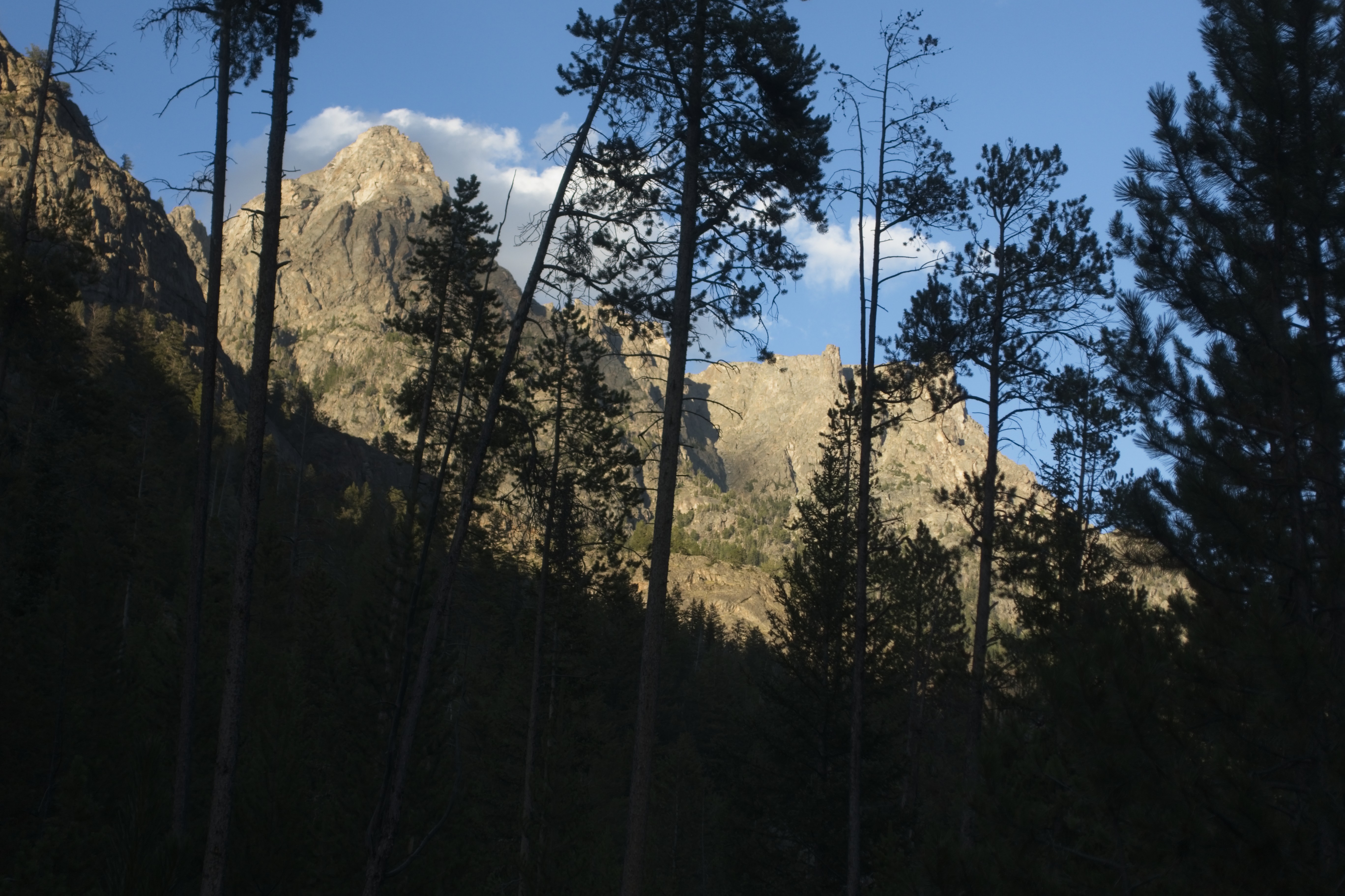
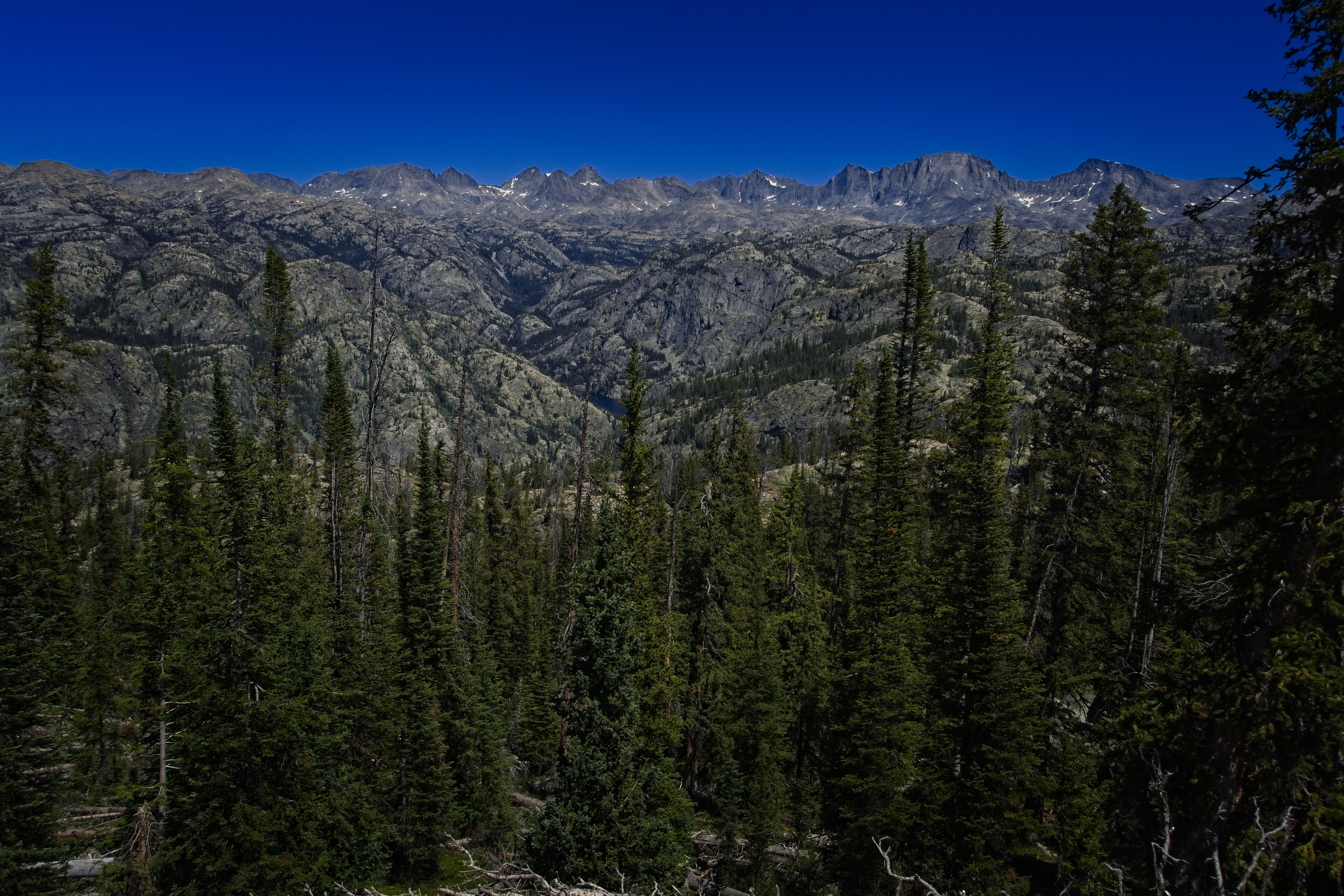
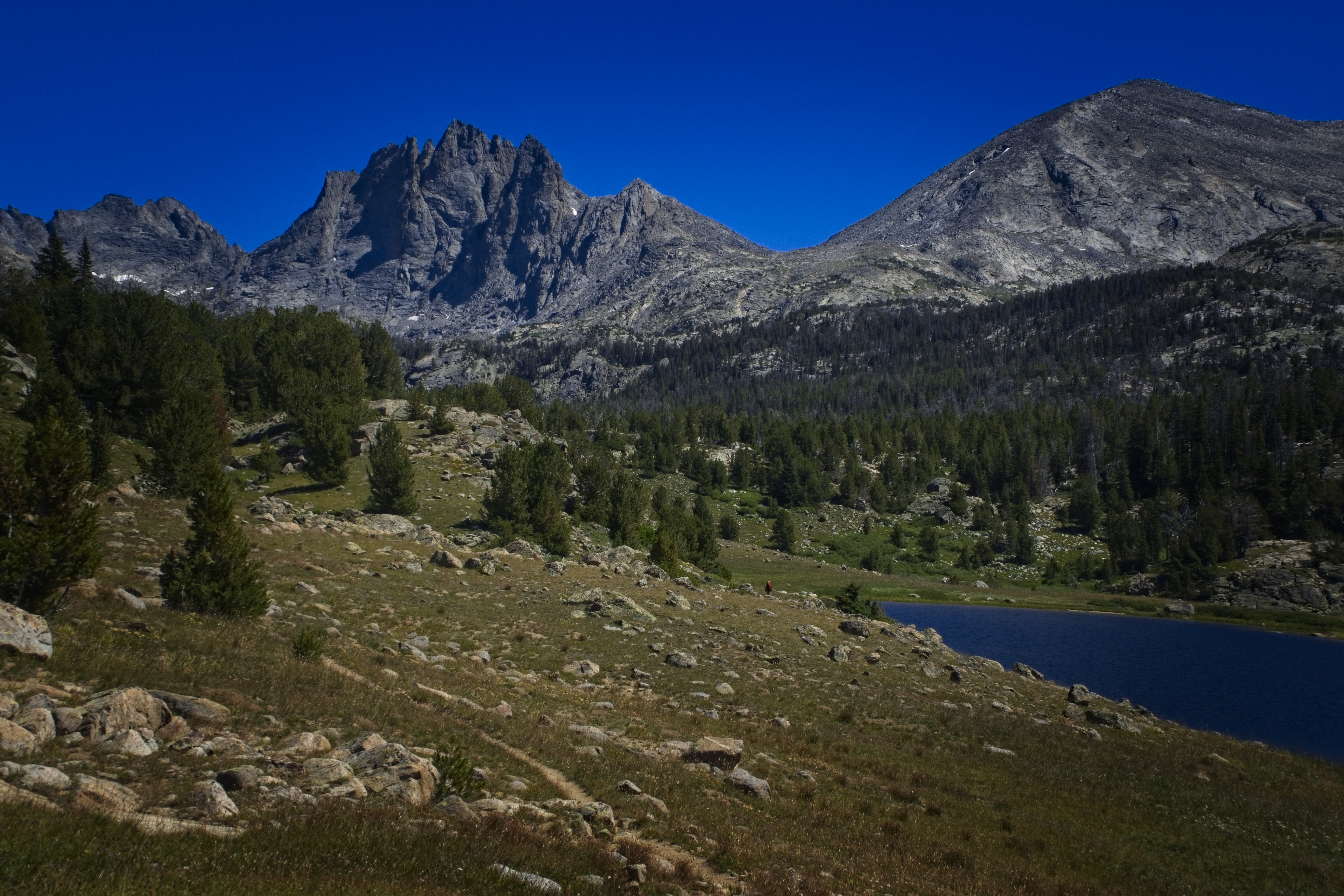
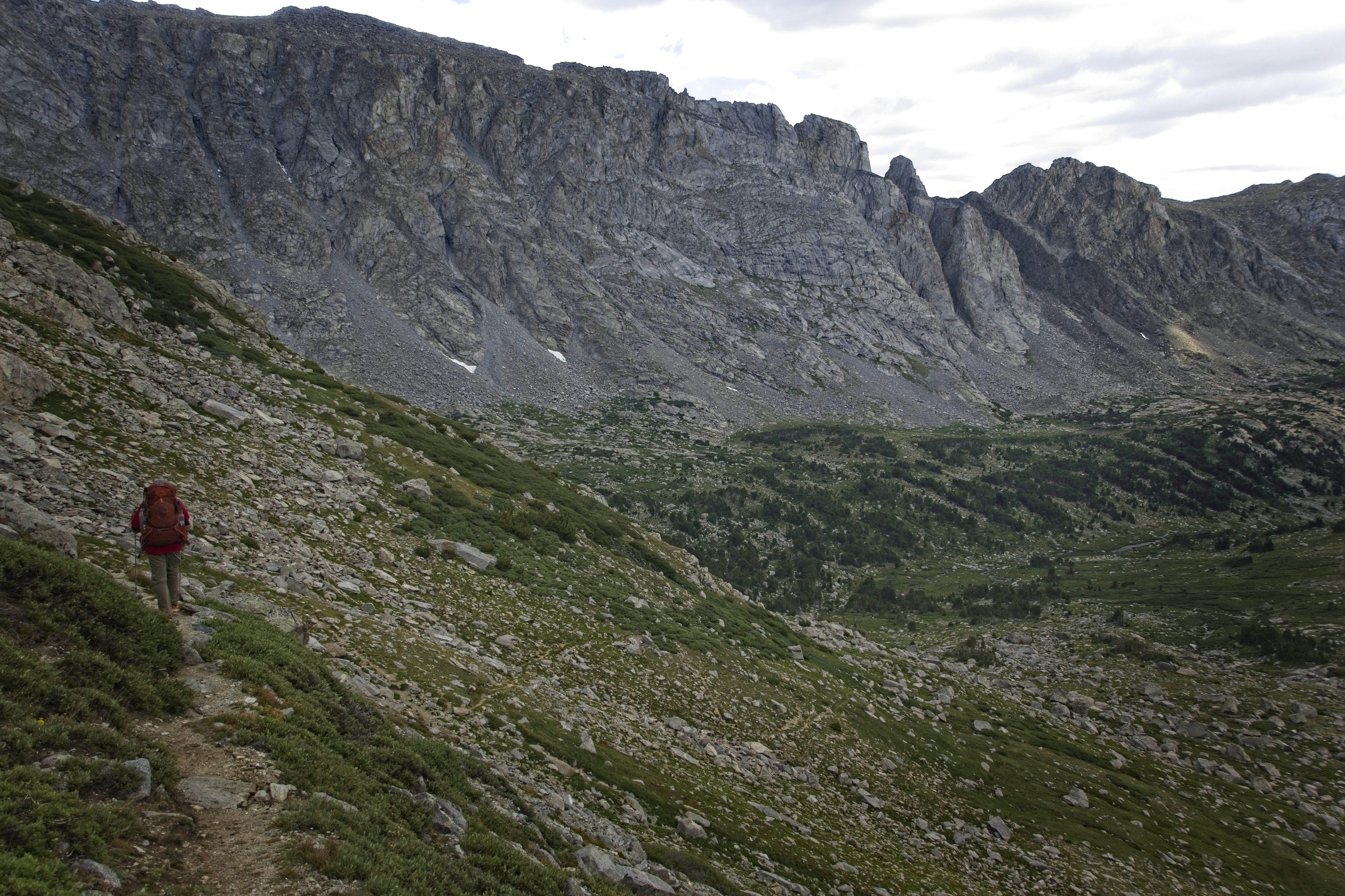
It was an easy walk in the morning up to Gunsight Pass, where we'd get our first real view of the Wind Rivers Range we've been sneaking up on. I've thought about this place for such a long time...really wondered what the country would be like to pass through, and now I'm here. It was great to see snowy mountains again. We had to drop down a long ways to the Roaring Fork, then sidehill for miles above the valley floor to reach the big lake in the Green River near a road terminus and parking lot. Cory and I walked along listening to music or podcasts. I had the collected audiobooks of C. S. Lewis, and occasionally pestered him with something cool that I heard. I particularly liked "The Abolition of Man." He really knew where we'd end up as a culture.
Michael in the Roaring Fork Basin.
Looking to the great lake in the Green River.
Cory on an arm above the Roaring Fork.
Approaching the Green River.
The sun was wonderful after the stormy weather of the days before.
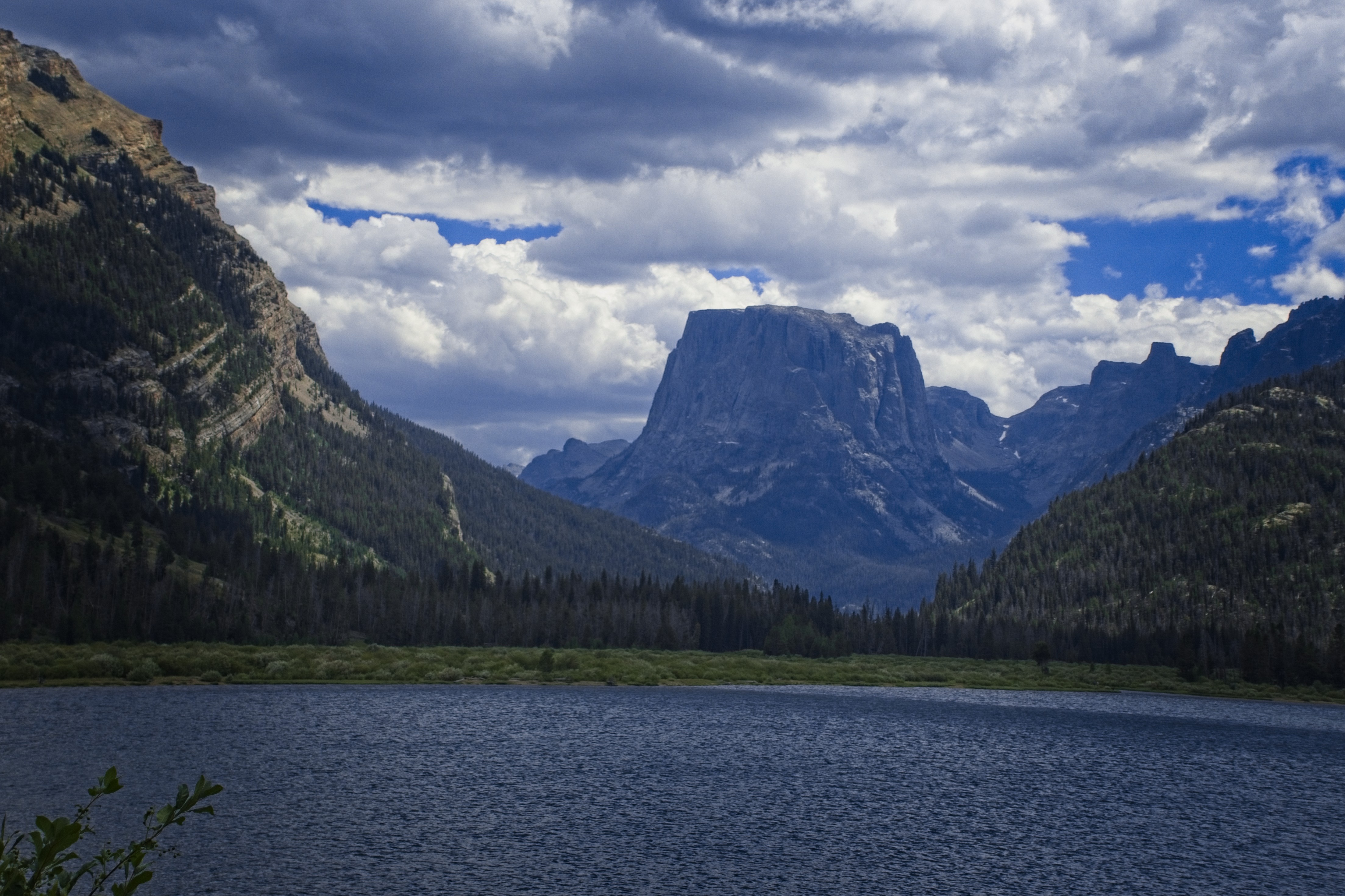
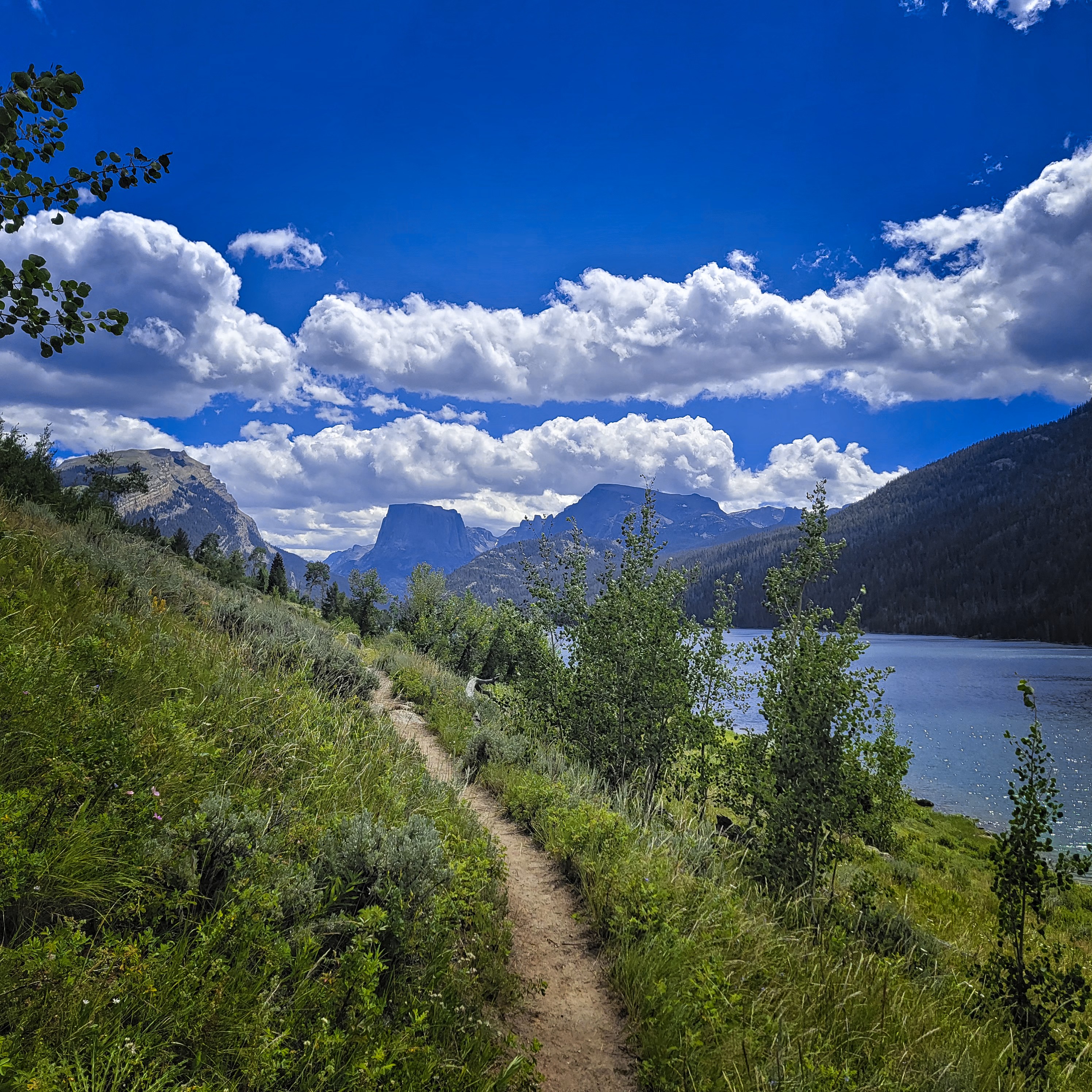
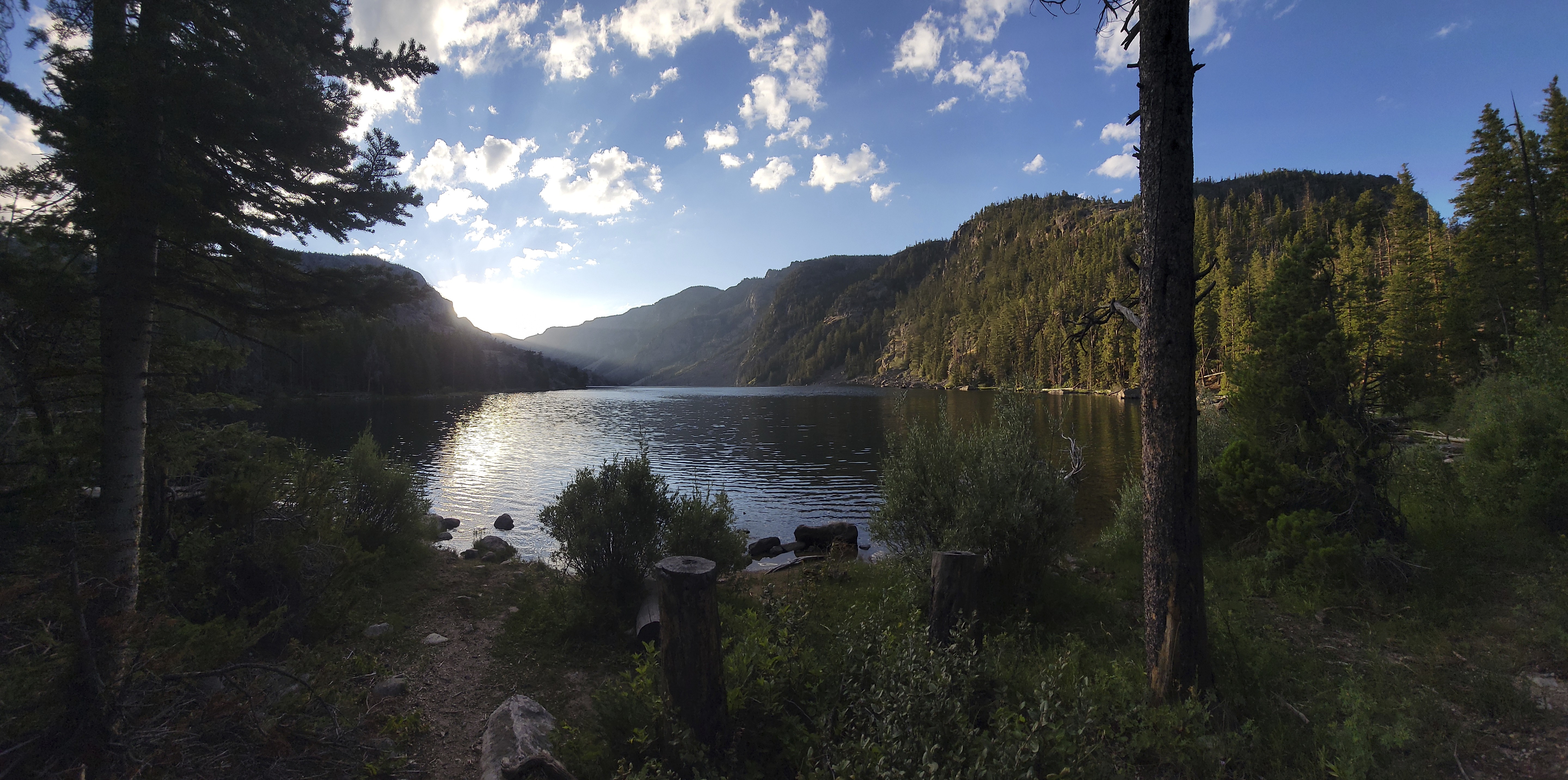
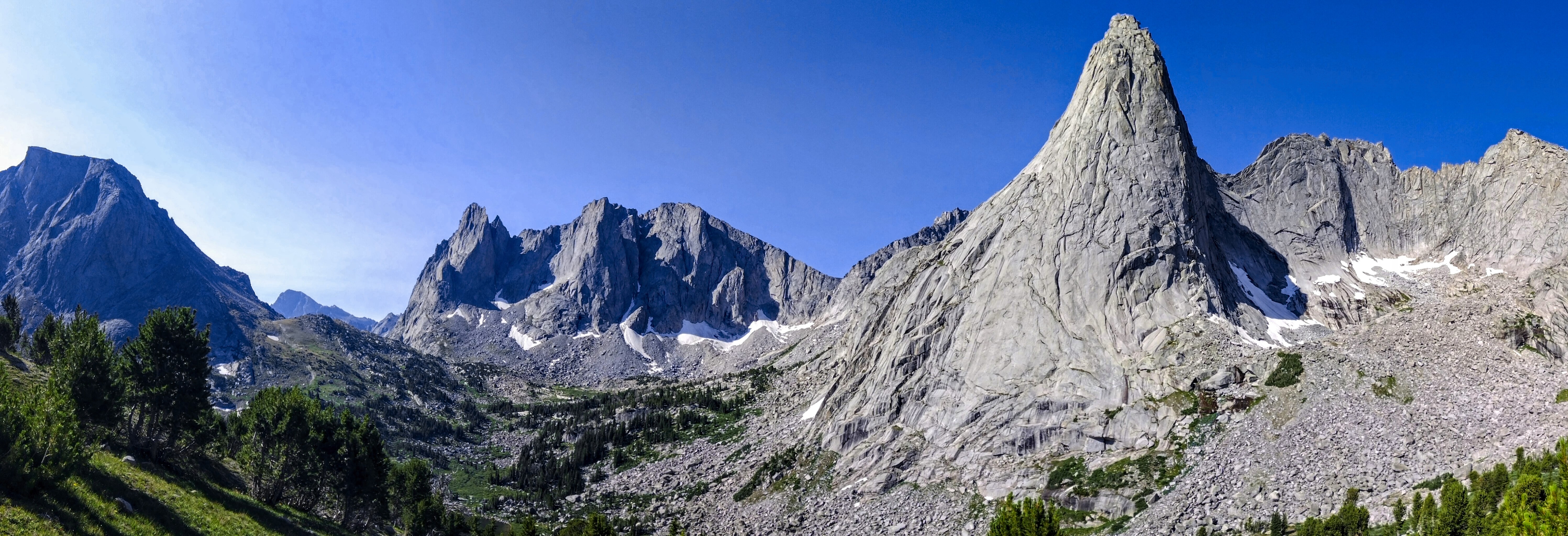
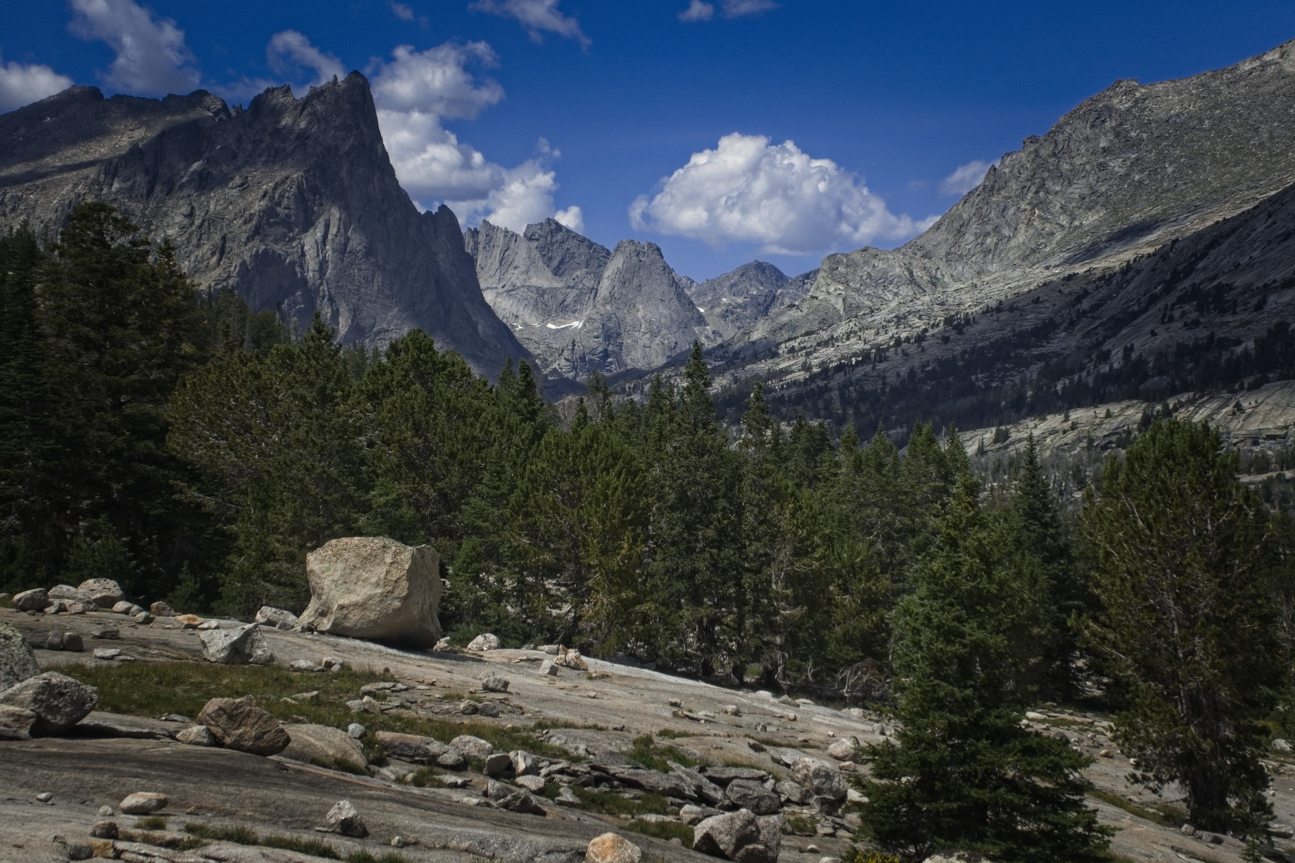
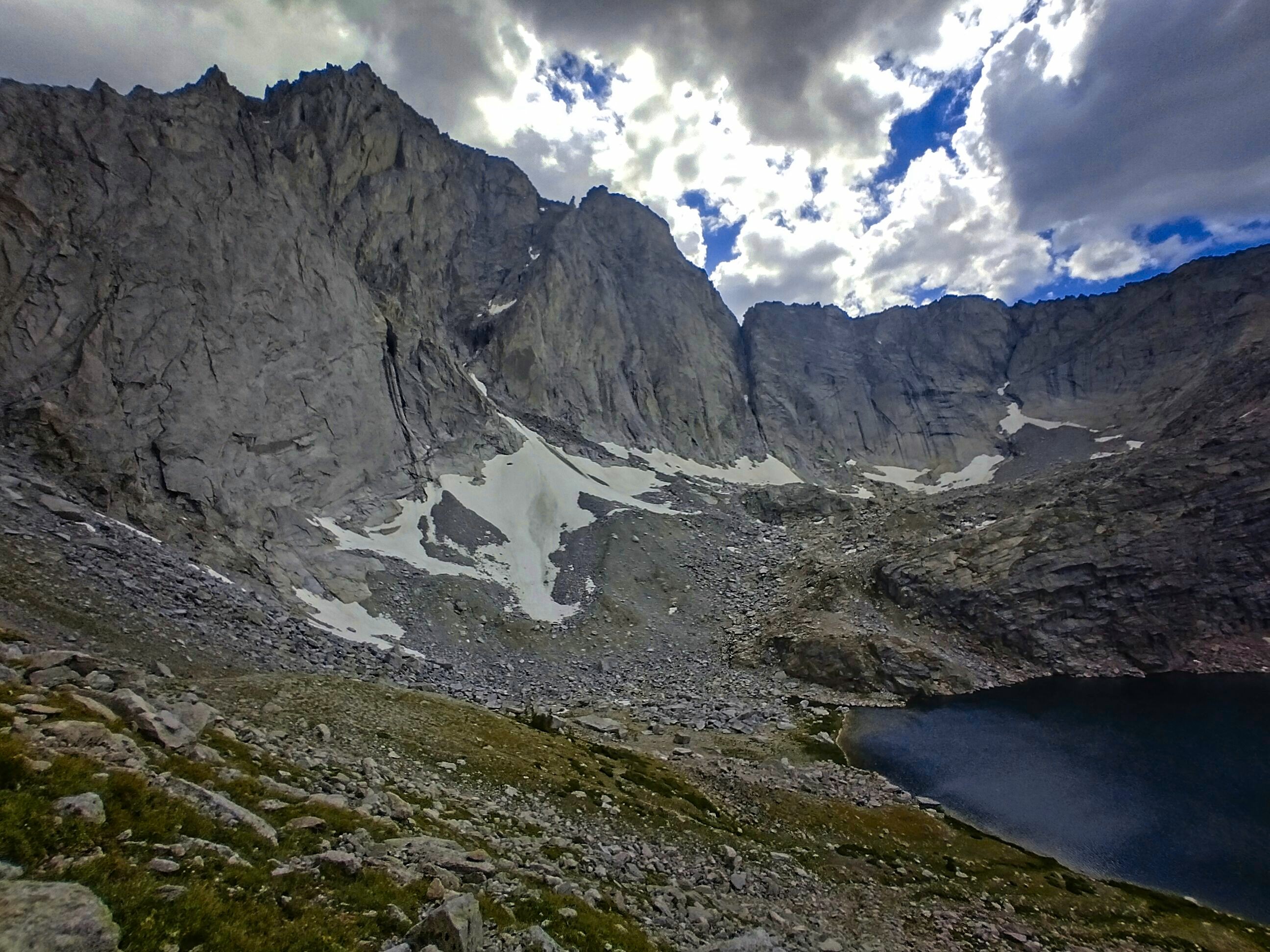
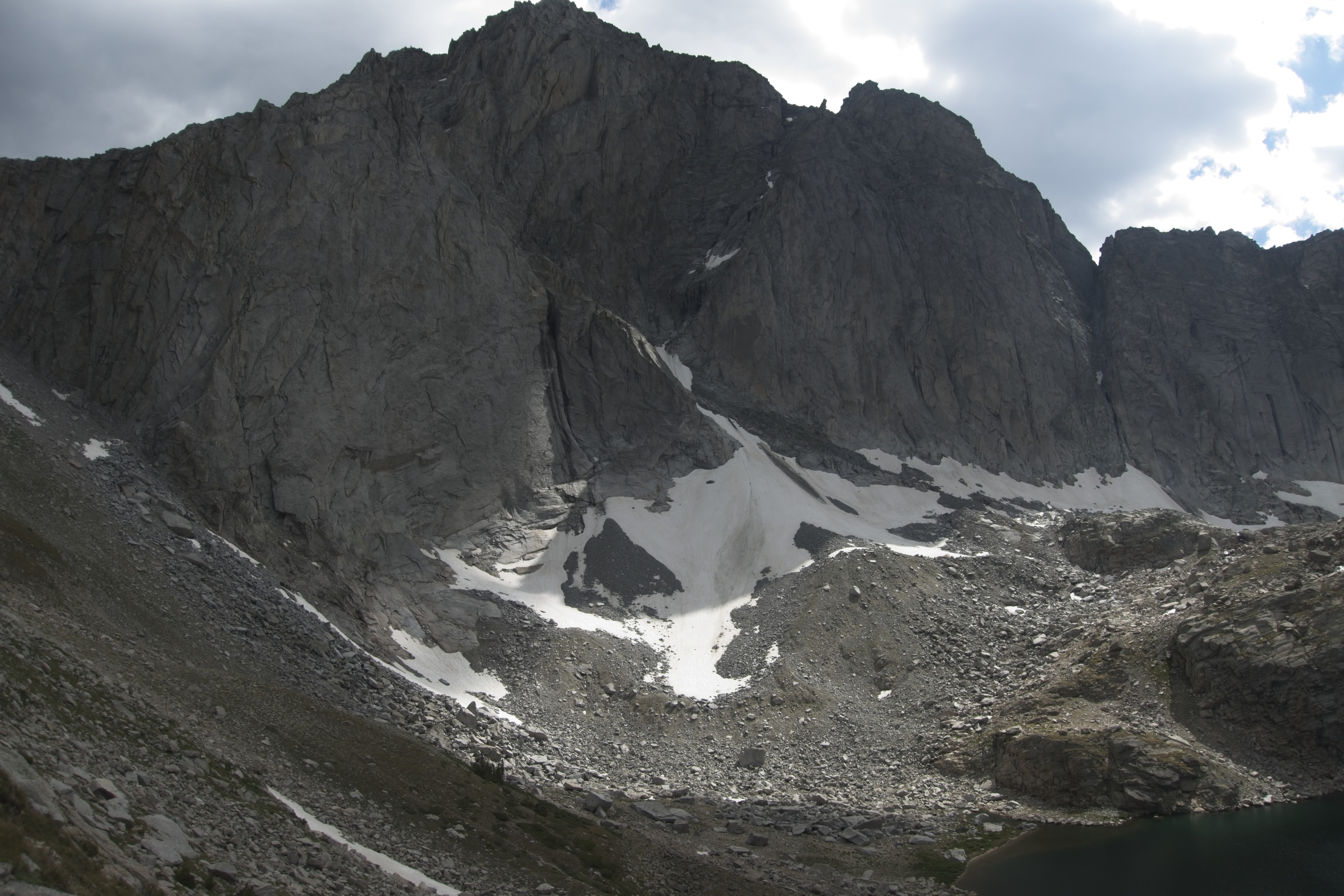
Squaretop Mountain ahead. Our camp is under it on the left.
At the end of the day we were under Squaretop Mountain, which looked to have some excellent rock climbing routes on it. We found some flat places and set up camp. A few minutes later Swede and Whitney showed up. We had dinner together and went to sleep.
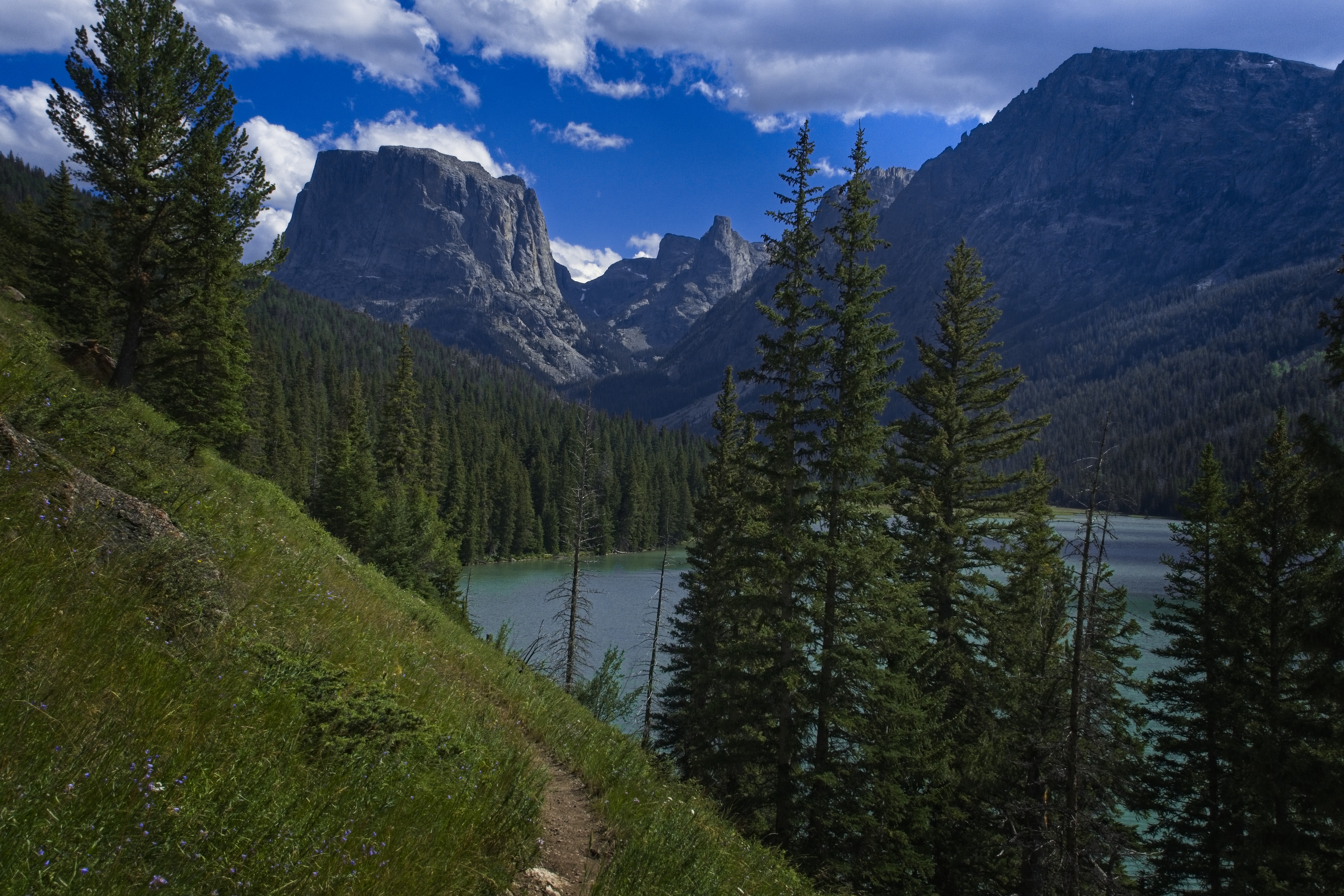
Another shot of Squaretop Mountain.
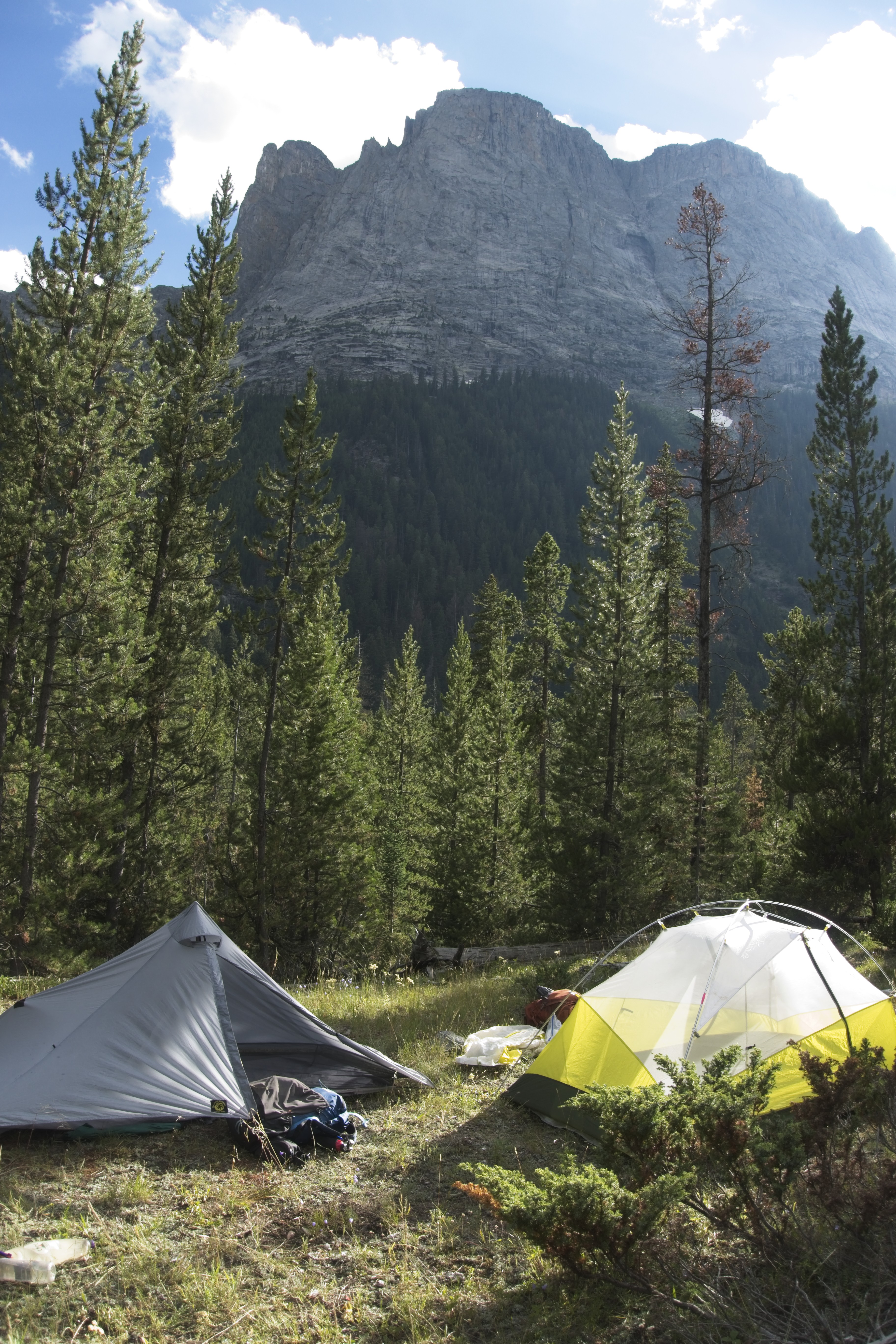
Our humble camp, soon joined by Swede and Whitney.
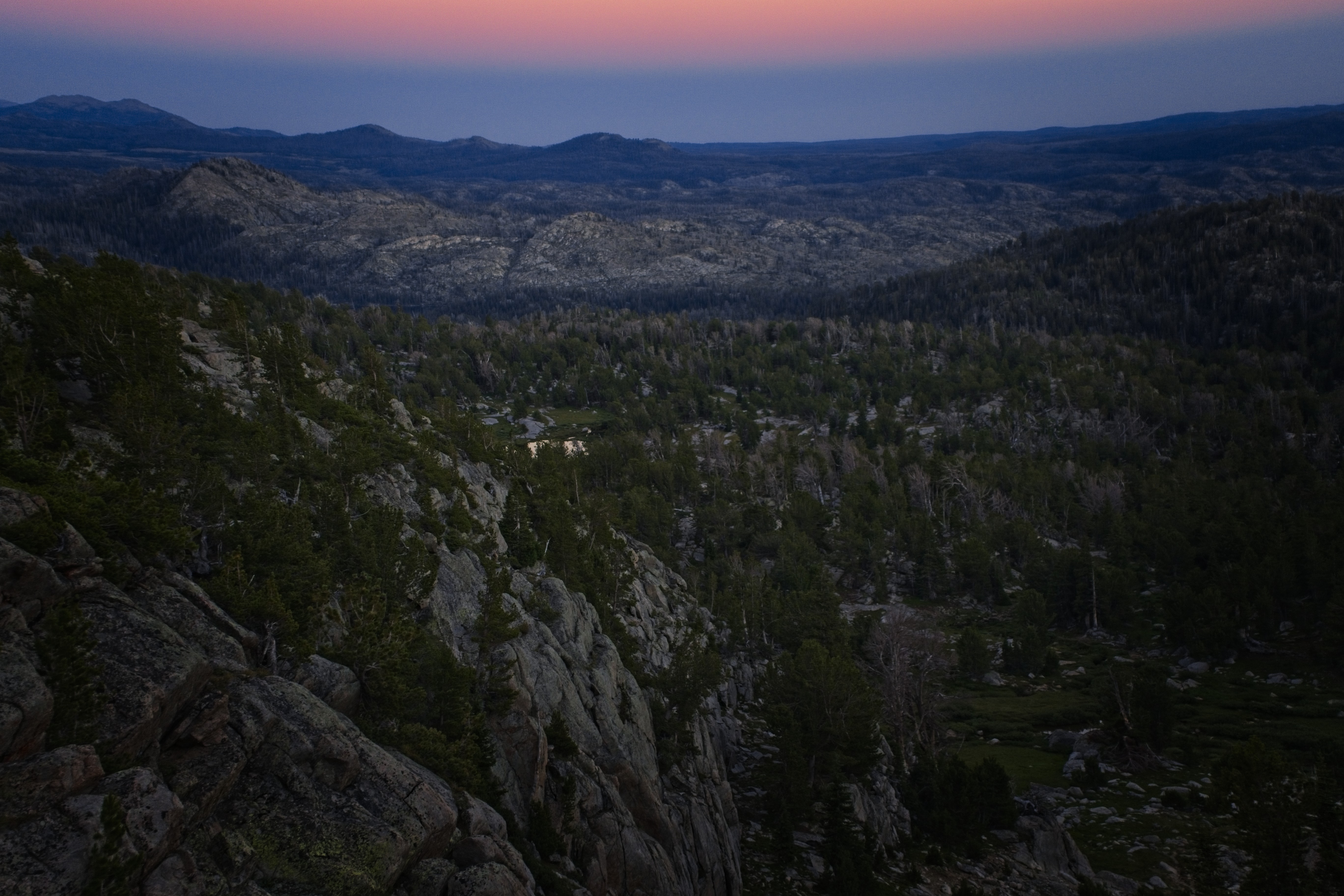
8 PM, the valley in shadow, though the peaks are still in sun.
August 11, Day 132
19.6 miles, 3300 feet elevation gain.
We started out roughly together in the chilly morning. At different times I walked with Swede or Whitney. Well, Whitney was too tall and therefore too fast. Swede I could just keep up with, though only for a short time. It's becoming very clear to me that I'm not a fast hiker. I'm quite slow, I'm afraid!
But he had many interesting observations. Unfortunately, my memory of this stretch is not strong. I think I was listening to a lot of books and podcasts. Could it also be that I didn't find the country particularly amazing?
Well, heck, I guess that is the case. I had built up "the Winds" in my mind as something amazing. It was nice enough, but it didn't have the unforgettable drama of Glacier.
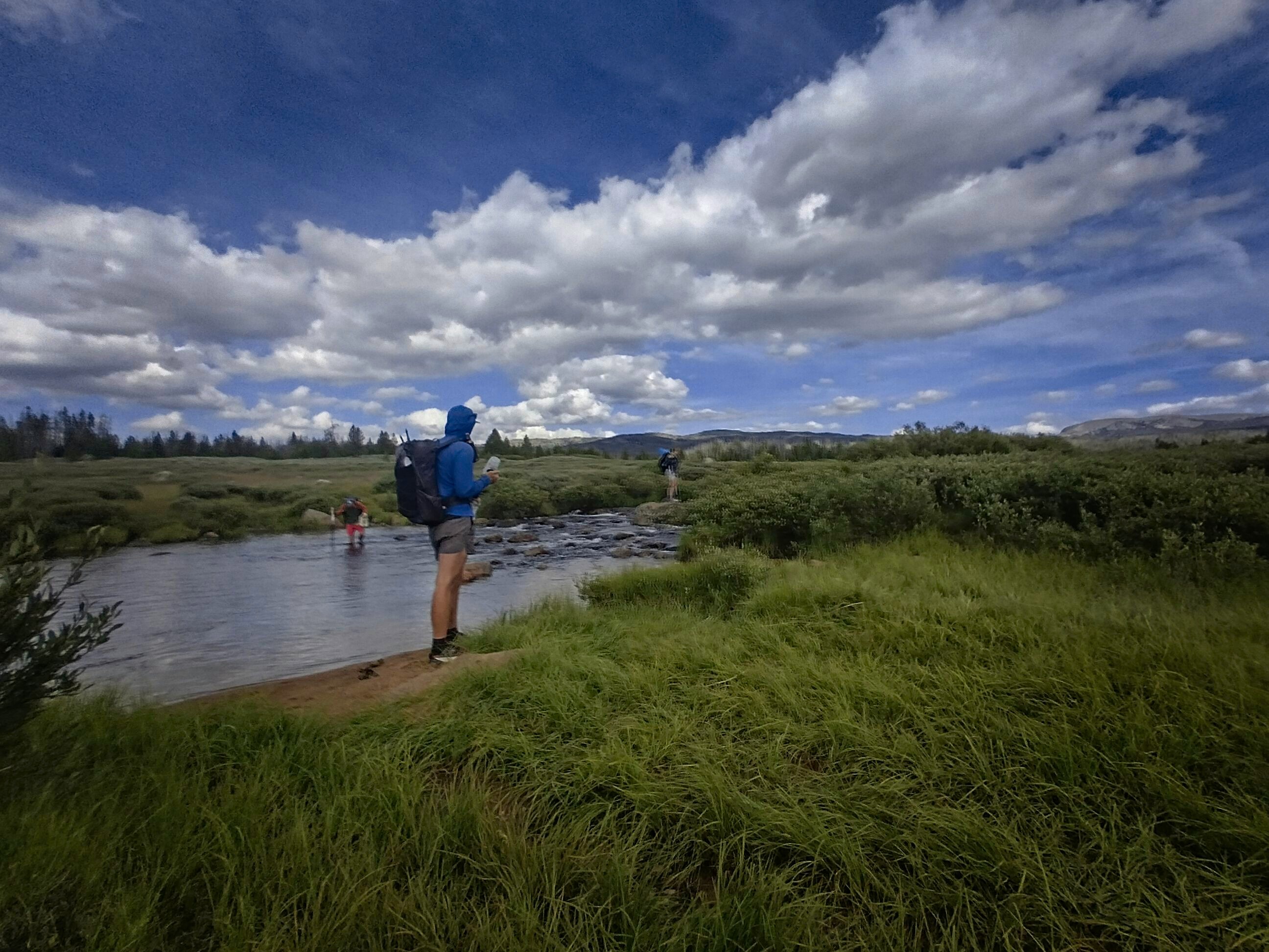
We made a few creek crossings. At one point I met Swede and Whitney again who reported that Cory had fallen right on his face into the creek! I was worried about his phone, knowing he keeps it in his front pocket. They showed me a video of the notable event. Looked rough! He was clearly disgusted, and got up and galumphed away. Out of paranoia, I decided to just wade this creek instead of rock hop, so I sacrified my dry shoes and sloshed across the icy cold water.
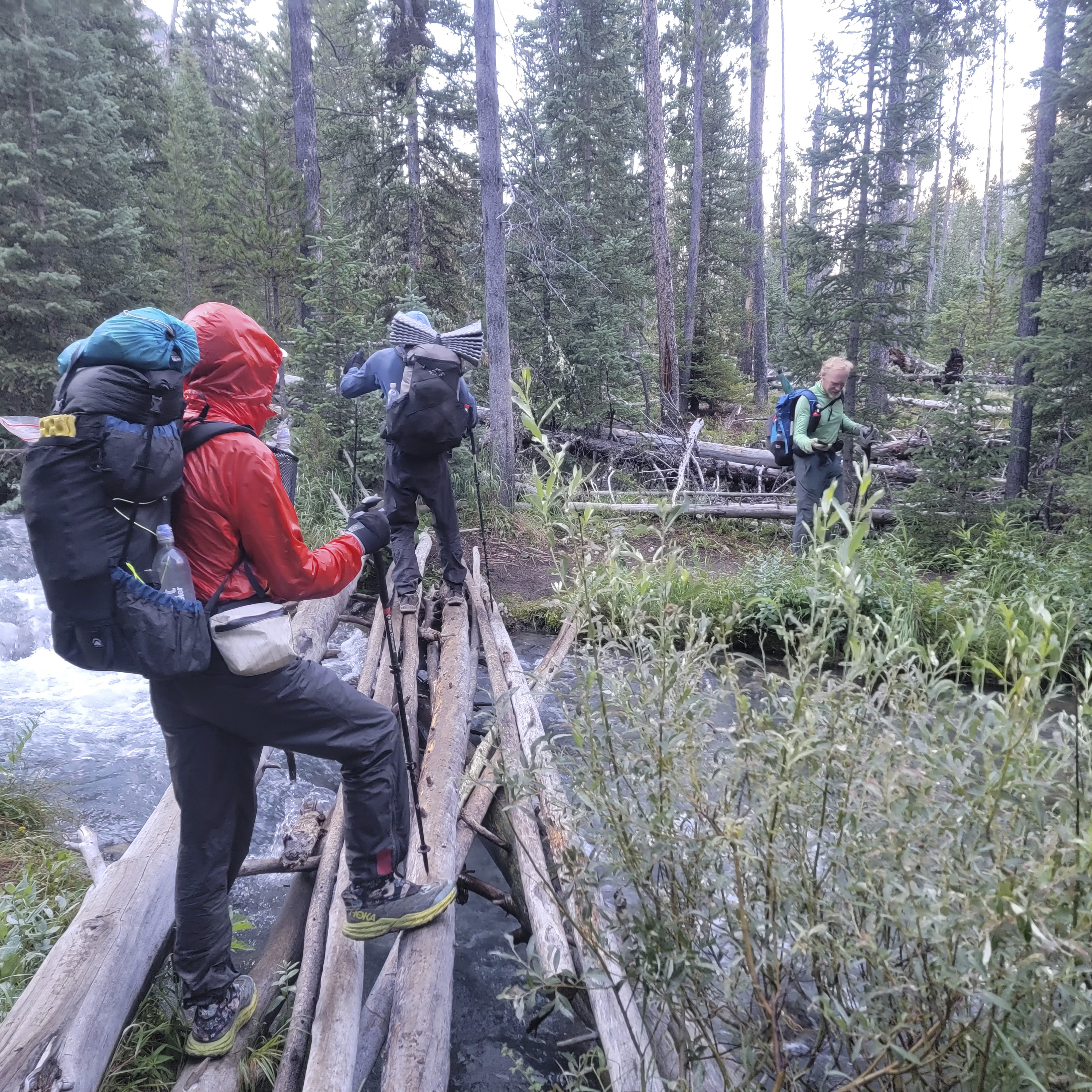
Crossing a river on logs at 7:30 in the morning.
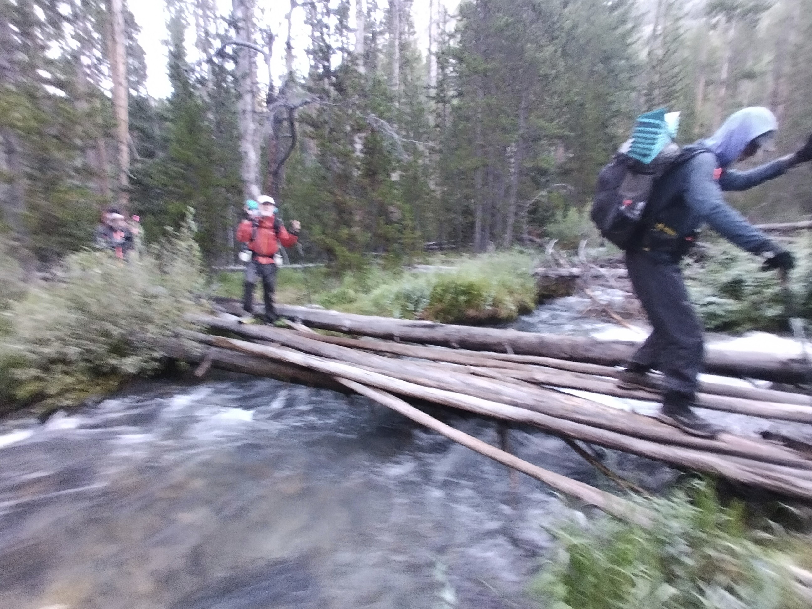
We made it across, though Cory would fall into a river later!
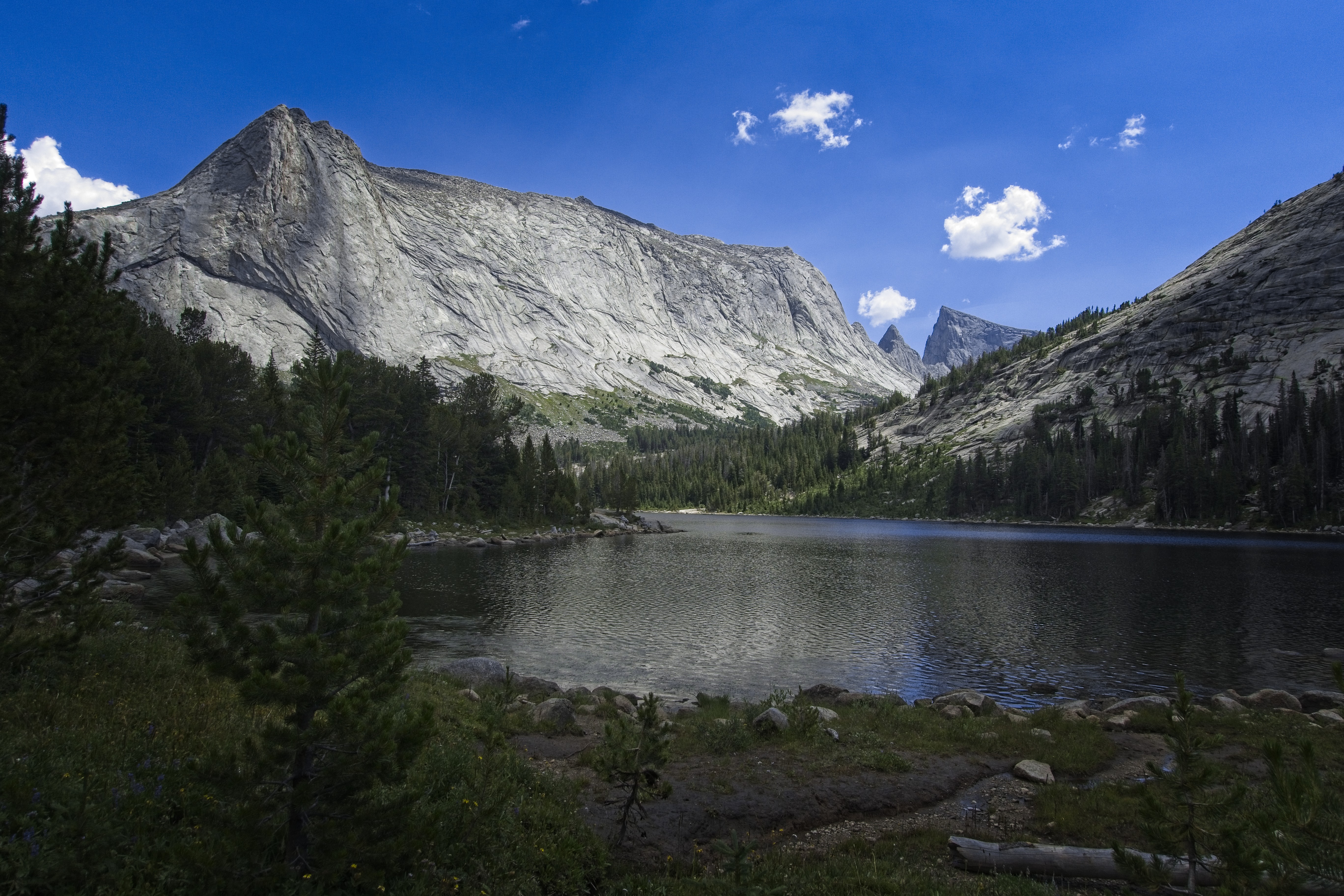
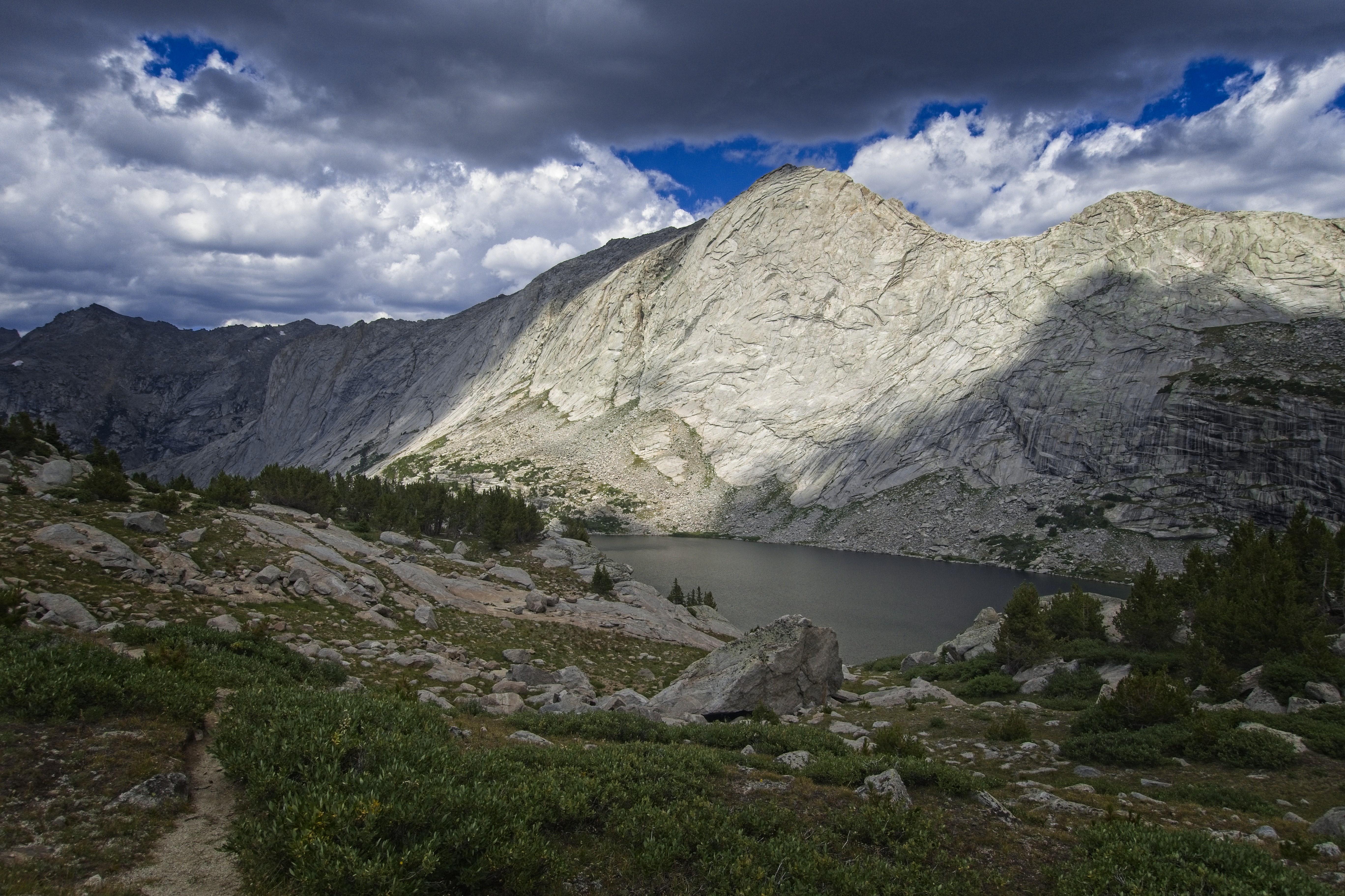
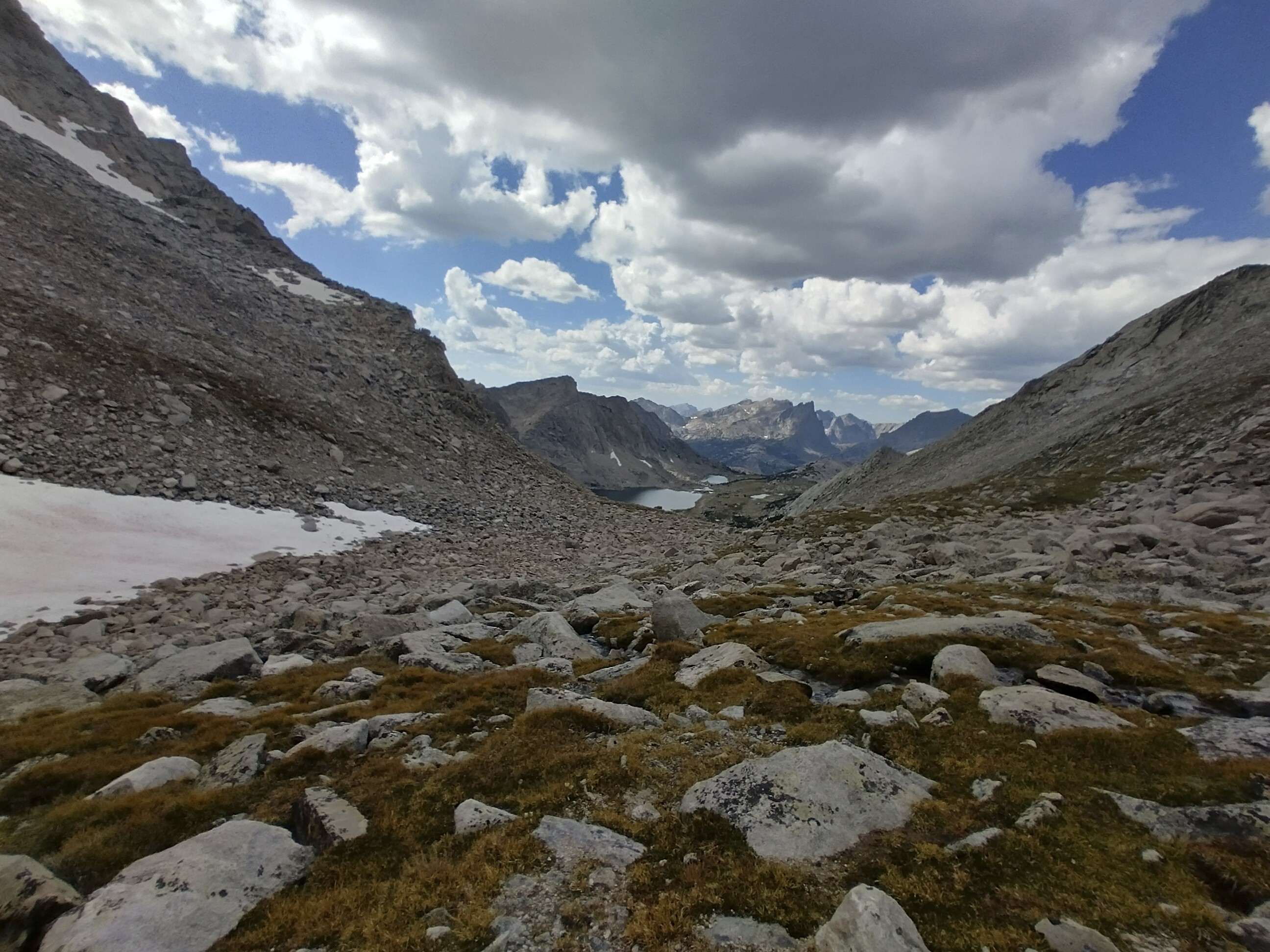
Green River Pass and Summit Lake.
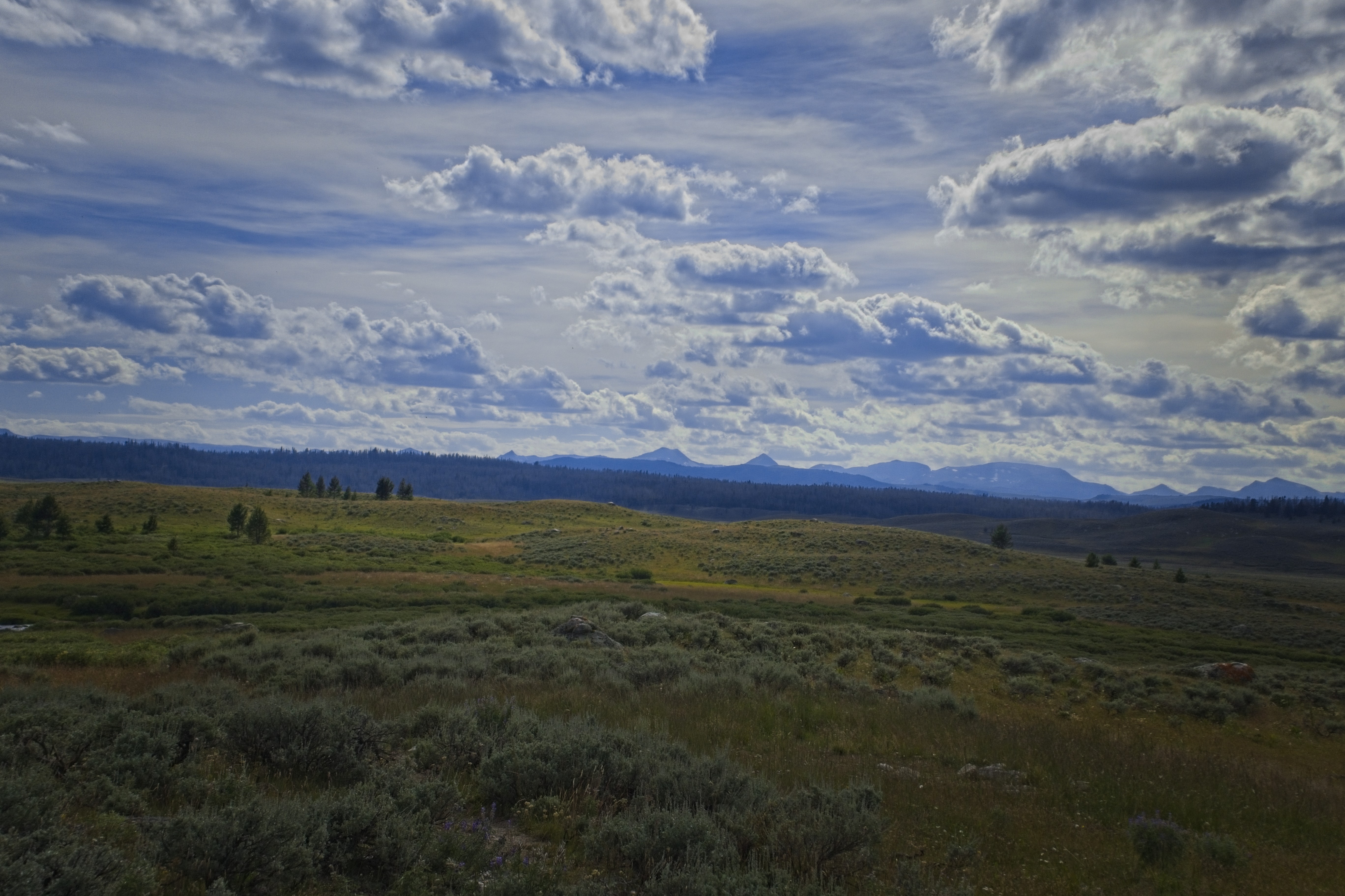
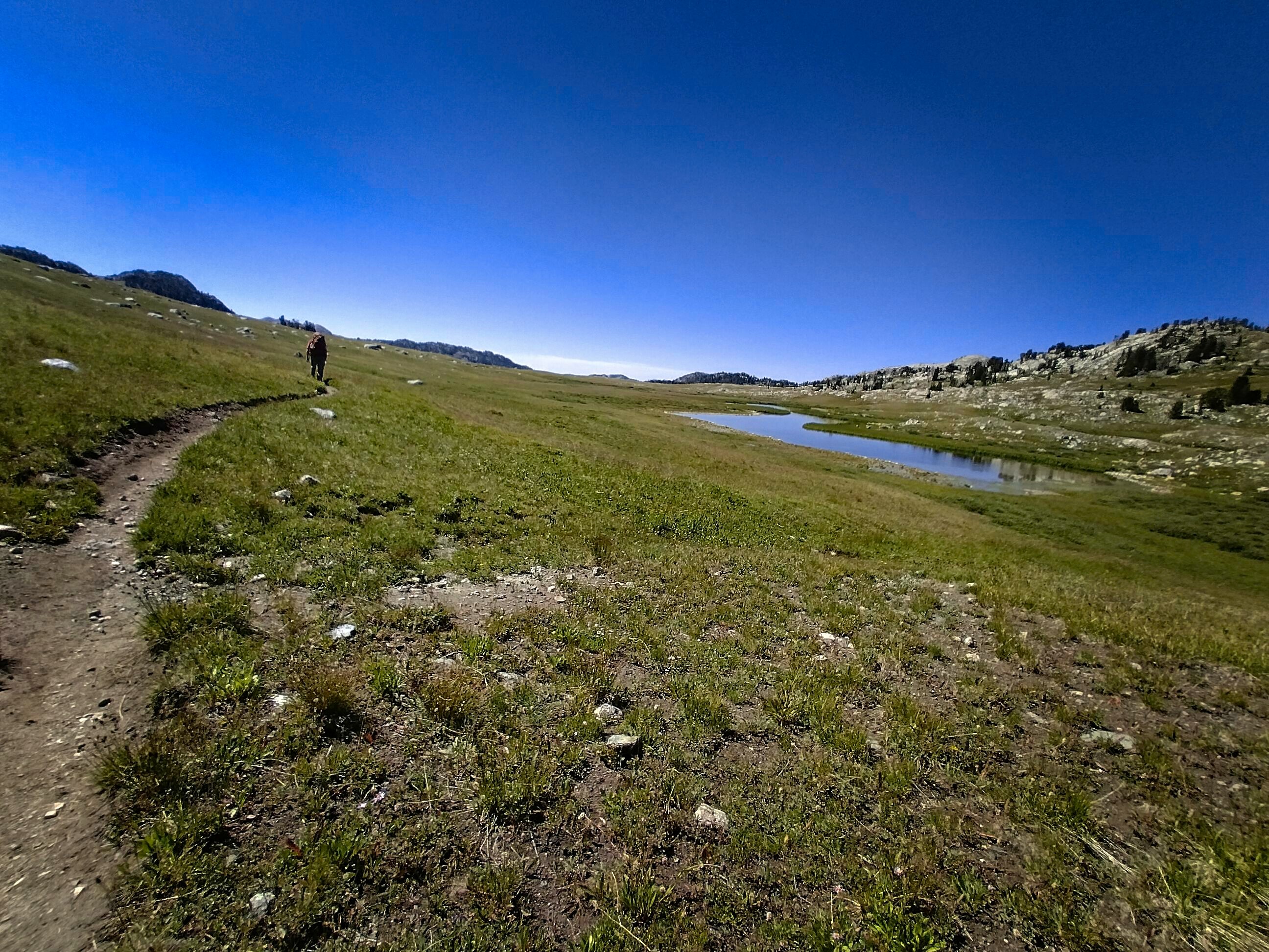
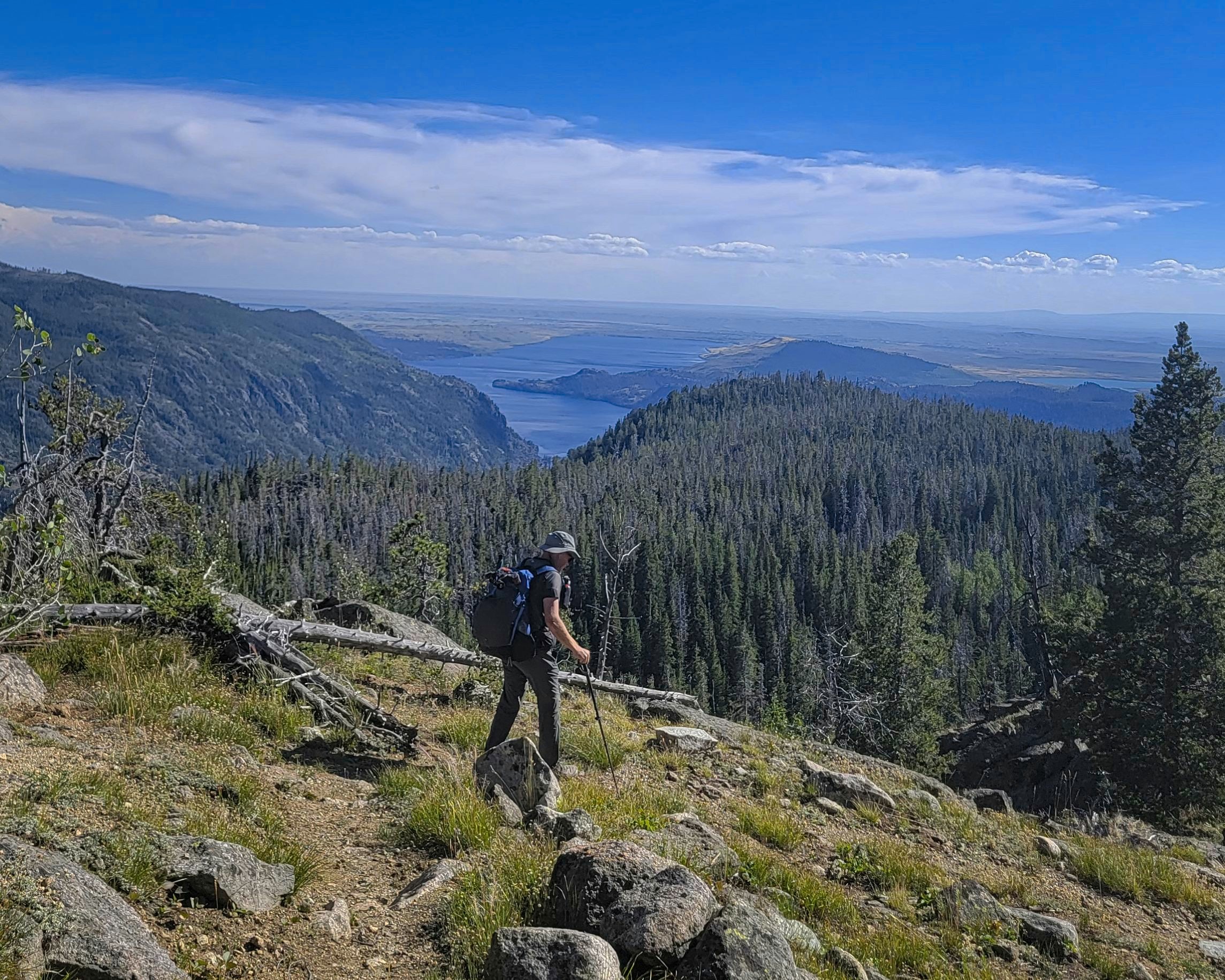
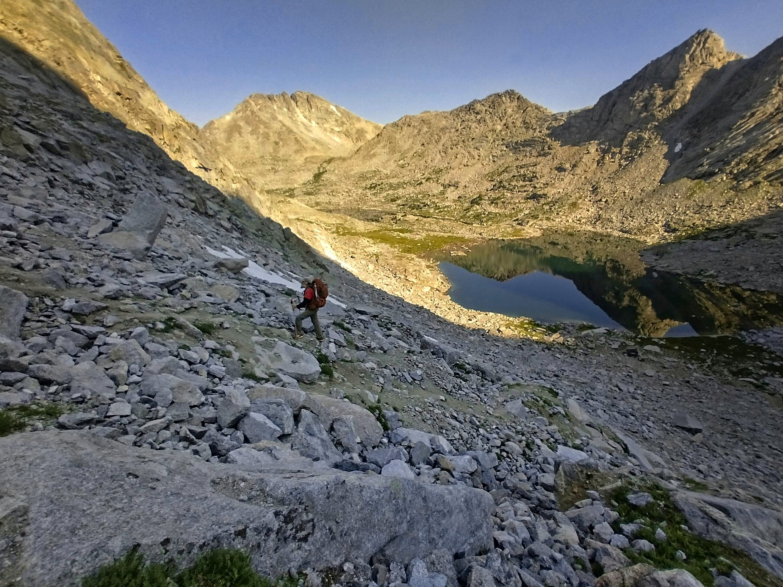
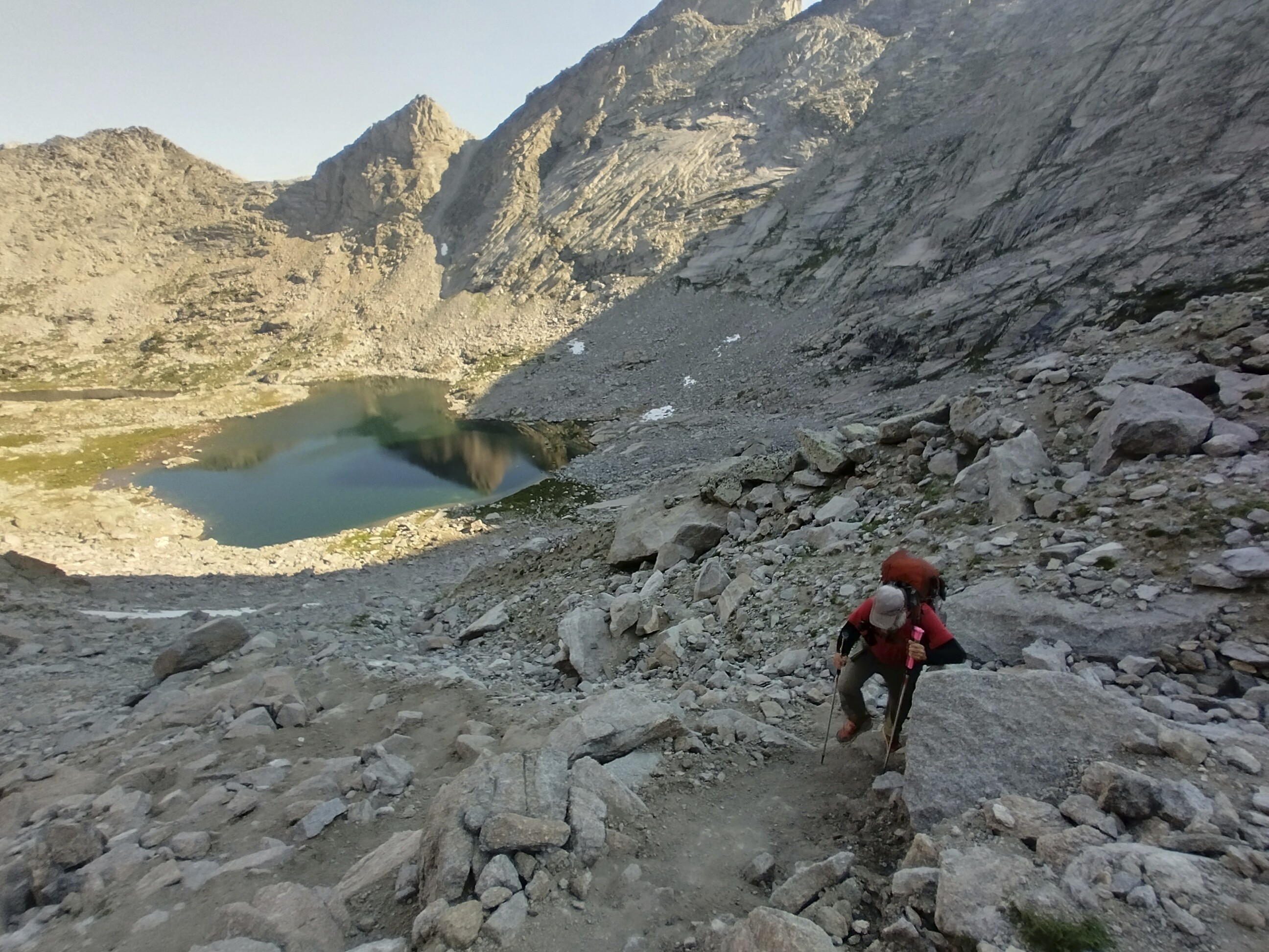
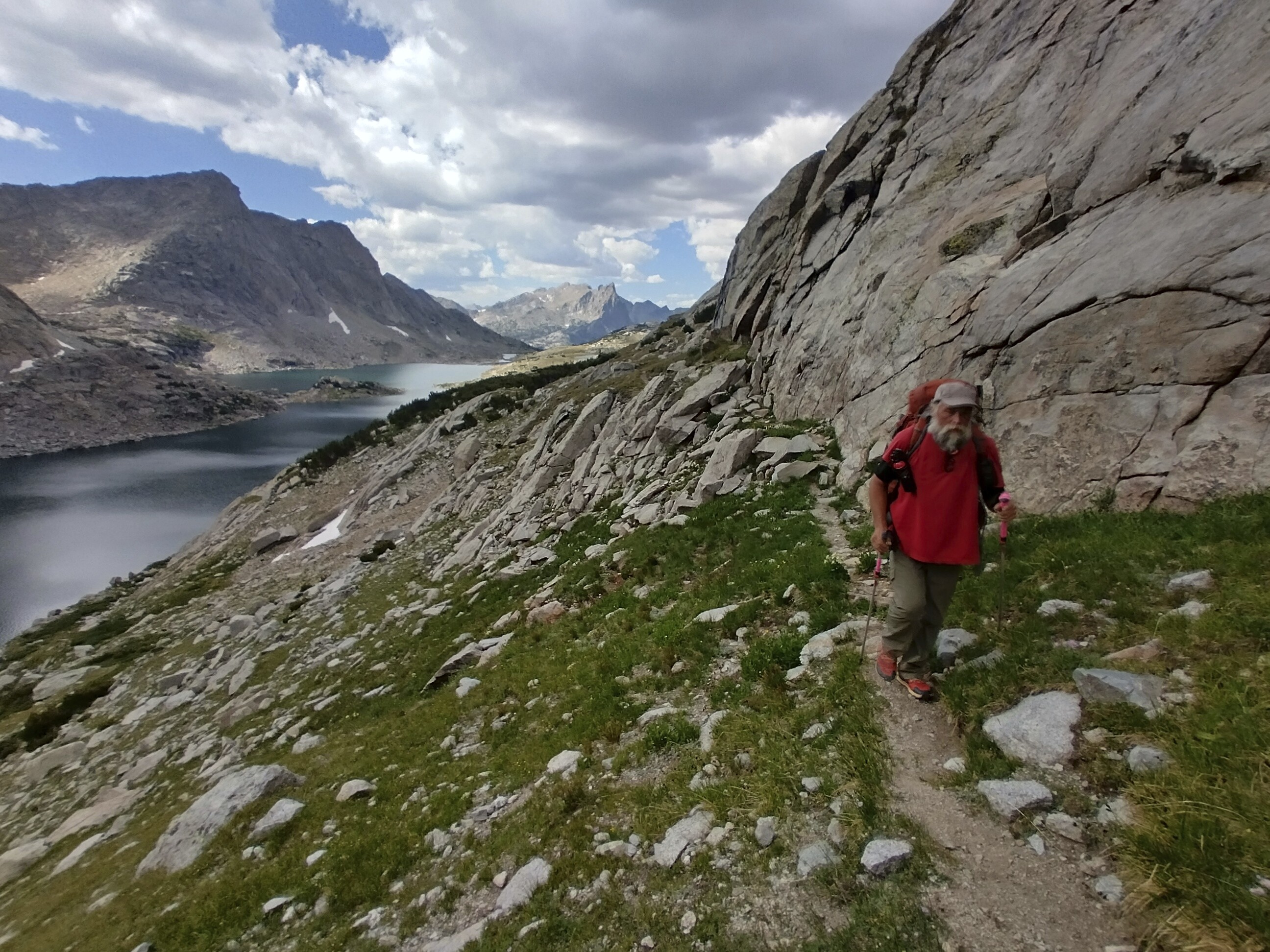
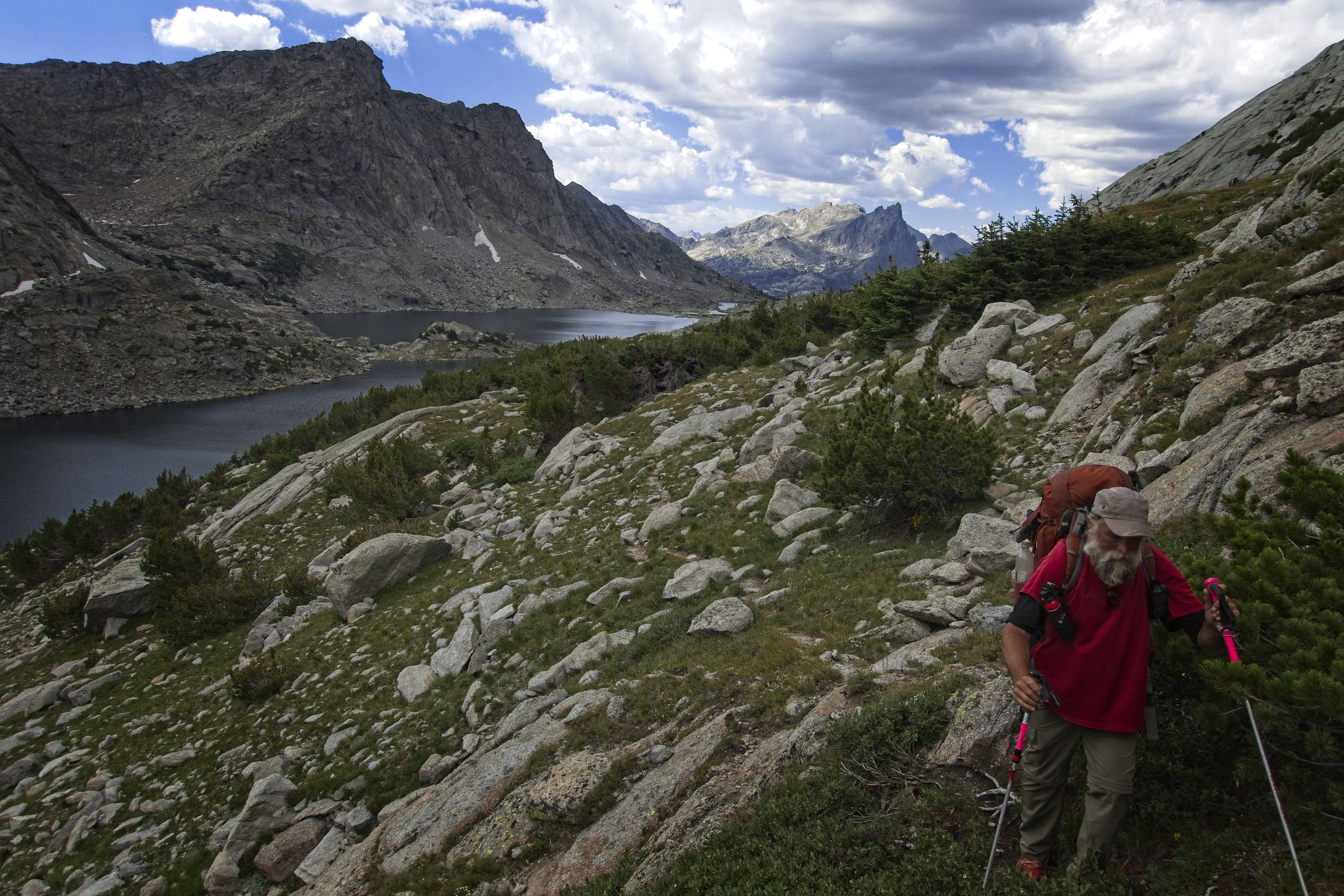
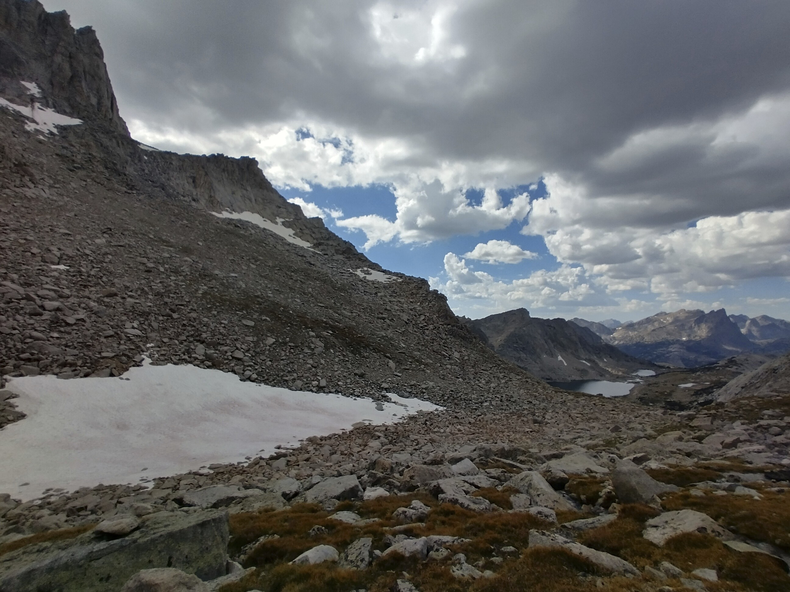
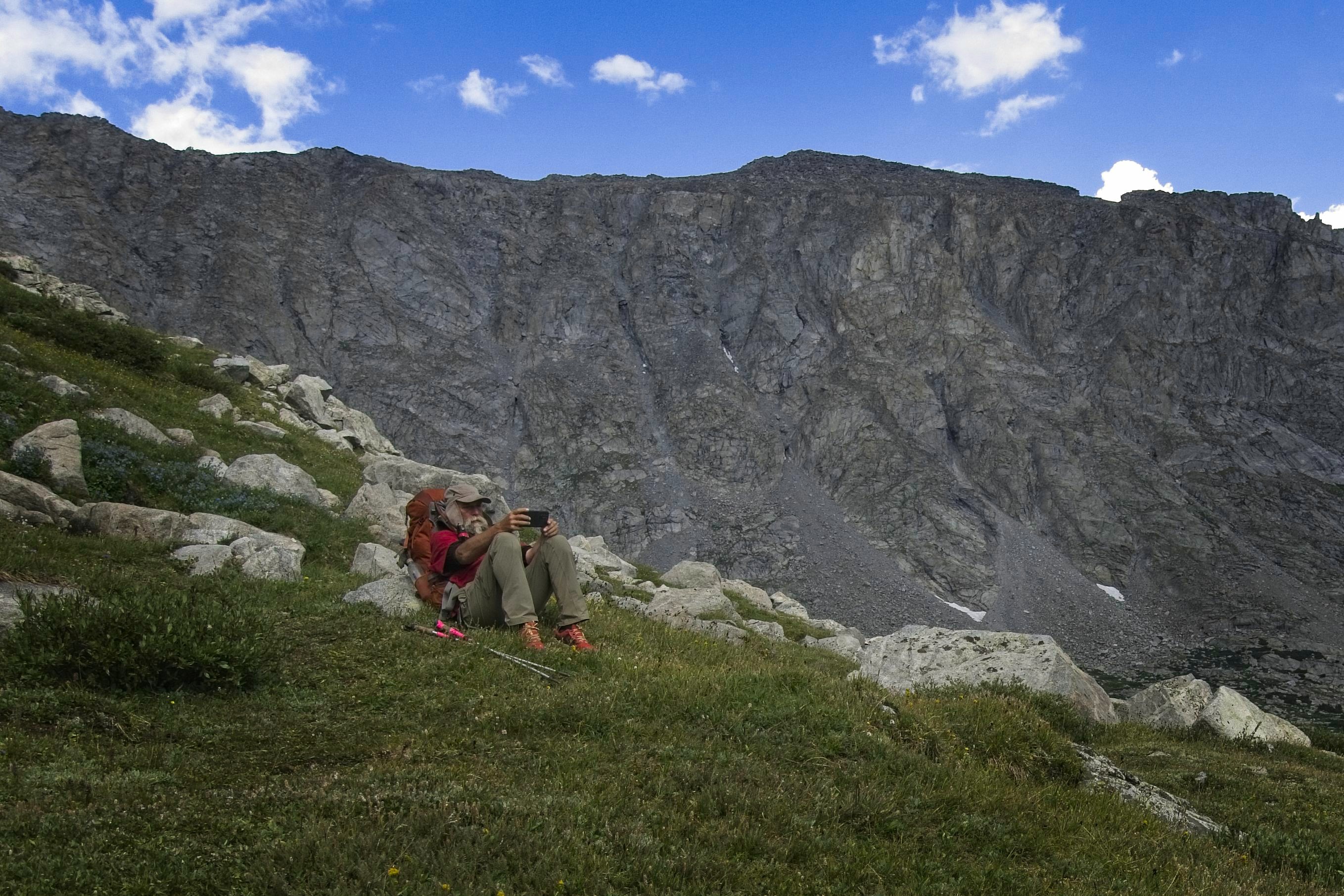
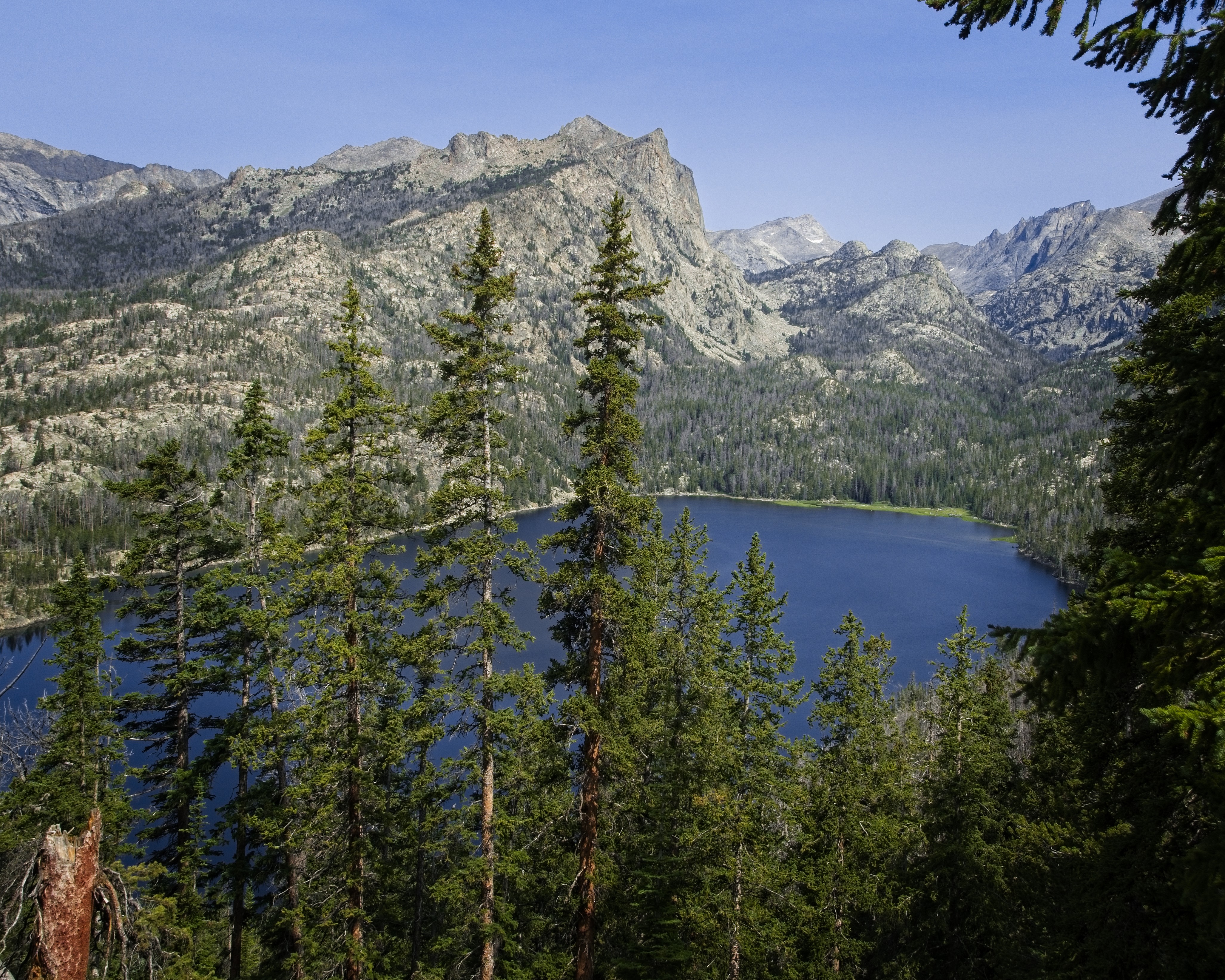
Later I met up with Cory in sunny high country. His phone was okay, thank goodness. We reached the Green River Pass and Summit Lake. High, brown, grassy country with granite peaks around though well set-back. We had a long rest sitting at the lake and eating lunch, then set off south on a variant to the route which would take us more directly to the Elkhart Trailhead and Pinedale beyond. The CDT heads a few miles off to the east here, but the country appears similar everywhere. You're walking through scenic bowls of granite with lakes and light forest no matter which way you go.
One of many lakes on our variant route heading south.
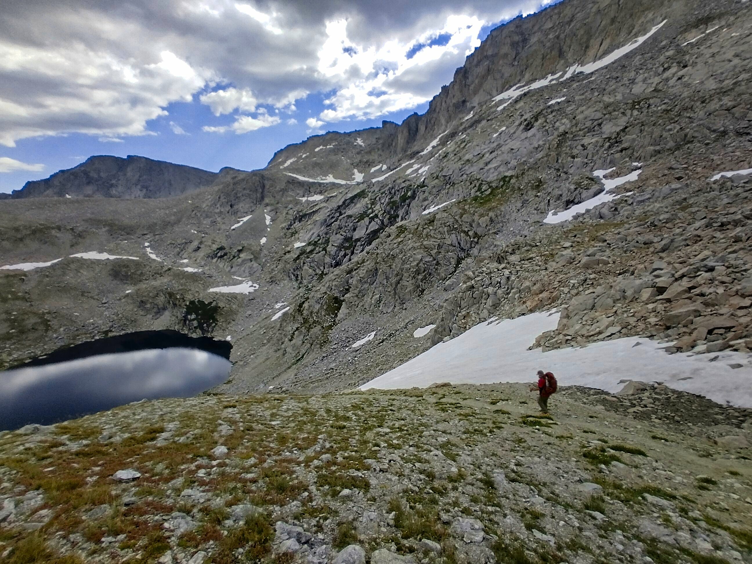
Looking down into our basin for the night from the Crow's Nest Lookout.
Michael starts down with Fremont Lake in the distance.
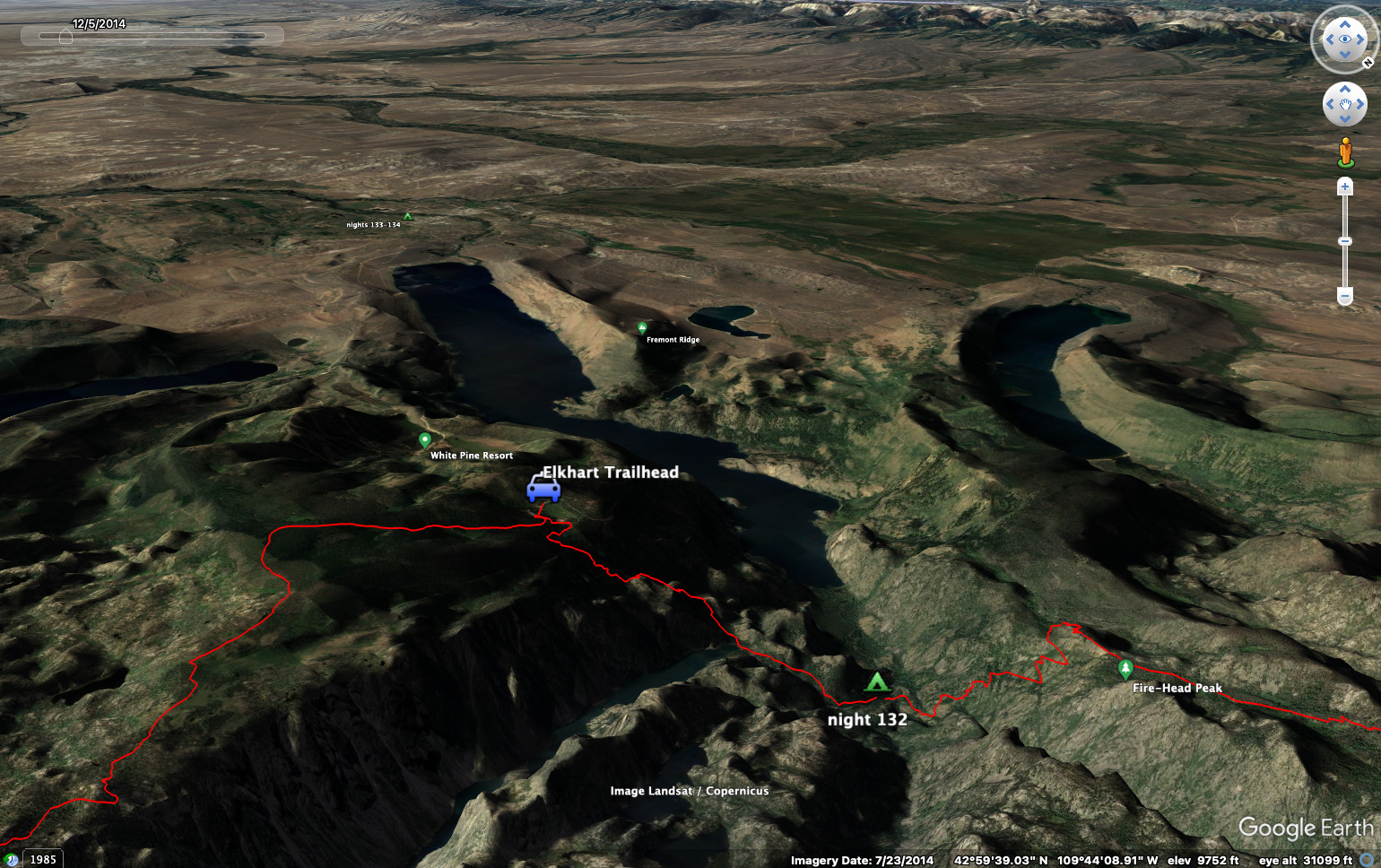
We went by Borum Lake, Gottfried Lake, two large but unnamed lakes, then Trail Lake. Then Trapper and Little Trapper Lakes, followed by an unnamed pass in old forest, then Prospector Lake. Finally a walk on a forested arm above Glimpse Lake to a viewpoint called the Crows Nest Lookout. From here we saw a deep chasm we'd have to cross before climbing up and out again on the other side to the Elkhart Trailhead. We decided that we'd sleep down in the chasm and climb out in the morning for a hitch to Pinedale.
We could also see the large and impressive Fremont Lake here which guards access to Pinedale. The descent was steep, sometimes hard to find and often sandy or rocky on something called the Pine Creek Canyon Trail. At the bottom it started sprinkling a bit. We crossed Pine Creek and found a broad flat place to camp. Since the rain was starting, I wanted to stay here. We did so, enjoying dinner and going to bed. A brother and sister came by, having made an ambitious bushwhack to a remote lake where they said fish were extremely abundant.
In the basin, checking the map.
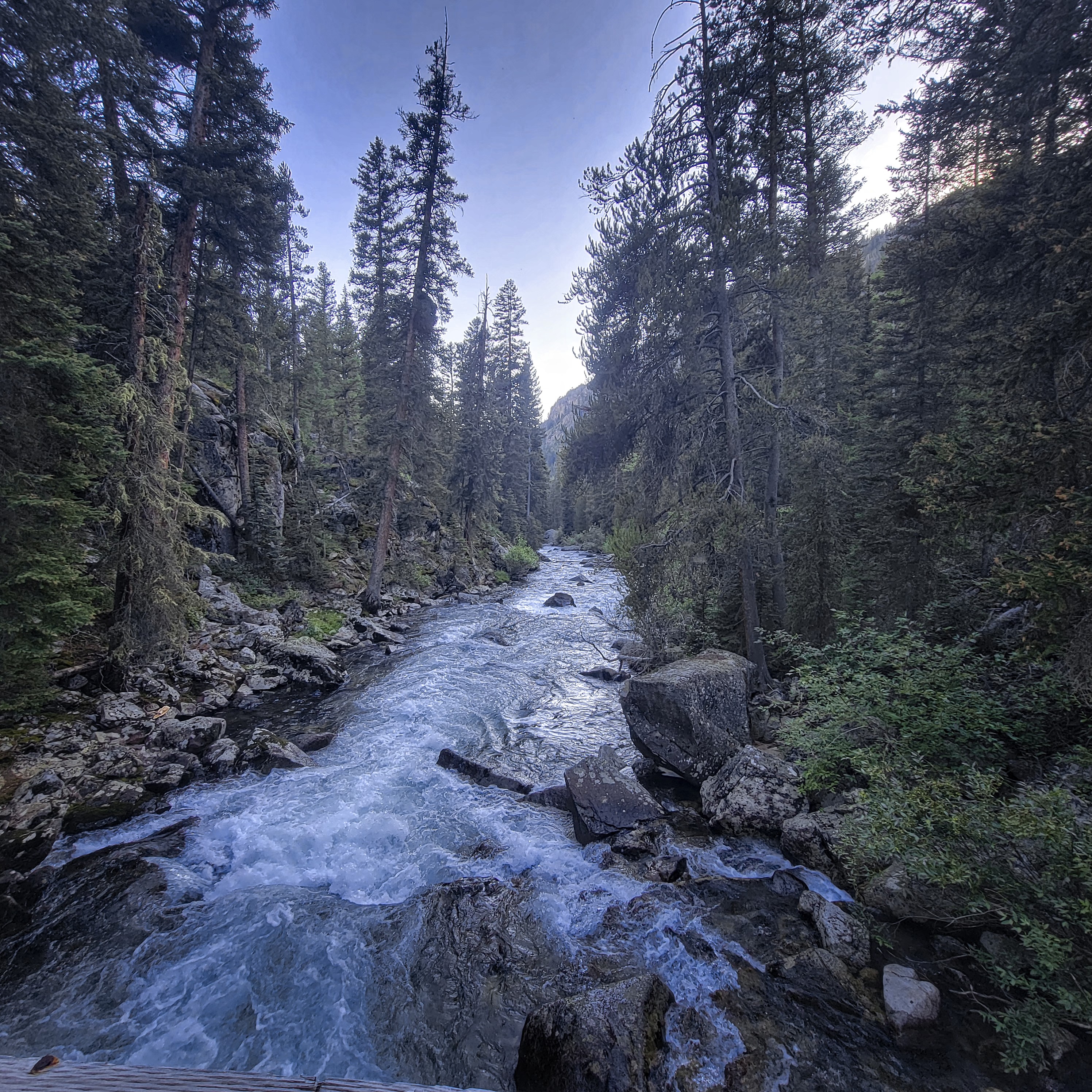
Crossing Pine Creek.
August 12, Day 133
3.6 miles, 1820 feet elevation gain.
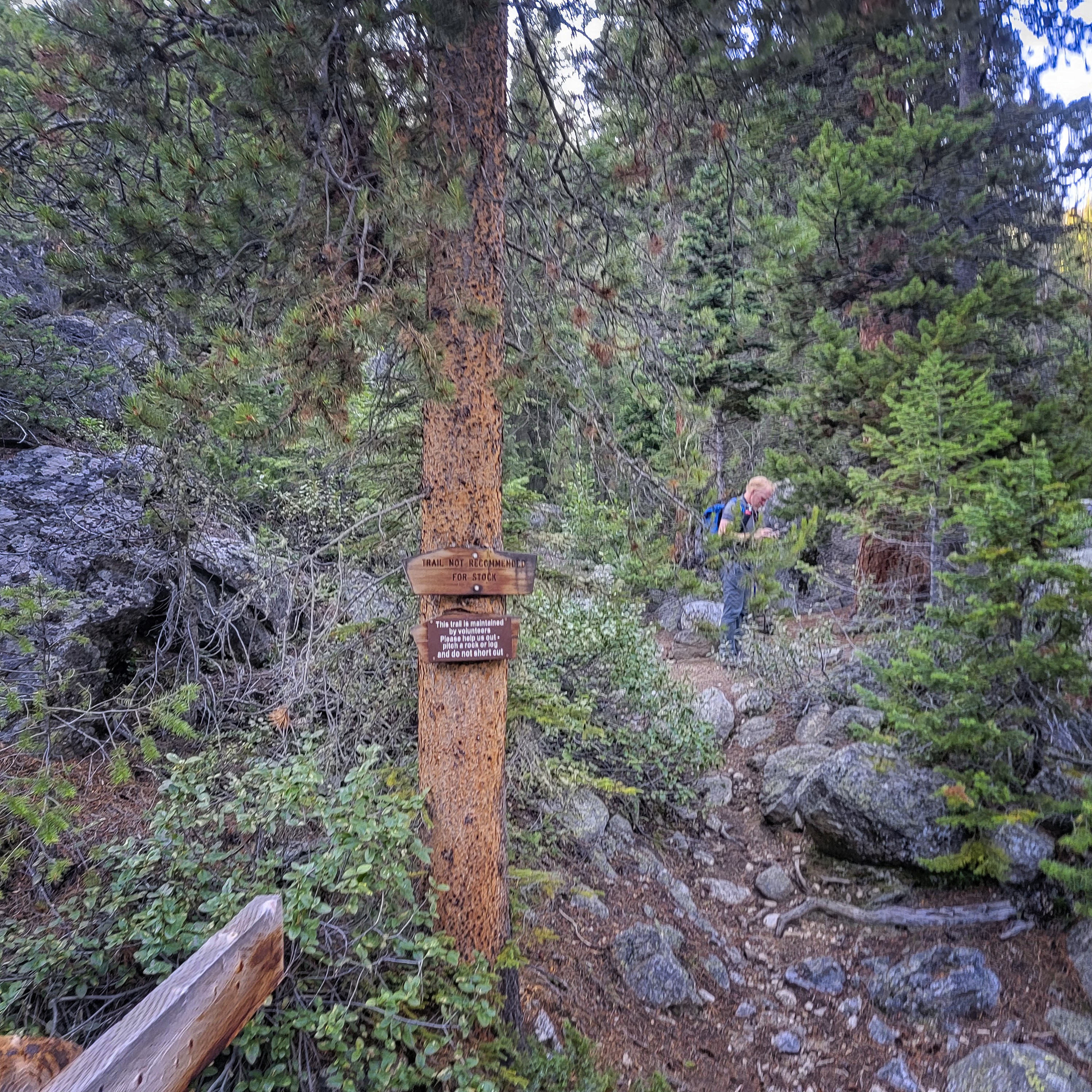
In the morning the trail didn't make it easy on us, as there were quite a few blow-downs to climb over, under or around. After Long Lake, we traversed south then started climbing, almost 2000 feet in total to reach the Elkhart Trailhead.
Long Lake.
We got up there then hitched a ride with no trouble at all. We'd heard this was a busy trailhead and it really was. Lots of friendly folks.
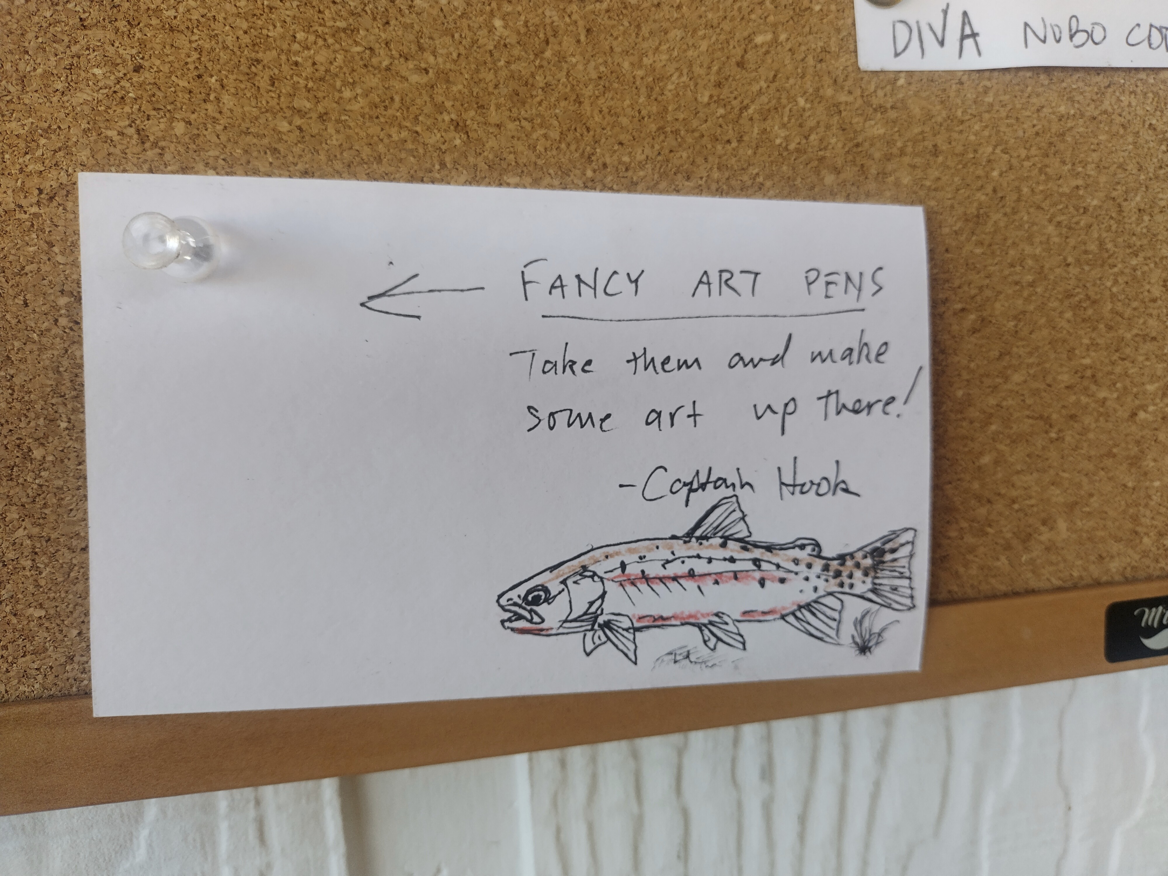
In the hostel, admiring a fish drawn by Tim, last seen in Montana.
There is a pretty new hostel in Pinedale (the Jackalope Motor Lodge). We went there and booked 2 nights. Only $40 per night, which was fantastic. We had little bunks that could be completely closed off like tiny Tokyo hotels, with wifi, a lamp and power inside to charge your phone. There was a hot shower, and the supermarket was just 5 minutes walk away. We visited the Heart and Soul cafe several times -- I loved their coffee.
August 13, Day 134
Zero day!
Nothing to do, really. Oh, a new pair of shoes arrived for me along with some insoles. Did our shopping and laundry at the hostel. I think we got Chinese food for dinner, which was okay. On the first night we went to Los Cabos for mexican food and that was quite good.
Chatting with people at the hostel, calling my sister and Barbara. Stuff like that. A good break!
August 14, Day 135
17.5 miles, 3350 feet elevation gain.
It was tough to get out of town. We tried hitching for a good long while. We starting leaving voice messages on a couple of phone numbers we got from the FarOut app. Finally though, a friendly man in a pick-up truck pulled up. I didn't recognize him at first, but we'd talked to him already two days before in the Ridley's parking lot. He'd come up on a bike then, but now he was doing the proper Wyoming thing of being in an enormous truck with a cowboy hat.
Very interesting man, clearly with a long history here. I kinda thought he was the mayor, or had been. He got us up to near the trailhead then the road was closed. A woman held a stop sign and walked up to us. Our driver knew her, her children, her parents, everything about her. He was a guy who enjoys people and keeps his finger on the pulse of the whole community.
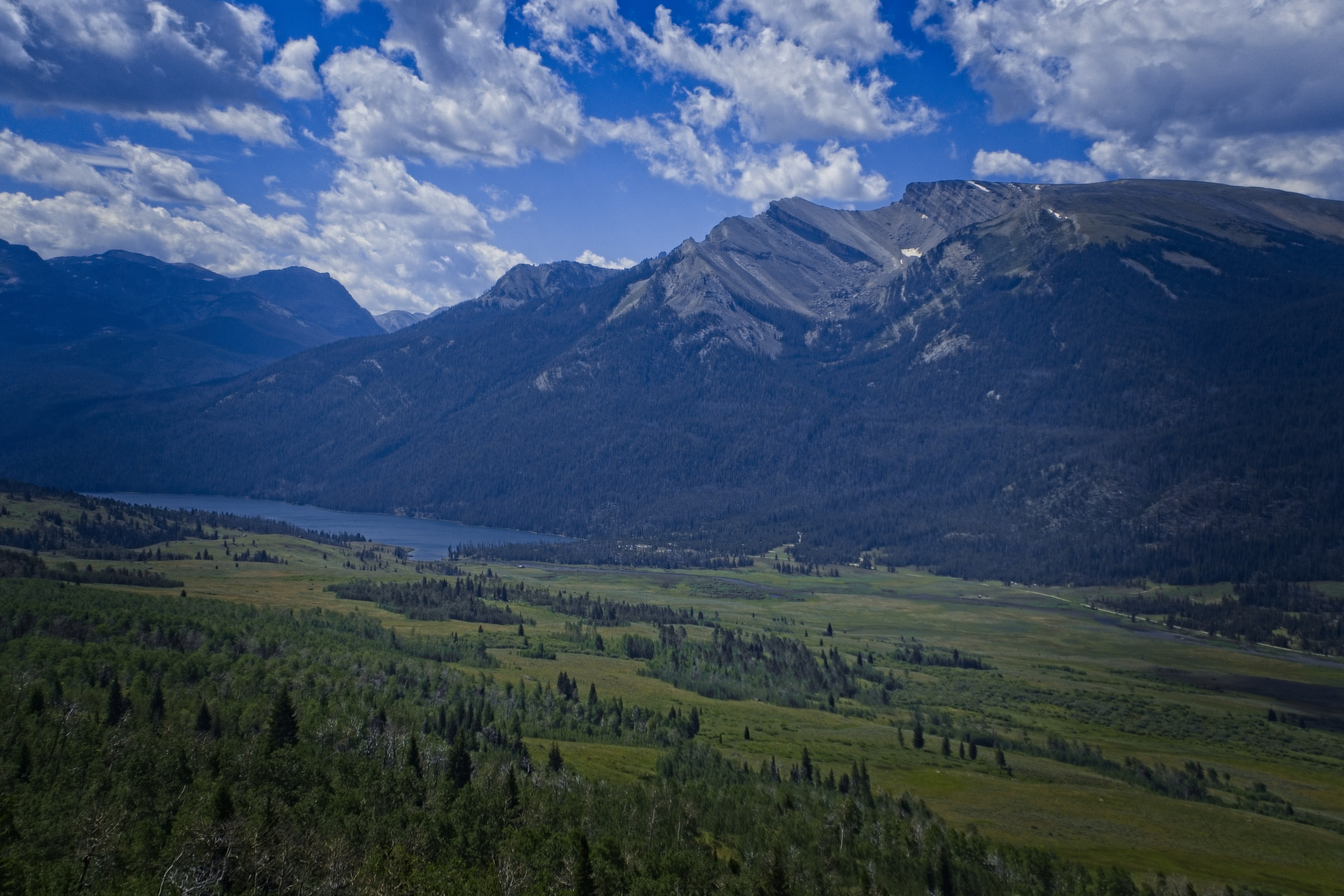
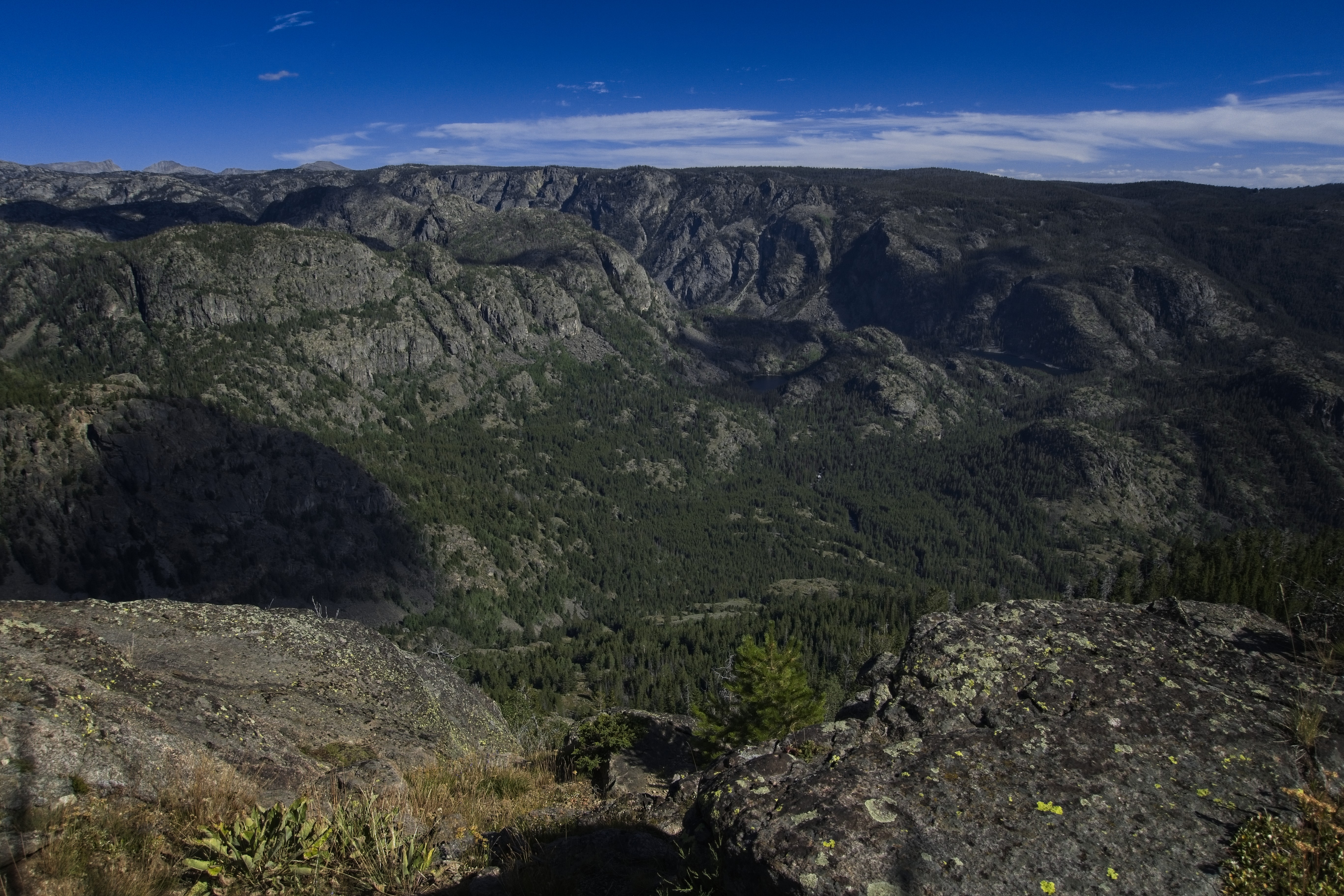
The incredible canyon view from Photographer's Point.
Resting near the end of a long day.
Cory preparing dinner below Hat Pass.
Sunset panorama at Hat Pass (10848 feet).
But by now it was 11 am, and we had wanted to hike a full day. So we took off quickly, first walking the road so that our driver could turn around and go back instead of waiting to drive us the last 1/2 mile. At the trailhead there were some Jehovah's Witnesses. I thanked them for their effort to share the spiritual life with people. I used to find such folks annoying, now I'm touched that they try! Nice folks.
We walked quickly up to Photographer's Point and enjoyed the view. Lots of folks here. I'd say this was the most crowded section of trail ever, even more crowded than the trail above Many Glacier so long ago in Montana.
More sunset...
The evening light was beautiful here.
We spent the afternoon walking briskly by one lake after another, probably a dozen named lakes in total. In the evening we stopped below Hat Pass and ate our dinner. It got cold up here quickly.
We hiked a final 30 minutes to the pass and set up our tents here. Shivering a bit, I crawled into the sleeping bag and conked out for the night.
More.
Last light.
August 15, Day 136
23 miles, 3030 feet elevation gain.
We passed by so, so many lakes.
If yesterday had many lakes, today would almost double that total. If you're a fisherman this must be an absolutely paradise.
Wind River peaks surrounded by lakes.
Cory travels relentlessly south.
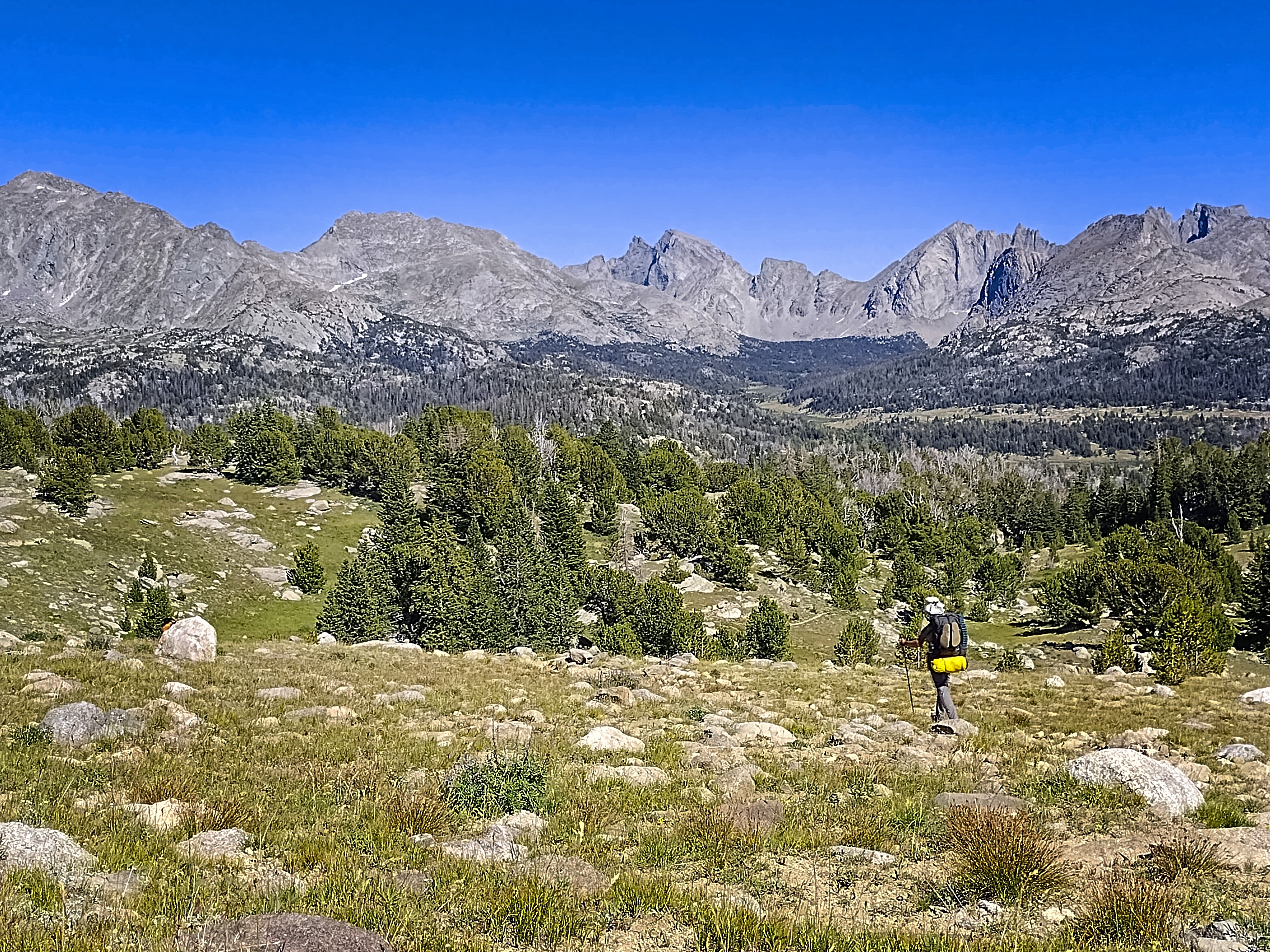
Hiker traveling in to the High Route.
I don't have much to say about the day. Cory and I traveled separately quite often. I'd said I wanted to program more alone time on the trail. I found that no matter how scintillating my company is (and Cory was always great company), my thoughts were too-occupied by my partner in grime. I wanted to untether those thoughts and let them float free. The best way to do that seemed to be to agree on where we would camp, then let our paces diverge naturally. Usually, Cory hikes a bit faster than me, unless it's a steep downhill, where I can get ambitious. But then he prefers longer breaks than I do. At any rate, we diverged and I got the quiet time I was looking for. We'd do this again over the rest of the trip.
Coming into the High Route country.
Our basin for the night.
Really cool guy I talked with a long time.
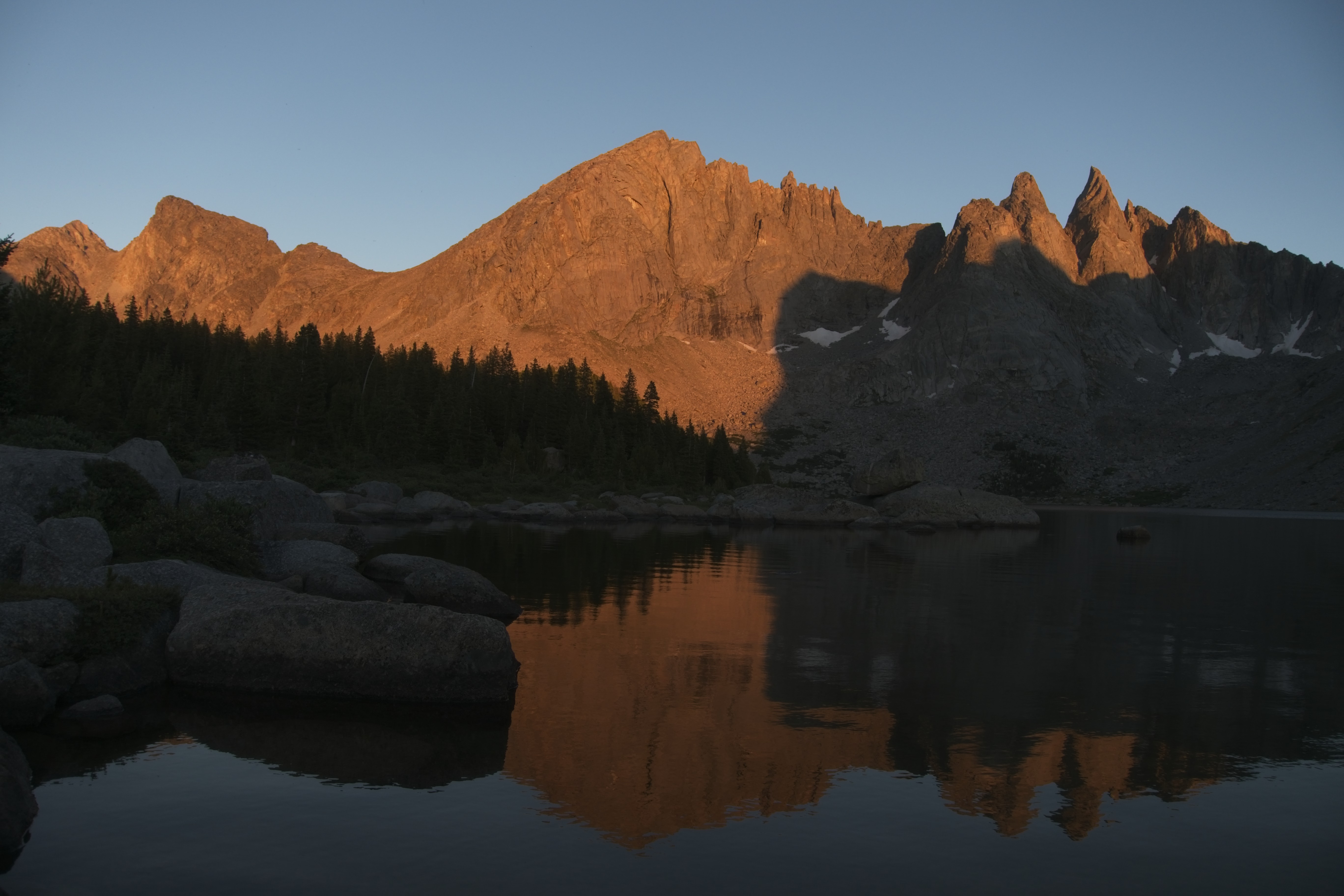
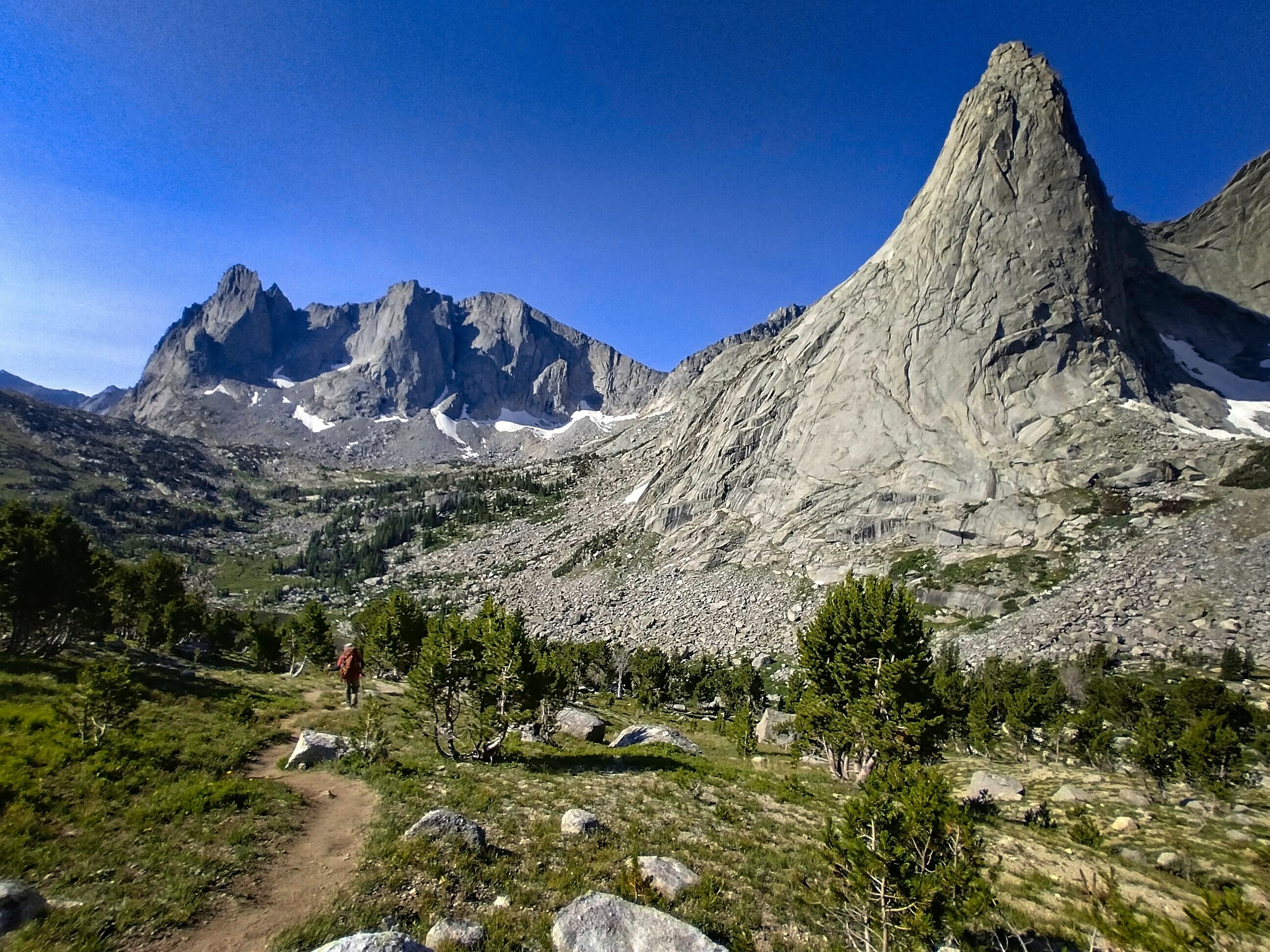
Shadow Lake with Wolf's Head and the Shark's Nose.
Again in the last western light.
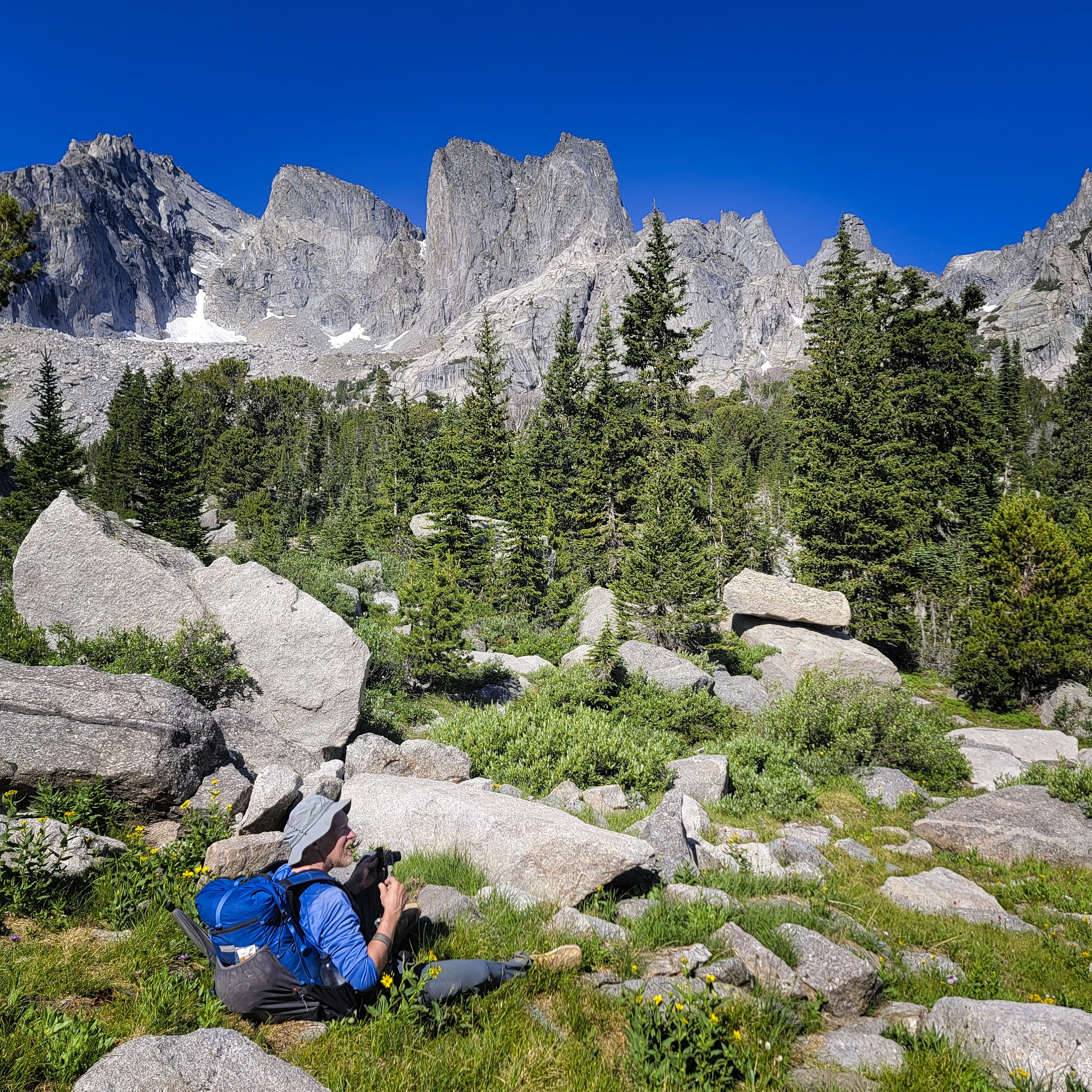
We turned onto the side trail off the main CDT that marks the Cirque of the Towers variation. This was a must-do for me. I've taken so many short cuts, I've walked so many roads just to make things a little bit easier. But I very much came for this section of trail. I arrived at Shadow Lake to find Cory stressing out and wondering if I'd passed by. The problem was that he'd assumed I was ahead of him all the time, but at some point he walked by me when I was resting. I called out hello but he had headphones in and didn't hear. Haha...
The sunset at this lake was fantastic. There was an interesting lady who had many things to say about hiking and her habits. She and her group were slowly crossing the range, traveling about 10 miles a day. She couldn't believe how much food Cory and I needed. I didn't say anything, but perhaps the difference between what she eats and what we eat has something to do with the fact that we try and do twice as many miles in a day!
We chatted a lot with a nice fella and his dog who camped right near us. A good, long day.
August 16, Day 137
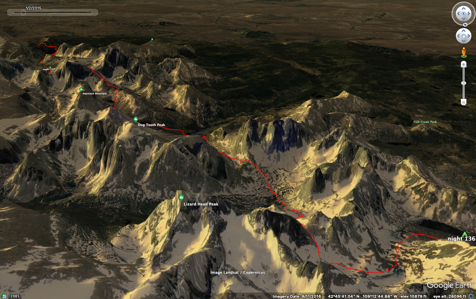
13.7 miles, 3750 feet elevation gain.
Hiking in high alpine country -- what a joy!
Cory climbs above Texas Lake.
The steep ascent to Texas Pass.
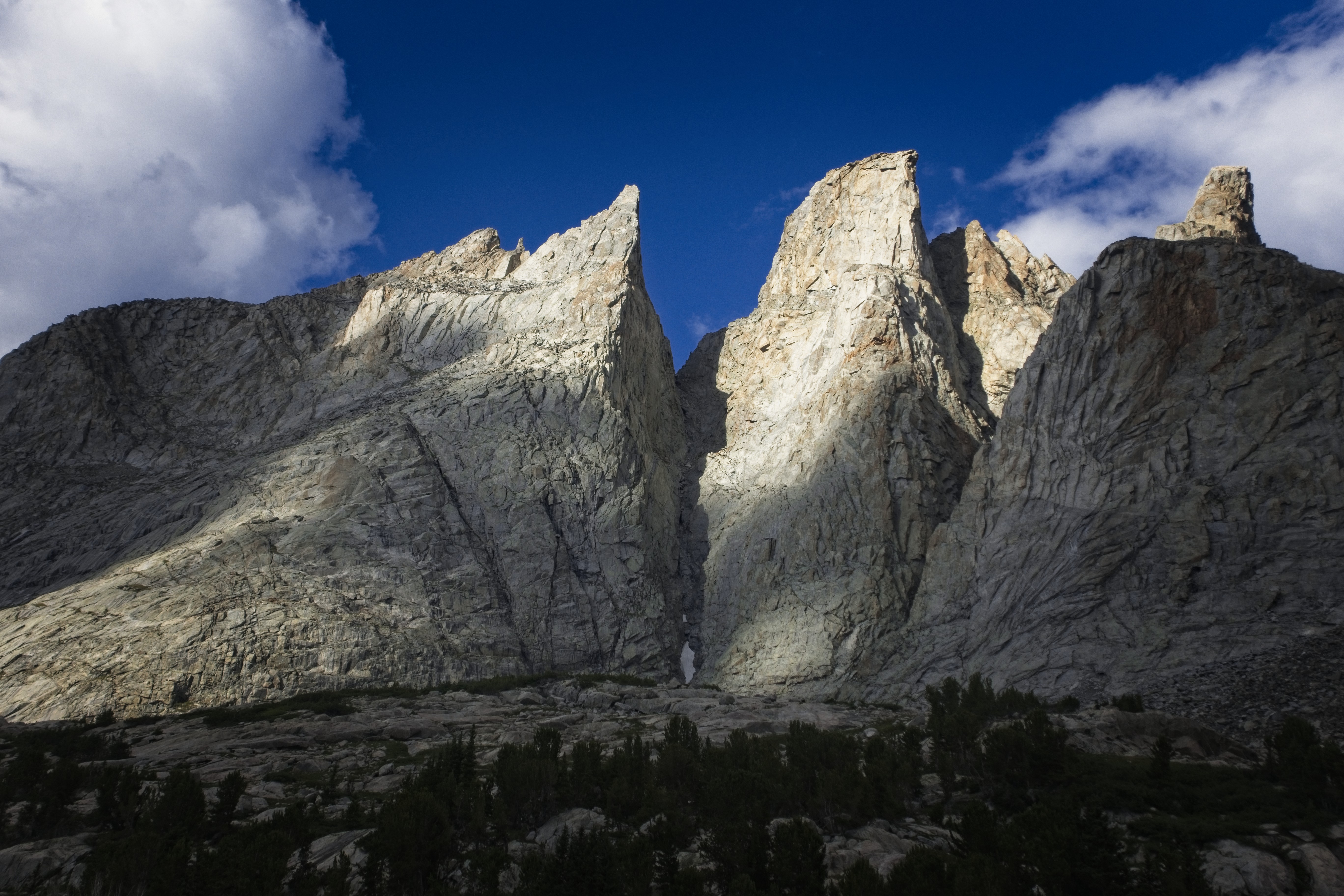
But a lot of work, too. The climb up Texas Pass is very steep. But not as long as I thought it would be. Soon we were sitting on top looking at the towers in the Cirque. It's unfortunate that there are so many pictures of this place! Let me add a few more...
A similar shot.
Cory looks into the Cirque of the Towers.
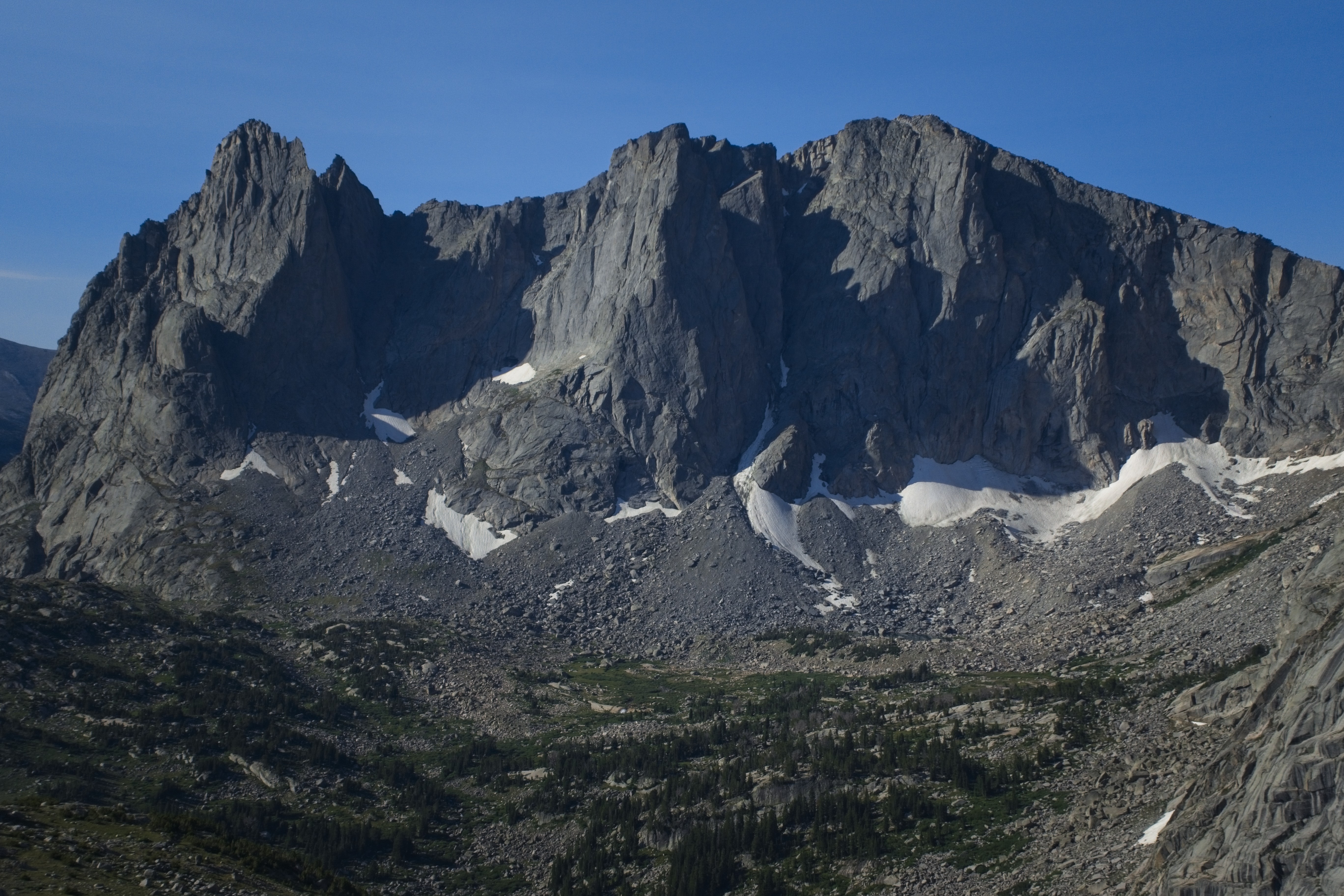
Incredible peaks in the Cirque...
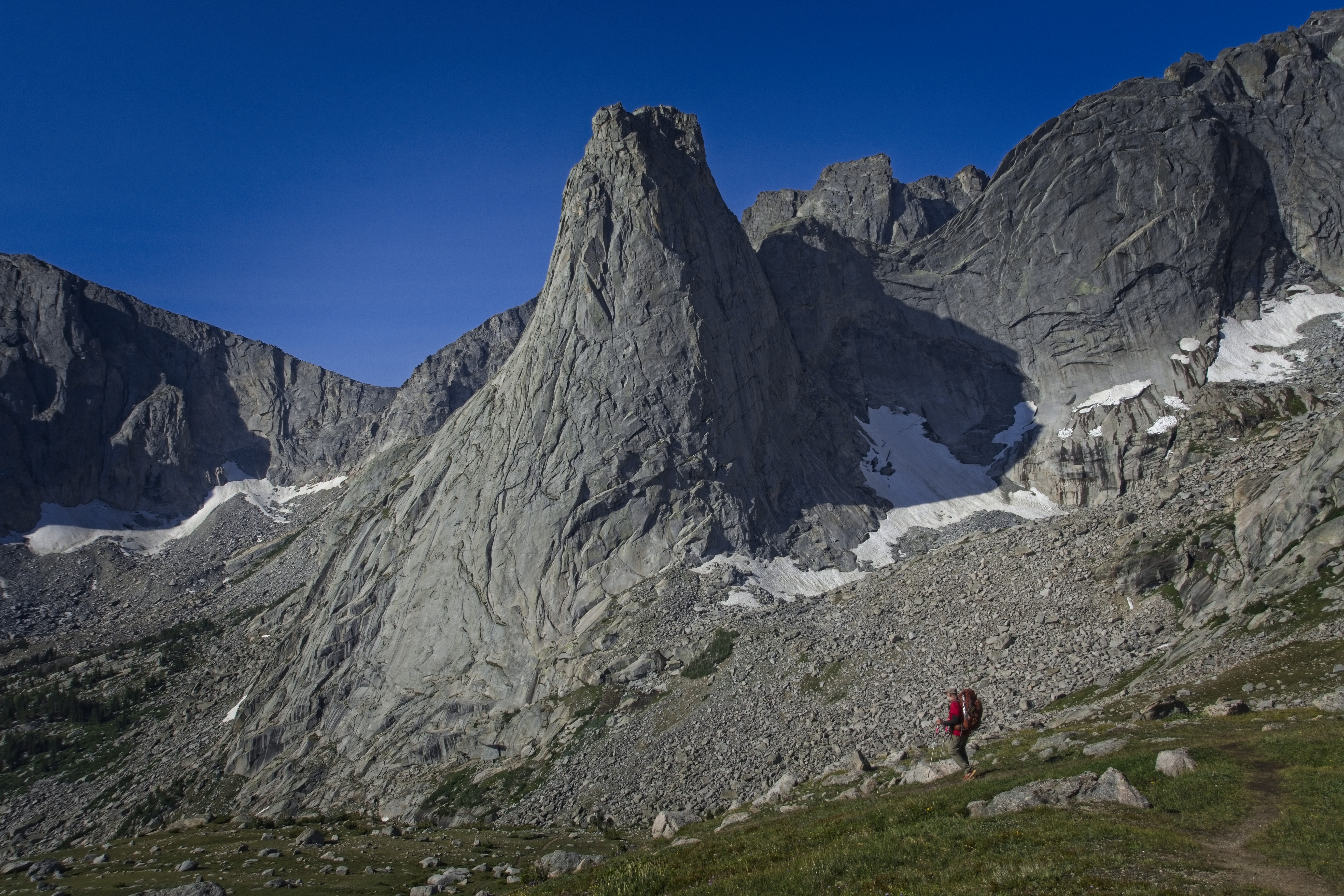
Cory under the iconic Pingora Peak.
We descended, eventually navigating dirt and tree roots very steeply down to Lonesome Lake. Here we stayed on the left side of the lake on a mix of trail and cross country terrain amid boulders to then climb up heather and bouldery slopes to a point west of Jackass Pass. That pass is several hundred feet higher, but our lower (unnamed) pass would still get us to Arrowhead Lake. It was also called the climbers trail. We didn't see any tents, but we could hear voices of climbers on the amazing walls above us.
We picked our way through huge granite blocks under War Bonnet Peak, then followed a more reasonable trail at the outlet of Arrowhead Lake. Descending further, we met North Lake, then rather tiredly climbed above it on trail called the Big Sandy Trail.
In here I chatted with a young man on a climbing trip. He told me about the famous routes. Now we dropped down to Big Sandy Lake and took a long rest at it's eastern shore.
More Pingora Peak.
Cory enters the Cirque.
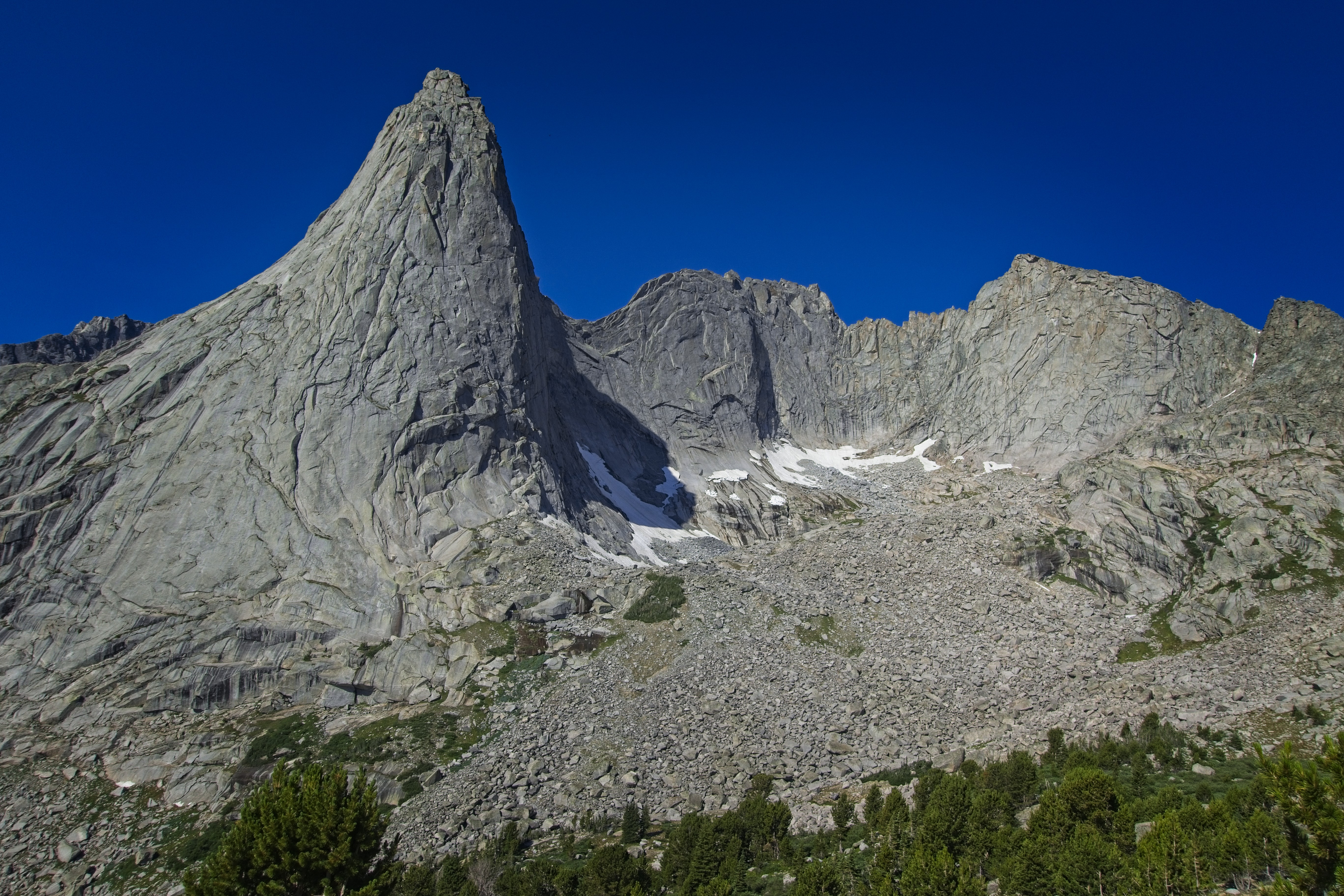
One more shot of Pingora.
Michael amid the towers...
Closeup of flowers.
Looking back to Texas Pass.
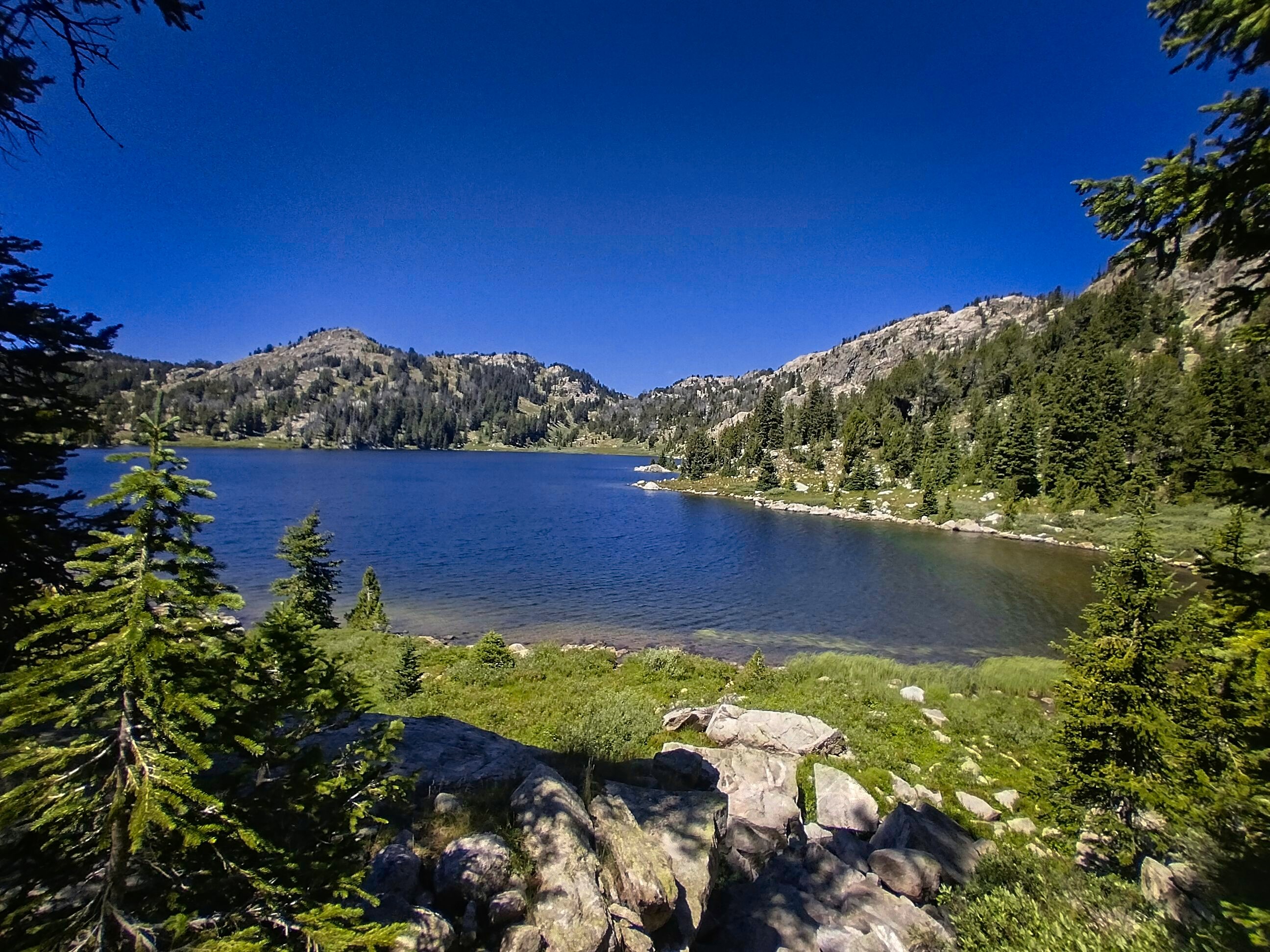
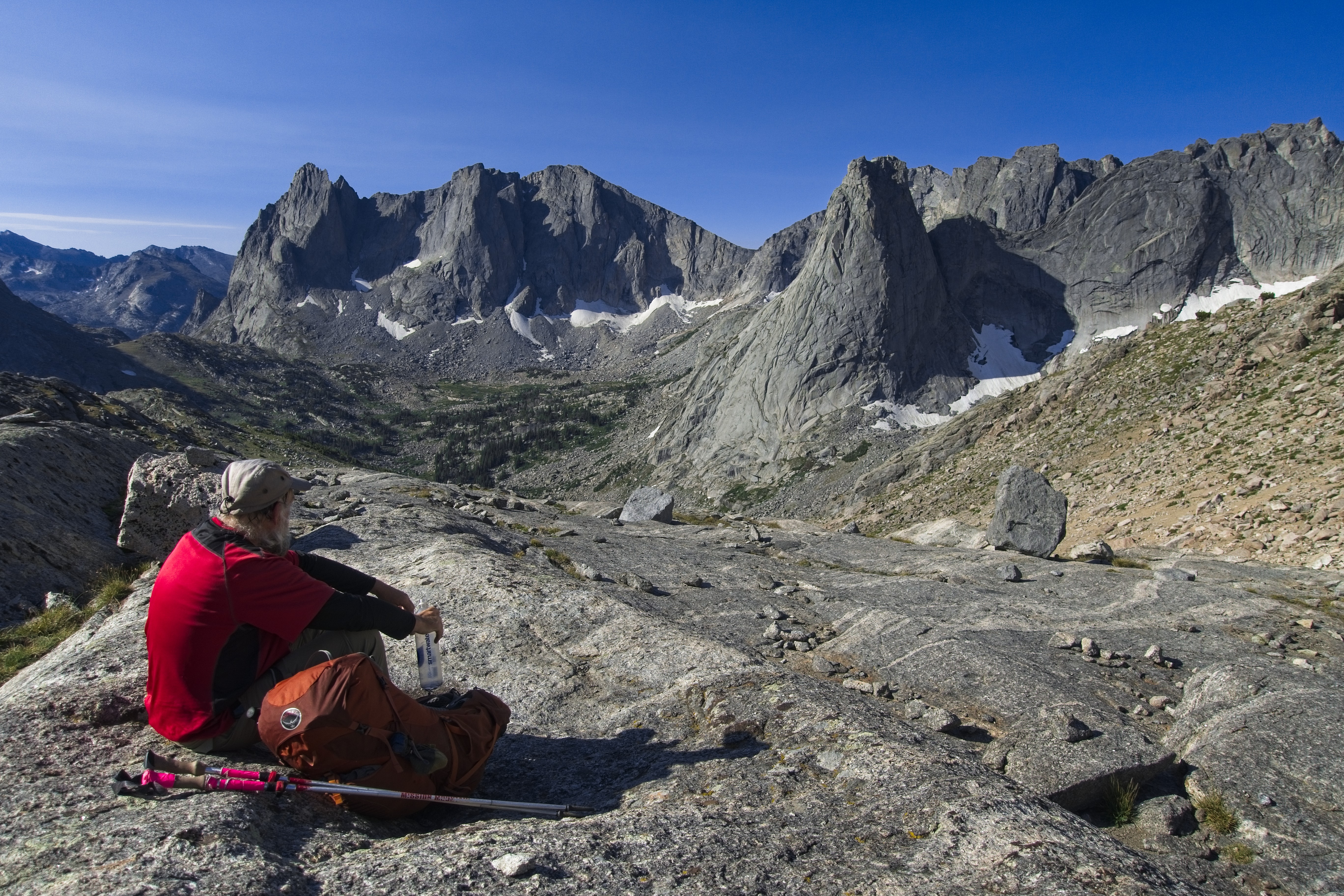
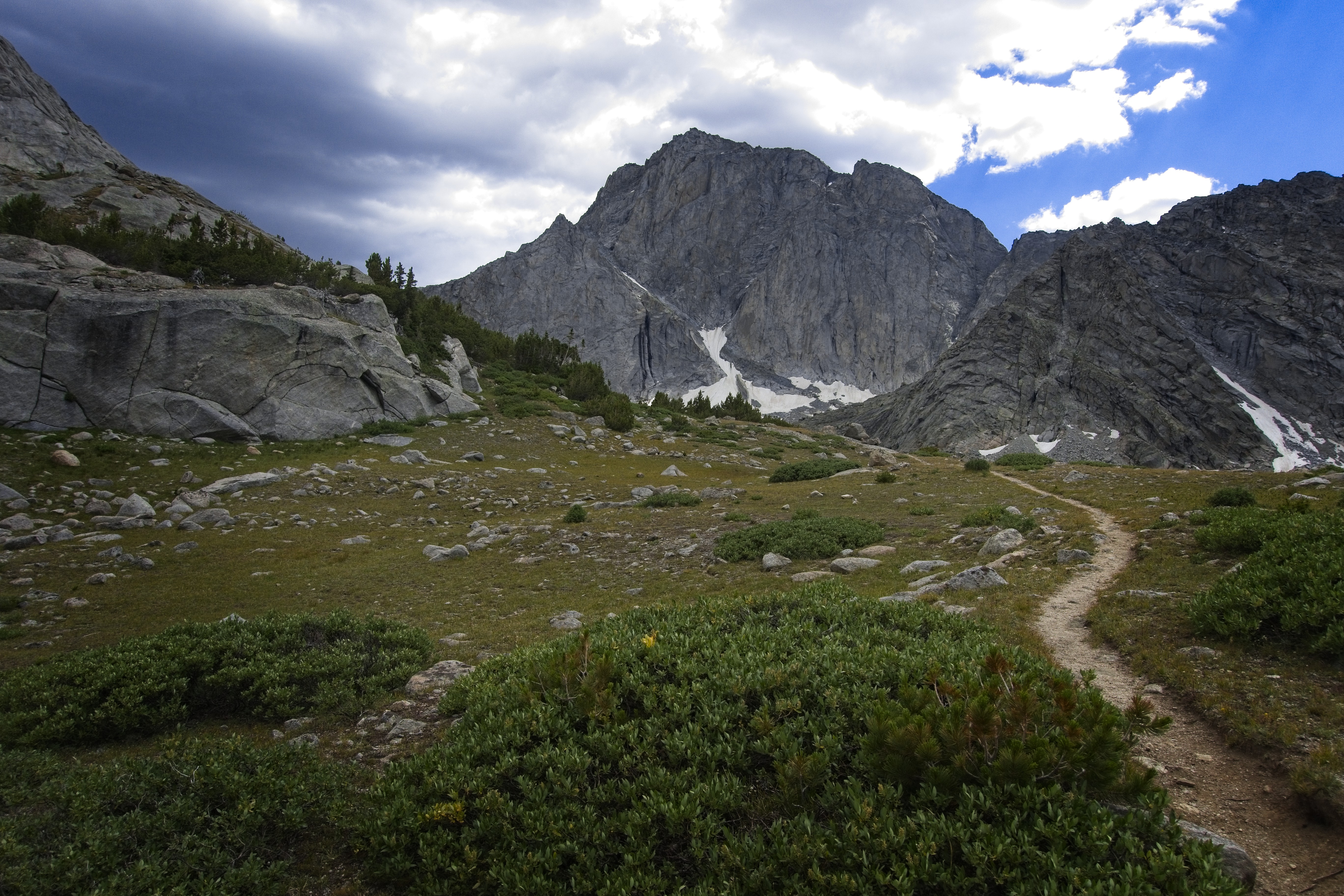
Following advice for a scenic variant, we climbed up into mature forest to the Clear Lake Resevoir, which had amazing views of novel peaks to the south. We walked the Clear Lake Trail up long granite sidewalks to the stunning Deep Lake.
Here, a long rest and a nap until the clouds came in and chilled me. Cory took off first. The hike up to a broad pass above Temple Lake tired me out so much! I just wanted to sleep in here...
However, some combination of wind, clouds and the drama of Temple Peak with it's hanging glacier woke me up. We traversed a high route above the lake, then climbed very steeply to a pass (Temple Pass?). This was just as steep as Texas Pass, but twice as long, I'd say.
Another shot looking back.
Clear Lake Reservoir.
Looking back to the Cirque from granite slabs.

Deep Lake with East Temple Peak behind.
Looking down on Deep Lake.
Temple Peak ahead.
Michael climbing to the pass by Temple Peak.
Temple Lake with the peak above.
Cory before the steep part of the pass.
Closeup of Temple Peak.
Cory in the Winds.
The pass looks steep and bleak!
Country at the top of the pass.
More views at the broad pass.
The view on the south side of the pass.
Cory and the upper Little Sandy.
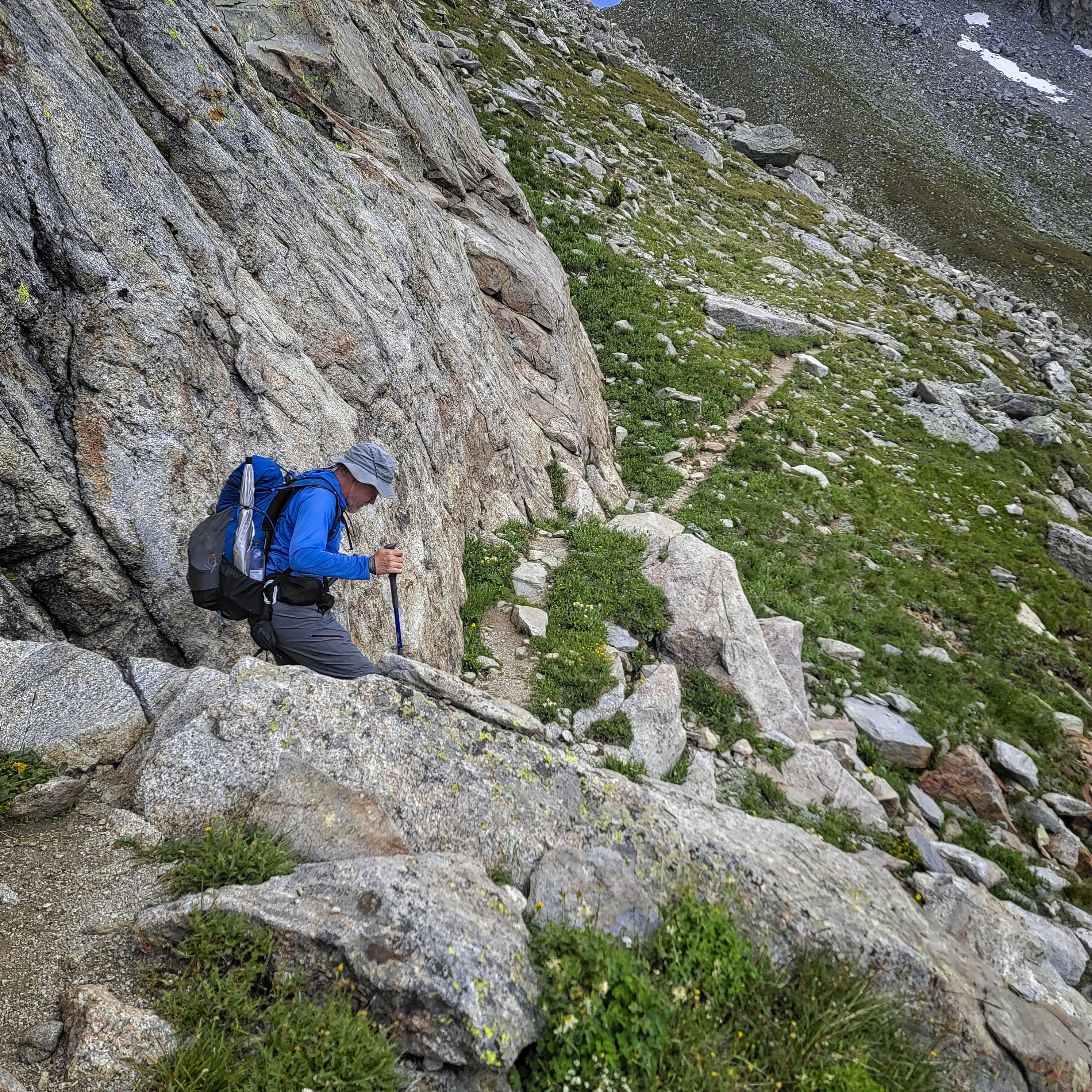
It took some effort to find the way down from the pass, but soon we were traversing down steep sandy slopes into the Little Sandy valley. Here we lost the trail for about two miles, but it didn't matter that much. We knew we were parallelling the trail, perhaps on the opposite side of the creek. We wanted to get down further then camp. We found a flat place and set up camp.
Wow, I was beat solid. Only 13.7 miles, but it felt like 25.
One has to rest at times.
Peaks on the east wall of the Little Sandy.
August 17, Day 138
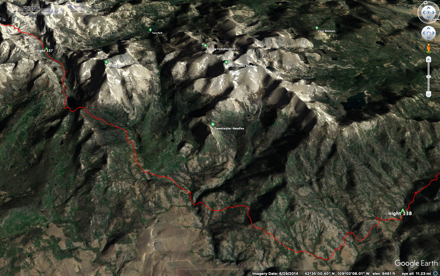
19.6 miles, 2445 feet elevation gain.
This day began in a crabby way. Poor Cory had injured himself the day before, somehow twinging something in his hip. For a few reasons he was up long before me and was waiting for me to get up. I found that hard to take, and stormed off to the bathroom saying something like "well I'd better hurry then!" I had to go in a serious way, then ruined the morning by somehow choosing a place to go where someone else did, and I dug up their waste with my shovel. Oh what a mess.
I came back, irritated further that Cory had continued to wait for me while I was doing my business around the corner. He was sitting there getting cold. "I'll need a long time to be ready!" I said, indicating that I felt pressured and squeezed somehow. Really, he was sitting still because his hip hurt. So we were just completely out of touch with each other on this difficult morning.
BREATHE!
Finally walking, and warmed up, I could relax and escape the hothouse of stress I'd built for myself. Cory told me about his hip and I was humbled for having thought everything is all about me (as usual).
The trail climbs up to a hanging arm to escape the narrow slot that the main watercourse becomes. After the lake up here, we lost the trail and fell into a difficult and occasionally stressful bushwhack. We ended up far away from the official trail, down amid weeds and boulders at the north shore of Little Sandy Lake.
We followed a game path up into steep boulders and cliffs above the lake, going up and down, always trying to go south and reach the lake outlet. Often the climbing required us to use our hands, sometimes we had to backtrack, too, getting cliffed out on occasion.
Cory was patient and just kept nosing forward, while I hated how much energy this was taking. I don't think we ever found the official trail again in this area, we just followed bits and pieces of things, some marked on the map, some not.
After a decent rest at the lake outlet, we climbed up through forest and boulder to get a glimpse back on the lake. What a mess! Comments in the FarOut app indicated we weren't the only ones to find this area difficult.
The rest of the morning and early afternoon were spent climbing to an unnamed pass, then a rapid descent on the other side to low, hot, sagebrush country and a parking lot.
Little Sandy Lake.
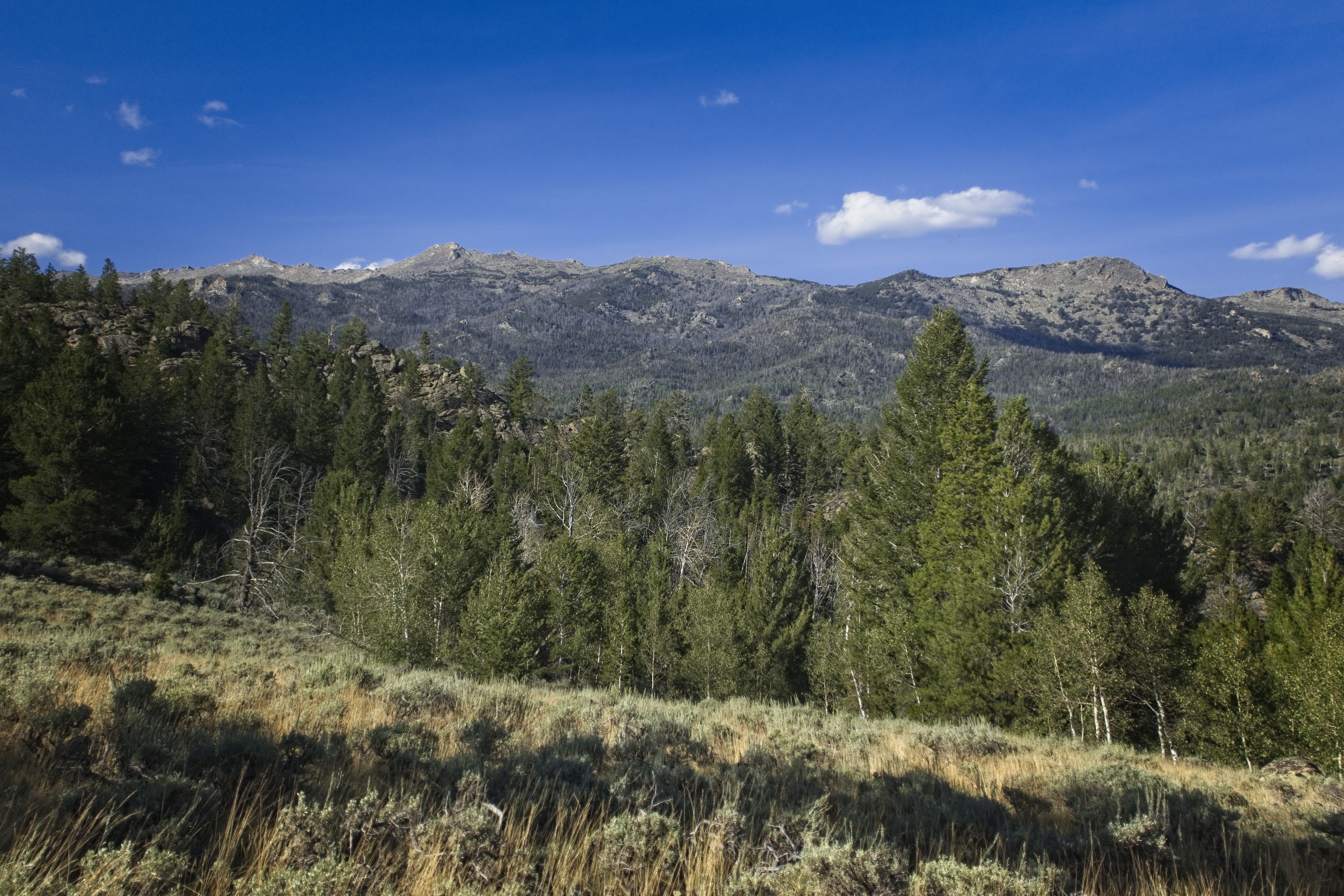
Sagebrush country as the day turns to evening.
We'd been walking separately since the lake outlet, but we both saw the curious sight of 7 men carrying gallon jugs, rather well dressed, walking up the road. At the bottom of the road was a campground and area marked Sweetwater Gap. We rested in the shade of the creek as a couple of northbound CDT hikers came by. We then curved along the Sweetwater River in a narrow canyon before climbing up an eastern slope and turning mostly east for long traverses of hot sagebrush arms marked by chittering grasshoppers bombing across our paths in the sun.
This went on for hours and hours, heading east and southeast. Finally we turned back northeast and the sun relented a bit. We listened to mournful cows in the distance and found a few flat spots by the East Sweetwater River. It started to rain lightly. Another hiker came long from the south, and set up his tent on the other side of the river. Cory worried a bit about dead trees here. Me, I just conked out. It had been a difficult day.
August 18, Day 139
18.5 miles, 2100 feet elevation gain.
At South Pass City we'd pick up our resupply boxes. I could also get rid of my bear spray and bear bag. Fantastic!
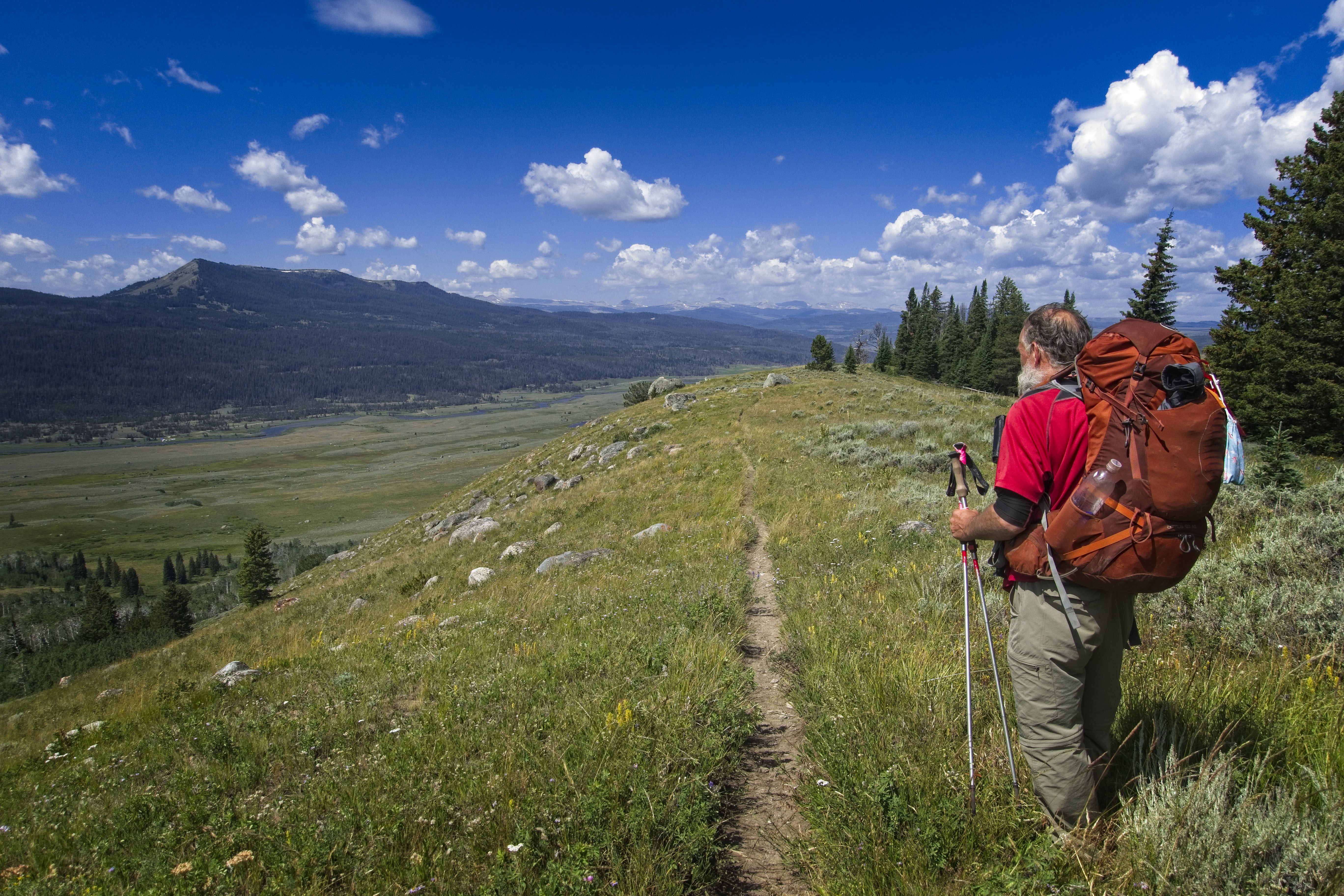
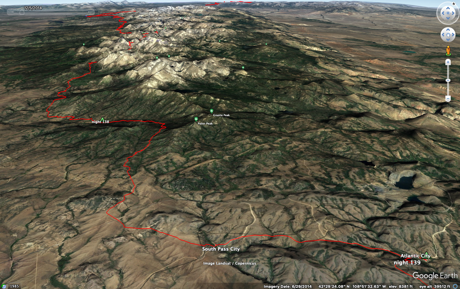
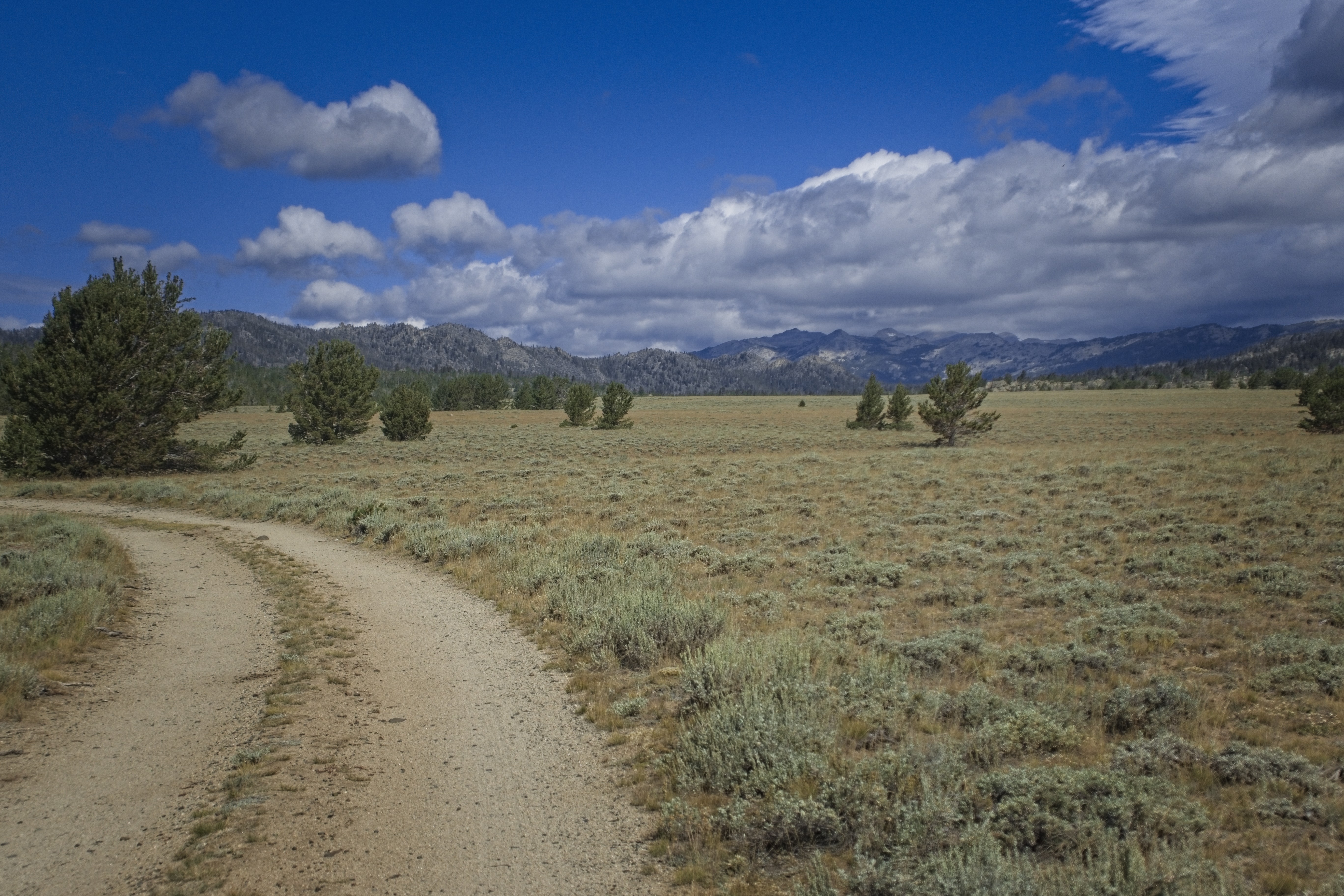
But there was a fair bit of work to do. We climbed slowly for a couple of hours to an indistinct pass in a country of forested hills with the occasional granite outcrop. Another hiker came and passed us like we were standing still. Once over the pass I hoped we could descend, but there was another hour of up and down before we really started going down. Here, the country turned to roads and open grassland. Cory was off ahead and I enjoyed the solitude.
Descending dirt roads to Highway 28.
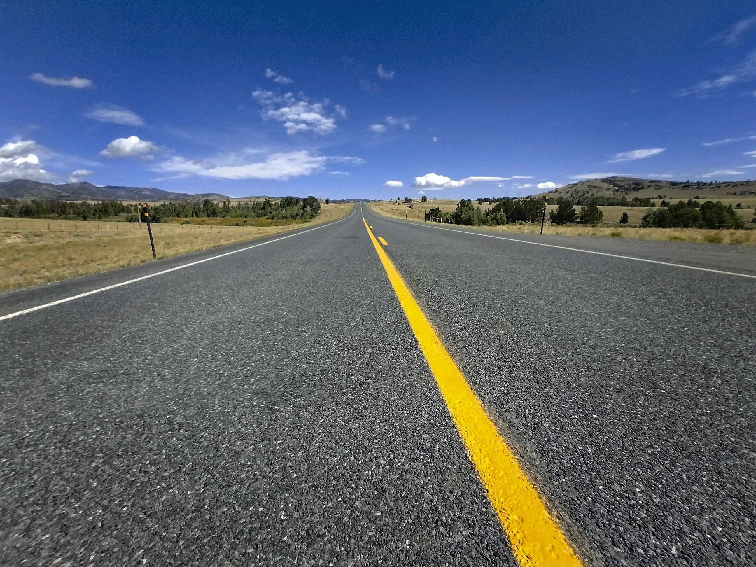
Highway 28: the Winds are finished!
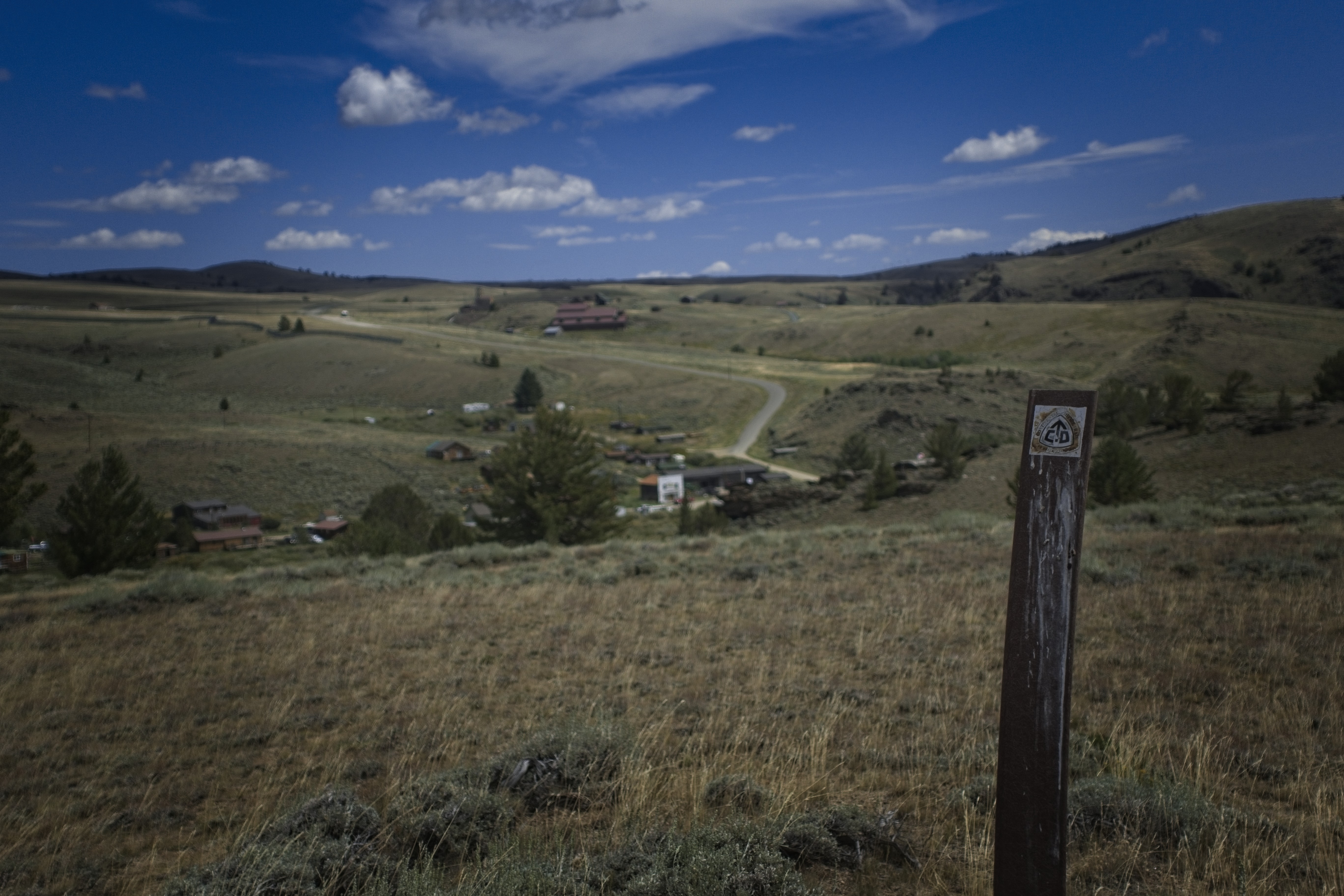
Looking down to South Pass City and our resupply box.
It was quite fun to start getting some perspective on the Winds, and see the great plain of the Basin out beyond and below us. In fact that had dominated the view the day before as well. I came to the highway and crossed it, perking up for the few miles to South Pass City. What would that place be like?
Well, it was nice enough. A little souvenir shop which sold candy and soft drinks. Cory and I took turns going in and buying each other another type we hadn't tried yet, while we wrestled with our resupply boxes.
Our plan was to camp here for the night, but it was quite hot and uninteresting here. We realized that we could walk to Atlantic City, get a hot meal, and get a leg up on the hiking for the next day. Awesome!
So we set out on the road to Atlantic City. Just as we left Swede and Whitney appeared. They'd had a break in Lander. In fact, many people went to Lander. I didn't want to go there because I thought the hitch would be difficult.
Cory and I walked companionably to the 'City. Once there, we went into the Miner's Grubstake restaurant. What a treat this place was. Burgers and beer, and lots of funny comments from the owner who affected a kind of Mae West personality. We walked over to the campground afterwards and for a few bucks got a laundry, a shower, wifi and power charging in addition to a place to put our tents.
Wind and rain in the evening.
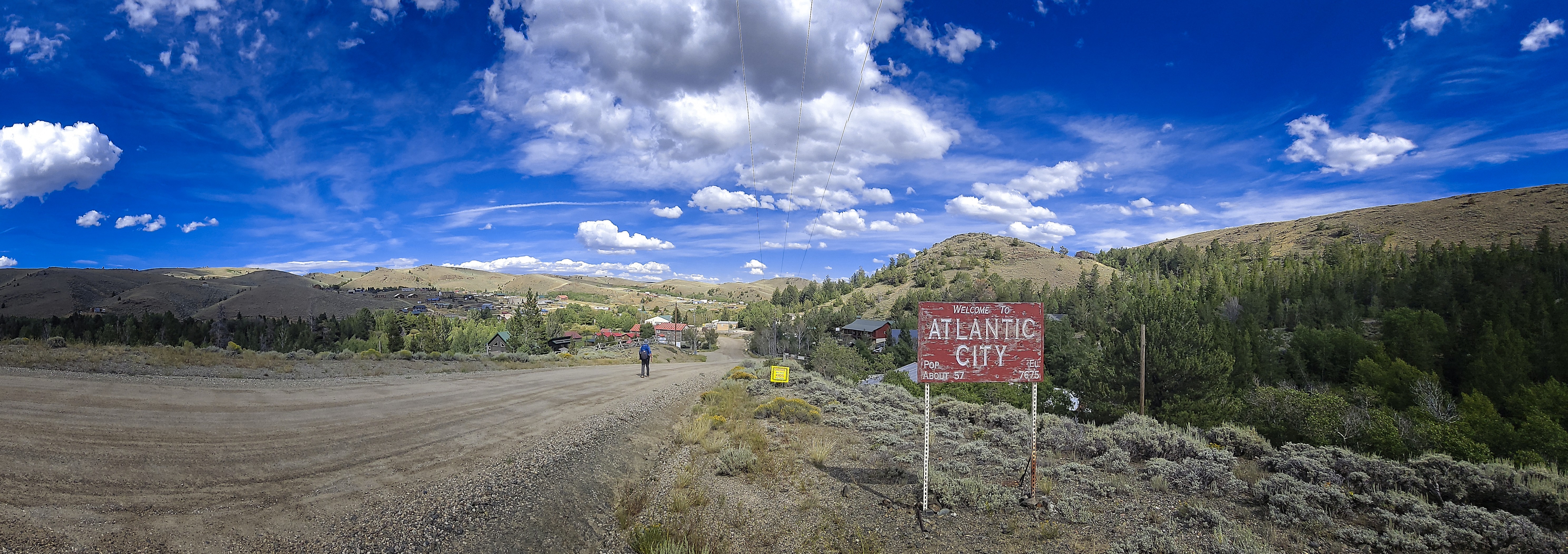
Coming into Atlantic City for the night.
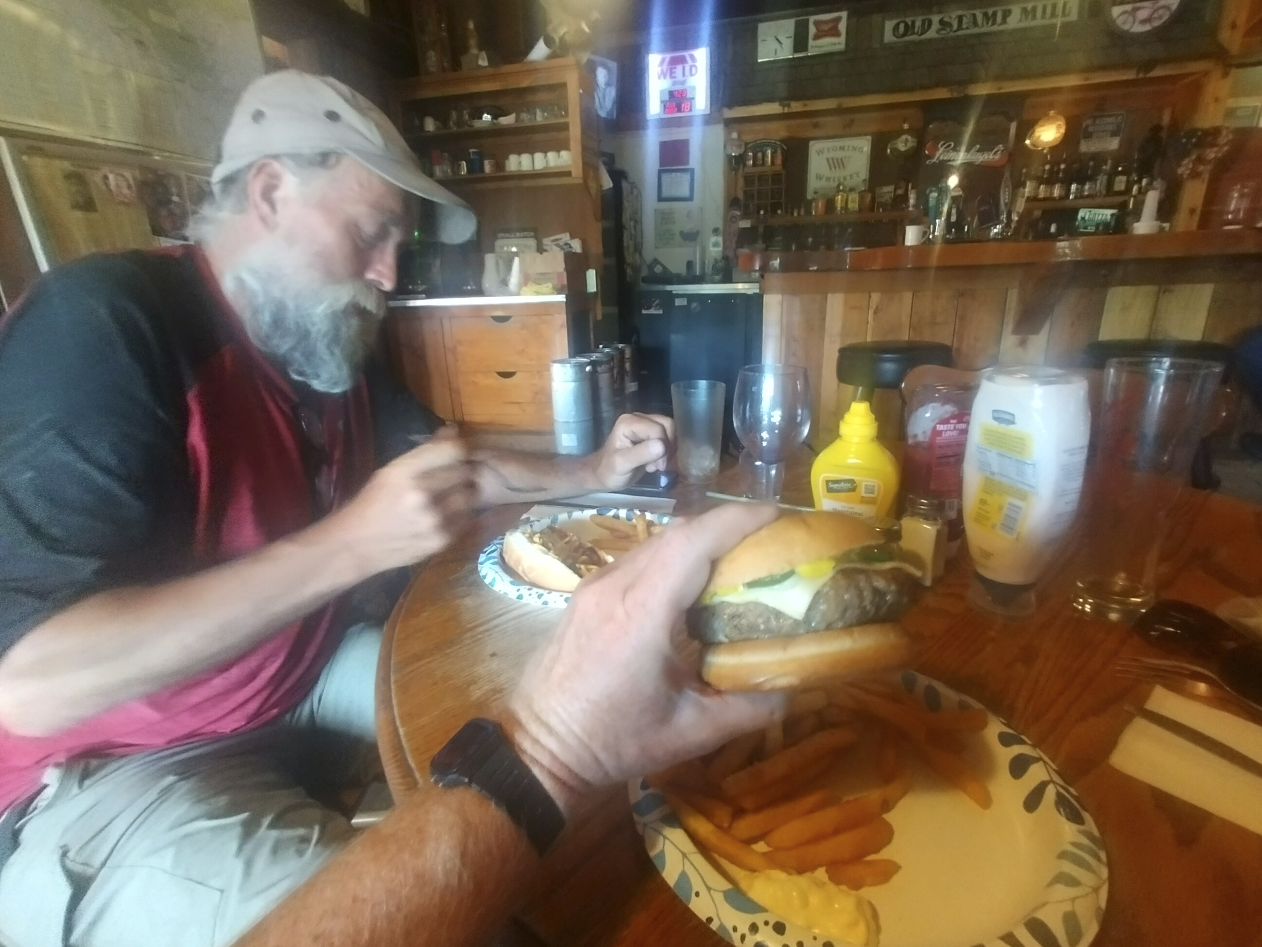
A fantastic dinner with a lot of personality on the side.
To go forward to days 140 and after, click here.