Thoughts on Wendelstein Country
I first thought I should write on Summitpost, but turns out my thoughts are way too subjective. So instead I'll speak of impressions. You can read maps and find trails, so I'll often be vague about that. I do suggest you use Open Street Map and not ordinary hiking maps. This way you truly find everything (well, not quite, but close). Be wary though, and use your mountain experience! I have followed a trail only later to figure out that it's actually a klettersteig or "via ferrata." Unmarked trails can be steep and dangerous, with slippery footing above cliffs.
I'll just keep updating this page as I learn more about the area.
Wendelstein from the east
I parked at the Stausee, just above the charming one-lane tunnel on the Tatzelwurmstrasse above Brannenburg. A trail leads up on winding, abandoned forest road on the east slope of the Schortenkopf, then meets a larger road before becoming trail again with the name "Steinerne Steig" (Stony way). Here a short but charming corridor of boulders is ascended in steps on a trail buried in leaves. At a narrow pass, a slight descent on road past a rather cute little quarry to views up and down valley north and south at the Unter and Obere Arzmoos. A "Moos" is a kind of meadow.
Wildbarren
Wildbarren forms the right side of a gate into Austria from Germany, with the Kranzhorn on the other side of the Inn as the left. These are the first peaks from the German perspective that offer a healthy 1000+ meters elevation gain for a hike to their summits, and thusly are of interest to the avid hiker or mountaineer looking to stay in training. The peak is forested to it's summit, though a few impressive cliffs and viewpoints abound. Ascent can be made officially from the West and Southeast Ridges, with an unnamed hunters trail providing a steep yet asthetic ascent along the northeast ridge.
The Bichlersee, which feels more remote than it actually is, offers bathing possibilities in high summer on the southwest side of the mountain. The Berggasthof Bichlersee offers rest for the weary hiker near the lake, with the Berggasthof Hohe Asten providing the same after a somewhat ambitious romp up and down forested hills to the north.
A parking lot with room for 7-8 cars exists just under 3 kilometers south from Flintsbach am Inn, providing access to the road loping around the north side of the peak past the remains of the Kirnstein Castle. A little ways further (~0.5 km) is another much smaller parking area providing access to the hunters trail going boldly up the east slope. It appears you could park in the hamlet Niederaudorf and follow a road and trail west for an ascent of the Southeast Ridge of the peak.
From the very small parking area, Barbara and I followed the hunters trail up, first on abandoned road strewn with leaves, and then to an apparent impass at a stony cleft draped by two enormous fallen logs. Mistakenly thinking the trail continues on the left, I led Barbara and our little dog up slippery leaf-covered slopes, moving from tree to tree as anchor points. The dog found water at a relenting of the angle, and we used her instincts to recover a kind of trail up a stony creek, completely buried in leaves, finally regaining the hunters path. It traversed off to the north, then started up again now with a dramatic cliff on the right and bold cliffs above. Somewhat improbably, the trail threaded it's way above these latter cliffs in a way that would be dangerous for an inexperienced mountain person.
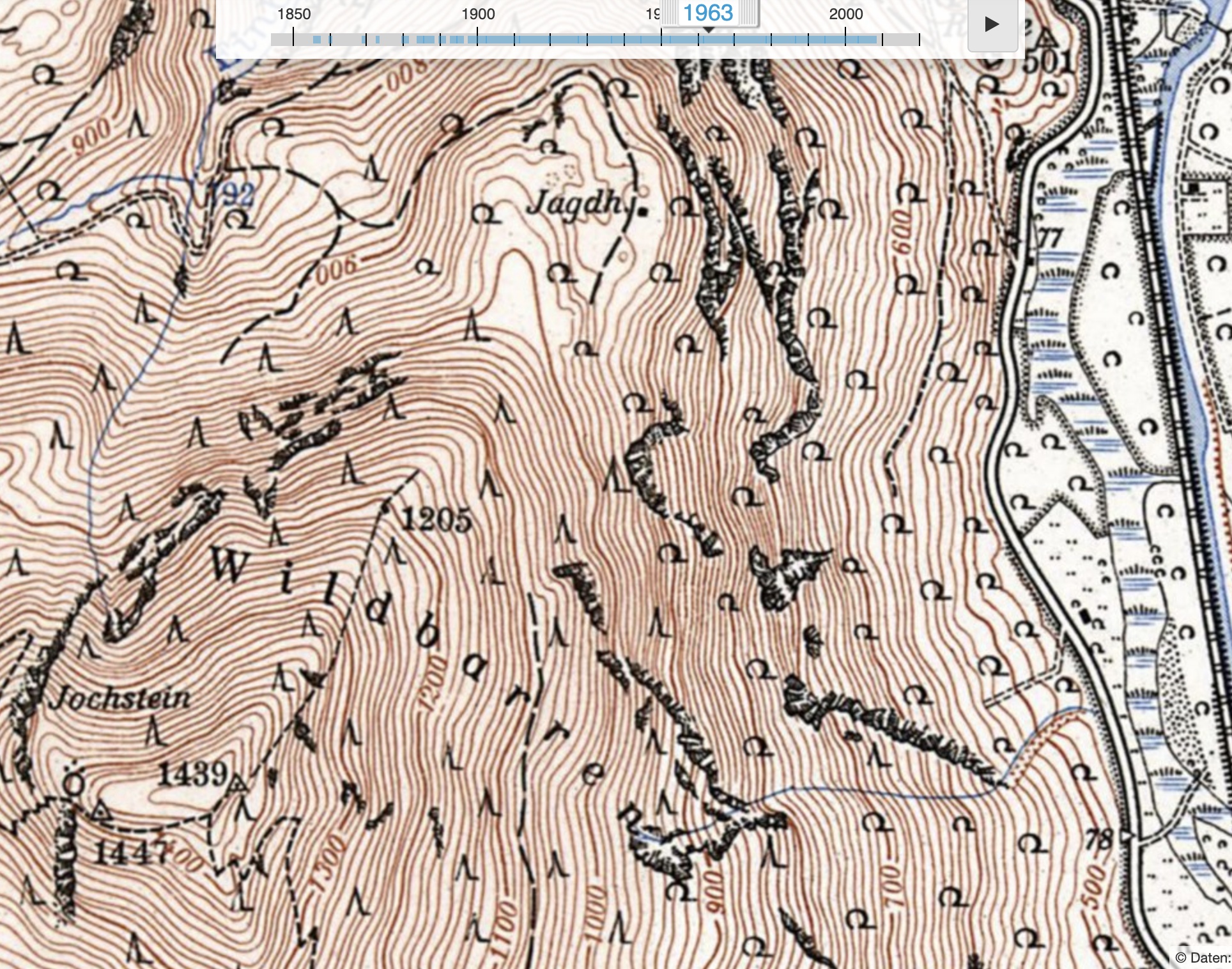
Here is a close up from a map of the Wildbarren in the 1960s. Note there
is no trail marked for the one I'm describing in the text.
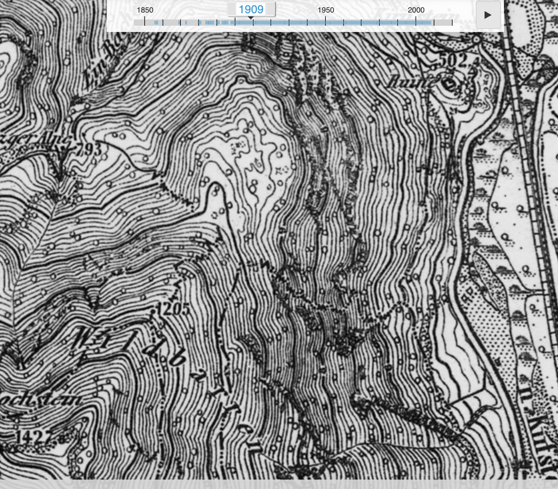
But here in this much older map (1907) the trail can be discerned. My
theory here is that there were more trails before the automobile and
the television. Mountains were more of a focus of attention for many
reasons.
It's little known, but such trails can be deadly -- my climbing experience causes the hair on the back of my neck to stand up when I'm in a position from which a slip would lead to disaster. On this trail, there were several such moments, each minutes-long. The deep carpet of dry leaves didn't help with the footing underfoot. I'm wondering how much actual hunting is going on these days. If I look at the number of people who spend many hours in front of a computer screen, I can't help but imagine that this trend has cut into the person-hours spent in the woods by that special tribe of humans -- the hunters that remain, despite the aghast glances of our wider society. In fact, I've rarely seen them in Germany. There was one, an aristocrat of the woods who really looked down his nose at me for the poor quality of my footwear in his estimation. He was impressive, intelligent and judgmental, all qualities perhaps learned from the wolf. But that was a decade ago, and I've seen none such since.
This trail finally gains the north ridge of the mountain, connecting with a forgotten road. From here, the ascent is increasingly magnificent -- forested still, but on a bold and narrow ridge. The tread is invisible from only meters above, the way is so faint, and yet, it is there.
Just below the summit there is a collection of orange crates sitting improbably on the ridge, nestled in the crook of a dead tree. Strange?

Just below the summit on the North Ridge.
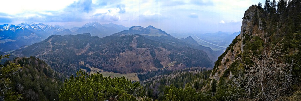
A view looking northwest to the Hohe Asten area, Wendelstein behind.