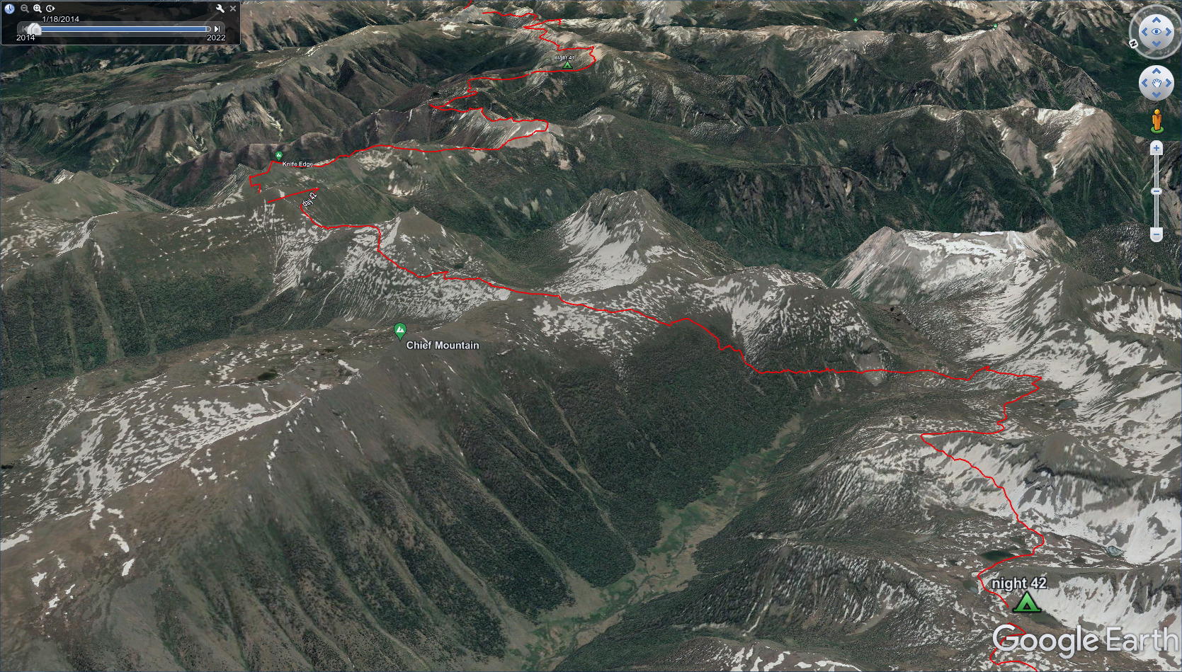
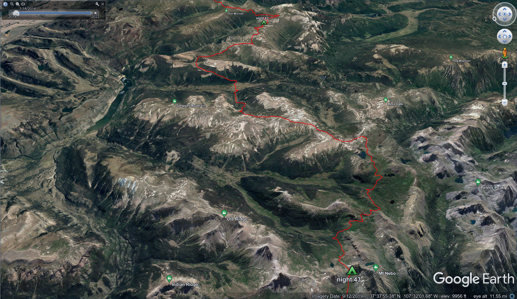
CDT - Pagosa Springs to Silverton
Friends: Shotgun, Critter, Mishap, Gargoyle, DivaLocation: Wolf Creek Pass, Archuleta Lake, Sawtooth Trail Junction, Ivy Creek Trail Junction, Williams Lake, Squaw Pass, Day 42 Camp, North Fork Pinos River Ford, Los Pinos River Ford, The Window, CDT San Juans Twin Lakes, West Ute Lake, Lake Below Nebo Peak, Hunchback Trailhead, Cunningham Gulch Trail Junction, Cunningham Gulch Trailhead, Silverton
Elevation gain: 6027m = 810m + 1287m + 1361m + 1866m + 703m
To go back to days 39 and before, click here.
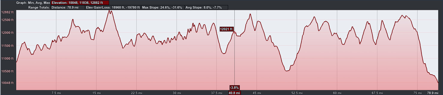
78.9 miles, 18968 feet elevation gain.
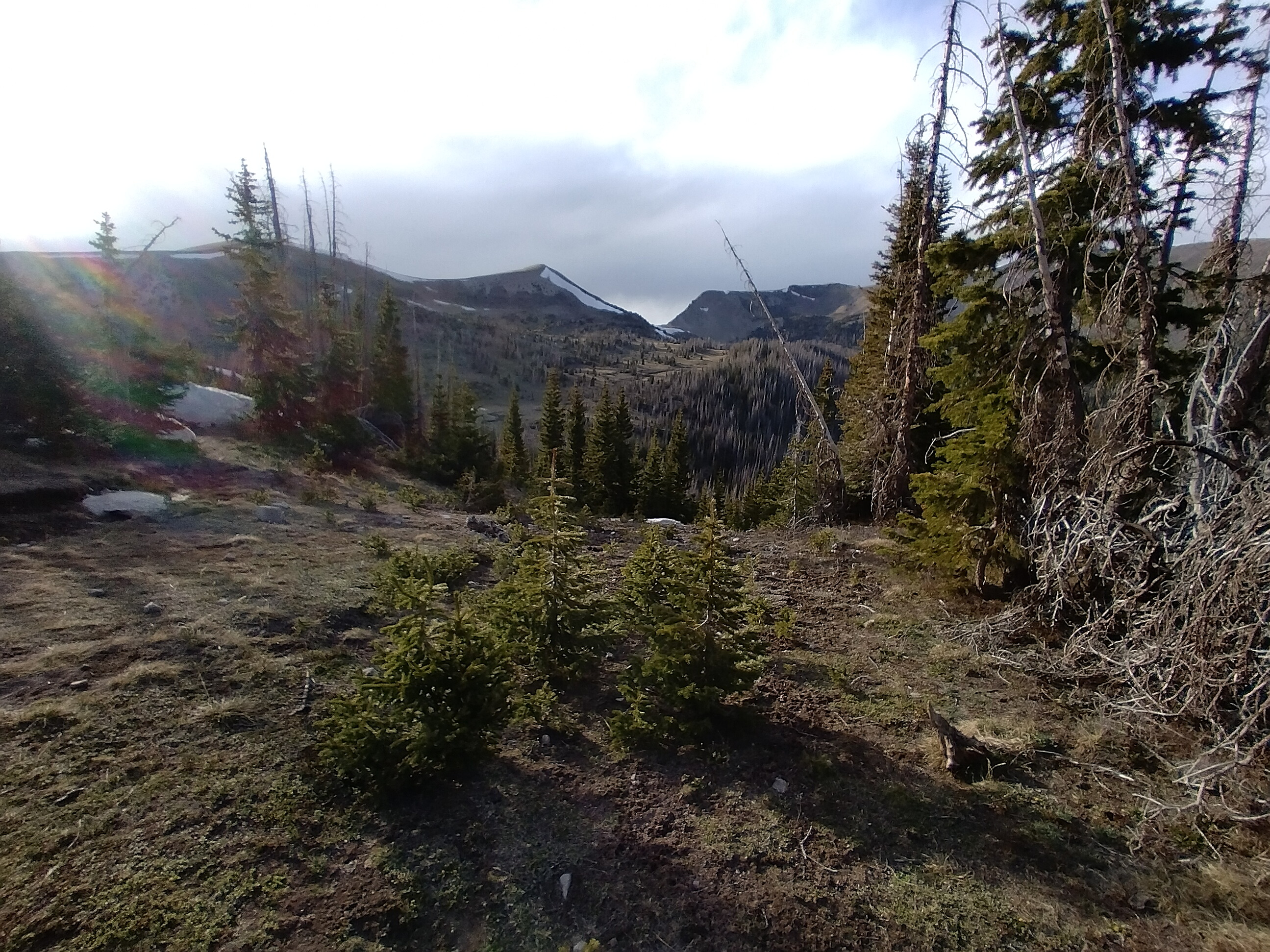
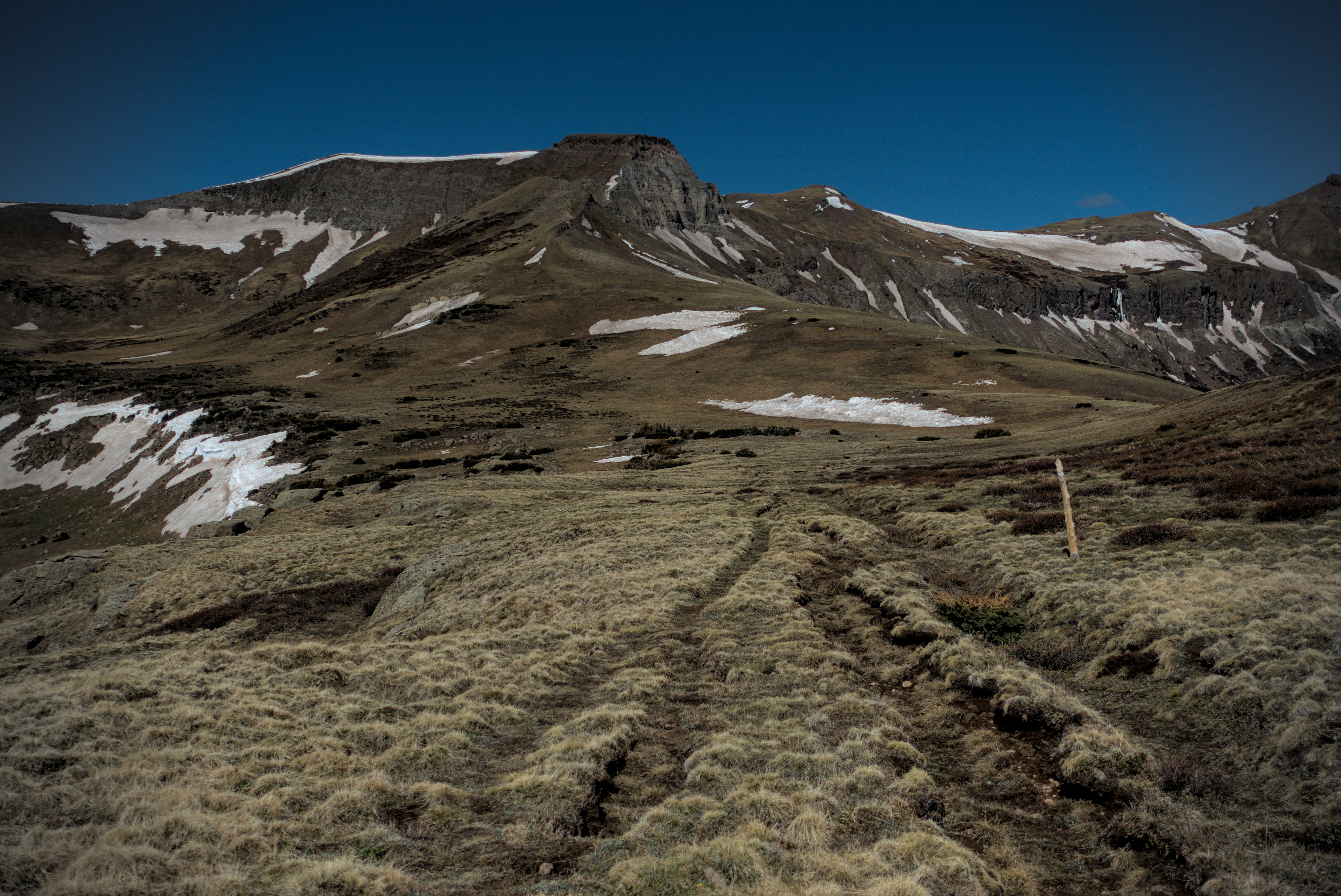
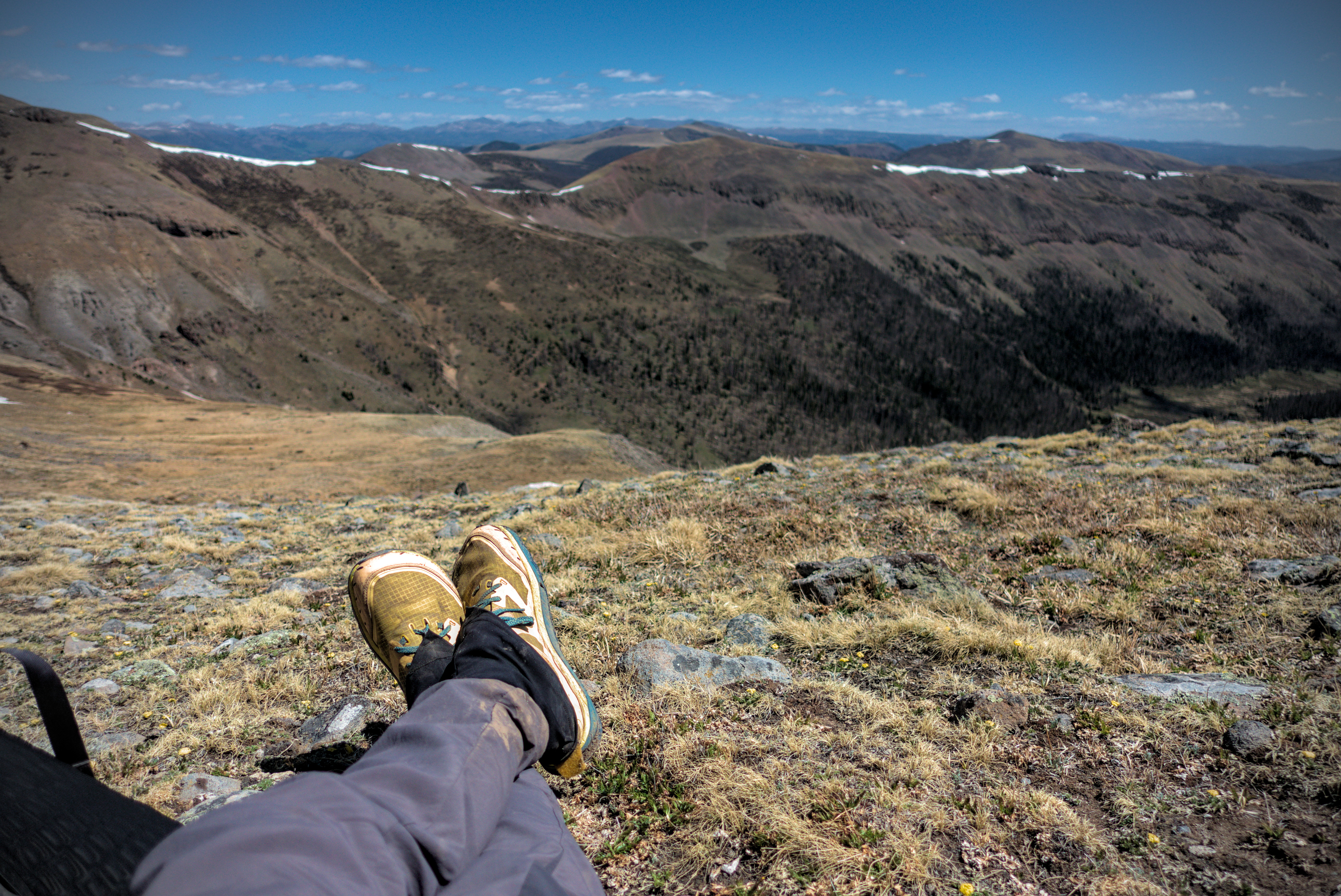
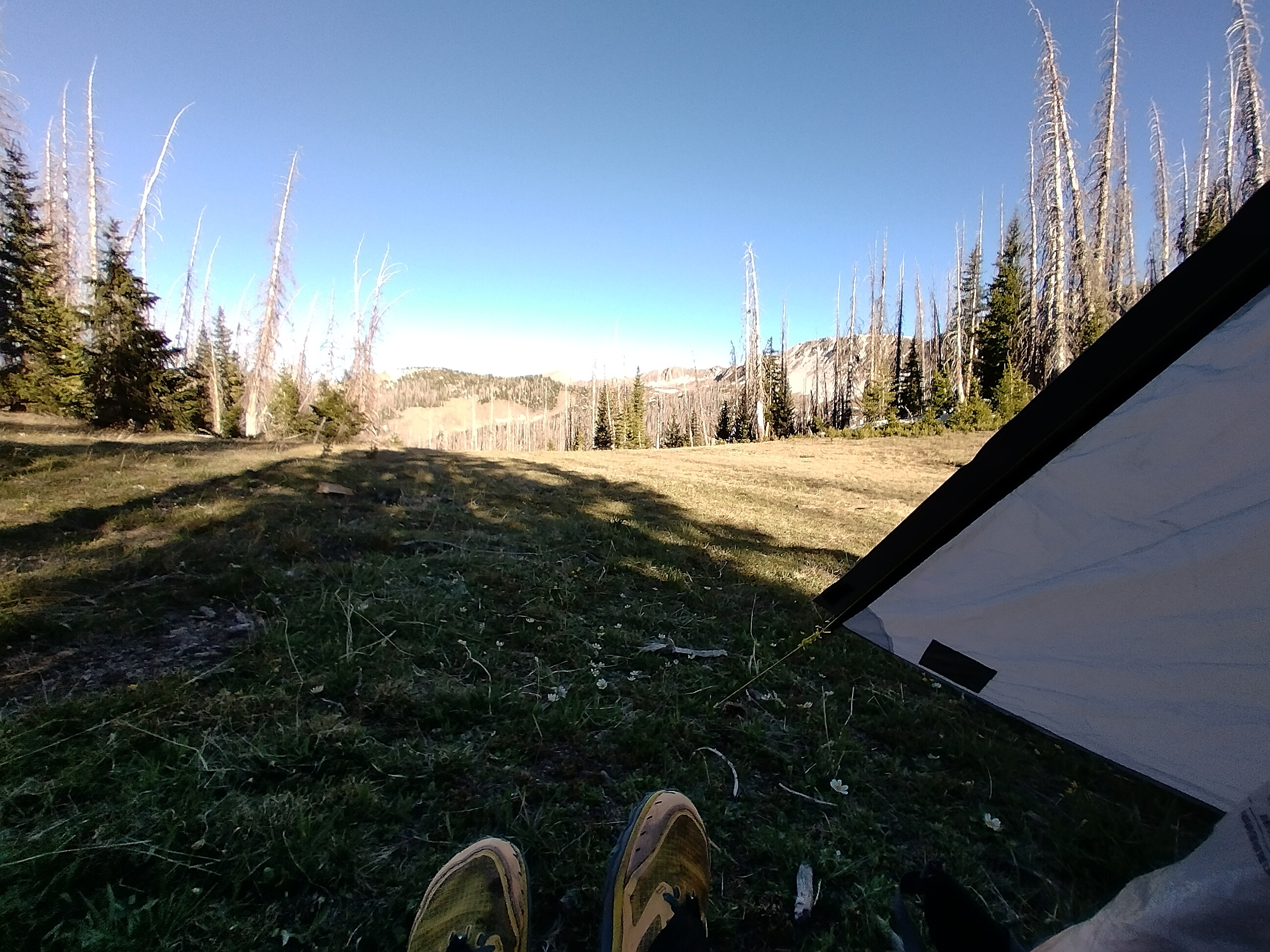
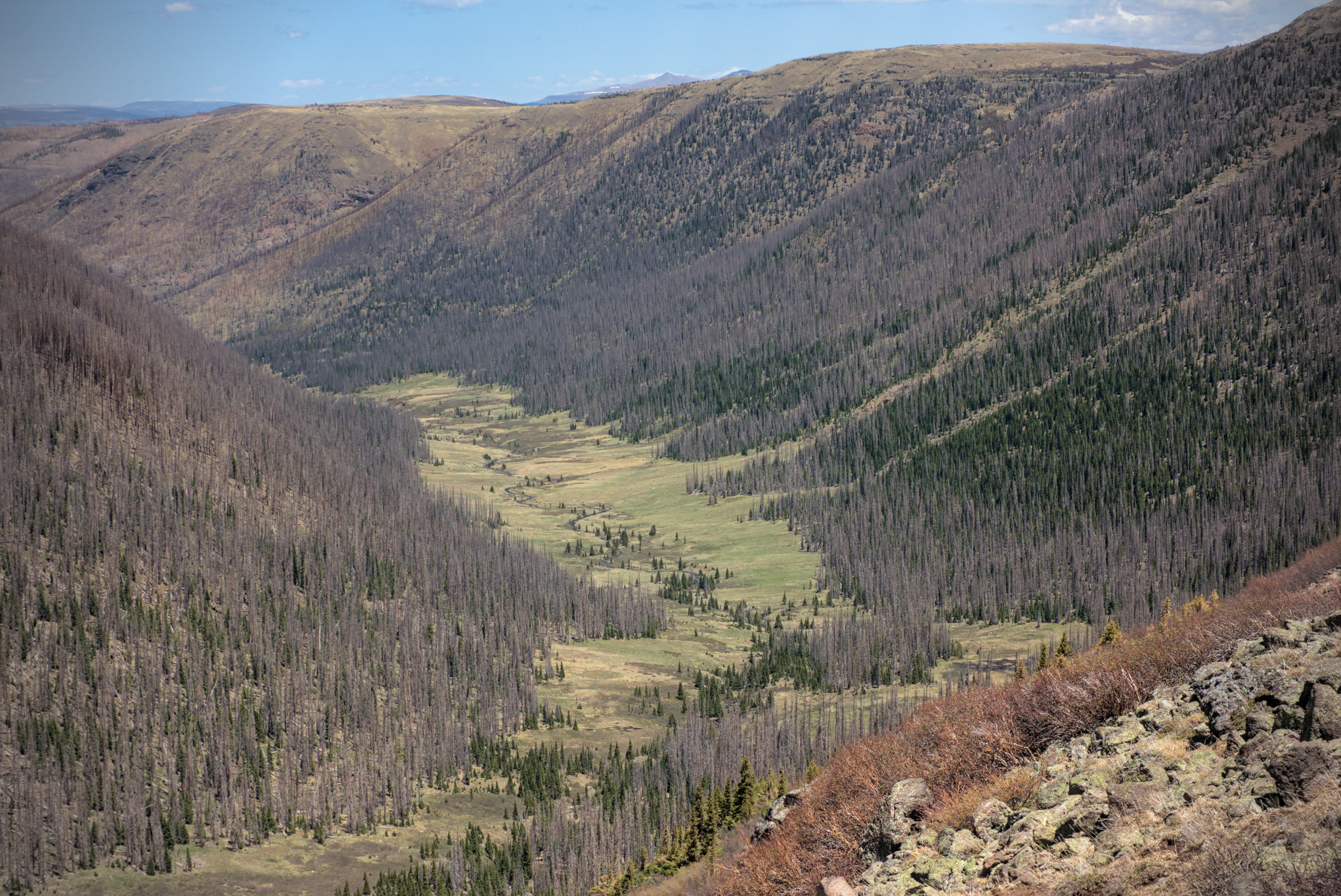
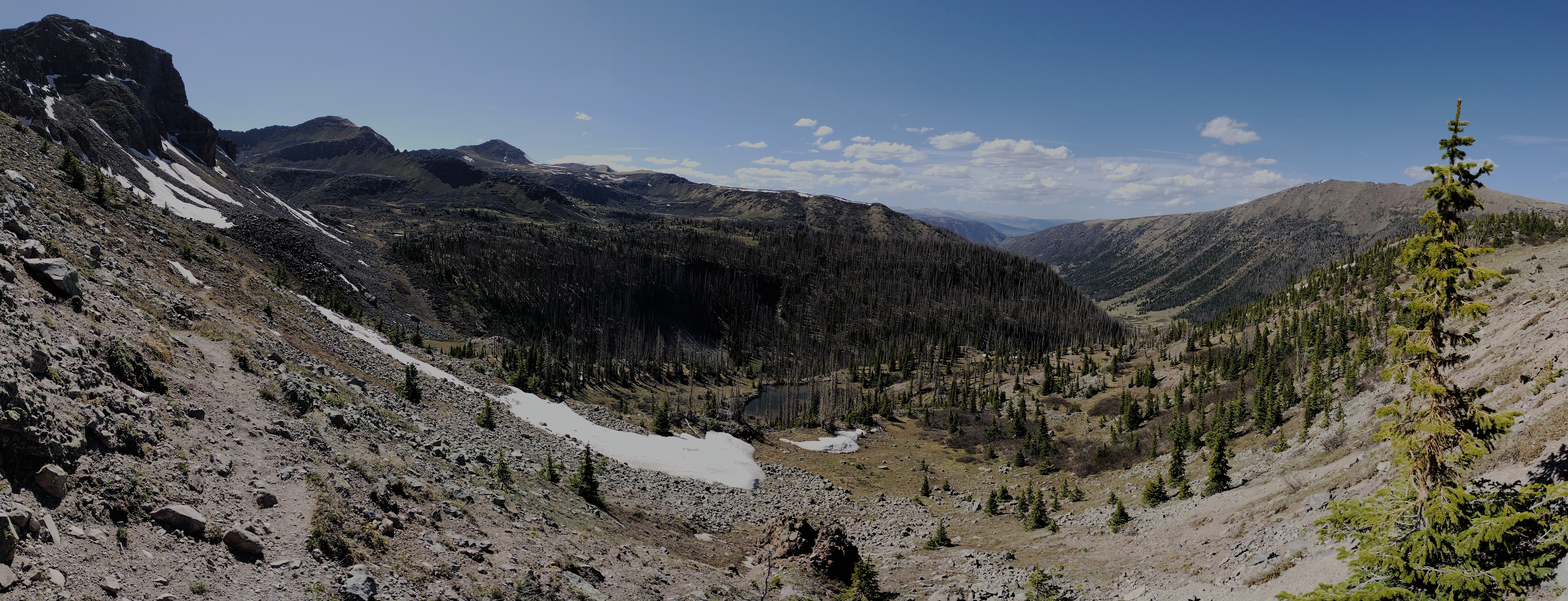
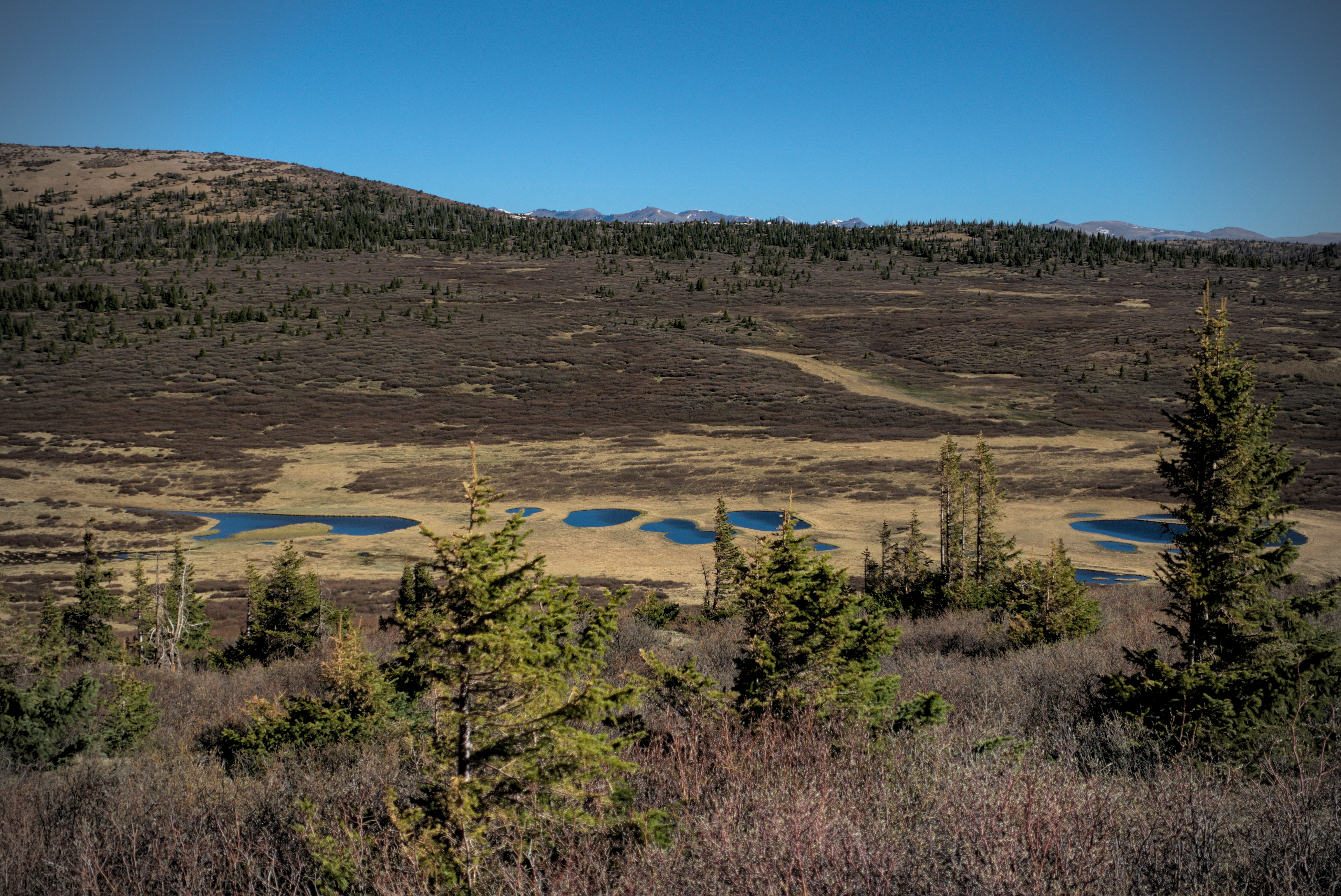
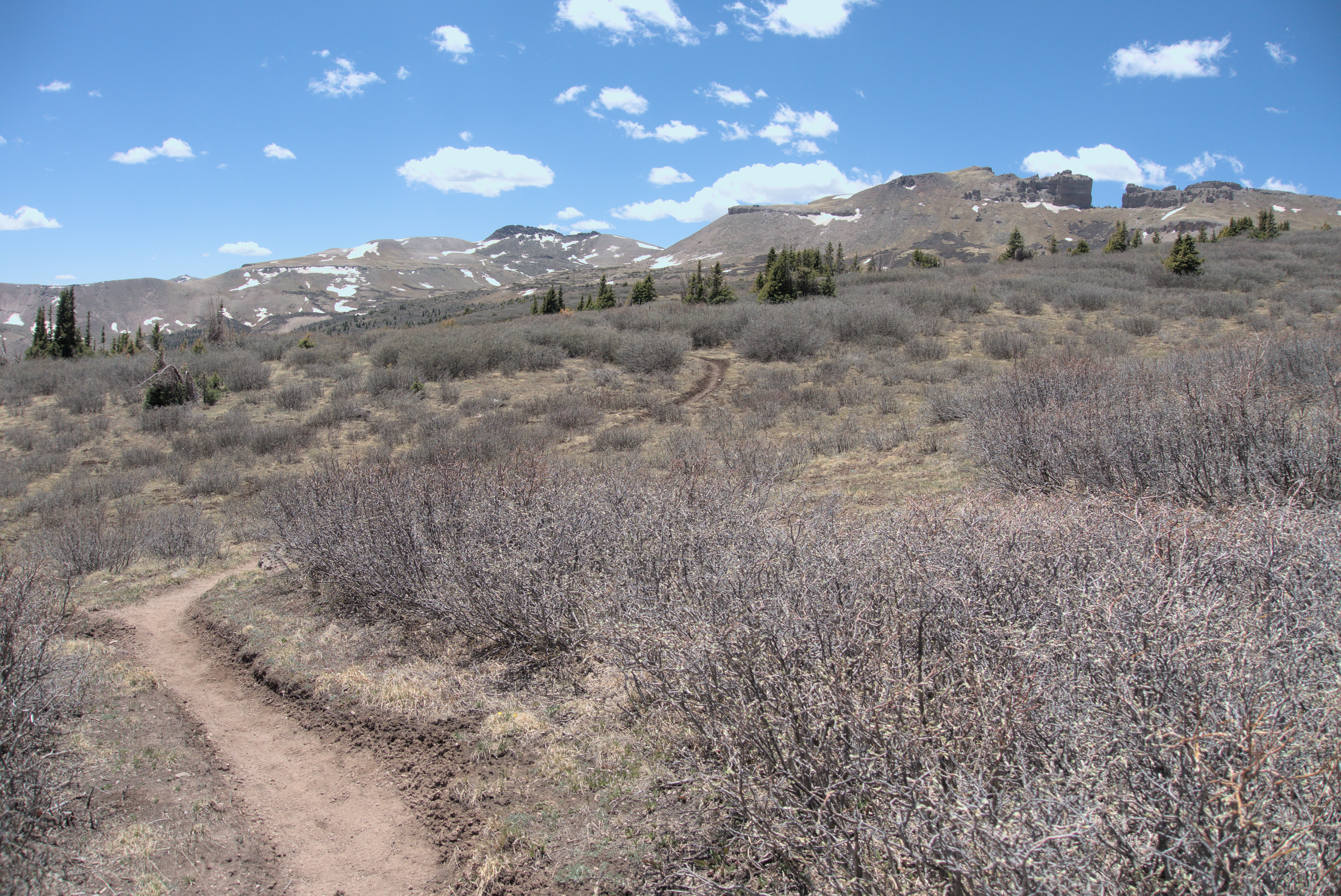
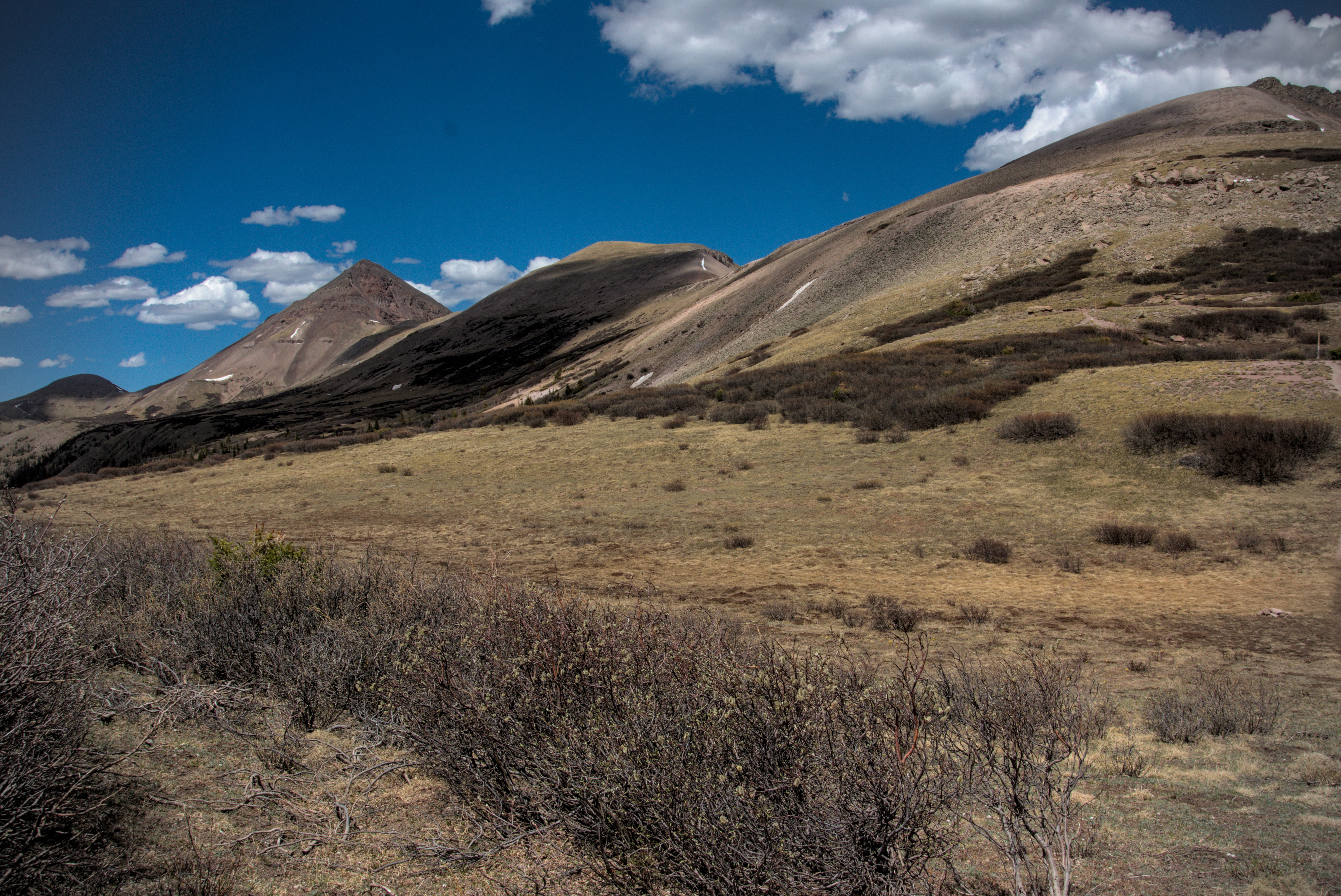
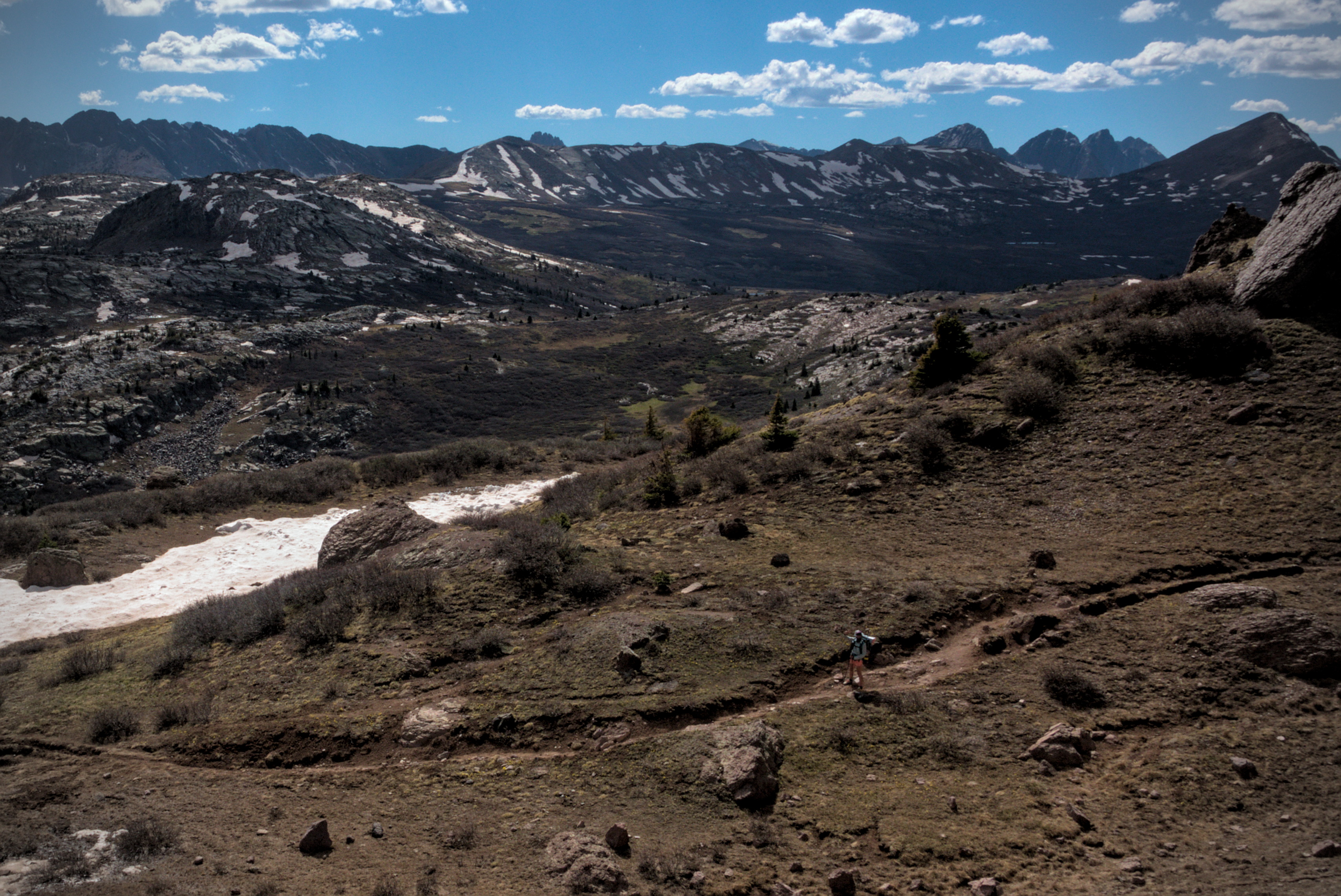
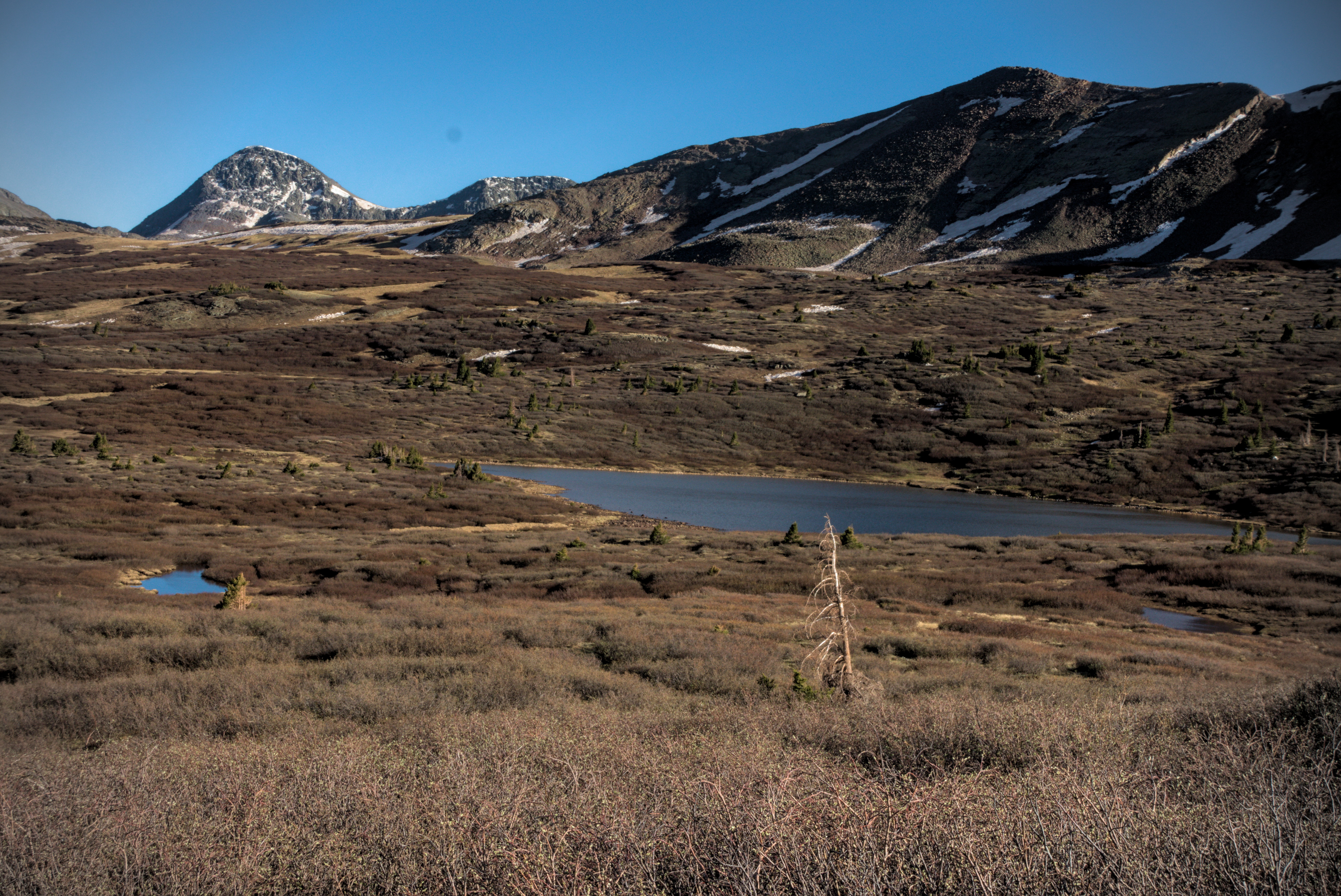
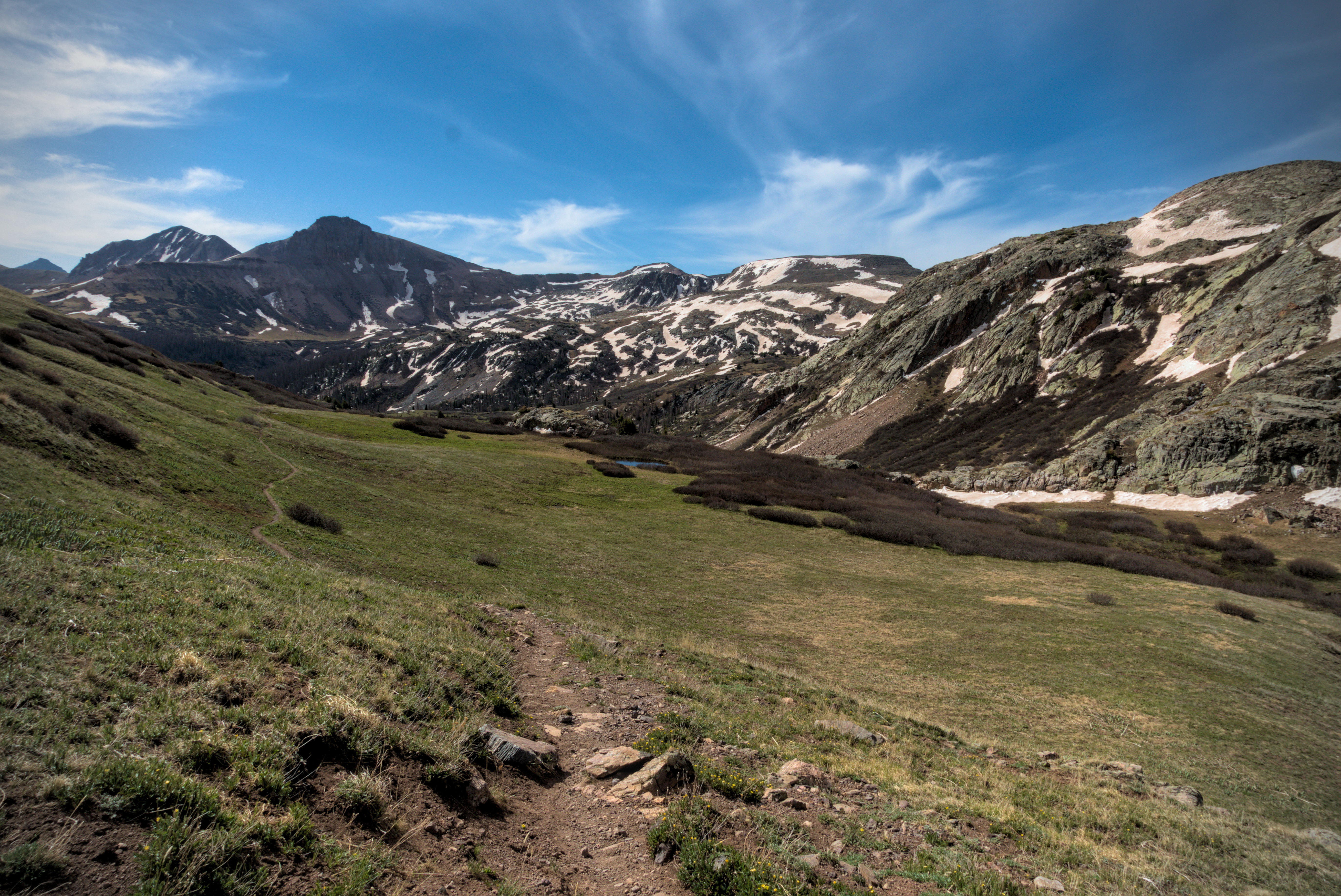
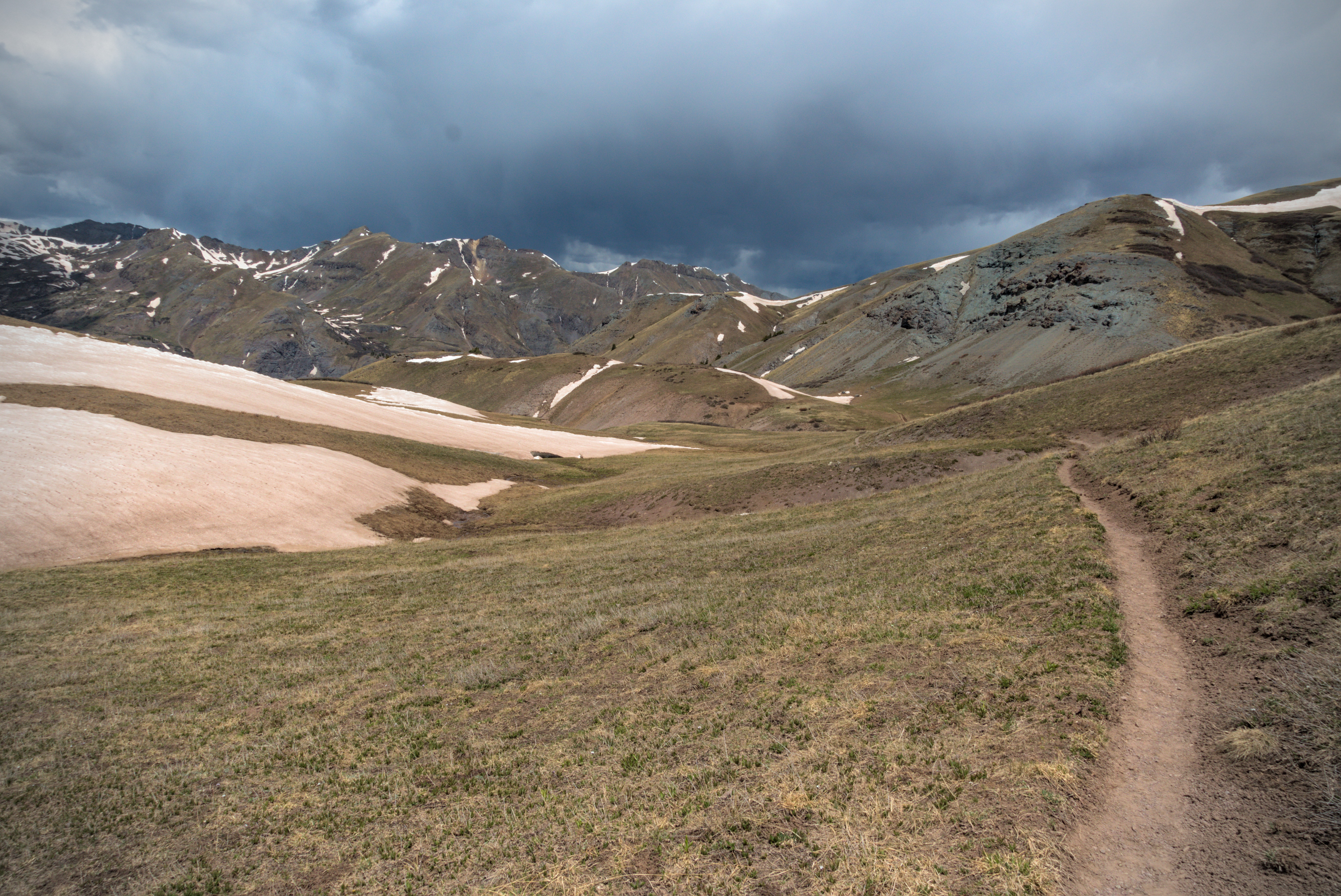
May 30th, day 40, 9 miles
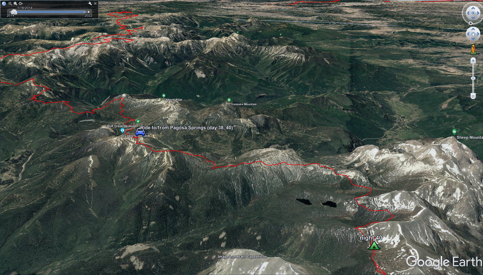
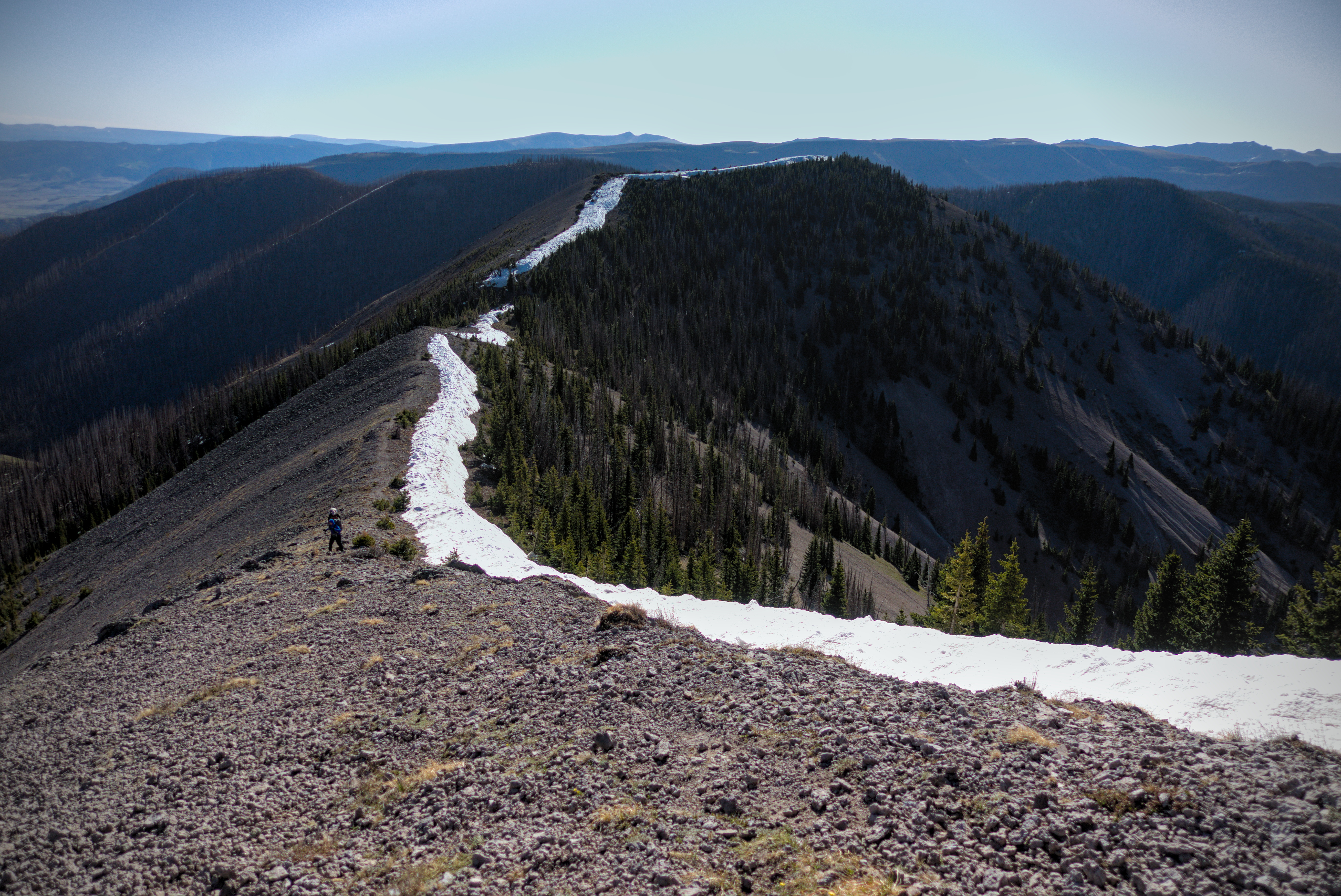
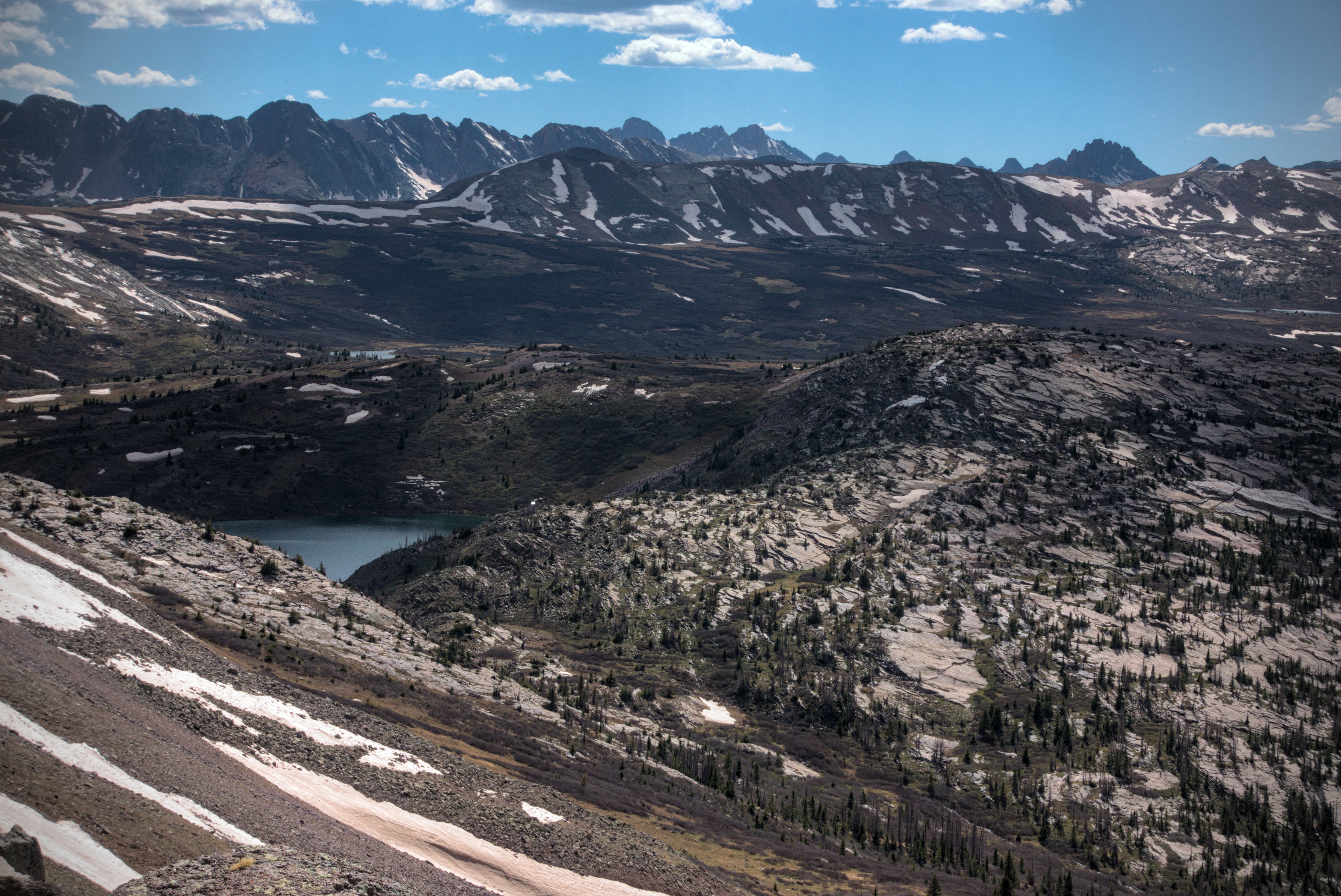
With the adventure of the southern San Juans behind me, today you see
the 9-mile stretch from Wolf Creek Pass to my camp on night 40.
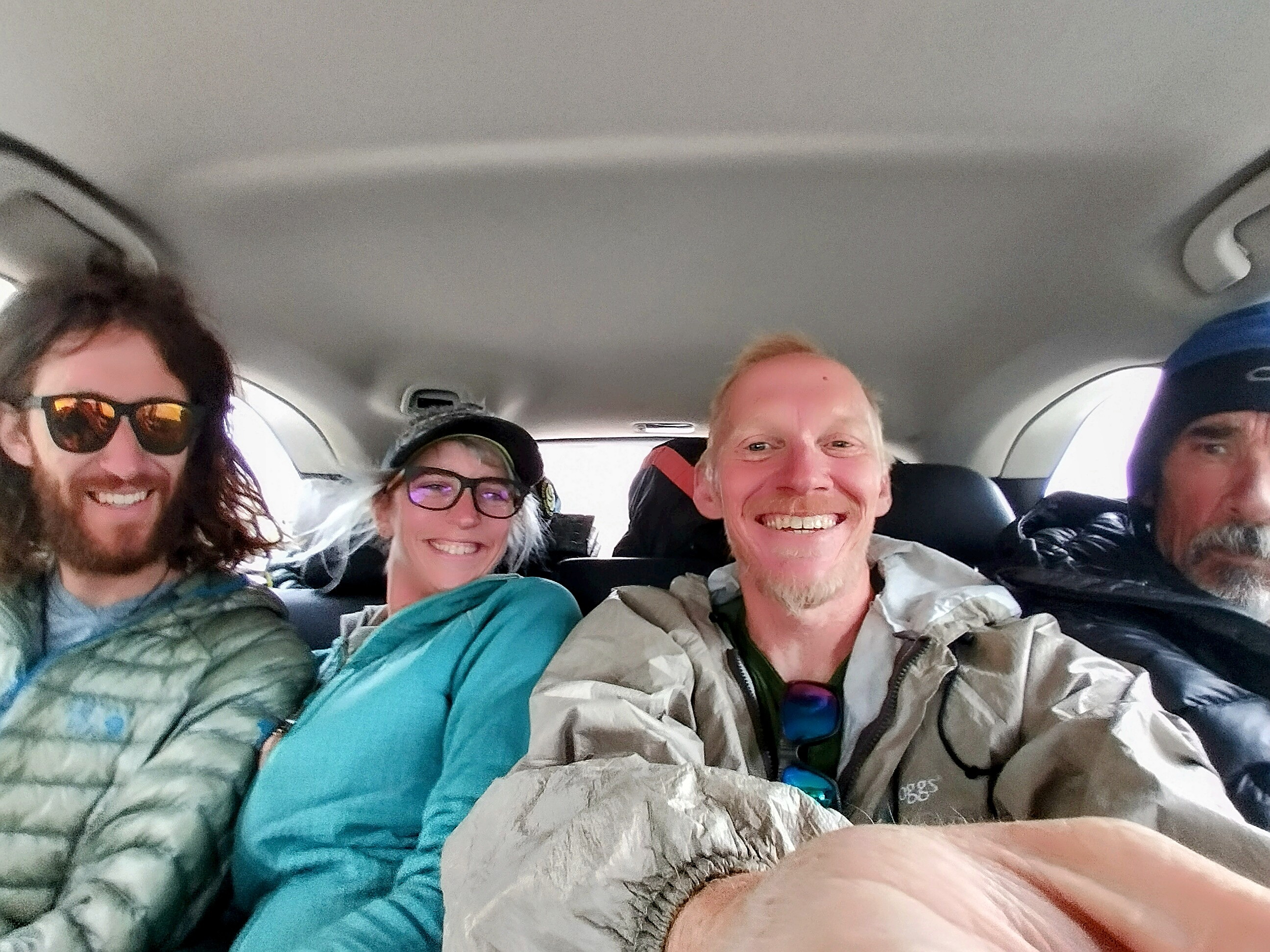
Gargoyle, Mishap, me and Flaka in Soul Trains car enjoying our ride to
Wolf Creek Pass.
Soul Train decided to make an afternoon hike with us from Wolf Creek Pass. She was really fast, and somehow I was too. We walked a while, talking about things. I was struck by the quality of peacefulness in the relationship between her and Smiley. Later, Gargoyle came up and we talked about an interesting movie which mixes dream and reality in interesting ways. Mishap spoke along these lines as well. I love wide-ranging conversations like that...I think I can probably get rather exhausting with my desire to talk like that all the time!
Anyway, we hiked up in occasional switchbacks on the south side of an east/west trending ridge. Soul Train said this area was great for backcountry skiing in the winter because it holds a lot of snow. We entered the Weminuche Wilderness, which would be home for several days.
Somewhere in here I went on ahead, enjoying the quiet country. I was hoping that a fair bit of snow had melted in the days away from the high country, and just as I was imagining that to be so, the trail started to trend on the north sides of ridges, and whelp...there was still lots of snow! I stomped through knee-deep snow in the trees, up and over logs, sometimes losing the trail amid confused tracks. The sun disappeared and it got cold and blustery. I remember my feet becoming quite cold in this area.
Squaw Lake Number 2 with the tedious snow traverses behind it. Note
all the dead trees!
Diva came along and we spoke for a couple minutes. It was here that I learned his usual pattern of travelling ahead of his group, then leaving them some sign to indicate where he'd found an ideal campsite. Good guy to have along, I reckon!
I wanted to reach a point where the trail turned north, at least, even though I knew the overall trend would be westward for days. You always want to feel like you're getting a bit closer to Canada!

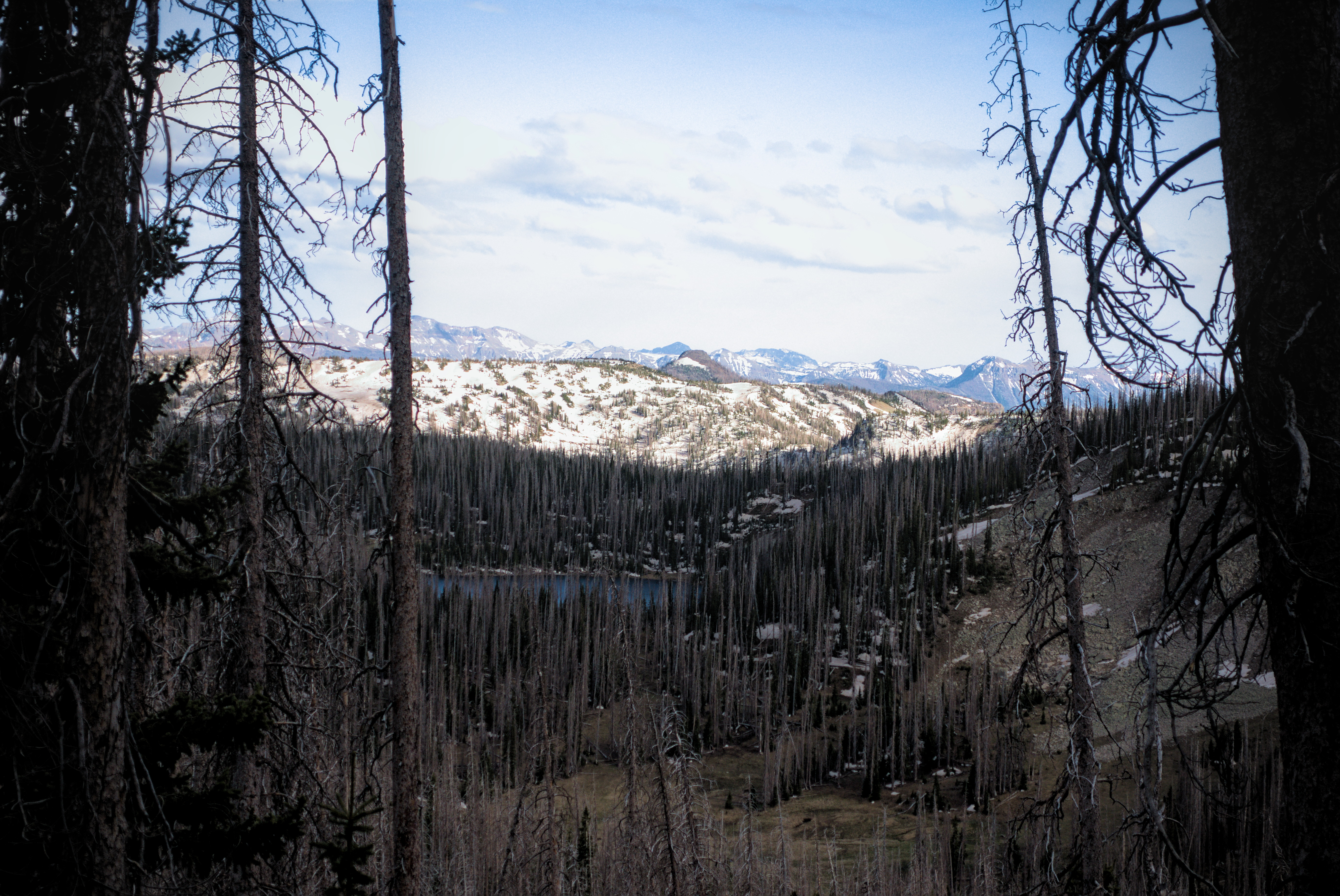
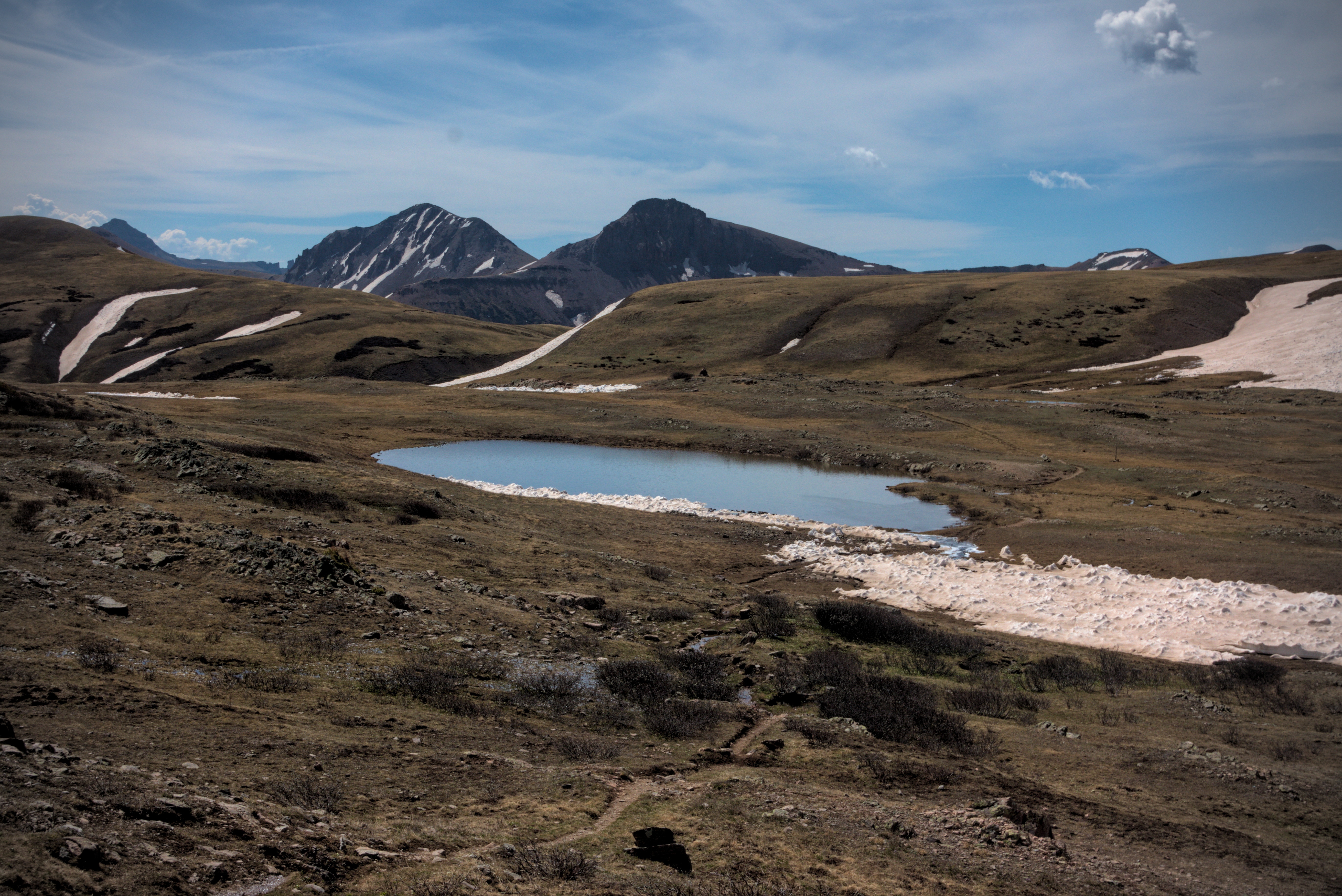
A lake near camp with no name.
I reached Spotted Lake in the second of three basins on the east side of the divide that I needed to traverse. A few tents were set up, using low trees as a windbreak. It was quite cold, and I'd done almost 10 miles, so I declared it was good enough for a "half days work." With 5 or 6 days of food in my pack and all the snow traversing, I was plenty tired.
In the night, an elk bugled right outside my tent -- pretty loud ol' fella! I looked forward to getting up early and warming up in the sun. It was night 40 of the trip.
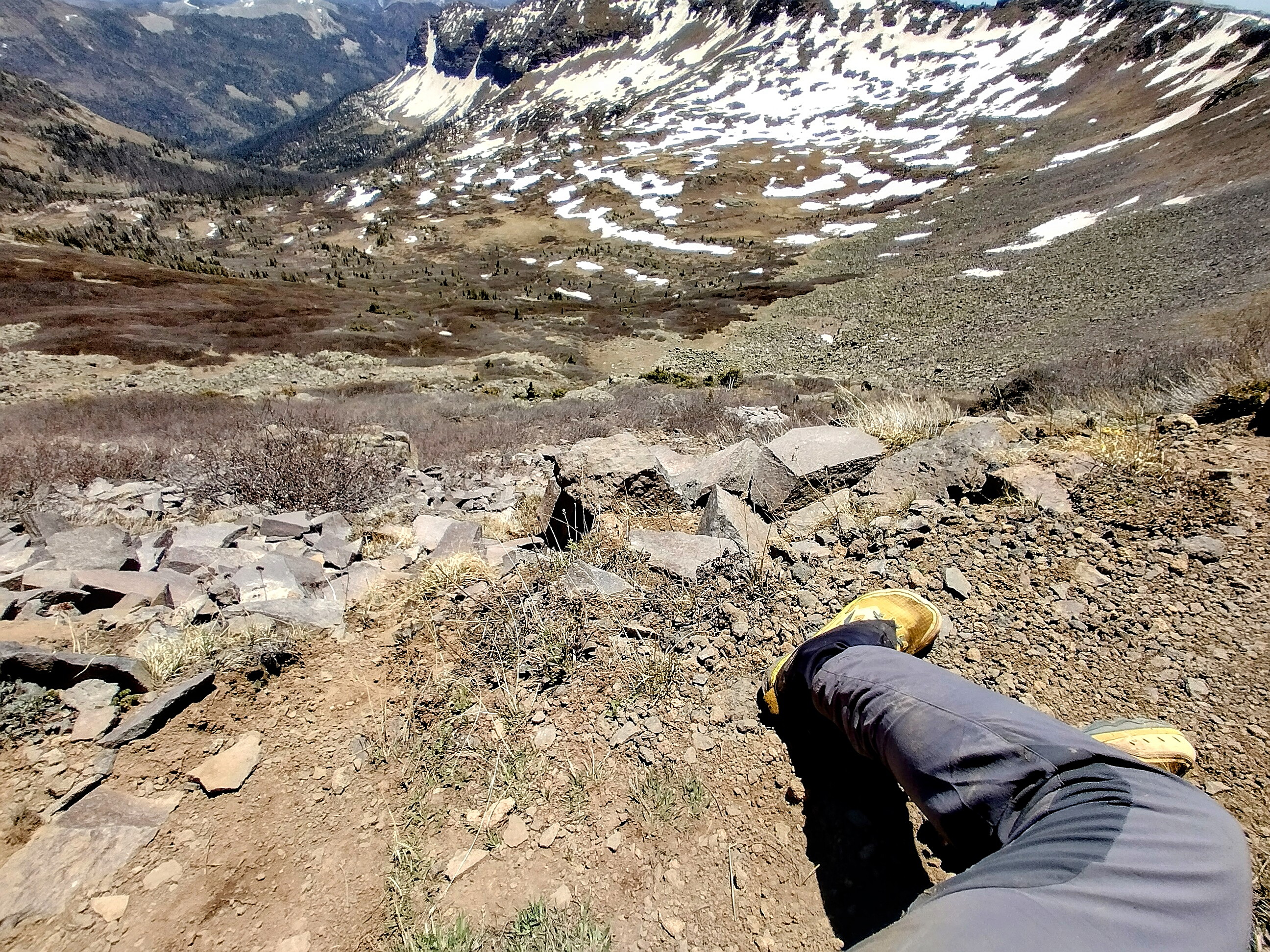
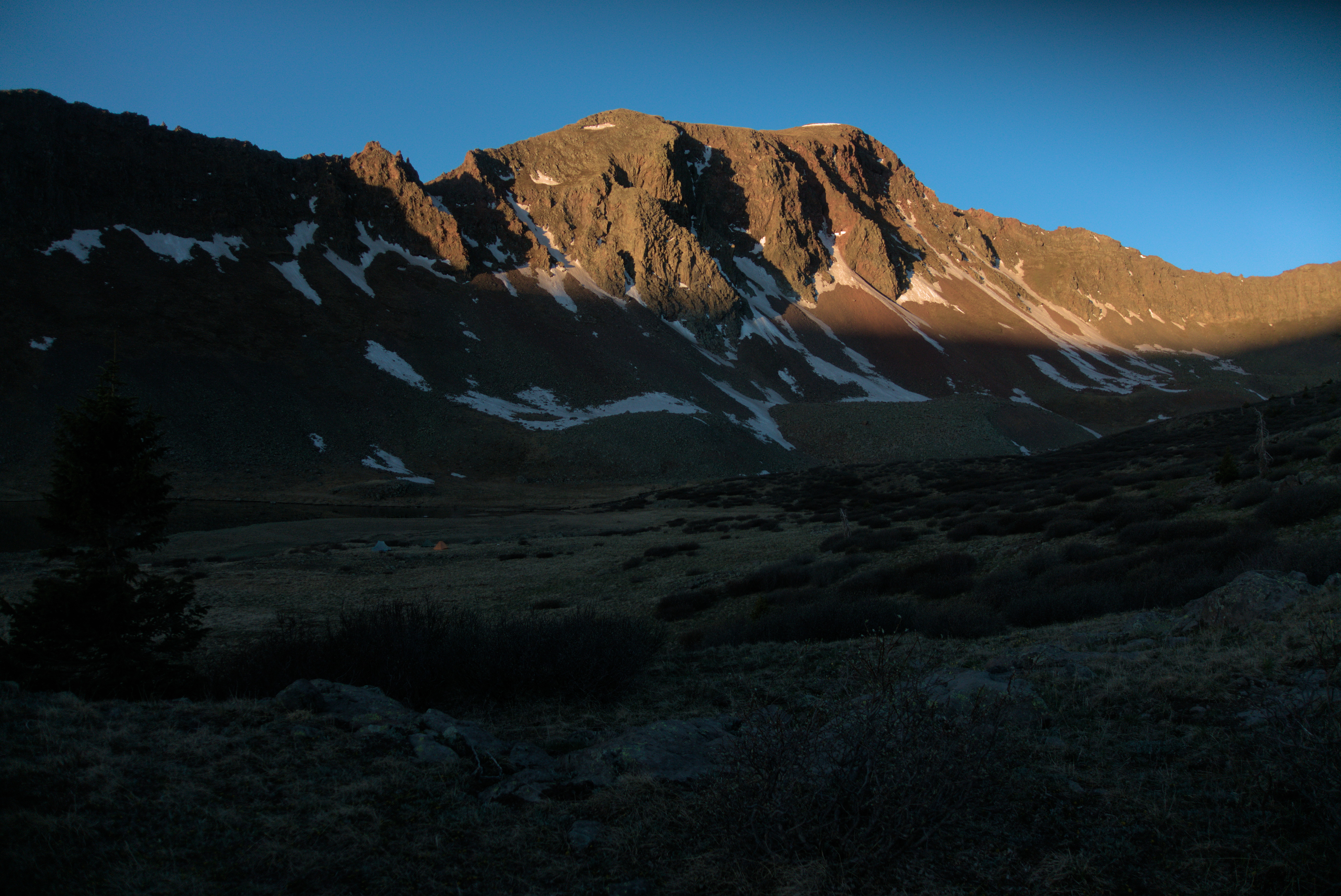
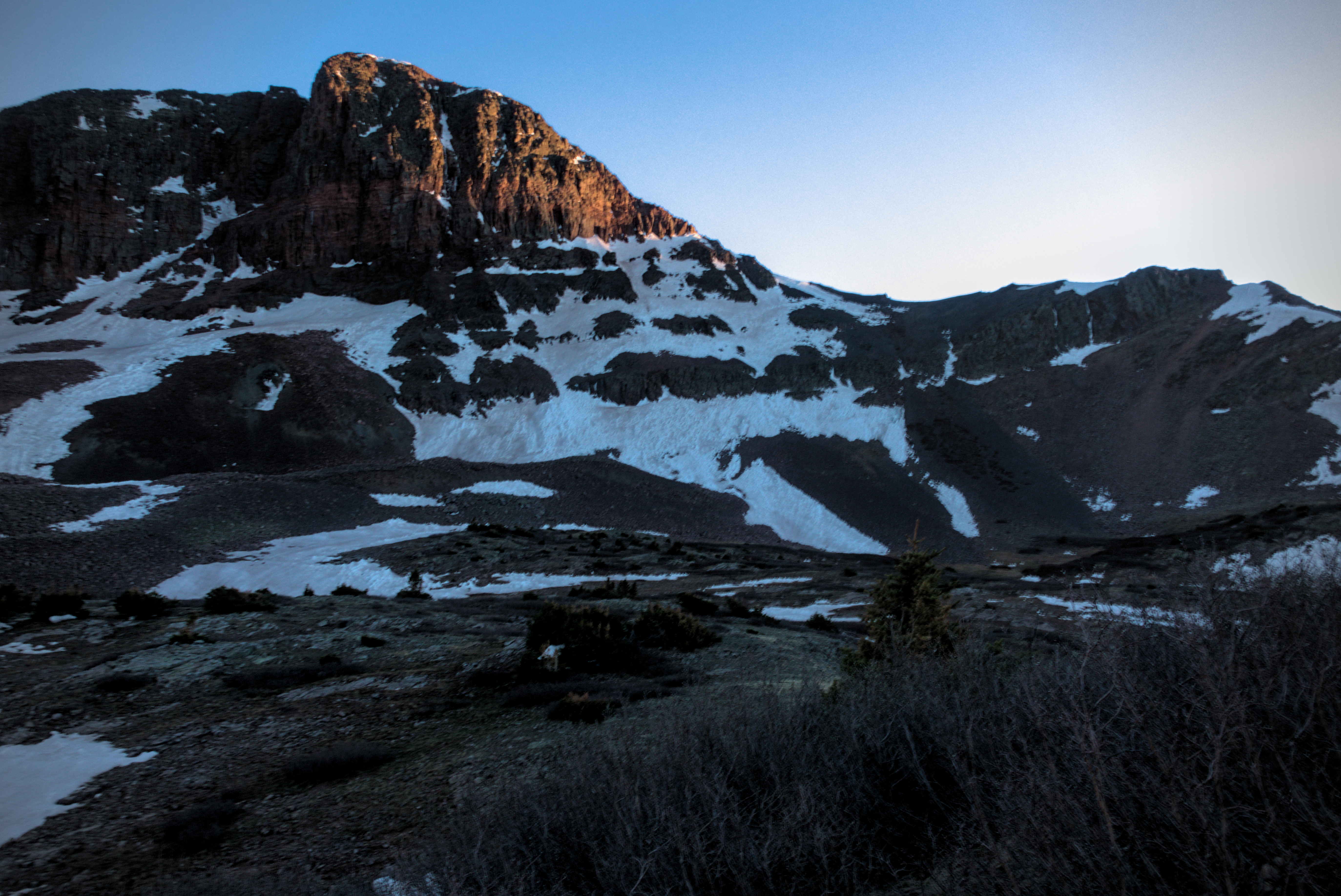
Looking to the work of the next day from camp. It's colder than
it looks!
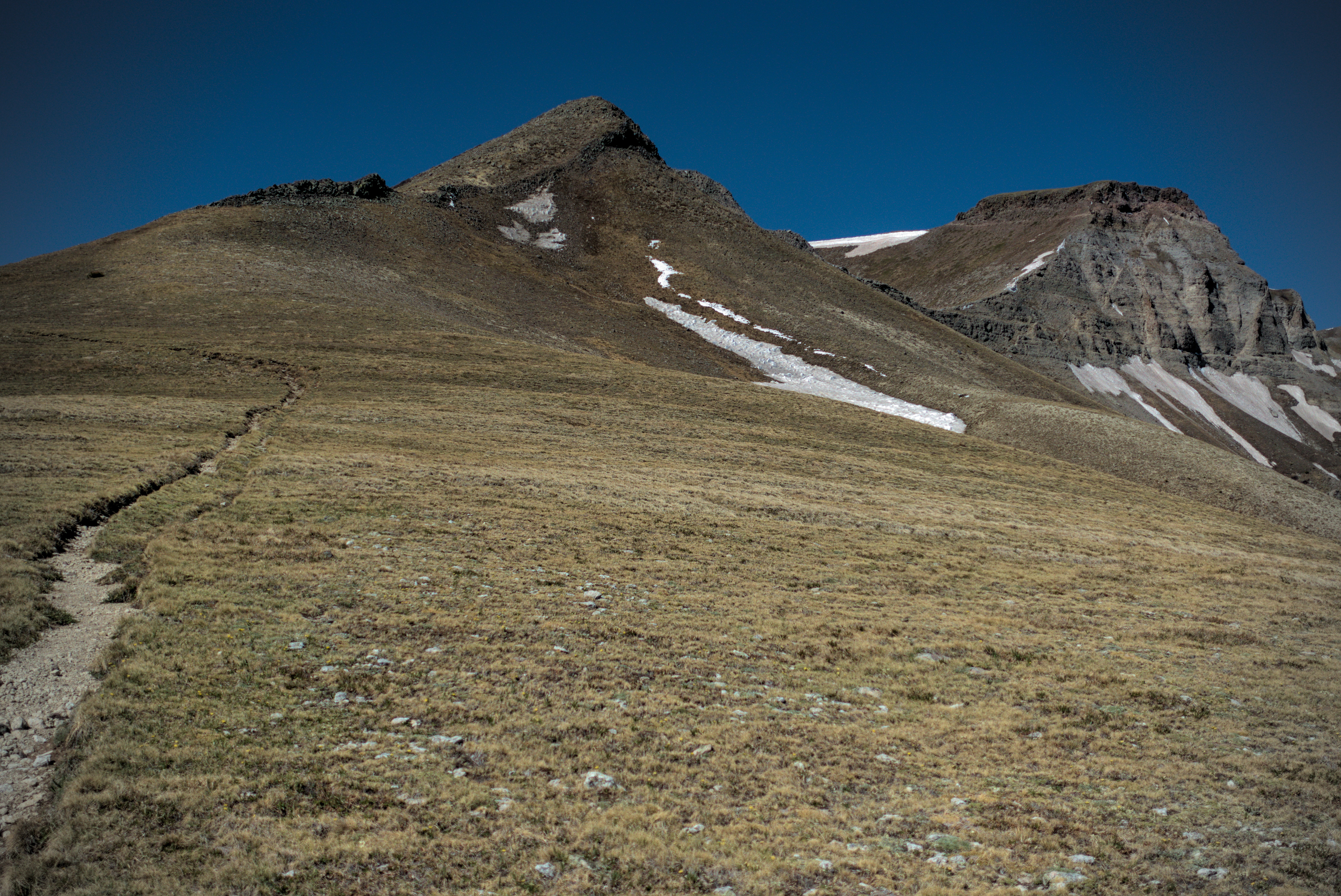
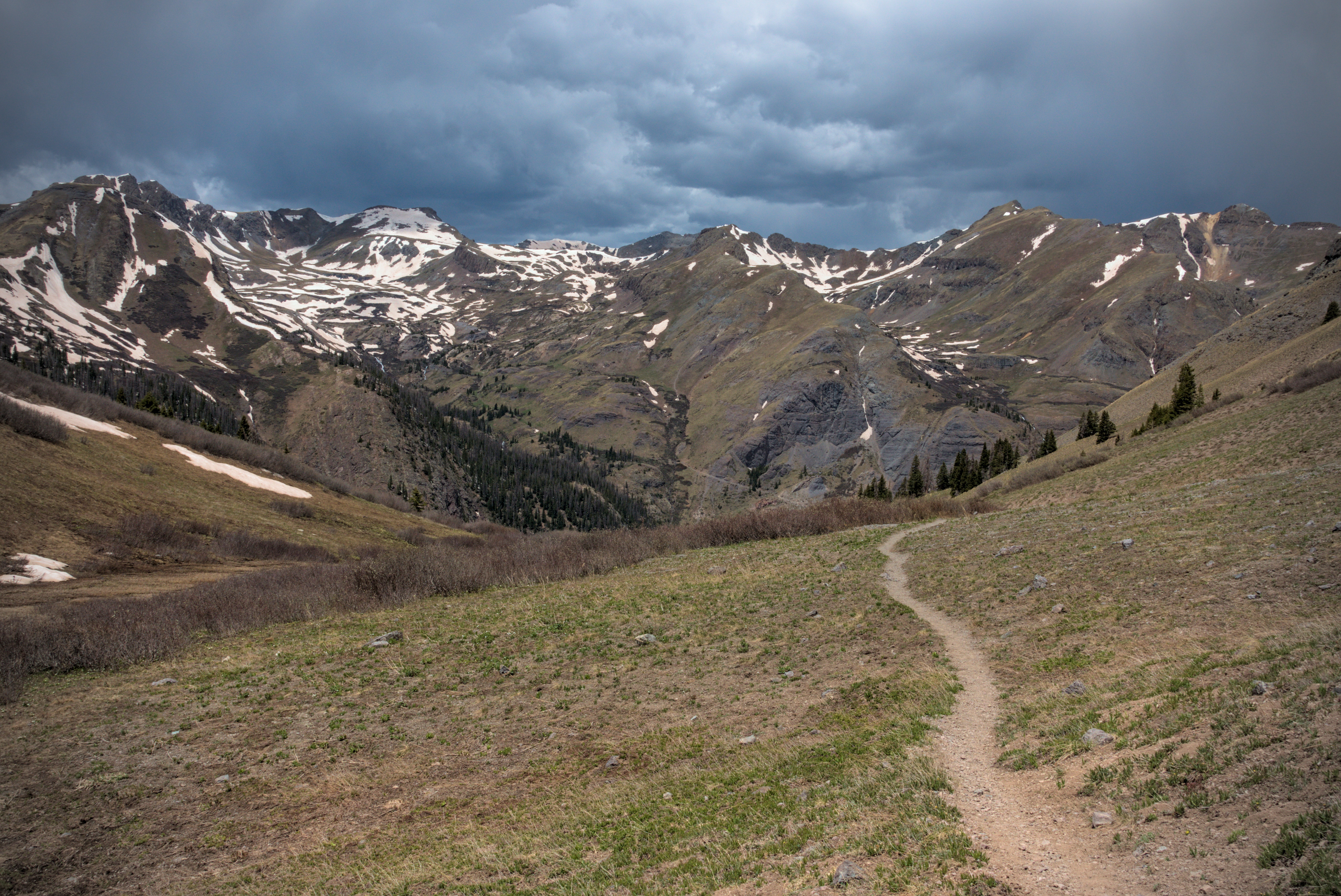
May 31, day 41, 18.8 miles
A long day, deep in the Weminuche Wilderness.
I followed my practiced routine in the morning...keeping my gloves off as long as possible to pack things up, then getting them on and starting away quickly to warm up. In the tent, there is always an explosion of gear spread out around me, but there is an order to it because everything has its general location. Headlamp hanging from the ceiling or on the side. Food bag always on the side, then zipped up in the odor-proof sack and buried in the pack. Extra clothing always goes in the sleeping bag. If socks are too soaked, they sit outside in the vestible, awaiting the morning sun. The phone always stays in the sleeping bag, and sometimes the power bank, otherwise they can drain fast.
However, the phone battery lasts surprisingly long if you do as I did, which was to turn it off at night, and only use airplane mode during the day. Later, in the more populated parts of Colorado I started leaving mobile data on because it was fun to get notifications about things. But before that, the phone would last for 3 days without using the power bank. It was my little SanDisk mp3 player that always surprised me with how quickly it lost a charge in cold, or how long it would take to charge. I think I only charged my headlamp twice on the whole trip. In truth, I rarely needed the headlamp. There are so many hours of daylight, I only found myself hiking in the dark a few times. And at night, beyond the light of the Kindle, what did I really need?
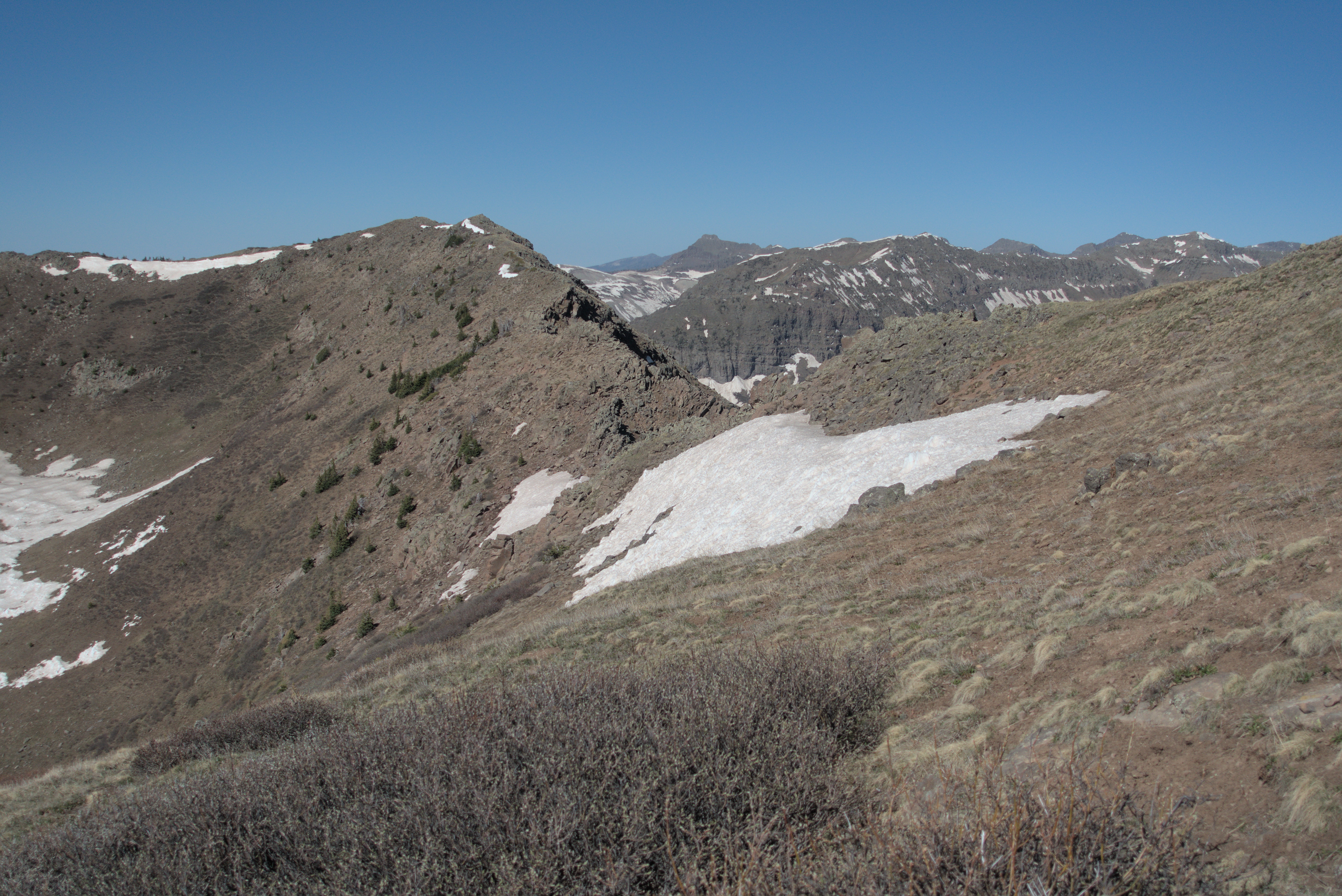
Looking back on the terrain of the day before.
I hiked up the west shoulder of Mt. Hope in increasing wind. I finally had to put my windbreaker on. It was a beautiful golden morning, and I enjoyed the scene of mountains breaking away off to the west in a snowy jumble. "That's where I've gotta go," I said. The hiking was pretty easy up here -- no trees means no blowdowns! And there was less snow on western slopes. Before long, I reached a key junction, where it's possible to "bail out" from the San Juans by heading north to lower elevation and a town called Creede. I really didn't want to do this...I felt like the "challenge of the San Juans" lay in accepting this wide trip away to the west. But a part of me sure was tempted to take it! I had a practical idea though, that helped me stick to the plan: we always worried about snow, not only in the San Juans but further on in Colorado. And the northern part of the state had a great snow year, with people skiing into May! So I couldn't use any rationalizations to skip forward via the Creede Cut-off that were based in saving days and effort, because I thought I would likely just end up in deep snow further north. And that would be very frustrating, and probably (I know myself) lead me to try and walk roads lower down.
So turning purposefully away from this enticing northern trail was an interesting point.
I was walking mostly on ridge-tops, dodging snow patches, but generally moving quickly over grassy, sunny slopes with isolated stands of trees. Ahead of me loomed a real mountain, and I wondered how the trail would tackle it. It doesn't have a name on the map, but it reaches almost 13,000 feet. In the end, the trail switchbacked up a rocky slope, leaving me with broad views in all directions.
Looking back on the work of the morning. You can see the trail cut into
the slope of the mountainside on the upper left.
Somehow, I'm going right up to the highest point, actually, a bit left
where mountain and snow touch on the horizon.
Getting closer to the high point in strong wind.
Looking to the right of my line into a zone of mysterious peaks.
The massive view back to the east gave me a feeling of accomplishment. I wondered though, where is everyone? Was I really still ahead of Flaka, Yeti, Mishap and Gargoyle? And what about Diva's companions...he had passed me the day before but shouldn't they have passed? But there were no tents beyond mine when I left in the morning.
Such thoughts often come...it is surprisingly comforting to know that somewhere up ahead is person X or Y, or just "a little ways" behind. In the next days I lost that sense, and felt a bewildering incredulity. I did see a few people, but they were self-isolating somehow. For example, as I came down from the peak, there was a little notch with a lake (it was the head of the East Fork Piedra River). I got out my sleeping bag and took an afternoon nap here, eating my usual peanut butter and tortillas, along with some chocolate. I was reading, and a person (man? woman? Oddly hard to tell) came in a futuristic outfit, face swaddled in cloth with sunglasses too...they zoomed quickly by me. I didn't know if they saw me or not, but their whole aspect seemed to suggest I'd disturb them if I shouted out a hello.
So, some of us traverse this country in a more ghostly fashion than others.
Anyway, before I got down to that lake, I rested in the warm grass a bit down from the crest, relishing the crossing of a divide to a new block of country. A herd of elk rippled across the west flank of the peak. This country reminded me a bit of the Stubai Mountains in Austria. Just a very big landscape.
Looking back, the spine of the divide is visible for miles.
Resting with new scenes ahead.
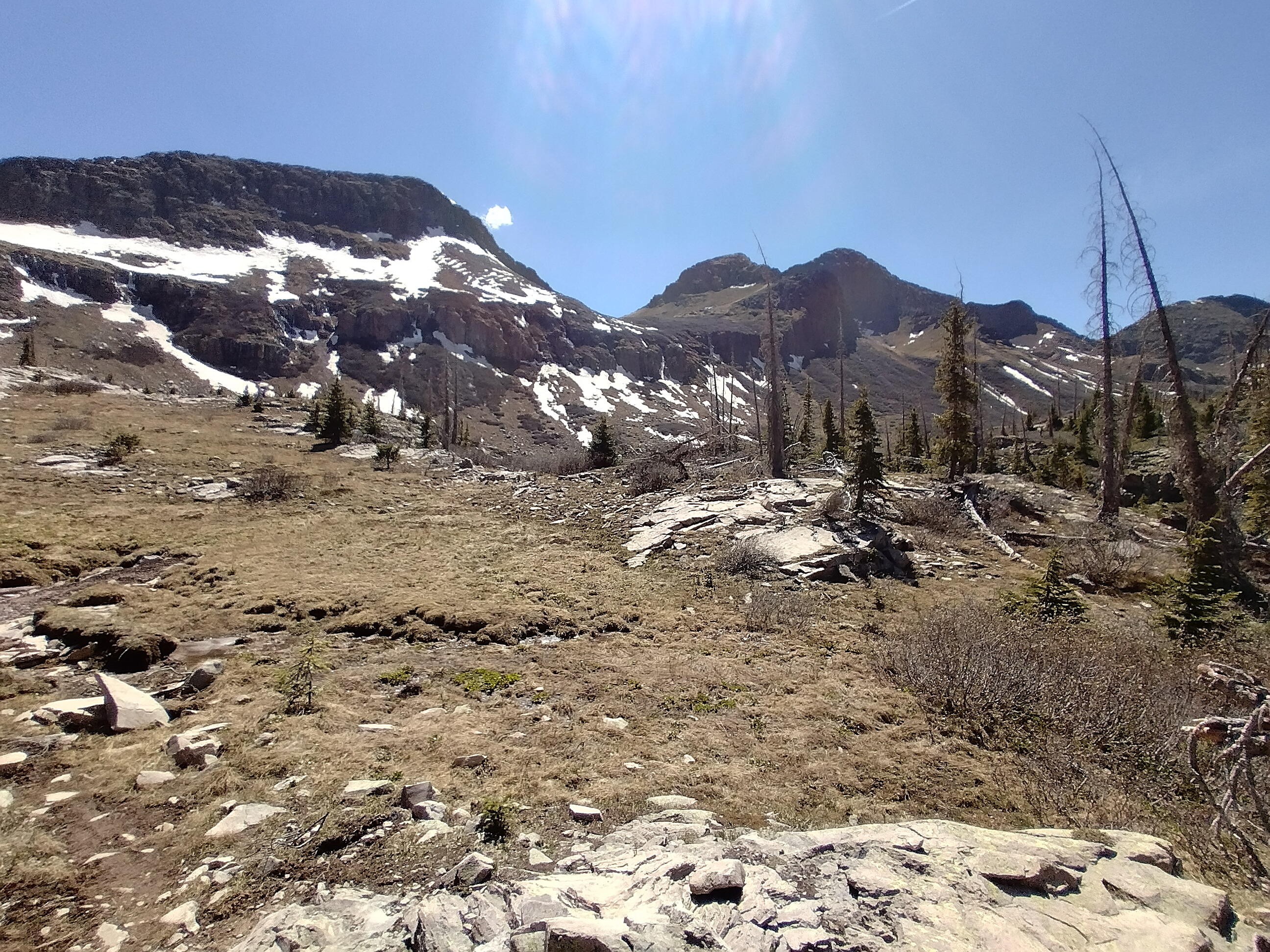
Beyond the lake I was getting tired. I had to climb back up through forest, then traverse the west flank of Palomino Mountain. After this point it was time to traverse a north-facing slope further west. Uff...get ready for snow again!
Actually, it wasn't that bad. It wasn't too slushy somehow, and lots of snow was melting out. Way better than the terrain near Wolf Creek Pass the day before. I skipped in and out of several north-facing basins with stunning granite walls at their back, climbing up to the crest. I was tempted to camp here, but the fabled 20 miles was on my mind. I talked with some people, but I forgot their names unfortunately. As usual, I may not make my original goal, but I end up setting "something." In this case, my goal became finishing the north-facing basins and stopping only after the ridges turn north again. It had been a very windy day, and somehow that tired me out, too.
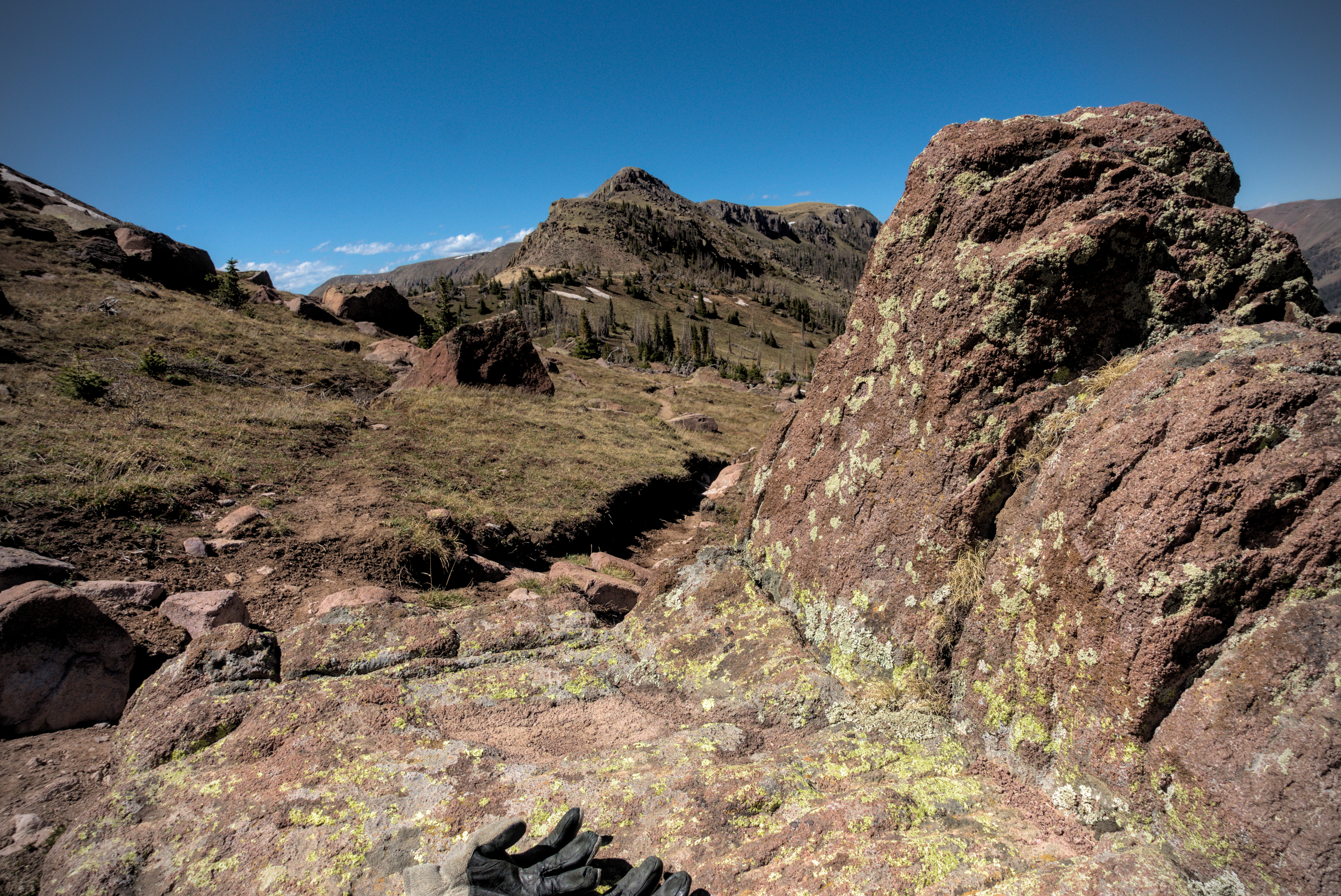
I traversed an open but craggy country. You can see my gloves lying on
the rock. I had to wear them in the biting wind, even though it looks
very sunny.
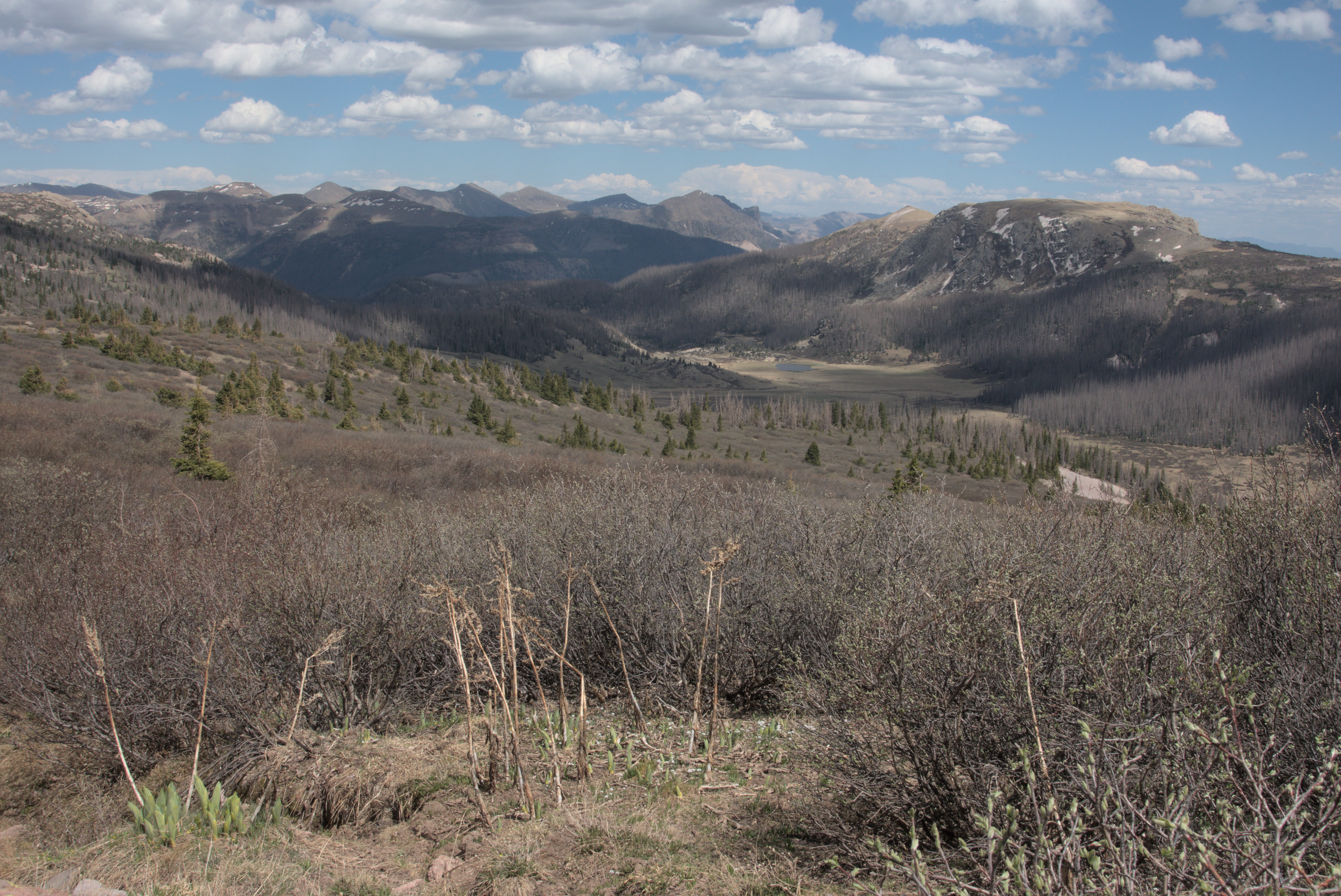
My job now is to traverse across the shelf of all the country in the
scene, just below the snowbanks beneath the crest.
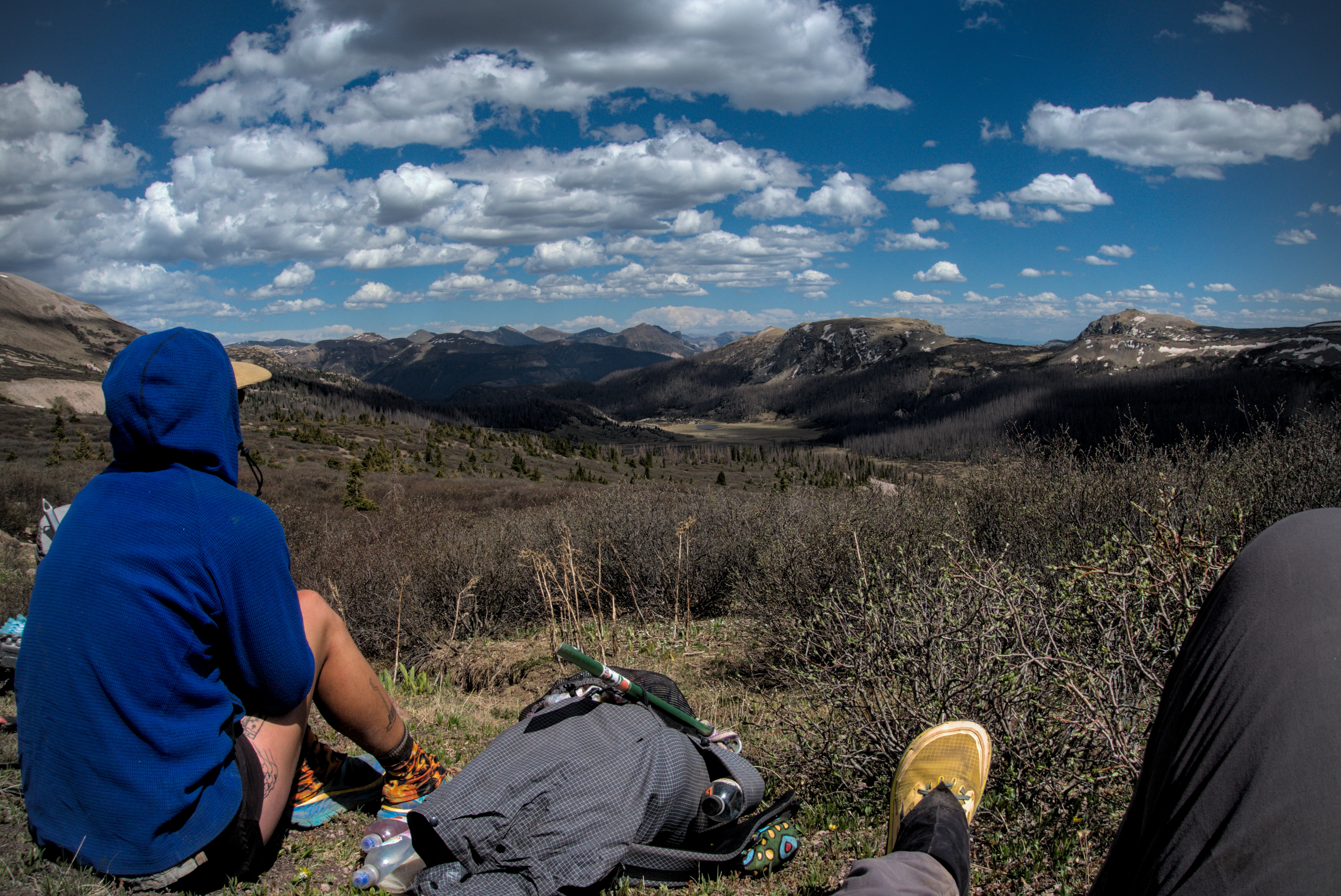
You can see a hiker in blue here, on this pleasant northern shelf not
too far from my camp.
I ended up stopping at 19 miles in a little saddle. I thought I'd boldly put my tent in the middle of the saddle, exposed to the wind, because I'd seen that it usually dies down at night, and I wanted to enjoy the sun to its utmost.
But it didn't take long to learn a lesson. While I fought to keep the tent from blowing away as I set it up, my ground-sheet was picked up from underneath the tent and was gone in a flash...first lifted up and carried to the east, then, thankfully, it dove into a gully where I had some hope of retrieving it!
I tied everything down, then ran down into the gully and saw it caught against some brambles. Thank goodness! I climbed back up, moved my tent dutifully, and made due with being in the cold shade, hard against a tree, with snow patches here and there.
I must have slept quickly...it had been a long day! No complaints about the weather though.
I didn't want to put my tent in the shade (waa!), but out in the sun
to the left, the wind was too strong for the tent to survive.
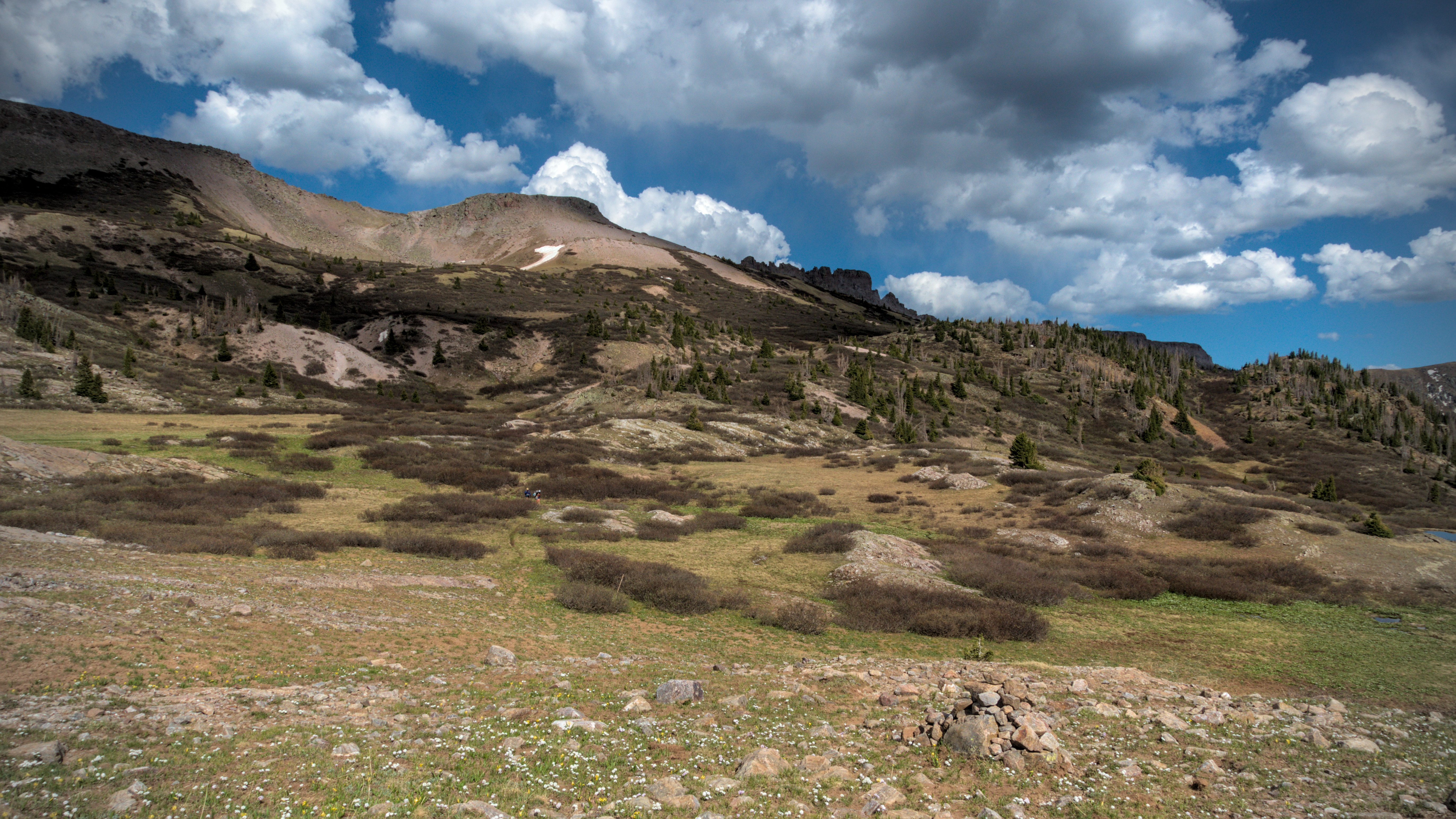
June 1st, day 42, 17 miles
A short day in miles (only 17), but high in adventure and frankly, long
enough!
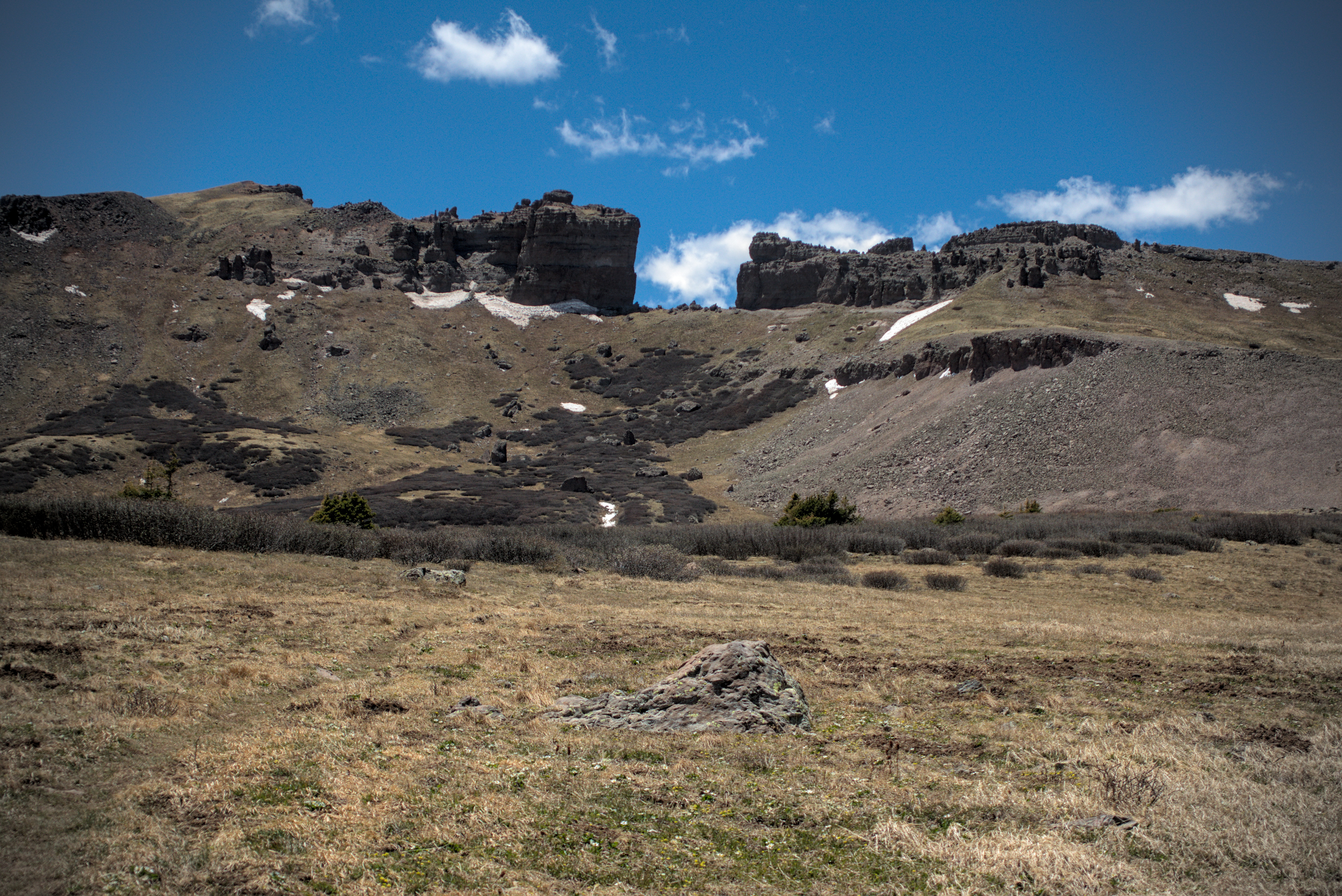
As usual, I was up at first light, walking before 6. Today would have a special challenge: a feature called the "Knifes Edge." People on the trail are quite worried about it. It's a traverse around a mountainside with a mix of steep snow and tough willow bushes that grow out from the slope in a way that always pushes you off. Smiley told us back in Pagosa Springs that he does trail maintenence here, cutting the bushes back. Another problem is that there is rockfall. Later, I encountered people who didn't think the traverse itself was so bad, but waiting for people who moved very slowly through the steep and rotten snow stressed them out, because rocks bounded down occasionally.
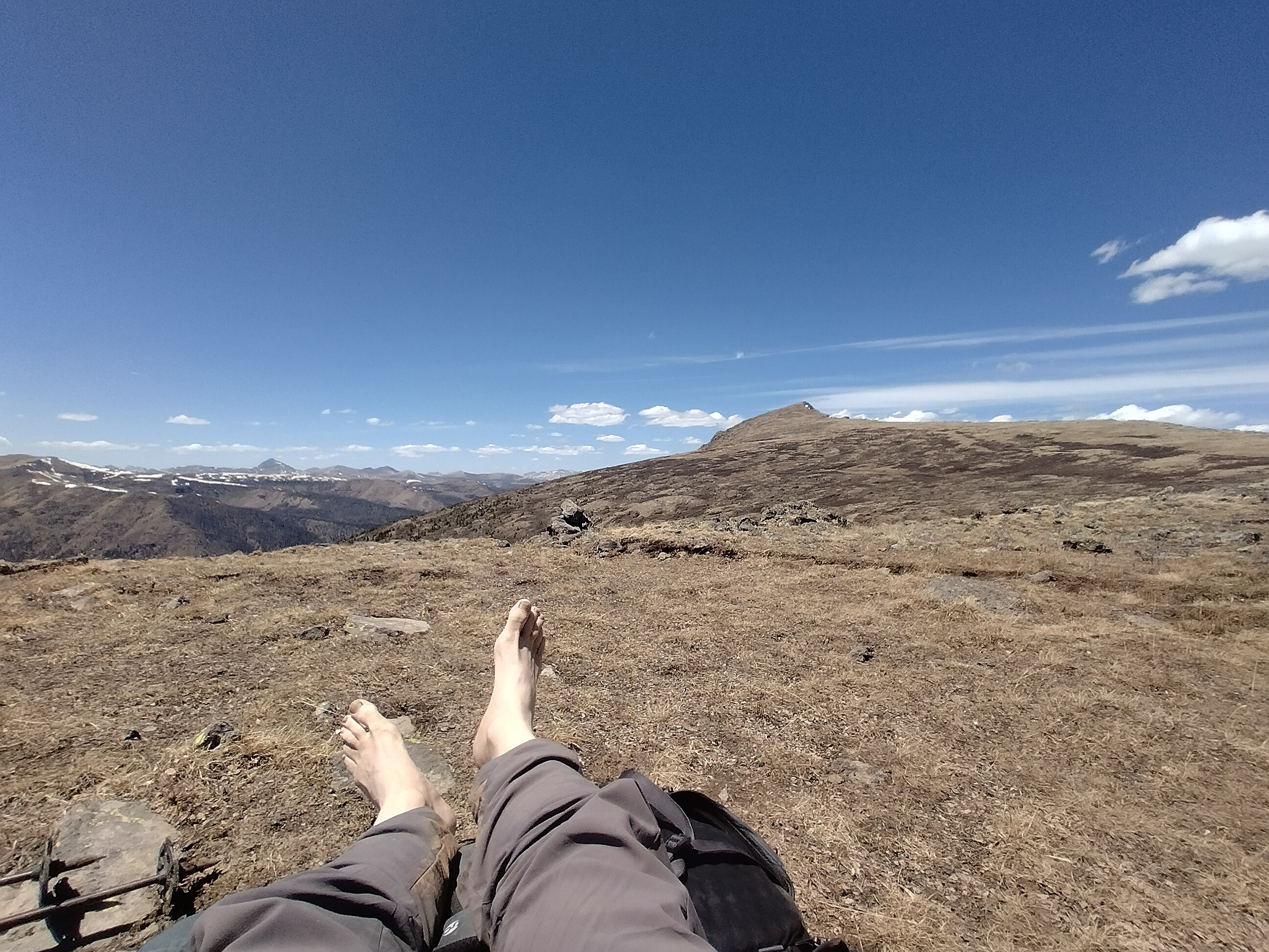
There are a few alternatives, one of which is to get on the crest of the divide and follow it over three peaks. I'd pretty much decided that I would do that, but I figured to make the decision at the last moment. I carried micro-spikes for snow, but no ice axe. I thought it would be kind of fun to leave the trail and get on the crest.
A quiet place for breakfast. I often sat in places and wondered if anyone
had ever been there. It was a ways off the trail.
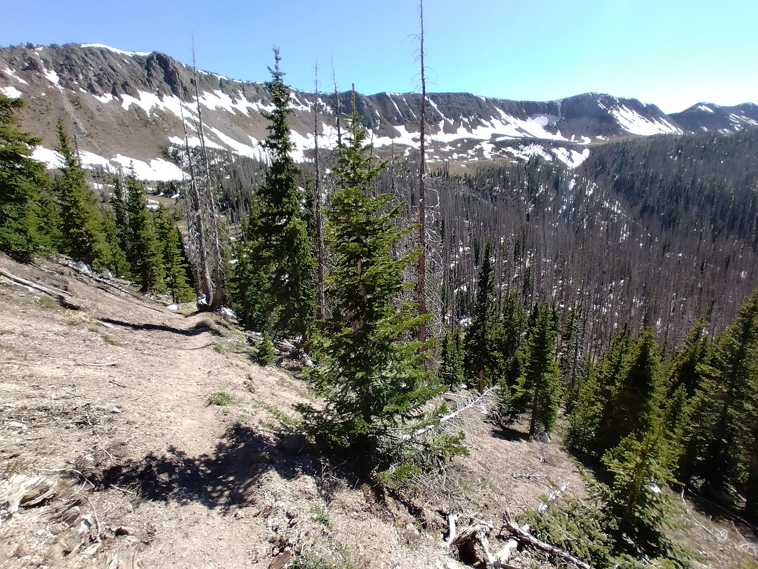
Forested ridges descent to lower country...
Looking back on the up and down ridges of the early morning. Another
hiker is in sight.
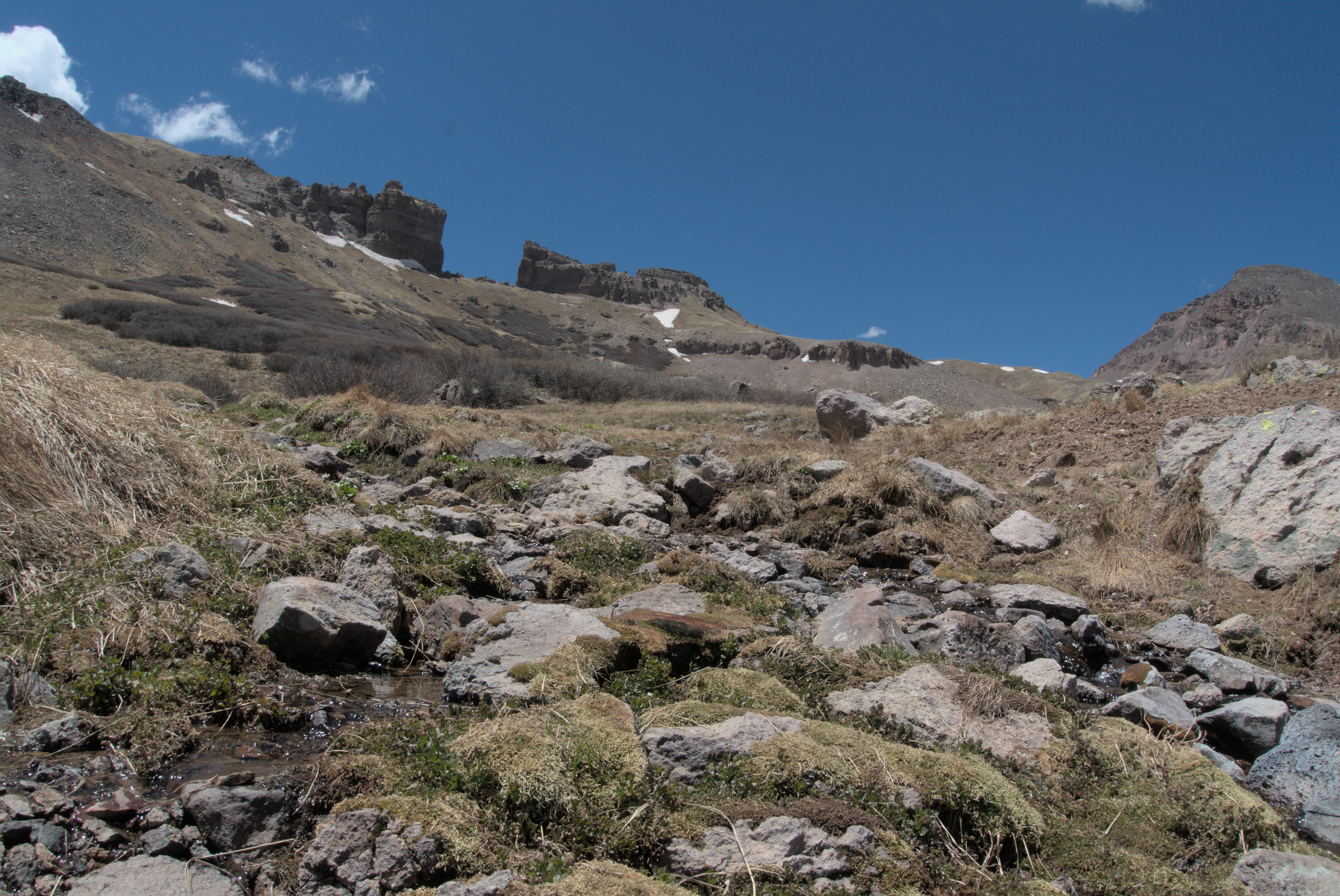
From camp, the trail goes up and down some forested hills. After a nice breakfast (I usually walked 2 hours, or at least 1 before breakfast) sitting on a sunny forested slope, I came to a dramatic crest marked by a thick plastering of snow on the right (north) side. For the next hour or so, I climbed up, down and up this crest again to a high point. Two people came along behind, passing me at some point. The weather was fine, and it was less windy than the day before. The ridge turned north, narrowed, then the trail left it for a basin on the east side of the crest. I got some water here in a little stream, then somewhat reluctantly left the trail to climb up to the crest. It just felt a bit strange to leave the trail this many days out from towns and all alone. I got involved with climbing up while avoiding the tough willows. Within 30 minutes, I was on top, looking ahead to the next two peaks.
This nice fella has a video of the hiking up on the crest that looks exactly like I remember it:
The crux of the route was between peaks 1 and 2, where the ridge narrows and you need to use your hands to get established on the second peak. At one point I chose a somewhat unpleasant loose traverse instead of an appealing steeper section that would get me past the difficulties much quicker. But I thought that even though the rock climb looked easy, I shouldn't risk a situation where, if a handhold breaks, I might get hit in the head. Indeed, distance from town influences the way you solve your problems!
The start of my cross-country journey up the first of three peaks, here,
looking back to the south.
Looking north up on the ridge. Peak Two is ahead, with the little notch
problem just before.
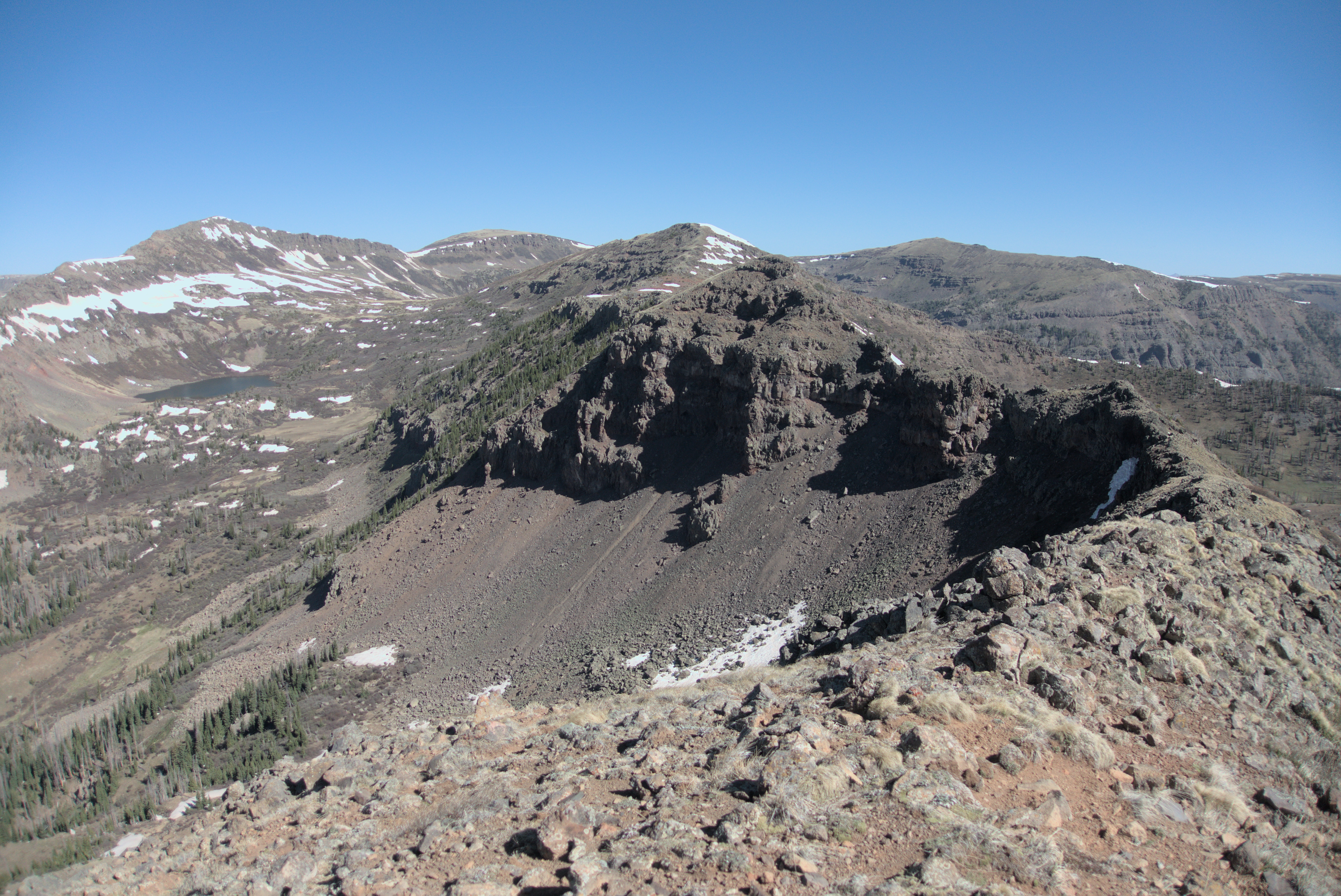
Wild country and a steep drop-off on the west side of the ridge.
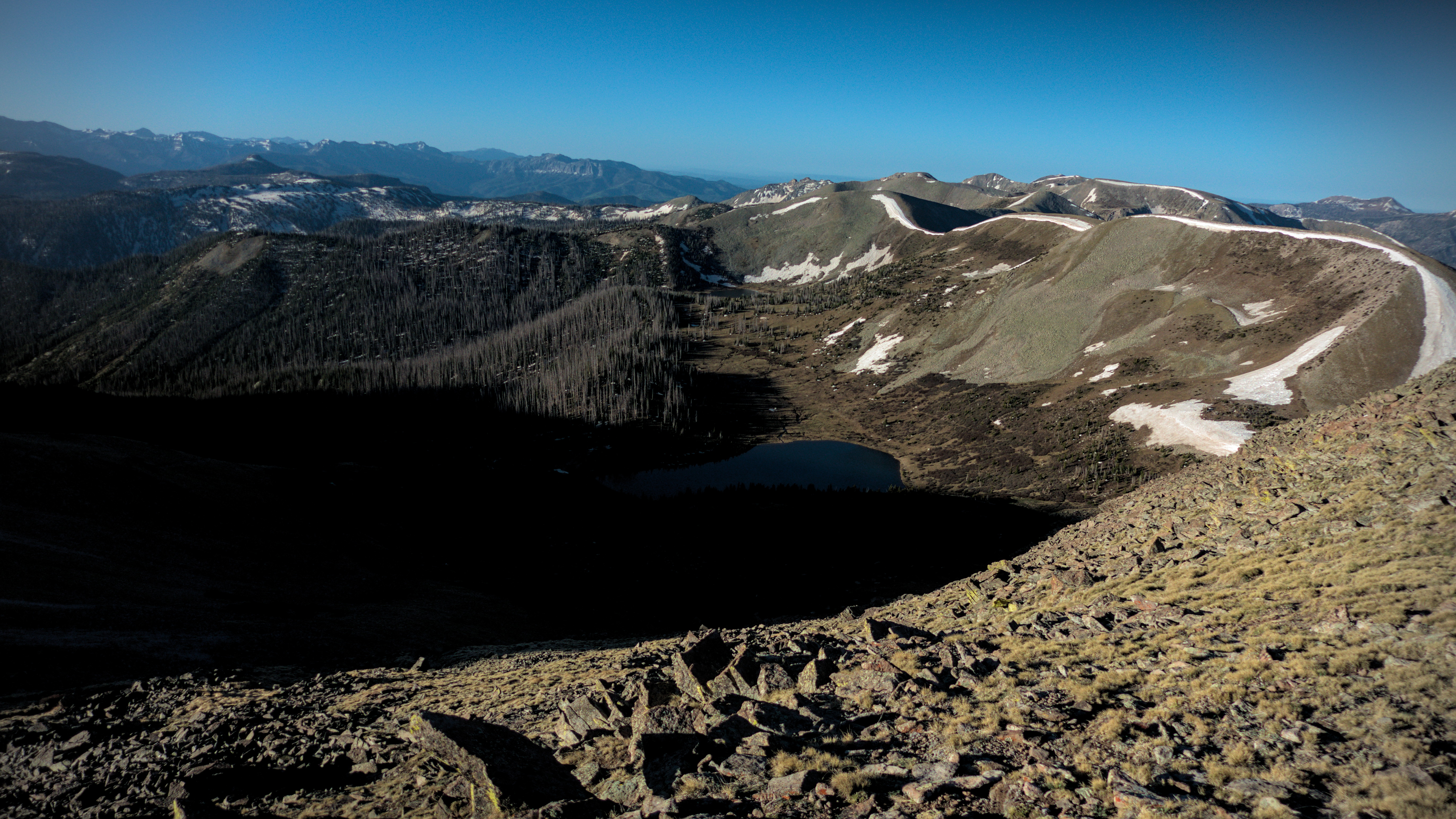
Trout Lake in the Upper Center, Williams Lake on the left, this picture
is from the second of three summits on the divide walk above the Knife
Edge.
The last peak is ahead, and things look pretty easy even though there is
no trail.
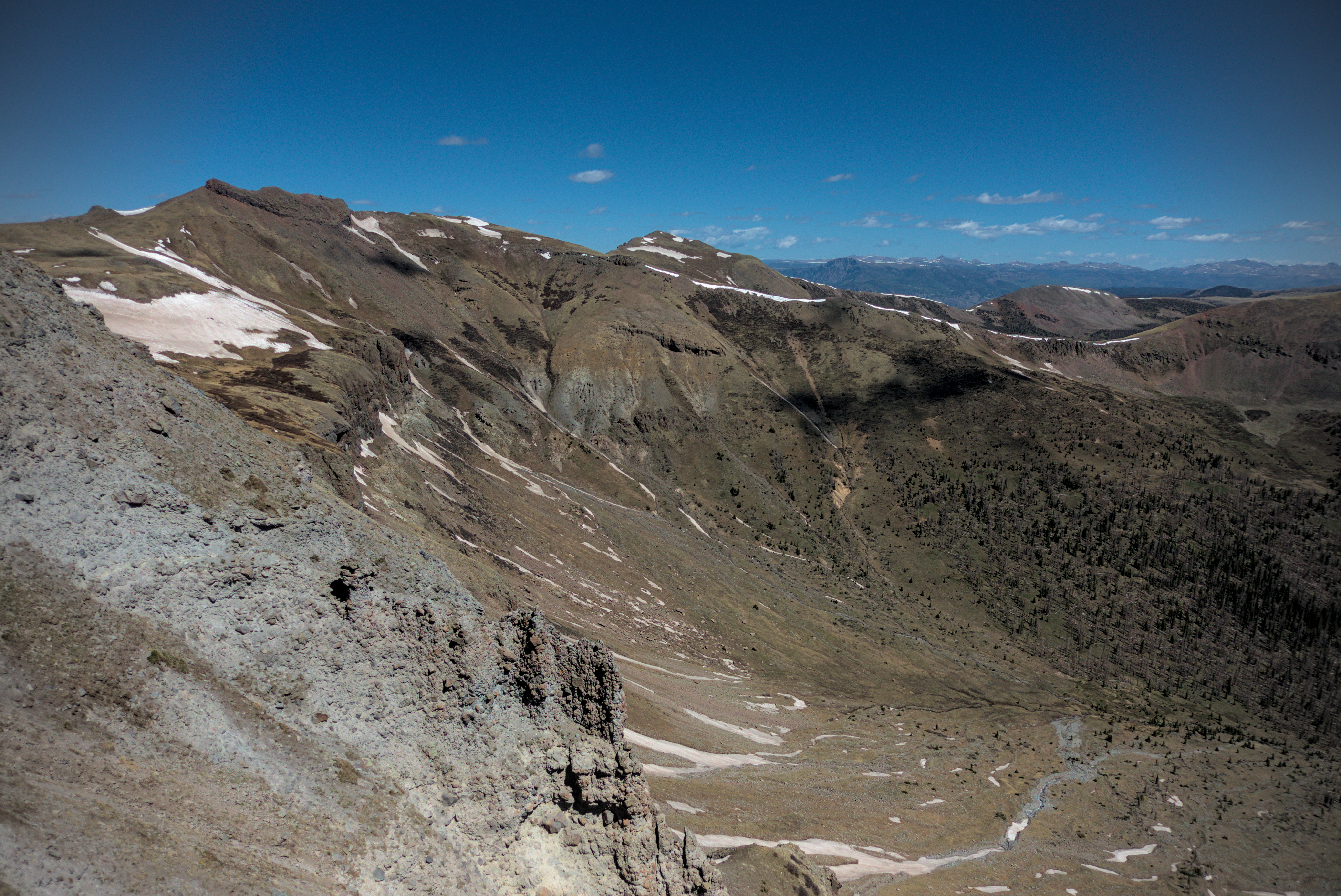
Down and up again over the third peak...and this time, the natural way led easily down to intesect the trail in a basin. When things go so easy, you really appreciate them. So often in Colorado, things take much longer than they should because of the snow or blowdowns, or even, increasingly, thick brush under which the trail turned into a stream. When this trail gives you an easy slope, it comes with an almost physical sweetness. I got down into the basin and congratulated myself on coming through all that. Unfortunately, I never was able to see the snowy traverse that worried people so much. I was too steeply above it to see. When I looked down in that area, a huge snow cornice blocked the view.
I crossed the broad, sunny basin and rested for a while before climbing out the other side. I was entranced by a view into the Little Squaw Creek valley to the north. A huge valley, without a trail or any sign of man, this was just one of many vast spaces radiating off the spine of the divide.
Climbing up a ridge west of the junction with the Williams Creek Trail.
The beautiful hanging valley of the headwaters of Squaw Creek.
A view into Little Squaw Creek, with pronounced oxbows in the stream.
Climbing to a crest, I slipped on the trail, tripping and ending up in a jumble of hiking poles, legs and outstretched arms a few feet below the trail in a little gully. Whoa! That was a wake-up call. Nursing a few bruises, I limped back up to the trail and sat for a while, thinking how quickly everything can change. I'd been on the move about 7 hours so far, it was a bit after noon.
Nursing my bruises after falling off the trail.
After a rest at the summit, with shoes off and feet drying in the sun as I watched the marmots clamber around, I moved down quickly to an important pass in these mountains, joining the Squaw Creek Valley in the north with Williams Creek Valley in the south. This has apparently been renamed "Grizzly Creek" but I'm ignoring that.
Also, the Cimarrona Trail branches off here to the south, winding around the southern escarpment of the peak with the same name. Standing in the broad, flat valley, hopping over little streams, I felt far away from everything. Somehow, it's the flat spaces that give me the greatest feeling of wilderness. In the peaks, on steep ledges...I feel "crowded about" by not only physical specimens of granite, but also ideas...about "how to travel" through this patch of snow, or to work up a slope of gnarled roots and shrub. At an apex of radiating valleys like this place, all those concerns fall away. Only dim murmurings in the mind about sufficient food stores and likely places to sleep remain. I soaked in this special feeling.
Enjoying a rest on the high ground east of the Squaw Creek Valley.
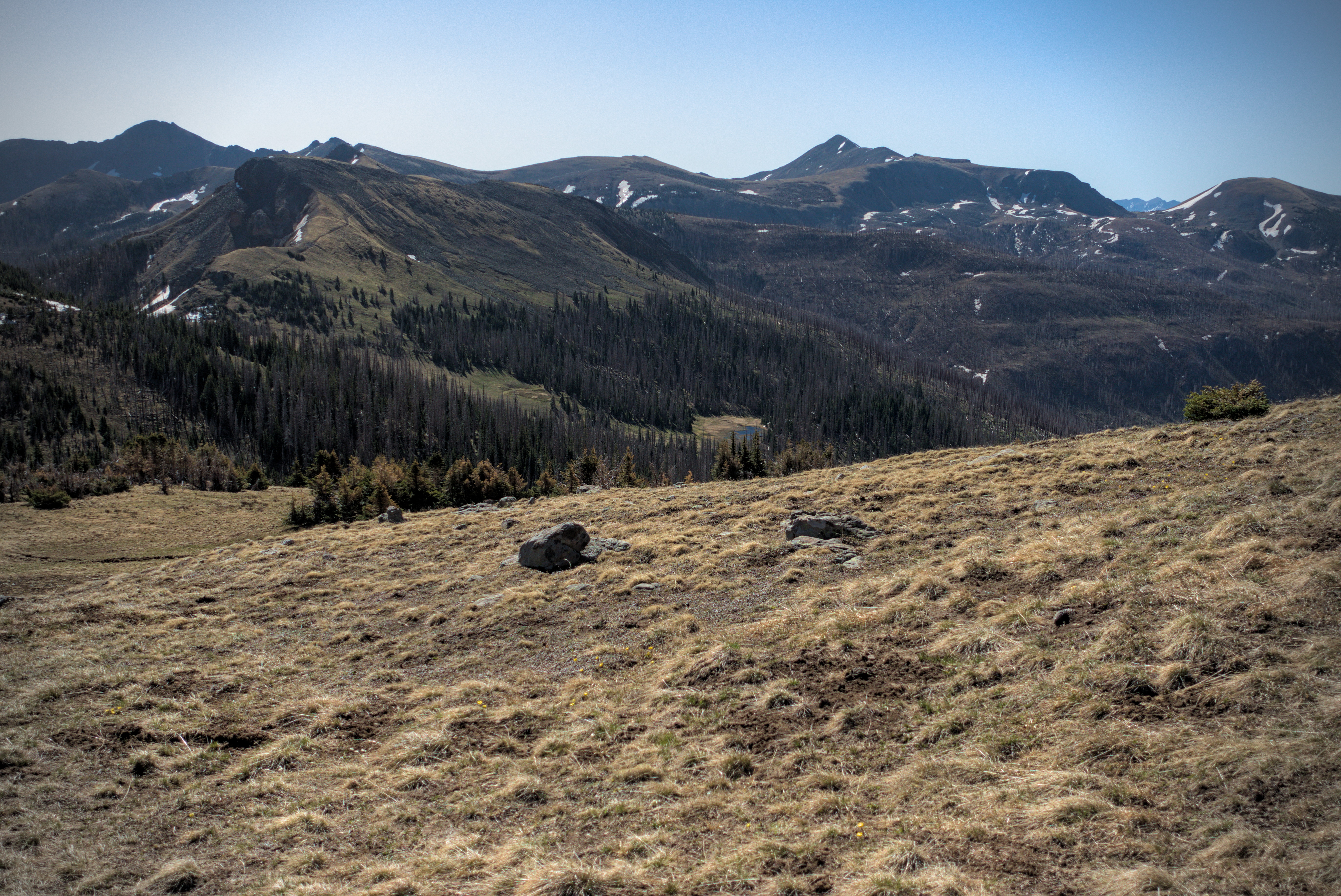
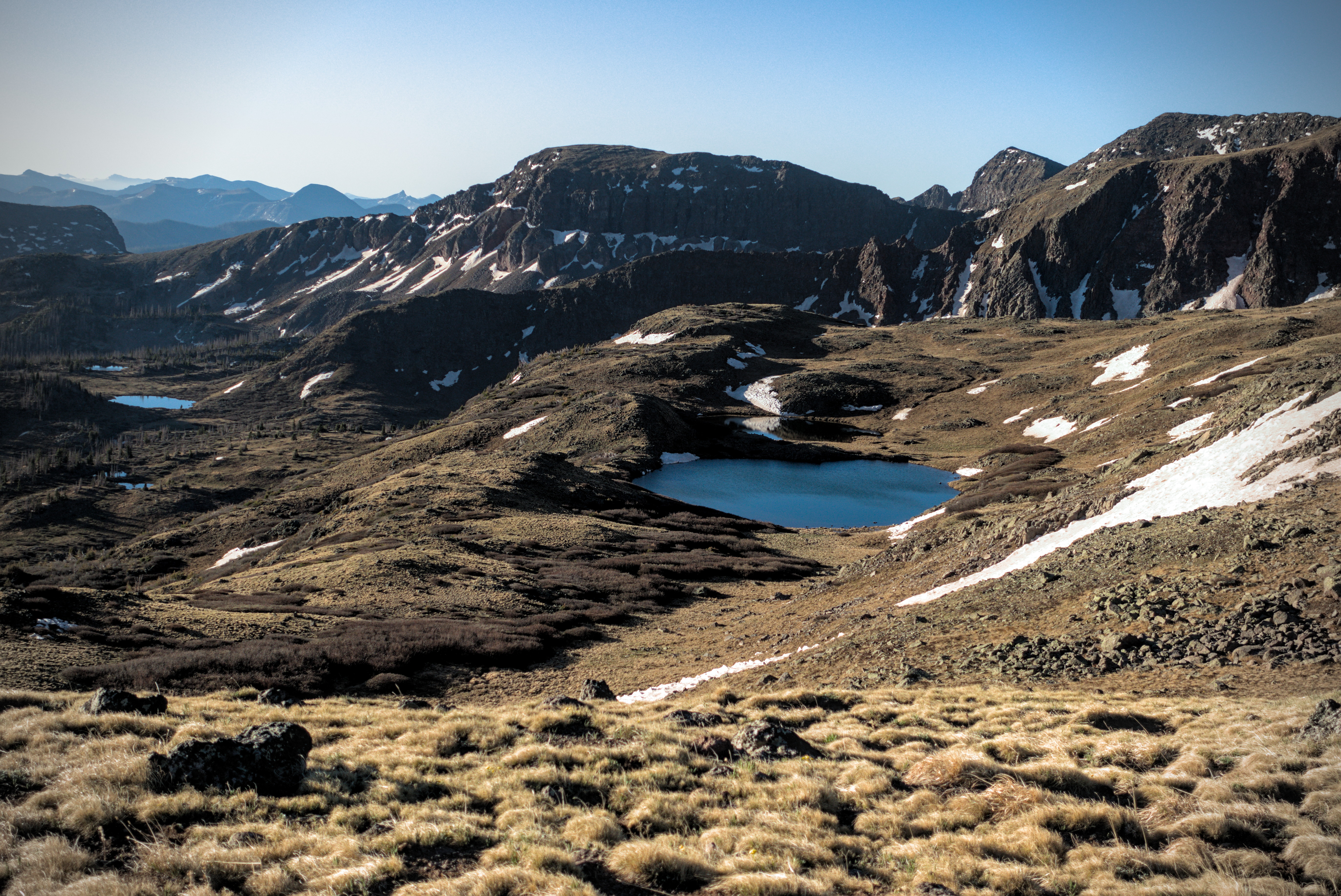
Still, it was hot afternoon and my feet hurt. I wasn't looking forward to a climb of 700 feet or so to reach the headwaters of Squaw Creek, first up a steepish forested ridge with the usual tiring blow-downs, then back into high alpine country. I ground it out. After a tiring hour, I was rewarded with little streams and meadows in one of the most beautiful north-facing basins of the trail. Dotted by lakes of dark blue water, this high bench of land gradually curved to open eastward, and thus my traverse finally turned north again. I've said already how much traveling north lifts the spirit of the CDT hiker! As the afternoon waned and I tired further, I rounded a corner to cross a snowy slope. Darn, there goes my chance of puttering around camp in dry socks!
Scenery on the high benches.
Zooming in, you can see the trail traversing for miles on the left side.
Still, I was able to look back on a rich chain of peaks behind me since Squaw Creek Pass. Then I found the perfect campsite, my favorite in all the San Juans...by a lake with no name, under a peak with no name. Far enough away from the peak that the western sun would have a longish run before hiding. I decided to stop shockingly early...at about 4:30 in the afternoon, and my days total mileage was a paltry 17.
I needed the gift of this time and place to enjoy myself. I should have given myself this kind of gift more often, considering that by the midpoint of the CDT I was tired and out of enthusiasm. Looking back, I see that I drove myself too hard.
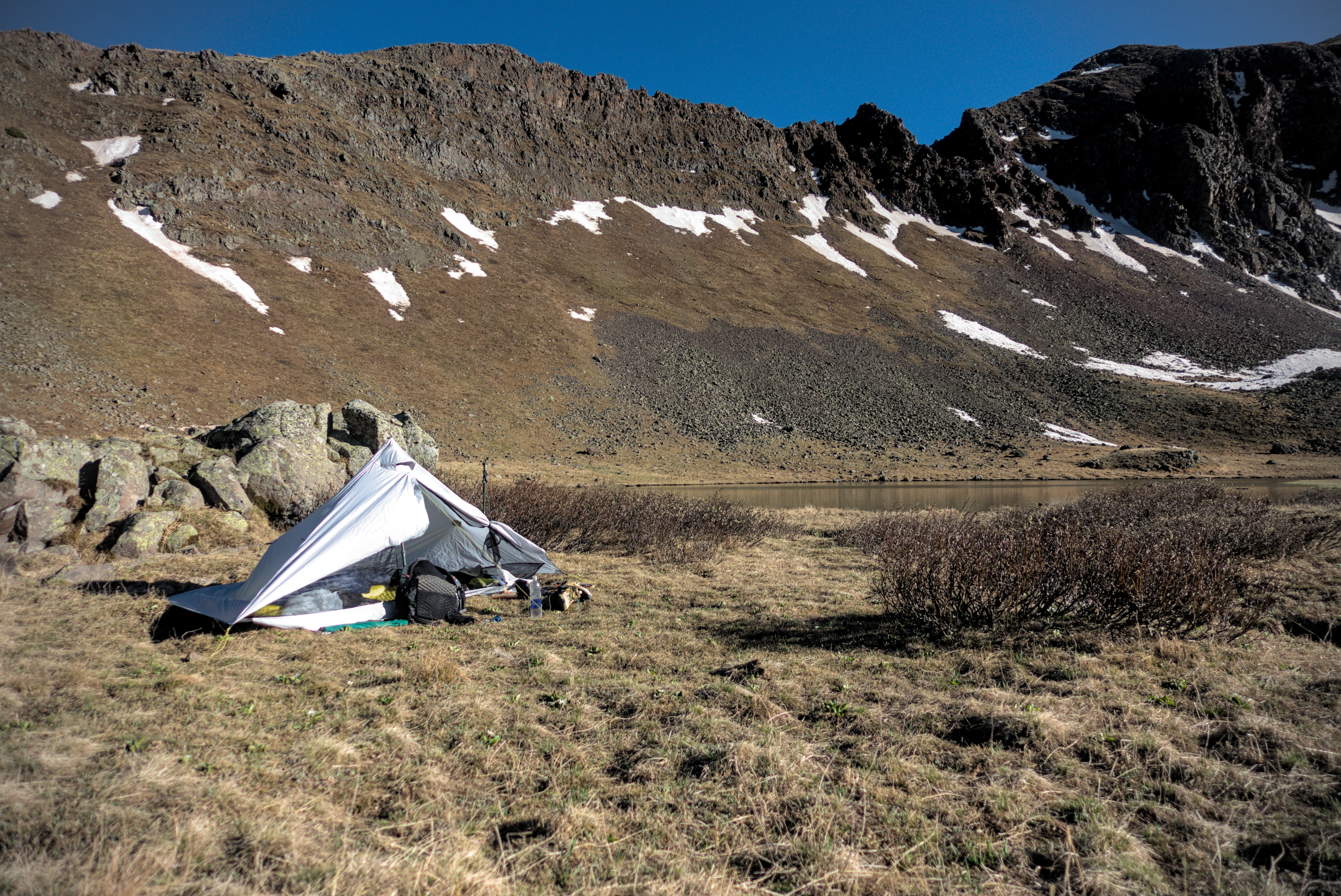
My home for the evening.
I relaxed deliciously in the tent (I remembered the devil-goat in the horror movie "Witch" asking: "do you wish to live...deliciously?" There is no better word for the joy of lying back with shoes and socks off, warm and dry!). I limped over to a rock and meditated, for the first time on the trail since I didn't know when. Oh, wait, the evening before reaching Cuba, New Mexico, sitting on bare sandstone of a mesa top under the moon. That was a long time ago...
It's funny how bad I felt for stopping early. I heard voices and saw people walk by, little knots of color in the distance. Someone else camped on the other side of the lake. I wanted to call out to everyone, "hi, I stopped early because...," then I laughed because I had no good reason. I guess I was proud to have finished the Knife Edge nicely, and I enjoyed the scrambling on the crest. I'd like to say that nobody cares but me, however, with hindsight, I have to say that thru-hikers are a judgmental lot. They set themselves a hard road, and on seeing someone in the distance camping before evening, they'll ask "hmm, I wonder what's wrong?" When they see that the camper is not one of their tribe, they'll say "oh, well that's alright then." That is...the other is just a tourist, and not a resident of a demanding way of life.
I'm not saying this is a bad thing. That sharp mindset is above all, productive. It standardizes interactions and allows strangers to easily travel together. Such people aren't likely to need help very often at all. They aim to be exemplars of their type.
My happiest moments were when I could shuck that identity and "become small." No longer even equal to the landscape, I was a child wondering at it. I suppose everything is like this. The city-dweller has his armor of appropriate mental states. But so does the wilderness-traveller, and I was surprised to find that this armor can be almost as confining.
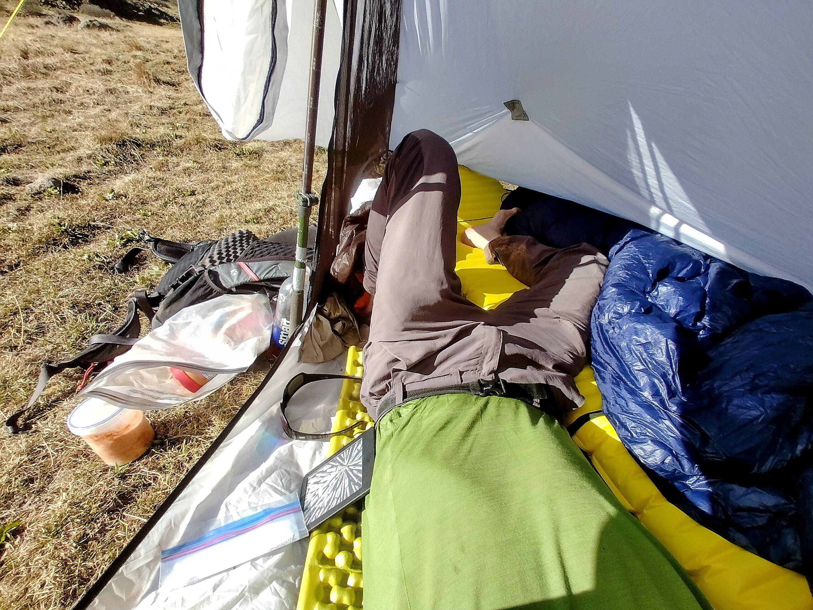
Ah, the joy of lying back on a fine cushion, warm and dry!
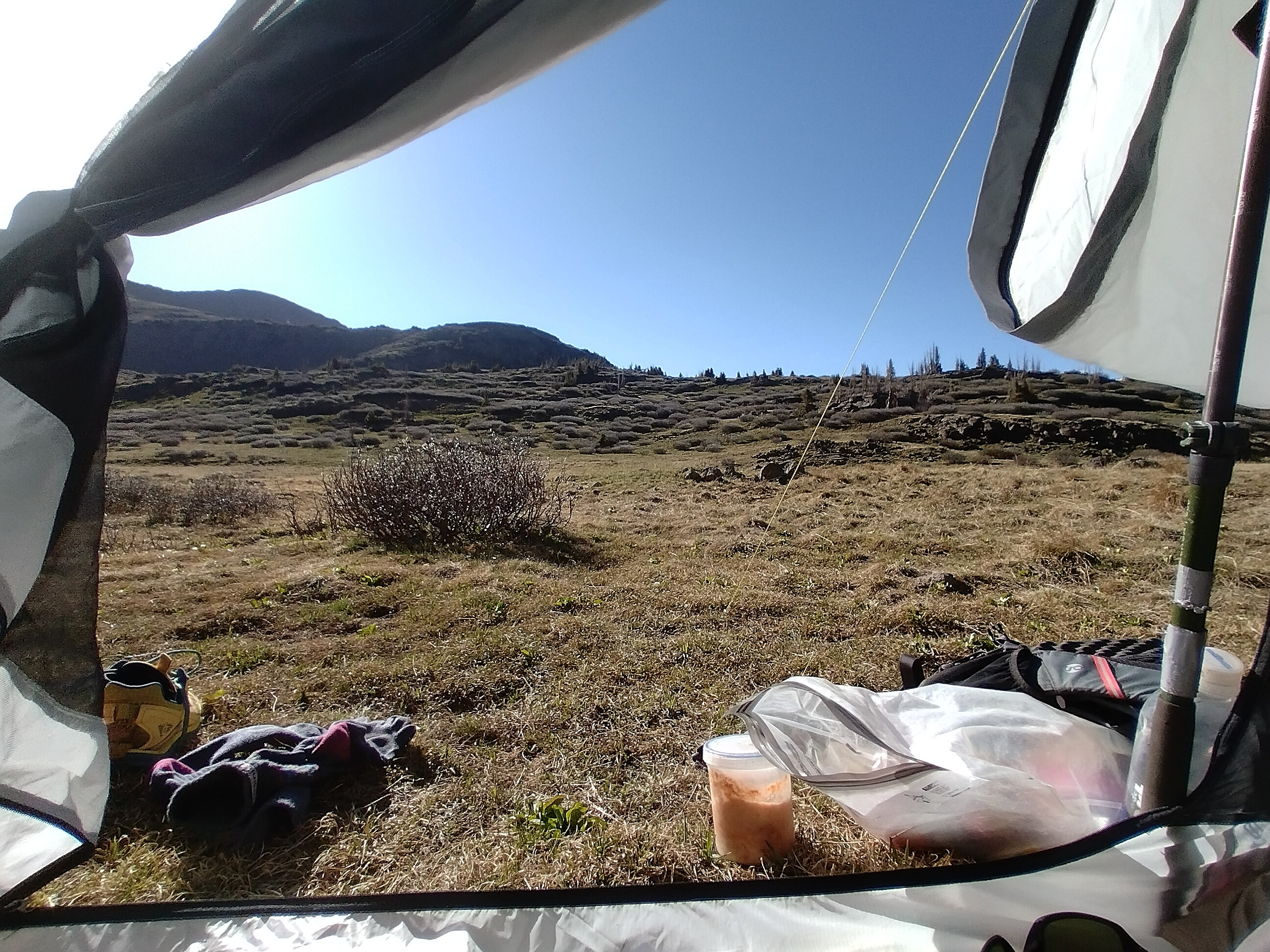
The view from my tent, you can see my hot-sauce-flavored instant potatoes
"cooking" in the sun.
I recorded a voice note: "...and other times, the path is full of stones. It is made of stones. And the stones gather snow around them. And if there's snow that means there's water, and that means there's small trees gathered round. And that means there's willows, and they try to grab at you as you pass by."
I read, ate my dinner, and gradually the wonderful evening came to a close. At some point I heard the voices of Shotgun and Critter, the two tall women who strode powerfully across the west. I'd last seen them in Cuba, at a Taco Bell where many hikers gathered to charge their phones before heading into the San Pedro Parks Wilderness. The stars whirled overhead, and I slept.
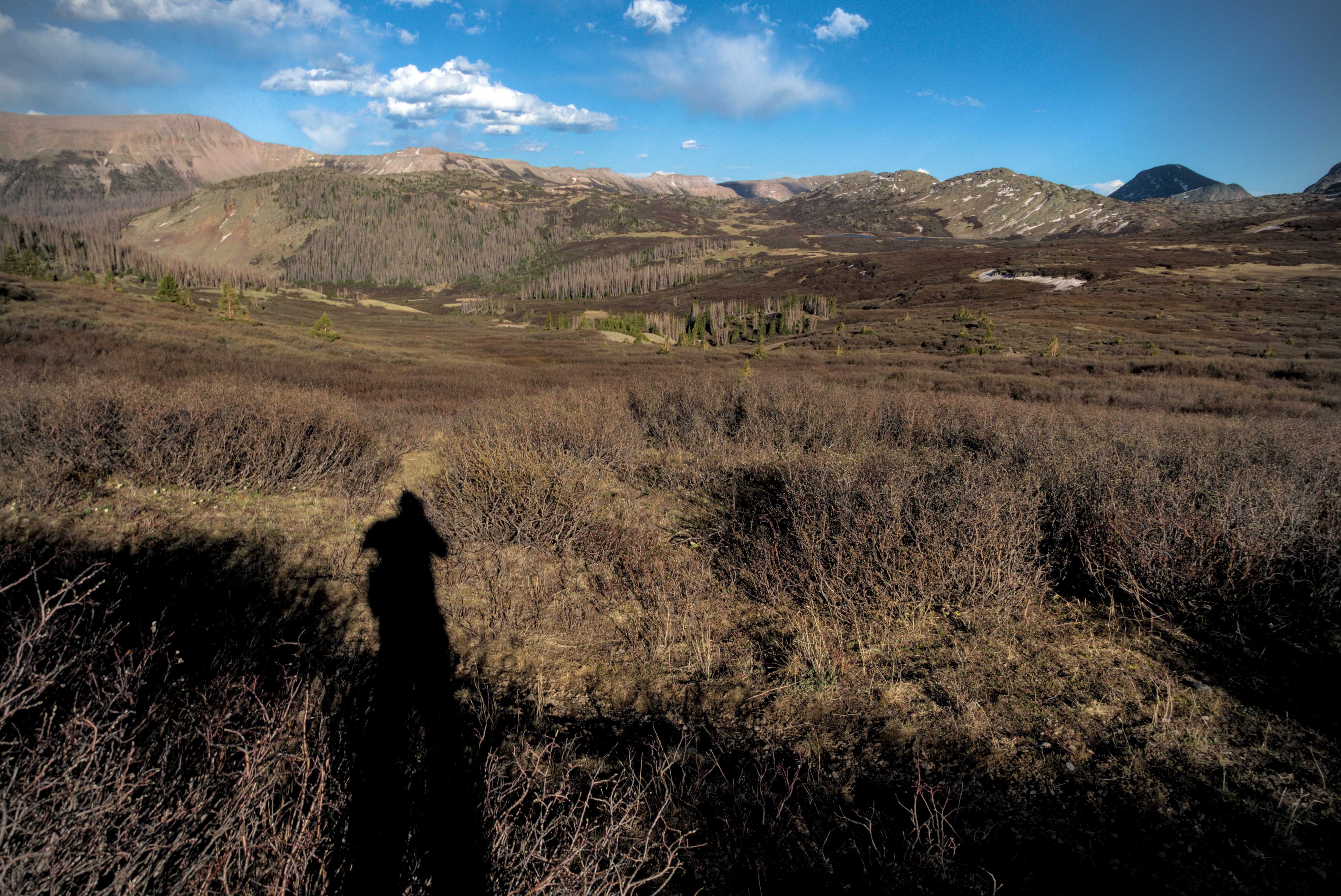
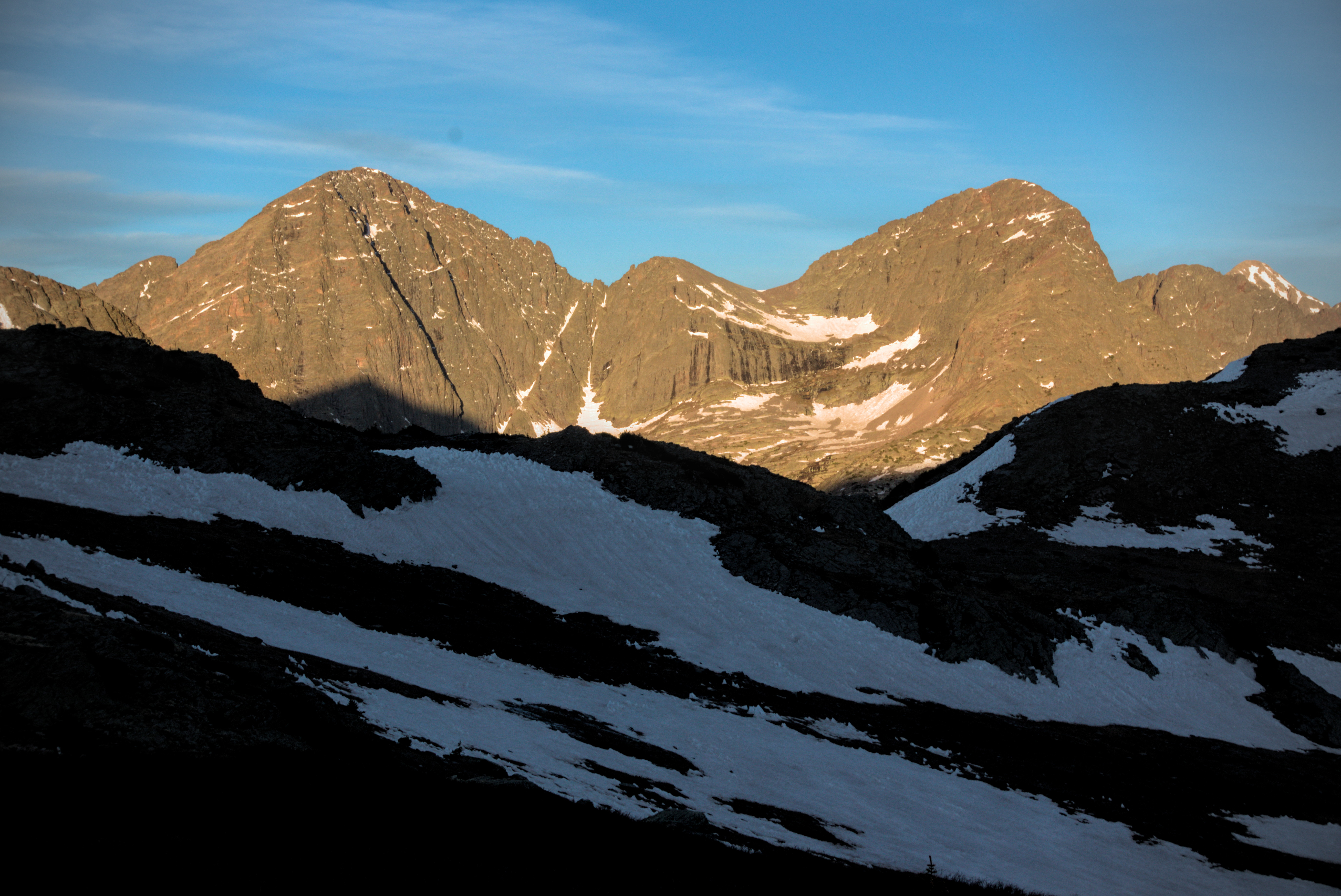
June 2, day 43, 25.4 miles
The most beautiful mountain day of the whole dang trip!
I was up in the gloaming, eager to begin climbing to warm up. I snapped a few pictures of my nameless mountain turning pink, then quickly put gloves back on. I took a wrong turn down to a little lake, then repaired my error by cutting through grass and shrub to regain the traversing trail. At the crest, I took some final pictures of Squaw Valley which would remain a special place.
Up early, saying goodbye to camp (note the other tents).
I believe I'm going cross-country here, not wanting to follow the trail
into dense willows.
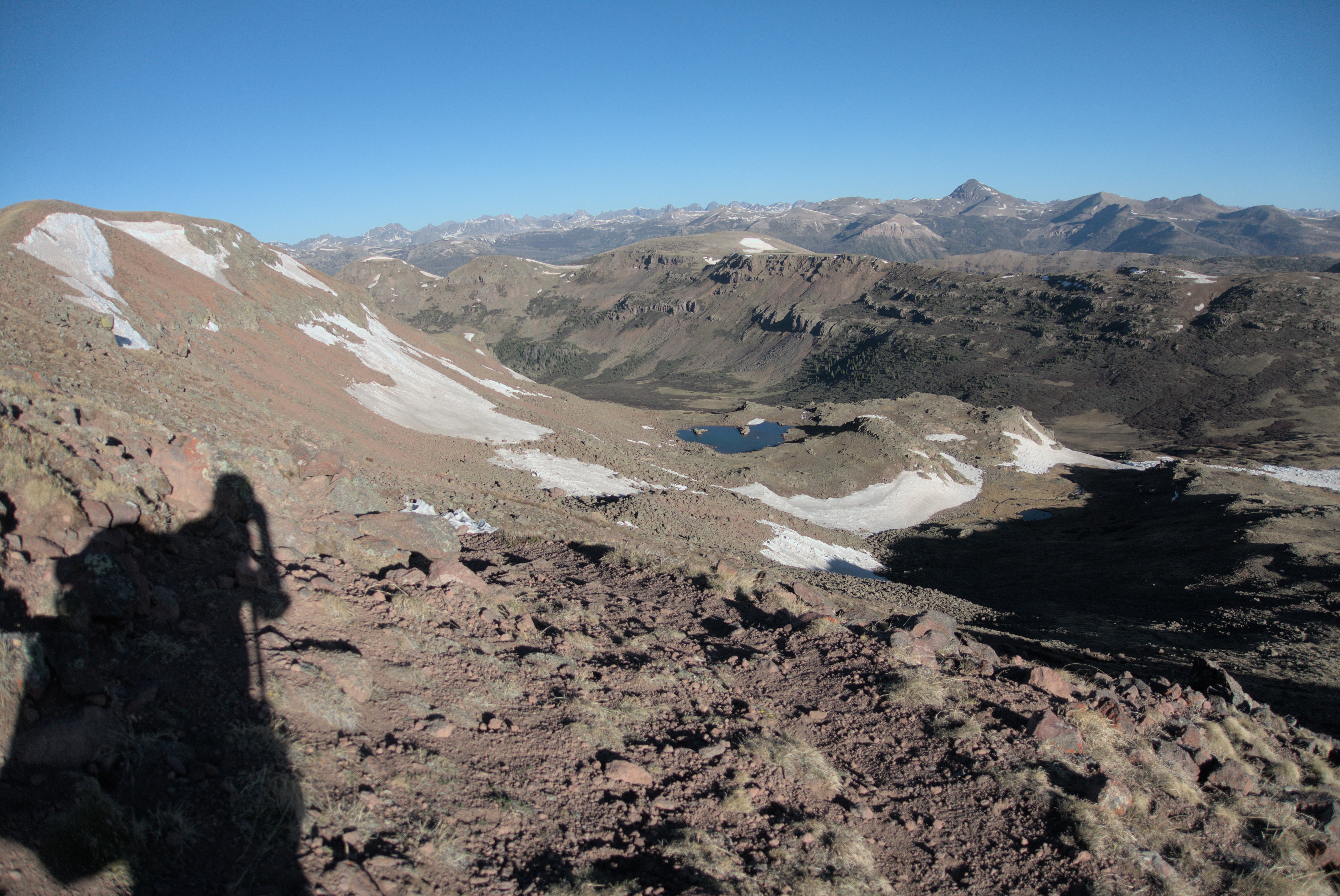
Goodbye, Squaw Valley!
Dropping into a basin, I saw 3 large elk moving away from me below, their light-brown bodies and dark legs fitting in perfectly with the land of which they were an integral part. As I climbed up the other side of the valley, I saw two people behind me. They'd catch me soon.
The way reached a long north-trending plateau, and became mercifully free of ups and downs. The pair caught me, they turned out to be Critter and Shotgun. We talked for a while. I heard them mention "dabbing," and my kids had talked about that years ago when we hiked the Karwendel Traverse together. I have a dozen pictures of them making what they called the "dab" motion. Critter explained that it is, well, a drug reference. It refers to a special way of imbibing marijuana with the aid of a pipe of some kind...and the "arm in the air" motion is somehow related.
Gosh, I'm out of touch!
But we enjoyed this long plateau and it's gradual, gentle descent. They said they wanted to cover 25 miles today. I balked, not imagining that I could do that in any dimension of reality. Critter lives somewhere near the San Juans, and Shotgun is from the city. But they were a perfect pair. I said goodbye as they raced on ahead, promising that we'd see each other again because they take long breaks. "Okay!" I said, not believing them. In a realm of gorgeously blue lakes, I watched them depart.
Impossibly blue lakes on the long trek north.
I was heading towards a major trunk valley. First I had to turn west and descend the North Fork Pinos River for several miles. I took no pictures in this rather narrow valley, trail paralleling the stream on the north side. But it was exciting to emerge on a vast, flat floor, criss-crossed by winding streams. The trail actually goes a mile north down this valley (the Los Pinos), then turns back to to the same point on the other side. No way! I decided to cross more directly, being ready to cross a river if I had to. I don't quite remember if I had to get too wet, but I weaved among the streams and soon reached the other side. Here, sure enough as they promised, I met Critter and Shotgun again. I joined them for lunch and why, they were right...they do have a long break at times. We talked of many things, then left together, first crossing a meadow behind a short forested stretch. We could see our goal...a wall of peaks blocking the way, around which we'd turn south to reach a pass on the other side at the head of East Ute Creek (the Utes were the local native americans), before climbing again. The mighty Rio Grande pyramid loomed before us, and we'd be passing a famous feature of the trail called "the Window."
In the broad Los Pinos valley, with the Rio Grande Pyramid ahead.
I liked the little post.
Critter climbing up to the Window, Shotgun behind.
Approaching the remarkable "Window" on the upper right.
I got a bit closer than this, but didn't go up to it, though some folks
do that (Mishap and Gargoyle did, I later found out).
I listened to music and ground out the elevation, the girls passing by me in the steepest part, a rather dusty climb in the sun beside a burbling creek. Soon enough, I was on an alpine bench and moving south, with a spectacular view of the Window on my right. I formed mystical ideas about it. It was indeed a window of blue sky with fluffy clouds surrounded by sharp vertical cliffs. I felt that it was a metaphor for the way we build a frame around reality, and only approach the real through a bordered lens in order to feel safe. But the yearning, the sehensucht, leads us ever into our Window, again and again.
I looked back down to the path and wandered in this high country, joyful but a little unmoored. The wind blew harder and clouds thickened. I have a voice recording that illustrates my state of mind:
The clouds are so close...I can touch them. If I crane my neck, I can bite them. They will taste clean and lemony, with an outer crunch.
I see the valleys behind me, with the peaks...all the things that I was. I leave them! I leave them alone.
And I wonder what lies over the hill? I stand in the sun-cupped snow, just below the base of it. What will I become?
I cannot fathom it.
Leaving the Window, heading further south. At the end of the day I'd be
far on the other side of it.
On a high plateau, where the sky dominates.
Looking back south to the Rio Grande Pyramid. I came down the slope of the
mountain on the upper right.
On a southern slope of Ute Benchmark, I met Critter and Shotgun again sitting in boulders and heather near a stream. I tried to explain my complicated thoughts about the Window with no real success! Critter has a neat tattoo: "the hermit" tarot card. I was a bit rusty since I haven't thought about it in a while, but I was able to explain the link between tarot and the kabala (the jewish mystical tradition), through the tree of life glyph. "The Hermit" is a path between two states of consciousness: the exalted throne of Tiphareth, associated with our true lord, Jesus Christ on the one side, and the seat of benevolent wisdom in Chesed, associated with many good things, including the planet Jupiter. The tarot imagery is pungent in order to get you asking questions of yourself. Why a hermit? What is there about goodness and wisdom that leads one away from crowds? What sustains someone like that?
I only hope I didn't bore her to tears with this explanation. But it didn't matter how much I droned on, because the view before us was immense...a sprawling wilderness valley descending to the south east. It had a path in it: the Rincon la Osa Trail. I imagine Critter will return and hike it sometime.
Sitting with Critter and Shotgun (not pictured), looking into the Rincon
la Osa country.
A similar shot.
Heading further west. We came through the notch in the ridge above Critter
and Shotgun.
Now, happy hours climbing a bit further then descending into the most beautiful basin of the whole trip, the Ute. Ute Lake and Twin Lakes nestled between rocky escarpments. The "San Juan mix" of alpine heather and shrub ran in long lines over a bony, beautiful land. At this point Diva appeared, with his trademark pink shorts! As he bounded up, I asked what he was listening to. "It's a podcast," he said. "Oh! I love podcasts! Which one?"
"Dungeons and Daddies," he said with a grin.
Well...I asked! He actually took off running down the trail. I tried to get a picture of him in front of a snowy peak. I'm really desperate for people in my pictures, because they provide scale and awaken imagination. Later I saw a stick in the middle of the trail, which was certainly his mark for his companions to exit and descend to Ute Lake where he found a good camp.
And now, a remarkable new country, with a different look!
Shotgun before dropping into the new country, Critter getting a drink
just behind.
Getting over a pass to drop into this new country. Diva can now be seen
in the lead.
Diva with a peak behind (possibly Weminuche Peak).
We traversed this luxorious country of willow, rock and tree.
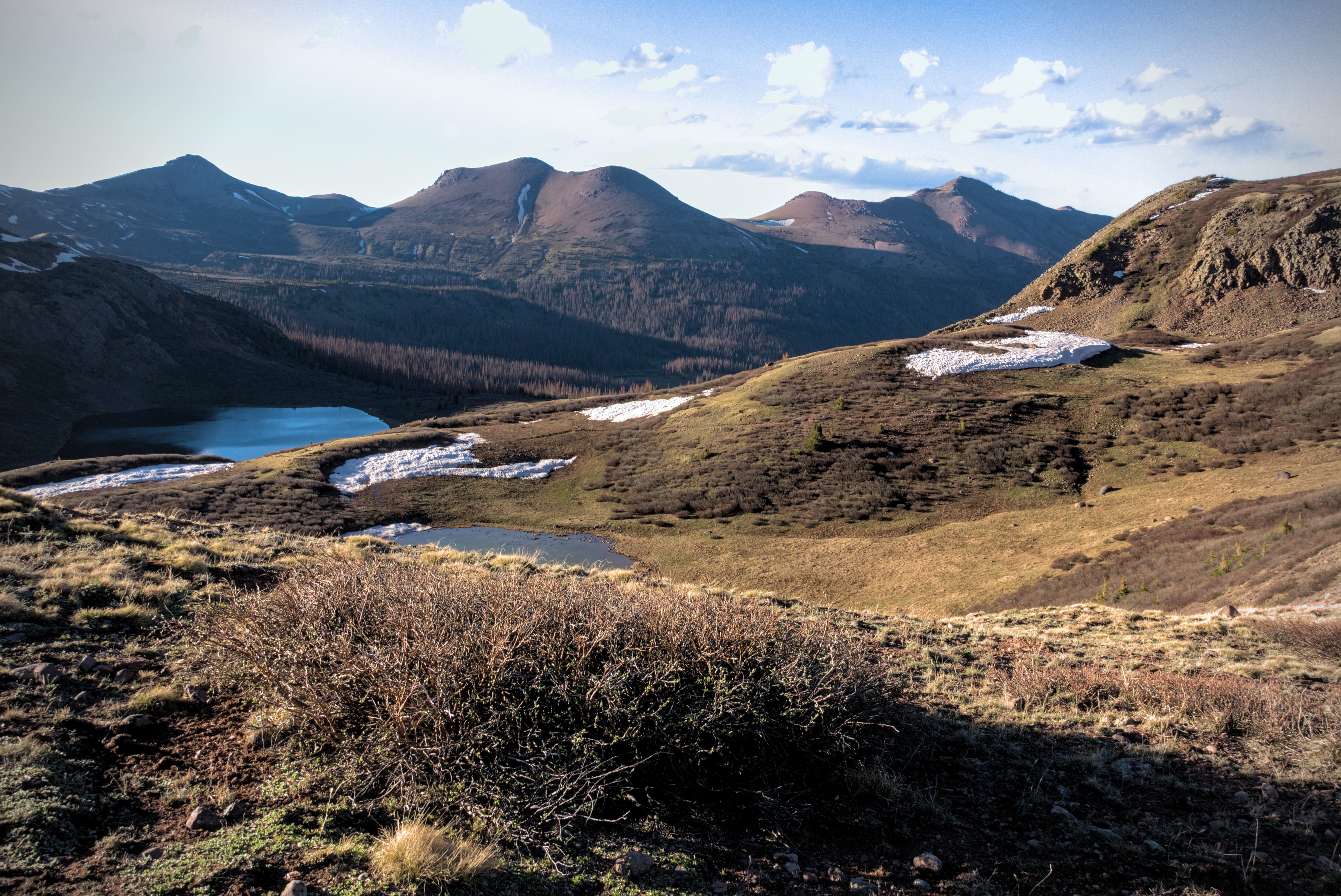
We moved quickly down, then I took a break at the Twin Lakes. After a brushy low point and intersection with Middle Ute Creek, the way climbed again. I continued to admire the basin, now from a new angle. I crossed a pass, and looked down on West Ute Lake. I thought this was the camping place Shotgun and Critter had mentioned. I'd enlisted myself in the 25 mile day idea, and felt relief at thinking I'd done it. Turns out I was wrong...it was another several miles and a decent climb to their destination, a little tarn below Mount Nebo.
Here, I made a blunder that made me ashamed later. On a bluff above the lake a Polish man was cooking some of many fish that he'd caught on a fire. But the country was in a complete fire ban. Shotgun was trying to explain to him the danger, elevated because of many dead trees around. I didn't really take it that seriously, and also thought we'd camp here, so instead of helping out with a scolding I just said hello and enthused about the smell of fresh fish!
Later, we walked together to the outlet stream where Critter was sitting in dense bushes. It was a tough crossing, but by pulling on the right branches we were able to get across without falling in (okay, the truth is Shotgun hopped and skipped in about 3 seconds, while I took a careful minute!). Critter stayed away because she was sure she'd kick the mans fire out, unable to contain herself.
These scenes will likely never leave me.
Down and then gently back up.
The Rio Grande Pyramid from the opposite side.
Tarns and peaks...
As we set off I made remarks along the lines of "is it such a big deal this high in the mountains?" and got an earful of data. Despite the high elevation, those dead trees are incredibly dry. Critter knows fire workers, and saw country like this destroyed by fire. I'd been charmed by the mans "bushmaster" approach. He brought little food with him, planning to live by fishing. However, this is not at all responsible use of this country. And we won't have it for long if even a few more people try to do that, setting fires every day as they travel.
They moved on ahead and I thought about it as I climbed tiredly in the evening light, the beautiful Window now directly behind me and two valleys back...my previous campsite so far away I couldn't pick out where it might be in a purple scrim of peaks. I saw that we have to hold each other to standards to honor the gift of this country. Truly, the man deserved to feel shame. To have his evening "ruined." Even out here, we have limits. And I'd allowed my desire for "blithe cheer" to lessen the effect of a necessary confrontation. I could have supported that confrontation, and I did the opposite.
So...later, in the moonlight, I caught Shotgun and Critter. Actually, they had slowed up considerably, waiting for me, I'm certain. We reached the lake, thank Goodness, and set up our tents.
Before I set my tent up I made an apology. They appreciated it. It had been a big day. I am only glad that I could recognize my error. But that recognition wouldn't have come without their strength of conviction about the whole thing.
Yes. We need to hold each other accountable. I thank these two for it.
Sitting inside the tent, eating my delicious instant potatoes with olive oil and taco seasoning, I listened to the girls talking through their tents. Shotgun needed some more water for something, but couldn't face getting up out of the tent to get it from Critter.
I could make amends in a small way! I got my shoes on, stepped out into the cold and retrieved the water from Critter. I was happy to be able to help in a small way.
It had been quite. A. Day.
Here, the Pyramid and the Window, now from the west side. We covered
a lot of ground!
Shadows are growing...
It gets cold when the sun goes away up above 12,000 feet.
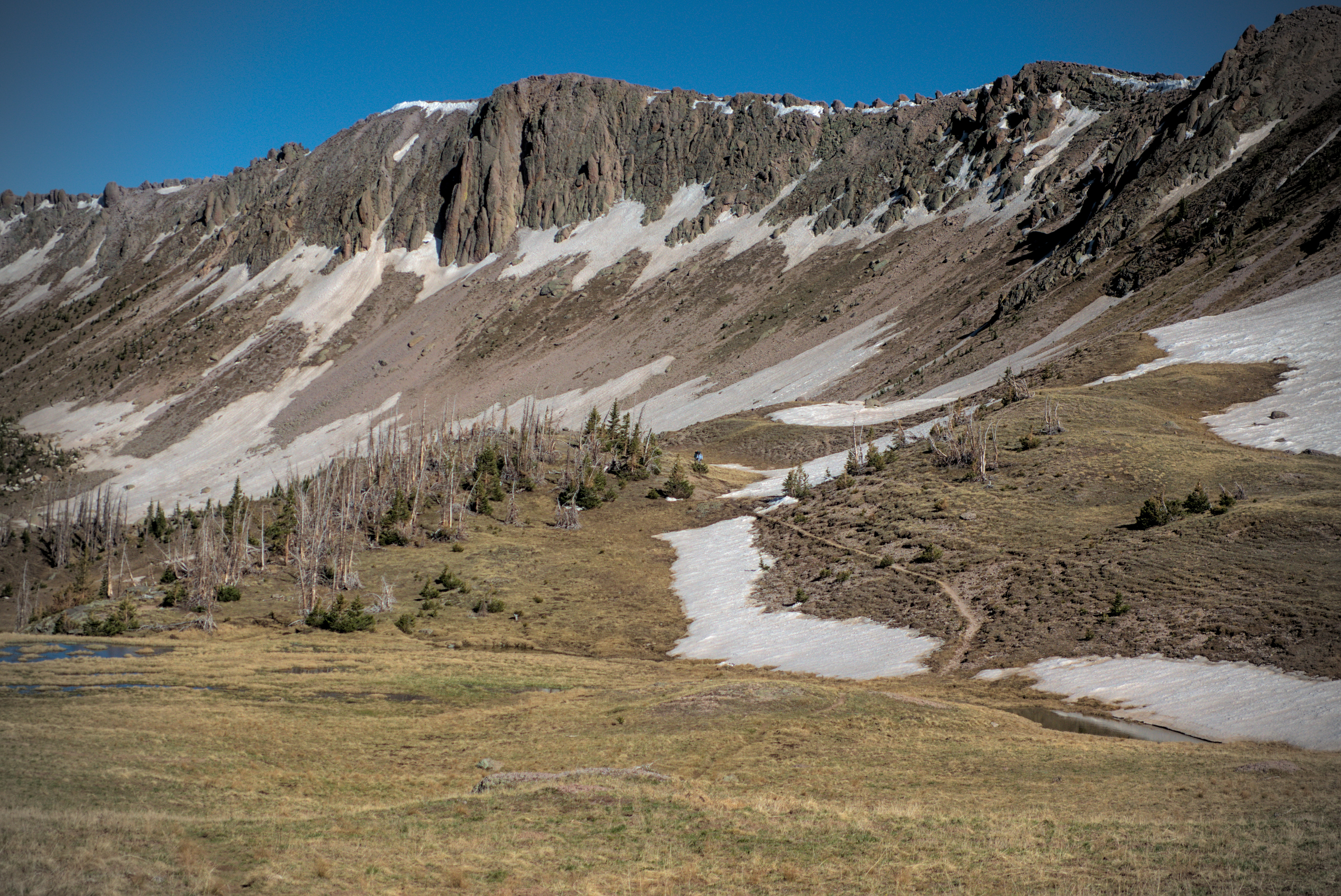
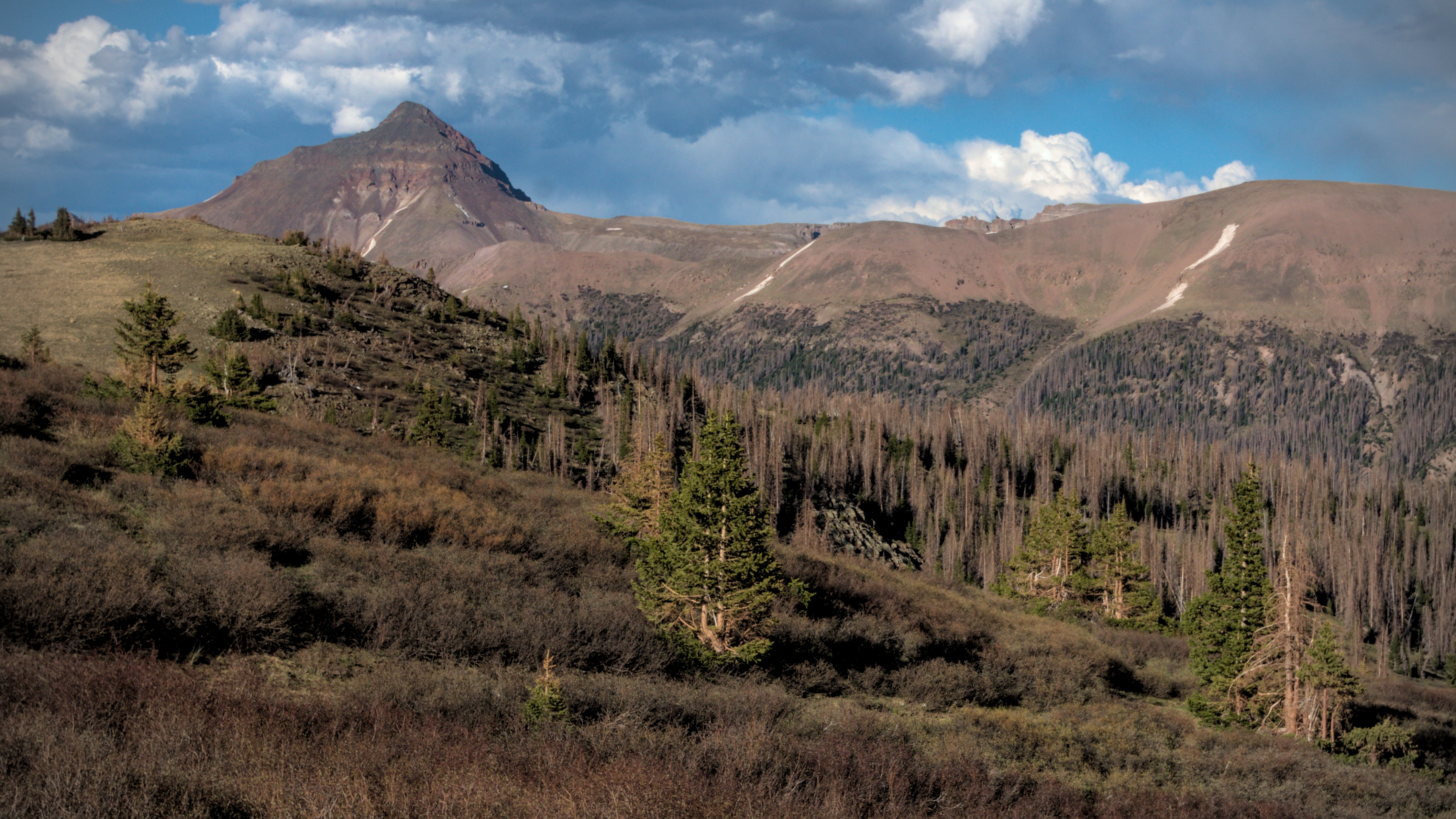
June 3, day 44, 13 miles
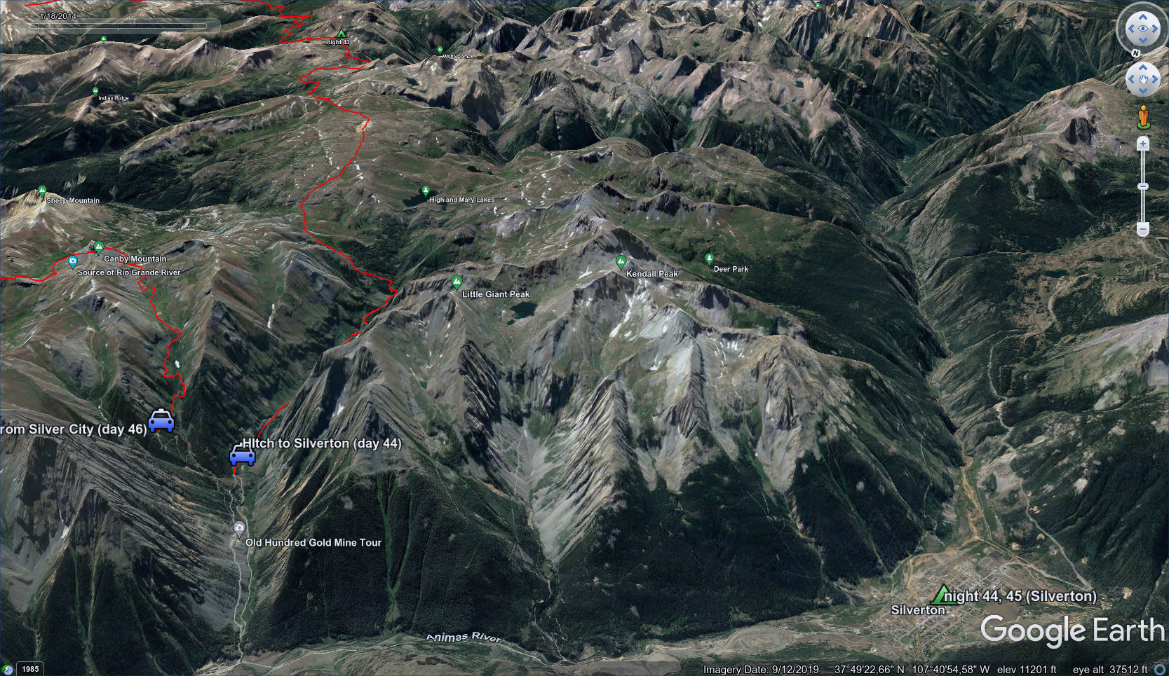
From our camp in the distance down to my hitch on the road to Silverton.
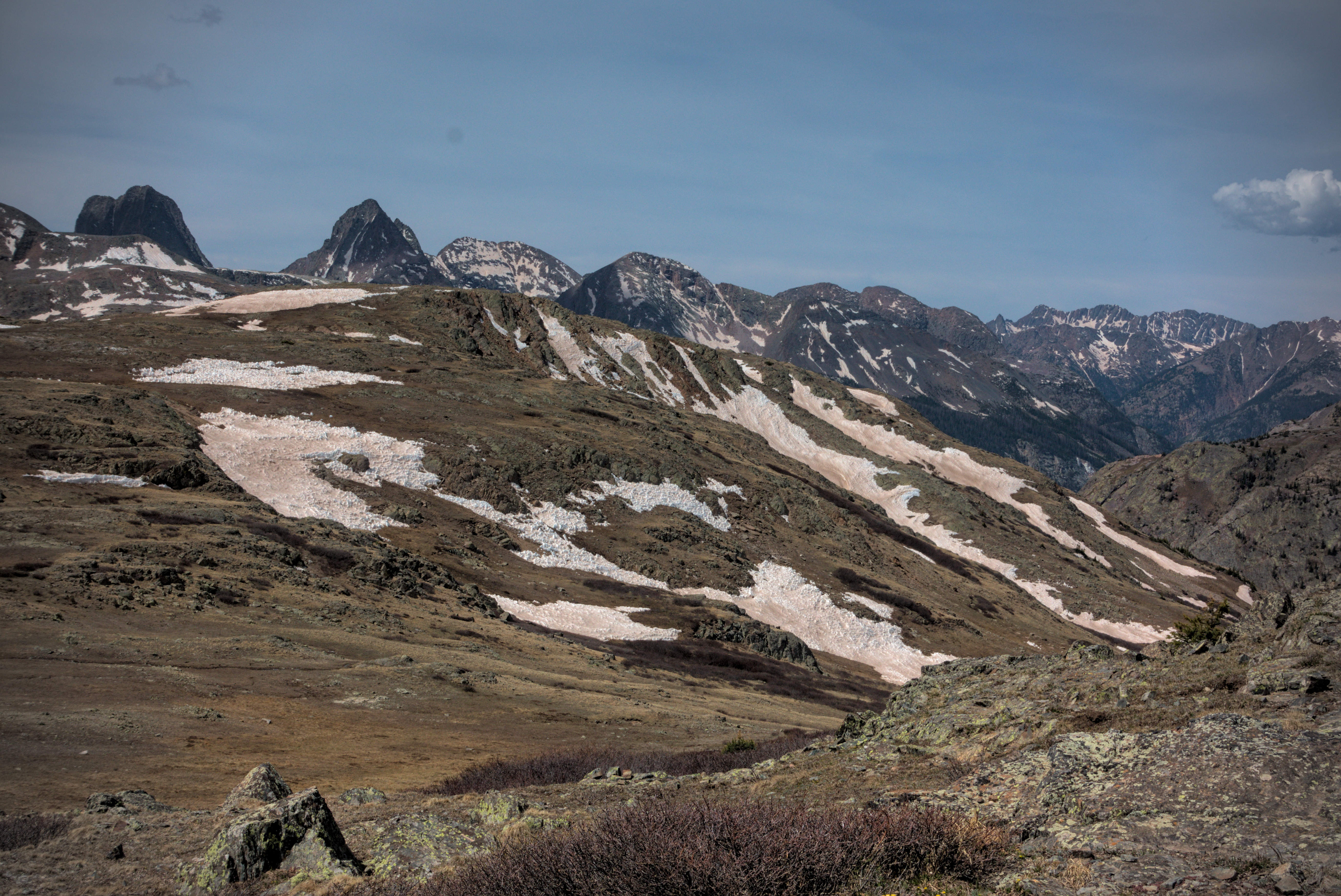
Very alpine peaks in the morning.
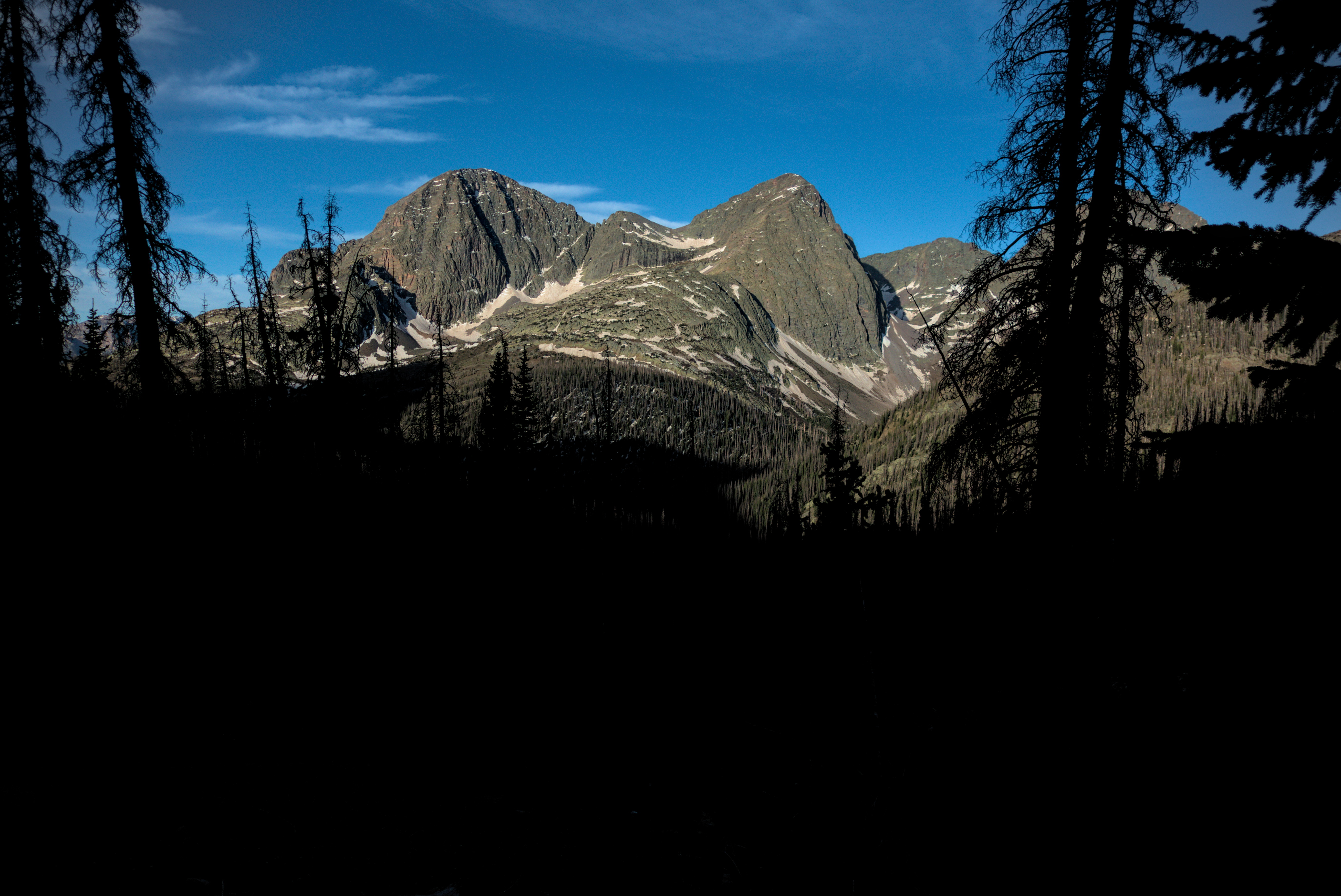
The same peaks, now from further west and north.
I was up before the girls, and I hope I stole away quietly without disturbing their sleep. I had a surprisingly hard time finding the trail descending to the west. We camped further away from the track than I remembered, and there were marshy meadows I had to tediously work my way around. Finally I hit the tread and limped stiffly down. It was very cold, here at about 12,400 feet. At least the deep rut normally full of water where the trail goes between willow bushes was frozen, and I could crunch through instead of either sloshing it or picking my way on hummocks of dirt on the edges of the trough.
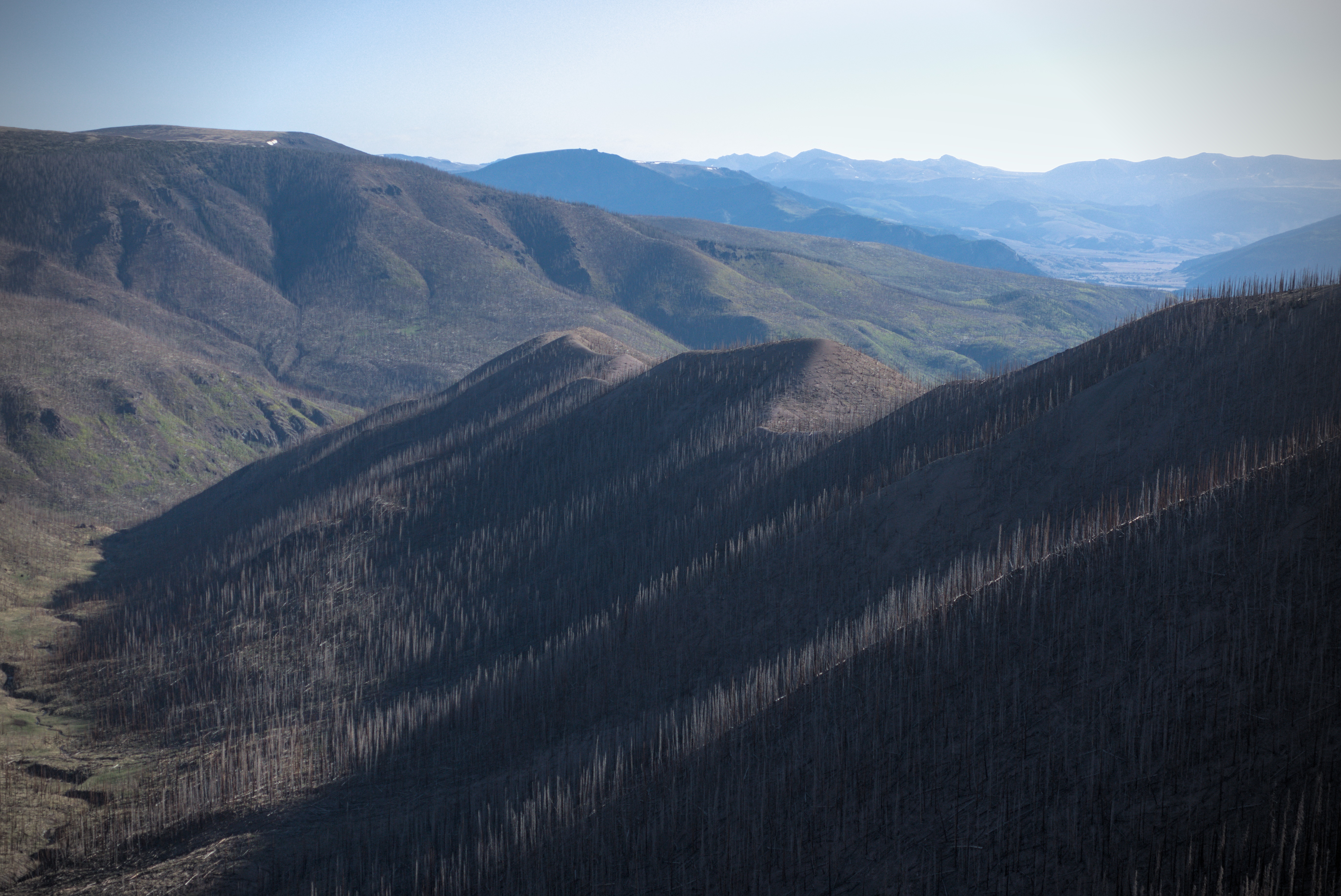
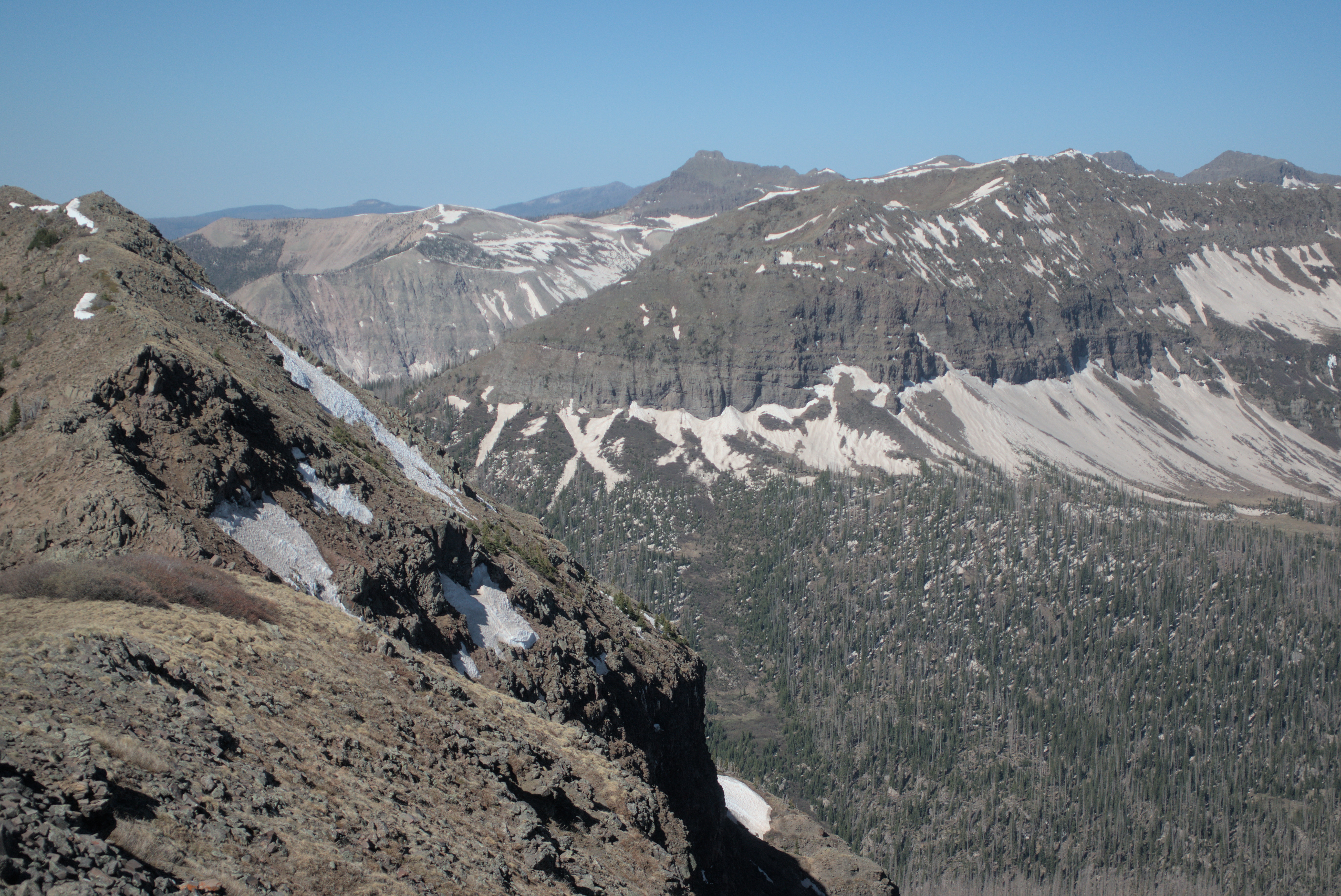
My route led me down 1000 feet then up again to avoid a sharp segment of the crest. It is a famous alternate route, and I thought about it only briefly. The truth was, I was ready for Silverton, and wanted to just plod along rather than face any technical challenges. As I descended I had great views of very alpine country: Storm King Peak, Mount Silex, and the Guardian (no relation to the communist paper out of the uk ;)). My old friend Theron told me that the deepest magic of the San Juans was in here. Indeed, I'd been seeing these craggier, dramatic peaks off to the west and increasingly, the south. Finding even 1000 feet up or down rather painful at this point, I was happy to admire them from a distance!
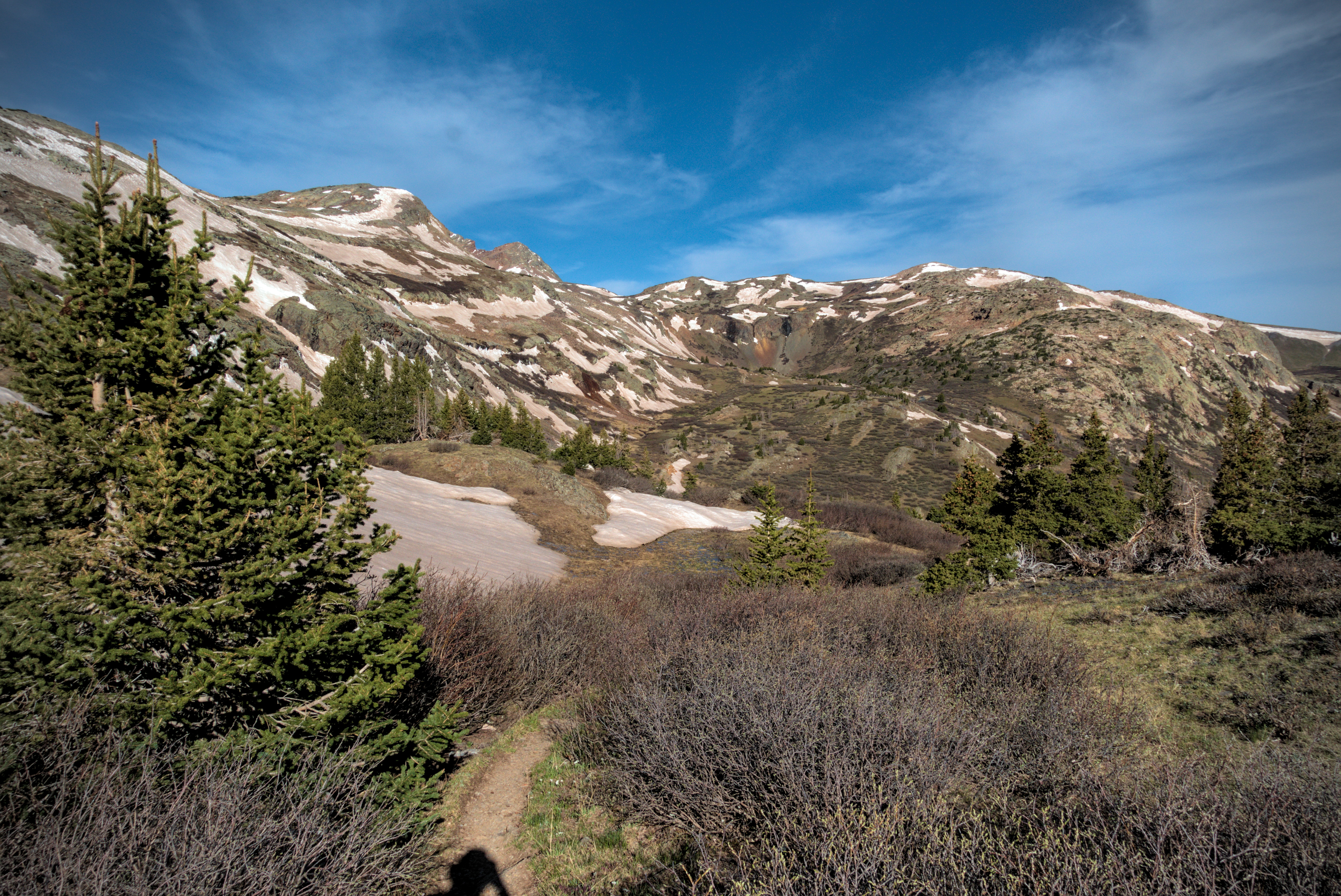
In the Hunchback Pass country.
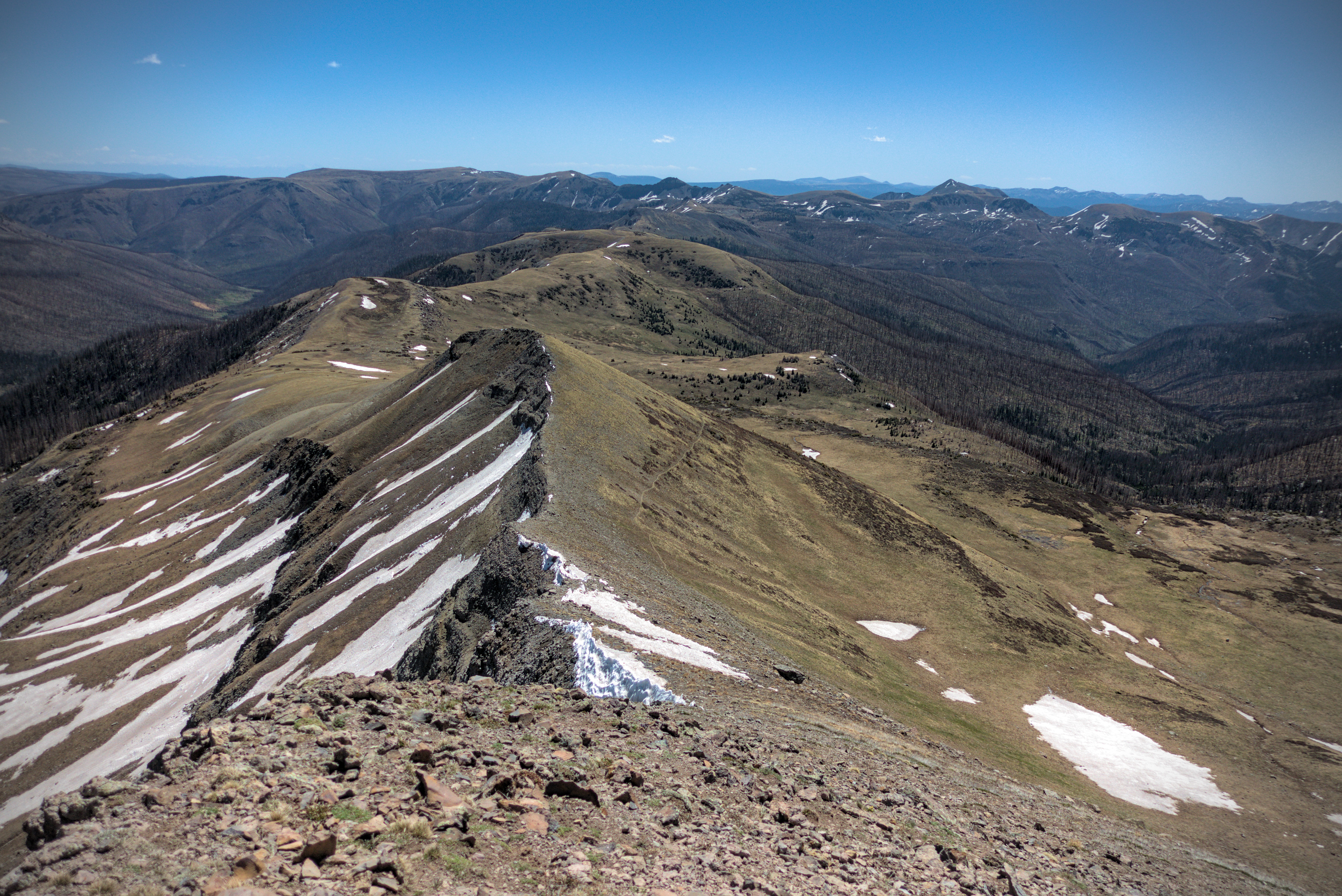
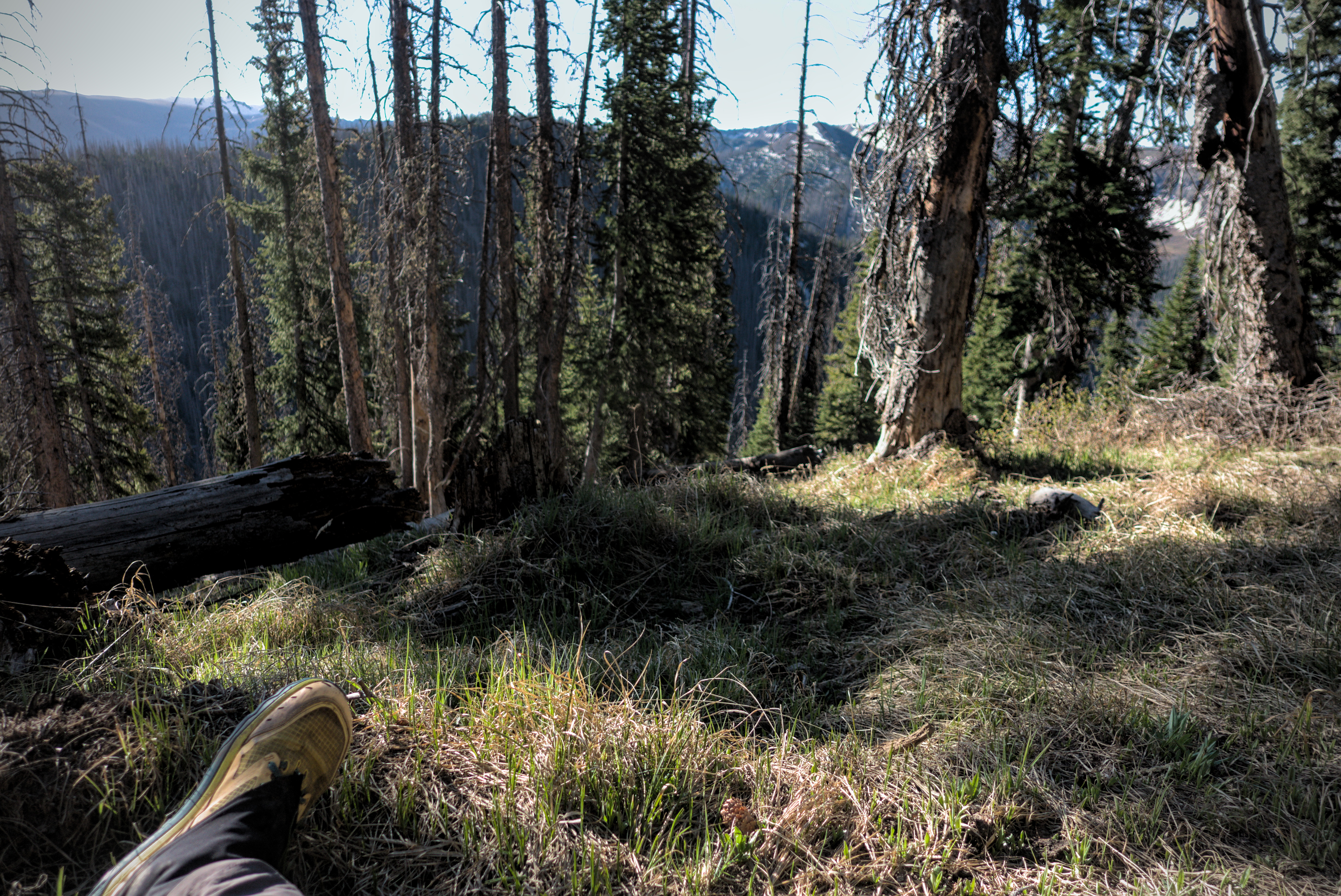
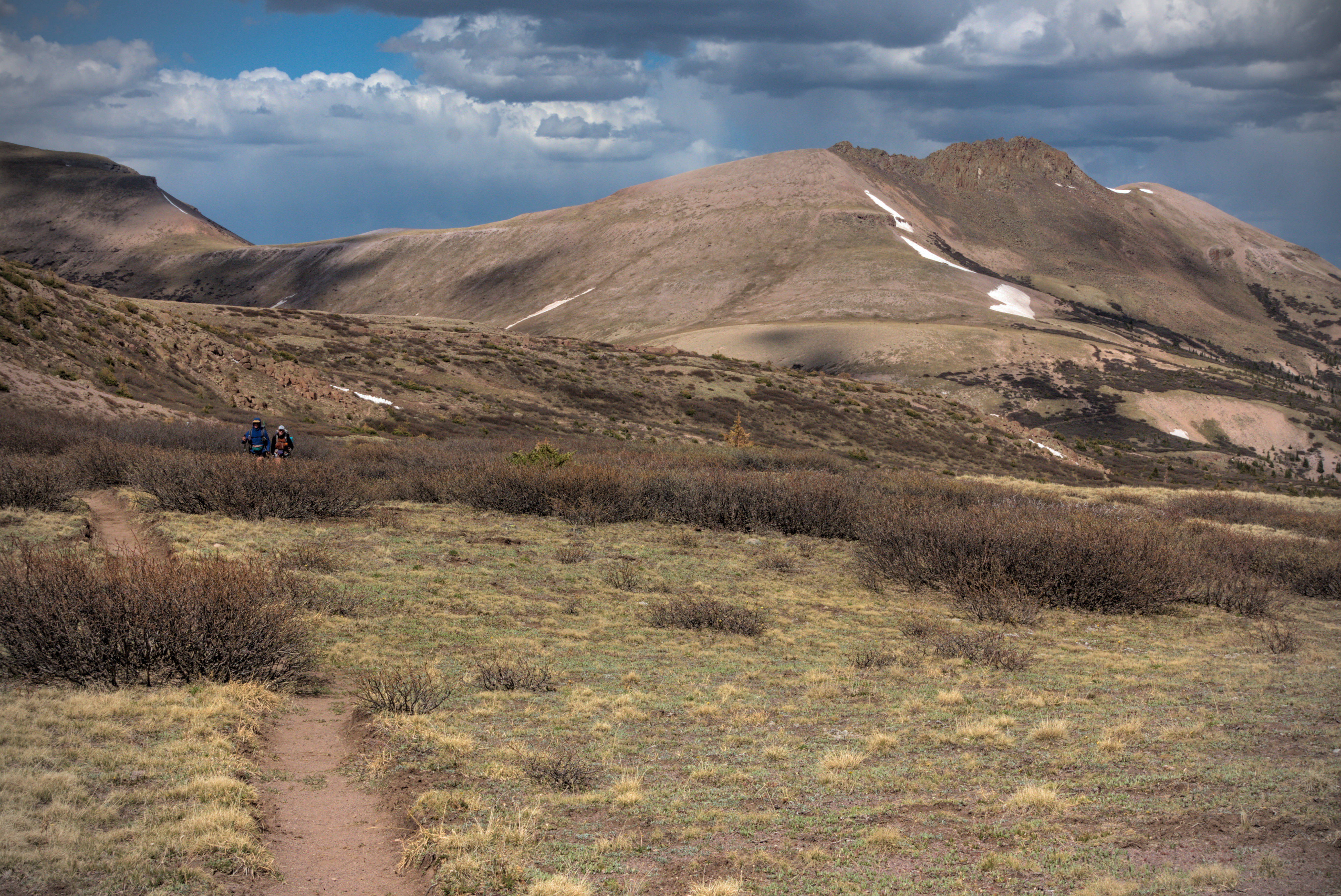
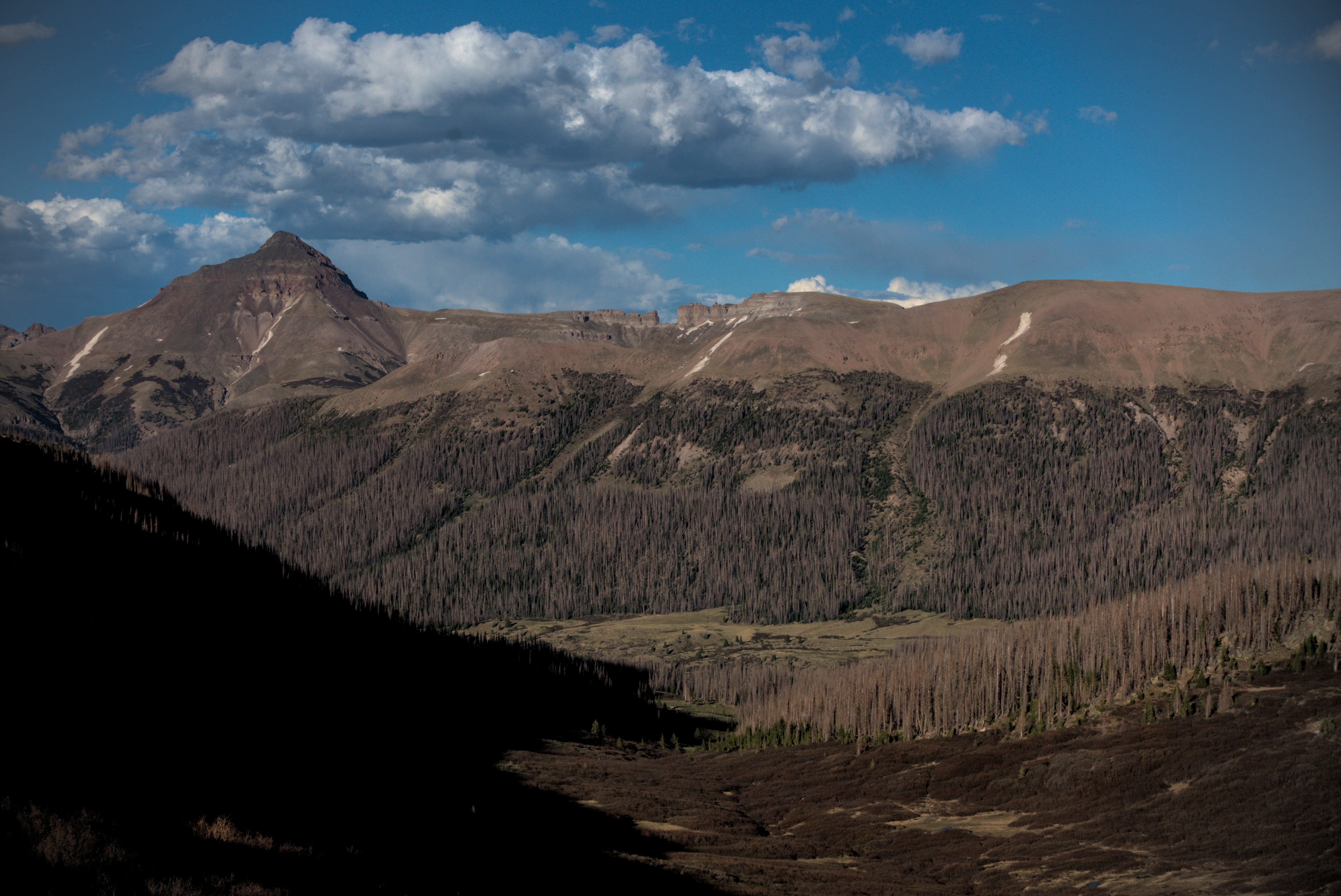
Before I knew it, I traversed a steep forested slope (not too many blow downs, thank goodness), then started climbing up a relatively narrow valley for this country, but still broad enough for great views. It was still very cold. At the top of the valley was Hunchback Pass, and my first exit from the Weminuche Wilderness, stepping into the Rio Grande National Forest. I descended alpine country to the east, then back west into a few snowfields under the north side of Hunchback Mountain. Soon I was in a little piece of civilization: a wide dirt road and a trail register in which I read names of people I knew. I saw Slim and Tall Son, among others. Awesome! Glad to know folks are moving along. Further, I crossed a stream and filtered water, resting a bit. It was time for the last big grind, moving northwest up to a pass and a re-entry into the Weminuche for what turned out to be a delightful long romp on a high plateau, similar to the one I'd enjoyed on the morning of the day before, only bigger and wider. There was always a pleasing sense of lower country on either side of me, but a firm way ahead, climbing slightly on a broad rounded ridge that I now think of as characteristically San Juan. This was a very scenic place, and I had a great sense of peace wandering through here. It went on for many hours, though I find I have little to say about it.

Lemonhope is two days ahead. Slim only one day ahead, but I'd
never see him again, darn it! Many other friends here.
I wrote my name ("Sputnik") and enthused about the Window the
day before.
There are a few options for heading down to Silverton. I decided to follow the Cunningham Gulch Trail. As I descended, I admired a huge north-south trending wall ahead of me, illuminating the depth of the valley I was dropping into with it's nearness and verticality. Increasingly black clouds loomed over those mountains, which were over 13,000 feet. Finally I reached forest, but continued steeply to reach a trailhead in Cunningham Creek. Weirdly, at the trailhead (where I half-expected to find people and cars), I still had to ford the river, as even the road went right through it! Ach...wet feet again!
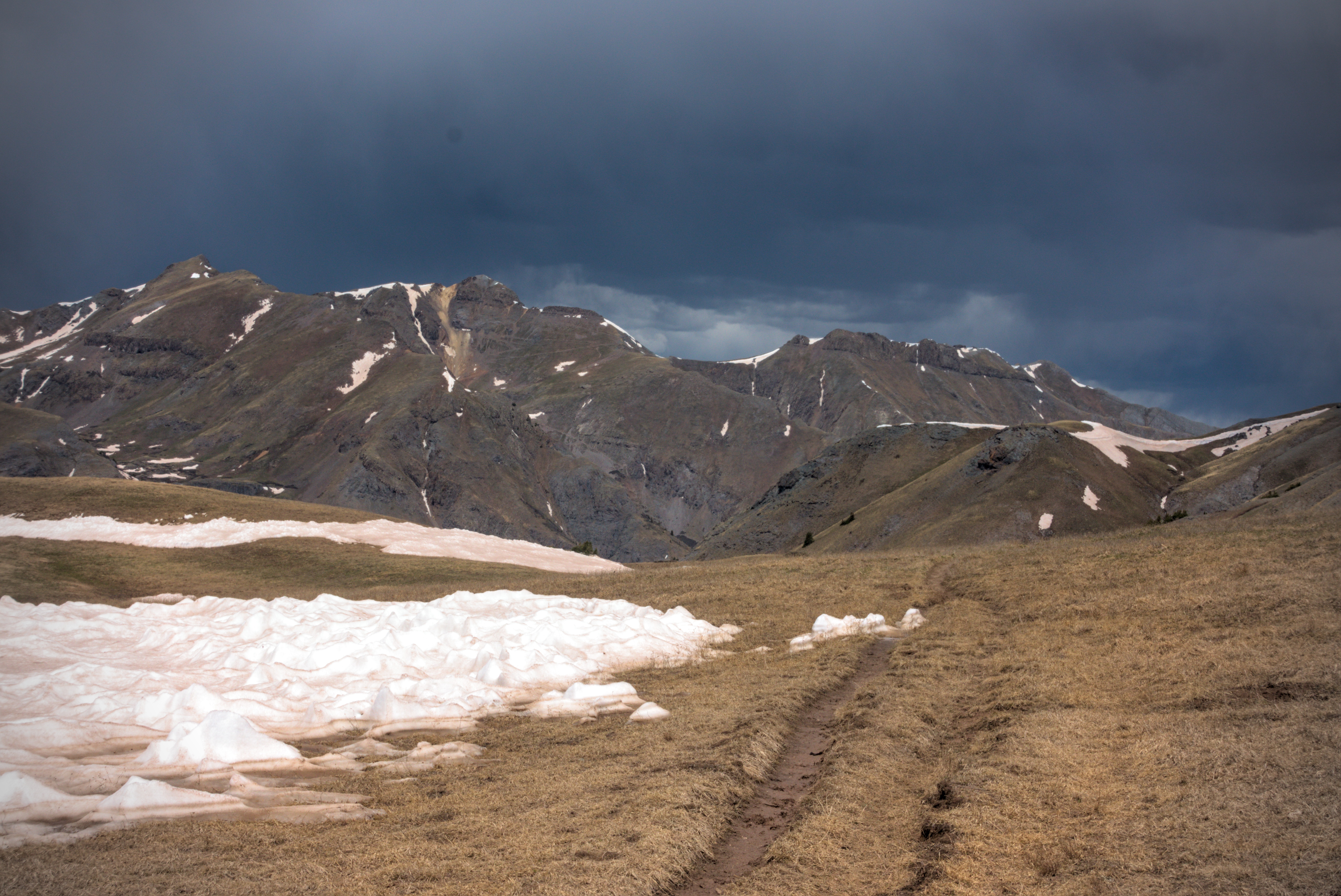
I began to wonder about the darkening sky, but it didn't storm.
Absolutely glorious walking up here.
The trail down Cunningham Gulch, into the deep valley.
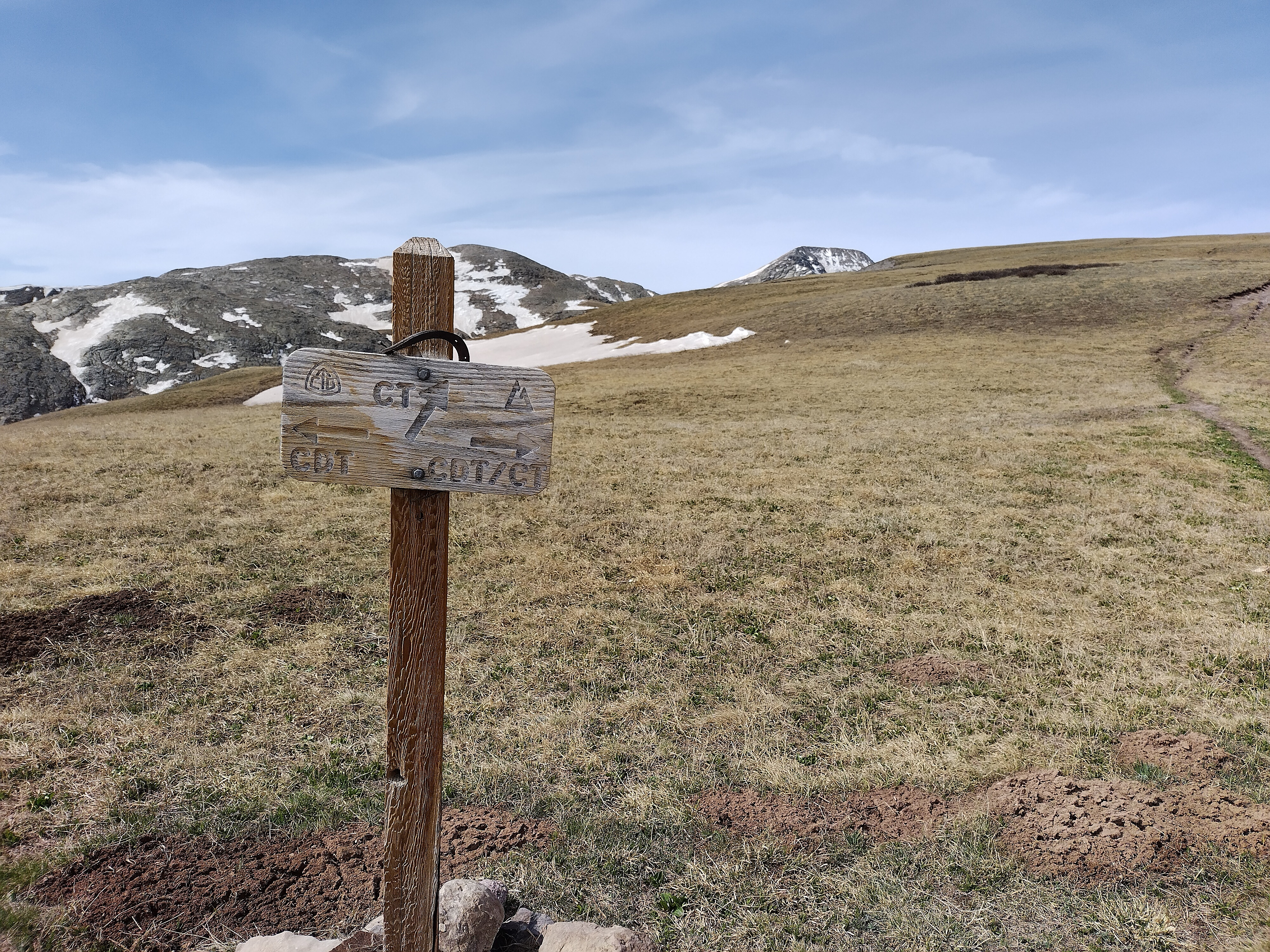
Junction of the CDT and the Colorado Trail (CT).
Now I walked a road down-valley for several miles, feet aching. I hoped for traffic, but no cars came by. Finally, beginning to feel a little bit outraged about it, I realized I might have to walk all the way to Silverton. But then after another half hour a truck came along and I stuck out my thumb.
Who was in the truck but Shotgun and Critter! The owners were a nice couple with a huge dog in the back. I was happy to climb in there with him. He slobbered on my legs and arms all the way down, the poor fella standing or sitting as needed when going over bumpy sections.
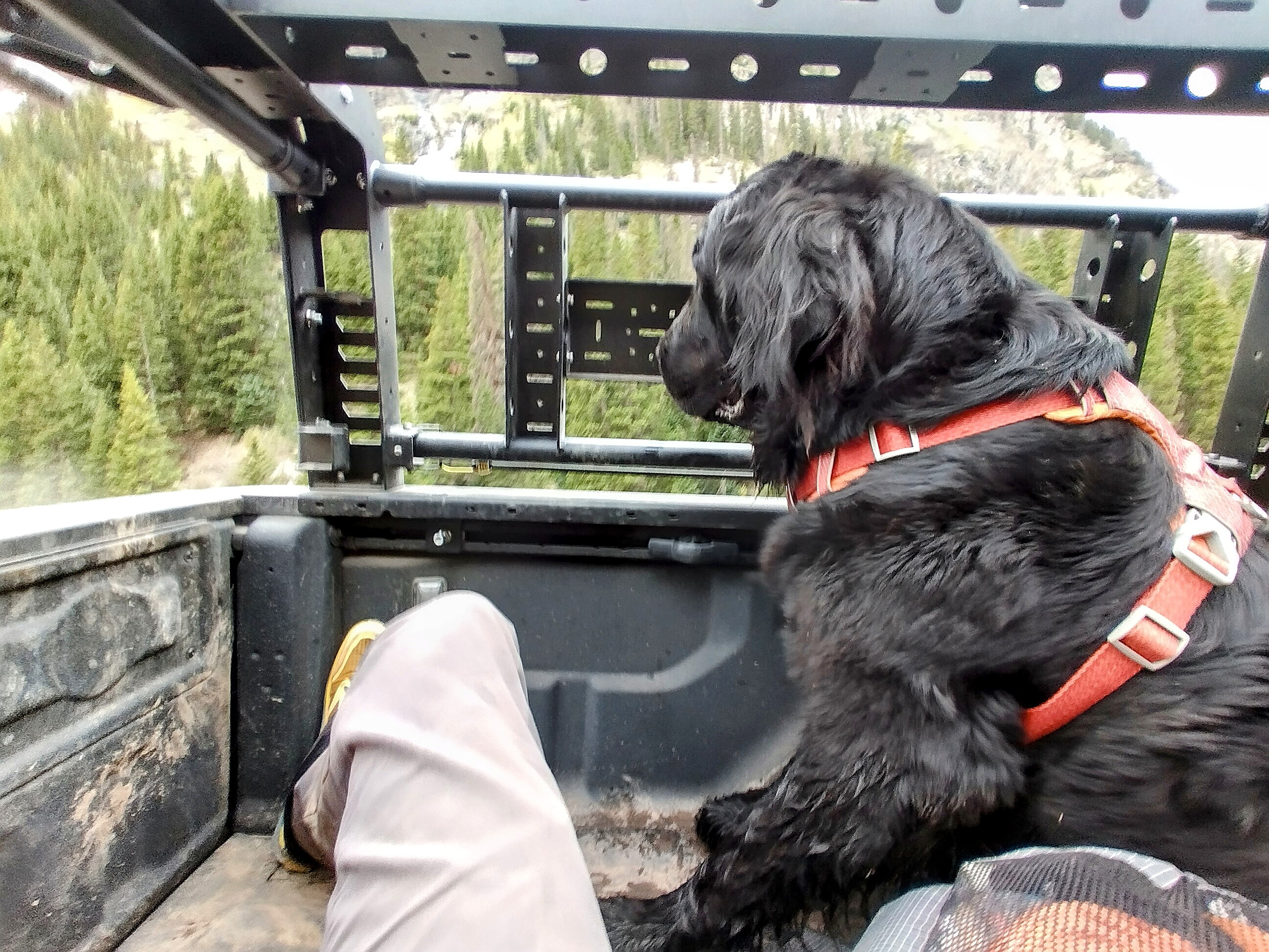
A fine dog of the afternoon, slobbery but kind.
And just like that, I was in Silverton. The next hours were a whirlwind. I met Lemonhope, and he, Shotgun, Critter and I went to a brew pub for pizza and beer. I was desperate for laundry, so after hooking up a place to stay I immediately went out to a laundrymat down the street to wash my clothes. Oh, I first had to buy a pair of shorts and a shirt, because in order to save weight I ditched my sleeping shorts and spare shirt in Pagosa Springs. The first place I went in to had a t-shirt for 40 dollars, and shorts the same price! But the lady inside was very nice and said that across the street I can find something much cheaper.
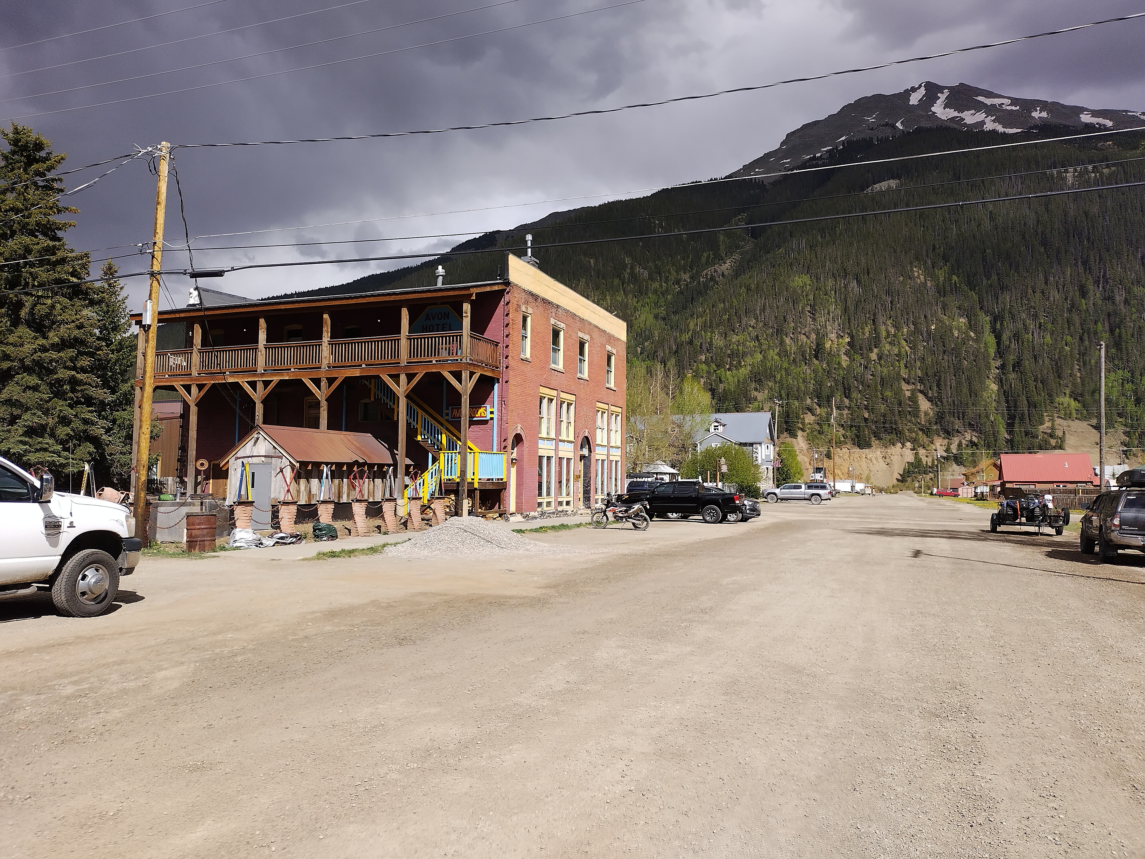
A most fine lodging house in Silverton. I stayed on the third floor.
It felt really good to be showered and wear ordinary clothes. My green shirt really had a rank smell...I could hardly stand it any more. The pants were holding up much better. But the Injinji Toe Socks, nice as they were...man...it just gets very tiring getting your toes into their individual toe pockets! I wandered around without socks and put my feet up as much as possible in the next days.
Shotgun and Critter went to a campground, and I never saw them again. I tried texting a book recommendation about the kabala, but it seemed that my european phone was bad at texting...often messages didn't go through.
I gave myself a full rest day, and managed to book a kind of taxi ride in a 4-wheel-drive vehicle up to Stony Pass on the afternoon of the day following. It was all about eating as MUCH AS POSSIBLE!
I made a friend here, a guy named Leftovers. We had dinner at the pizza place one night, and the second night, I made pasta in the hotel (we had free use of the kitchen, which rocked). He was Lithuanian, but lives in Poland. He pointed out that with low wages in Poland, it takes longer to save up to come do trails like this. He hiked the Pacific Crest Trail a few years before. We teamed up for the taxi ride the next day, and planned to walk roughly together for a while. Leftovers was constantly boggled by how light my pack was, and I felt the same about his in reverse! It was so heavy...I couldn't imagine carrying it one mile. He is a bigger person, true. But still!
As I come to the end of this report, I have to say that this section of wilderness is the spiritual heart of my trip. It contains intimations of that golden "becoming" that I (we) long for. But also I brought my sin with me. On that long, central day, I made an error in my mind though I can't share details. It's taken until now, the middle of October to fully understand the scope of it.
If you look deeply into yourself, you'll see that you will be the last one to forgive your sins. Forgiveness is misunderstood. We walk the hard roads, at least in thought...and I no longer think "thought" is less substantial than the physical world (I think it is more substantial). We only grant ourselves forgiveness when our reason fully damns us. And then...the gratitude for the error and the hard roads overwhelms and diminishes the pain we felt.
The pain is the becoming. And there is love for us all.
'Are the gods not just?'
'Oh no, child. What would become of us if they were? But come and see.'
--Till We Have Faces, by C. S. Lewis
To continue the story, the walk from Silverton to Salida click here.