CDT - Chama to Pagosa Springs
Friends: Katherine, Si Nombre, Cutie, Yeti, Flaka, Info, Special KLocation: Cumbres Pass, CDT Trail Lake, CDT Blue Lake, CDT Summit Peak, Long Trek Mountain, Elwood Pass, Wolf Creek Pass
Elevation gain: 3986m = 1190m + 1073m + 926m + 797m
The slope was covered with flowers which shook continually in a light breeze. It went down a long way and ended in a winding and wooded valley which curled out of sight on his right hand round a majestic slope; but beyond that, lower down -- so much lower down as to be almost incredible -- one caught the point of mountain tops, and beyond that, fainter yet, the hint of still lower valleys, and then a vanishing of everything in golden haze.
-- C. S. Lewis, "Perelandra"
To go to days 34 and before in New Mexico click here.
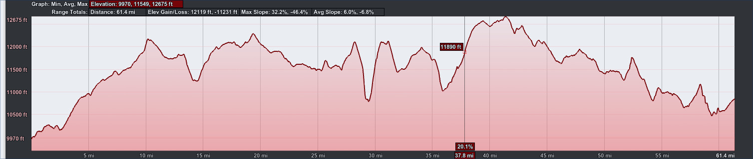
61.4 miles, 12119 feet elevation gain.
May 25th, day 35, 19.3 miles
It had been a great rest in Chama, but it was time to get moving again. I'm glad I had to wait for the storm to pass. I heard about many folks getting snowed out of the mountains. It wasn't so bad in the end that the post office just forgot about my tent sitting there.
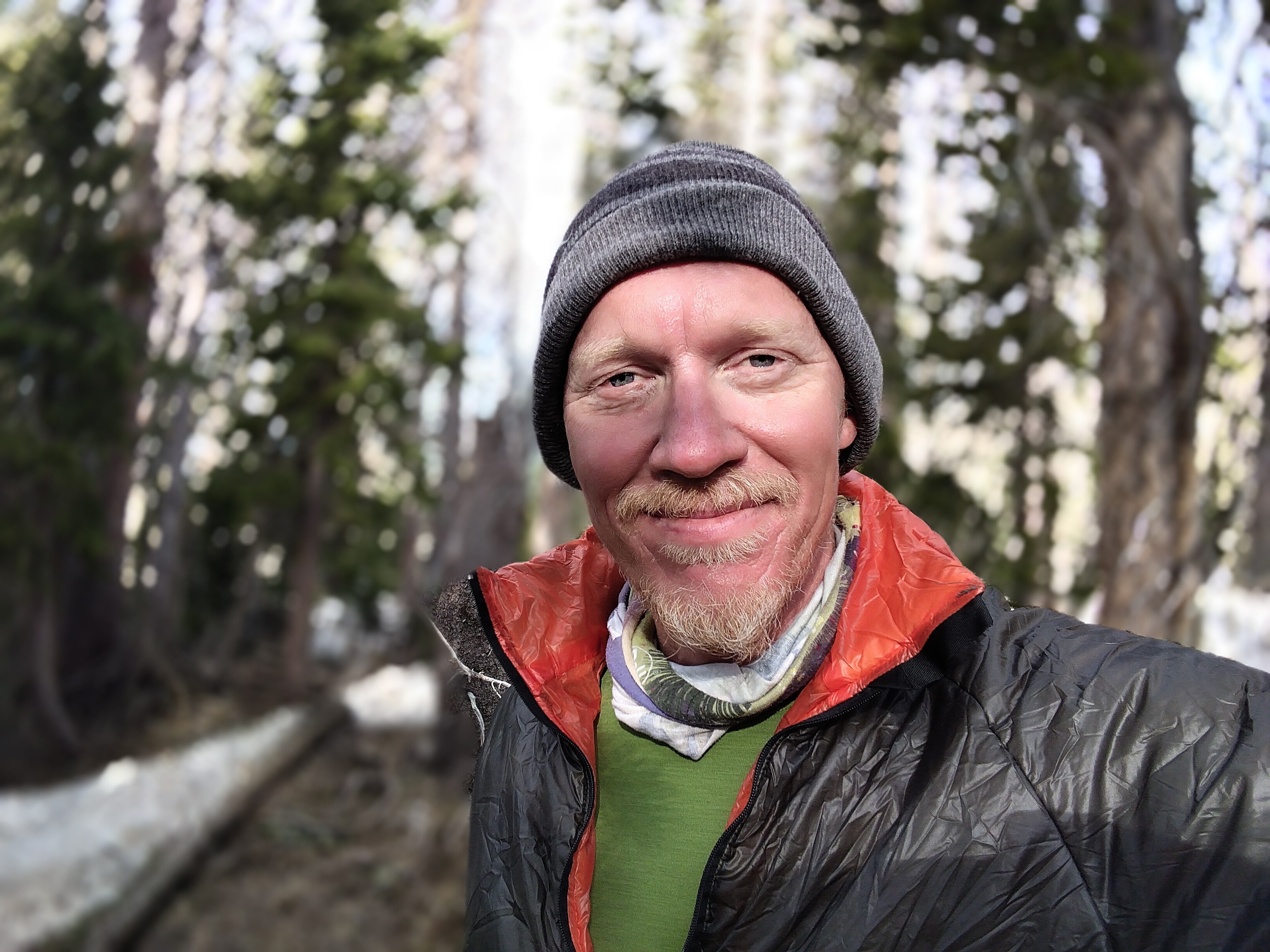
I was up early. I stood across the street and stuck out my thumb for about 30 minutes. It's hard to drive by a lone person in an empty early morning street, but many succeeded in doing so. As often happens, there is better luck in turning a small interaction into an opportunity for a conversation, and then asking that person! Enter Keith, a guy from up north who was here as a volunteer worker on the Cumbres Scenic Railroad. His job was to help rebuild a maintenance shed up at the pass. He was going in and out of the hotel to his truck. He said he'd have breakfast then be happy to give me a ride up there. Perfect! I could use another breakfast. I think we went to the Boxcar Cafe. Soon enough we were off, and got to the pass just in time to see a handful of hikers walking purposefully away from the road. I took a picture of Keith and I, shook his hand and started off in the cold morning air.
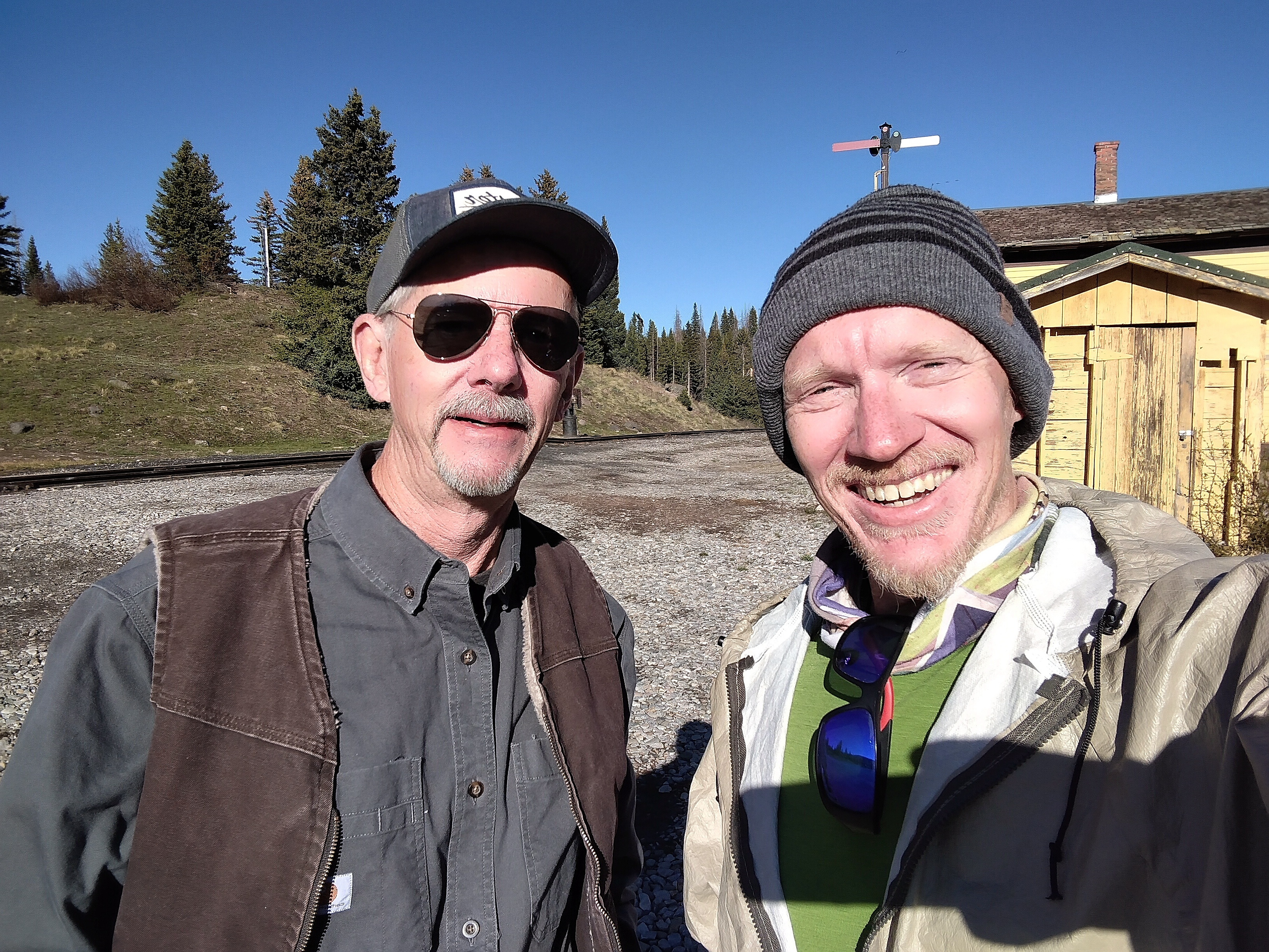
With Keith at Cumbres Pass. Thanks for the ride, Keith!
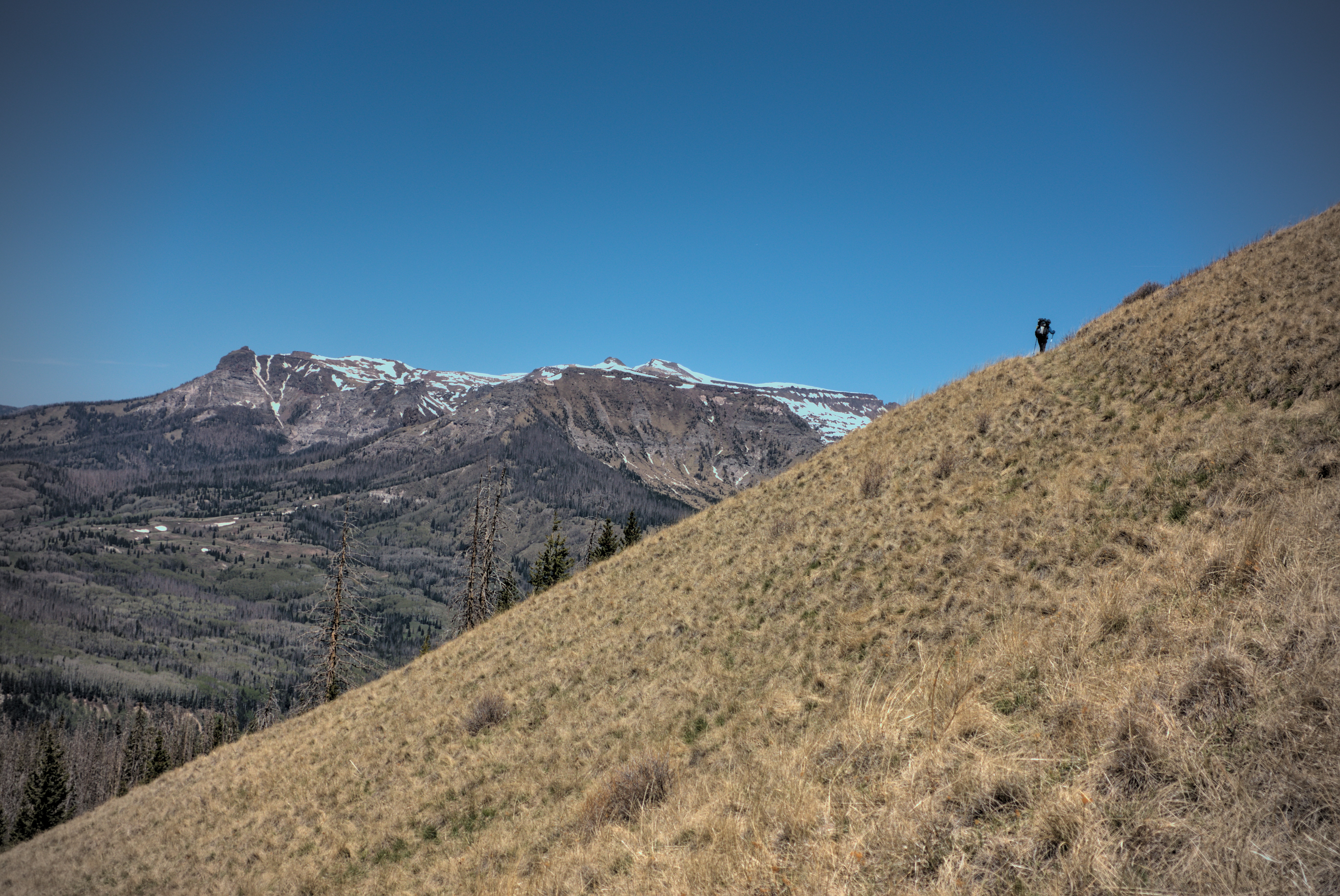
Scenery near Cumbres Pass.
Katherine and a couple other folks on the trail.
Internally, I thought "this is it...finally...the Mountains, the MOUNTAINS!" Right behind that thought was "okay, don't be too steep, pleez?"
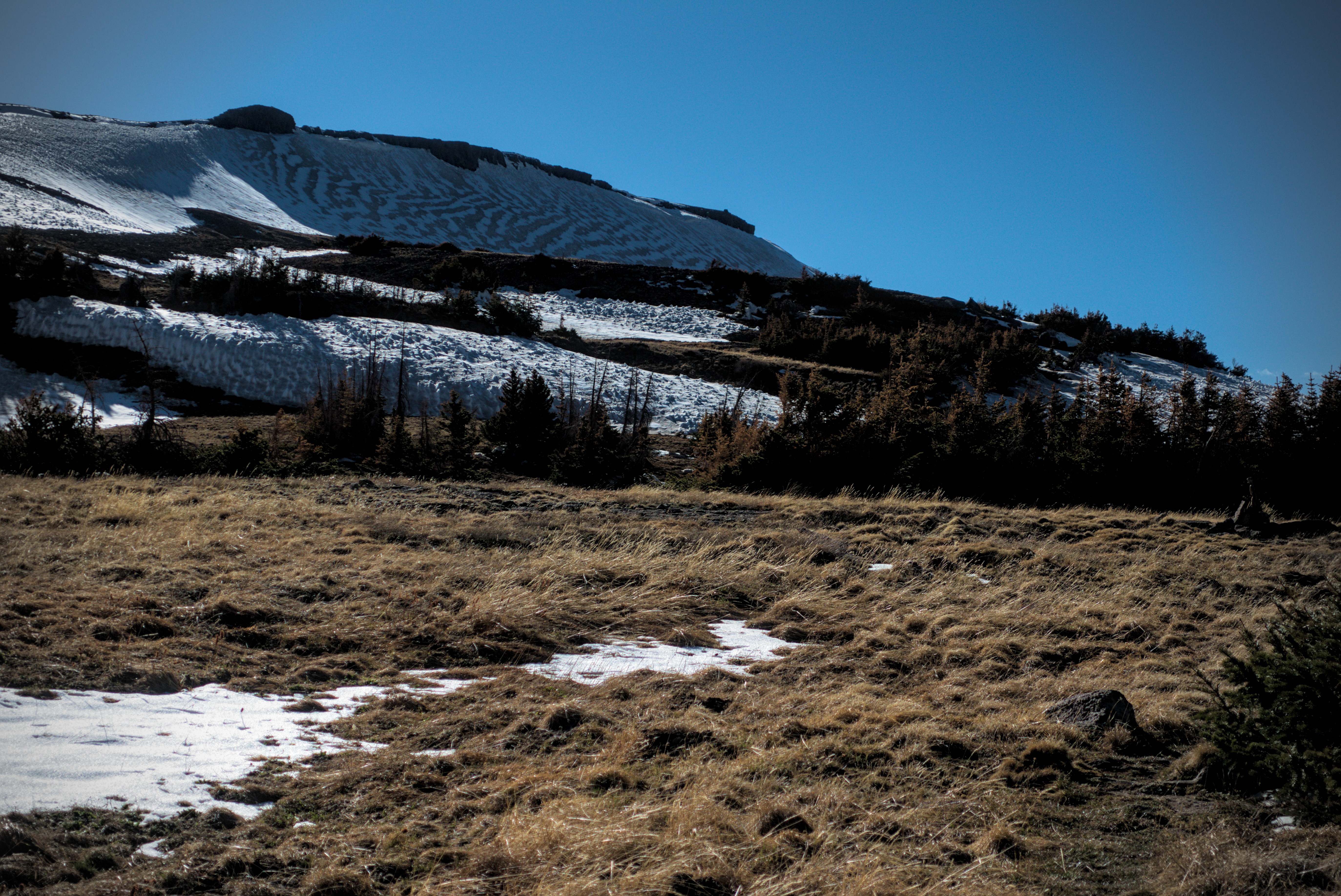
The trail was quite nice, following a gentle ridge mostly on the left (southern) side. Views back down to the road dominated for a while, then, after a long switchback I climbed up onto the characteristic landform of the San Juans, a broad, high ridge that slides through the country like a whale. I was in the Rio Grande National Forest. The trail led purposefully north and the ridge narrowed in a pleasing way. It's always nice to feel vast tracts of land below you on both sides.
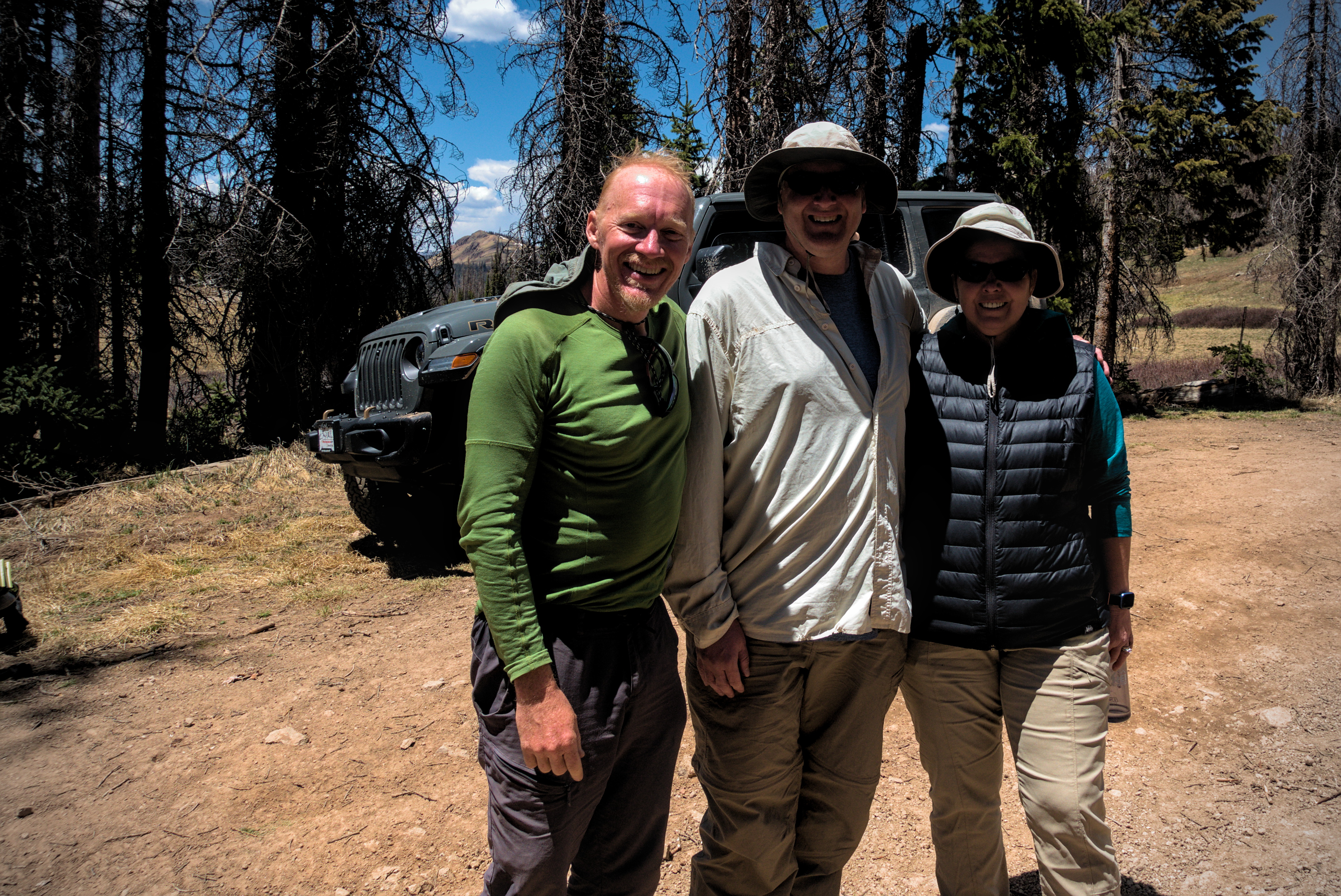
I met Katherine in here. I hadn't seen her since we stood together in front of the strange motel in Cuba, wondering if the colorful old woman cleaning the rooms would grant us one. I met a woman from Germany and her friend, whose names escape me now. Such meetings take place at the beginning of stretches, and more rarely at the end. Six or eight people seem like a lot when bunched up, but before long the distances between them become planetary. Though about an hour later I did meet Si Nombre again.
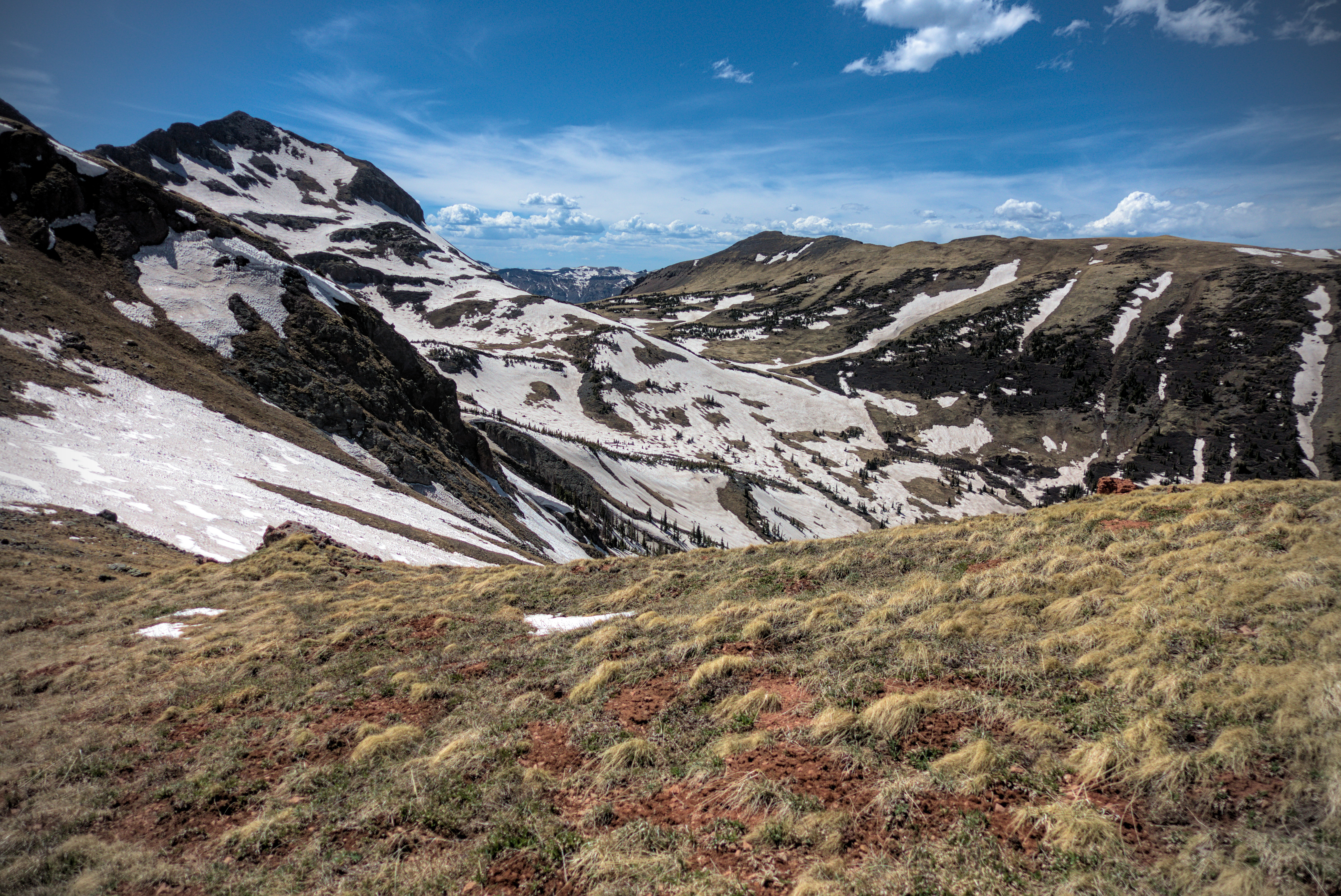
Into the heart of the wilderness!
Climbing up to the crests...
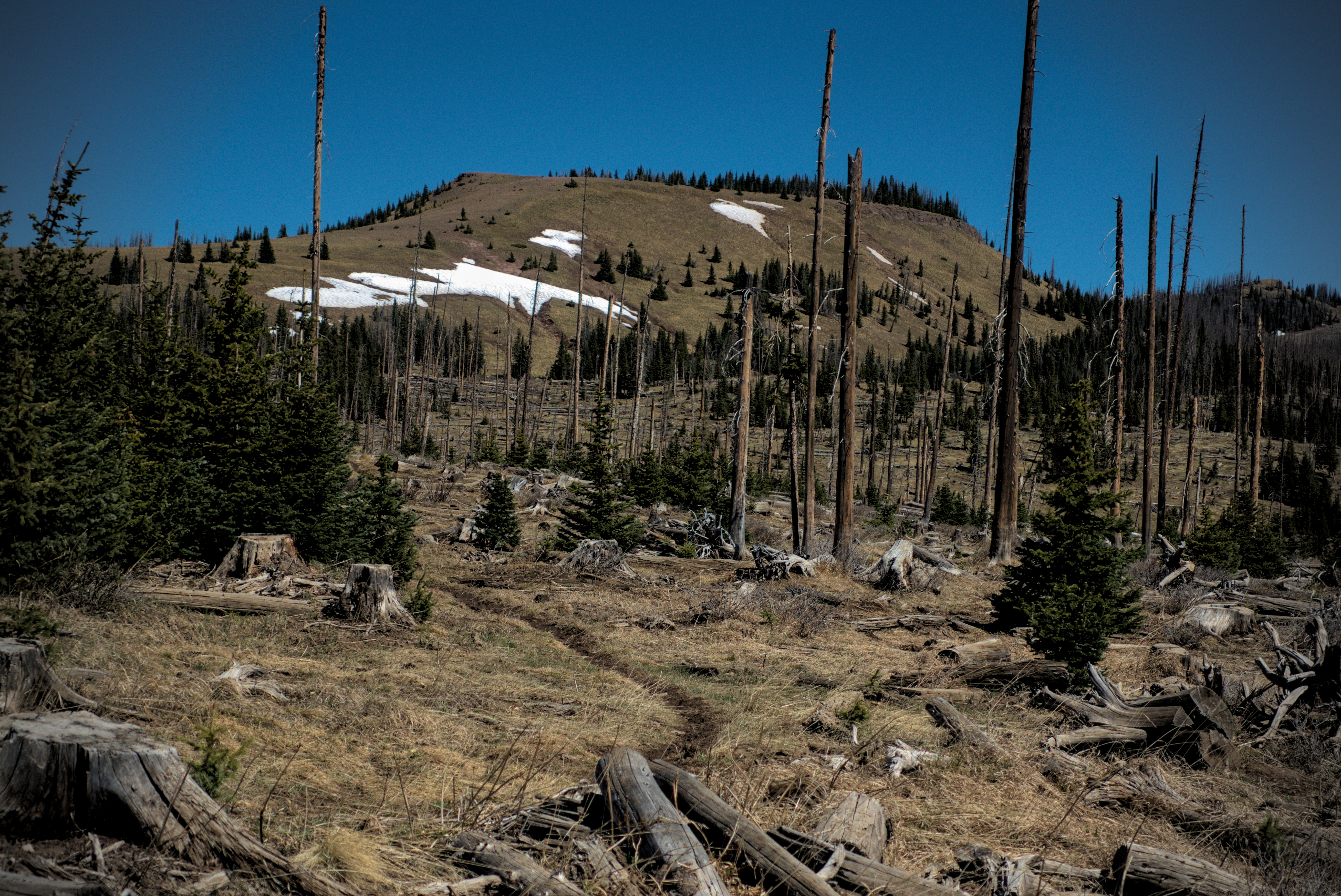
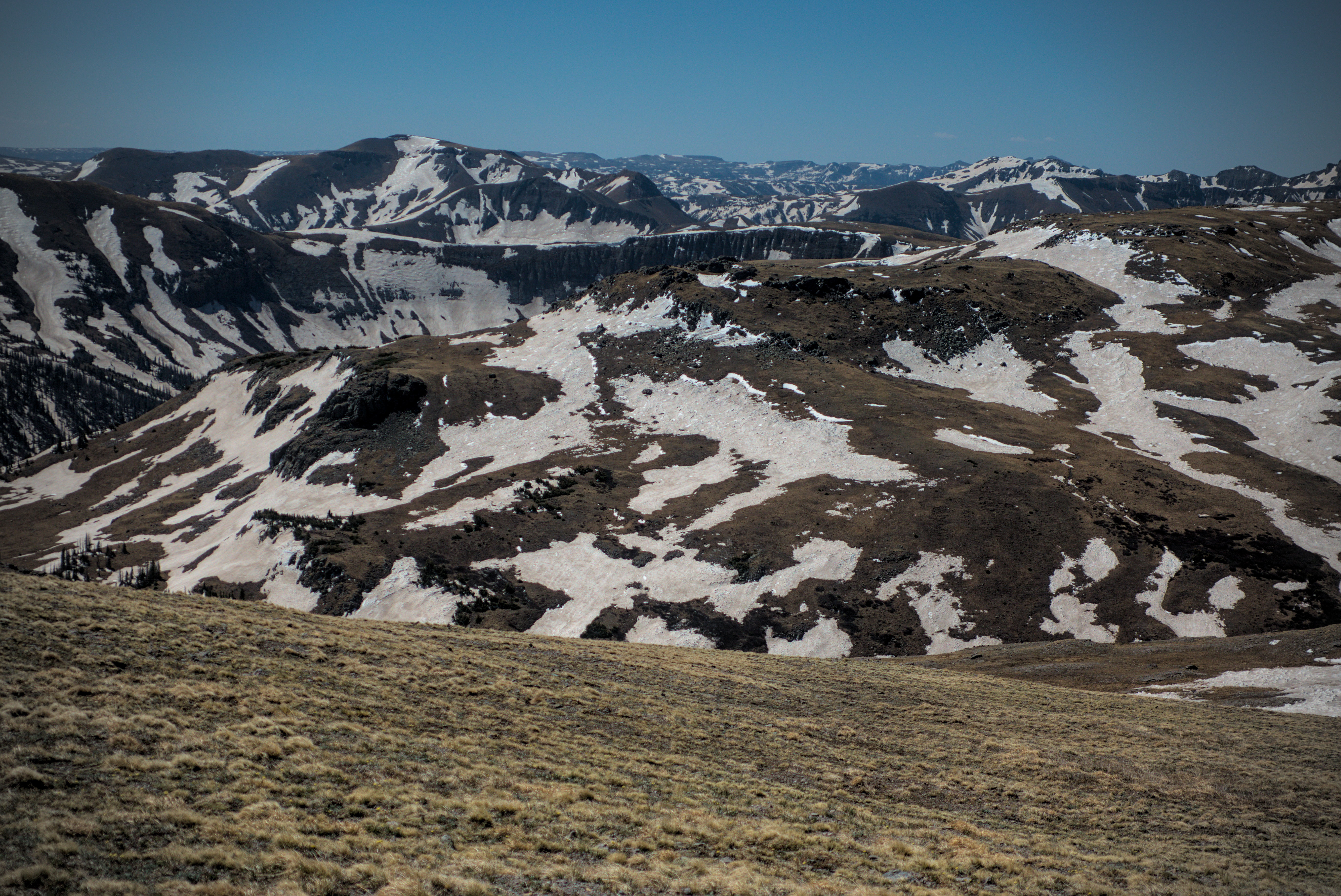
I reached a high point on the ridge in strong wind called Flat Benchmark. It marks the boundary of the South San Juan Wilderness. A good handful of hikers were crouching among the rocks built up as protection against the wind. I sat for a moment and joined their conversation easily. Maybe too easily, because I felt a bit like an outsider! The little bubbles of community are gossamer thin, yet, perhaps more important because of this. I set off again, stomping through the snow...not yet aware that I wouldn't experience dry feet again in the day for a long time! I wouldn't drop below 11000 feet until a brief dip into a valley the next day, and my campsite this evening was at 12000. So I was properly in the alpine world I'd dreamed of for such a long time.
Si Nombre, Katherine and another fellow sitting at the point where
the trail climbs to the ridgetop.
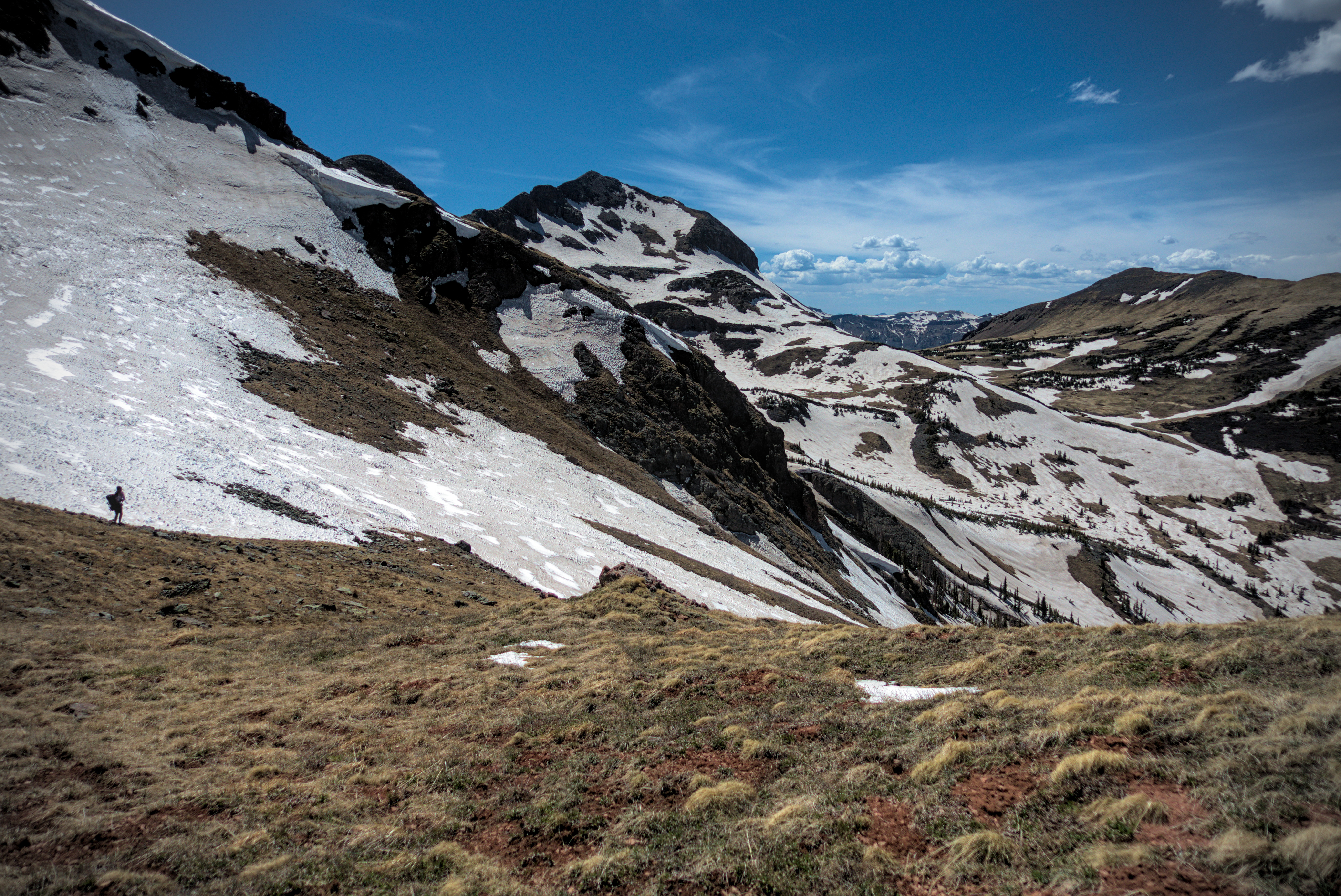
Approaching the wilderness boundary at Flat Benchmark.
Like a layer cake, and our home is the frosting!
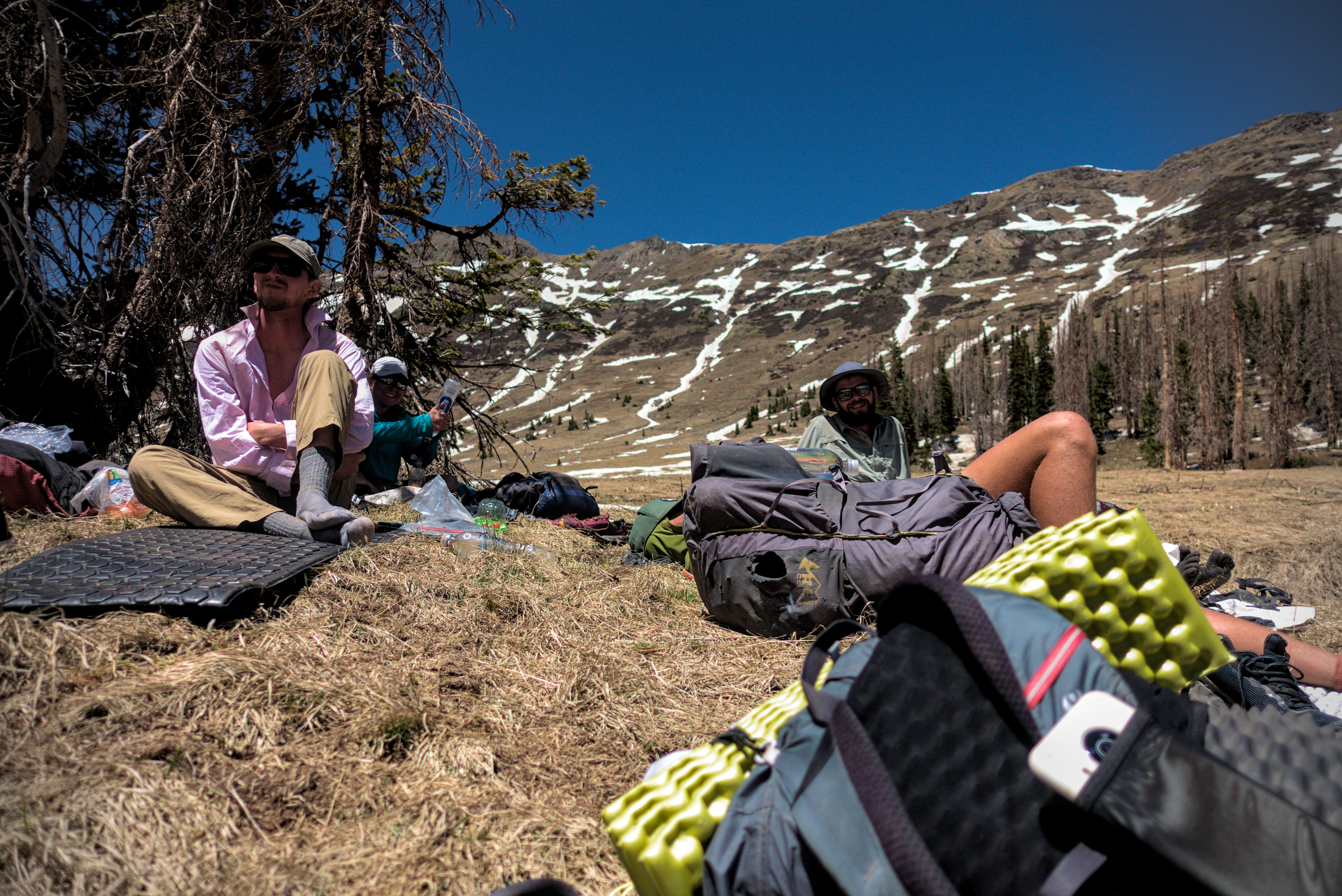
I came down to a flat place on the ridge which held the Dipping Lakes. Some folks were here, looking for camp sites. I met Diva with his characteristic pink shorts. He was very concerned about the danger of camping in stands of dead trees, and pressed on. I did too. It was about 17:00, and oweing to the late start I thought I could do some more miles.
Coming down from Flat Benchmark.
One of the Dipping Lakes.
Pano-rama somewhere along the way. The landscapes were just so big.
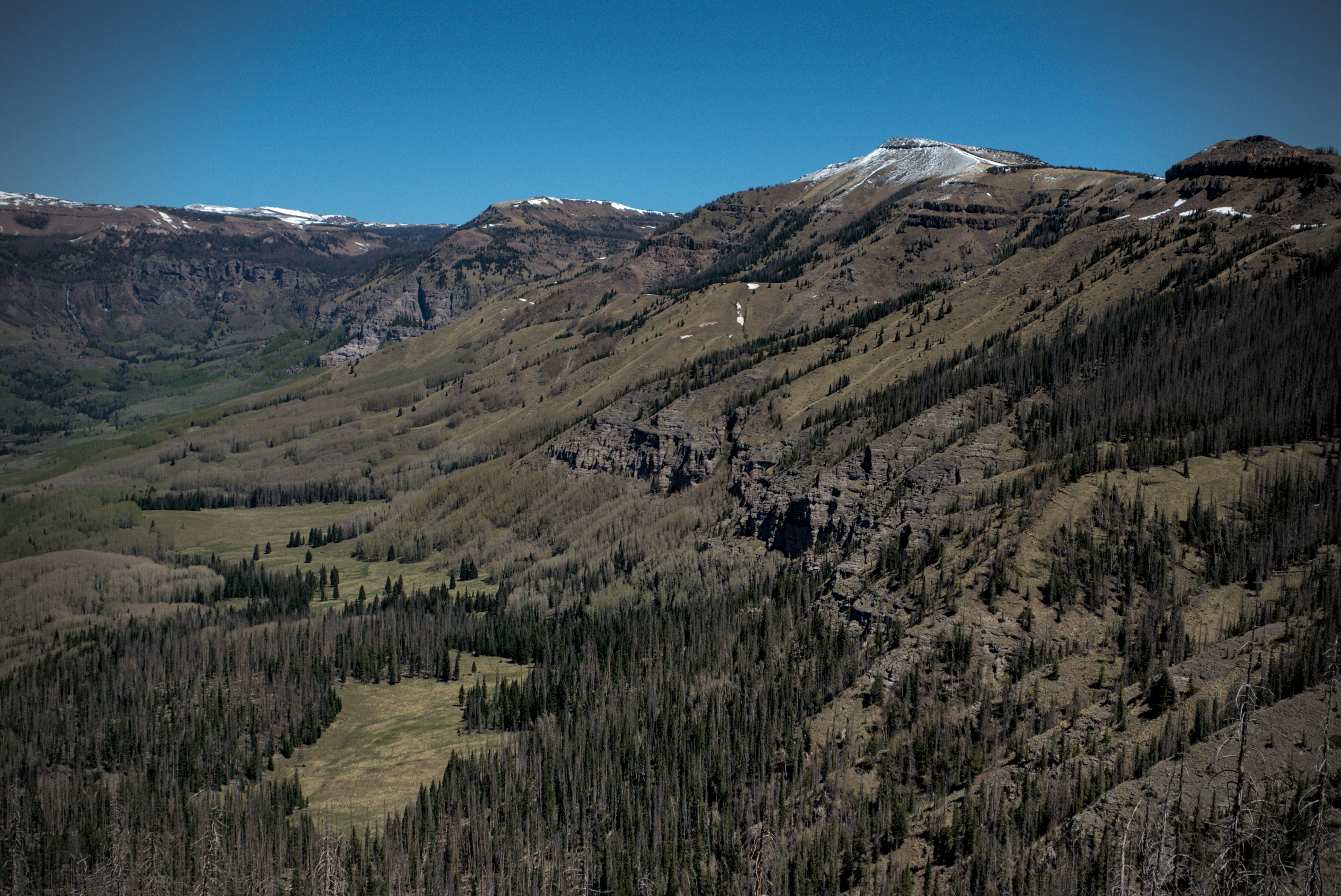
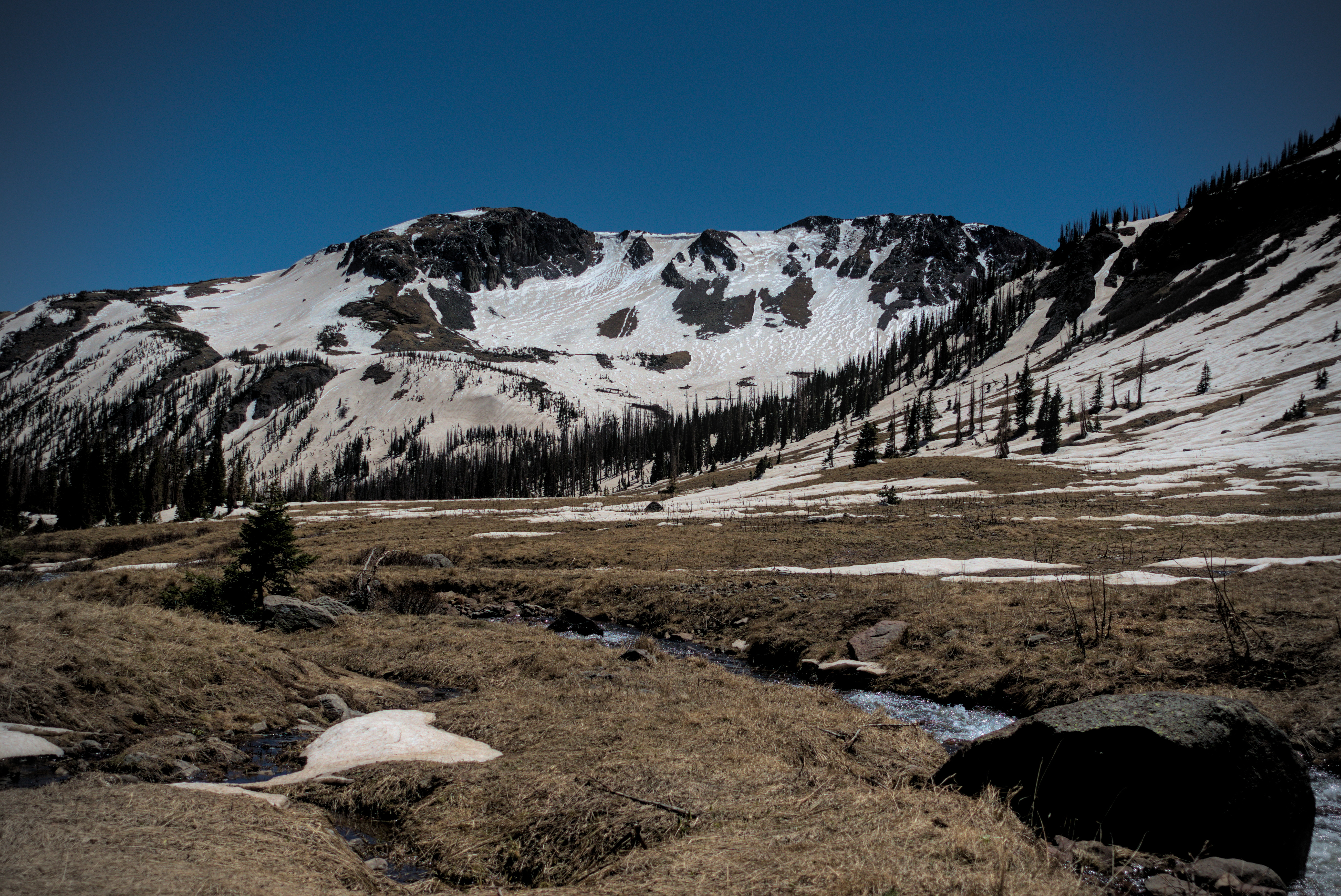
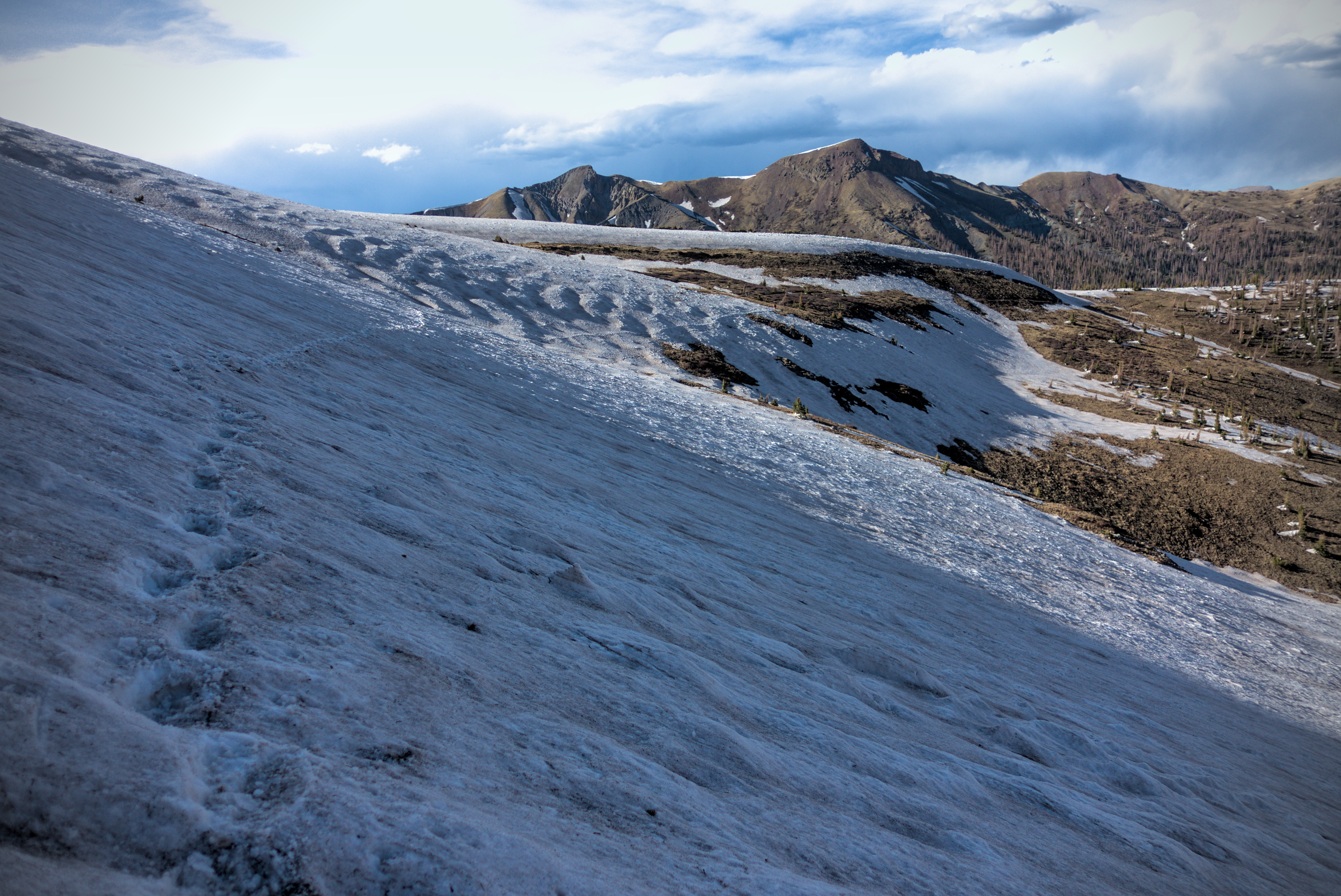
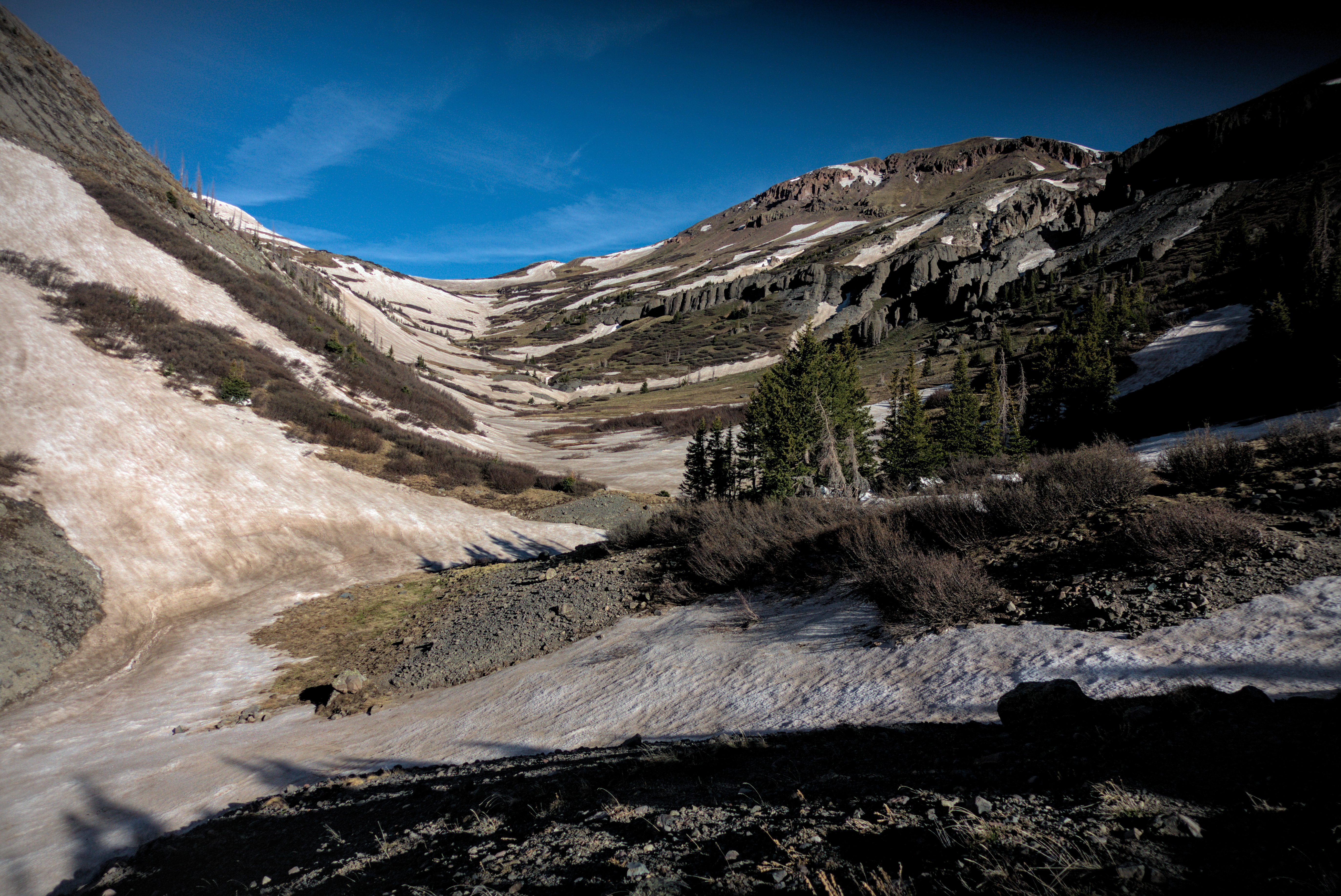
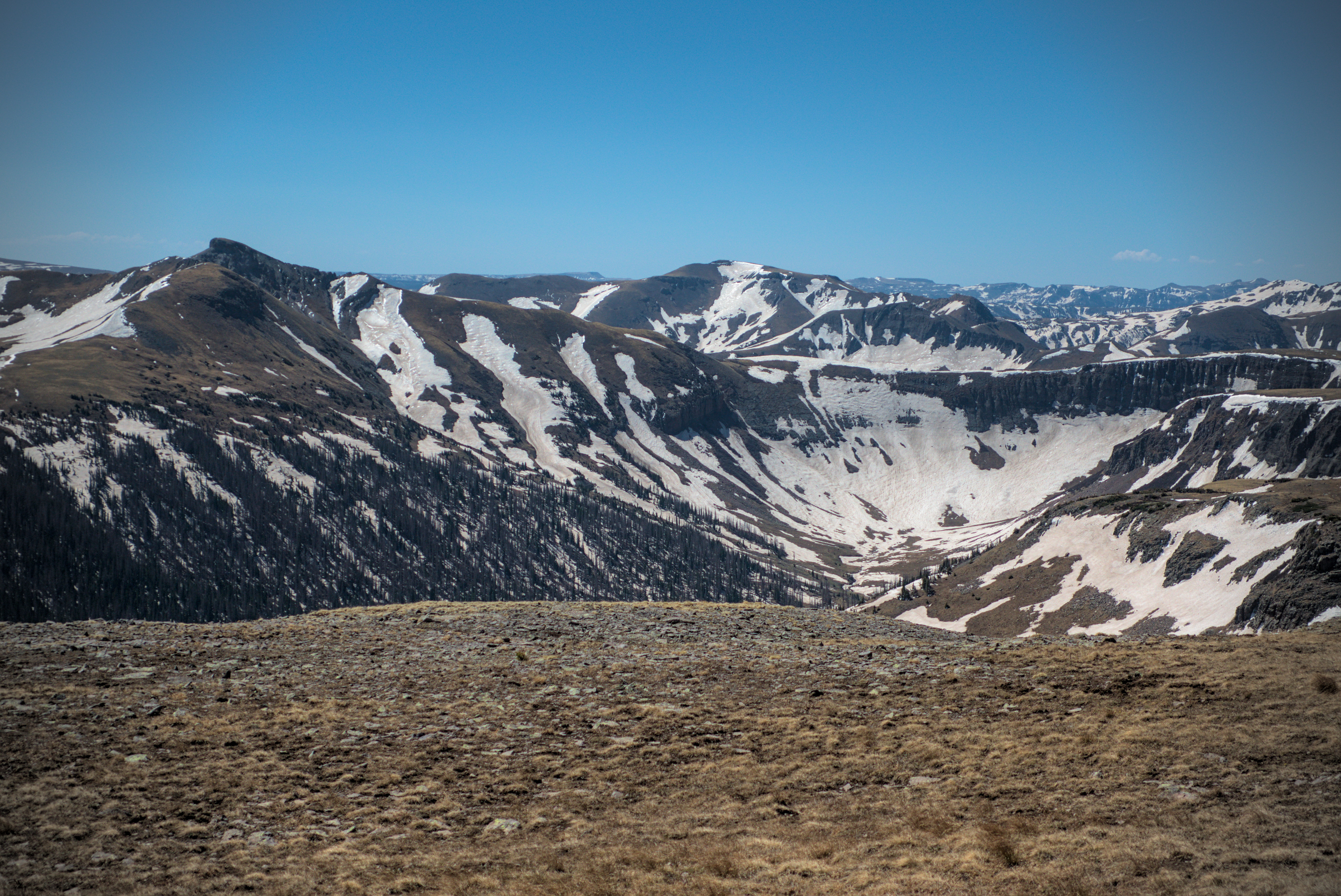
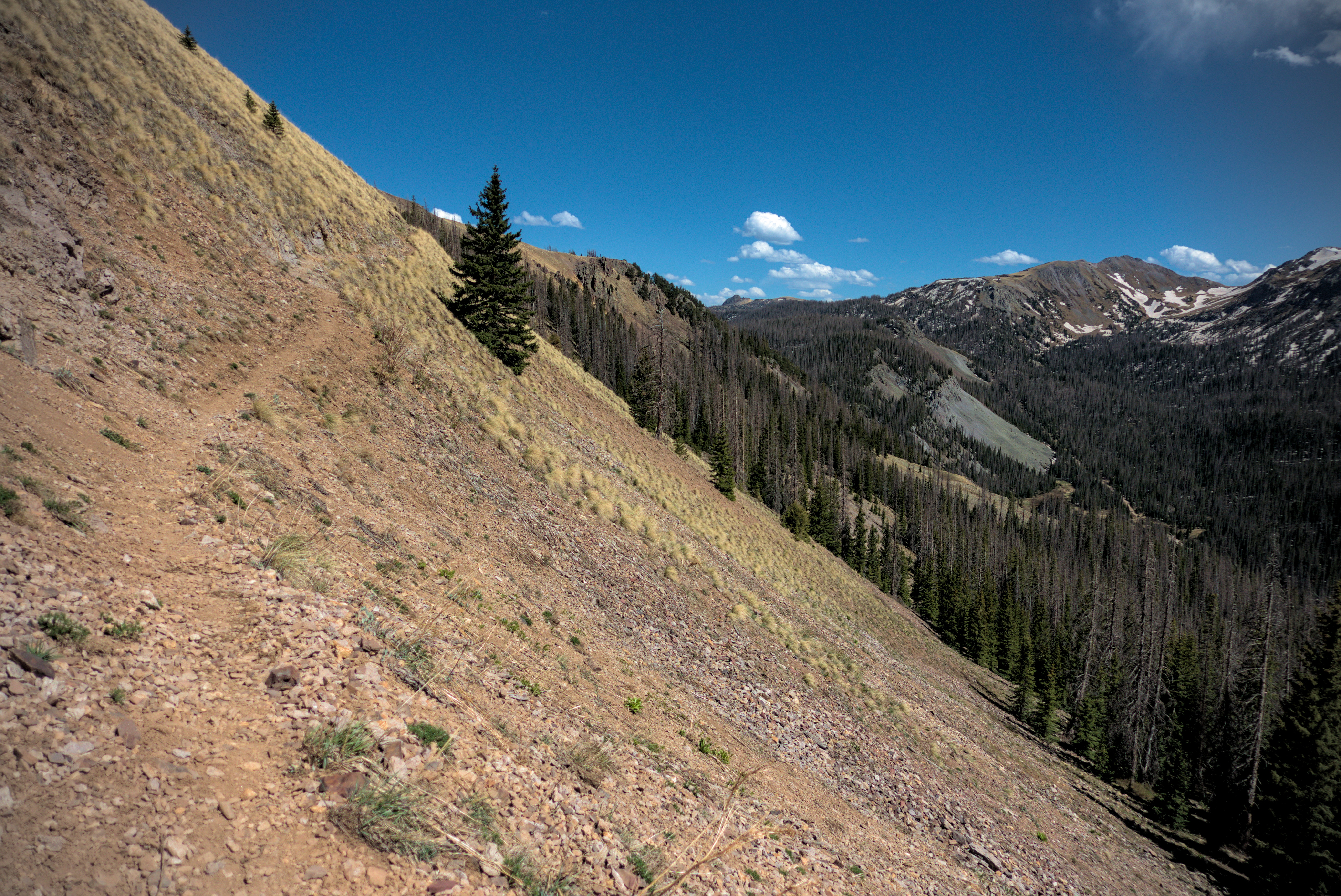
I'm glad I did, because the next few miles were very scenic in the evening light. The trail led across a dramatic shelf dropping off to the right, with mysterious snowy mesas on the left, blocked up with so much wind-sculpted snow that I thought of glacial slopes. I could feel how important the wind is to this place, how it shapes and dominates the lonesome winter world. I encountered the fabled penitentes, the stooping figures of snow carved by wind, casting shadows across snowfields. The snow was re-freezing as the sun left, and I crunched through fields of these praying forms, feeling a bit like I was on another planet. I didn't see anyone else in this huge landscape.
Interesting and windy country south of Trail Lake.
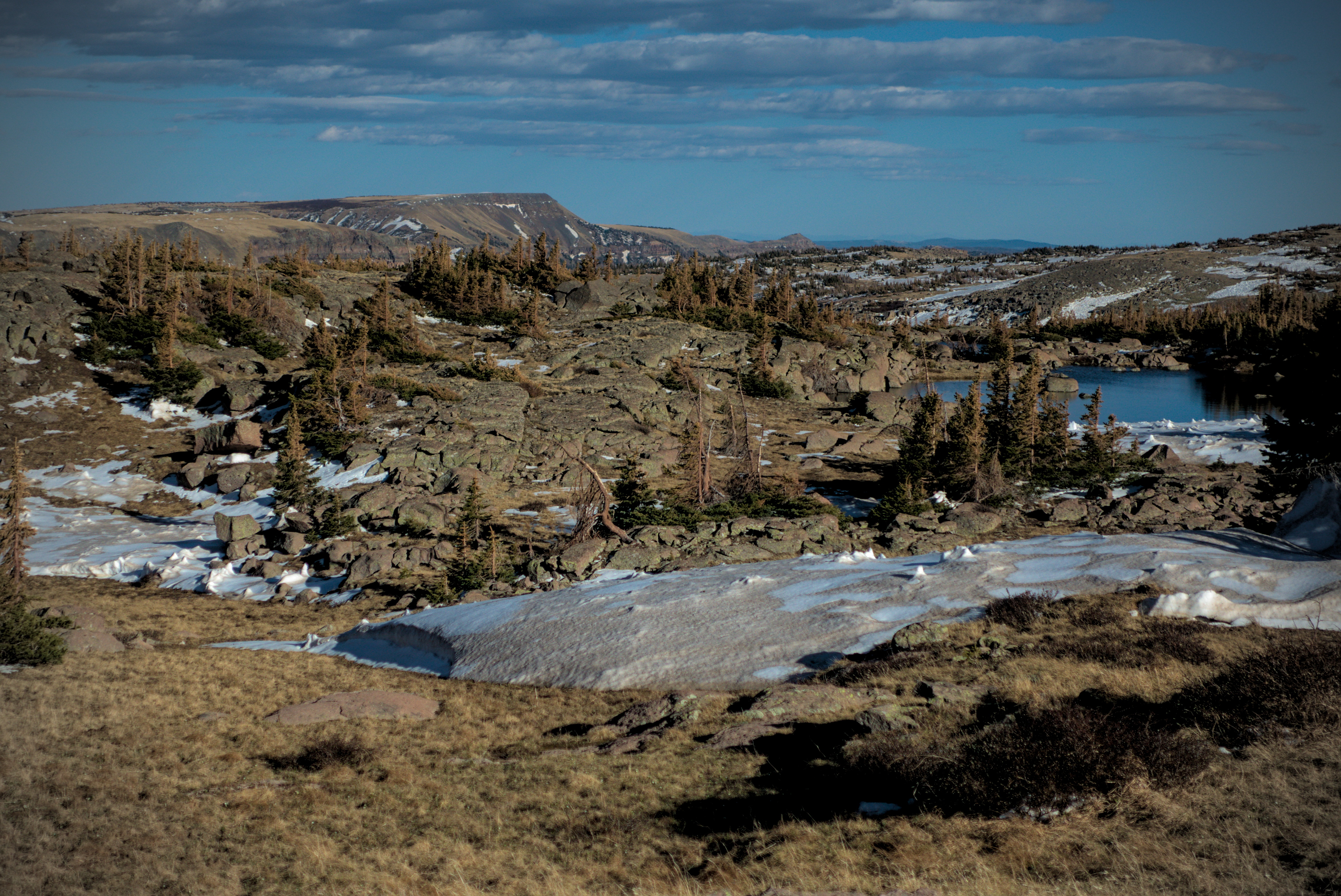
Looking to the east from the Trail Lake country.
Enjoying myself in here...
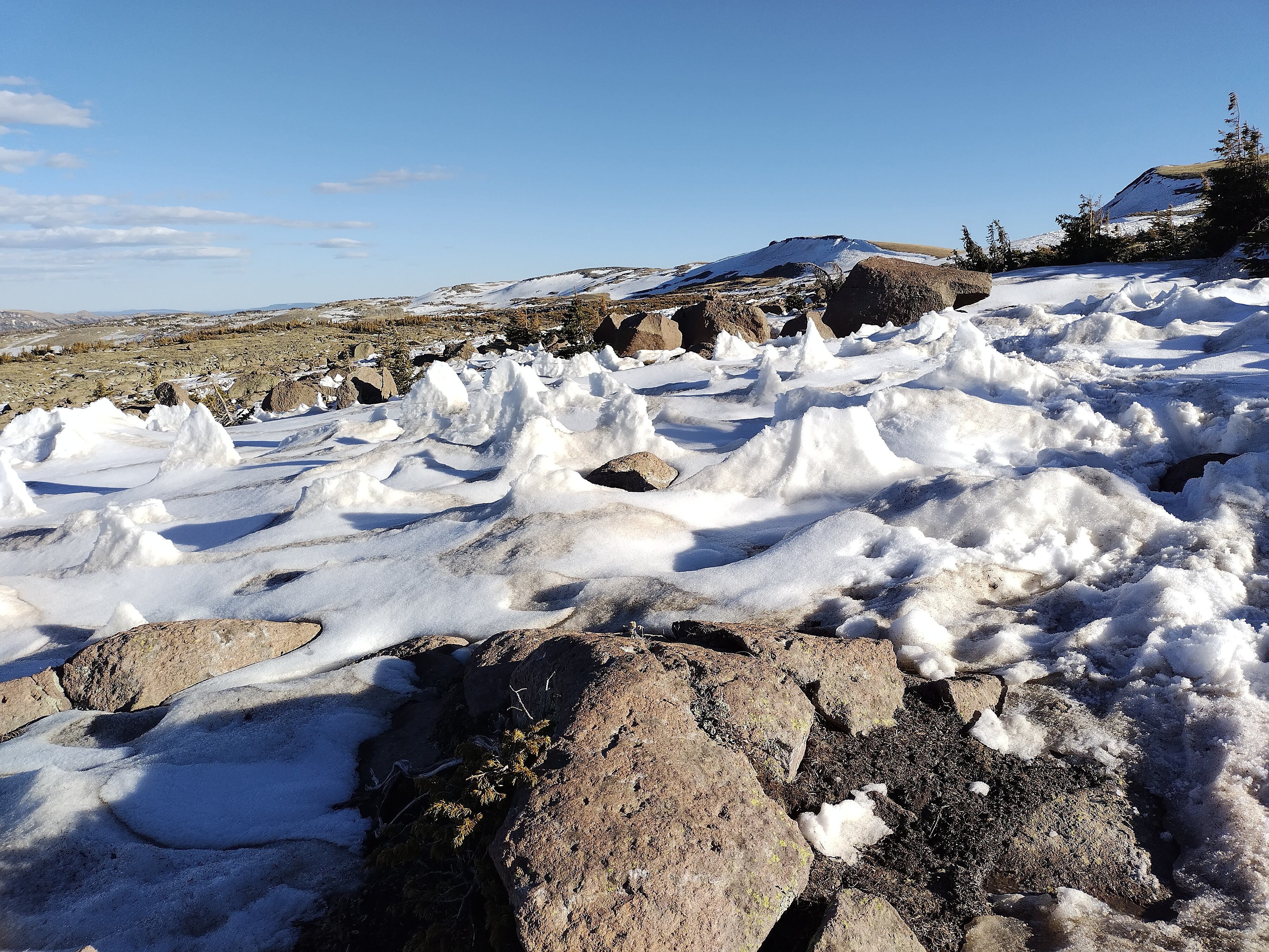
Snow penitentes.
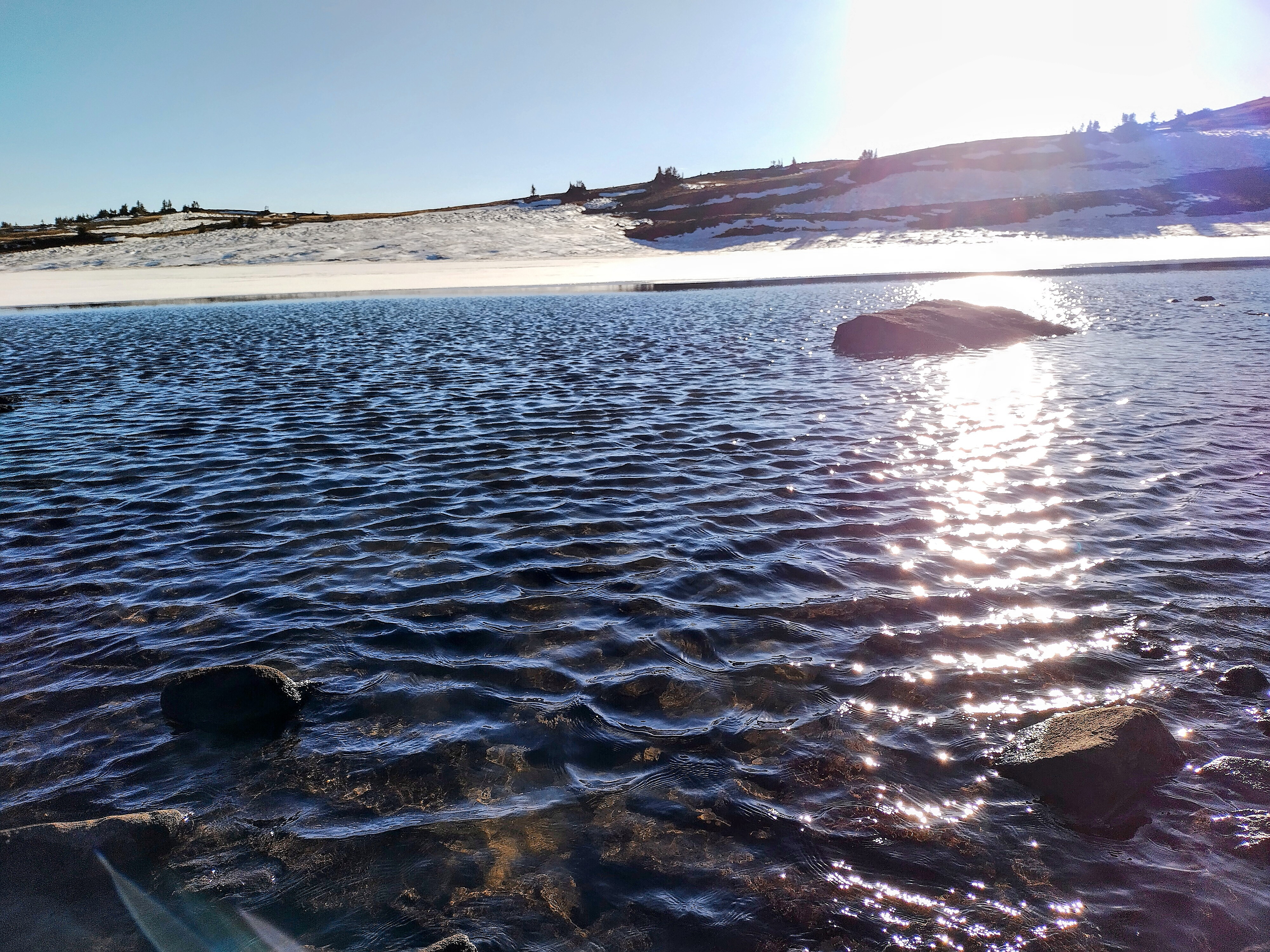
Trail Lake in the evening.
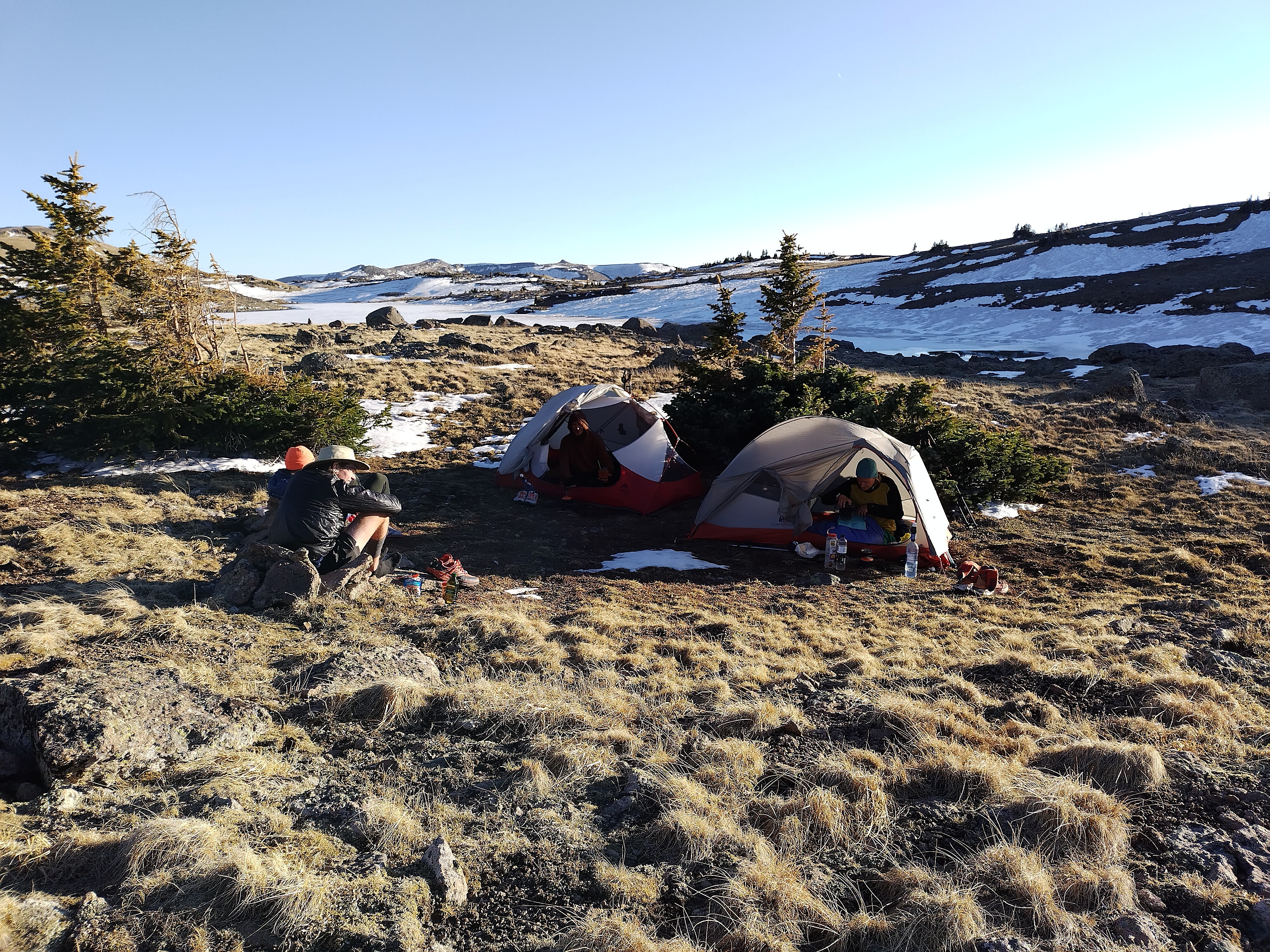
Cutie, Special K and others eating dinner at Trail Lake.
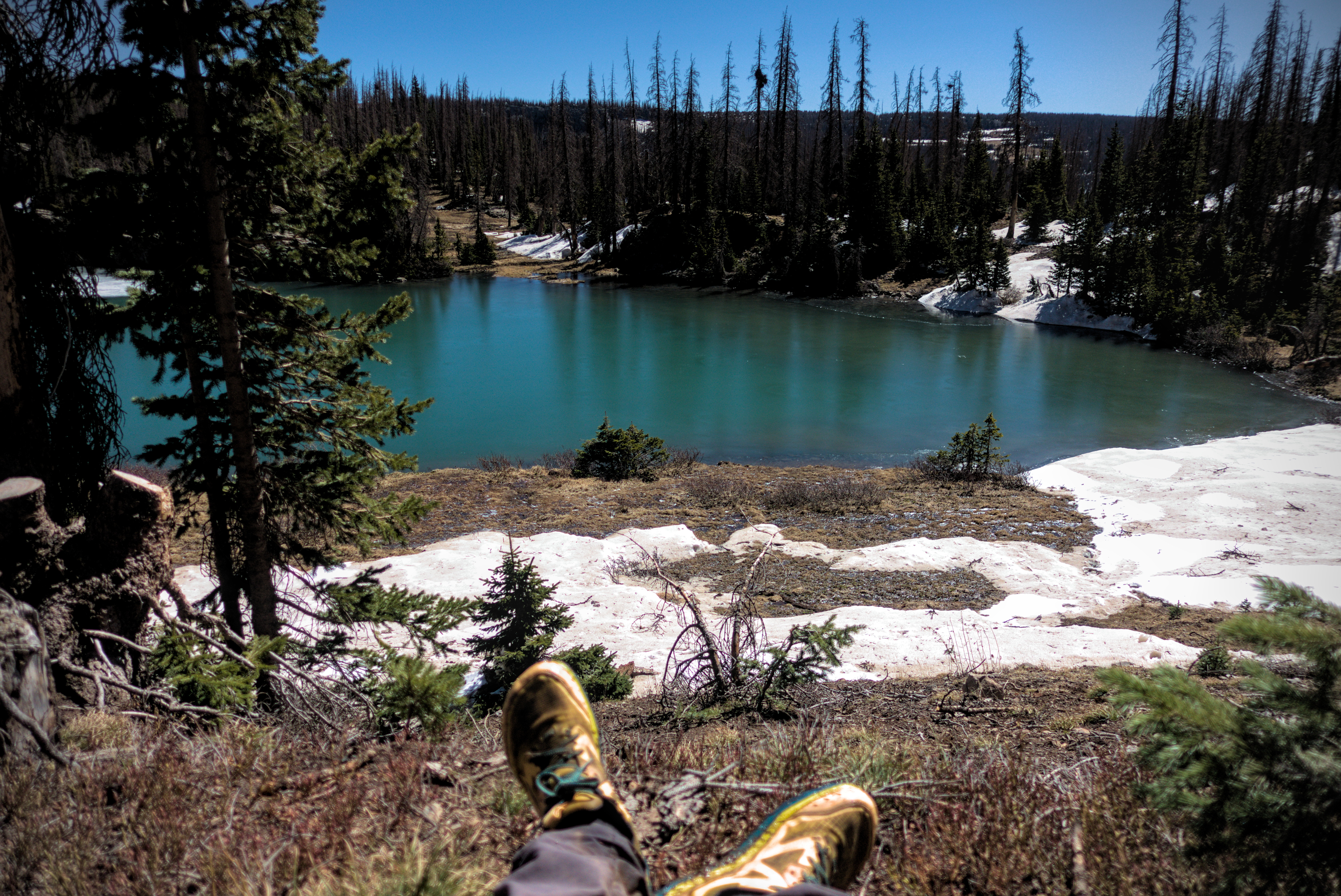
Finally though, I came gently down to the north to reach Trail Lake, and people in the evening.
Huddled amid a few scrub trees about hobbit-height, everyone ate their dinner and zipped into sleeping bags soon after the sun hid itself behind broad ridges to the west. I set up my tent near Cutie, who just used his red bivouac sack. I imagined how cold I would be in that! I was already cold...tonight would be the first night to use the tent I had ordered. I hadn't had time to seam-seal it in Chama, and prayed that it wouldn't rain or snow until I got to Pagosa Springs where I could do the job.
May 26th, day 36, 18.6 miles
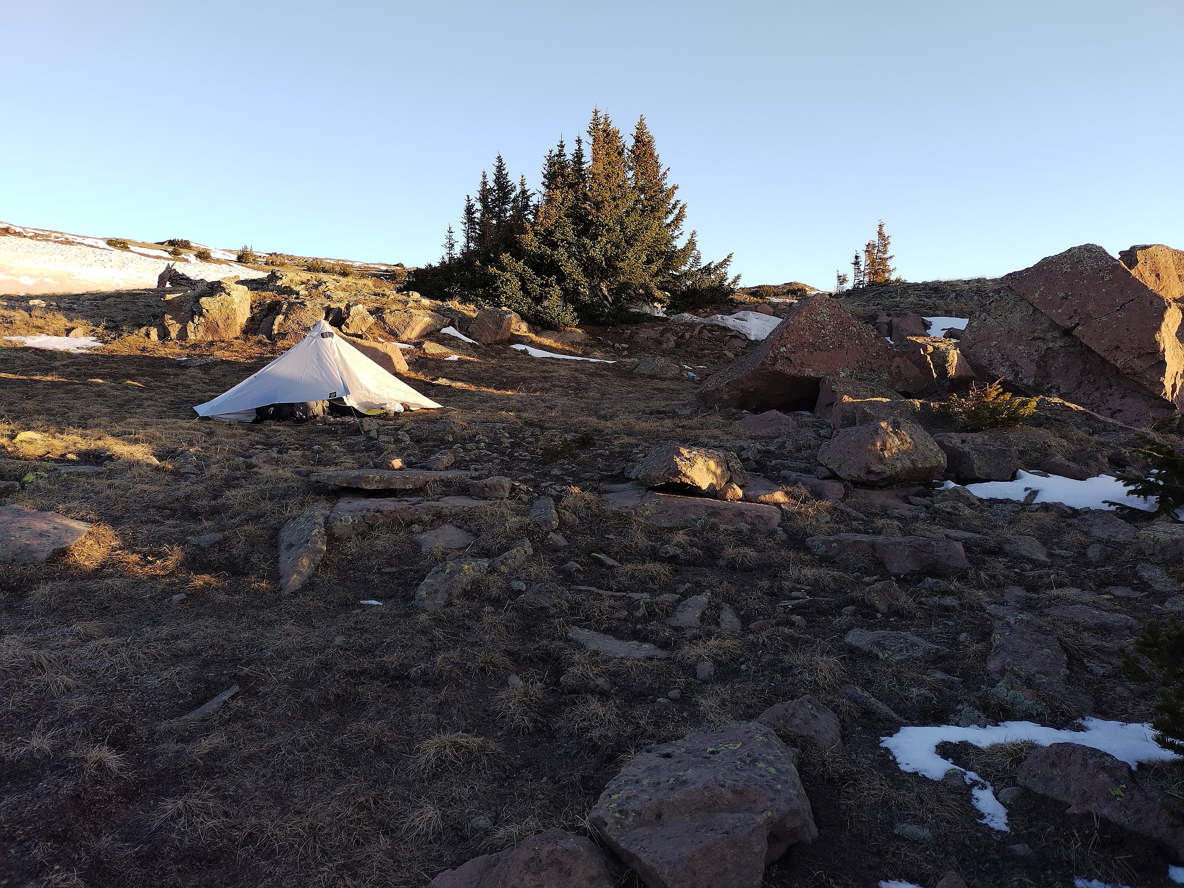
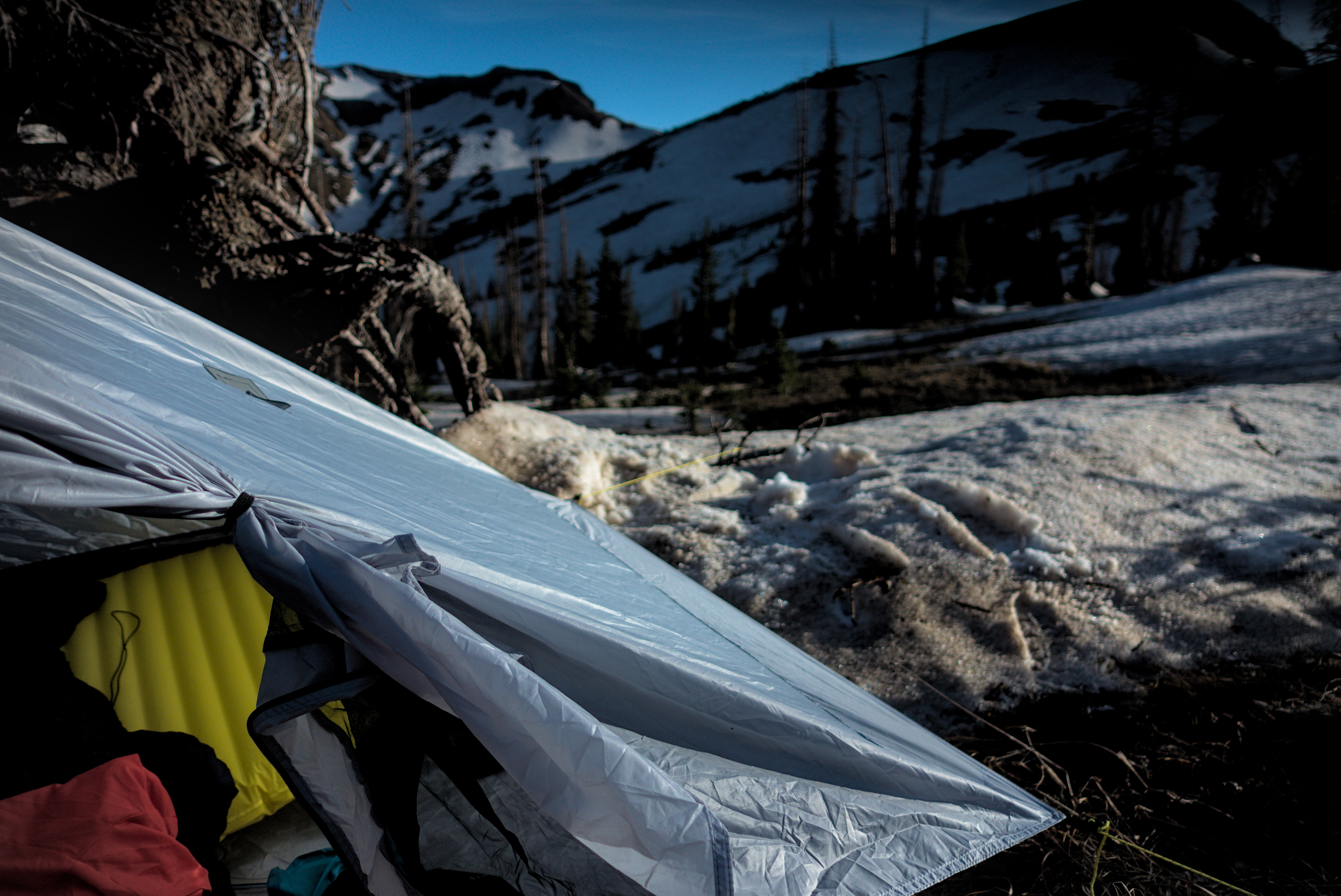
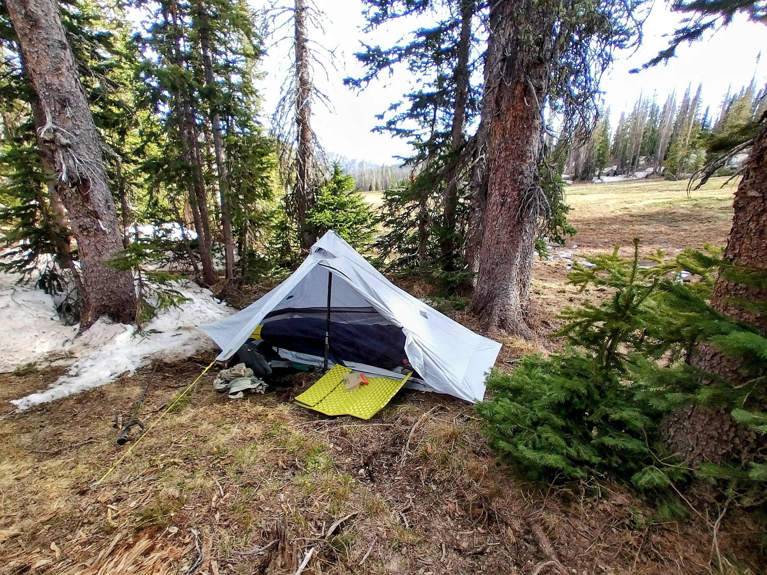
My tent at Trail Lake in the early morning.
Today would be the first full wilderness day of the San Juans. I was excited, and as usual, oddly refreshed. The night had been cold, and I had to do some crunches here and there to warm up. The good thing about a bit of wind is that even when the tent is closed up, there is no condensation.
I hiked away before anyone else got up, as usual, limping heavily at the start. The track led north, gently up to pass Peak 12372 on the right. On the other side was a new vista, looking down into the East Fork Navajo River valley on the left. I'd been crossing high tundra slopes with frozen streams and patches of snow. As I descended slightly, it was fun to stay on the ice patches and make good time crunch, crunching over the top of snowfields that I knew would be mashed potatoes by 11 o'clock.
Down in the valley, at least half of the trees were dead. Both dead and live ones gave me a lonely feeling with their thin profiles, branches staying close to the trunk, signalling a world of bitter cold.
I crossed the head of the Navajo River Valley then traversed a long slope northwest, mostly on snow which was beginning to soften. A north slope above Blue Lake was entirely on snow, and there were truly heroic posthole sites in the trees. Often, with heart in throat, I attempted to get around them on snow where nobody walked, and then bam! I fell through and found myself in a little hip-deep snack stand, pulling on branches to escape.
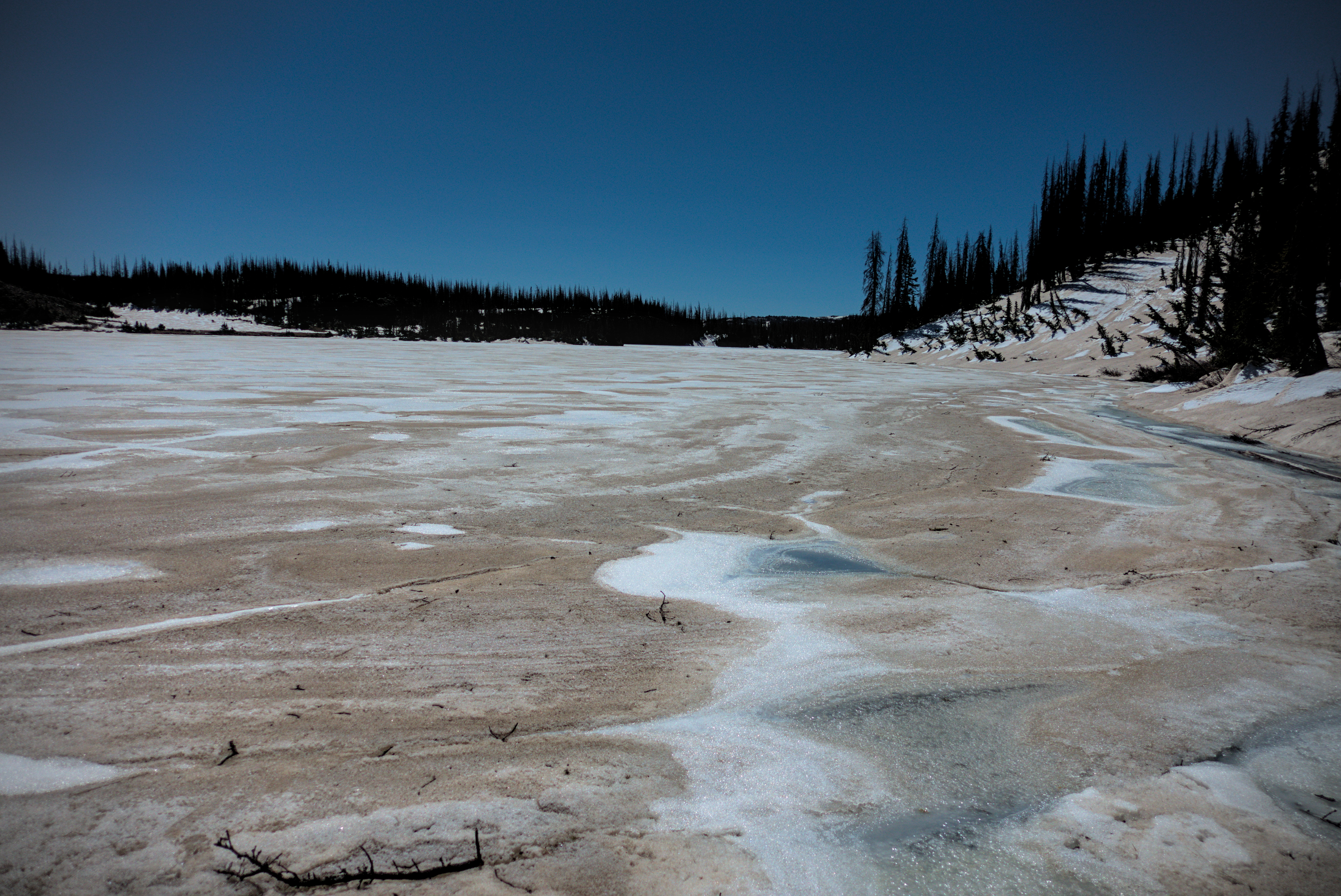
At Blue Lake, which was indeed brilliant blue, although half covered in ice, I walked along the shore for a while, though it was exhausting with the snow and downed trees. Boldly (stupidly!), I ventured down to the frozen part of the lake and decided to walk across it to the northwest head of the lake. This actually worked, but I had some scary moments when my foot crunched through to a lower layer of ice.
The headwaters of the Navajo River.
Resting at Blue Lake.
Looking back over my frozen crossing of Blue Lake.
Looking back through the work of the morning, the country paling in
the distance.
Near the high point of the ridge before dropping into the Middle Fork
Conejos valley on the right.
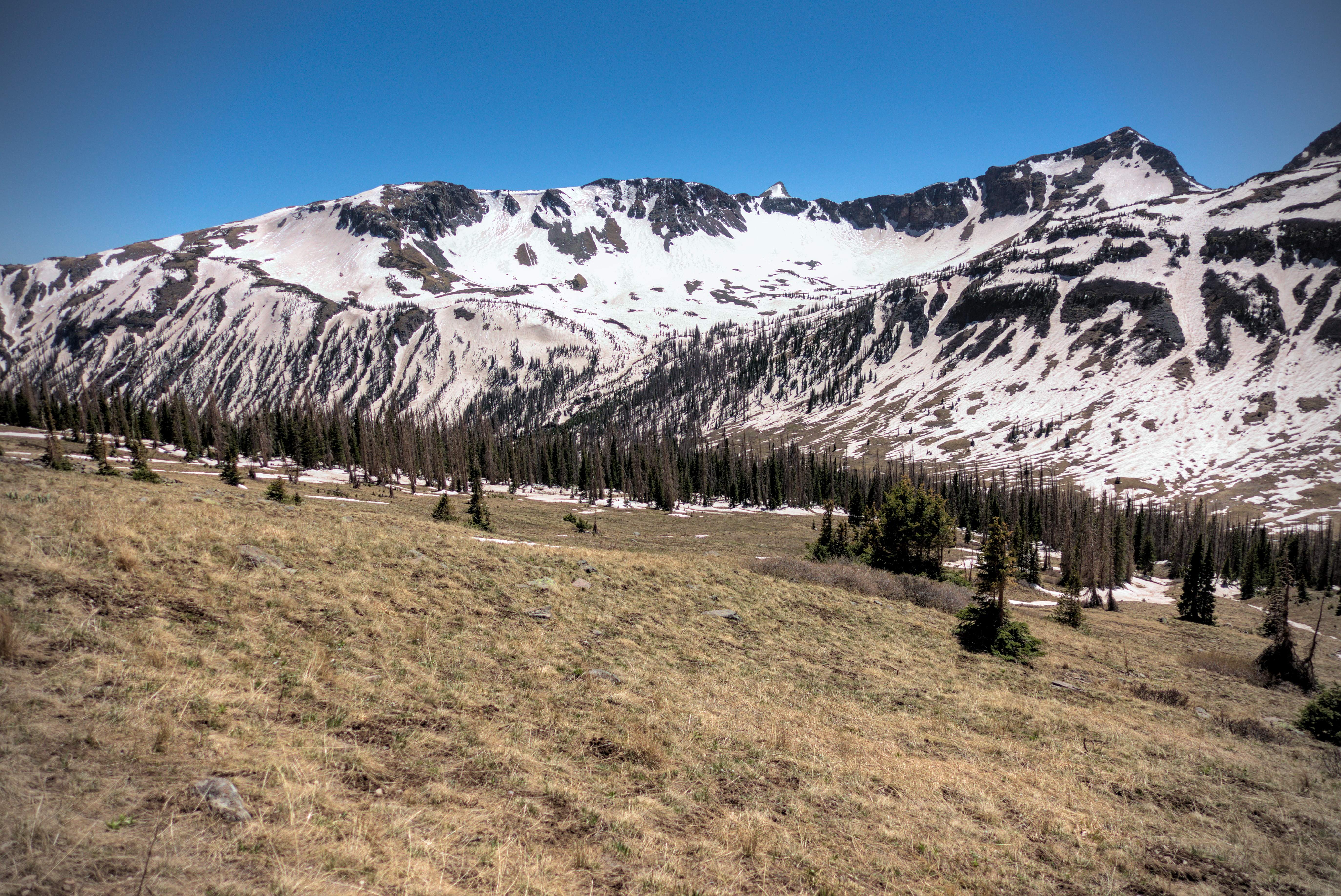
Of course, my feet were soaked, and from now on for weeks would remain that way all day long. Anyway, I made it back to shore where the trail turns up to the north, first over a local hill, then into a broad saddle where I saw deer. Turning west, I got a sense of big mountains in front of me. I'd seen them in the distance, and now was teased with that common occurance in broad western mountains, where the mountain before you disappears behind local rises which obscure it. Still, it was a steep elevation gain of about 500 feet along a ridge to a high point at about 12150 feet in snow and rock, before I could really see the great escarpments of the Southern San Juans before me.
I sat and ate lunch at this high point, feet drying in the sun. Cutie passed by. Peak 12887 dominated the skyline at the head of the Middle Fork Conejos Valley, which I needed to descend into then climb up out of onto a shoulder of that peak. I looked directly opposite from my highpoint to see that shoulder and wondered what it'll feel like to be over there. I was thankful to see plenty of brown patches amid the snow.
Now came an extensive snow descent, riven by tracks where many people had glissaded on their butts. I found it easy to stomp down, and enjoyed the warm sun and dramatic views. Instead of keeping to the trail, which traversed a slope north, I decided to descend all the way to the valley floor, and just climb up the other side. I'd already had my fill of north slope traverses! This was a good decision because I could just relax and stomp my way down to the floor instead of making all these micro-decisions about where the next best step is.
On the valley floor, I dodged marshy terrain, hopping on rocks or making little detours that would appear senseless to someone at a distance. You see, it all looks like brown, short grass, but some of that grass is underwater!
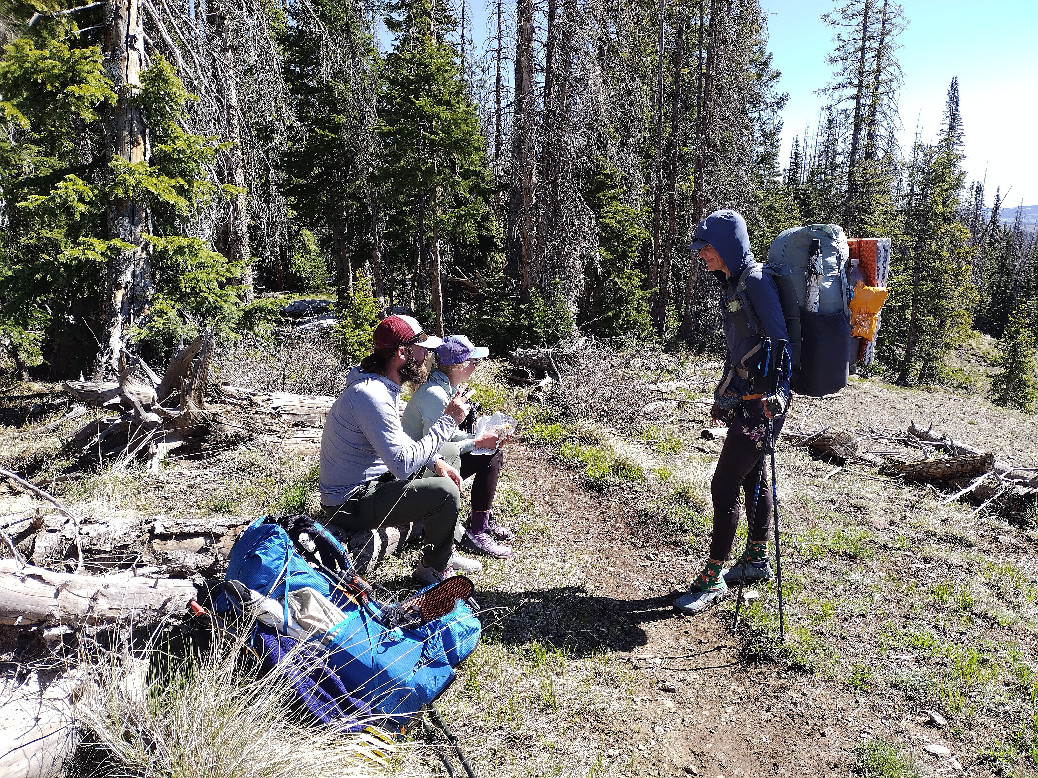
I crossed the river and came upon some folks spread out, eating and drinking. Man Hands and others were there. I filtered water, ate a candy bar, and got moving again, heading straight up the open country just west of a stand of trees.
Good folk taking a well-deserved rest in the Middle Fork.
Looking back across the river to the snow-slopes I descended on the left
side of the peak.
Climbing out of the Middle Fork.

I've reached the scenic point opposite my lunch place high on the left
slope of the mountain in the distance.
Generally, you avoid stands of trees unless the trail takes you into them, and even then, you might try to stay out. With so much deadfall, it's sometimes best to ignore the "luxury" of a trail because of the traffic jams. Granted, you are the only one trying to go anywhere!
As I got up a little bit, I looked behind me at the north slope I'd descended, and was again glad that I didn't stick to it on a long traverse -- it was pure white ski country for at least a mile.
Boy, it was tiring hiking up at this point! I'd been on the move about 7 hours. The altitude made me slow. It was also a blow to the ego to be in my own silent world and suddenly some of the folks from the river were near me and passing me. The young man experiences the mountains as populated by various old folks who seem to be standing still and fiddling with things unnecessarily. The old person looks around bewildered at these ephemeral, almost elvish forms flitting by, wondering how they move so fast!
But I wasn't THAT slow. It was about an hour after the rest at the valley floor when I stood at the point I'd admired from the opposite valley wall. This was a beautiful place. I was properly in the wilderness, the sun was shining, and the wind wasn't severe. Looking back over what I'd come through boggled my mind pleasantly.
A zone of snow traverses, finally needing snow-spikes.
Time to drop into the next valley. This place is so scenic, and just...big.
A hiker contemplates the descent.
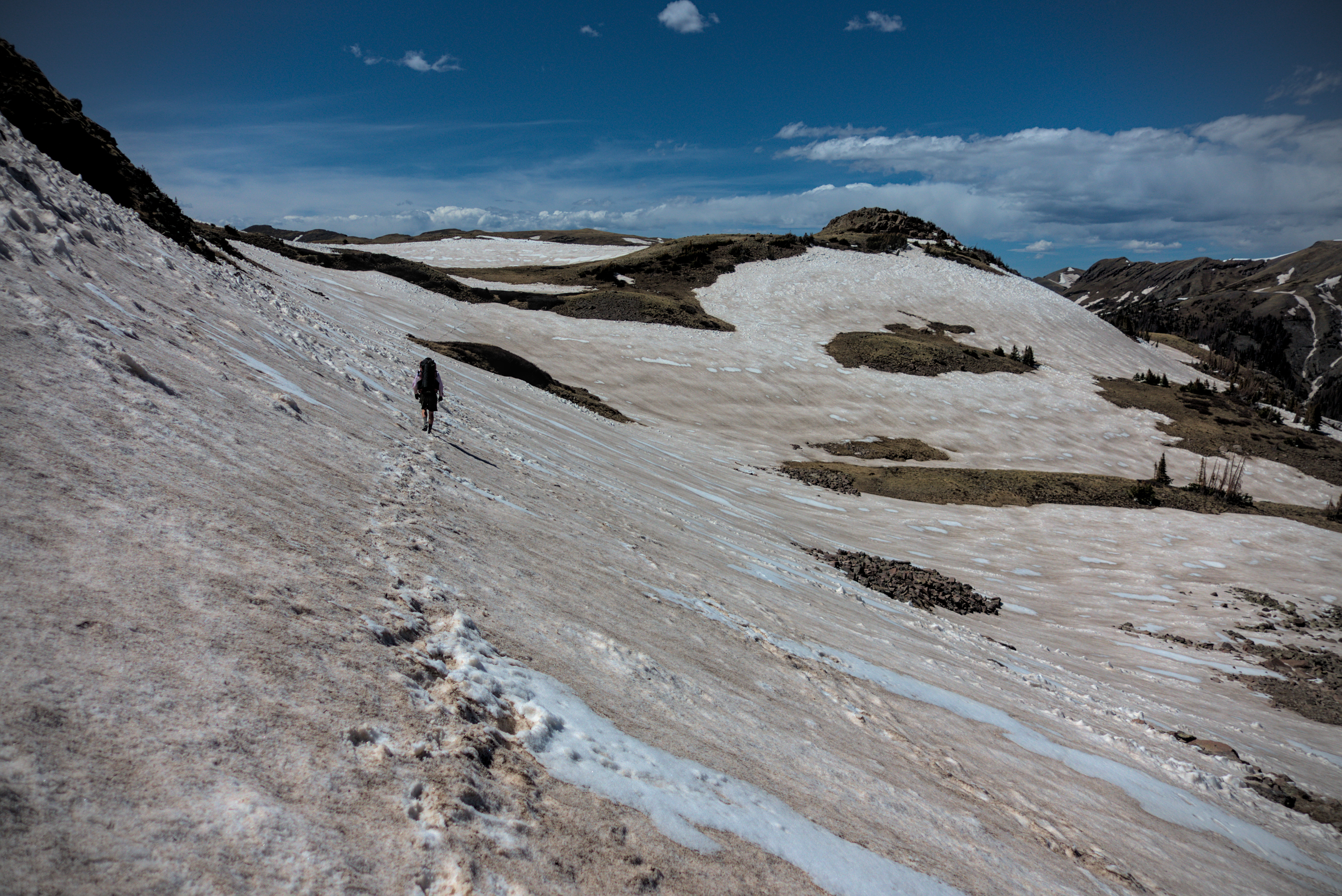
I turned north again, now crossing snowfields. One was steep enough that I got out my snow spikes for the first time. The next valley to drop into was dead ahead, and the scene of it was remarkably beautiful. Brown grass, red dirt, huge snow patches, blue sky and outcrops of forest. I had dived, and was still diving, into something vast. I stomped down snowfields for about 500 feet, and this time traversed above the valley floor of the North Fork of the Conejos. I thought about camping here, at a little ledge of trees and snowpatches near the stream, but after getting water I decided to keep going. It just wasn't very flat, it was wet, and shucks it was just a bit too early to stop.
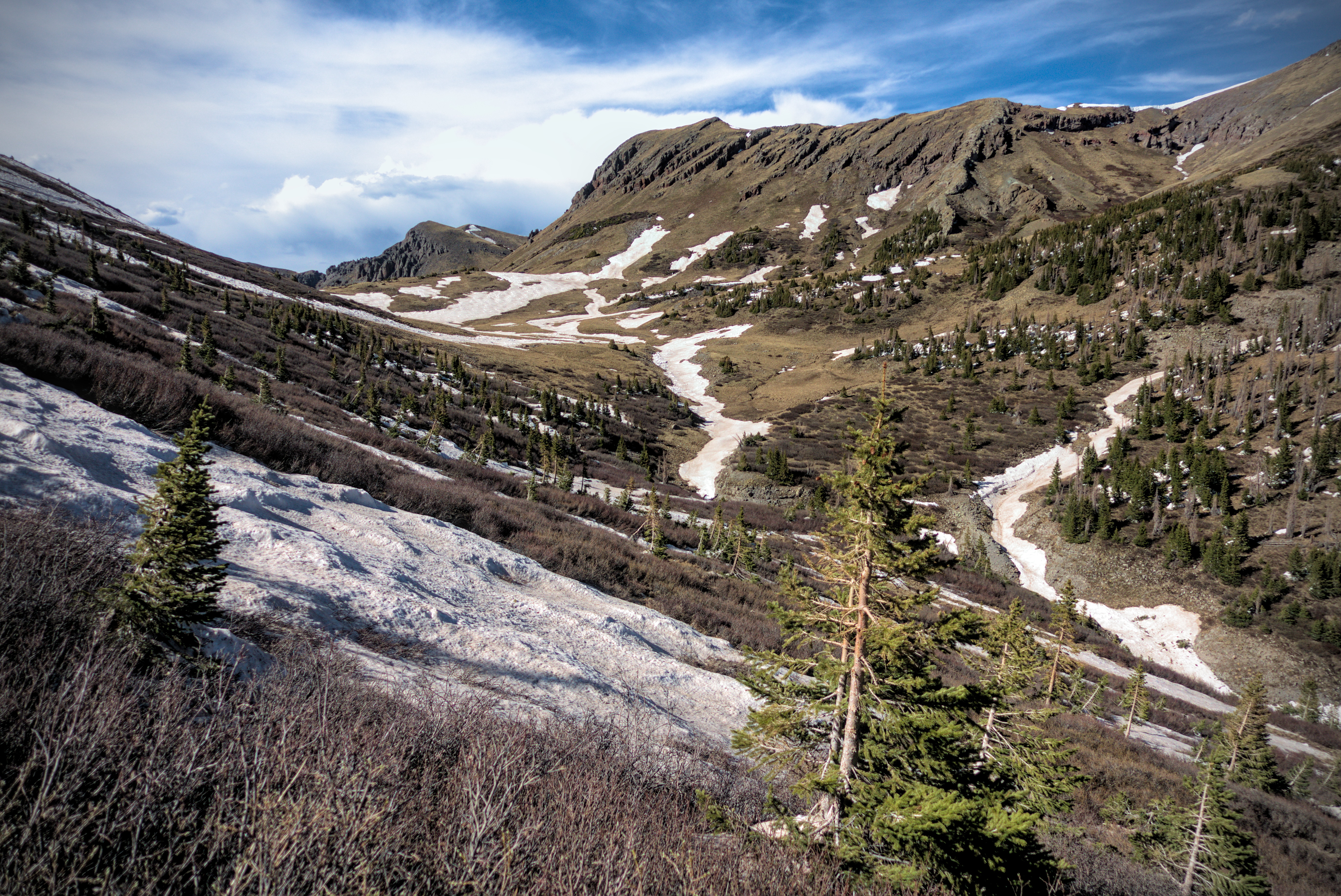
The upper North Fork of the Conejos.
Mysterious, nameless valleys radiating off my position constantly...
The snow is re-freezing in the shade already...
Rounding a corner I now encountered for the first time the scrub brush that would bedevil me for many days in these mountains. The trail traversed a hillside covered in these bushes. In a little north-facing indentation, I met a wall of snow and had to climb over it and through these brambles, pulling on them and getting slapped constantly. Feet balancing on logs or collapsing snow above steep drops, trying to use my head and shoulders to bull my way through a cabal of bushes and dead tree limbs, I finally had to give up and strategically crab to the right over uncertain terrain, hanging on branches. Escaping the indentation, I looked back at it and realized what should have taken 2 minutes to walk through took 15, and now I'm covered in scratches and carrying an aching tiredness.
"Embrace the suck!" they say about this trail, and they mean it.
Anyway, Cutie passed me again as we escaped the bushes, and now I was eager to camp, but the wind had gotten pretty strong. There just weren't any good places. A saddle at 11800 feet might have been okay, but I passed by it and was pushed around by the wind in a very narrow saddle at 12000 a bit furher north. I kept going until I reached a long ridge arm which marks the steep snow descent into the impressive Adams Fork Conejos.
I wandered down the arm a bit, determined to find a place to sleep. Eventually I found something that was dry and level, with a bit of wind protection. As usual with such places, the pitch was creative, with a mix of dead-man anchors in snow, tied off branches and maybe one ordinary stake in the ground. It was about 17:30. I'd been on the move since 6. I'd covered 18.6 miles, not reaching my desired 20, but I thought it was enough. It had been about 3500 feet of climbing, too.
I shoveled some food in my mouth, probably cous-cous with olive oil and taco seasoning. I was at 11722 feet above the sea. It didn't feel as cold as the night before. I heard coyotes howling in the night.
Tent life as the sun goes down.
Last view before sleep and the howling of coyotes.
May 27th, day 37, 17 miles
In the morning, I packed up and eagerly set off for the descent to the valley. I followed tracks in the snow down a steep snow slope, and right away had to stop and put on spikes because the snow was rock hard. After just a few minutes, I balked at the steepness of the descent -- it was a dangerous place! I crabbed over to a tree, then traversed west and back up. I saw that I'd followed tracks of an unusually bold person off the trail. Plus, they likely went down in the late afternoon when they could do a standing glissade. Still...it was a long ways down, and without an ice axe I wouldn't be able to self-arrest if I fell.
So I eventually gained the main trail, which was still a little nerve-wracking in the steep icy snow at 6 am. Eventually though, I felt bold enough to again leave the track and bomb down to the valley, confident after the day before that this is the best way to deal with northern slopes. I made my own trail down through sparse forest, but saw that I wasn't the only one with this idea when I came upon Cutie and several others packing up their tents on the scenic valley floor. "Darn, I could have camped down here!" I thought. Oh well, my campsite was...interesting up there on the ridge. And the coyotes were rather dramatic...
Campsites in the Adams Fork of the Conejos.
Pleasant walking to the valley head.
As usual, Cutie walks quickly and catches me!
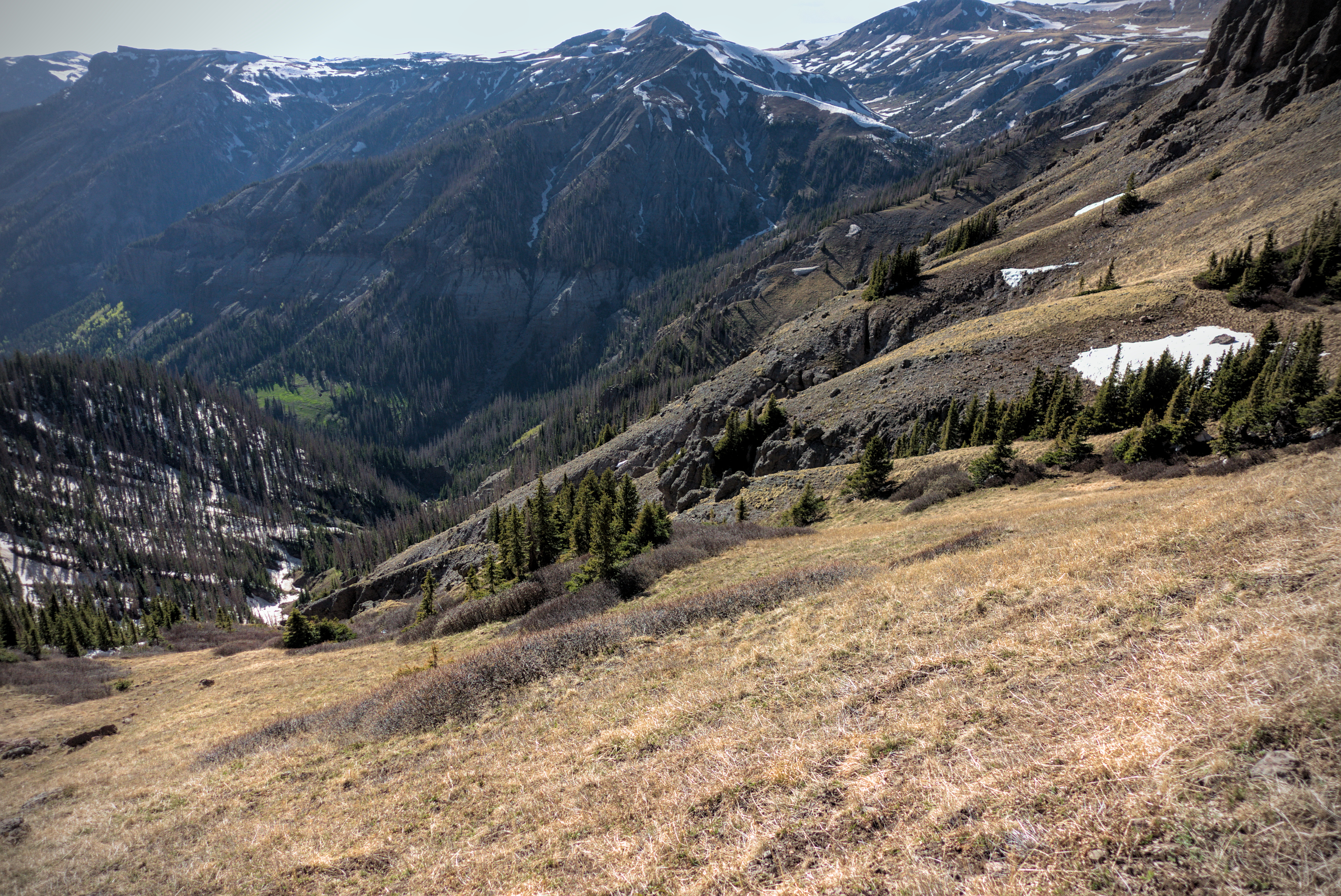
It doesn't show up on maps, but the north side of the river has a pretty good trail, and thanks to it's south-facing slope, I know I made much better time on this than I could have on the other side. Somewhere along here in the Adams Fork I heard a sound above, and looked up to see an enormous elk running, absolutely flying across the slopes above me. It was like something in a dream.
The valley narrowed, and I was glad the trail continued cutting across the hillside. I climbed above the trees into a zone of frozen creeks and craggles of rock amid snowfields. I seem to write the sentence "Cutie passed me" a lot, and it happened again here, though we exchanged friendly words about the scenery. There was another guy, very fast, and with a very small pack who I (of course) never saw again.
Rounding the valley head, a look back to Peak 12636.
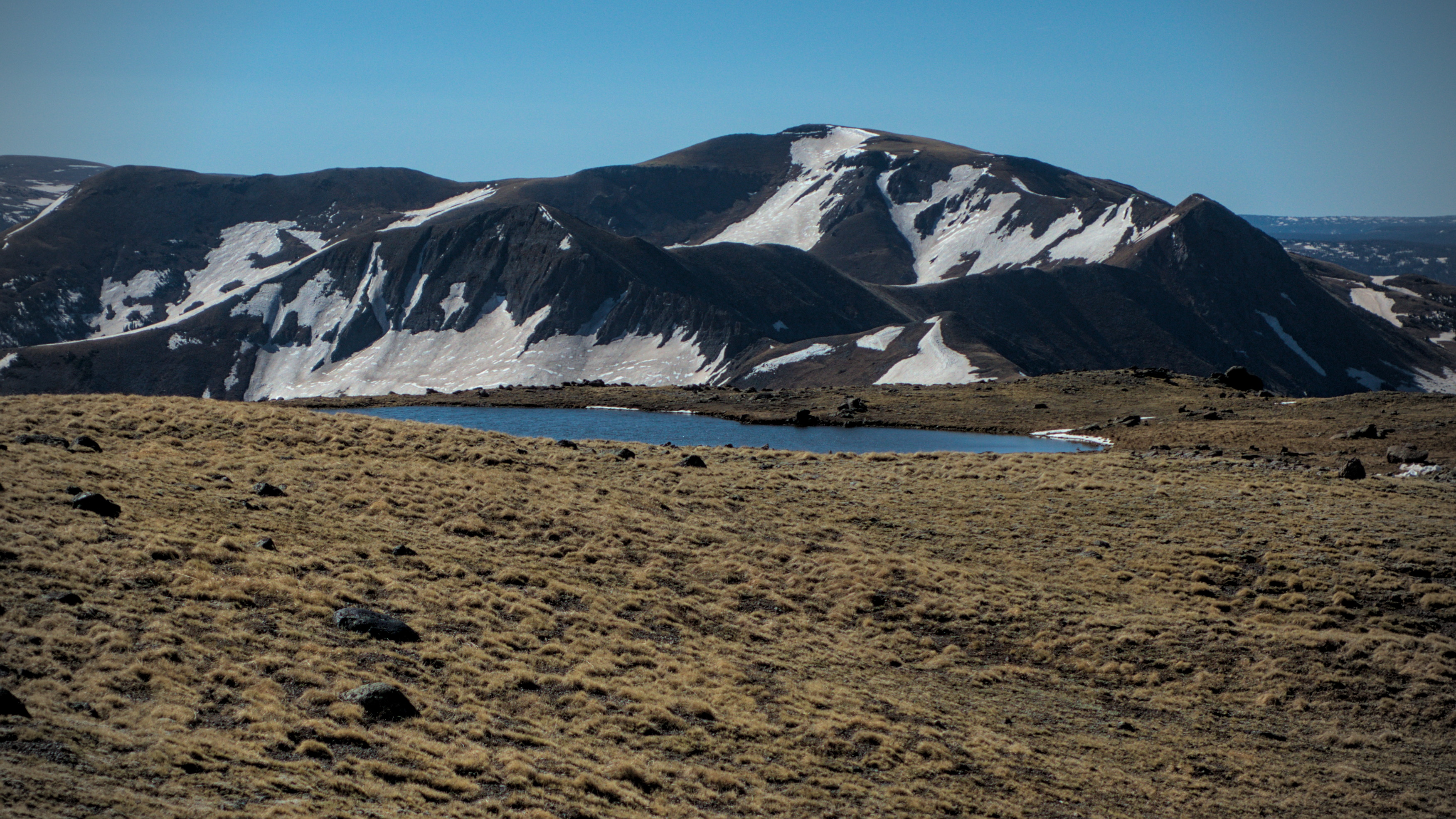
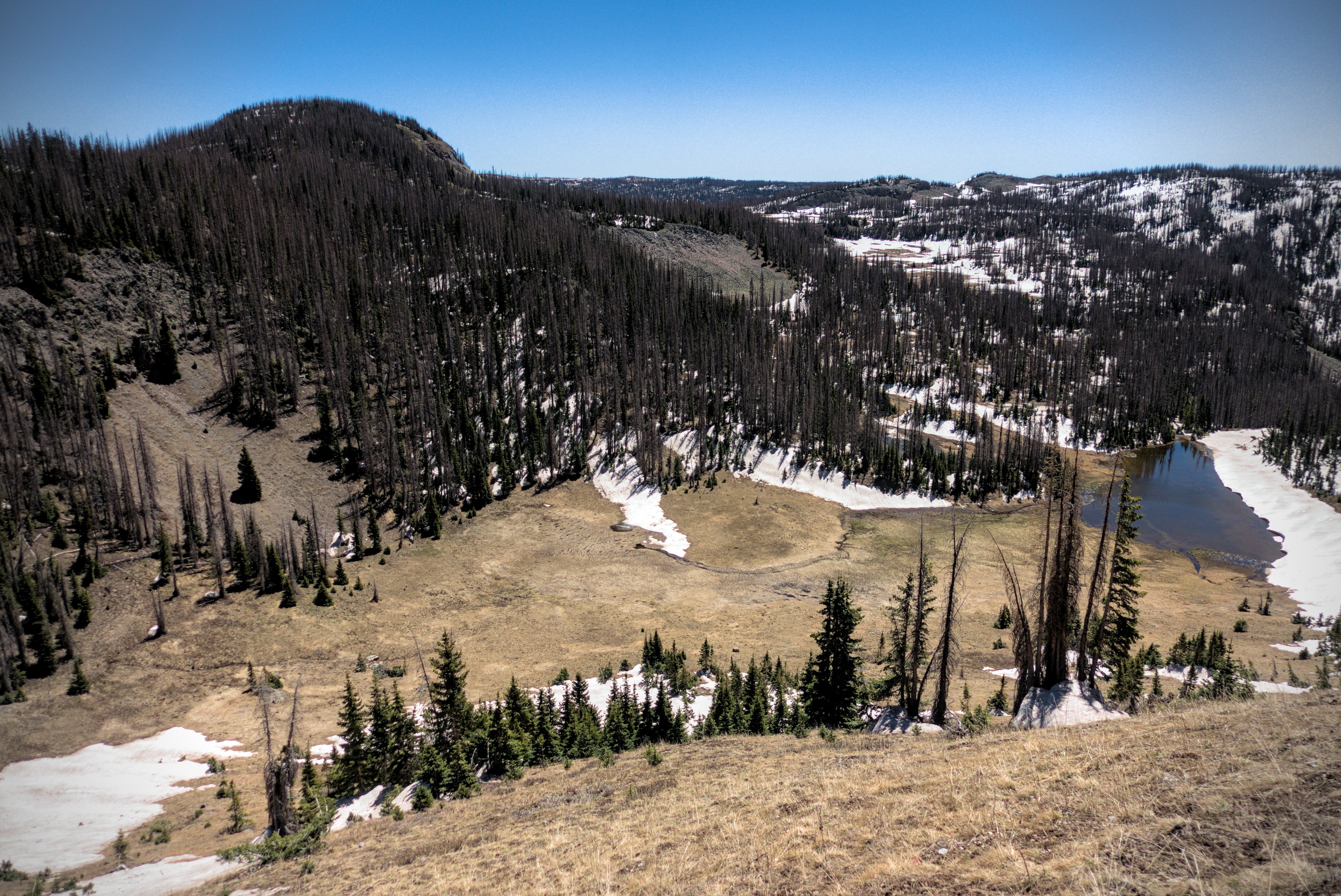
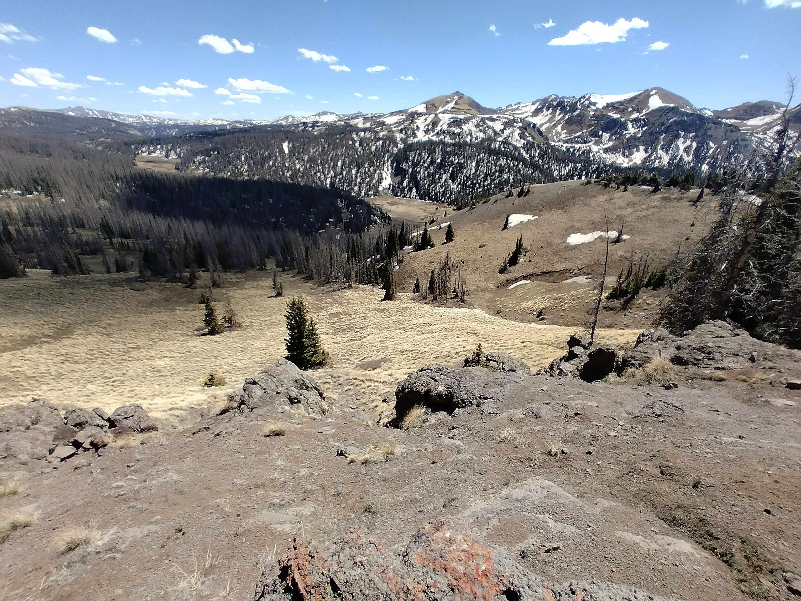
An unnamed lake on the plateau south of Summit Peak.
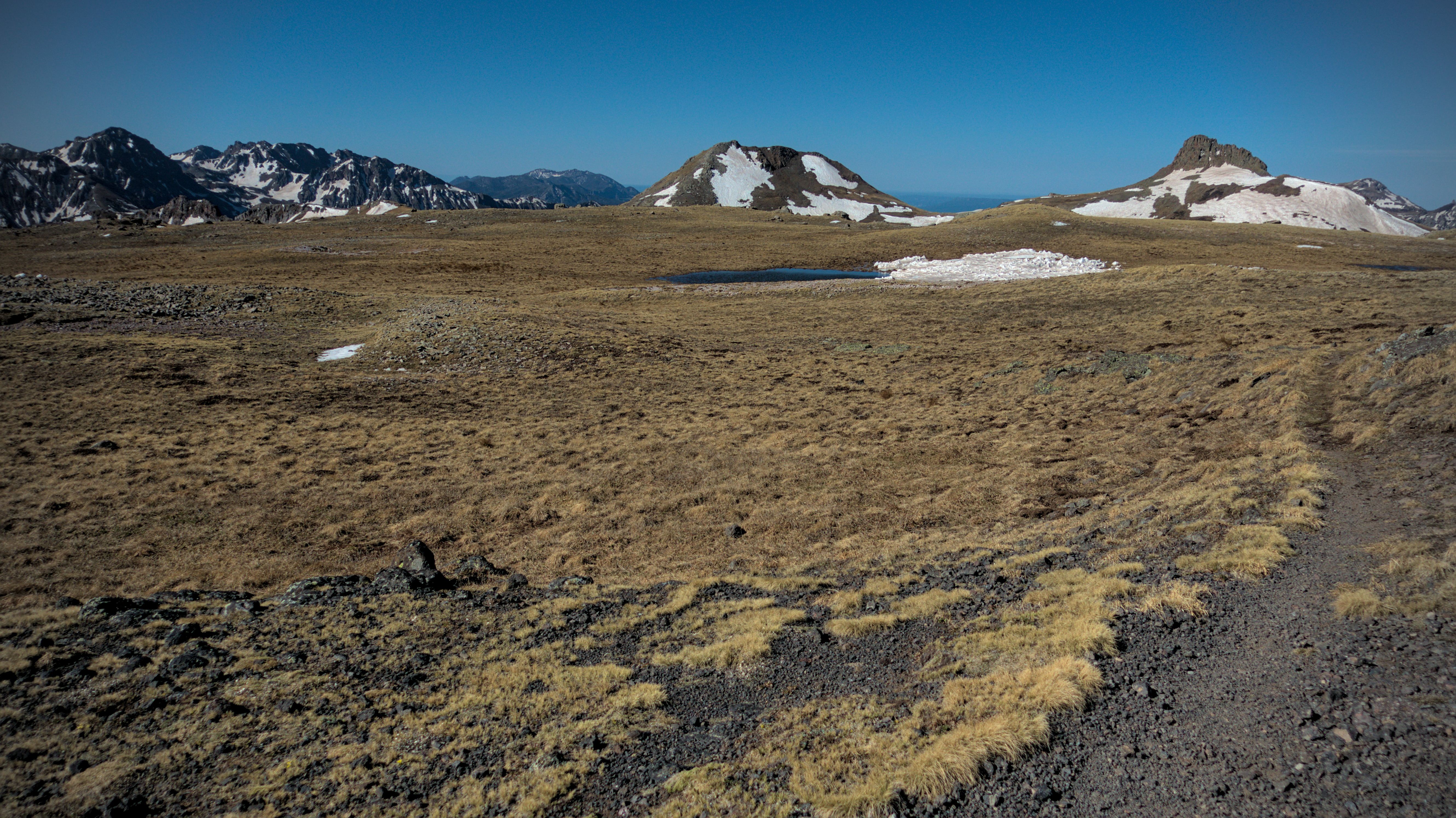
I enjoyed this plateau immensely.
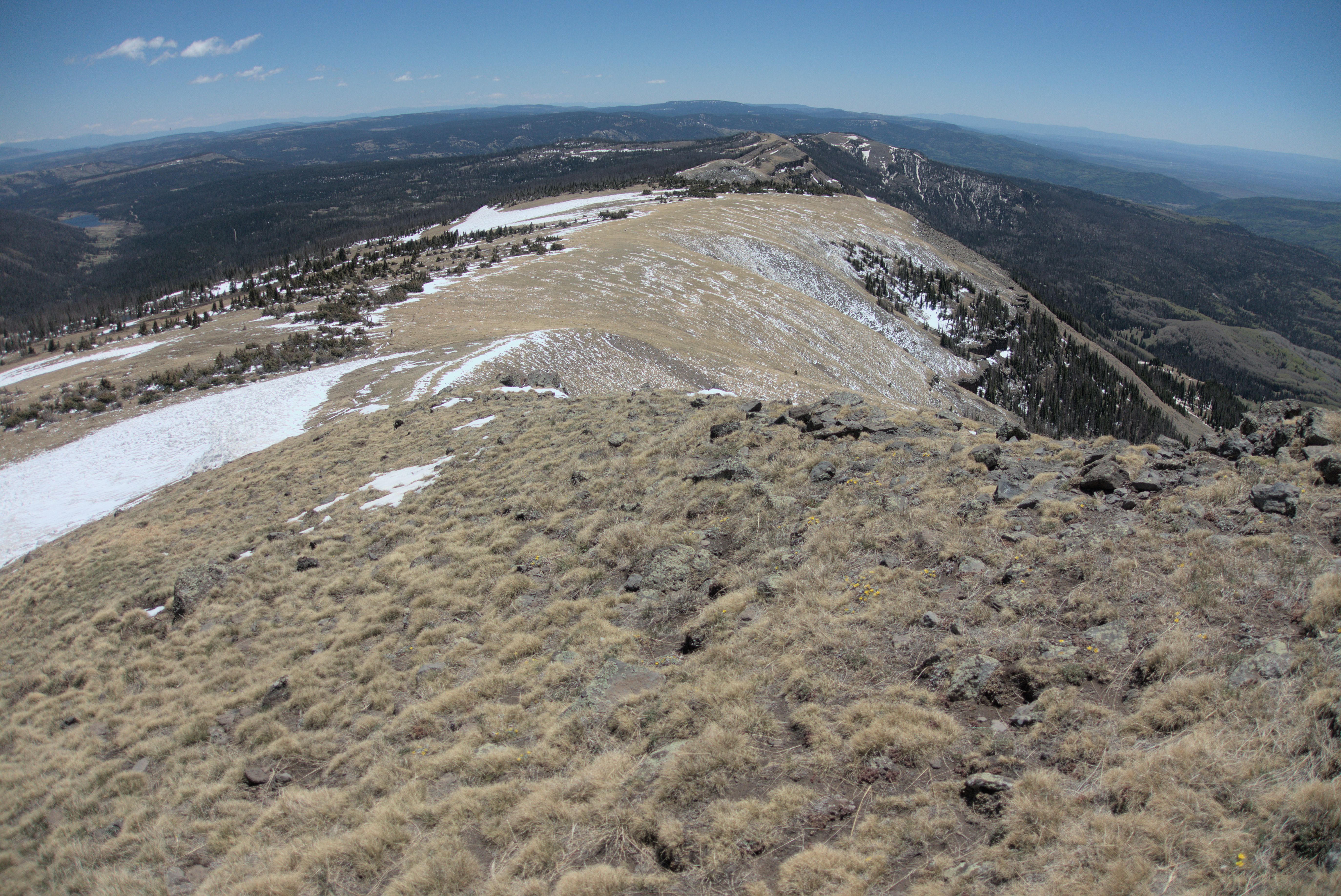
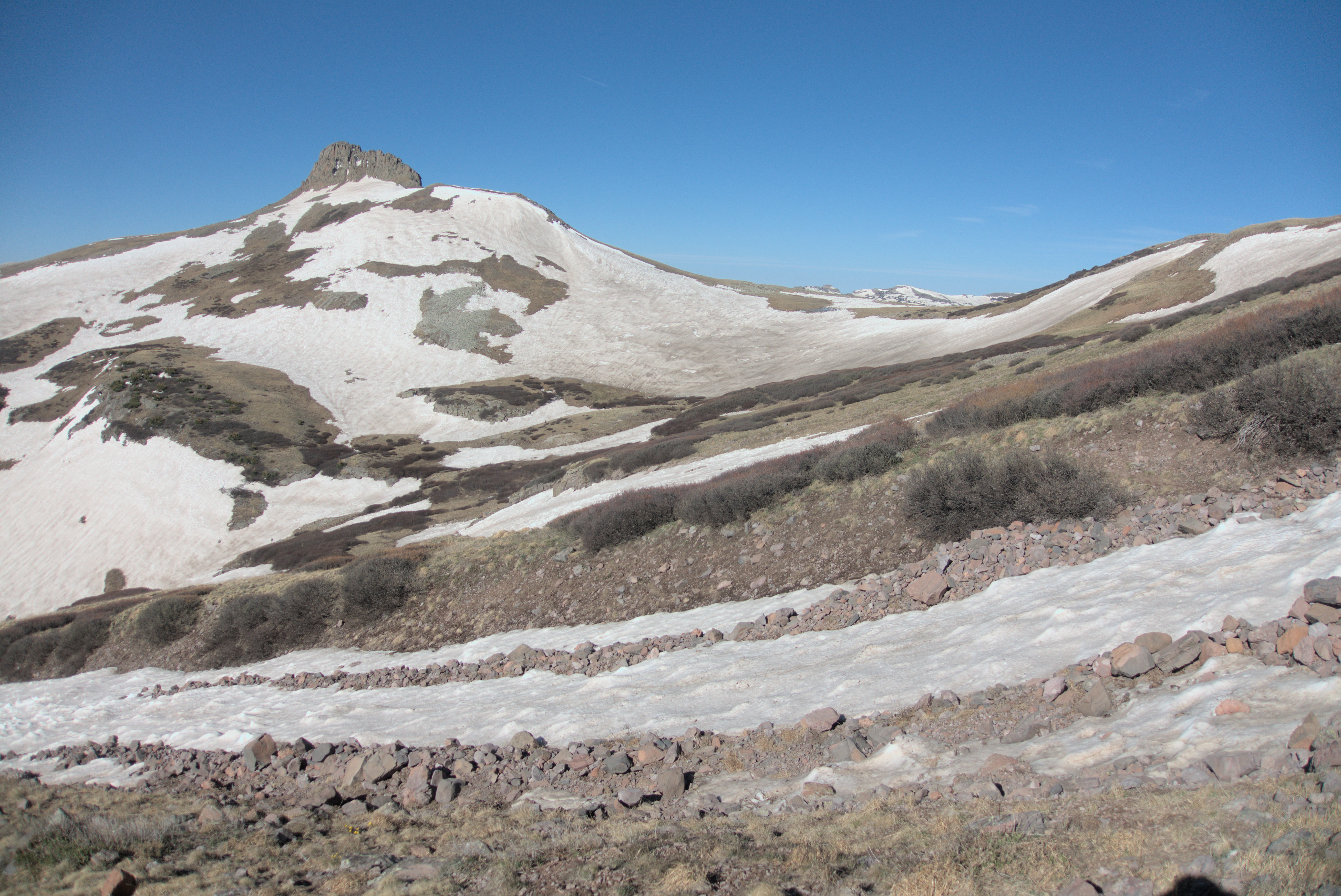
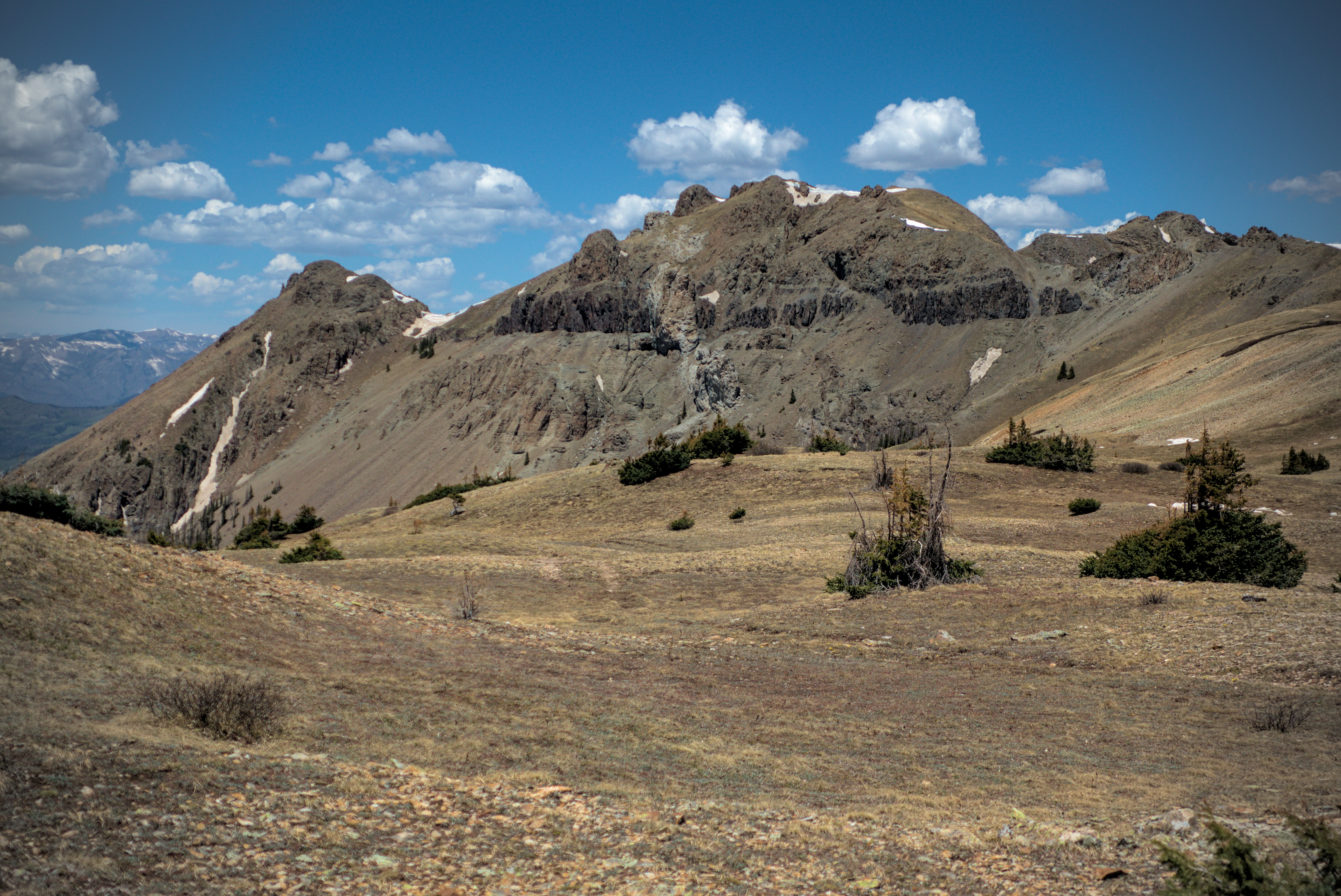
Shortly before reaching a plateau, the trail turns back to the east in a big switchback under Summit Peak. I entered a very scenic zone on an escarpment east of it in which nestled blue or frozen lakes, and big views in all directions.
I saw ptarmigans in here and managed to get a picture of them with their brown coats on.
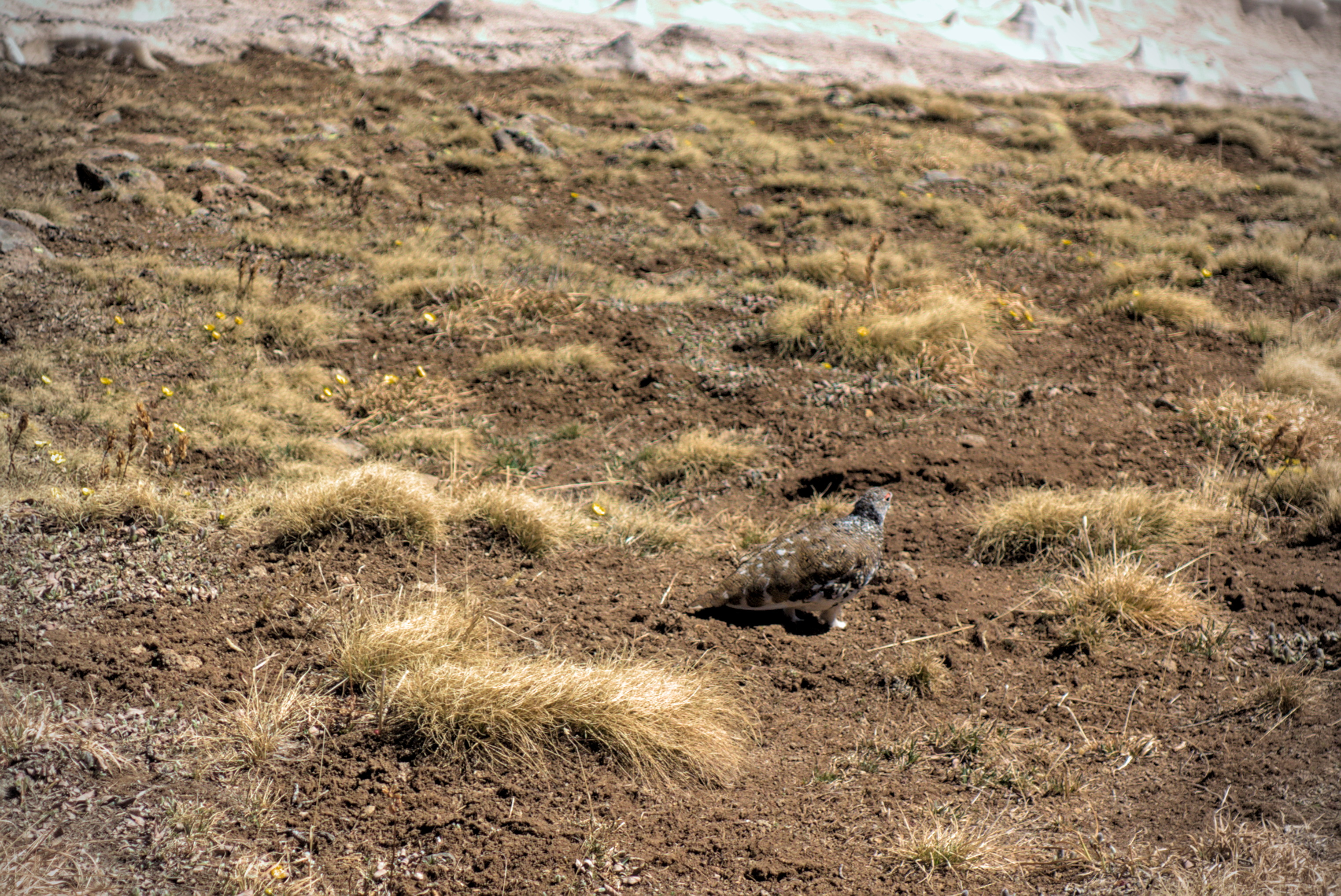
A family of ptarmigans also enjoy this place.
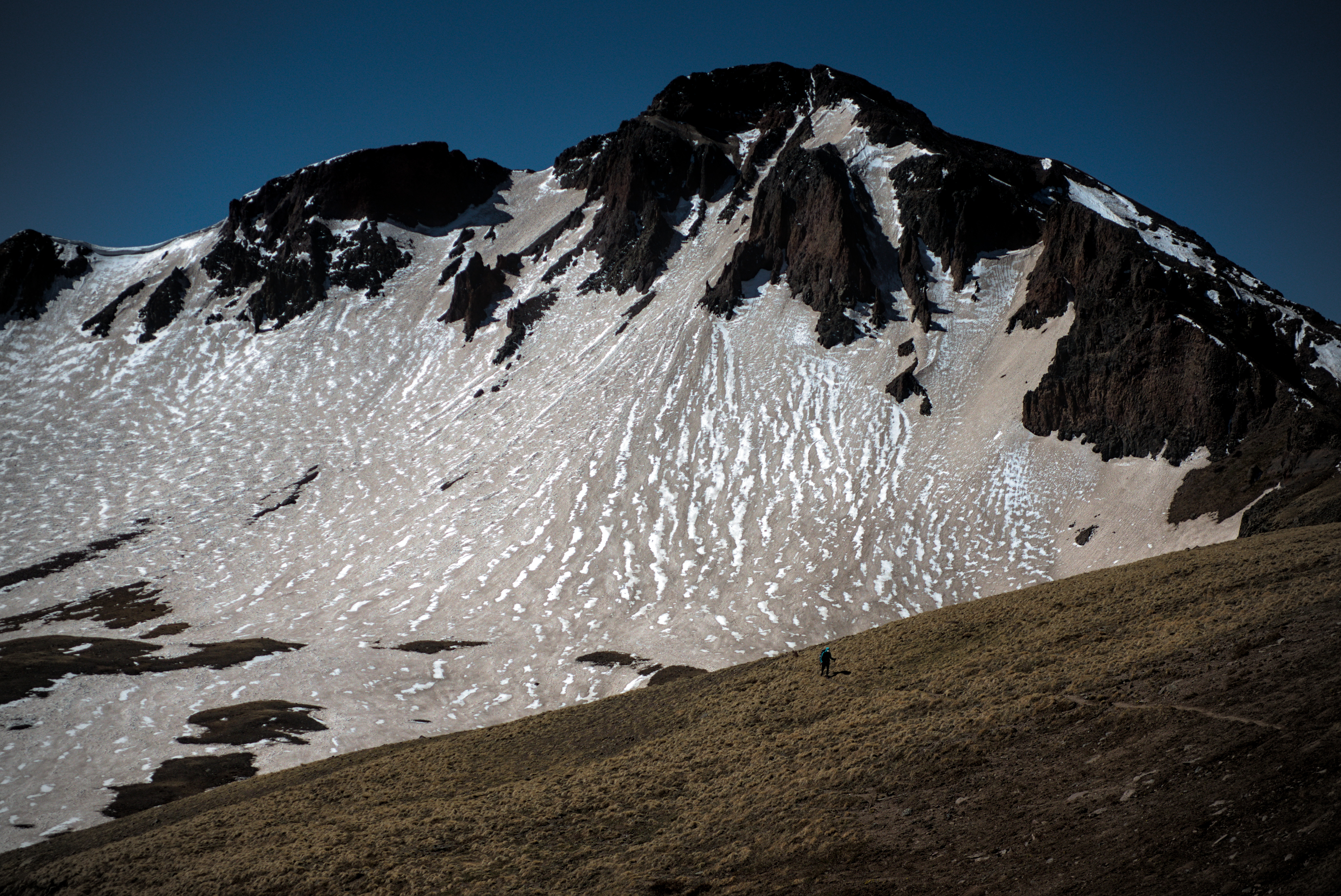
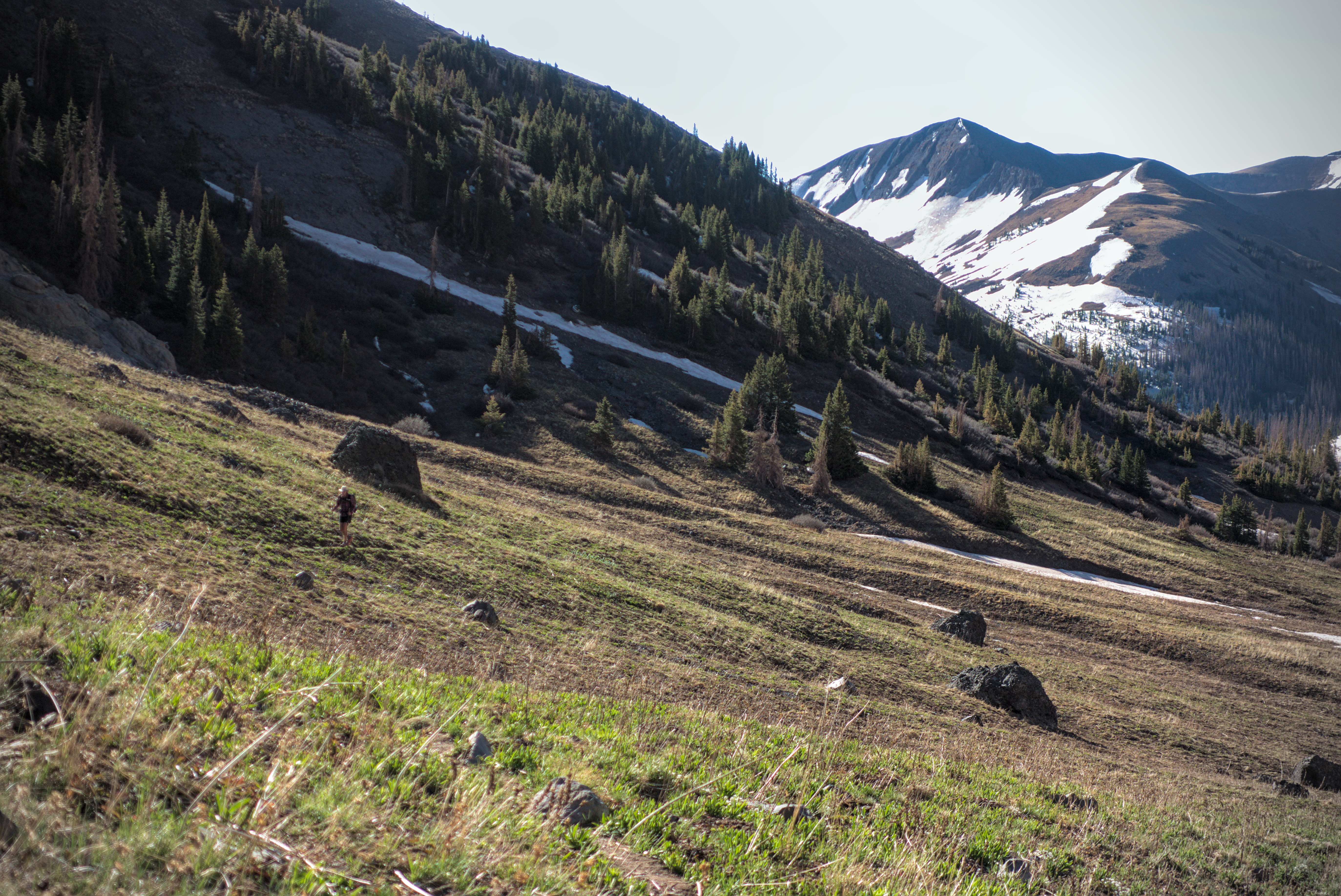
A hiker is happy to be on grass after the long snowy traverse
below Summit Peak.
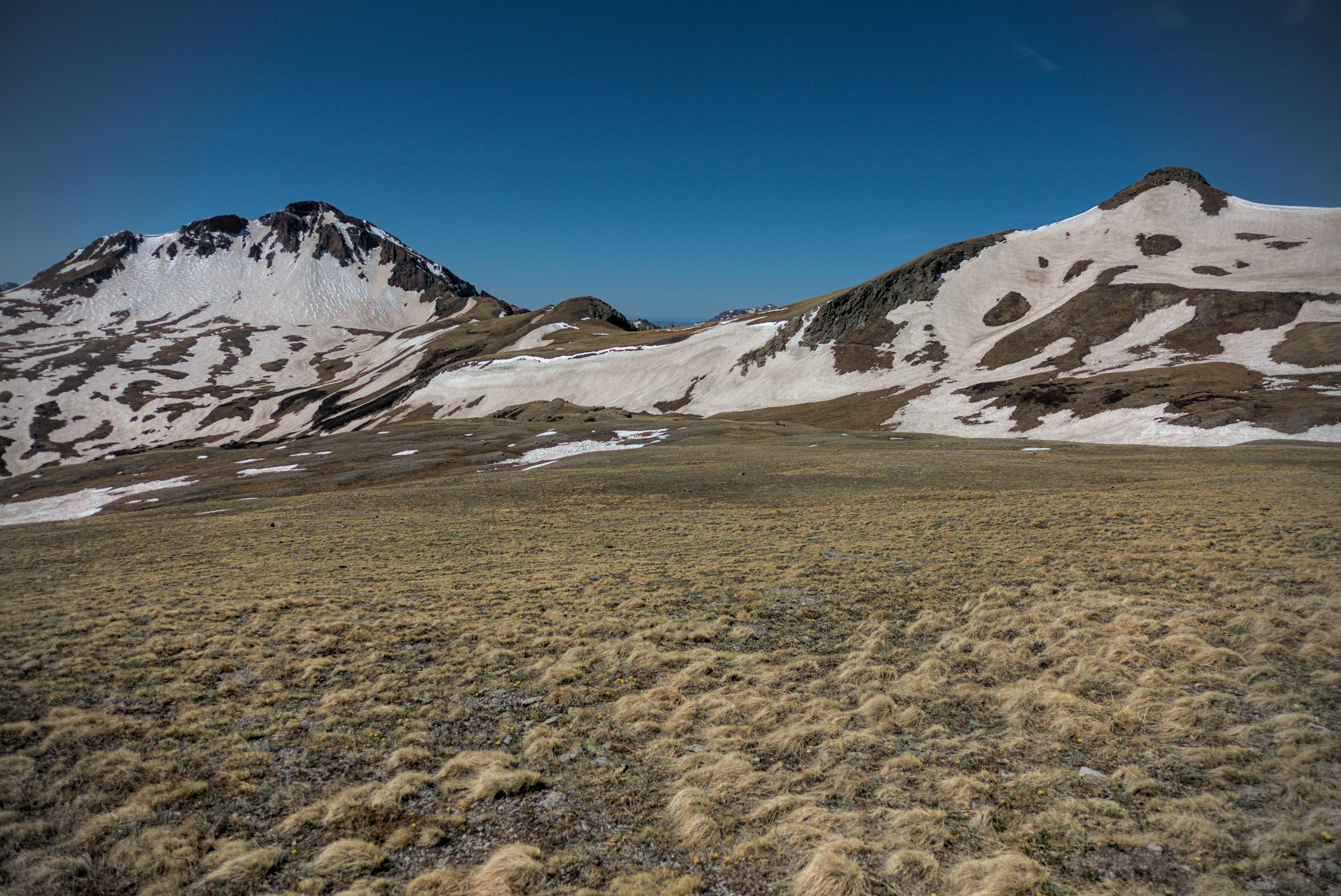
Looking back to Summit Peak from near Montezuma Peak.
Huge new vistas of country on my right, to the east.
Same.
Incredible country near Long Trek Mountain.
Rounding that peak, there was a new vista with Montezuma Peak as my next goal (traversing under it, that is). It was over 14000 feet, and the trail itself hit a high point of around 12600 feet. To reach it I crossed two extensive snow fields, walked by a frozen lake, then traversed a steep slope that gave some people a bit of pause. Later, from a distance, I saw people working their way very carefully across. I might have used my spikes, but I don't remember any special difficulty.
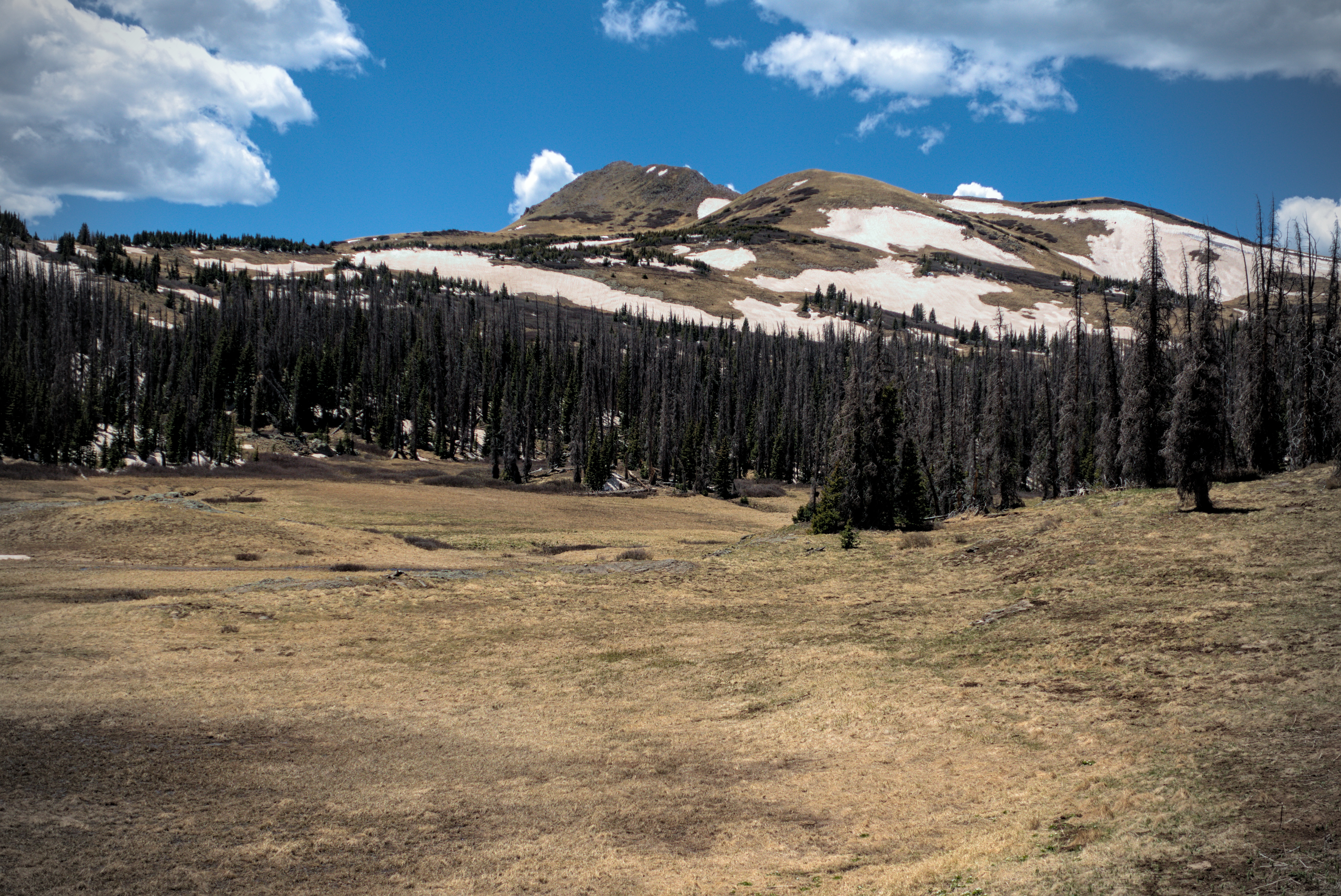
Around here I left the South San Juan Wilderness and entered the Rio Grande Forest. This was probably the best combination of scenery and fairly easy travel. I'd made it through the steep descents and climbs of several valleys now, and could see lower country ahead of me with less snow. And getting there was mostly flat or slightly downhill. I enjoyed this place quite a bit!
Descending to parklands of Elwood Pass.
Trail magic!
The country was lower, but the traverses were often steep.
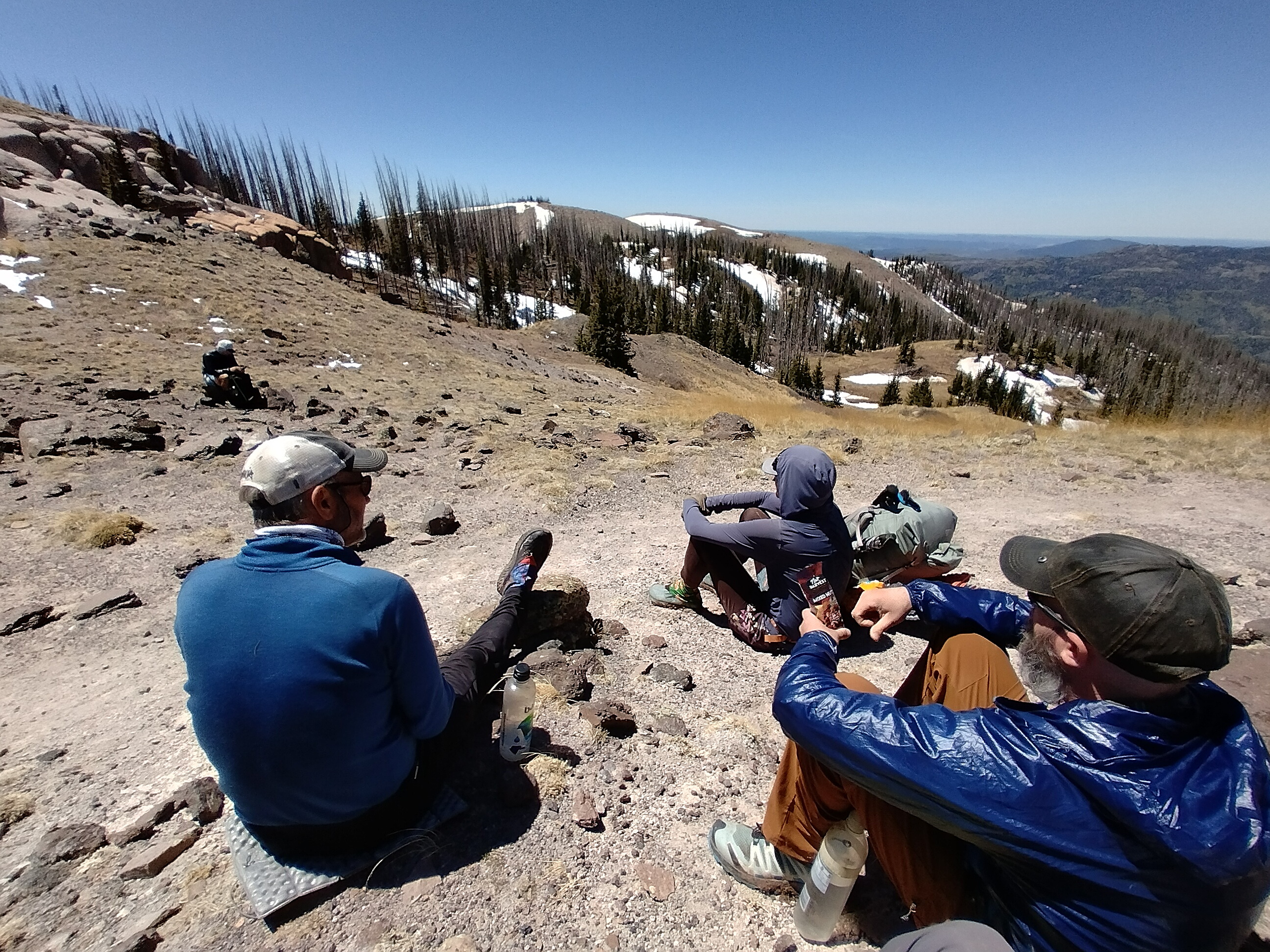
After some hours, I was making my way down snowfields and forest that led to a road junction called Elwood Pass (11631 feet). I was overjoyed to see a crowd of people and a few cars, with chairs scattered around and a few familiar faces. Trail magic! A wonderful couple had brought all this gear and snacks just to delight us hikers coming out of the high country. I ate handfuls of cookies and gulped down a couple of soft-drinks. I met Info here, who I had last seen in Chama. This was really enjoyable.
I set off with my usual starting-out-limp. How far would I continue? Immediately, I was enjoying the snow-free walking, and there were only occasional blow-downs to step around or over. I was on a distinctly sub-alpine ridge, a mix of meadow and forest, with rocky outcroppings here and there. It was wonderful to see a deep valley below on the left leading out to civilization. And the snowy peaks I'd emerged from looked foreboding in a satisfying way -- I came through that.
Looking back to the high country from more gentle ridges west of
Elwood Pass.
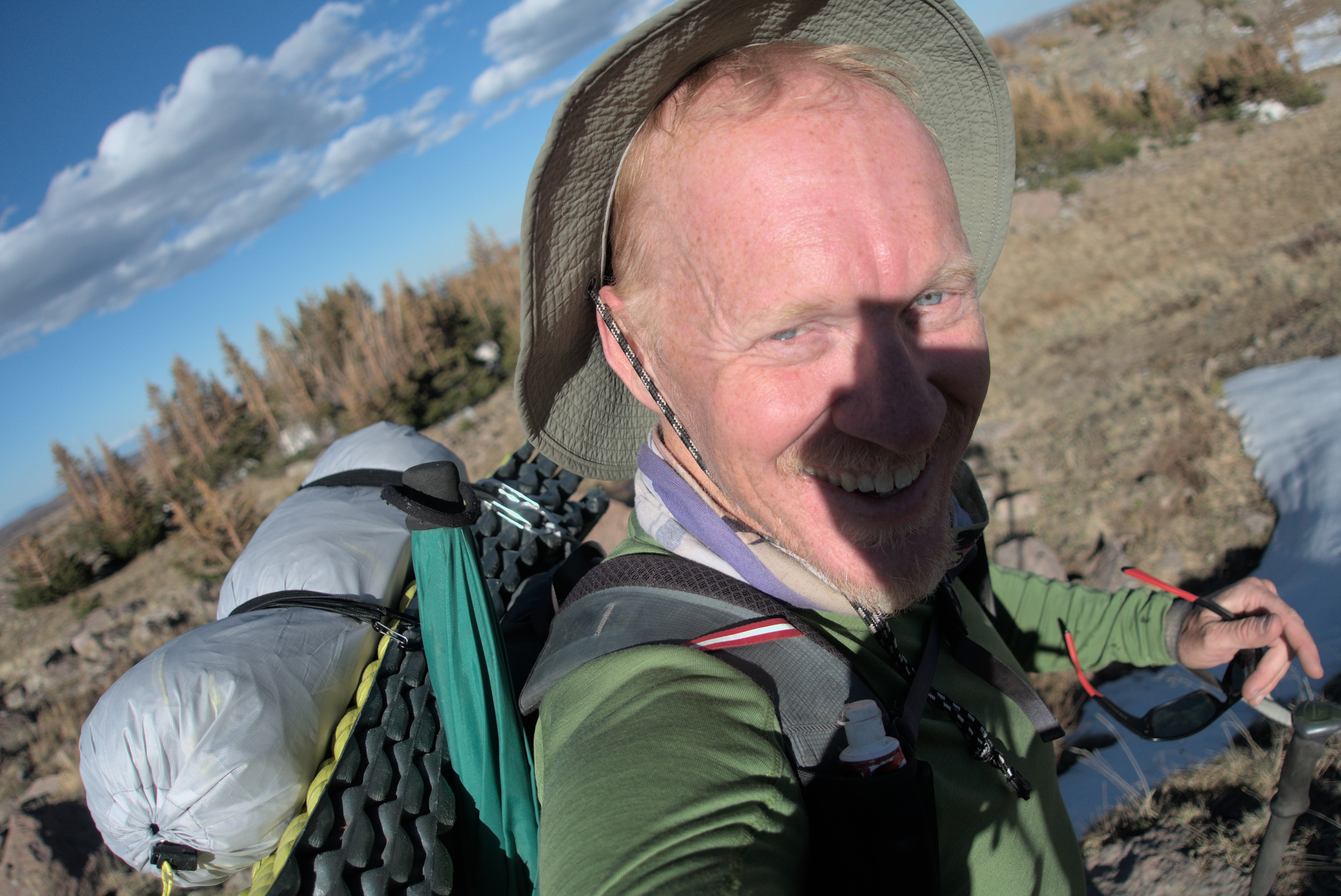
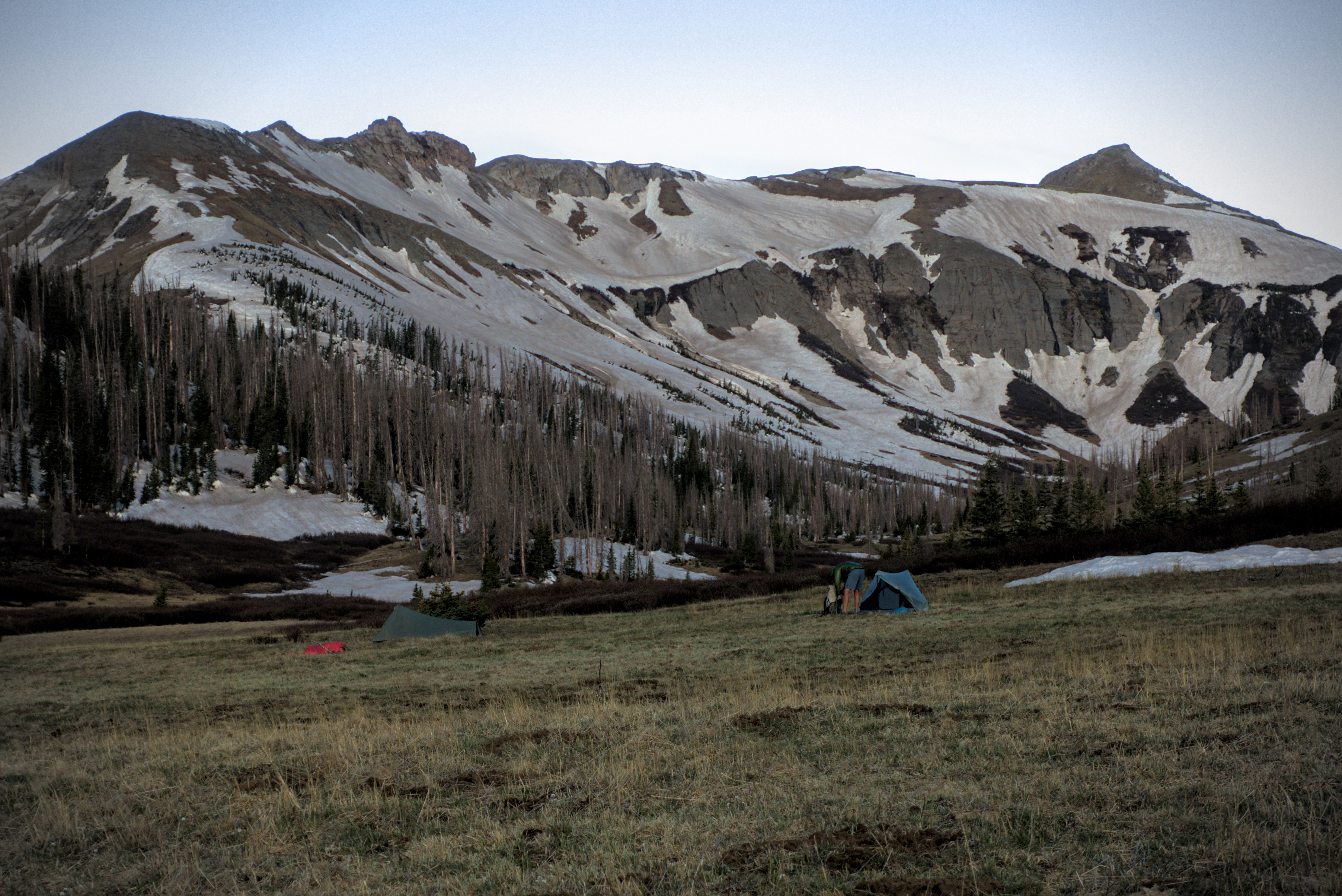
My camp for the night.
I guess I look tired but satisfied.
Some of the hillside traverses were very steep. I couldn't imagine crossing them with snow. I came to a water source described in the FarOut app as decent for camping, and immediately starting looking around. Right at that moment between 6 and 8 other hikers came up and fanned out looking for that magic combination of level, dry and wind protected. I ended up using a bank of remnant snow as an anchor and to help level the floor. I conked out quickly after dinner, my head spinning with the panoramic views of the day, and the jubilant sense that I'd made it through the hard parts of the southern range. I thought about town the next day, with restaurant food, beer, shower and bed!
May 28th, day 38, 12 miles
Hiking out, I didn't know it but this would be the day of maximum blow-downs of the whole trip. It started out right away, with climbing over some trees to end up somewhere off the trail...then climbing over more trees to get close to it again, then ducking under some downed trees to then follow a boot-track in a wide detour to avoid an enormous blow-down to... finally stand on the trail again. Whew!
That would happen for most of the day, until I gave up in disgust and bushwhacked down to a road. But first there was an interesting cross-country trip to climb a slope up to a ridgeline rather than follow the trail in a meander around and slowly up. It's always neat to make your own way, and I had fun doing this, especially when I know I'm saving time by avoiding the disaster of deep timber!
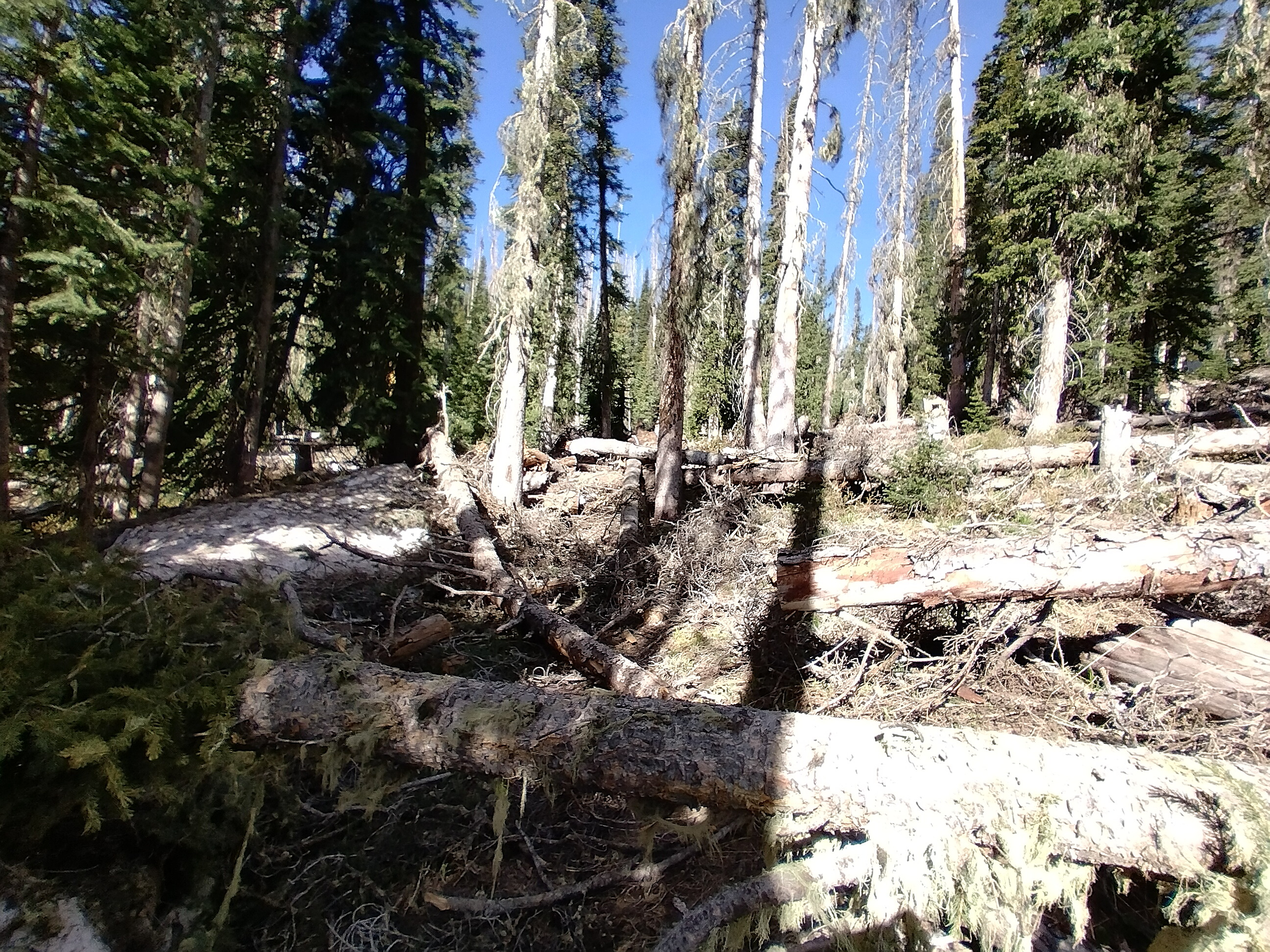
The picture doesn't convey how bad the blowdowns are...
I was really thankful now for steep and rocky slopes, because at least I was clear of the trees. But at Bonito Pass and several other unnamed passes where the wind was able to blow through the ridgeline, I was always greeted with a pile of trees playing matchsticks. I was surprised by these continental Rockies forests. I thought they would be broad parks, with easy cross-country travel...but very often, the forest was dense and impossible to move through quickly if there wasn't a cleared out trail.
Anyway, already exhausted, I came to a hilariously difficult section above a lake near the Wolf Creek Pass Ski Area. It was a master class of deep snow, steep slopes, downed trees, half-buried brush and vines, and trail washouts on steep ground. One foot in mud, one on snow, a gloved hand pulling on a branch (that breaks), and the other hand fighting to retrieve a hiking pole from a snow-bank. I crabbed slowly forward in a series of tableaus. It was a kind of triptych of all possible trail-horrors. Eventually I lost the trail and decided to kick steps in the snow straight up a slope to a ridgeline. However, the snow was too hard and cold, and my feet were soon painfully frozen. I kept thrashing around corners in the forest, wishing it would end.
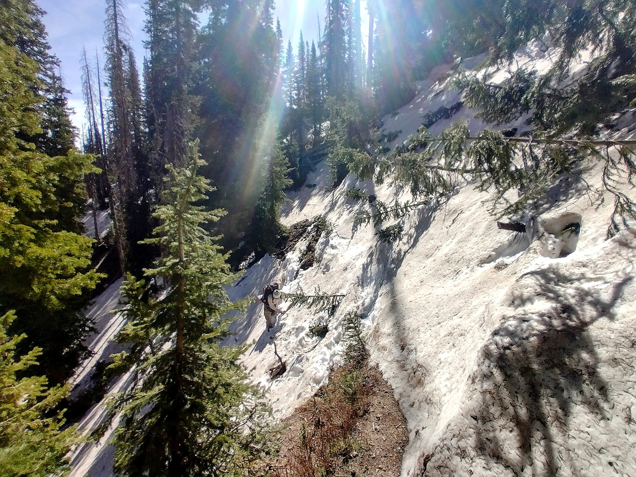
Do you see the guy in there, making his way through the mush?
Finally I came out into more open ground and made that decision I mentioned before to leave the trail and get onto the roads of the ski area below. This is not a romantic ending to the section, but I was furiously happy with the choice to get the hell off the "red line!"
Eventually I hit the road, soaking my feet one last time in a surprise marsh. No matter...! Soon they'll be dry. I filtered water, then set out to be a road-walker again -- how nice it was! Within an hour I reached the highway, and, joining up with Yeti and Flaka, we arrived triumphantly at the pass.
However, no one would pick us up for a ride into Pagosa Springs!
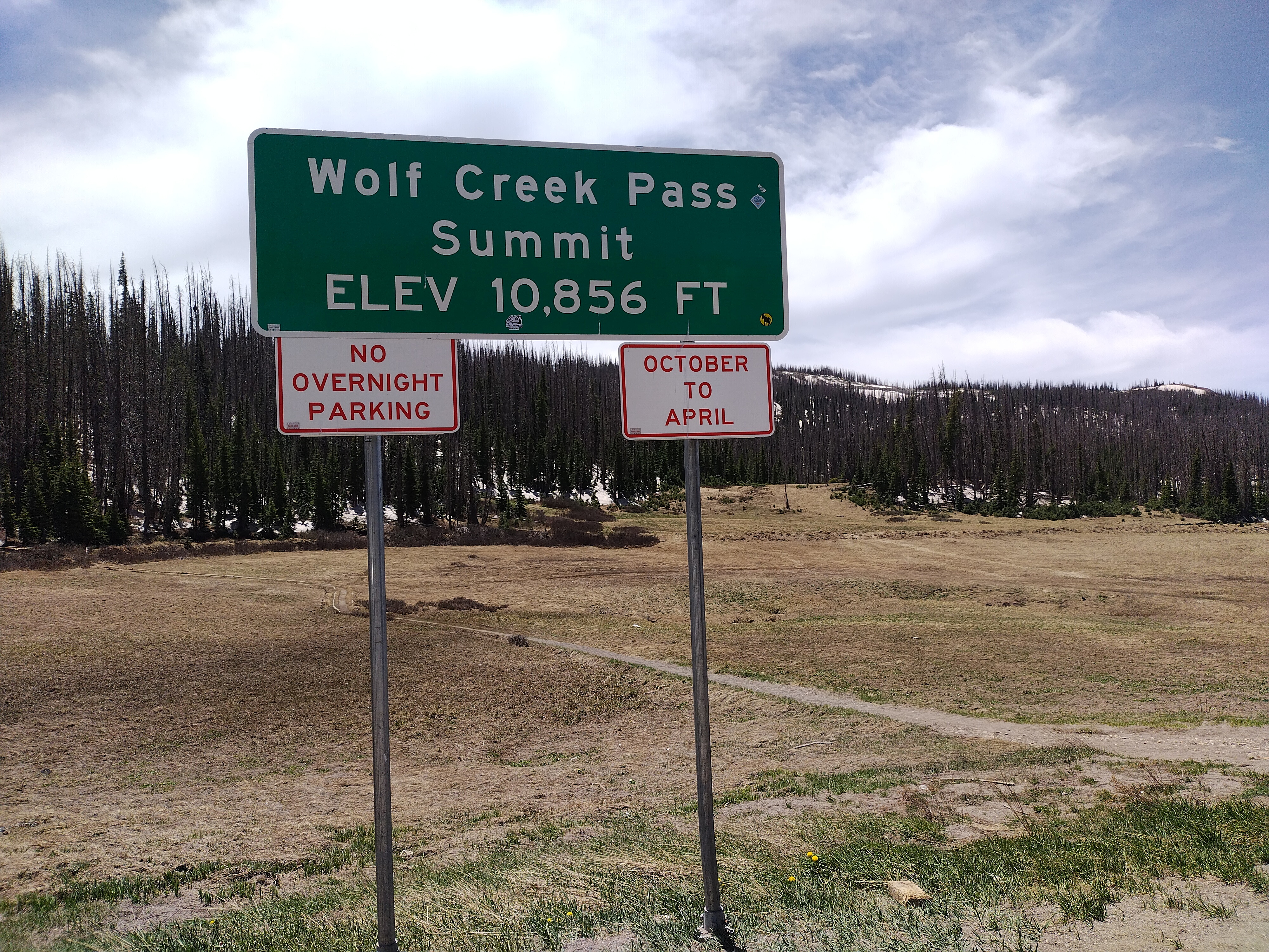
The pass!
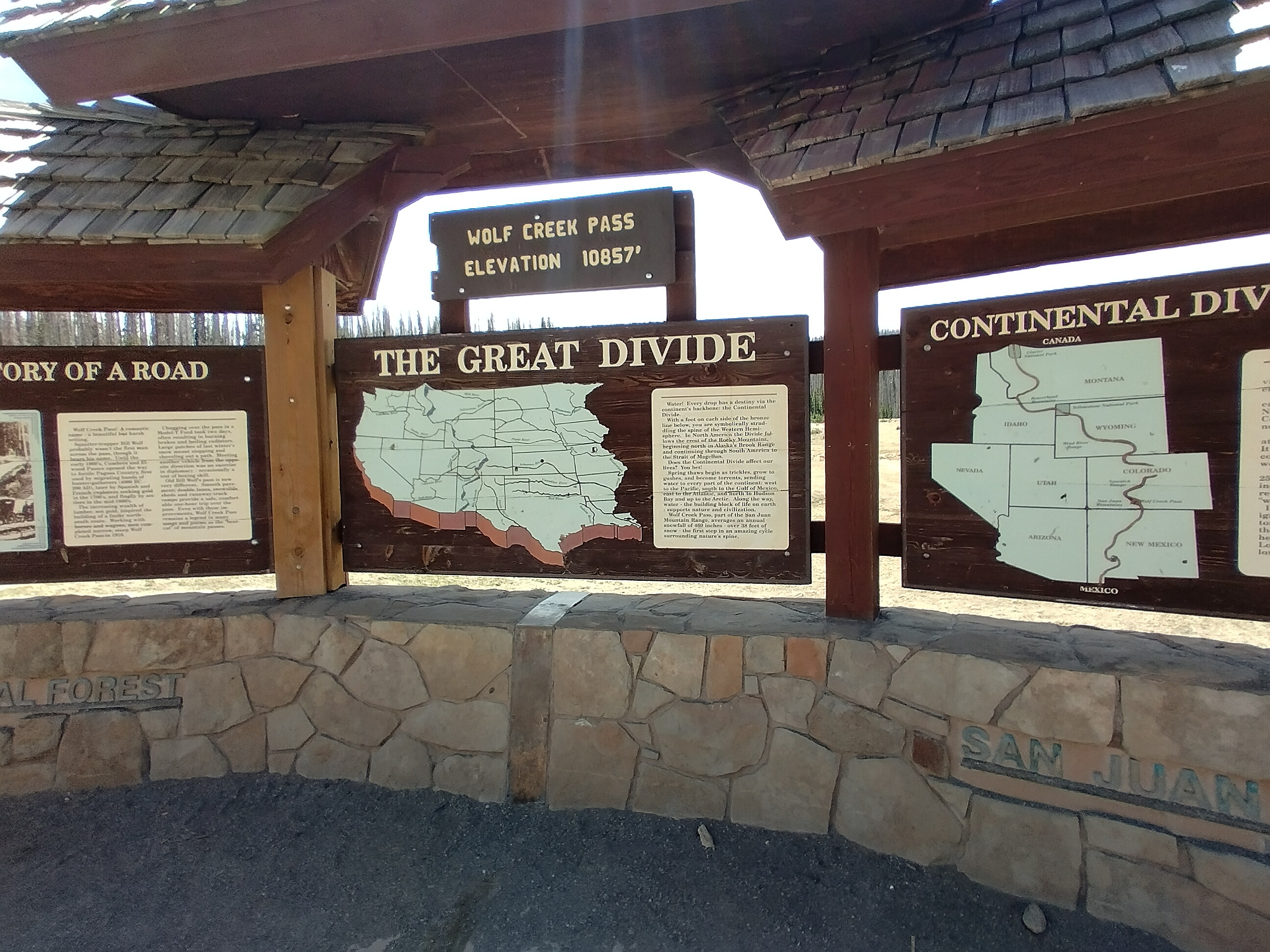
An exhibit about the pass...
Most of the license plates were Texas, and these visitors have a bad reputation for picking up hitchhikers. Finally, however, Flaka called his friend Smiley, who came and got us, bringing us to his house where we could spend the night. Amazing! Oh, there was an incredible burger first. Yeti and I tried to figure out where to stay, when Smiley came back to the burger joint and told us to stay with him.
And so it was that I got to enjoy an amazing evening in Smiley's house, watching an old episode of Survivor with the gang. It was this wonderful feeling of normality that I'd missed. TV, a beer, the news, some chips, and that great feeling of a hot shower. I slept on a mattress Smiley and his girlfriend found somewhere and put behind the couch.
Not a care in the world...
To continue the story, the walk from Wolf Creek Pass on to Silverton click here.