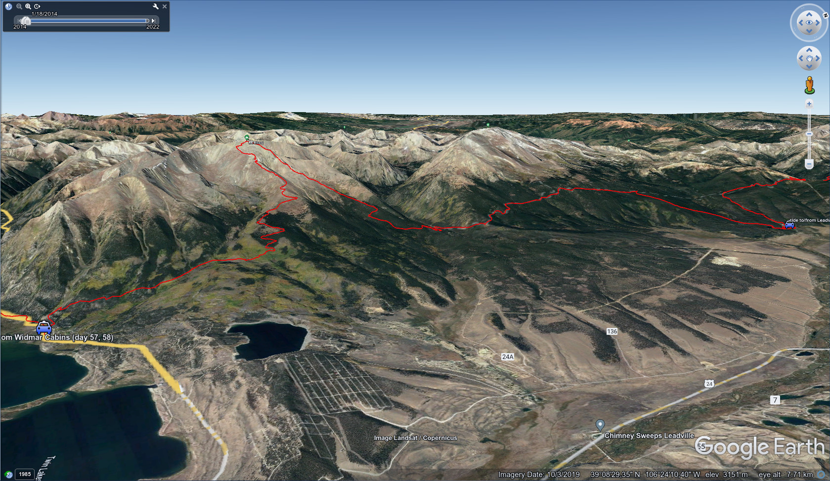
CDT - Twin Lakes to Interstate 70
Friends: Mishap, Gargoyle, LeftoversLocation: Twin Lakes Town, Mount Elbert, Mount Massive Trailhead, Leadville National Fish Hatchery, Tennessee Pass, Kokomo Pass, Searle Pass, Copper Mountain Ski Area, Grays Peak Trailhead, Grays Peak, Mount Edwards, Argentine Pass, Argentine Peak, Decatur Mountain, Revenue Mountain, Sullivan Mountain, Geneva Peak, Webster Pass Colorado, Tiger Road Bus Stop, Rainbow Lake Colorado, Frisco Colorado
Elevation gain: 8516m = 1761m + 1425m + 1015m + 0m + 1981m + 1219m + 0m + 0m + 0m + 571m + 544m
To go back to days 57 and before, click here.
June 17, Day 58, 21 miles
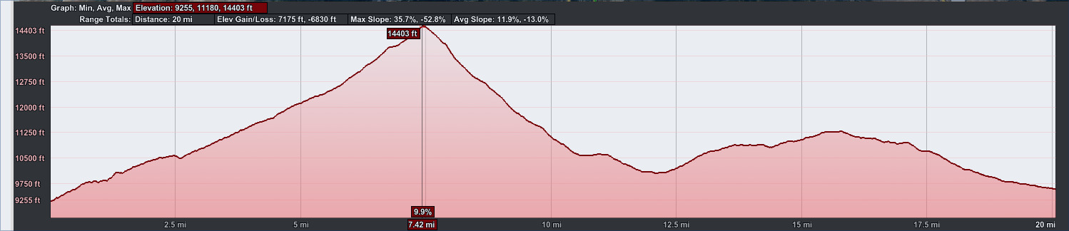
20 miles, 7175 feet elevation gain.
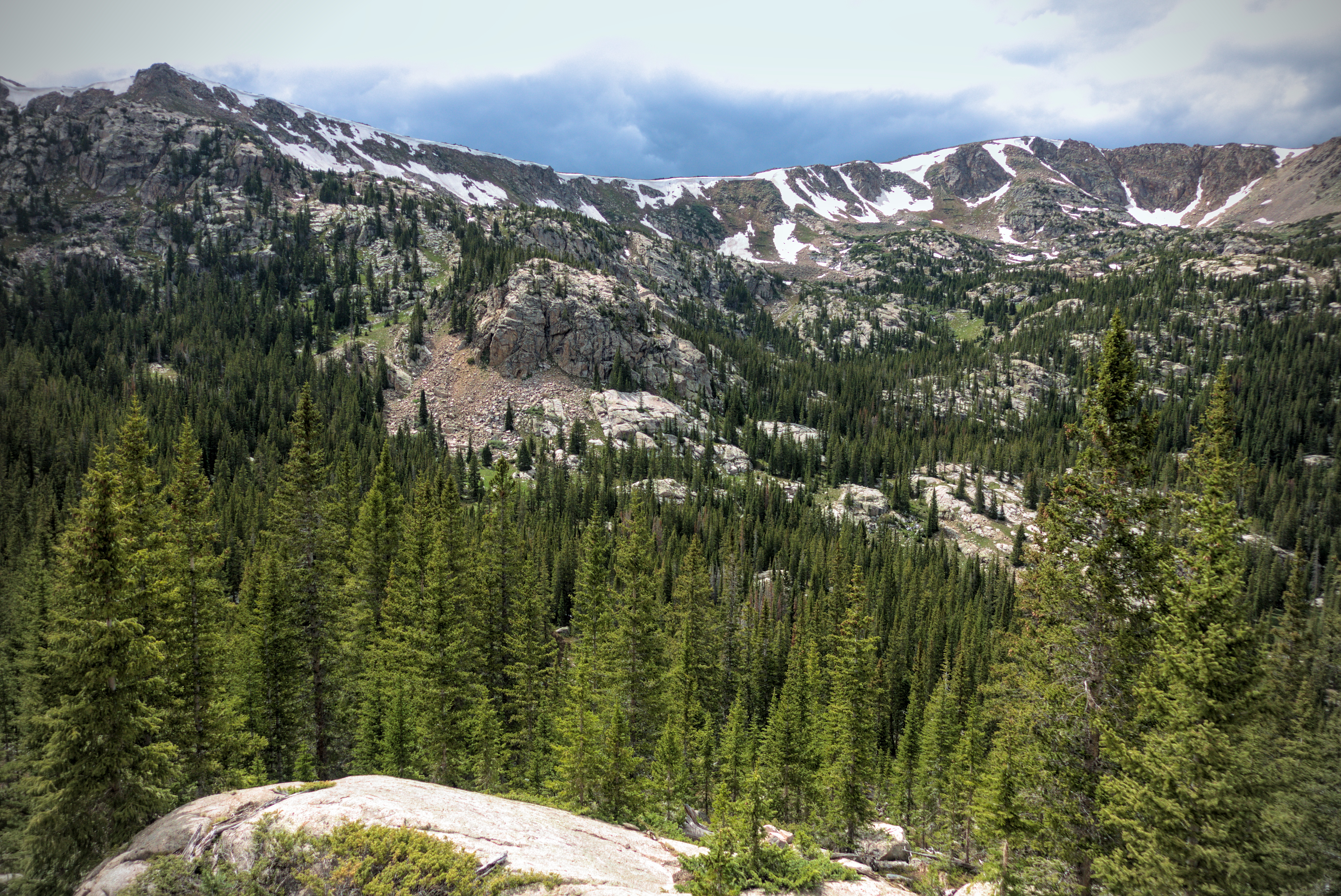
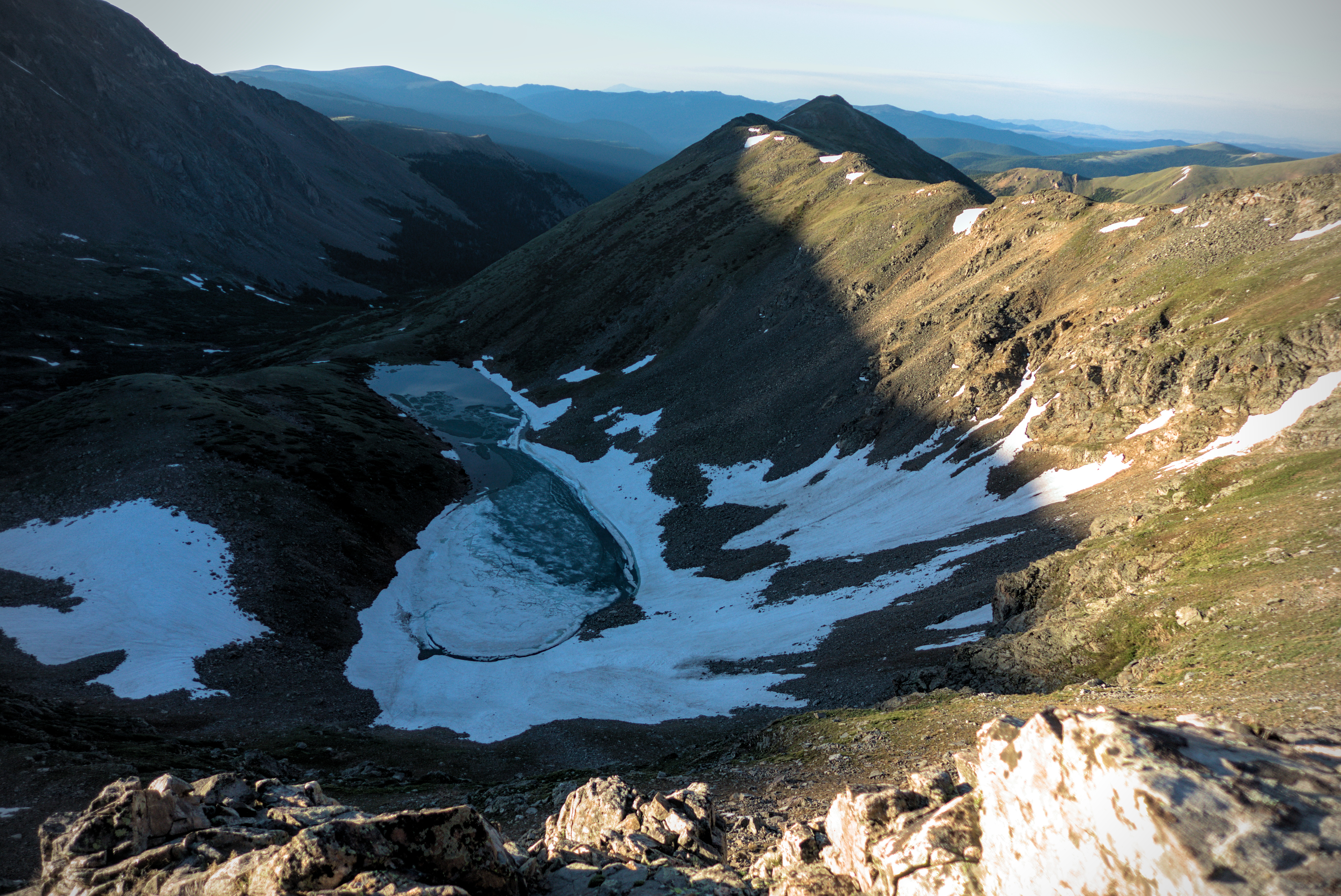
Day 58, showing the climb of Mount Elbert.
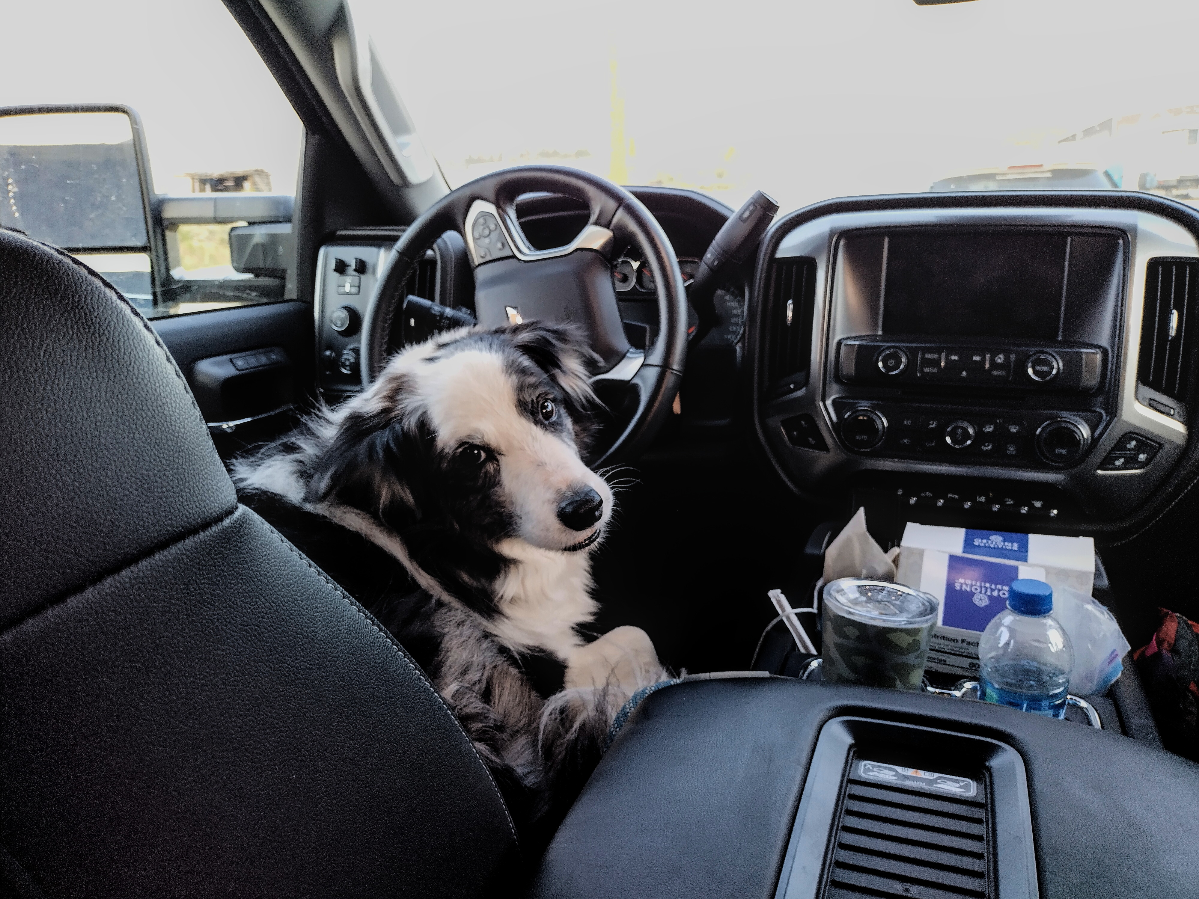
Blue the dog in the van.
The plan was definitely to climb Mount Elbert along the way. Mishap and Gargoyle also planned to climb Mount Massive for an absolutely huge day. I was like "no way!" Leftovers also demurred from Mount Elbert. I could see how happy he was to have an easy day walking in the forest, and felt a bit envious. But I simply couldn't leave out the 2nd highest peak in the continental United States, eclipsed only by Mount Whitney in California! Ach...
Mishaps mom drove us to a spot on the road on the west side of Twin Lakes where we could follow a road up. I think this was a shortcut that cut off a mile or so of the red line. We started out. Pretty soon me and Leftovers were walking together. I said goodbye somewhat sadly, imagining all the nice naps Leftovers would get to have on the main trail. I turned up to the west on the Mount Elbert trail. Pretty soon I was passing some families out for a hike of the peak. Some people were already coming down, which was a good idea because the afternoon thunderstorms were beginning.
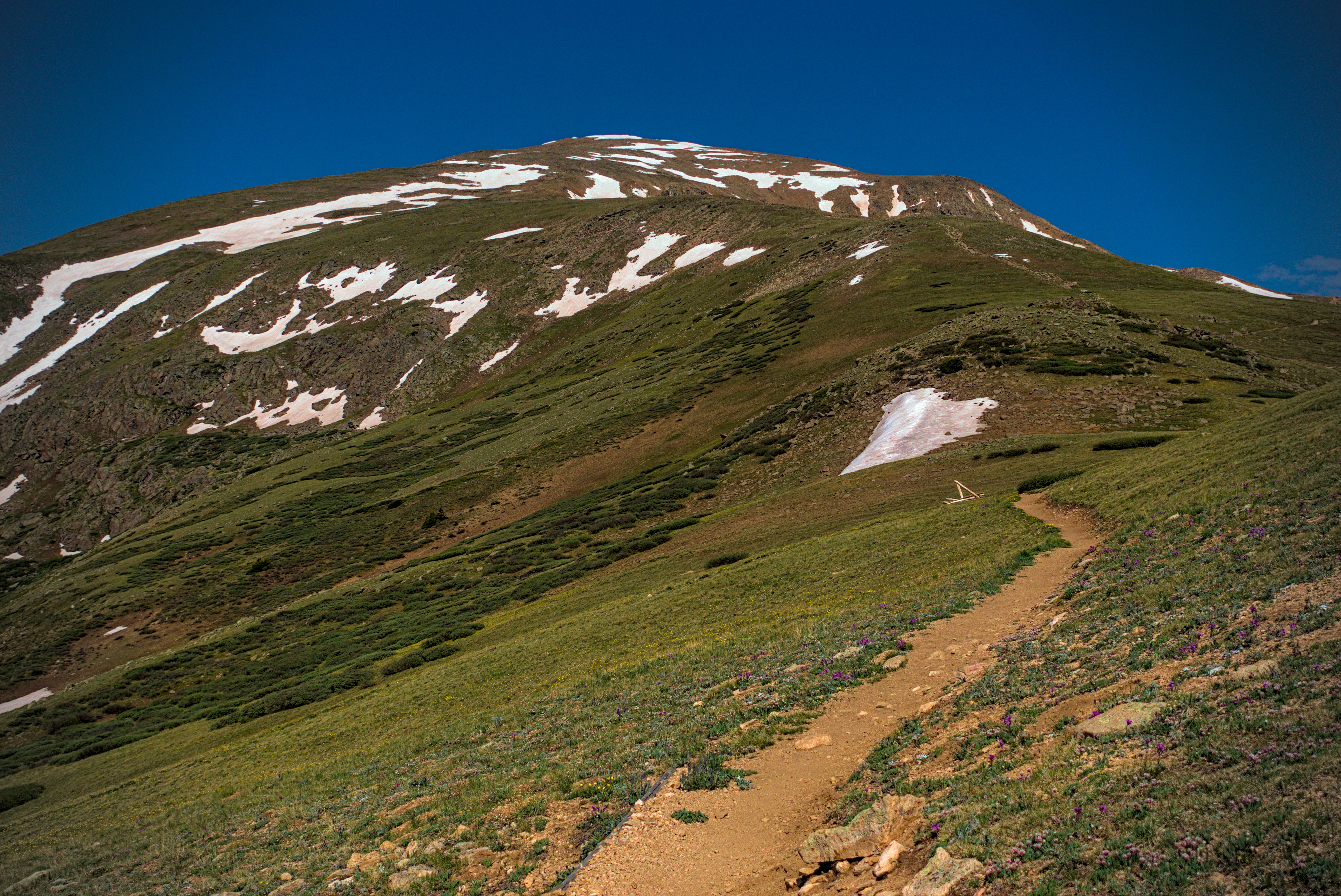
The middle slopes of Mount Elbert, above the trees, but
still the summit is a long ways away.
I listened to a heartbreaking podcast about family courts in the USA. Apparently, there is a need for safe "handoff sites" for divorced fathers to pick up their children for a visiting weekend. It happens quite often that a divorced mother is enraged at the father, and she'll create accusations that the father has abused the child/children in some way. Then, a male member of her family takes it upon himself to defend the honor of the family by killing the father. These things happen when he comes to pick up the child for visitation. It has happened pretty often (see the John Mast documentary). And the charges are usually groundless (if they weren't, the law would have intervened already). In our modern world, we point fingers at men for being violent, and women get a pass. However, women often execute violence by proxy...that is, they get a male to perform the violence nurtured in their hearts.
Depressing media material notwithstanding, the country was gorgeous. Gradually, the broad ridge narrowed and defined itself above the surrounding country. I admired the ridge I'd descend later, off to the right and looking spectacular. I knew Mishap was somewhere ahead (later, she texted that she saw me getting water below). Gargoyle was probably far ahead.
It was fun to have a day pack, that's for sure!
I met Mishap at the summit and we asked around for a little cardboard sign folks had made with the name of the peak. Somebody took some pictures of us. This was my first Colorado "fourteener," since I skipped out on San Luis Peak at the tail end of the San Juans. The views were incredible. I really like this early summer look of high Colorado peaks, with snowfields alternating with tundra. We saw back into the Sawatch where we'd spent so many toilsome days!
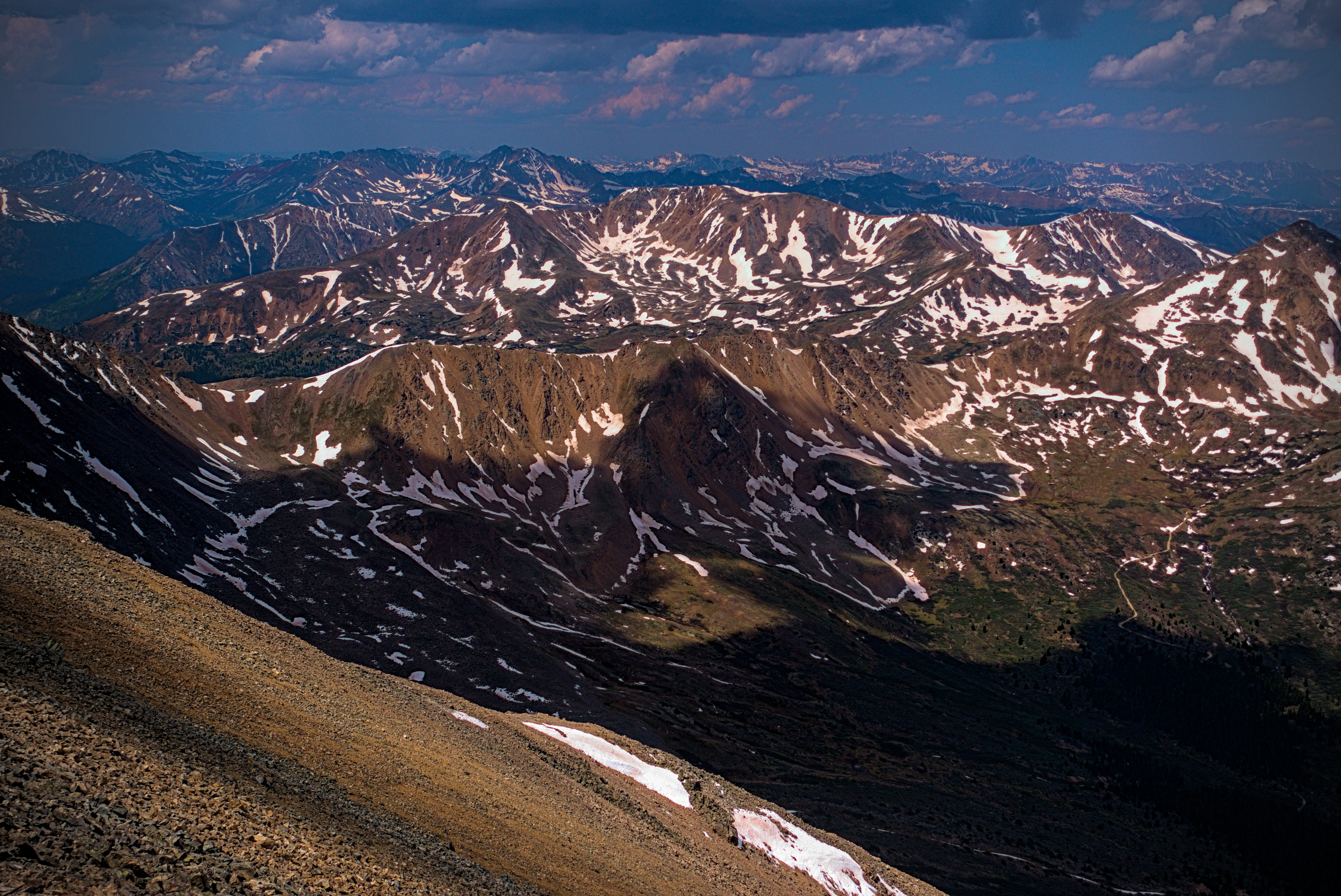
A view into the Sawatch Mountains from the summit.
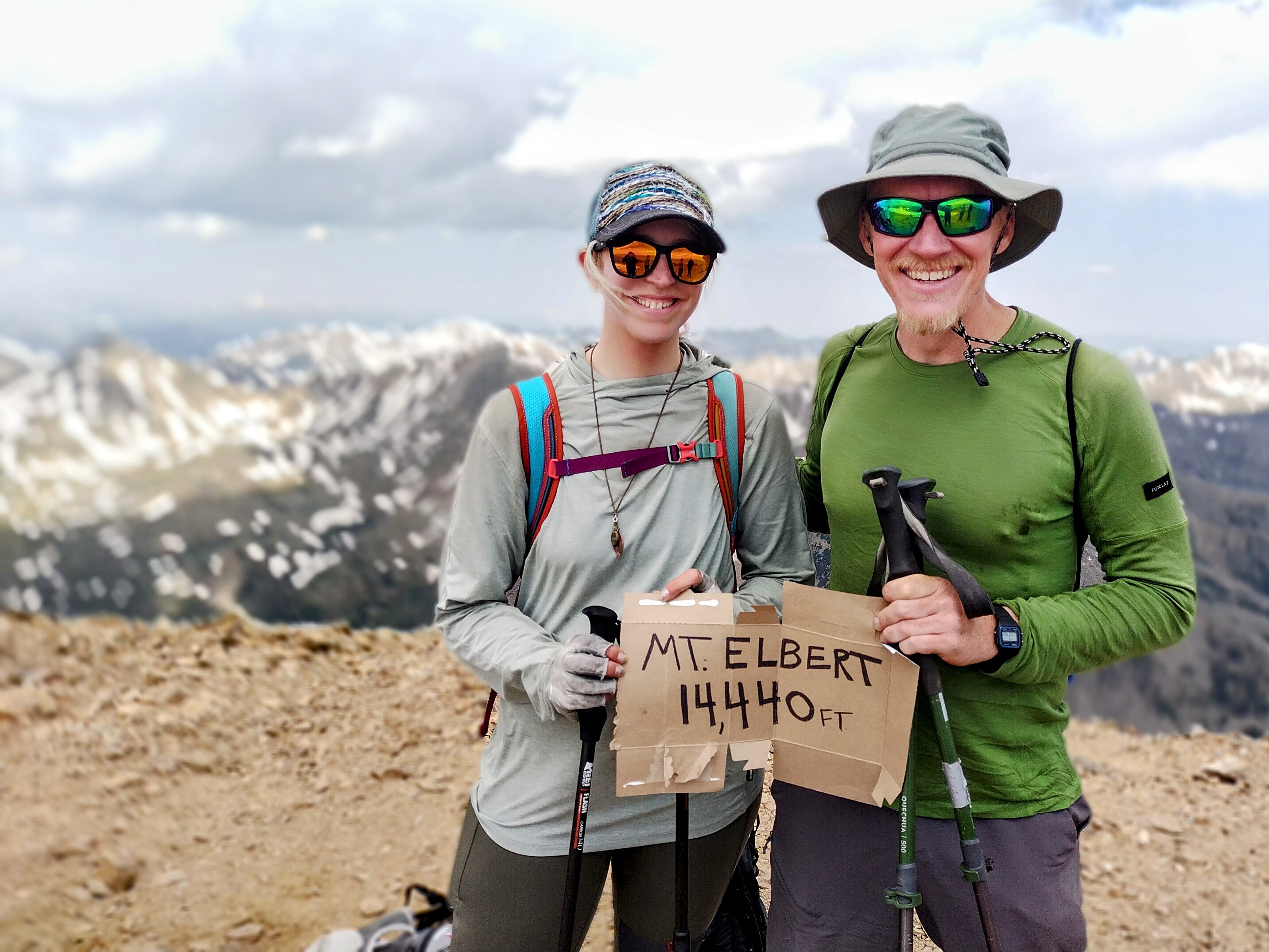
Mishap and I on Mount Elbert.
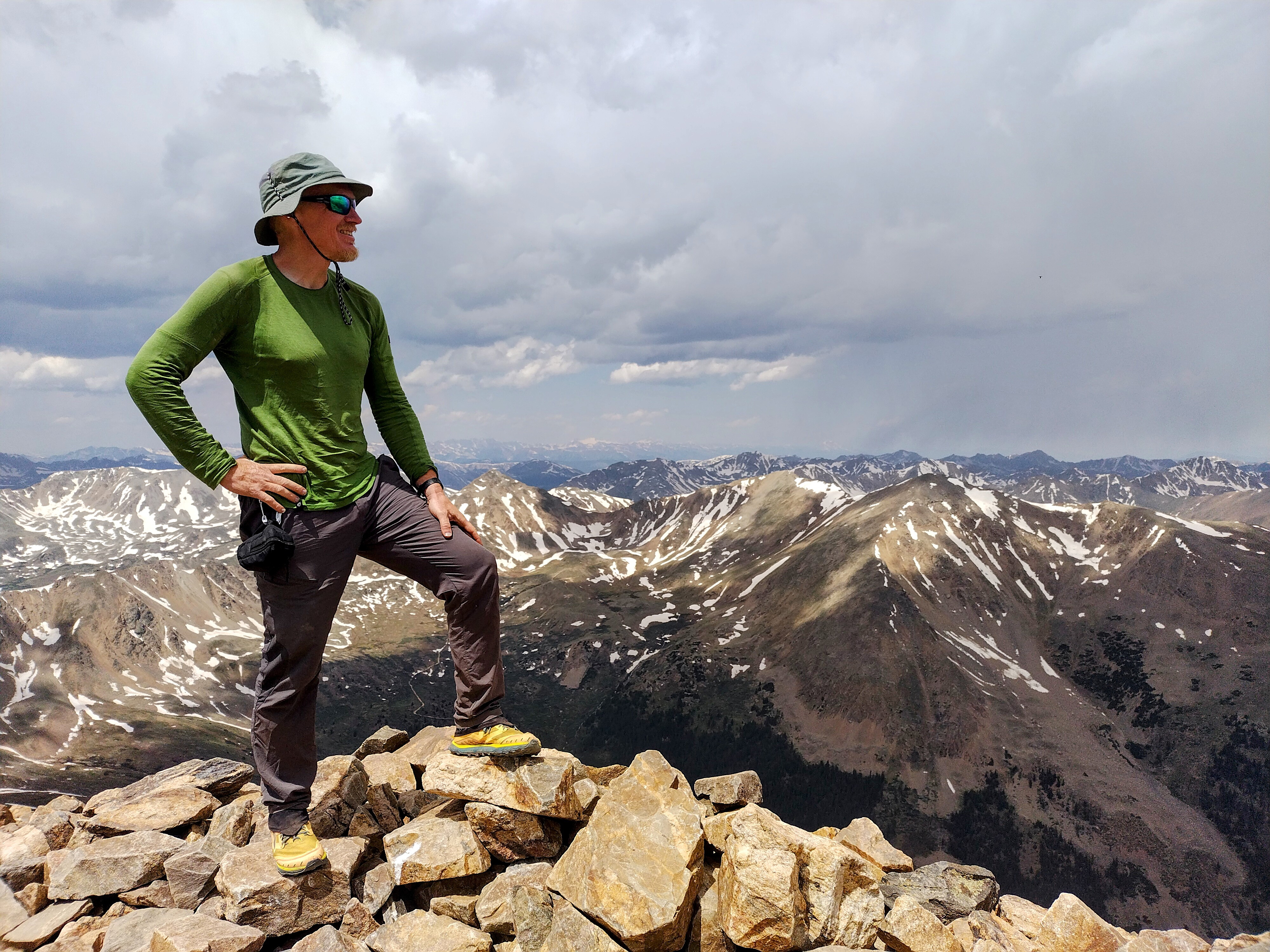
Hero-me on Mount Elbert.
We hiked down together. Storm clouds were brewing, so we moved without stopping until we got down into the trees. Mishap met a volunteer trail worker who knew a part of the Appalachain Trail that they both remembered fondly. We separated for a while as it rained lightly in the forest. Later, the rain got heavier. I crossed Halfmoon Creek, then climbed 1000 feet tiredly up the other side. It was a long rainy walk for a while...
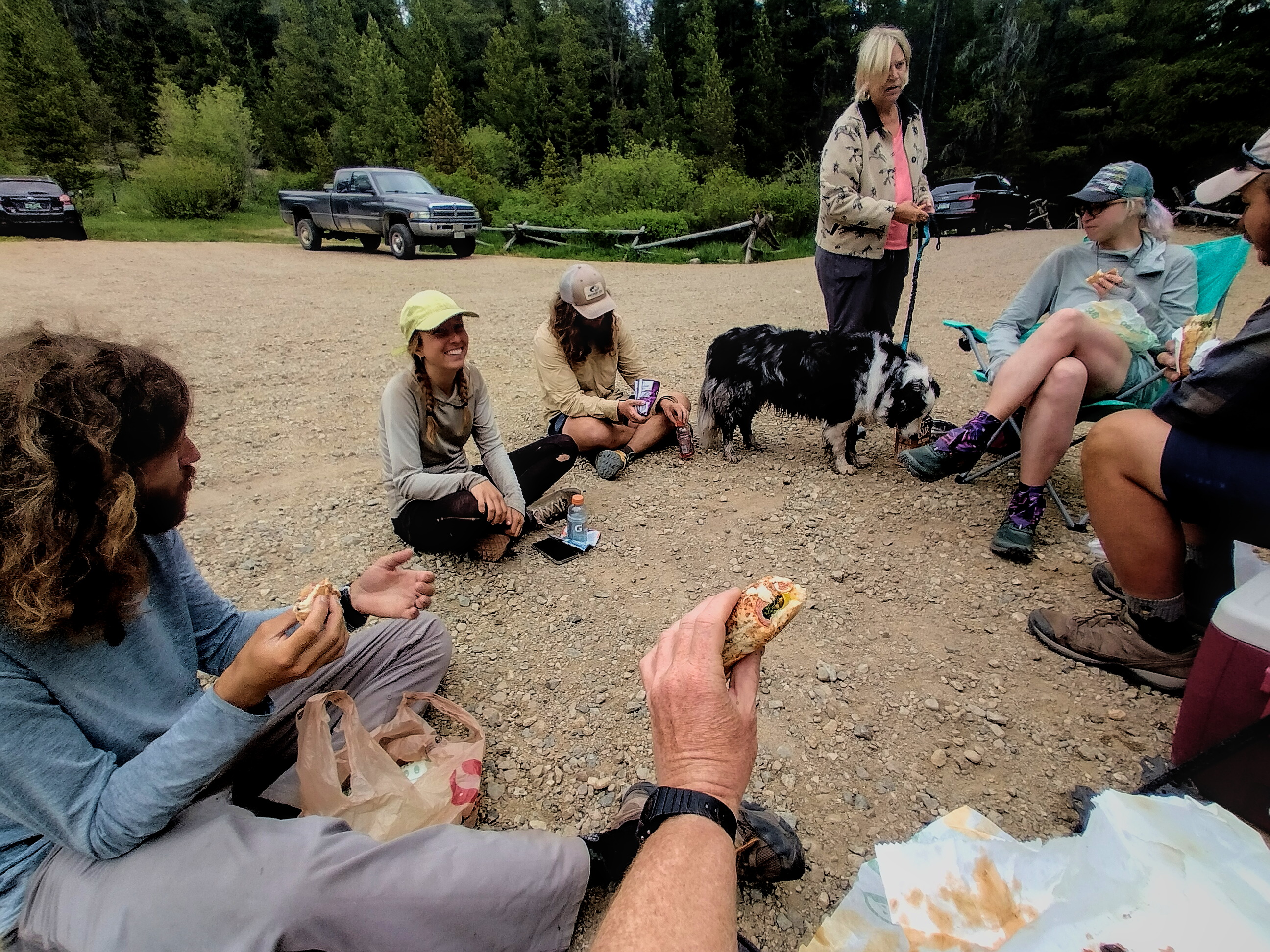
Later, I followed the Native Lake Trail downhill to the right in order to reach a fish hatchery where Mishap's Mom was picking us up. Near the hatchery, the forest was beautiful with boulders of various size intermixed with light forest on a broad, pine-needled floor. Mishap came along and we walked the final bits of trail to the parking lot. We ate snacks and drank sodas until all five of us and the dog Blue were together again. The rain had stopped, and it was a pleasant late afternoon. It had been 21 miles and 5780 feet elevation up and down. Whew!
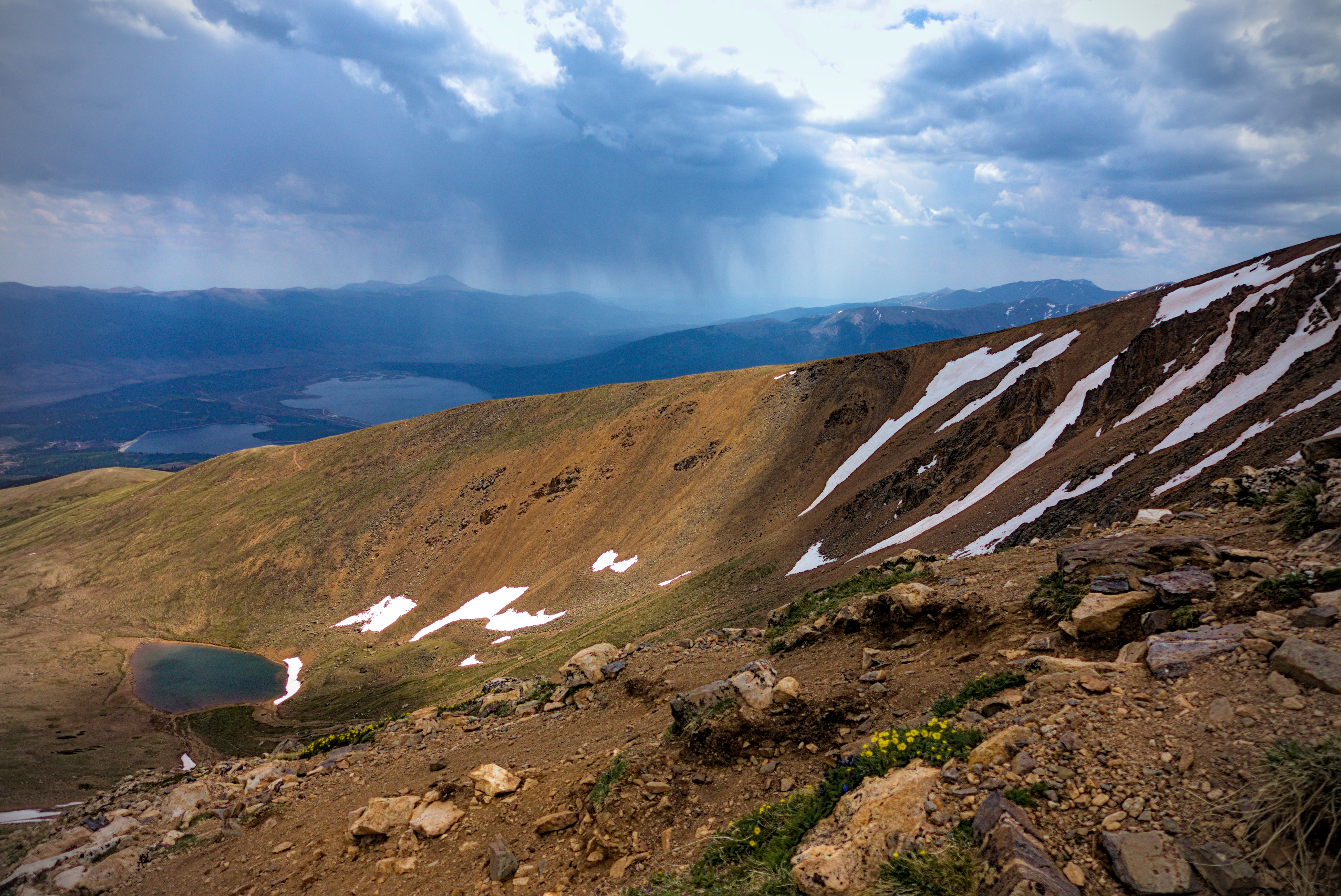
On the descent, looking over at the ascent ridge as rain
comes.

Rain above Twin Lakes...
Forest near the fish hatchery.
We went to Leadville for dinner and a hotel. Because we didn't want to wait an hour for a table, we went to an odd little Chinese restaurant run by an old lady with a lot of character. She would tease or scold us in various ways. We were the only people in the restaurant! Detour showed up and shared stories of sleeping on summits in the last days.
June 18, Day 59, 20.2 miles
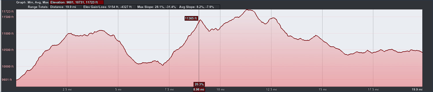
19.9 miles, 5154 feet elevation gain.
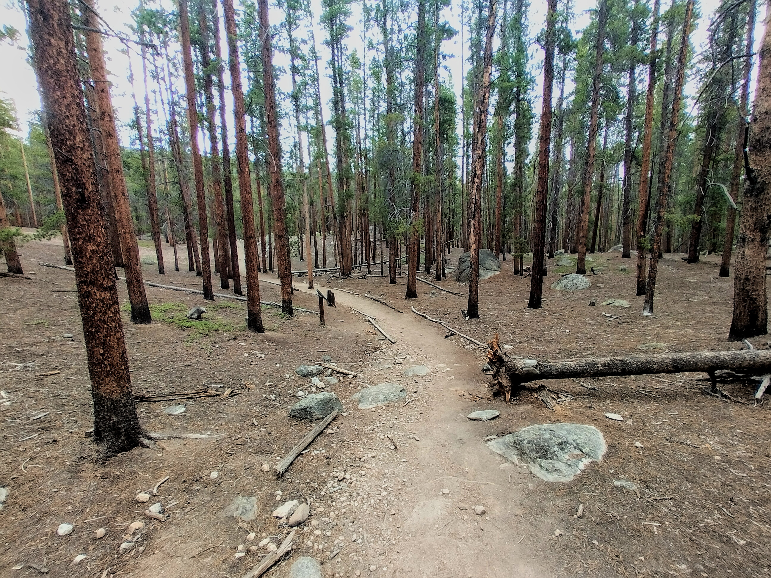
A long day of mostly forest hiking.
Making my way north...
Some pleasant country southwest of Tennessee Pass.
Lunchtime snack with trail magic provided by Mishaps mom!
Lush sits in a yellow cap.
In the morning, we were back at the fish hatchery to walk up and over a forested pass to reach Turquoise Lake. Once there, we climbed again into a zone of alpine lakes, remnant snow and forest, with the true crest on our left side. Gargoyle was walking on that in some fashion. I could see some dramatic cornices up there. I was happy with a gorgeous granite slab to practice some rock climbing. This time, I had my umbrella for the afternoon rain showers.
After the lake and granite climbing, the trail meanders through open forest for many miles. Near the end, there was a little rocking bench for a nice rest.
It was 20.2 miles and 4680 feet up and down, almost as much as the day before with the climb of Mount Elbert. Don't underestimate these "forest days," you can really rack up elevation!
Somebody somewhere on the trail.
Gargoyle sets off to walk a highline right on the
crest.
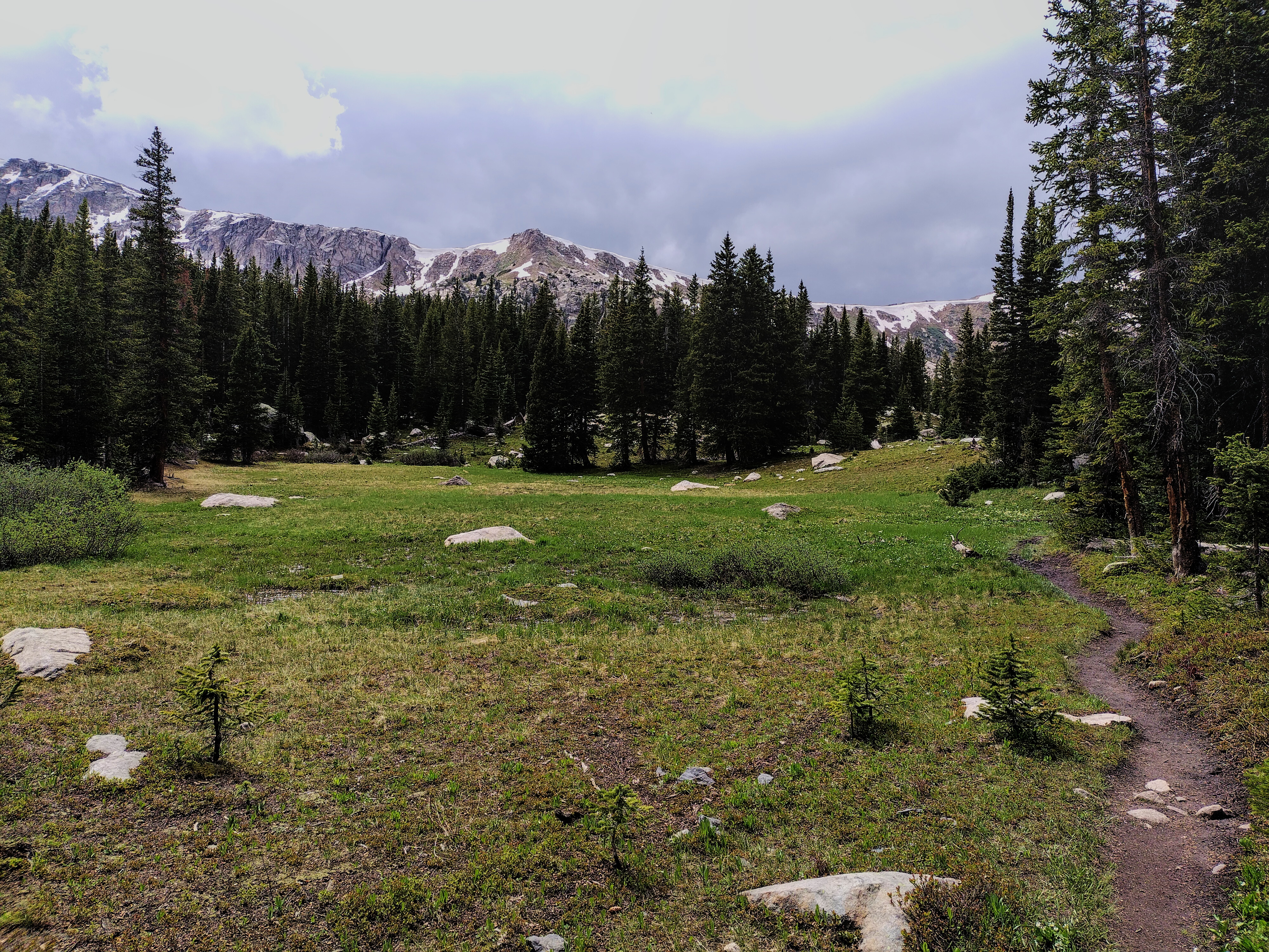
A high meadow under a cloudy sky.
We also saw Google and other folks camping in the trees along the way, with more people camping at Tennessee Pass. We got to the pass, and Mishap's Mom pulled up just when it started to rain really hard. Whew! Down to Leadville for pizza and beer :).

Digging deep, I only find the ability to nap now...

Mishap and her mom at the nice bench about a mile
from Tennessee Pass.
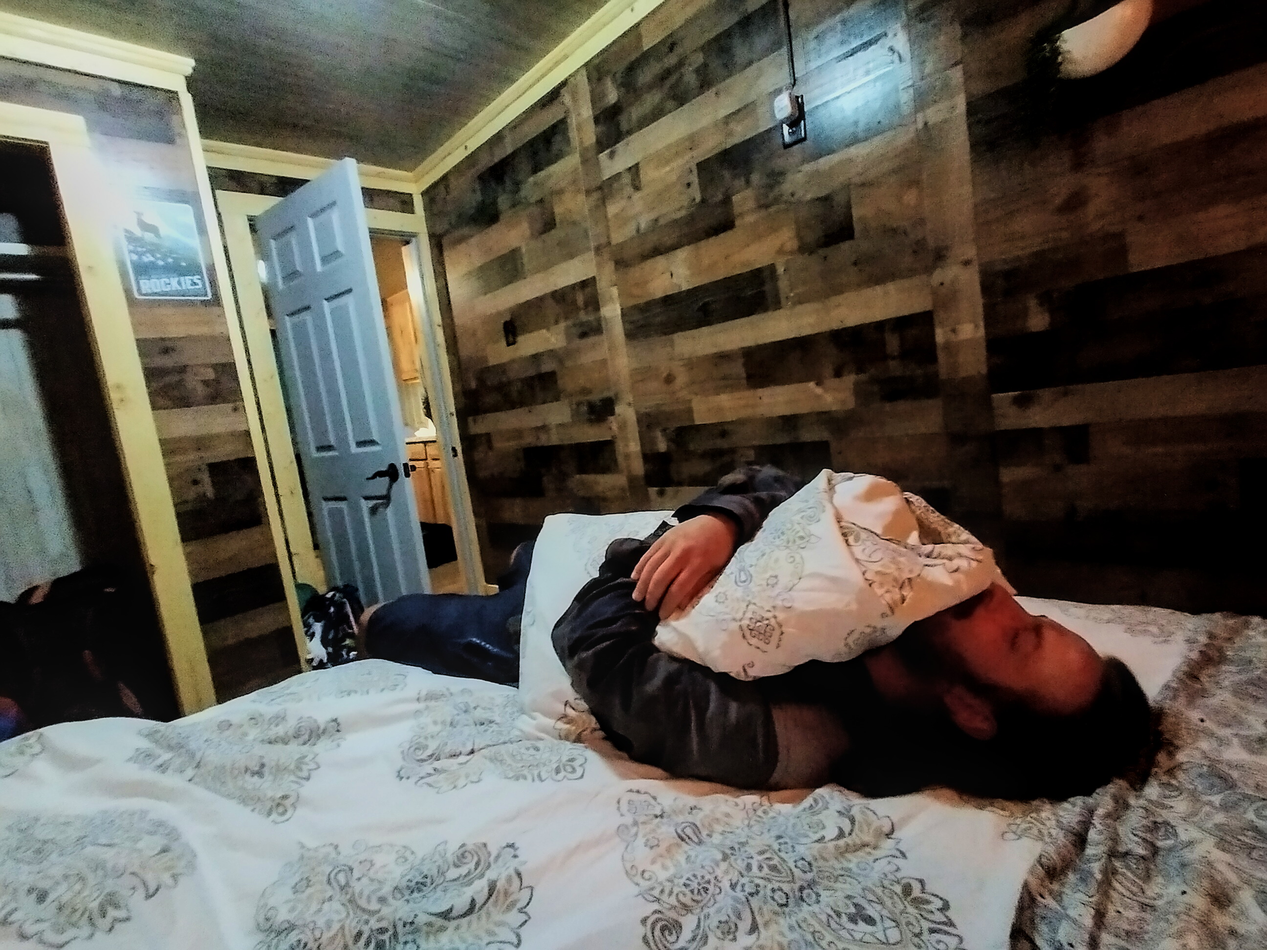
Leftovers gives in to exhaustion in Leadville.
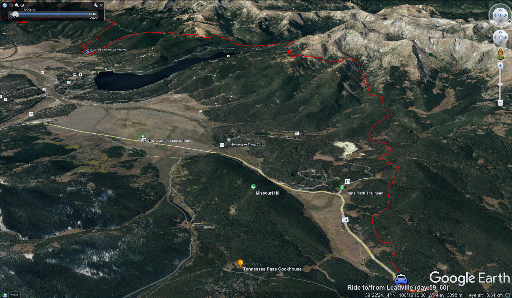
June 19, Day 60, 21 miles
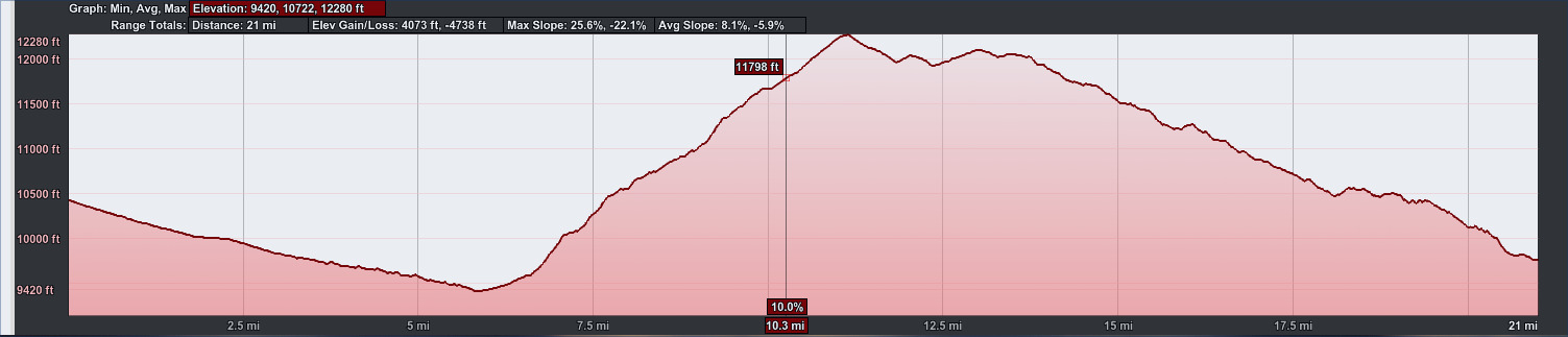
21 miles, 4073 feet elevation gain.
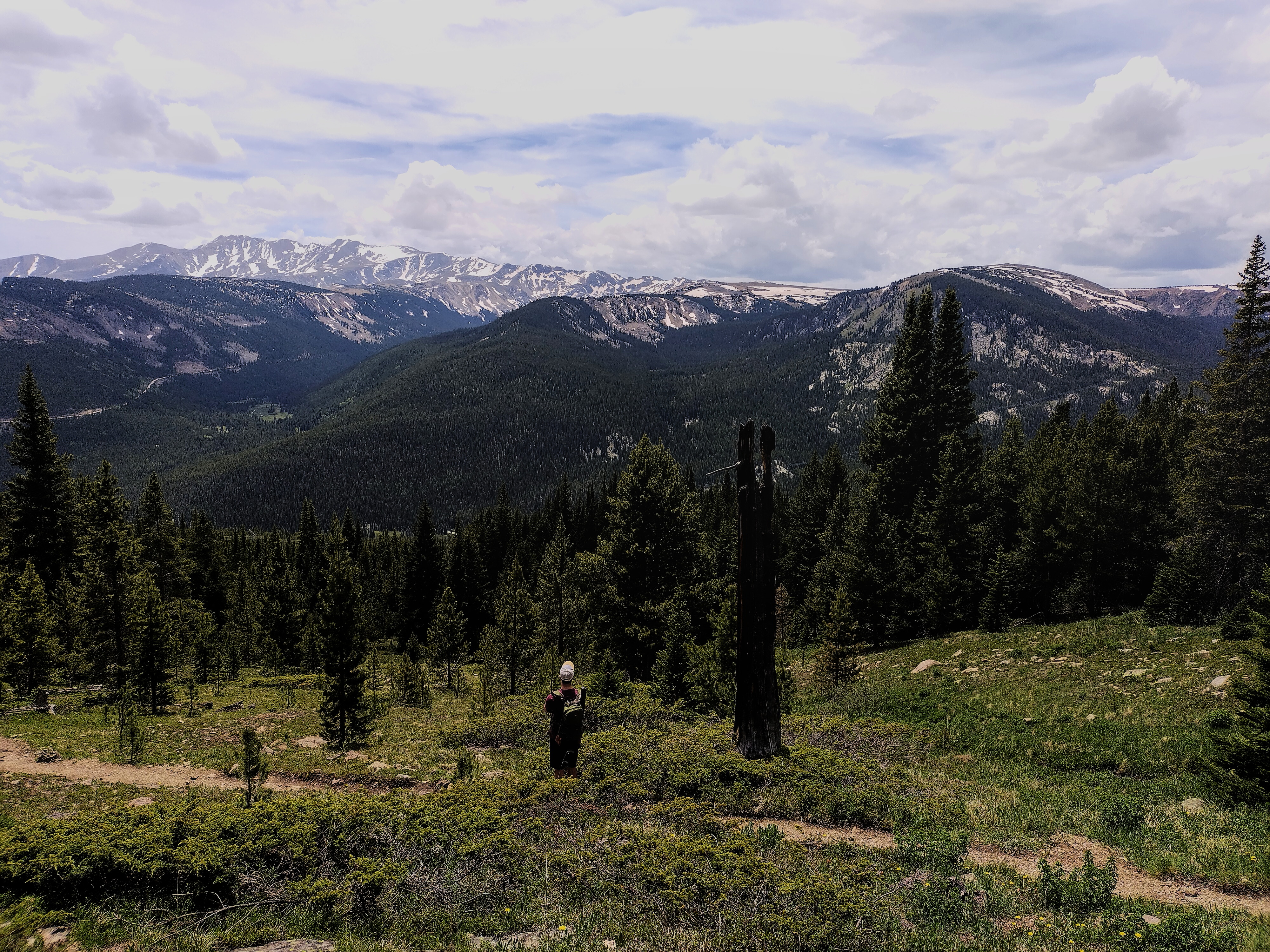
From Tennessee Pass to Copper Mountain ski area.
For the last day of slack packing, we'd walk from Tennessee Pass to the Copper Mountain ski resort. Leftovers and I followed the road to shave off about a mile of walking, while Mishap and Gargoyle stuck to the red line. After some miles, Blue the dog joined them.
In Cataract Creek, where the trail climbs back up to Kokyo Pass, Leftovers and I were briefly discouraged. He even thought about calling it a day. I felt almost the same, this being day 7 of a stretch without a rest day. Keeping up with these young folks was getting tough! But, knowing that I'd get a rest tomorrow, I ground it out, making for the pass in cold, spitting rain.
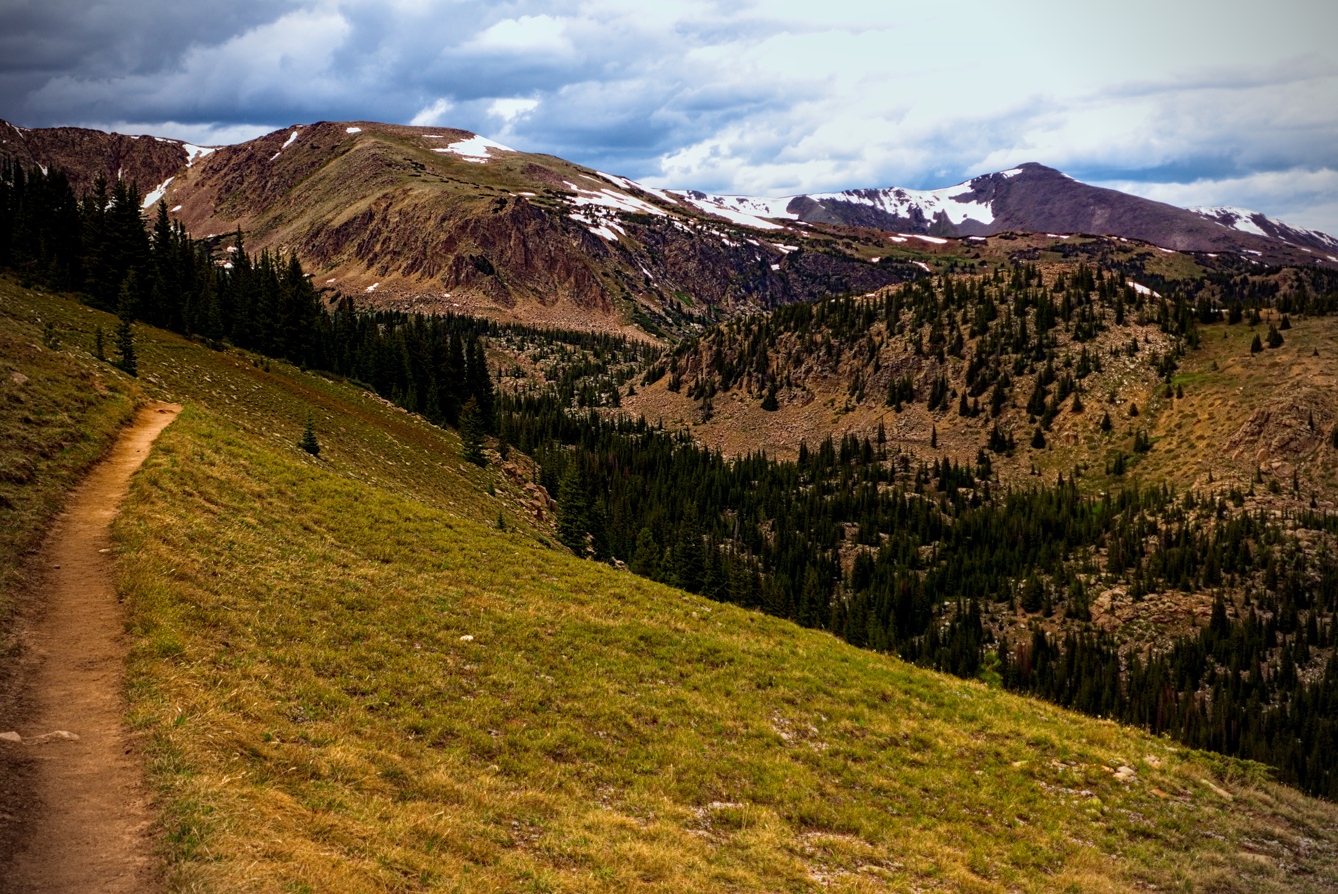
I passed a tent where folks were waiting out the weather. From the pass, I walked the high country for a few hours to Searle Pass.
Leftovers and I occasionally met up and joked about one thing or another. I think this was our most companionable day together. By now, we knew each other pretty well and could poke fun at our tendencies. I let him walk on ahead of me at some point, as my feet were really hurting and I needed to slow down and take some ibuprofen.
Leftovers with his humorous view of things above Kokyo
Pass.
Eventually, I descended to the resort, where Leftovers had found a brew pub. We ate a great dinner there. I was very happy because finally we'd earned a rest day, after seven days and 140 miles of tough mountains! This day was 21 miles and 3330 feet of elevation gain/loss.
It was a very scenic drive back to Leadville along the east shore of the Mayflower Tailings Pond in the sunset. We looked up to the crests where we'd been walking. Mishaps Mom was amazed that we were up there only hours before. I thought how great it was that she could share in what her daughter was doing. Also great that Blue was able to get in some long walks with Mishap. Blue was a wonderful dog.
June 20, Day 61
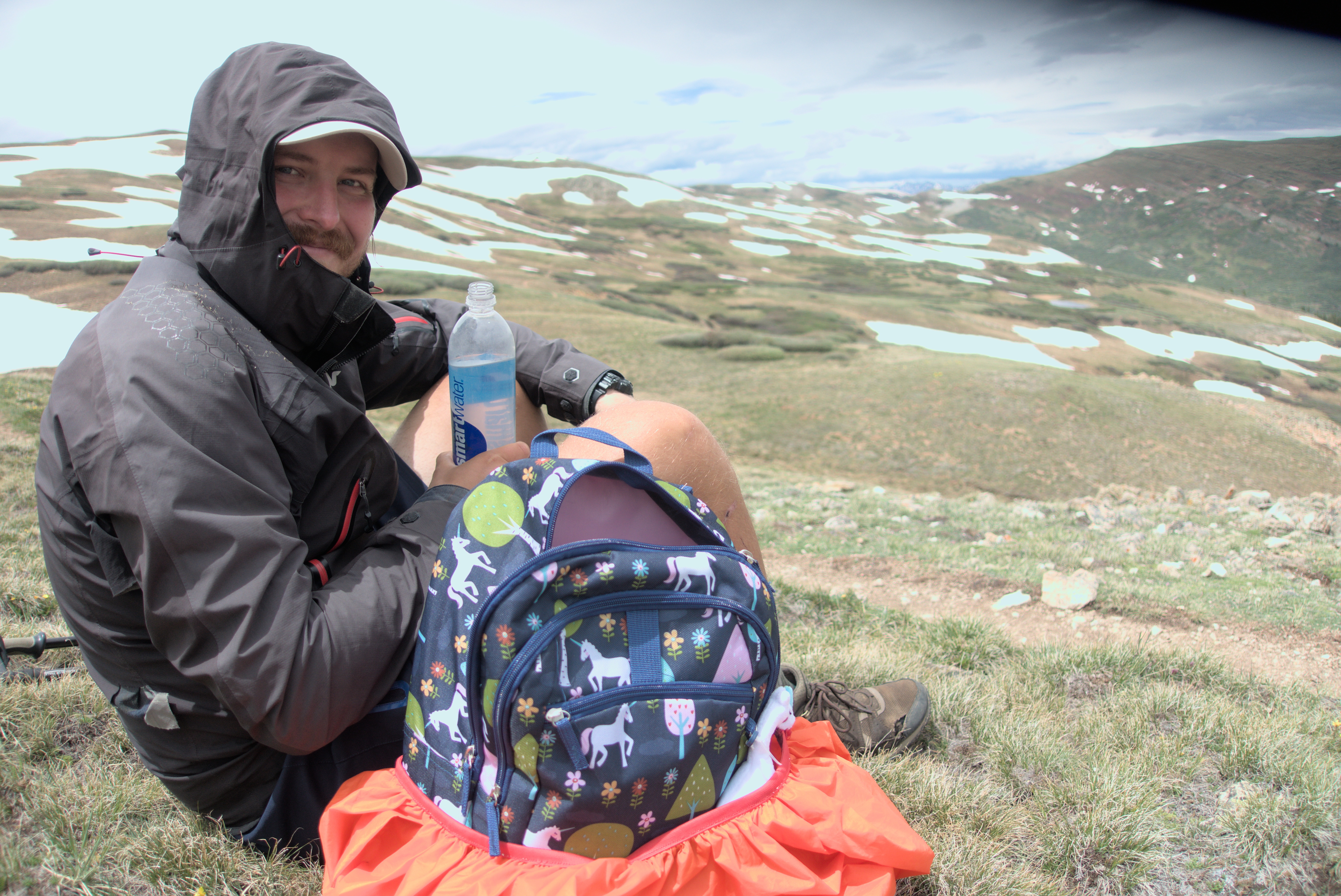
I am responsiblah for the grill.
Rest day! Leftovers and I were of the same mind: stick around the house and don't move far from the bed/couch!
I worked on the blog and nursed a sore shoulder. The cause seemed a mix of too many mosquitoe bites... Maybe even a spider bite? But also an overuse injury from leaning on my poles too hard. I hope it gets better...
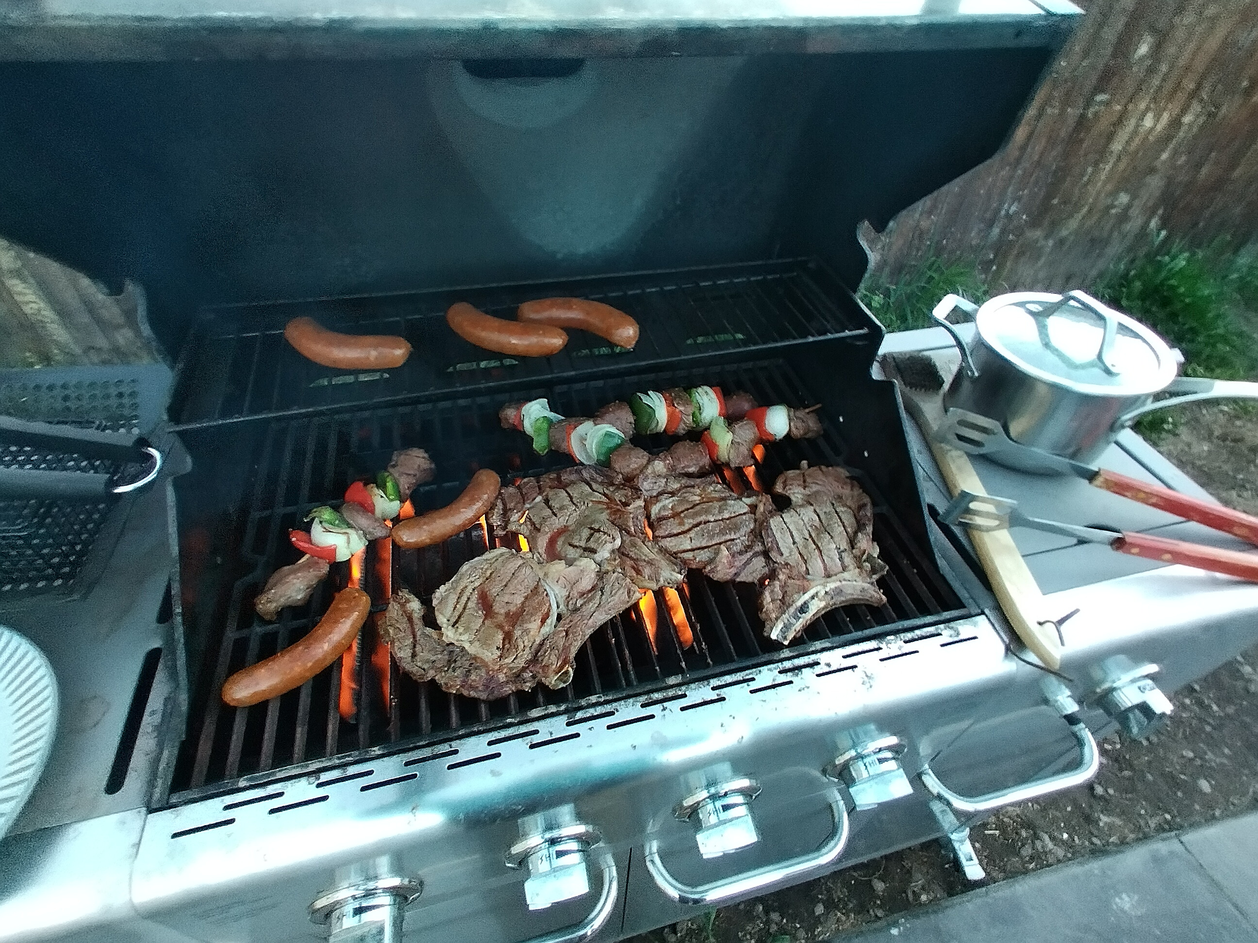
In the evening we had a grill feast, inviting Google, Pecarino, Lush and Shredder over for dinner. We had a big plan for the next two days, and I tried to sleep early, though shoulder pain made it hard...
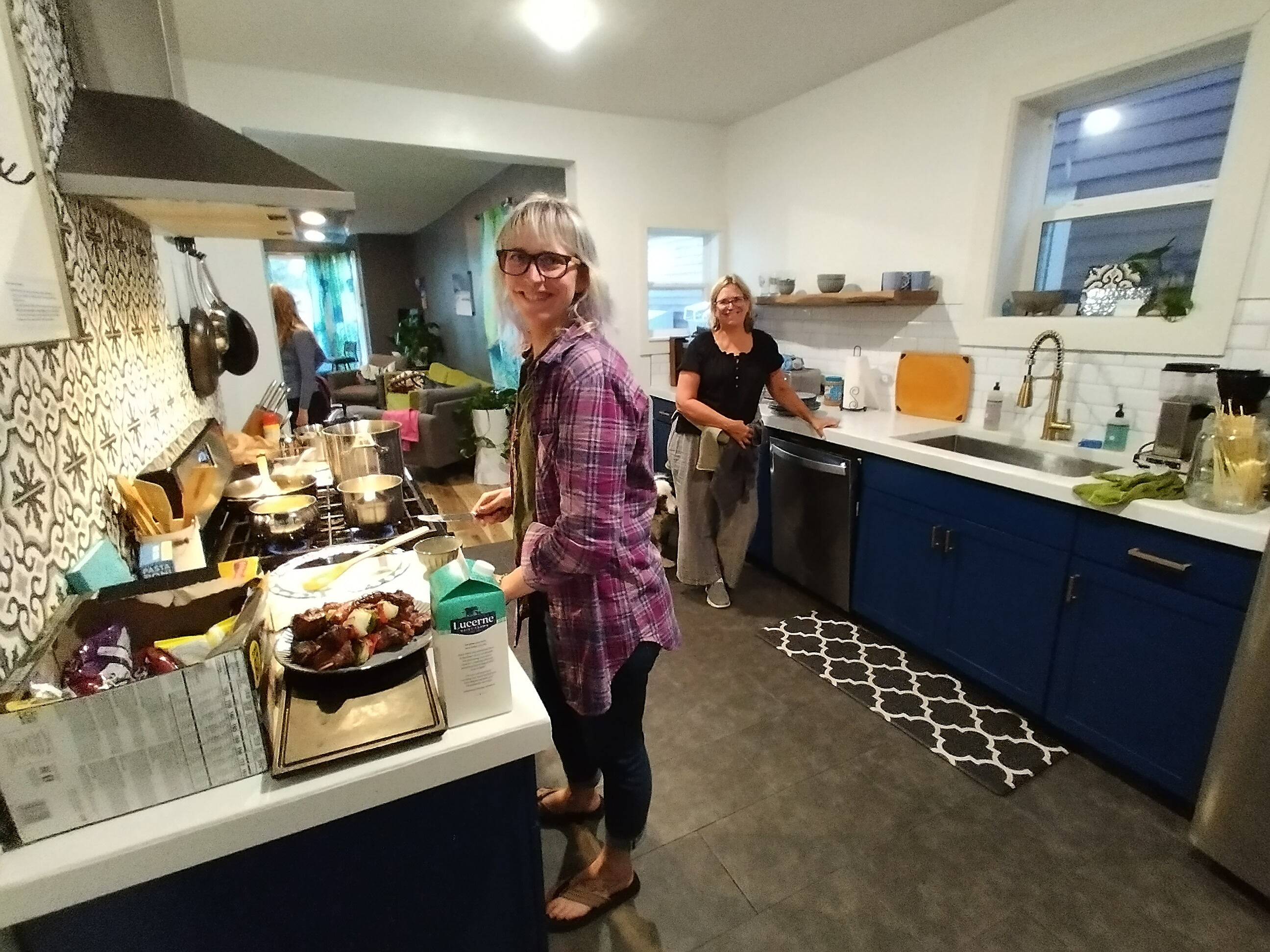
Preparing a fine dinner in Leadville.
That was the greatest dinner of the whole trip. It was fun that we made it ourselves, and shared it with others, too.
June 21, Day 62, 11 miles
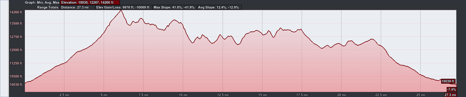
27.3 miles, 9976 feet elevation gain.
Exciting day, short in miles but outrageous in elevation
gain.
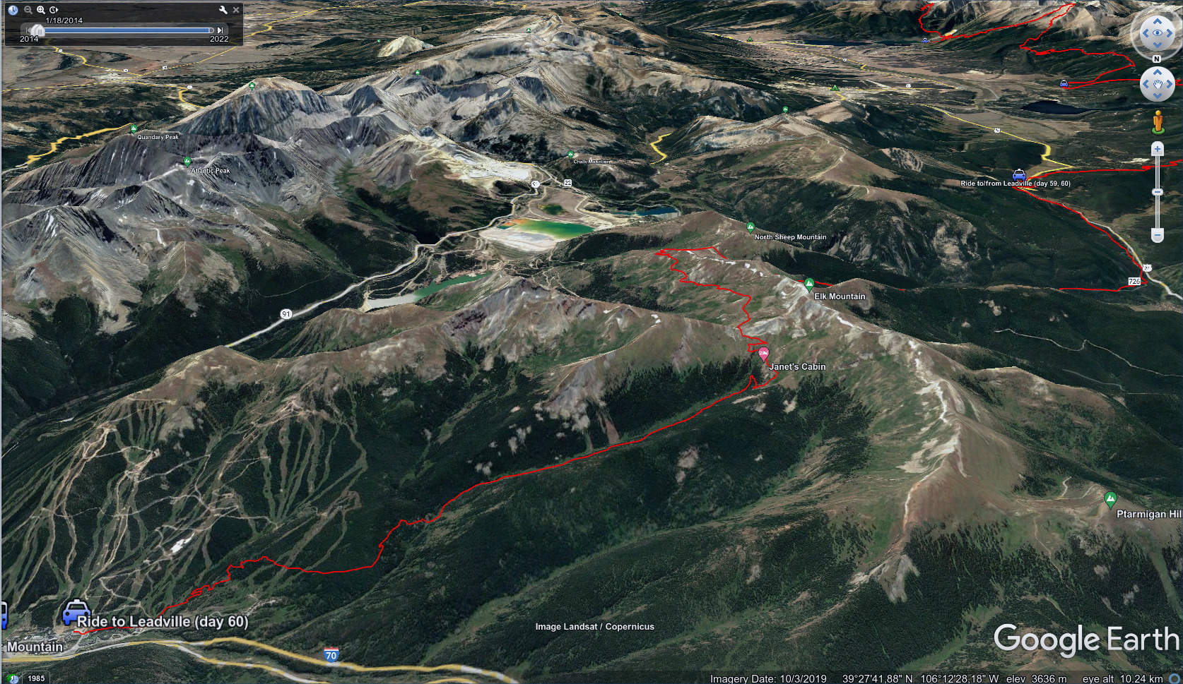
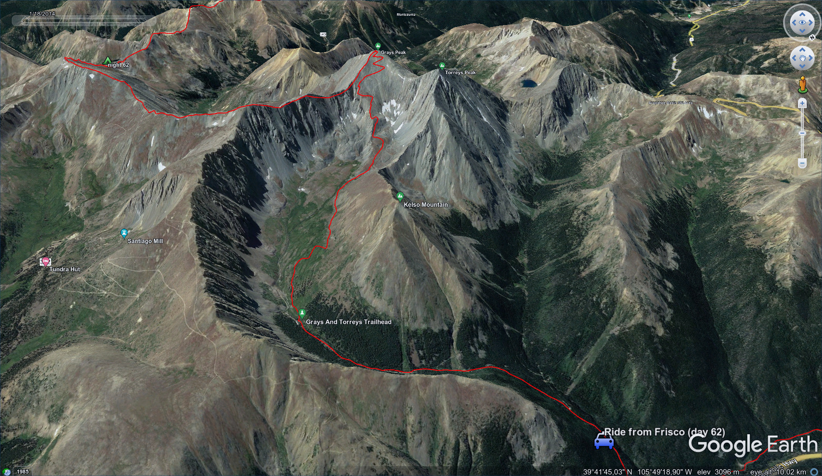
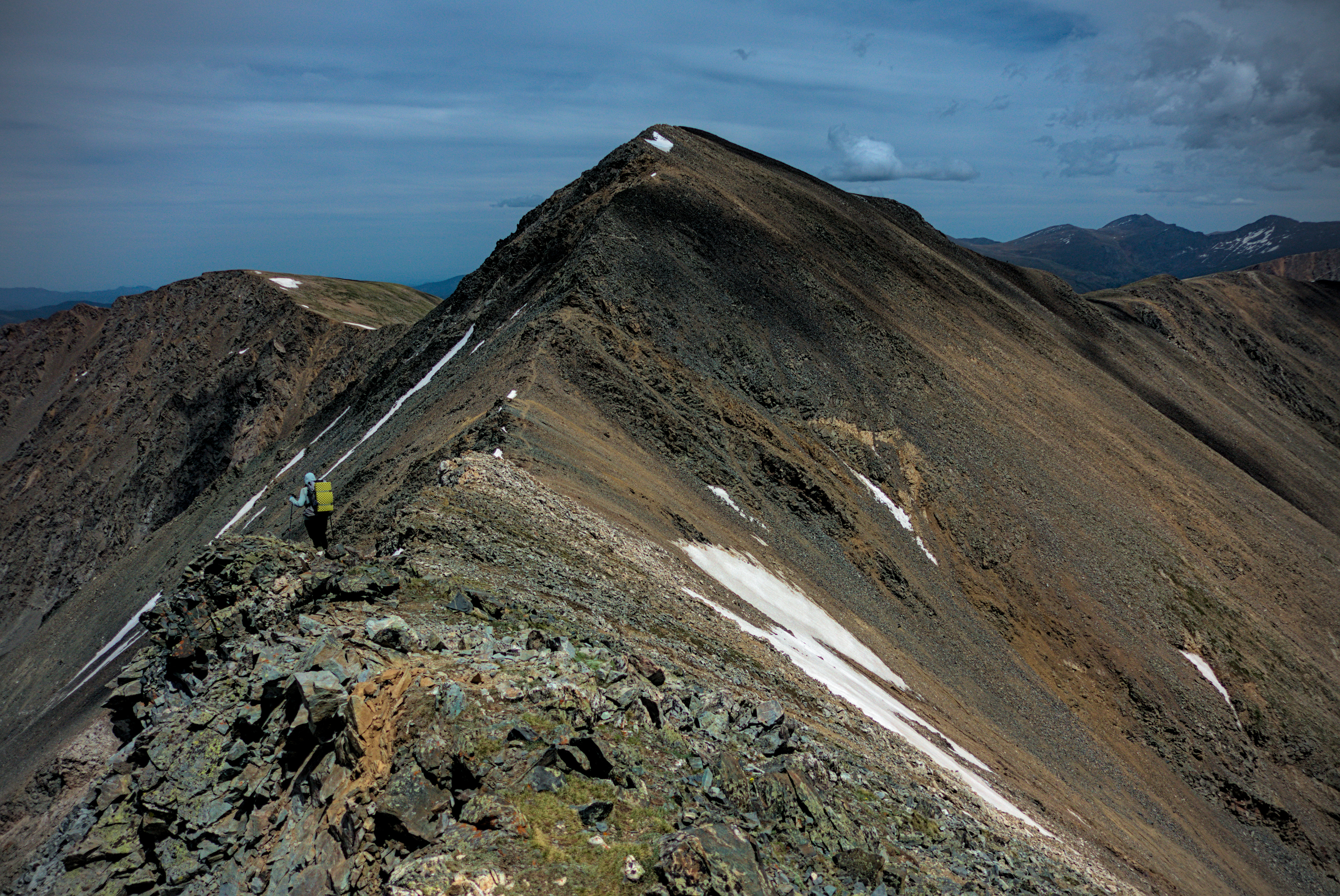
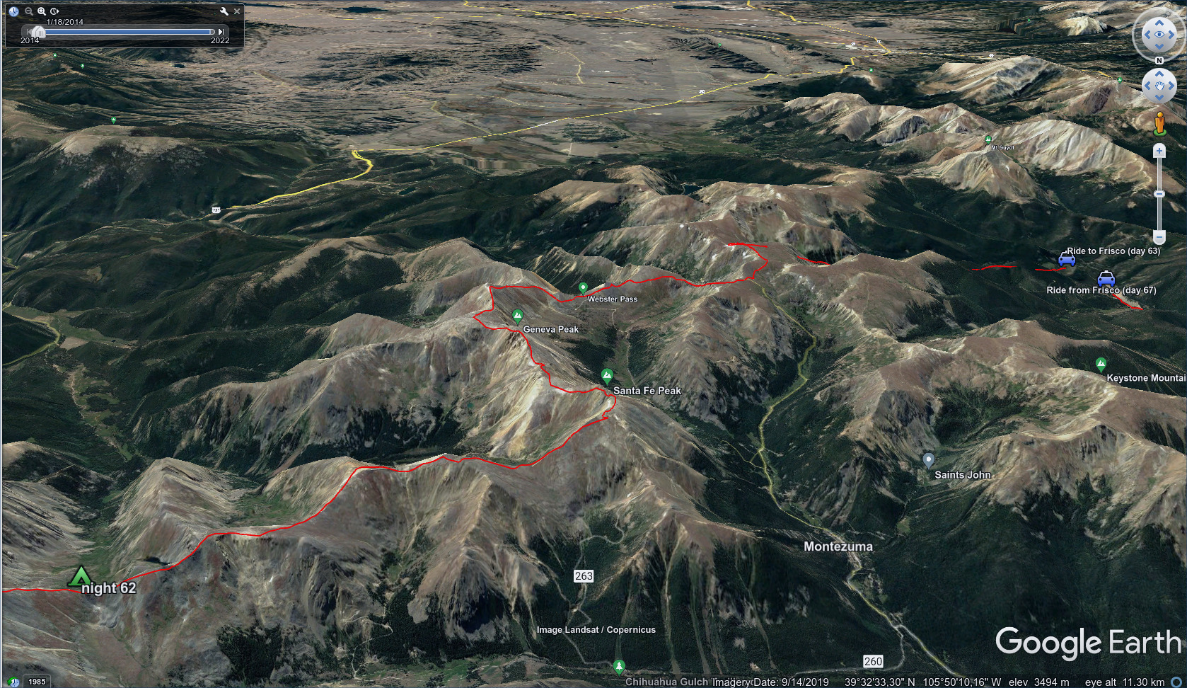
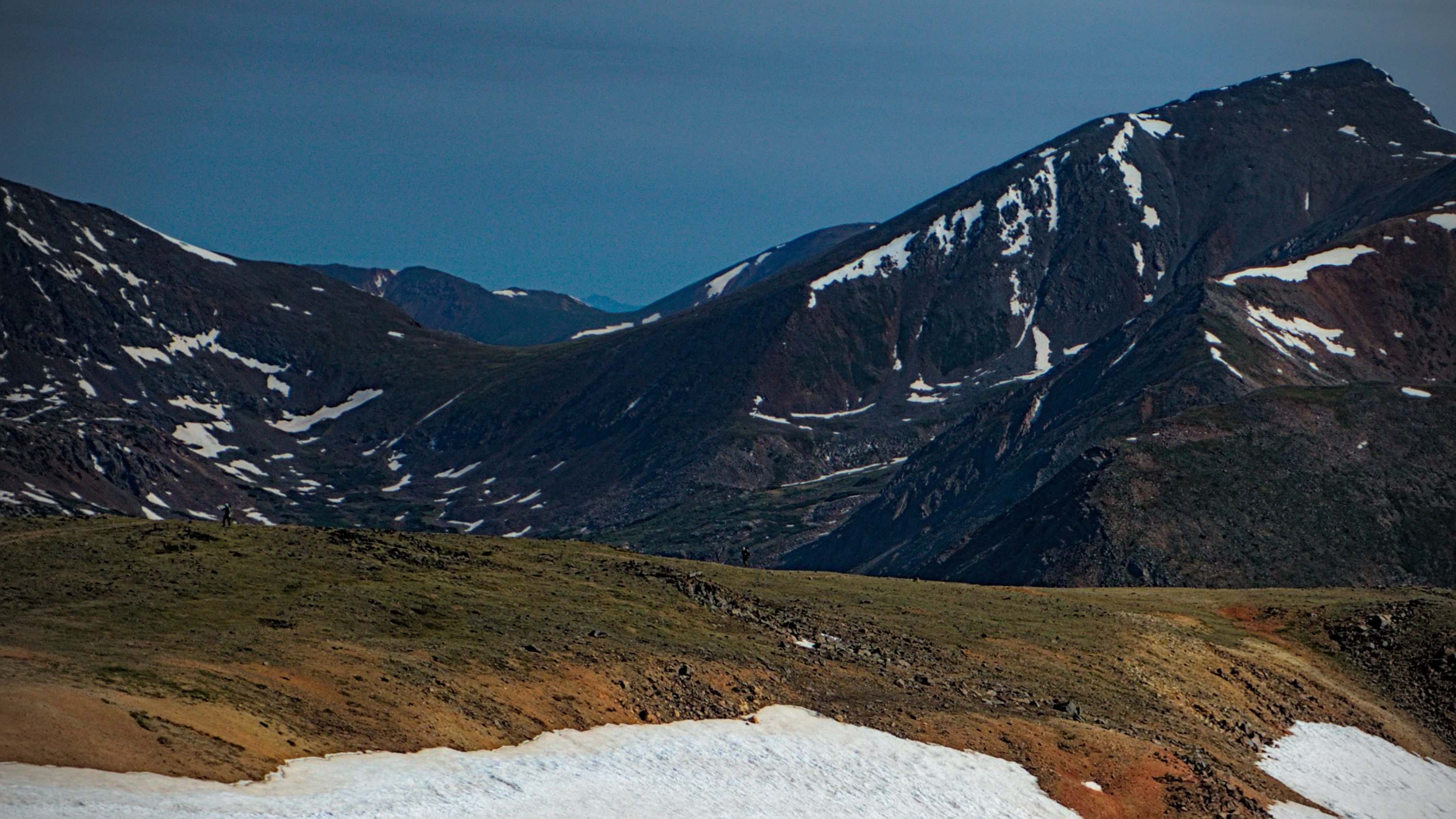
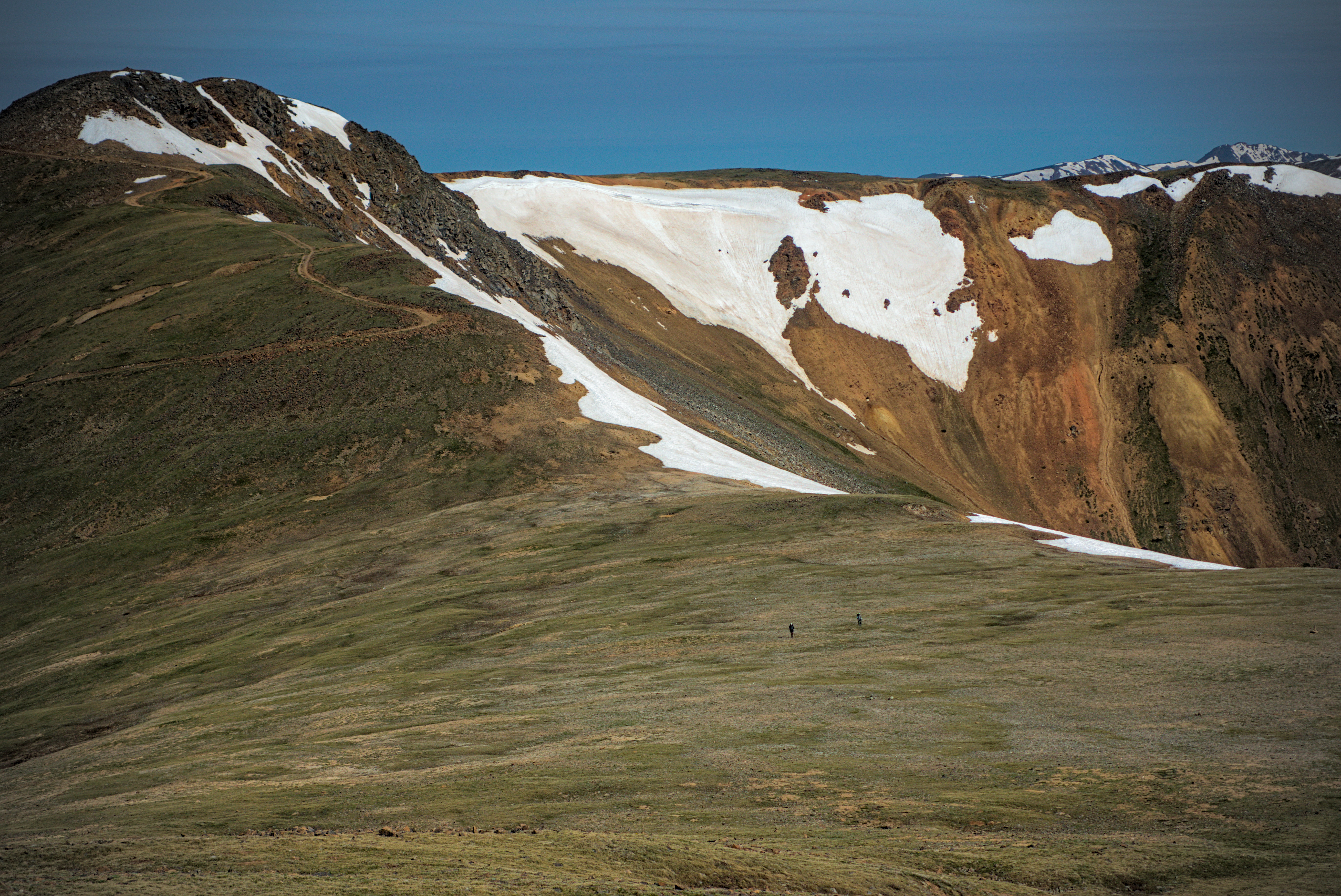
Some bad weather was coming soon, and Mishap had a clever plan to beat it. Thanks to her mom's help, we could start anywhere and travel any direction. The idea was to hike the section south of I70 with the highest section of the whole CDT before the weather turned. We'd hike south for two days, then mop up the section between Copper Mountain and a remote location on the Swan River where Mishaps mom could pick us up.
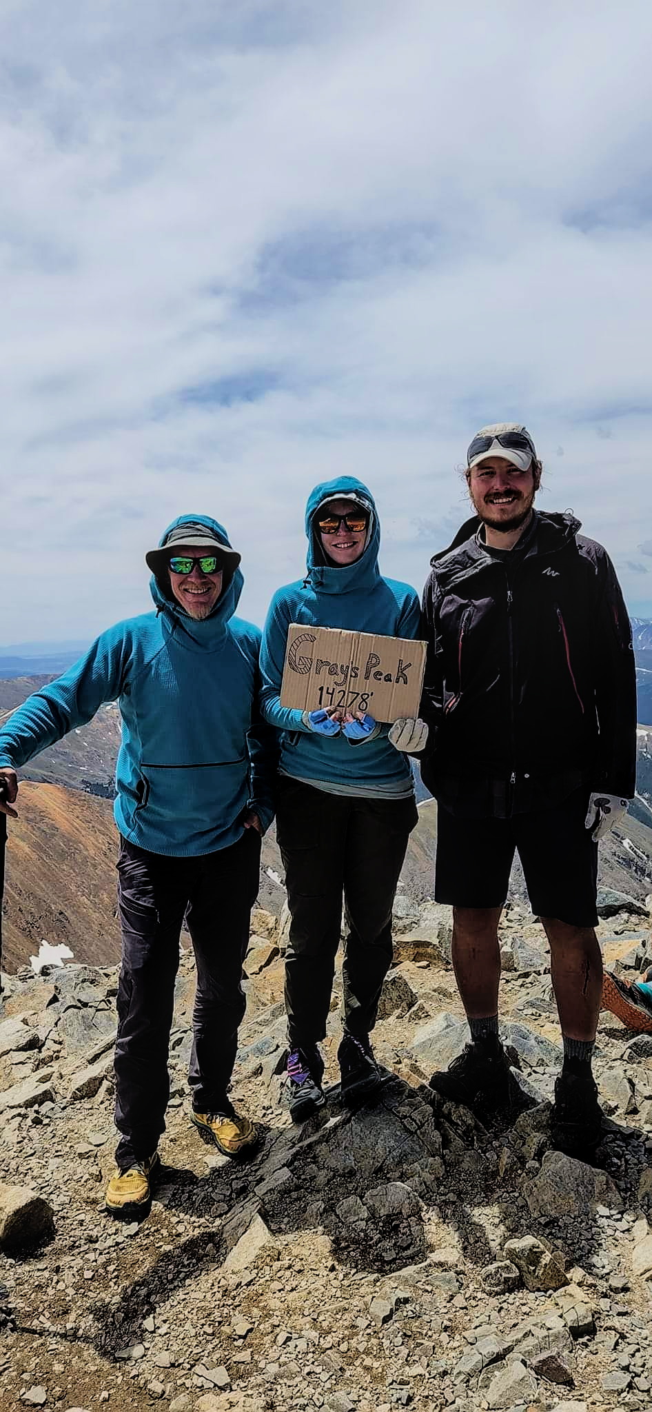
Sounds good! Mishaps mom drove us as close to the trail head as she could, which was about a mile up a steep dirt road exiting off I70. It was quite an adventure for her! We hopped out, heading south and up into the great basin with the Grays Peak Trail. I got generally in front of Mishap and Leftovers for this section. Gargoyle had left us the evening before, preferring to do this section in a long push heading north.
I had one problem...we'd be without water for up to a full day with our plan to leave the red line and travel directly on the crest south of Grays Peak, and...one of my two water bottles fell out of my pack in the truck.
I met a man (Chris) coming down from the peak and asked him if he had a spare water bottle. He didn't, but he had one of those expensive REI plastic bottles which he generously gave to me. Oh gosh, this was such a great gift. I was quite worried about staying on the crest if I didn't have an extra water container. I would have had to go down into the valley if I didn't have it.
Grays Peak at the valley head.
Torreys Peak, Grays hidden behind a local rise on the left.
My savior who gave me a water bottle below Grays!
Thank you Chris!
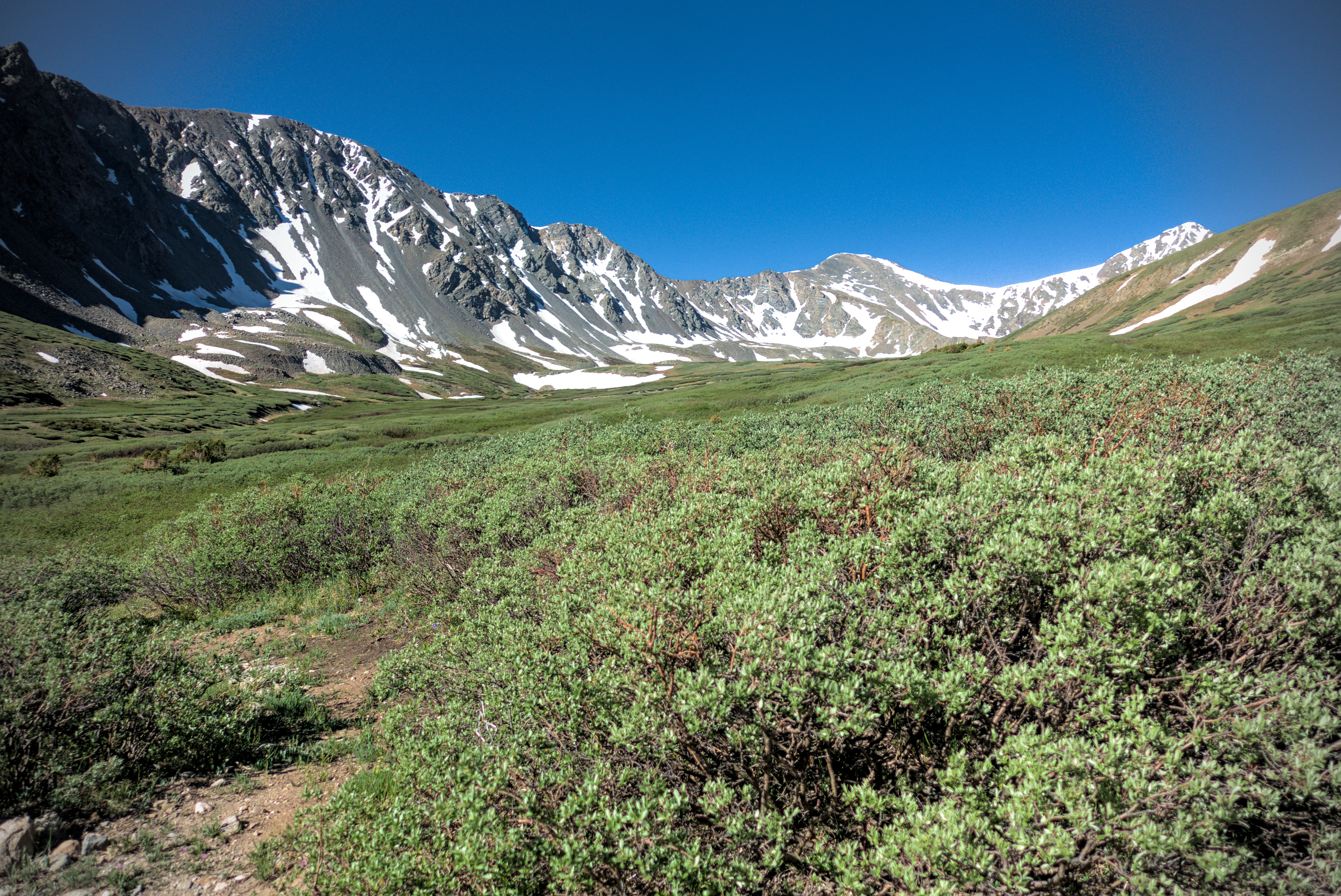
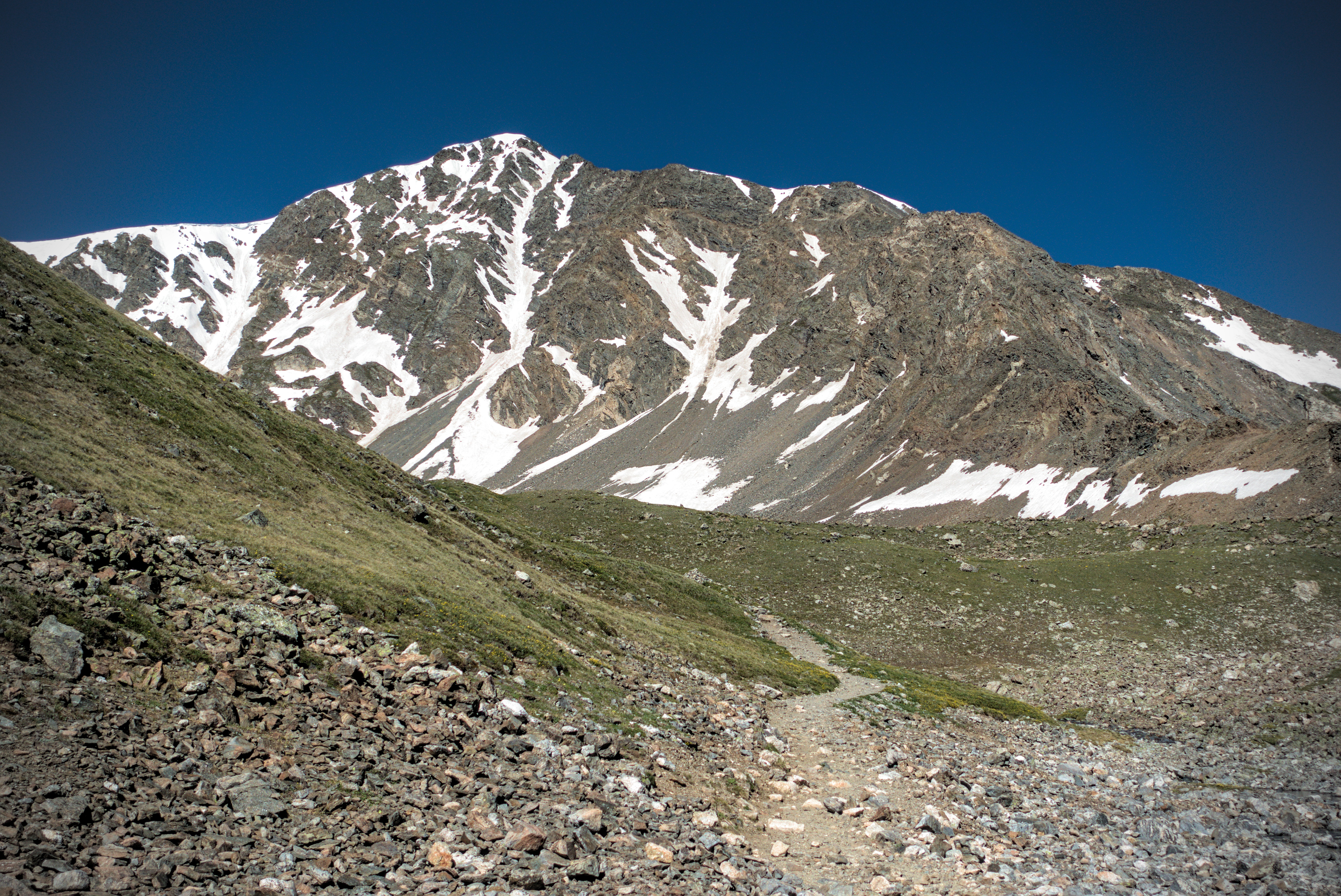
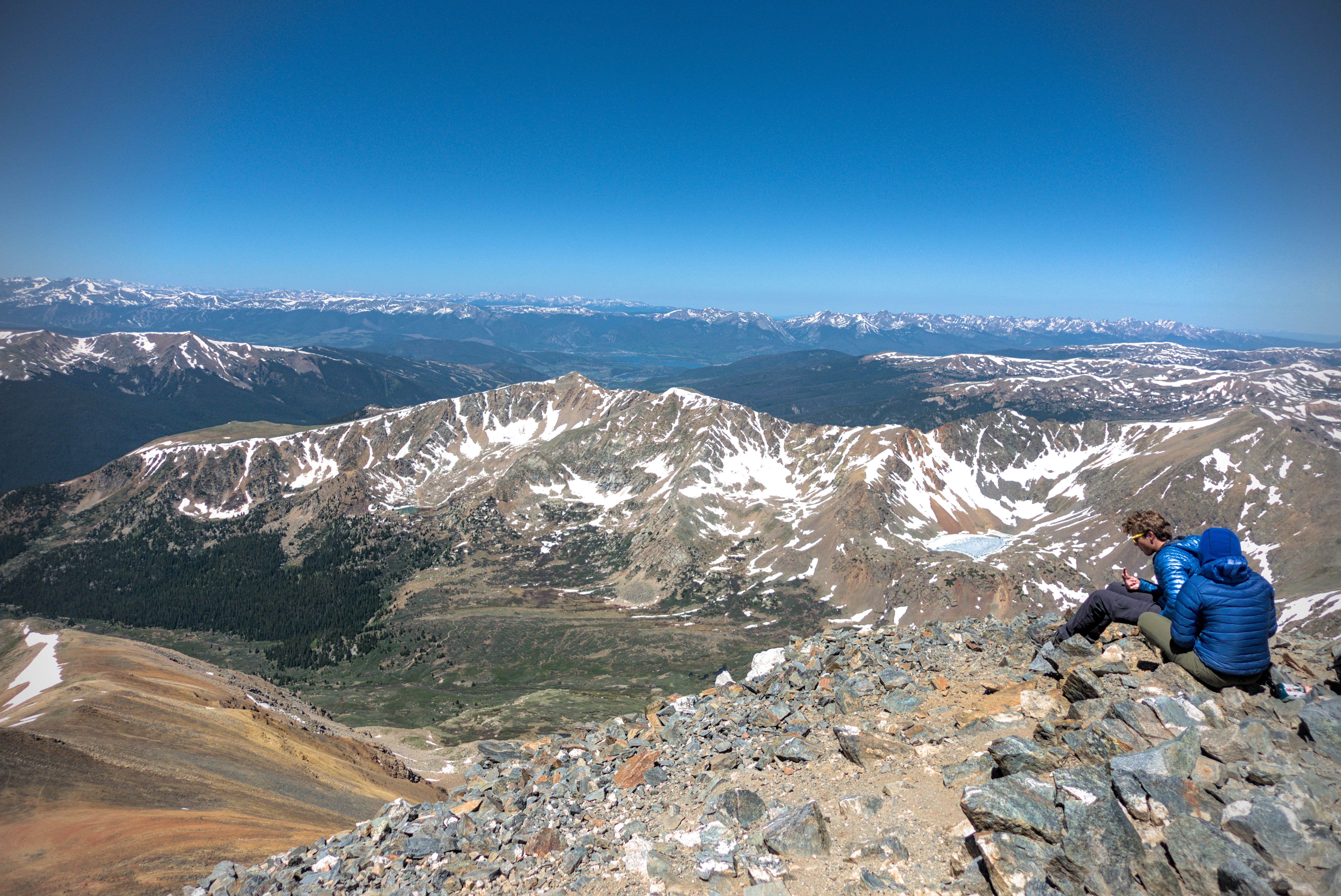
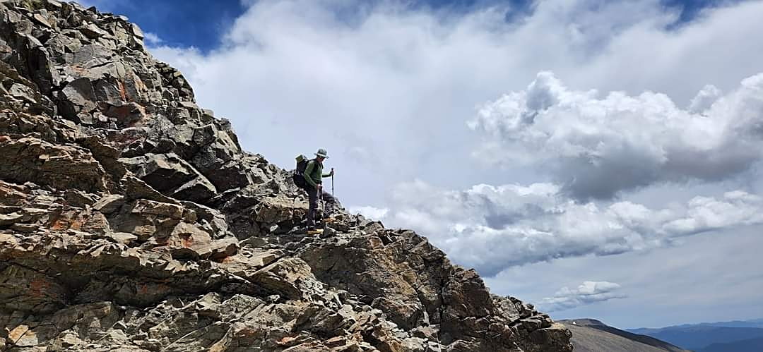
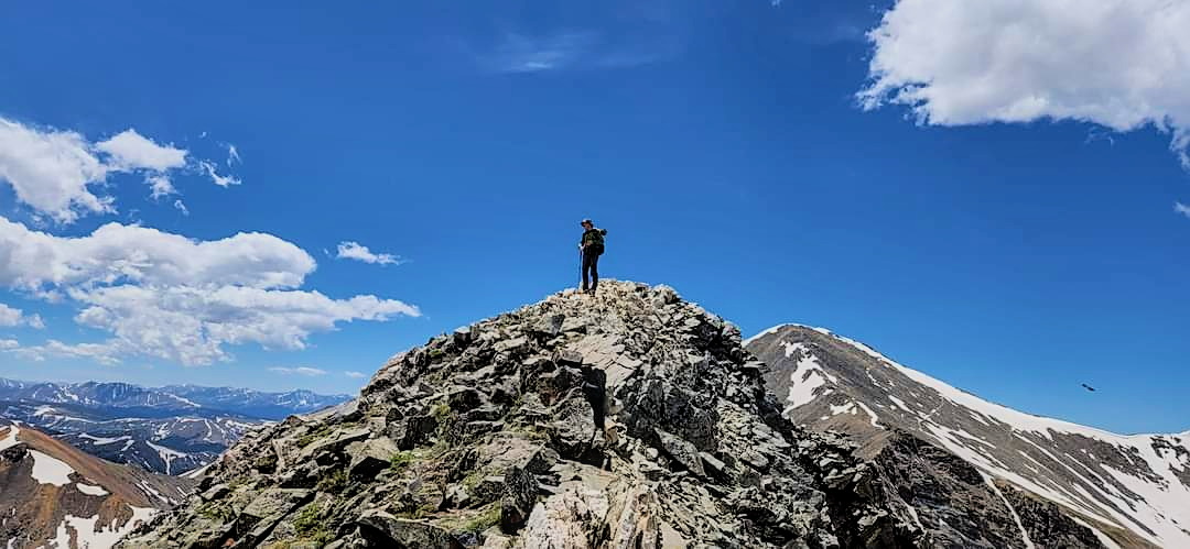
The hike to the summit was enjoyable. I was reminded of the Alps in this section. The trail was reasonably full of people -- what a contrast with other sections.
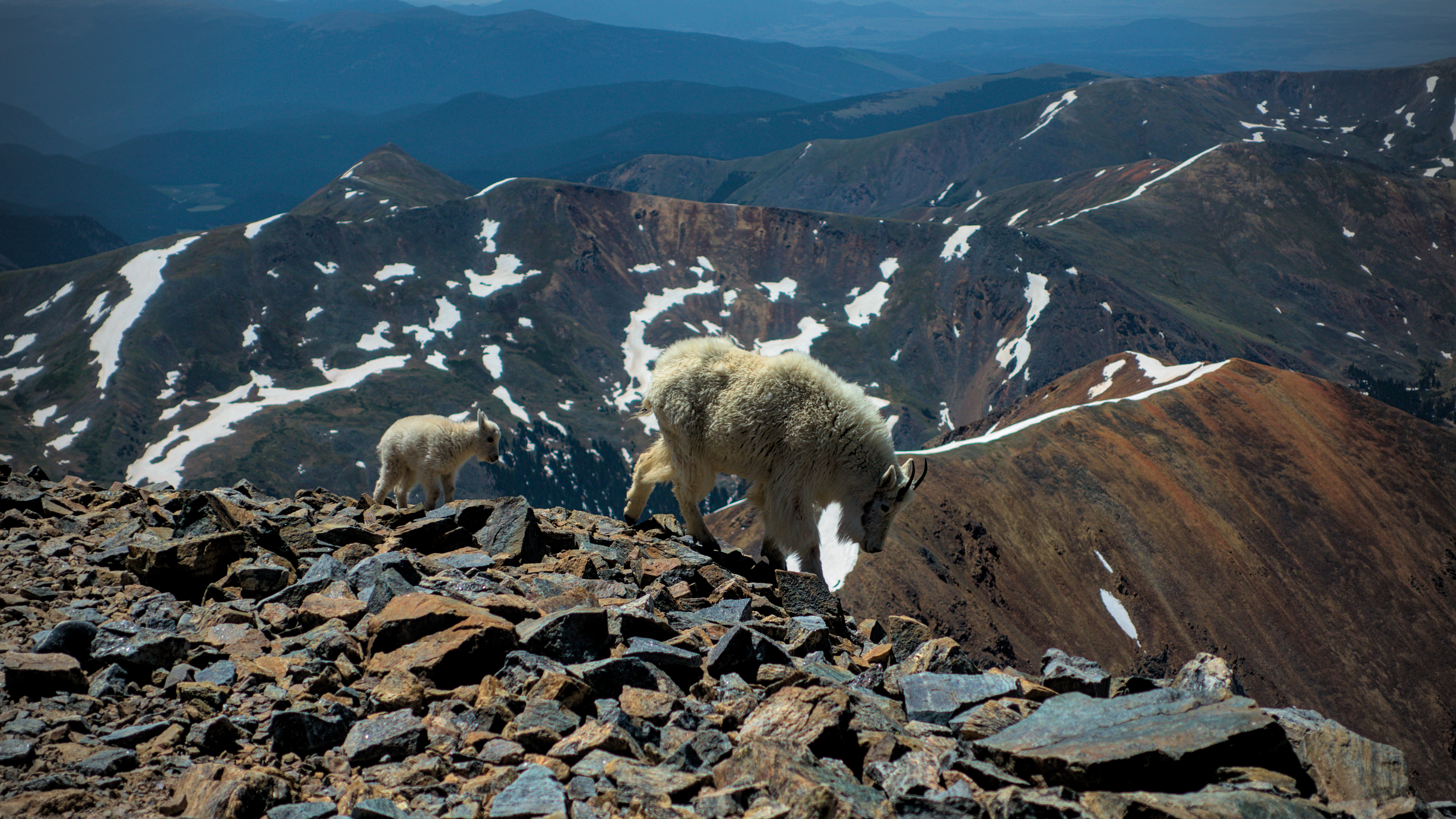
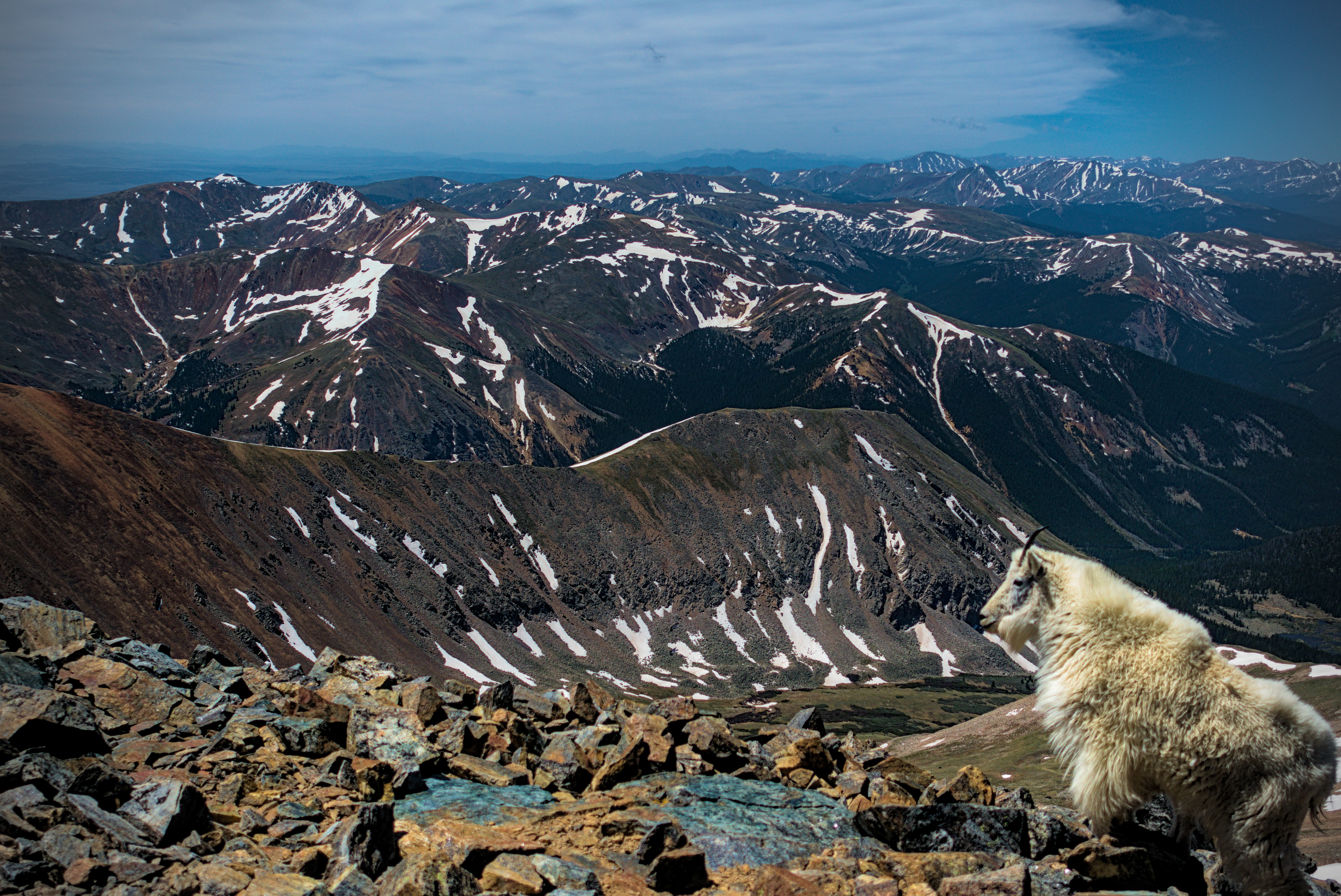
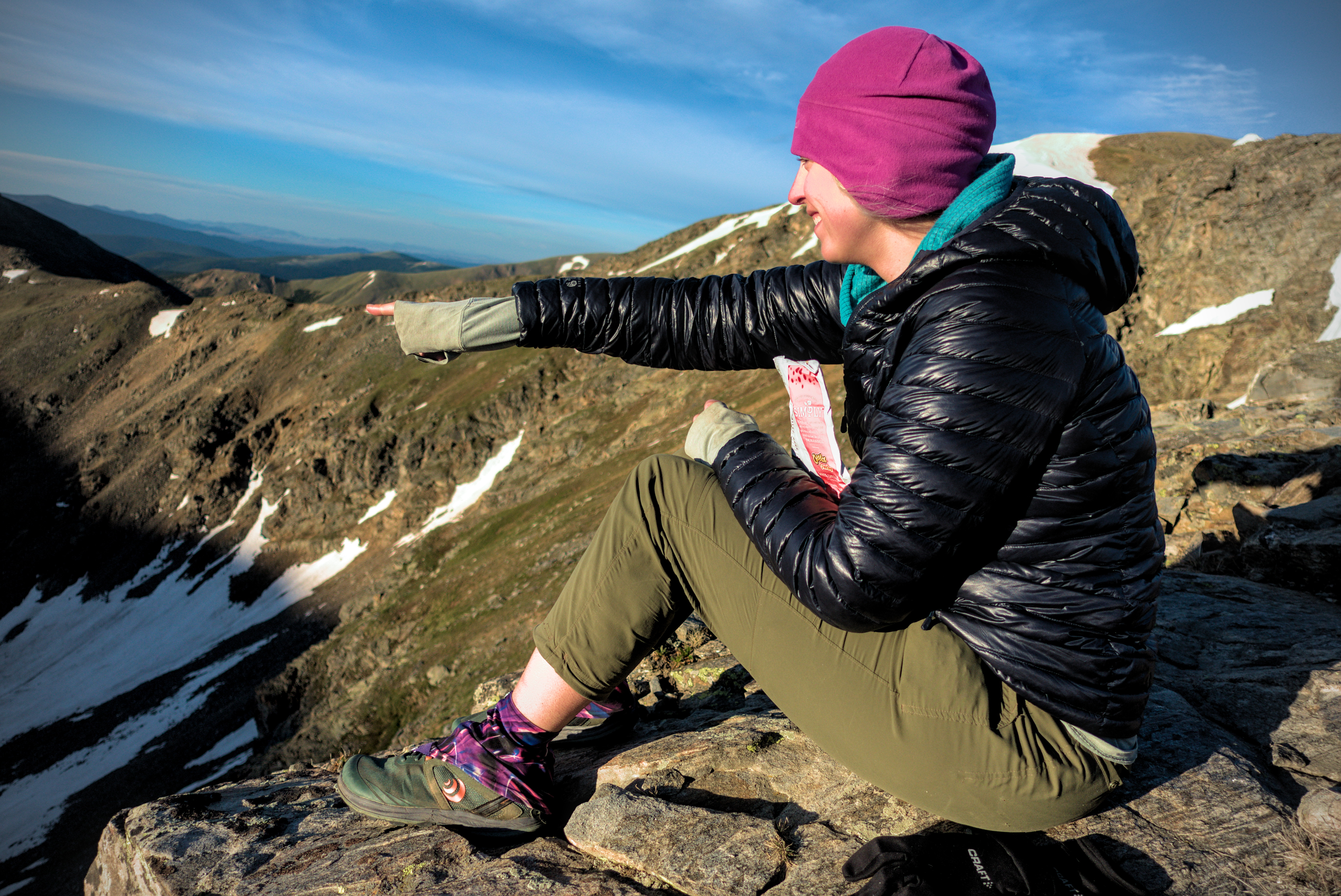
At the summit I settled in to wait. I was nervous about the next section. We'd read many comments by others about how steep it was. A little family of mountain goats came along and posed in a friendly way. A little baby goat gamboled.
Pano-rama on the Grays Peak Trail.
Looking across to Edwards Peak from high on the Grays Peak Trail.
A blue-clad person descends to the saddle between Grays
and Torreys.
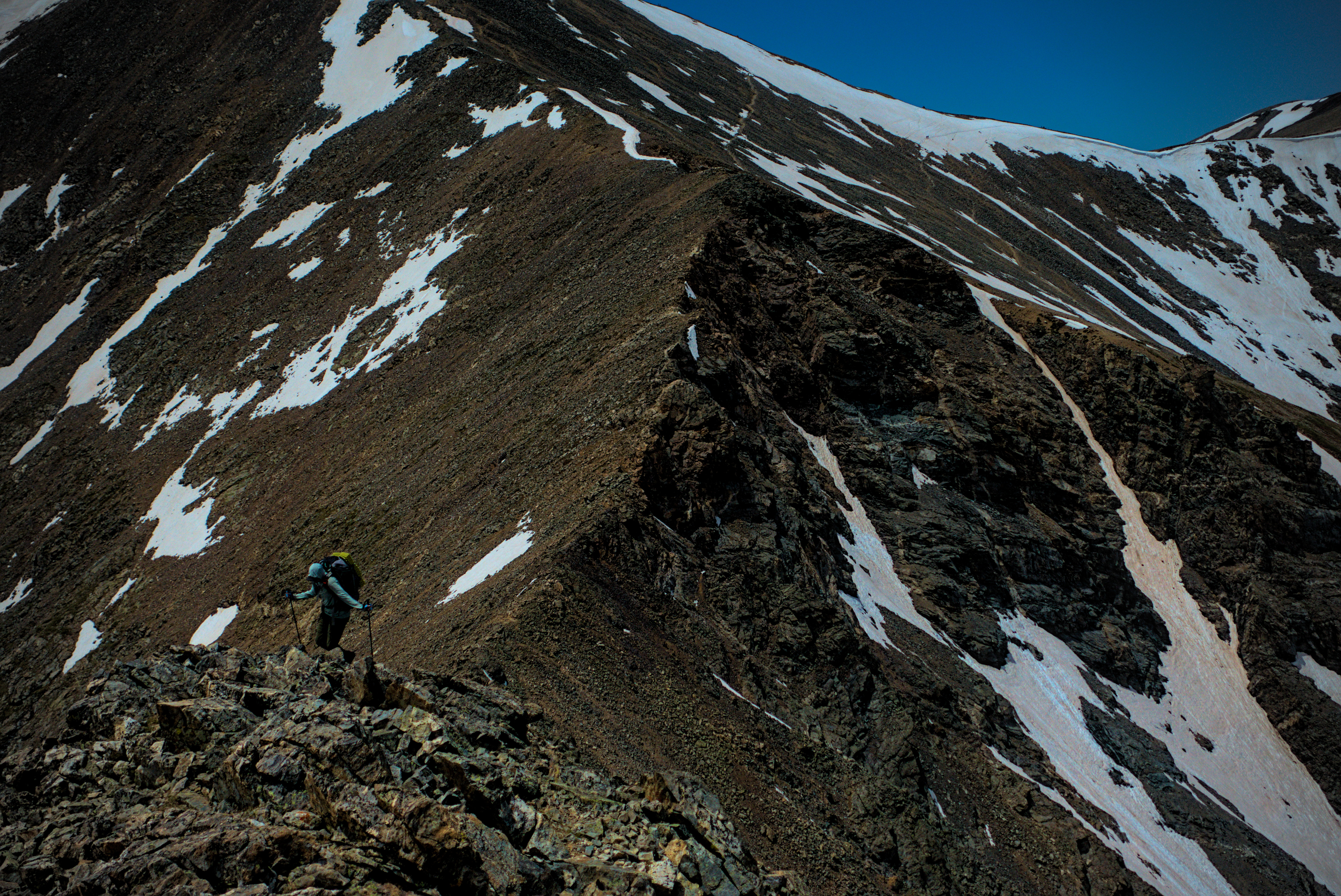
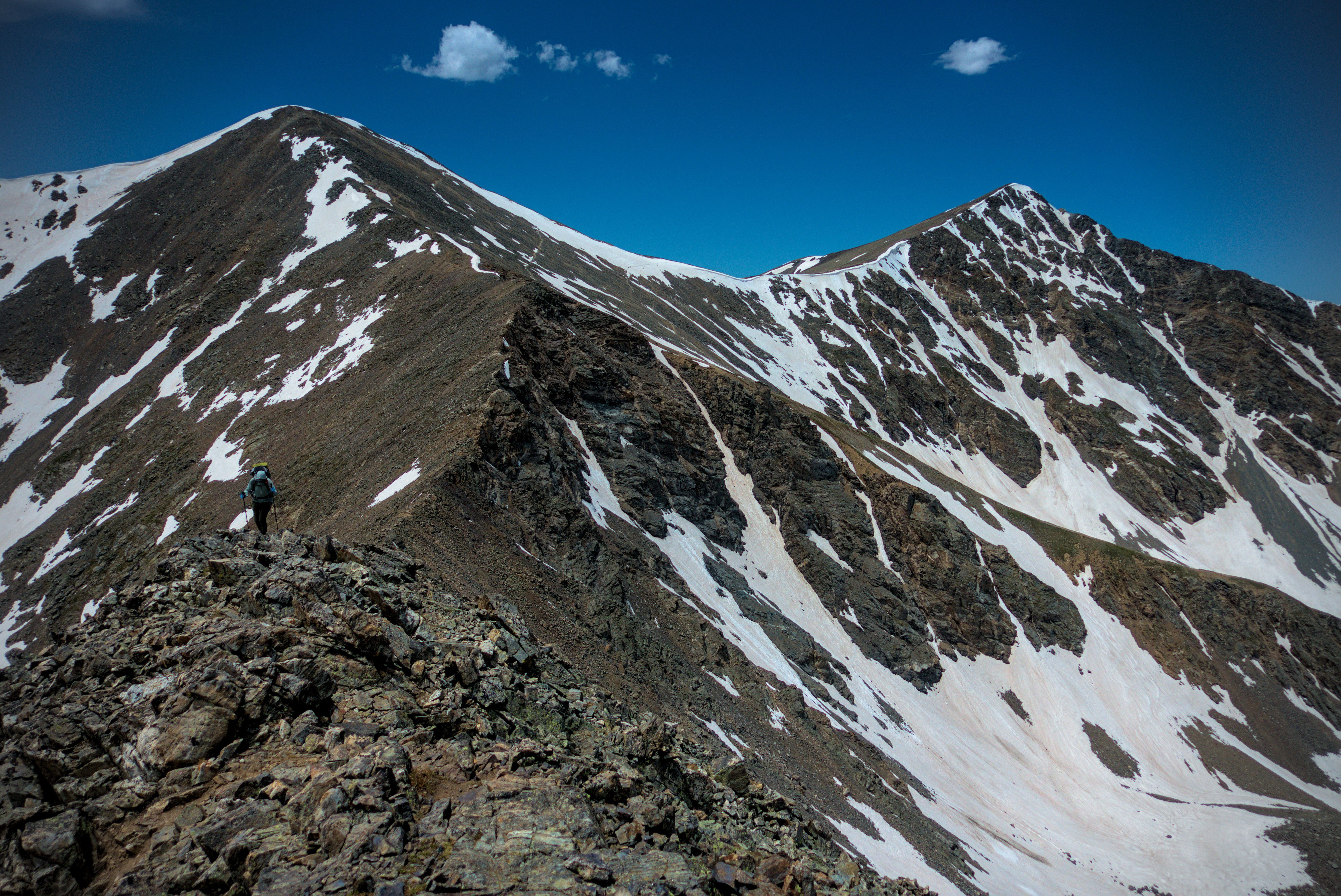
Once the three of us got our fill from this high point, we started down to a notch, the first of several before reaching Mount Edwards. I was a bit crabby in here, not entirely sure of the wisdom of staying on the crest. In fact, Mishap and I got on each others nerves. There was a lot of "I know that. Don't you think I know that?" kind of discussion. Or I'd make a joke and she wouldn't see the humor. Or vice-versa, I guess. Happily for Leftovers, he seemed immune from these petty activities.
Looking south from the summit of Grays Peak.
On the summit, with a view west.
A kid and his mom.
Mom is looking nobly to the east.
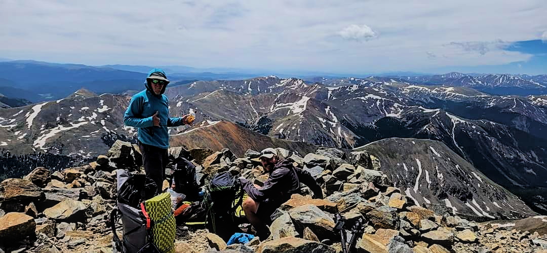
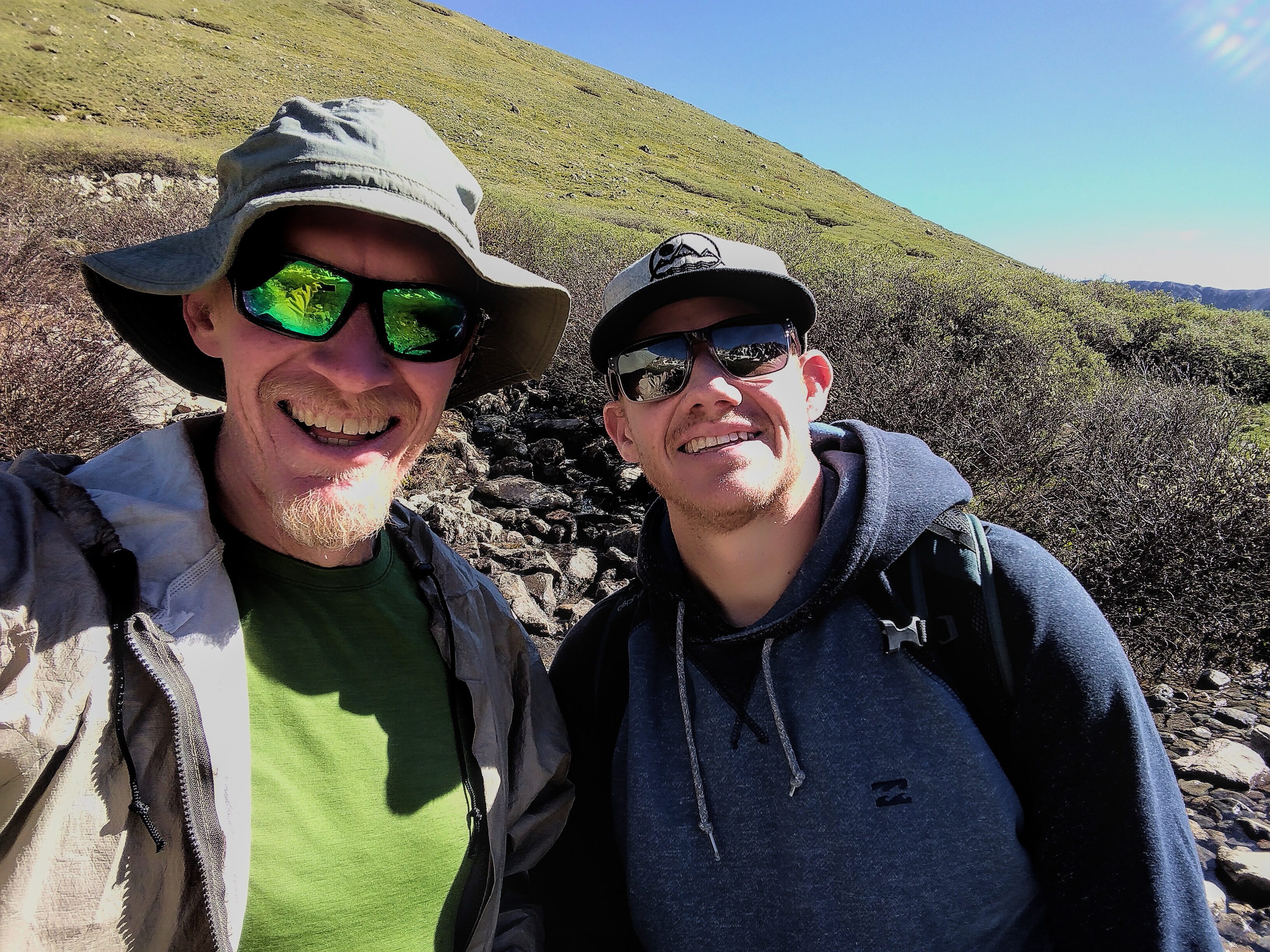
Me and Leftovers on Grays (low-res).
Me, Mishap and Leftovers on Grays (low-res).
In truth, the trail was never any problem. Of course, we'd been smart (and lucky) and were travelling it in the best possible condition: bright late morning sunlight after days of settled weather with little snow. We got some very scenic photos in here.
I gleefully avoided the summit of Mount Edwards, really happy to shave off 200 feet of elevation gain in what I knew would be a monster day no matter how I sliced it. Down from the summit we had a bit of luck: a remnant snowfield with a trickling stream of water. Yes! So we'd have some water for the next hard 15+ miles of ridgetop travel.
Mishap with the bulk of Grays Peak behind.
On the crest, Grays and Torreys behind us.
Leftovers (in the back) and Mishap making for Edwards Peak.
Edwards Peak ahead of us.
Later, I wondered if this is where I got giardia, as there was sign of elk around here. I'd gotten spotty with treating my water in the last weeks, and would soon begin the payments for that! (hint: those payments lasted for months).
We descended a bit to Argentine Pass, below which sat a truck bringing people to the high country for some reason. Goodies? Snacks? I wondered. But the truck was too far away to contemplate going down there!
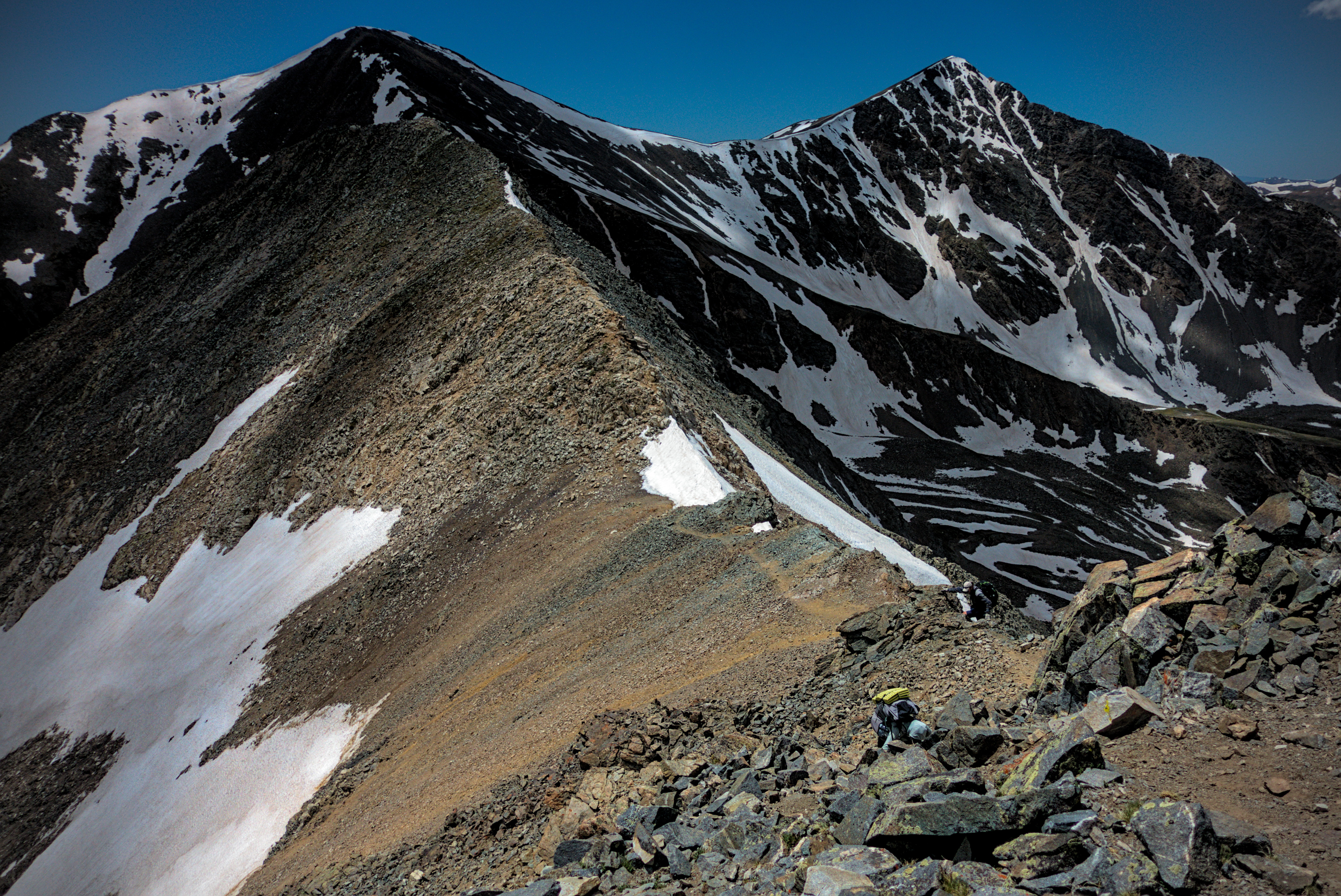
With the red line heading down to the valley from here, I set off steeply up towards Argentine Peak. Okay, we are committed! By now I was pretty tired and the afternoon grew late. The sky was a mix of heavy clouds in some areas, and sun in others. Sometimes it grew cold and windy, then became fine again.
Me on the ridge between Grays and Edwards (low-res
image).
Me on the ridge, Grays behind (low-res).
Moving upward on thin scratch of trail.
Weirdly, a powerline goes over the ridge on the other side of the peak, and there is a little emergency hut of some kind. It was too early to stop, so I didn't investigate it. In general though, I was always worried about the wind up here, knowing that if it was strong enough and I couldn't find any protection, sleep might consist of me wrapping myself up in my tent like a burrito and laying there until morning.
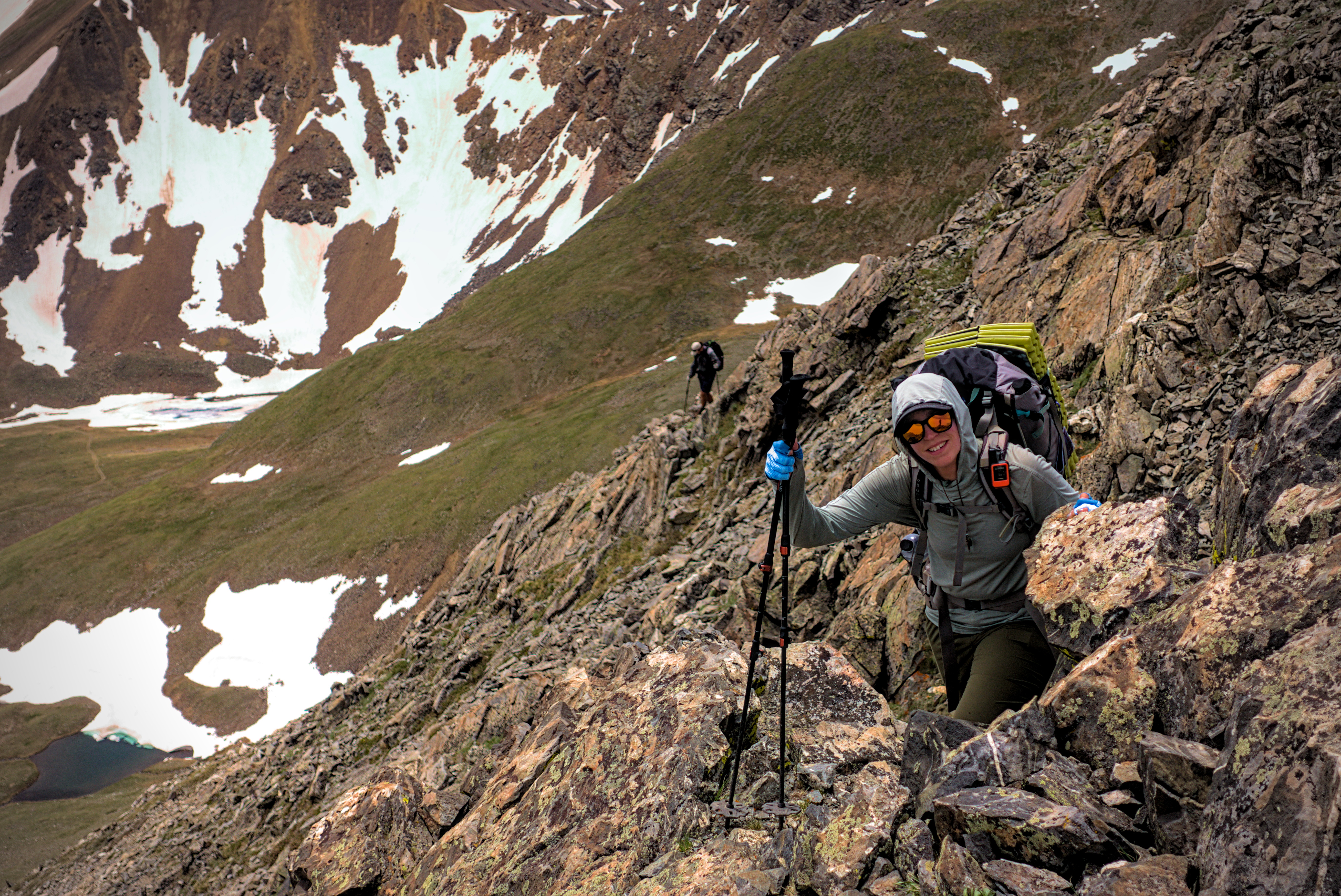
The ridge down from Argentine was quite dramatic...quite steep and I had to look carefully for the right way. I reached a saddle before Decatur Mountain and decided this is probably the right place to camp. I didn't know how far behind me Mishap and Leftovers were, and I knew we should stay closer together on this off-trail stuff.
So I set up my tent and enjoyed the view of Grays Peak and other mountains. It was "international hike naked day," and I paraded around naked for a while. After an hour or so, Mishap and Leftovers came down the ridge and had to endure the sight of me posing dramatically nude on various outcrops. Leftovers set up his tent and retreated inside, refusing to participate in such shinanigans. Mishap briefly celebrated the day, though she really would have preferred to get a picture on the summit of Grays in her birthday suit. "But it was covered with kids and stuff!" I said. Or, alternatively, Edwards Peak but I messed up that plan with my gleeful avoidance of the summit.
Anyway, Mishap felt I'd made an error by camping so early. In fact, we'd only hiked 11 miles, though it was the biggest elevation day of the whole trail at 6500 feet elevation gain. That's a big reason why I stopped! She said she can't sleep if she stops to early, and besides, I snored and would make that even harder. "Well just go keep walking then!" I thought.
I include all this to say that, despite the best of intentions, hikers can get on each others nerves. The truth is, even though we didn't see things the same, she had good reasons for seeing things the way she did. But I did too, and this might be why "trail families" don't always last forever. People want different things and move at different rates of speed in order to keep an internal balance with all of the things that are affecting them.
I saw a movie recently with a scene where a young man discovers girls and asks a wise man why girls are so different. He said that according to Saint Thomas of Aquinas, it is because they have 5% more water, and so, are affected differently by gravity.
Ha! That is funny, but I see some truth in it...not only between men and women, but between all individuals. It's as if inside we have a small ocean of a unique size. Gravitational forces move it suitably or painfully in multiple directions...listing to the side one day, and stretched impossibly between diverse points of gravitational power on another day. With more or less mass in a different person, they may not be affected at all...or, may be affected to a totalizing degree, such that what looks uncertain and ambiguous to their companion is plain as day to them.
Anyway, I was determined to enjoy the longer evening here. I read and ate, watching the changing patterns of sun and shadow on the peaks all around. It was an exposed ridge with no trail anywhere near us, just the scratch of a few dozen footprints from other hikers. We saw no one until the afternoon of the next day.
Looking back to Grays Peak. We traveled the spine rightward
from the summit to this camp spot.
Looking to the next days work from cap, up the spine on
the left, and off out of sight to Decatur Mountain and
beyond.
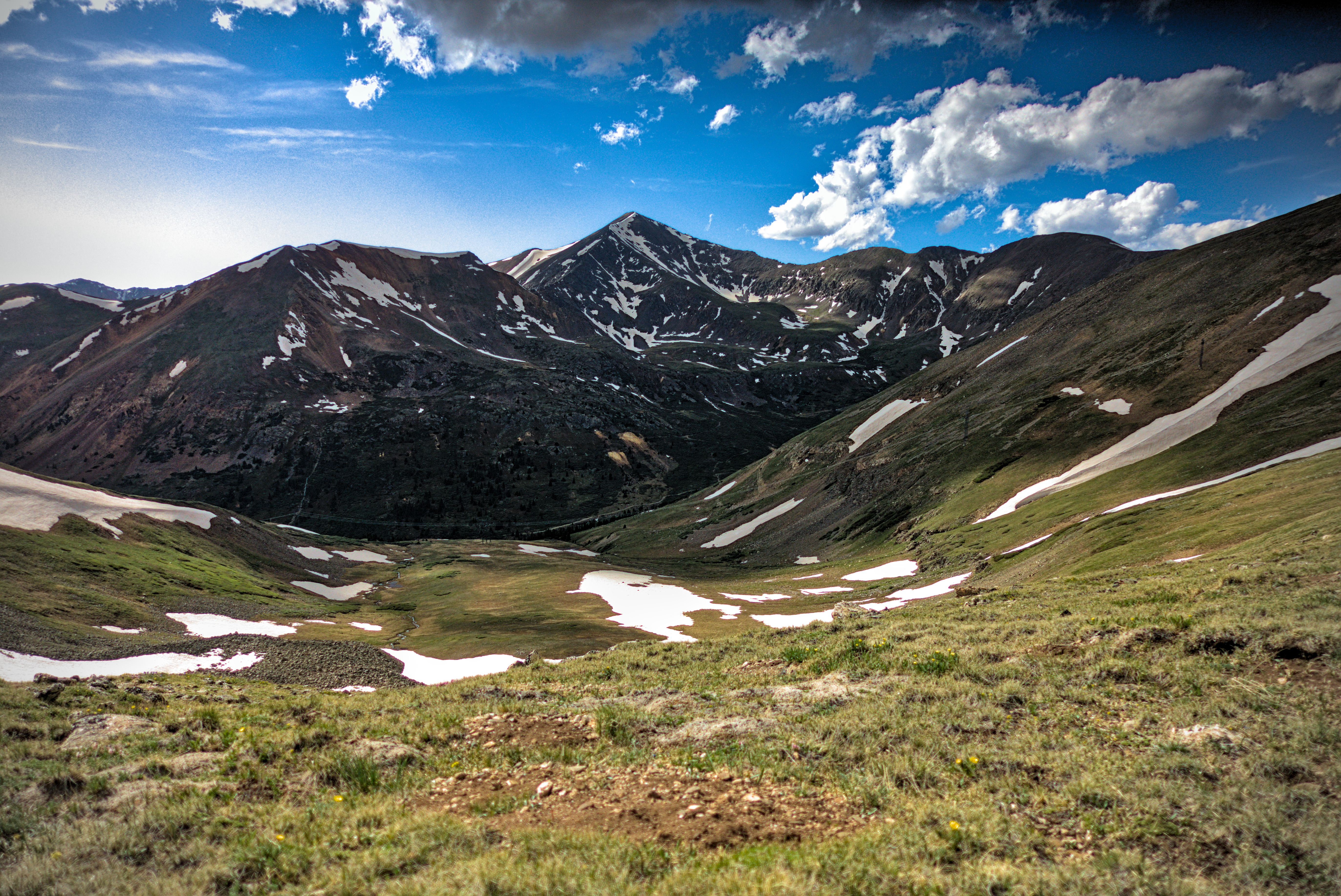
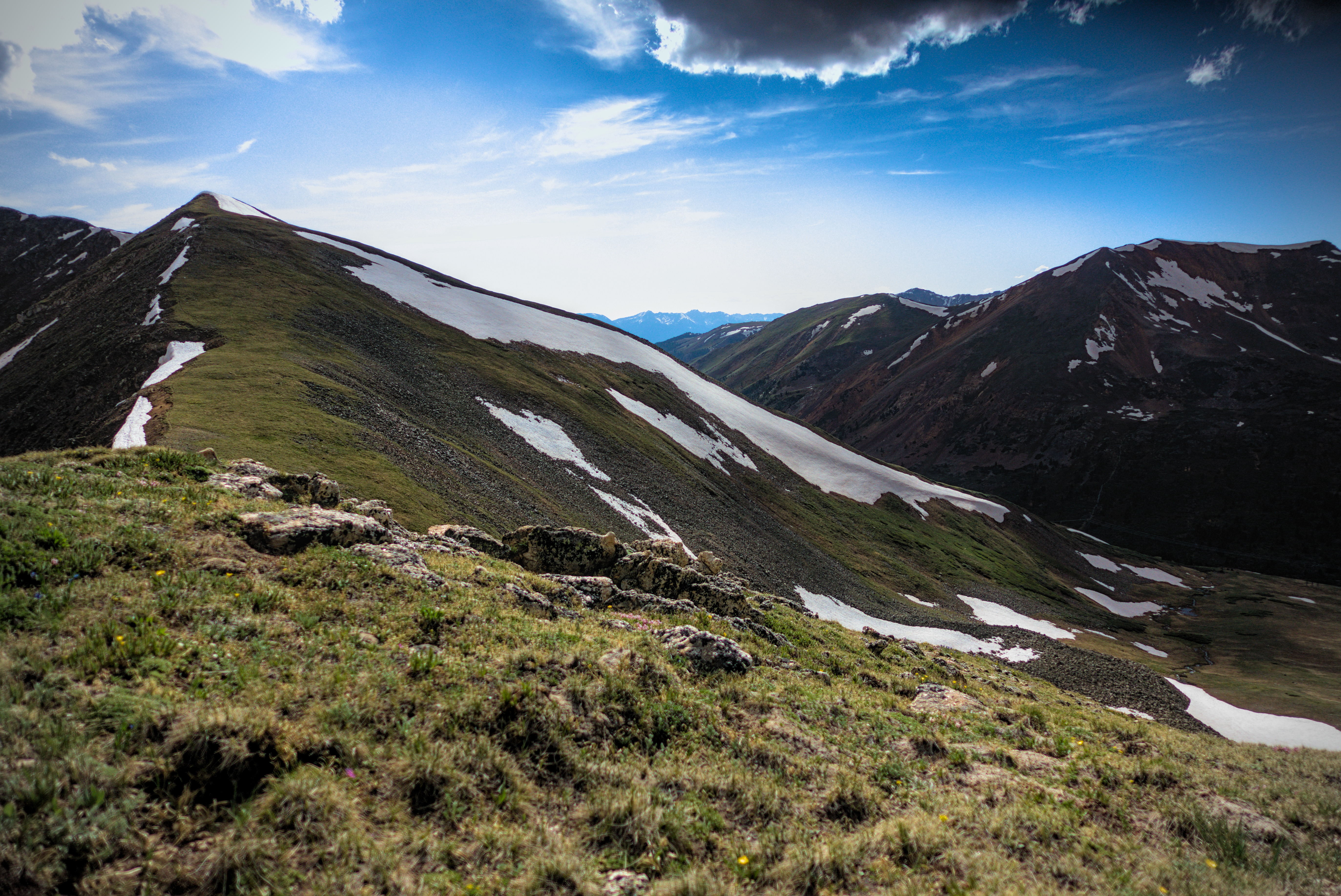
June 22, Day 63, 16.3 miles
An incredible amount of up and down and up!
In the morning, Mishap was off first, and I followed. After picking my way below a snowy section, I climbed steeply down a trail amid large blocks. Suddenly, I lost my balance when I misplaced a hiking pole -- I was in the air!
I flipped head over heels, then landed painfully first on my knees, then my chest. Groaning and yelling with the pain, I lay there a while, grateful that nothing seemed to be broken. Mishap came running up from her perch at the next saddle to see if she could help. Moral comfort was indeed helpful, and after a few minutes we went back to her spot.
Mishap points to a white pixel she believes is a goat
down at Shelf Lake.
Shelf Lake.
Feeling a bit demoralised, and wondering what this would cost me in new bruises, I sat and tried to regain my excitement for the ridge. I knew we had a tremendous amount of work in front of us, and later, was happy to find that we could bail from the ridge to reach the junction where Mishap's mom would pick us up, and save five miles of tiring up and down terrain. Even without the accident, I'd need this accommodation!
A tiny Mishap and Leftovers traverse the green ridge.
A tiny Leftovers and Mishap march through the high pass
between Santa Fe and Sullivan Mountains.
On Geneva Peak, looking back north through our country
of the morning.
We wandered for steep miles to the point where the "red line" trail from the valley rejoined the ridge. Already, we could see the crazed line made by the divide... Jogging merrily left and right across our horizon, we'd add at least two more giant curves to the spectacle of it before the end of the day. I alternated between feeling generally okay and being a little scared about the new discomfort in my ribs as the day wore on. Once I lay down and stretched, hearing an ominous "pop" in my sternum, then feeling greater discomfort on standing up again.
Oh jeesh.
That was really irritating. I already had all this pain in my left shoulder/arm...now the bruised ribs...along with the sense of being tired. I pretty much decided to separate from the group because I felt like I was falling apart trying to keep up with them. I blamed myself for the fall, because I was just pushing too hard.
An unidentified hiker traverses the high country.
Mishap with the bulk of Handcart Mountain behind her.
On the positive side, by traveling south, we were meeting many people we knew on the CDT. Mishap met someone she'd been looking for based on obscure summit registers since the San Juans! Pretty cool...We also met Gargoyle here, it was the last time I'd see him.
I was happy to finally descend to the valley by a steep trail down the Middle Fork Swan River, and then a long walk through forest to again reach the CDT. Mishap's mom was there, and we all walked to the truck along with Blue the dog.
I was so tired and sore, I lay in my room, though Mishap brought me a beer and a burger (thanks!). Over the next days, they did more slack packing and I retreated to an Airbnb for three days of rest.
Nice comment from old friend Theron in this section:
No need for you to be concerned about steep snow on Gray's. This ain't the North Cascades, Jack! Sorry to hear about the fall!
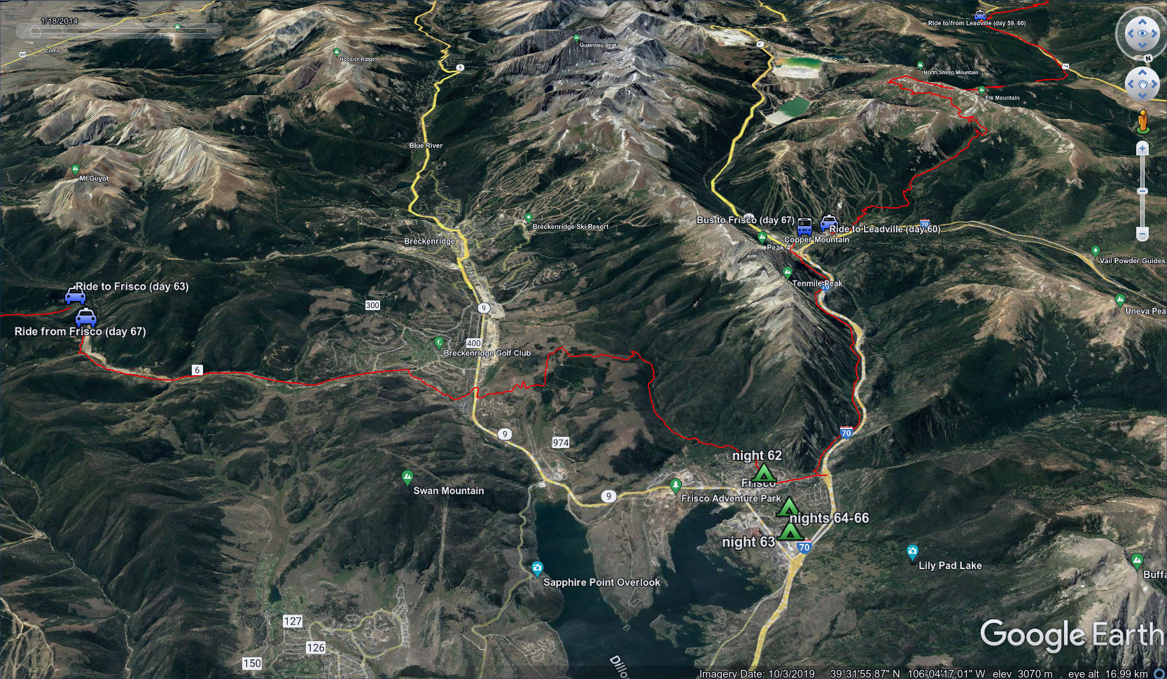
June 23-25, Days 64-66
Much copied from the blog entry here.
I visited REI, mostly took it easy, smoked a cigar along the river in Frisco, cooked dinner at the AirBNB and chatted with another guest.
The two hikers from the San Juans, he who carried her
for exercise before sleeping.
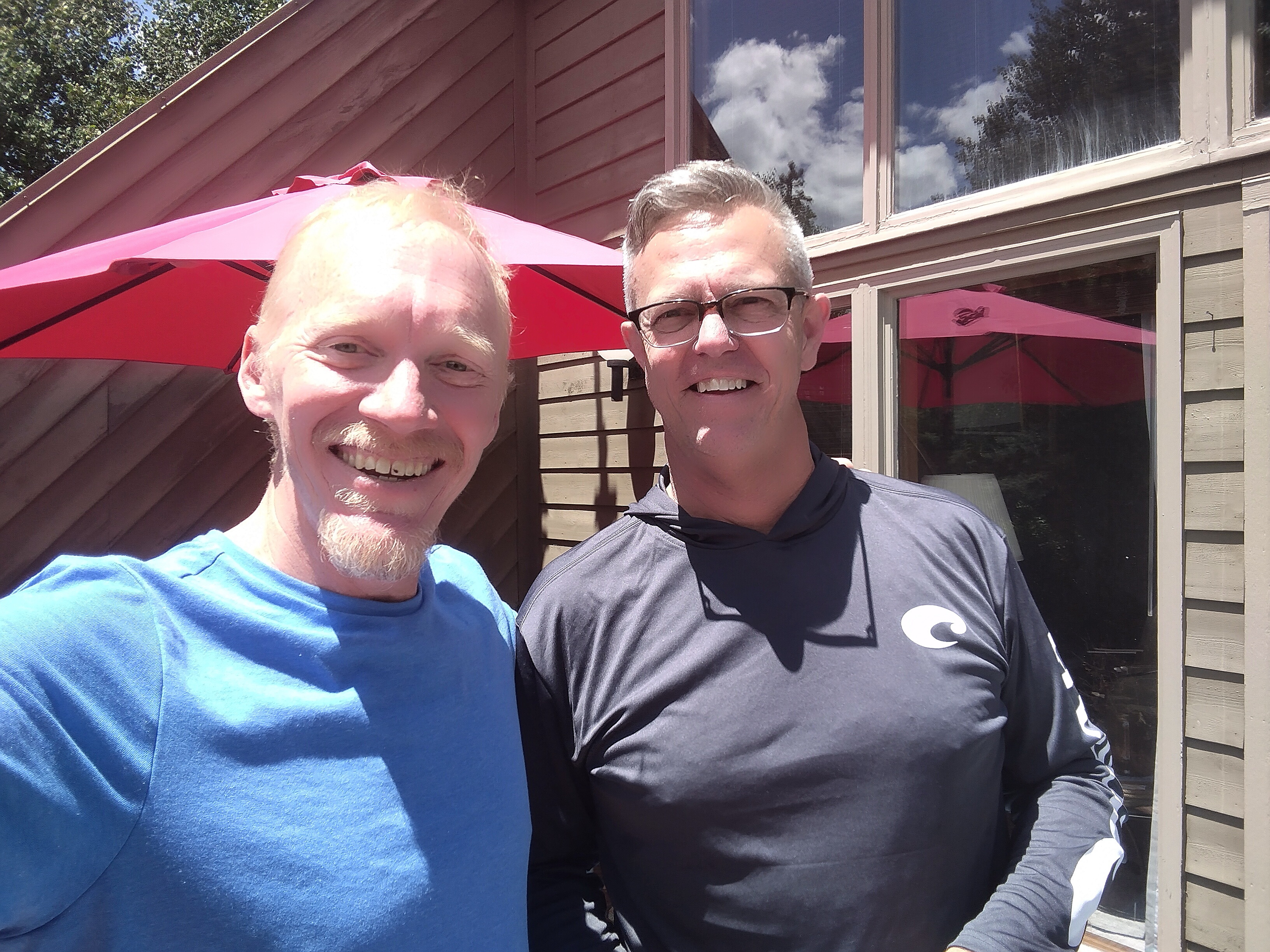
Fellow lodging guest Roger. We had good conversations about life,
and he gave me a ride to Swan Creek.
It's easy to take your health for granted...I do this a lot. But when you lose that "easy feeling" that grants enthusiasm for big hills, things look very different. I didn't overthink it though...I just tried to enjoy myself and rest a lot.
As it turned out, three days of rest wouldn't be enough, and this was a hard thing to bear...
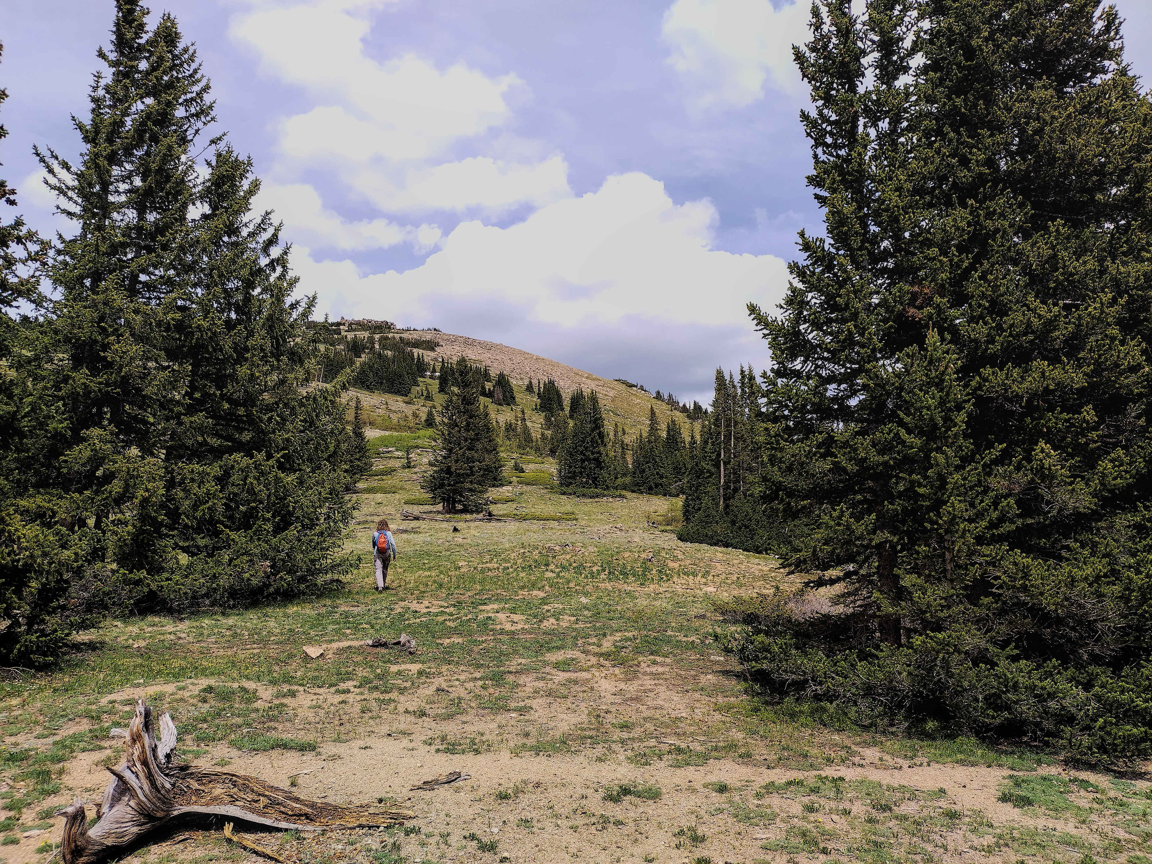
June 26, Day 67, 21.4 miles
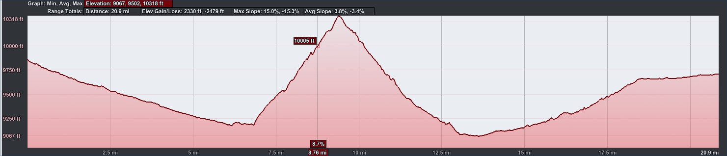
20.9 miles, 2330 feet elevation gain.
Hike from Swan Creek to Copper Mountain, driven off
the crest by rain and fresh snow.
Roger gave me a ride back to the trail in the morning, which was so helpful. I started walking where Mishap's mom had picked us up a few days before. I just walked the road to highway 9 between Frisco and Breckenridge, saving 10 miles of effort. Then I got on the red line trail to complete the section to Copper Mountain. I'd climbed up to a gorgeous plateau with an impressive view of a high ridge I'd need to cross over, when storm clouds appeared. Soon it was raining, with thunder sounding over the ridge. I found a low route that touched Frisco, then followed a valley trail to Copper Mountain. Despite heavy rain, I enjoyed the walk down to Frisco on good trail along a rushing stream, with happy hikers and bikers coming up the opposite way.
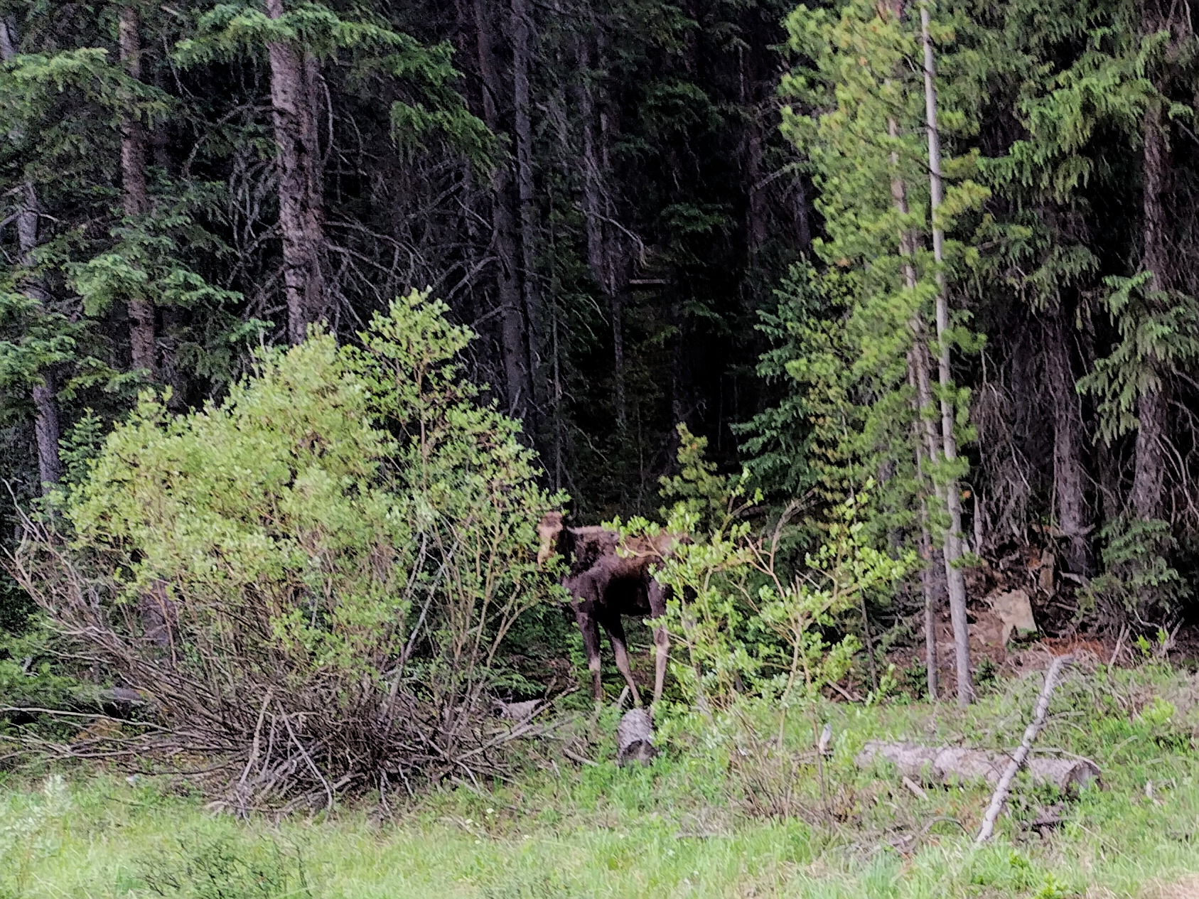
A young moose in Swan Creek.
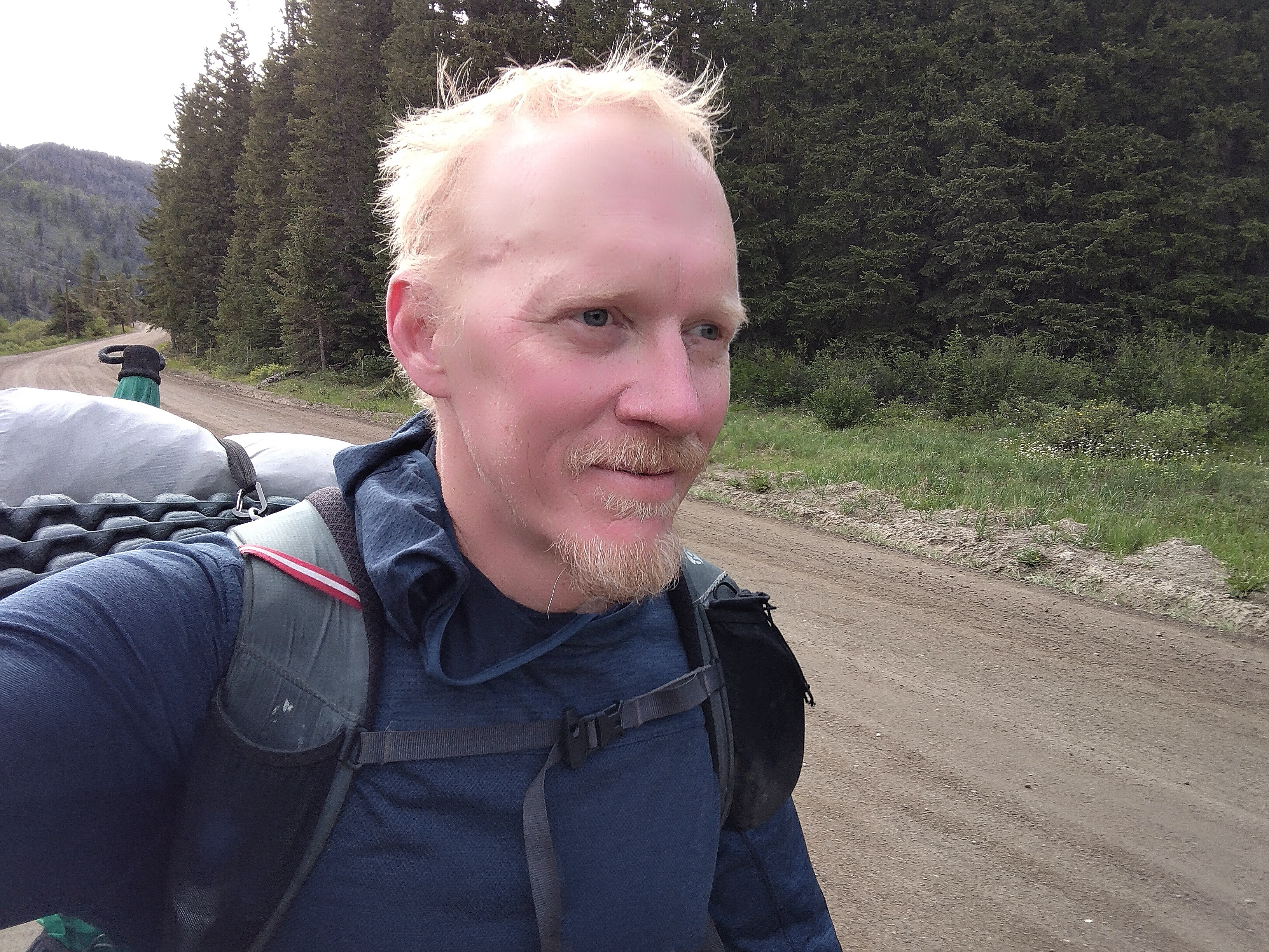
Sporting new clothes in Swan Creek. A bit too warm, actually.
In Swan Creek near Highway 9, looking to crest peaks
I hope to hike over.
Uh oh, storm coming in.

Drat...it is the low country for me.
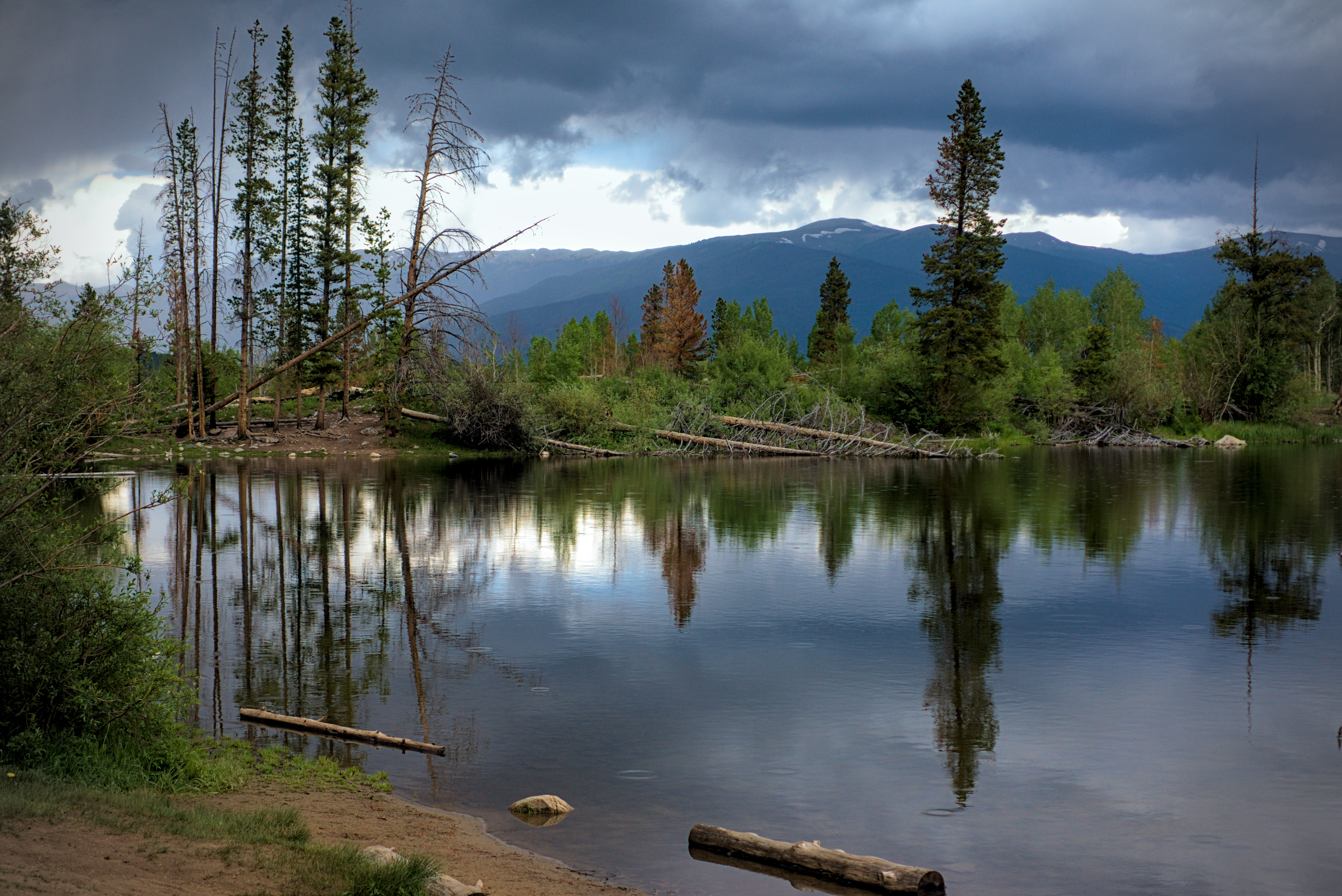
Rainbow Lake at a break in the storm above Frisco.
I reached town in an absolute downpour, happy for my umbrella, but my feet were squelched. I drank a hot coffee, rented a room for the night, then walked six miles to Copper Mountain, taking a shuttle back to town in the evening. I'd connected all my "footprints" now, I just needed to get up to i70 and the Gray's Peak trailhead to finally escape the "Frisco Basin" where I was beginning to feel a little trapped.
On the shuttle, I did meet Master Chef and her husband Fuego, the inimitable Czech couple who are so much fun to see. We all went to dinner with Info, who I'd last seen in Lake City, and a fine fellow whose trail name I forgot (for the second time, I think! He and I met on the trail once in the Northern San Juans).
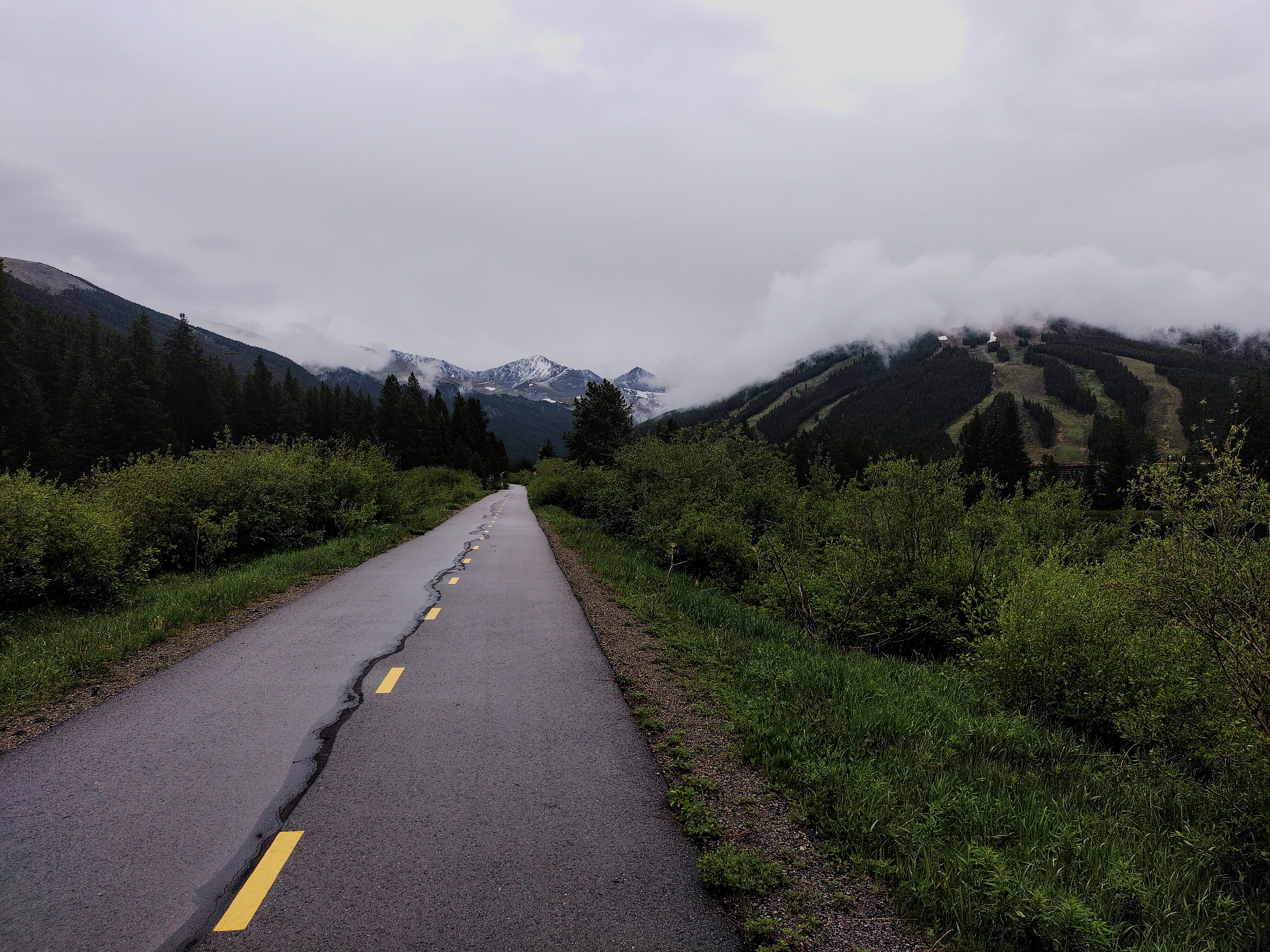
The rather boring bike trail between Frisco and
Copper Mountain.

My room in Frisco...first signs of Giardia here!
Walk back to Copper Mountain
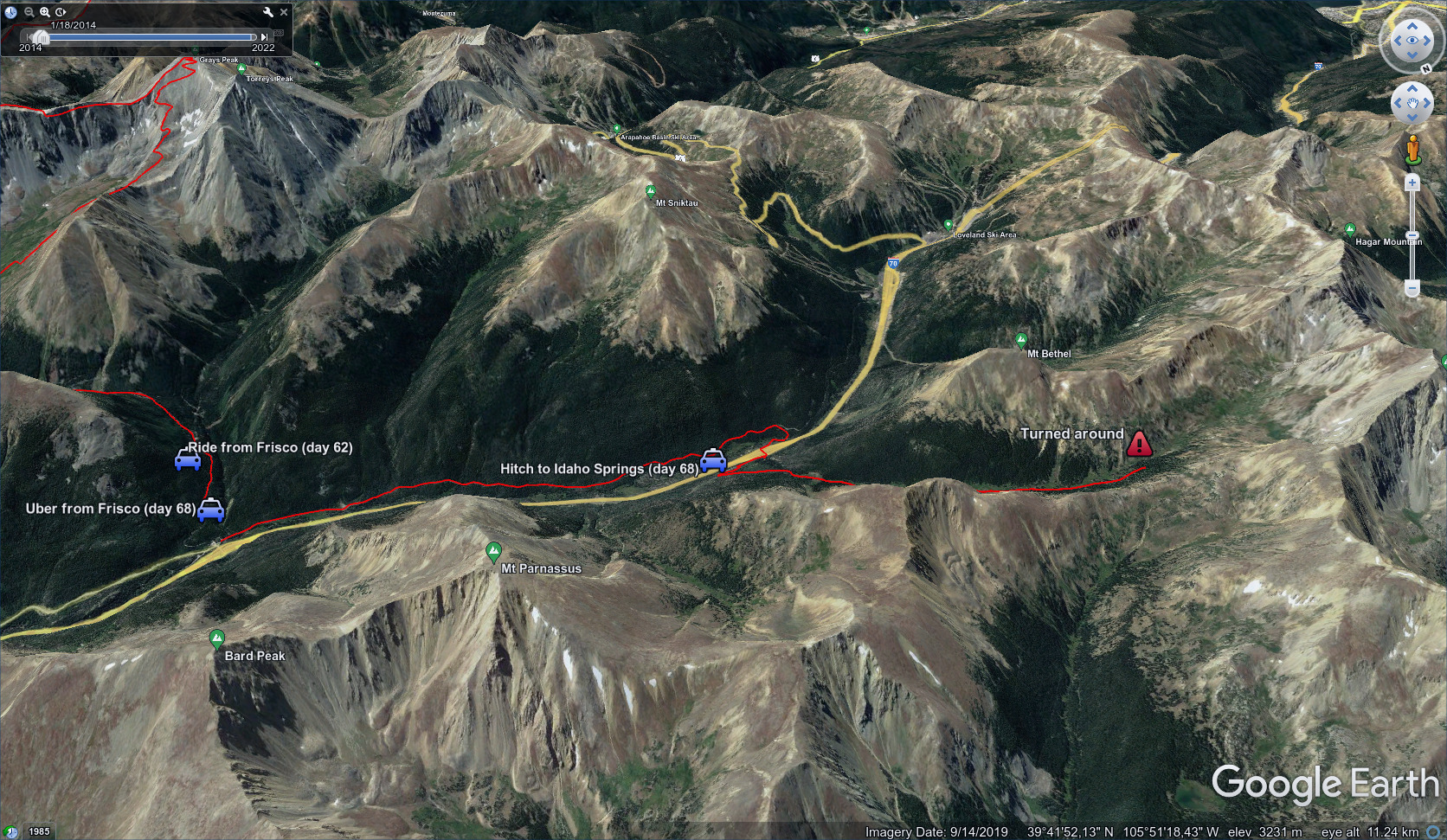
June 27, Day 68, 11 miles
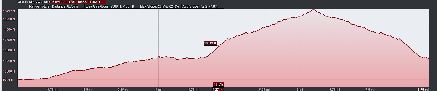
8.75 miles, 2366 feet elevation gain.
Only a short day today...turned around, sadly.
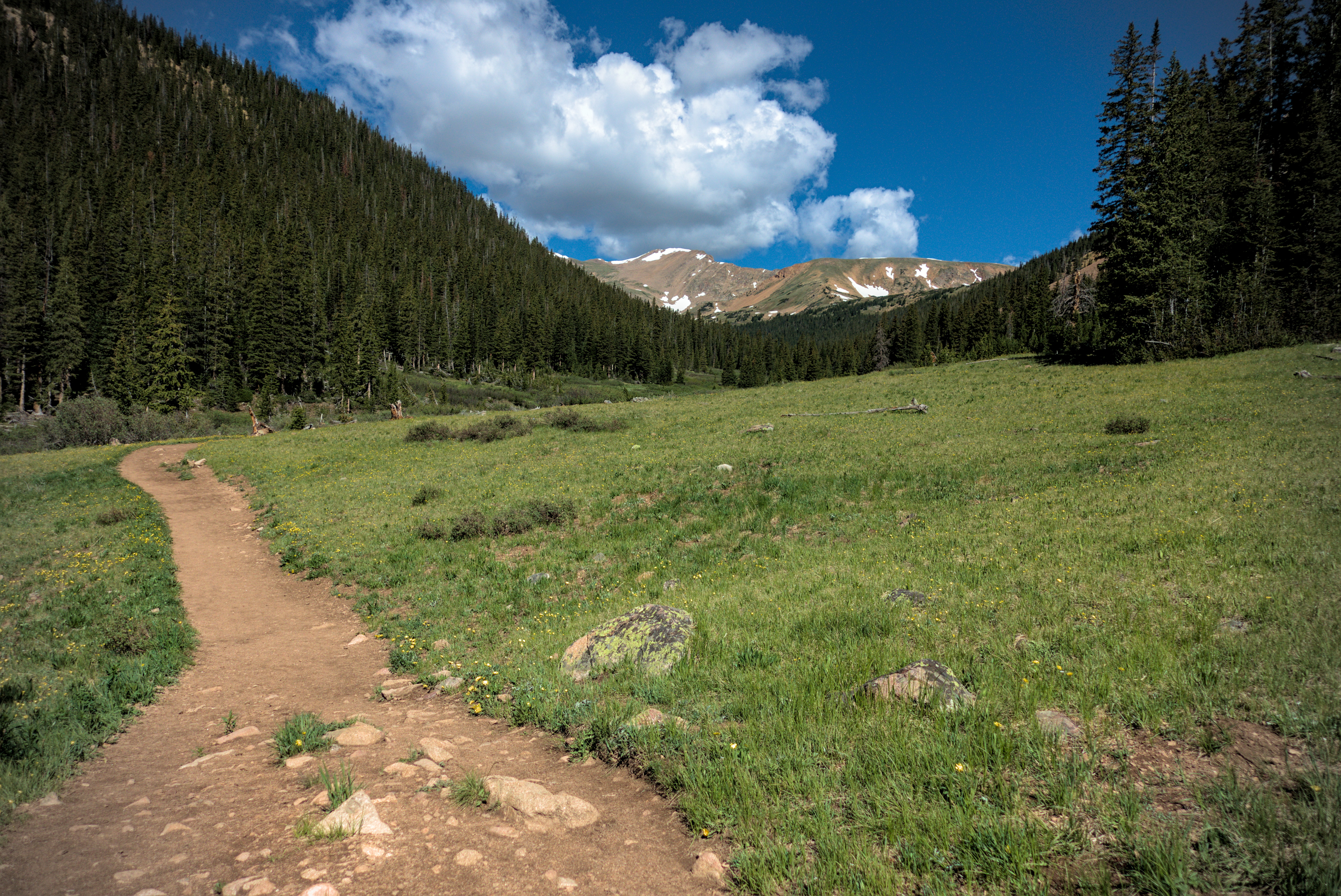
In Herman Gulch, looking to the high country.
In the morning, I paid 60 bucks for a ride to the Gray's peak exit on i70. I walked back west asking the highest for three miles or so, then finally crossed to the north side of this important roadway. I was escaping the vortex!
Not.
As I climbed up Herman Gulch, I had serious stomach problems. This lead to delays and even, nightmarishly, a soiled garment. I felt really crappy...tired... Couldn't eat anything. And breathing was becoming uncomfortable. The night before, I'd noticed how painful it was to turn over in bed, and these chest pains were getting worse.
I started to mentally calculate easier ways to get over Berthold Pass that might save a couple thousand feet of climbing. I was in poor shape. After a while, even reaching the town of Winter Park in a dignified way started to seem impossible.
Paralyzed by my thoughts and discomfort, I found a flat spot and resolved to camp early and see if tomorrow brought better news. Feeling good to have simply made a decision, I was driven back into consternation when I just tried to lie down to test how level my sleeping spot was.
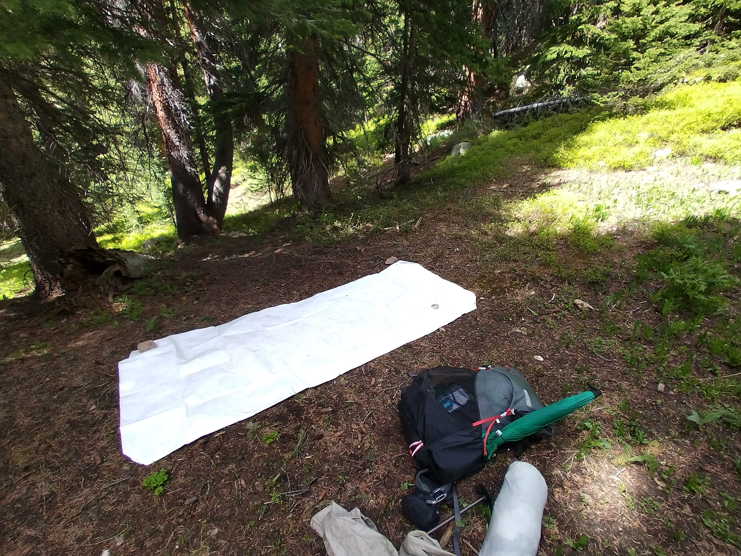
My sad attempted camp, where it hurt too much to lay down.
The pain of lowering myself to the ground... And getting up again, was so miserable...I asked myself what the hell I was doing here. Bruised ribs, sore muscles, a sick gut... Something had to change.
With some disgust, I packed up my things and marched back down the valley into the trees. Failure.
You never want to look it in the face. Or let it into your mind. I had a hundred recriminations for myself at earlier points... Warnings unheeded, blithely ignored. The sick gut was fully my fault. In prior days in high mountains, I didn't always treat the water. I had to own that one. Muttering and unhappy, I slowly descended.
I did run into Apples and her husband Man Hands. Wow...I last saw them in the Cebola Wilderness north of Pie Town, New Mexico. She had cheerful words of encouragement, but I didn't believe them. I was really thinking my trip is probably over.
Near the car, I met Anna and Matthew, two skinny students and keen hikers from the Denver area. I asked for a ride that direction, and they were happy to take me to Idaho Springs, so long as I promised to tell them everything I could about hiking the CDT. This cheered me up a good bit, taking me away from thoughts of failure. Matthew and Anna, thank y'all so much for your help and interest!
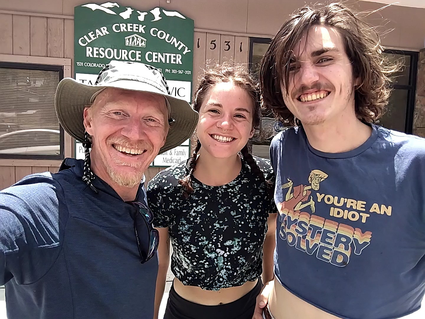
Thank you two for the ride to Idaho Springs!
I spent a night in Idaho Springs, calling my nephew Stephen in Denver. We hatched a plan to meet up there for lunch the next day. And so, I was going down to the flatlands, but with a more than faint hope of returning within a week.
To go forward to days 74 and beyond, click here.