CDT - East Glacier to Helena
Friends: CoryLocation: East Glacier, CDT Night 91, CDT Night 92, CDT Night 93, CDT Night 94, CDT Night 95, CDT Night 96, CDT Night 97, CDT Night 98, CDT Night 99, CDT Night 100, CDT Night 101, CDT Night 102, CDT Night 103, MacDonald Pass, Helena
Elevation gain: 11785m = 954m + 759m + 775m + 1143m + 1195m + 483m + 1144m + 1827m + 1311m + 839m + 959m + 396m
To go back to days 90 and before, click here.
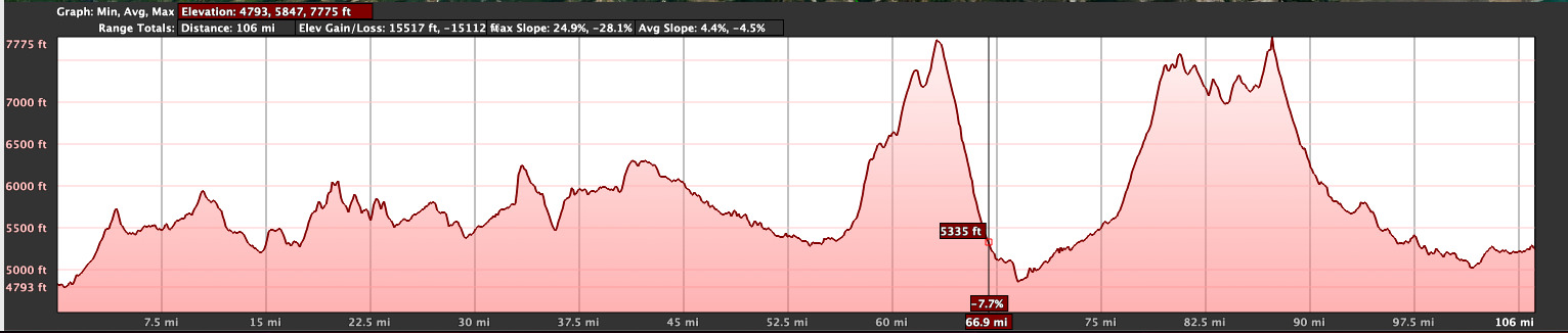
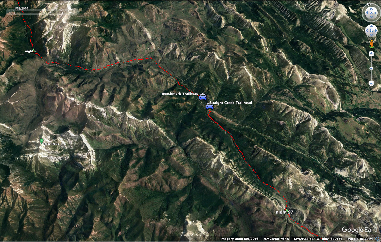
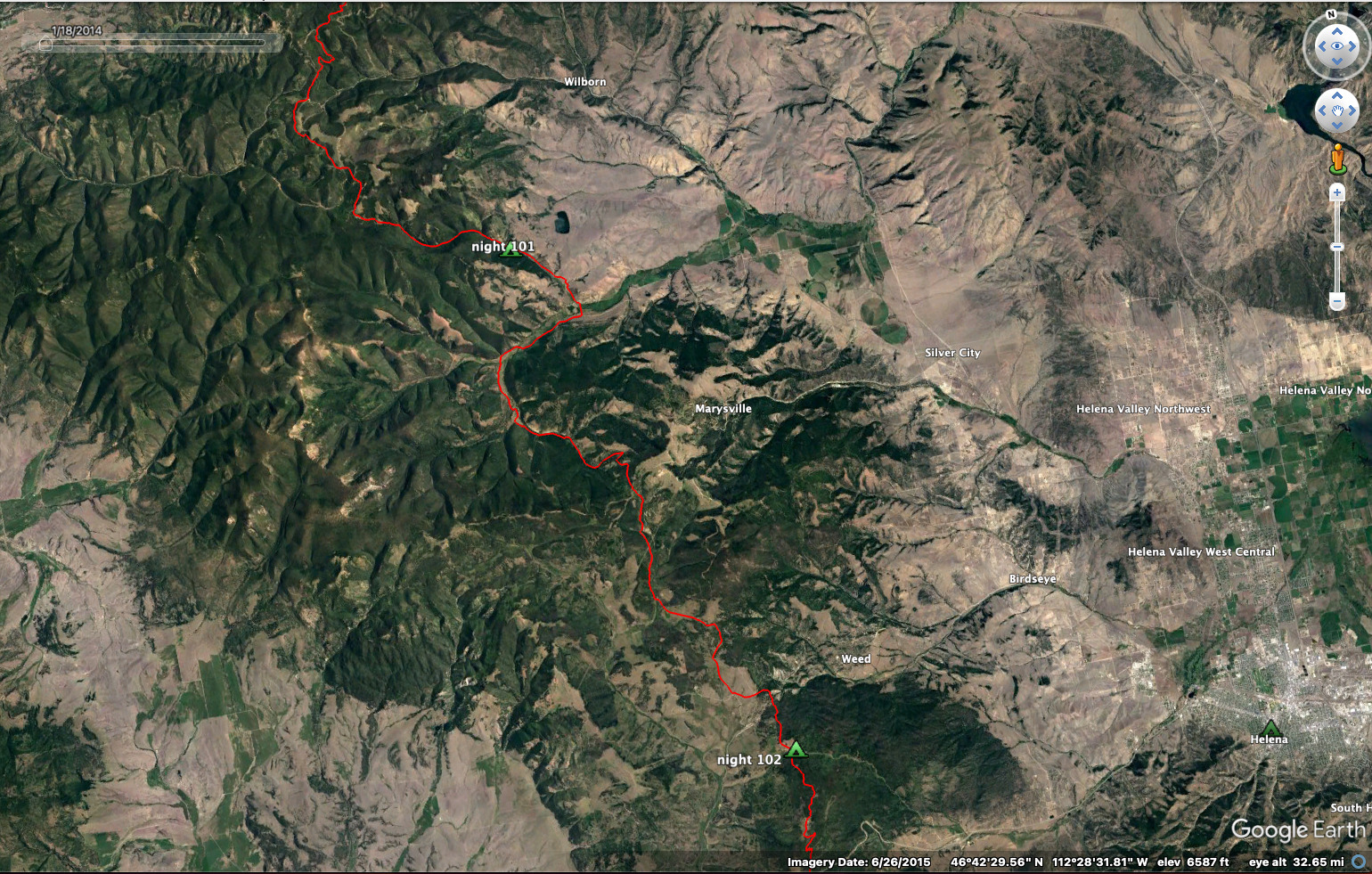
228 miles, 38,600 feet elevation gain. The short discontinuity is because
of a hitch to the Benchmark Wilderness Ranch, then another hitch back to
the trail (skipped a mile or so of road walking).
The text below refers to the same events as the blog entries:
July 1, Day 91
Zero day!
Cory and arrived reasonably early in town. We found a place for one night at Brownies Hostel and Bakery. "We'll take it." Along with a collection of delicious pasteries. My feet were so sore. The room was ready after just a few minutes of hanging out on a balcony upstairs. I took a shower and just went to my room to charge the phone, the battery pack, the camera. I spent time making a little movie on the phone and fell asleep while it uploaded.
I came out around 6 or so to find Cory sitting on the front porch conversing with other hikers. We got laundry started and headed over to the Whistle Stop restaurant, staffed by a gaggle of cheerful eastern european young men. "You know, the only hope for Europe to emerge from the hells of liberal hedoism are you guys?" I said, outing myself as the weirdo. But our waiter agreed with me. I was at home, lol...
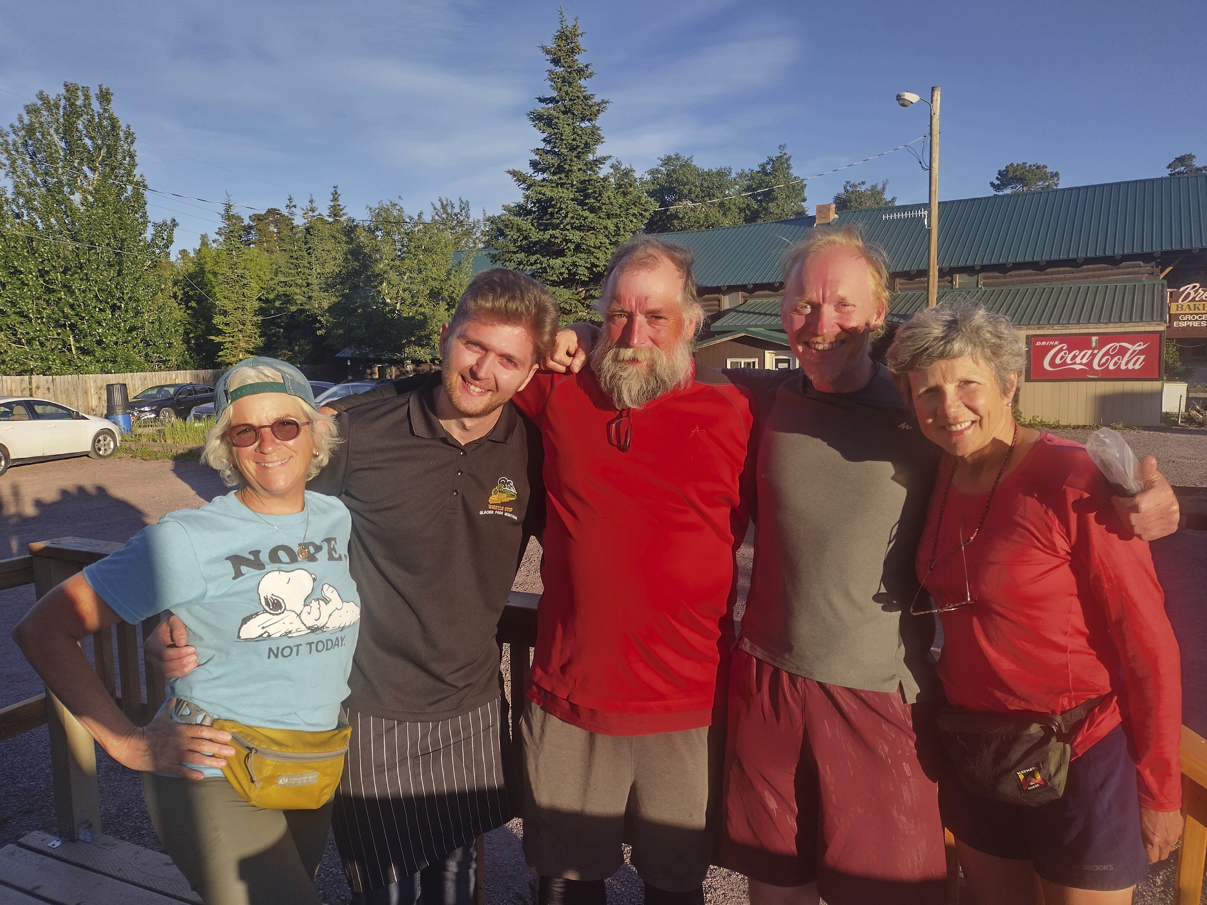
One of the east european waiters with Cory and I and two wonderful ladies
from the trail. The one on the left is called "Mix Tape," and she was
ending her hike here. The one on the right (U-Turn) continued on the trail at
a faster pace than I could keep.
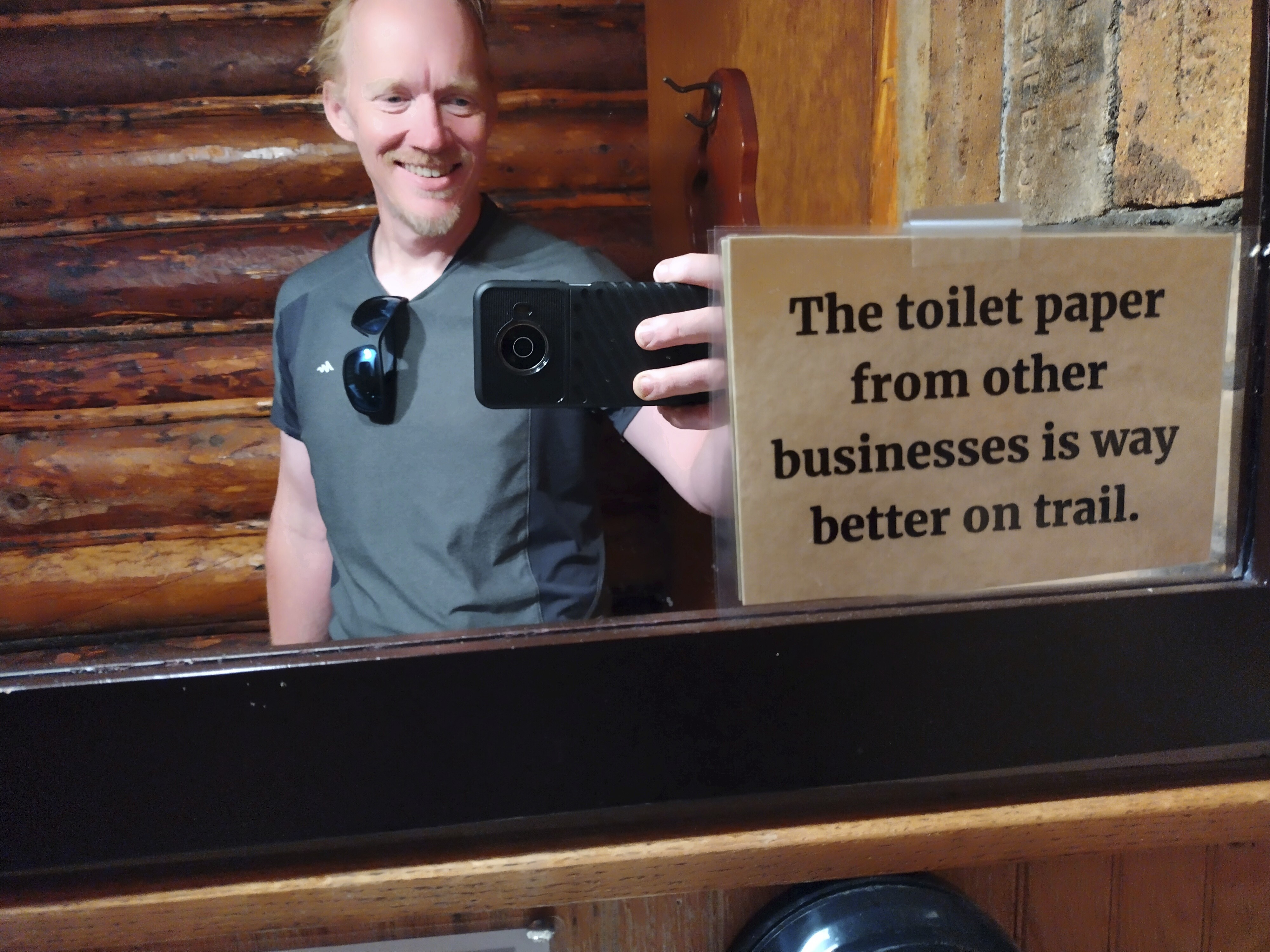
I loved this little sign. These people know hikers! We always steal toilet
paper. Cory was better than I, he always bought and paid for it.
In the last report I described how Cory's insoles helped me out in the last painful hour to town. I just had to get these insoles for myself. In fact, it was a very good purchase. The key insight here came from social class. Cory is a working-class man, not someone I usually see. He pointed out that the high-end "sports" insoles cost 50 bucks and are not very good. The best ones are 13 bucks, and have names like "Dr. Schols Shop Floor and Steel-worker Insoles."
This was absolutely correct. For the rest of the journey, my feet felt much better, so long as I had reasonably fresh insoles. I got new ones in Butte, Pinedale and a few other places as well. I found that doubling up insoles was helpful to a point, but with all the river crossings seemed to make it too crowded in my shoes, so I had to drop back to one. But always the "Steel-worker Insoles."
The food in town was so expensive. It cost over $100 to buy six days of trail food, and I don't mean fancy backpacker meals: just ramen and instant potatoes along with some jerky, oatmeal and candy bars. Cory had to buy headphones and I think they were fifty bucks, ouch!
The next night we ate at the same excellent restaurant with Mix Tape and U-Turn. It was neat (and rare!) to have dinner with some women roughly our age. There aren't that many older folks like us on the trail. I might be a snob, but I think we have deeper conversations. A table of twenty-somethings is full of stories about very very long days and stumbling through the dark to some fantastic situation. That just tires me out!
We had a little cabin to sleep in at the Looking Glass Hostel. The owners made a trip to the big city and picked up the insoles for me at a Walmart. Awesome. Cory got the bed and I slept on my mat on the floor.
July 2, Day 92
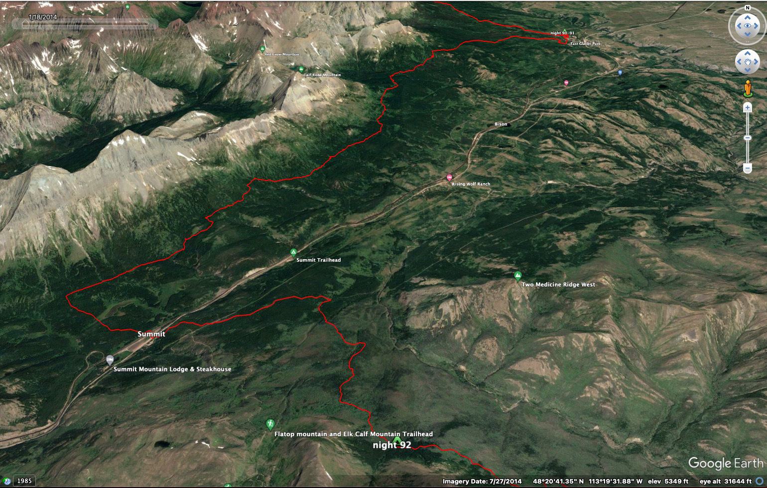
20.5 miles, 3100 feet elevation gain.
We were up and out pretty early, wanting to at least make it to the Summit Campground on highway 2, about 18 miles away. Many people were slack packing this section, shuttling back to town for one more night. I dislike carrying 6 days of food, it's the most I ever carried (like on the section to Pie Town last year). But there were no high passes to cross, so it was tolerable.
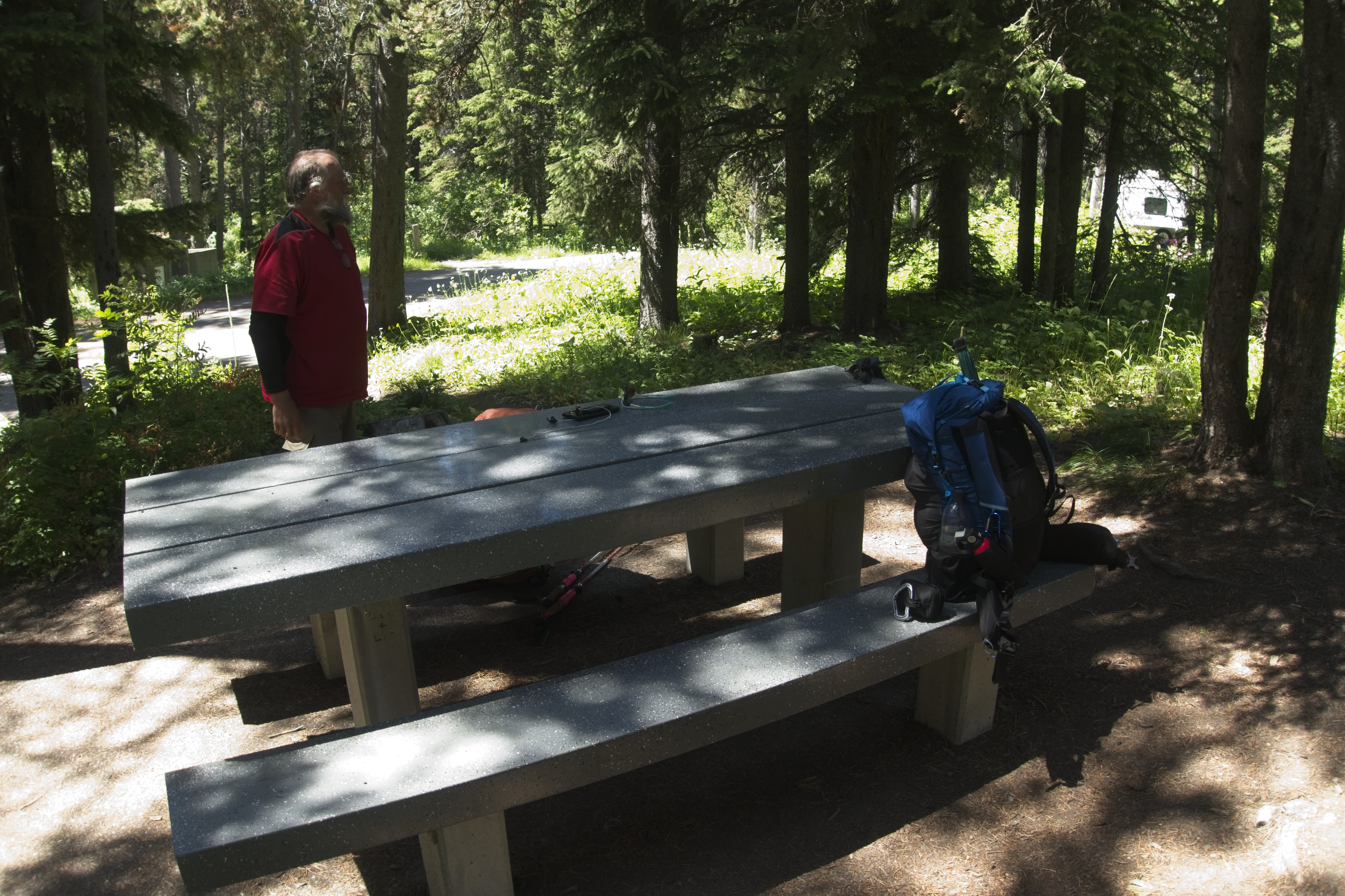
Cory and I lay down on this fine concrete picnic table for a rest before
getting a few more miles in.
We met some of the young folks along the trail, as by their slack-packing arrangement they were walking north. We were always in the trees, only once coming out above them for general views of a country baking in the sun.
At the pass we had to wait for a train to pass. I sat on my pack under a shade tree and waited, but Cory went and stood by the train in the sun. I was apprehensive about this section, which reportedly has the highest concentration of grizzly bears in the continental US. We saw much bear scat on the trail. But I was getting used to that, as Glacier was full of bear sign, too.
This section was special for Cory, as he'd tried to walk the trail in 2020, but got Covid in the Bob and was quite sick. He had to exit in the middle of the Bob off to the east, and told me about an adventure which followed on a tiny plane where he hitched a ride in exchange for his bear canister. They are worth about fifty dollars if unused, and everyone carries them everywhere up here.
I'd also bought a permit to cross the Blackfoot territory. Some of them regard Glacier National Park as stolen land, and some surly graffiti on a park sign gave vent to that frustration. Maybe one day they can call it their own again, who knows. The last one standing wins the game. But the land is huge and old. Won't it outlive even their passion?
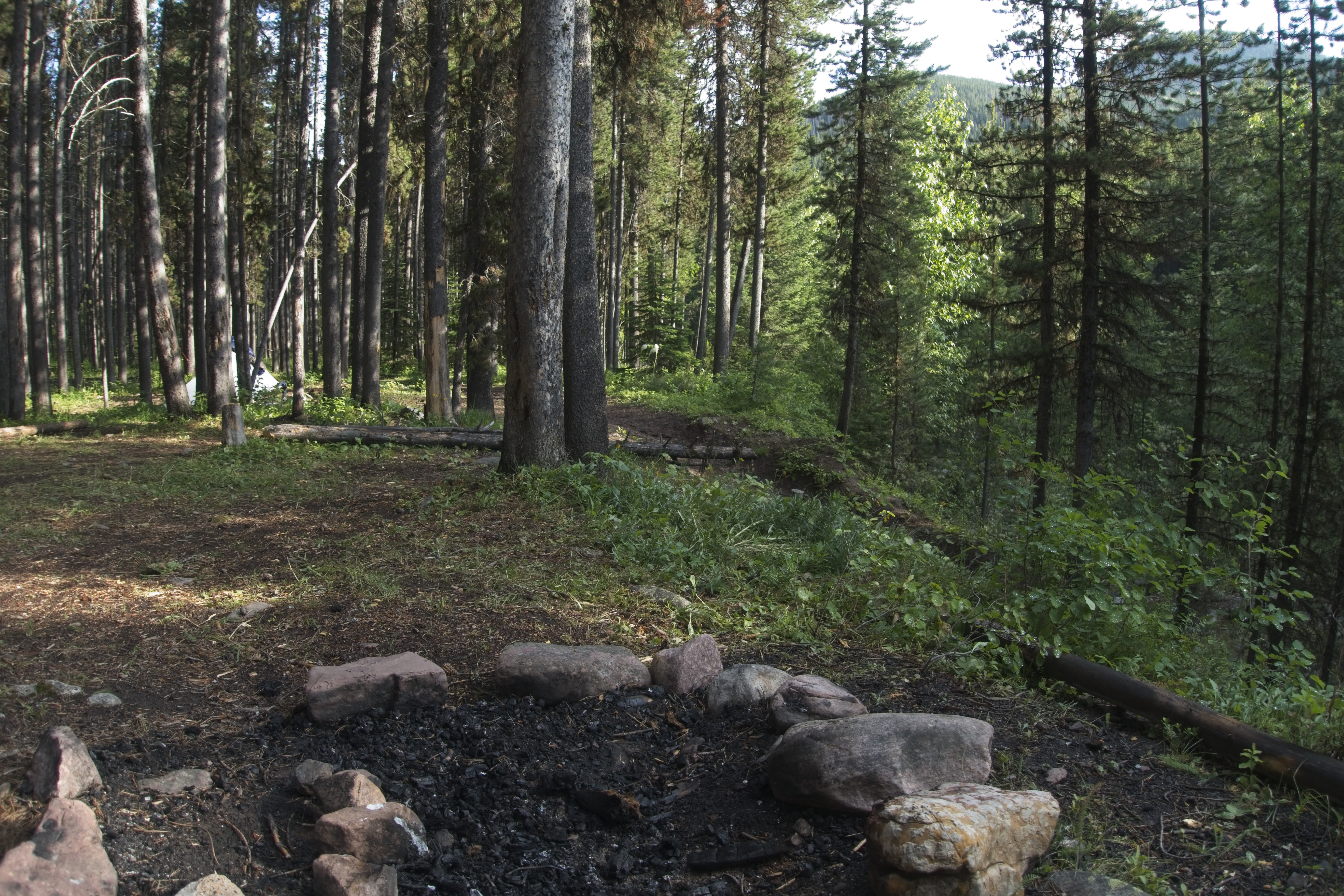
Tiredly, we climbed into the forest east of Summit, where Cory remembered some good camping spots. Some ptarmigans walked on the trail in front of me, cooing softly. We found a nice place, though a squirrel chided us until full dark, and then again at first light, desiring that we move on through.
July 3, Day 93
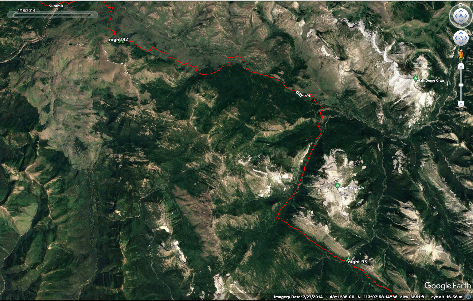
18 miles, 2500 feet elevation gain.
A long up and down walk through the trees. I suffered a bit because I knew there was an easier way along the valley floor, but Cory was keen to take this route. But I was happy in the end, because after all the ups and downs we crossed the river, then were able to take a shortcut further on that saved a big hill climb. The shortcut required some cross-country walking for oh, a quarter mile or so. I kinda expected a bear every moment.
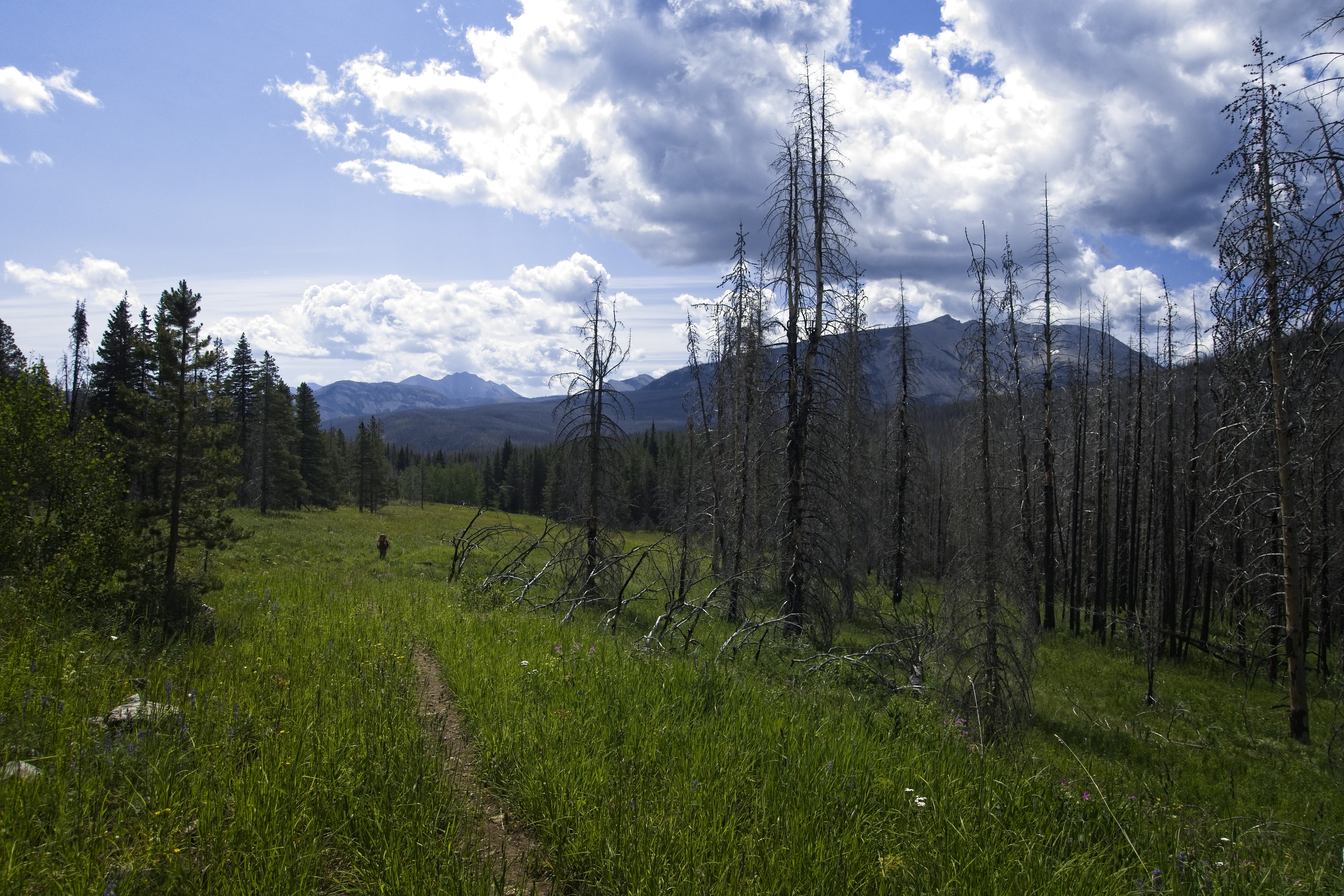
Finally heading south and into the Bob.
Cory's big map of the Bob Marshall Wilderness Complex was a lot of fun to look at during the day. "You know, Cory, we won't really be in the Bob until tomorrow."
"What!" he said, surprised. He'd been describing the country in a big way, saying "you know, here in the Bob, there are very few people." And similar statements. He pretended to be deflated by my lawyer-like technicalities. I'd shine him on a bit by making replies that agreed in general, but firmly maintained that we weren't there YET.
"Why yes, so I hear. When we arrive in that fabled country we may indeed feel a sense of isolation! Though, for now, I do attest that this Forest Service land is reasonably expansive and isolated, if lacking a certain grandeur."
Grr.
Haha. This is how thru-hikers entertain themselves. But seriously, his map was a great joy to look at. In fact I'm ordering one today just to peruse it back here in Germany.
We hadn't seen anyone all day. I made a bozo move at one point. We walked along in open forest, pine needles on the ground, with the land sloping uphill on the left. Suddenly I came upon a pile of bones and matted hair from a big animal...maybe a moose or elk. "Hey," I said to Cory, behind me a little bit, "look at this, wo--"
"KEEP MOVING" he said.
Oh...right! This was here because a bear was chewing on these bones and dropped it. Bears are territorial about their carcasses. Holy heck -- we might be under surveillance right now. Needless to say, I got moving, and quickly.
Afterwards I found it funny that, yes, I knew about that, but in the moment I was wide-eyed and happy-go-lucky. It's an unfortunate personality trait. On several other occasions Cory was much sharper about knowing what was going on around him than I was. Good fella to have along!
We reached camp and enjoyed the solitude. But just as we imagined we'd have it to ourselves the gaggle of folks from town arrived and set up all around us. By the end there were at least twelve tents. I fell asleep to music since the young folks talked until deep in the night. I also got in a meditation session, which was too rare.
July 4, Day 94
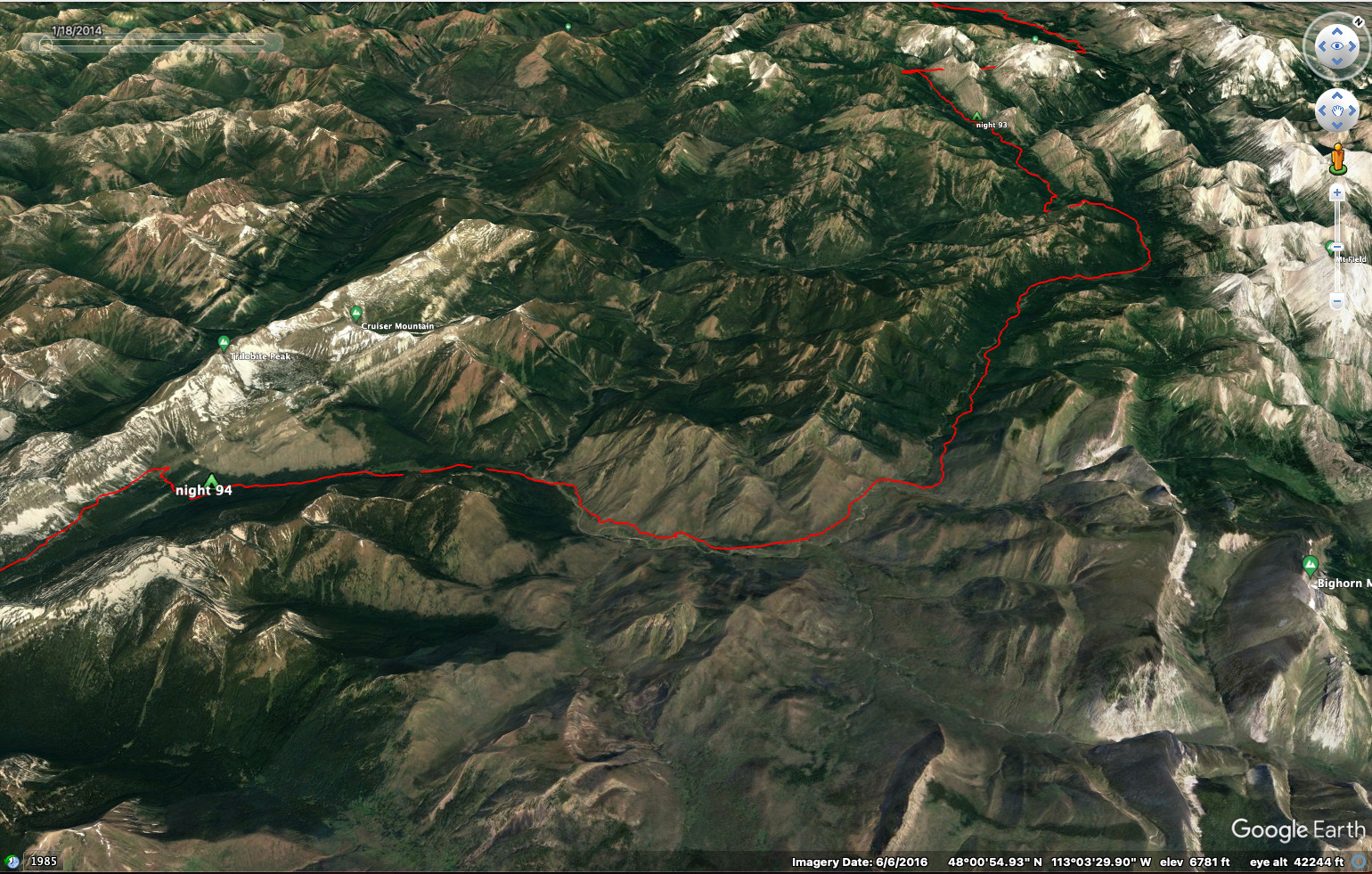
23 miles, 2500 feet elevation gain.
Cory and I were up and out early, he a bit miffed at all the noise and crowd of the night before. It was much like the night at Many Glacier. "Soon we'll be spread out, and crowds will be a thing of the past," or so we hoped.
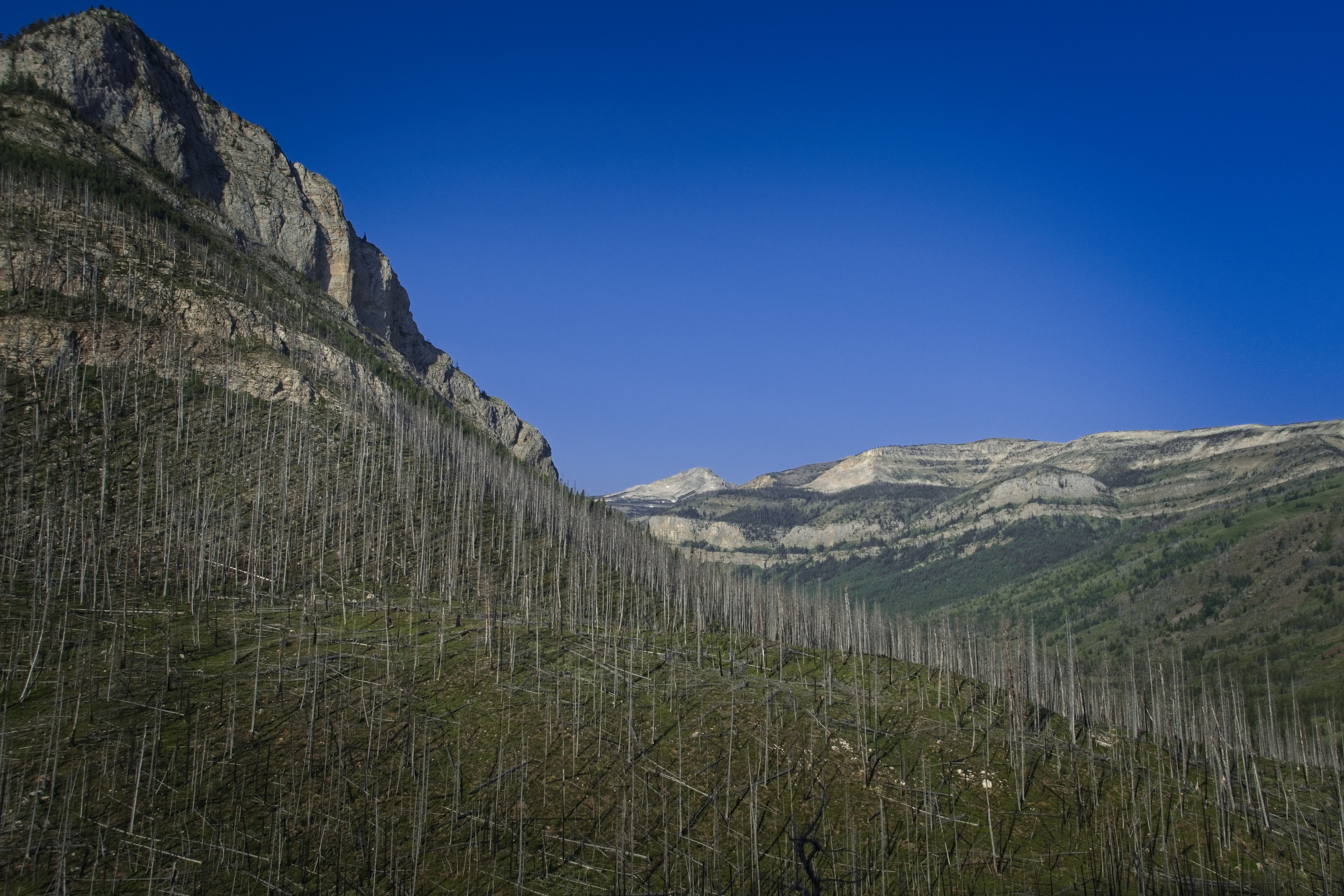
I was freezing in the damp morning. My fingers lost their feeling and I stopped to get wet gloves on. It rained on and off, with peaks visible in the distance. I lost Cory for a while in here and spent a few solitary hours in the misty high country above Beaver Lake. Eventually the sun re-emerged. I came upon Wrecking Ball and her friends, who told of the terrible fire that engulfed this place more than a decade before. I somehow felt the forest was resilient and more than equal to the fire. At any rate, we were finally in the real "Bob."
Cory in sunnier country south of Badger Pass.
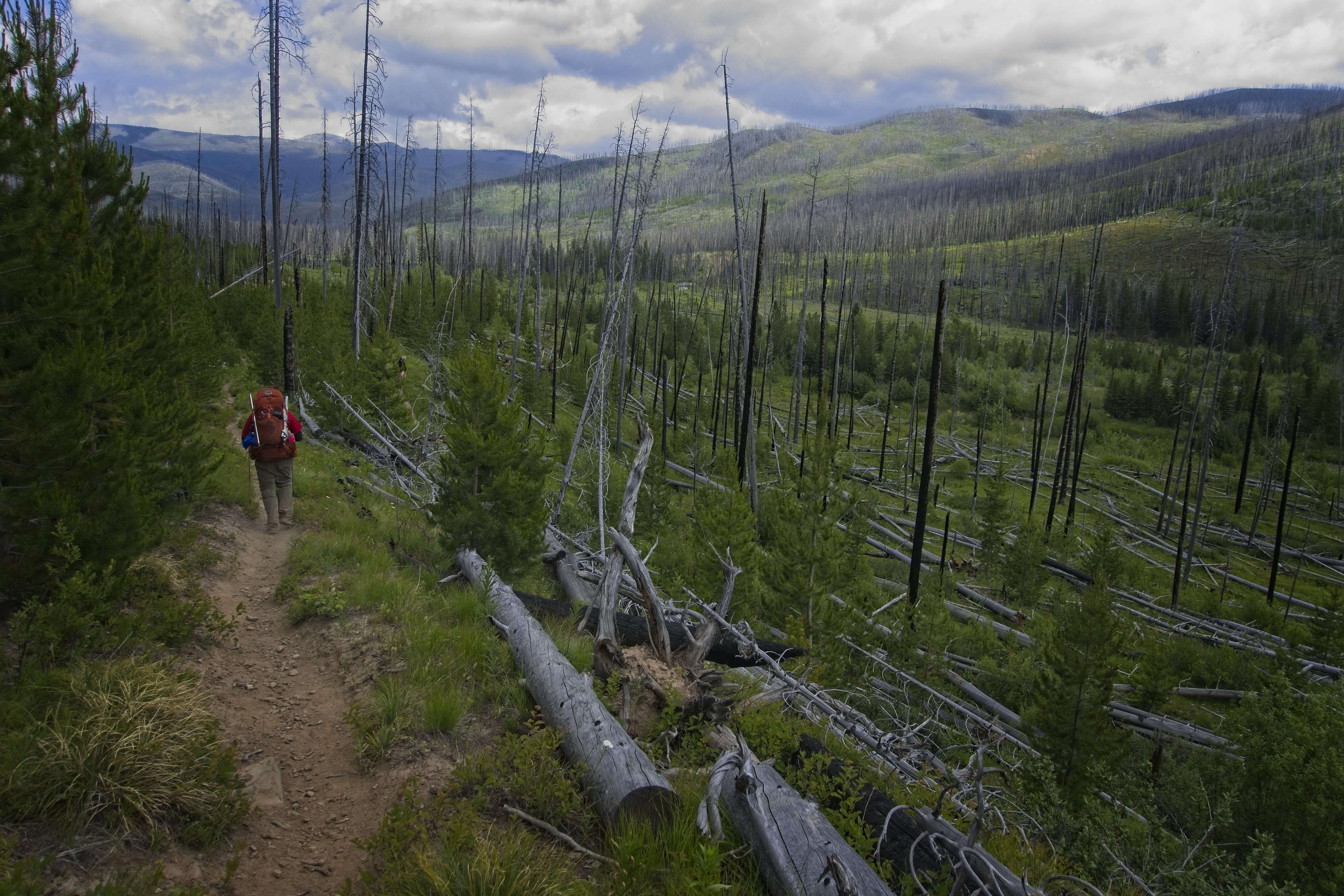
Long, isolated valleys.
I was keen to take the Spotted Bear Pass alternate, which would save almost a day. But Cory needed to follow the official route, because it was from there that he'd left the trail three years before. So we had a final companiable walk to the junction point, planning to meet up again in Helena. I had his email, since SMS messages didn't work well with my german phone.
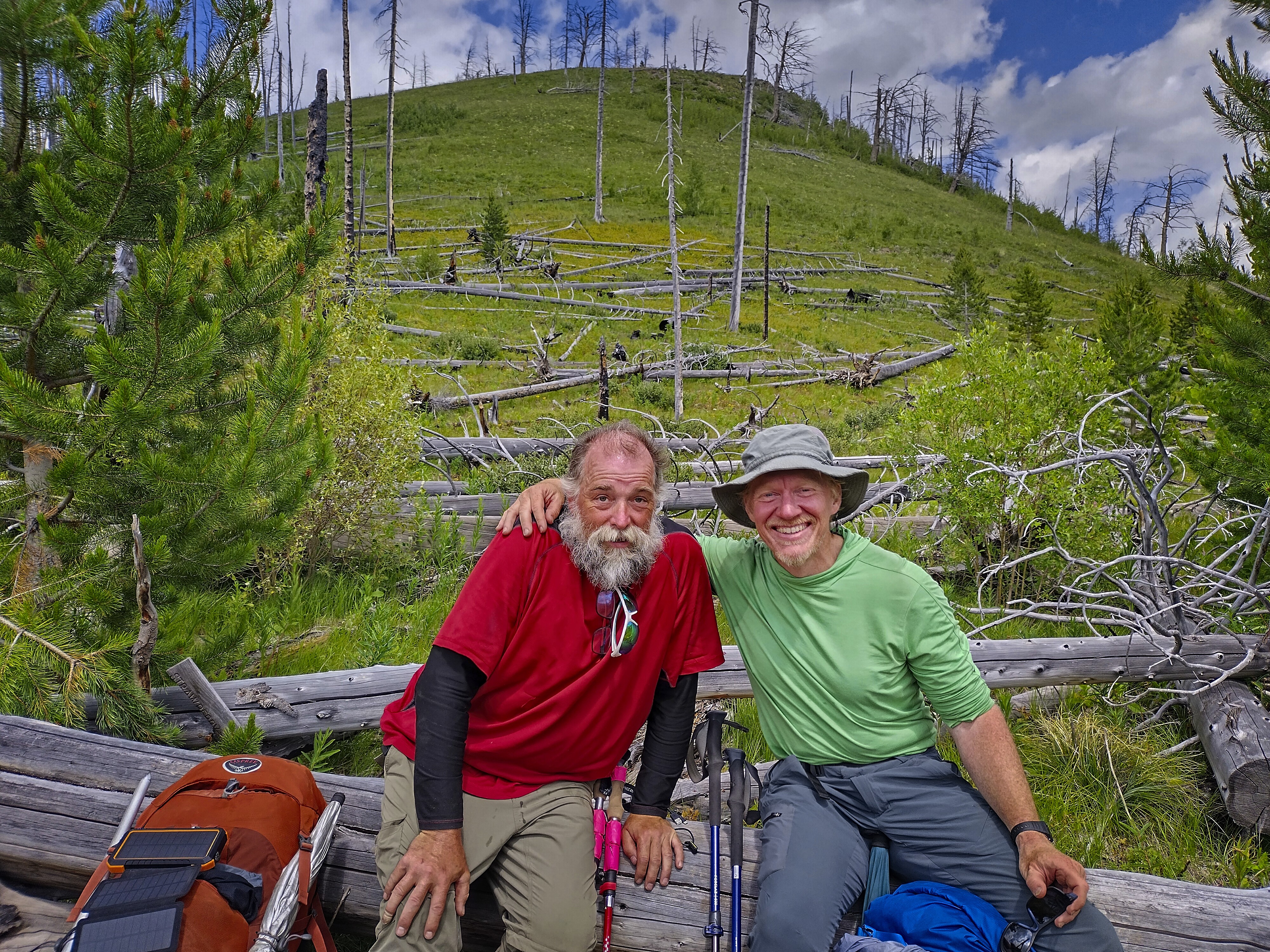
Cory and I part ways for, as it turned out, 11 days.
I moved quickly west for a mile or so to a point where I could cross the Flathead River at a ranger cabin. I rested there a few minutes with Wrecking Ball and her crew, then set off again. I was getting used to the thigh-deep crossings, but blisters became a problem because I never had dry feet anymore for many days.
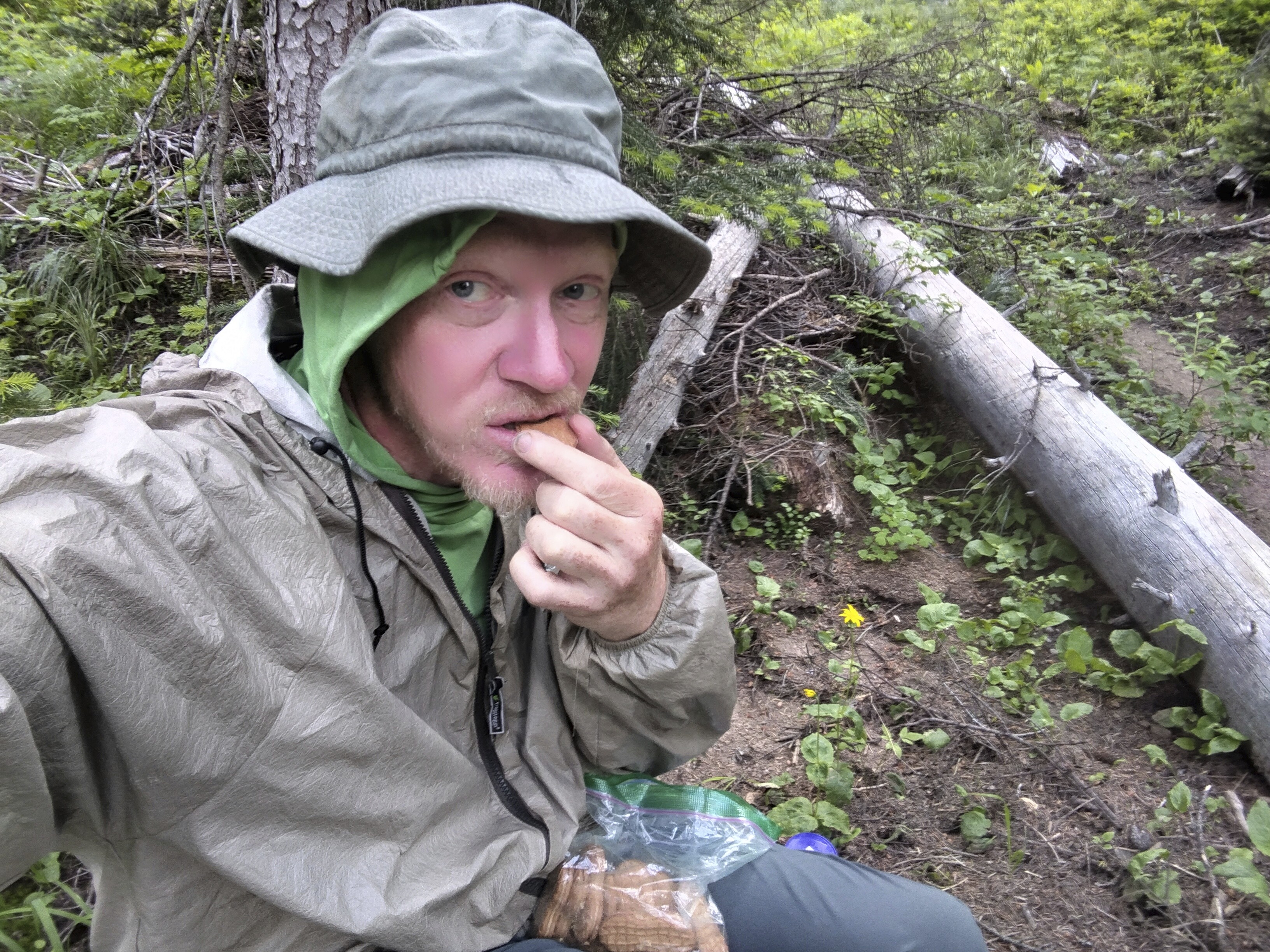
Snacking on Nutter-Butters in the damp forest.
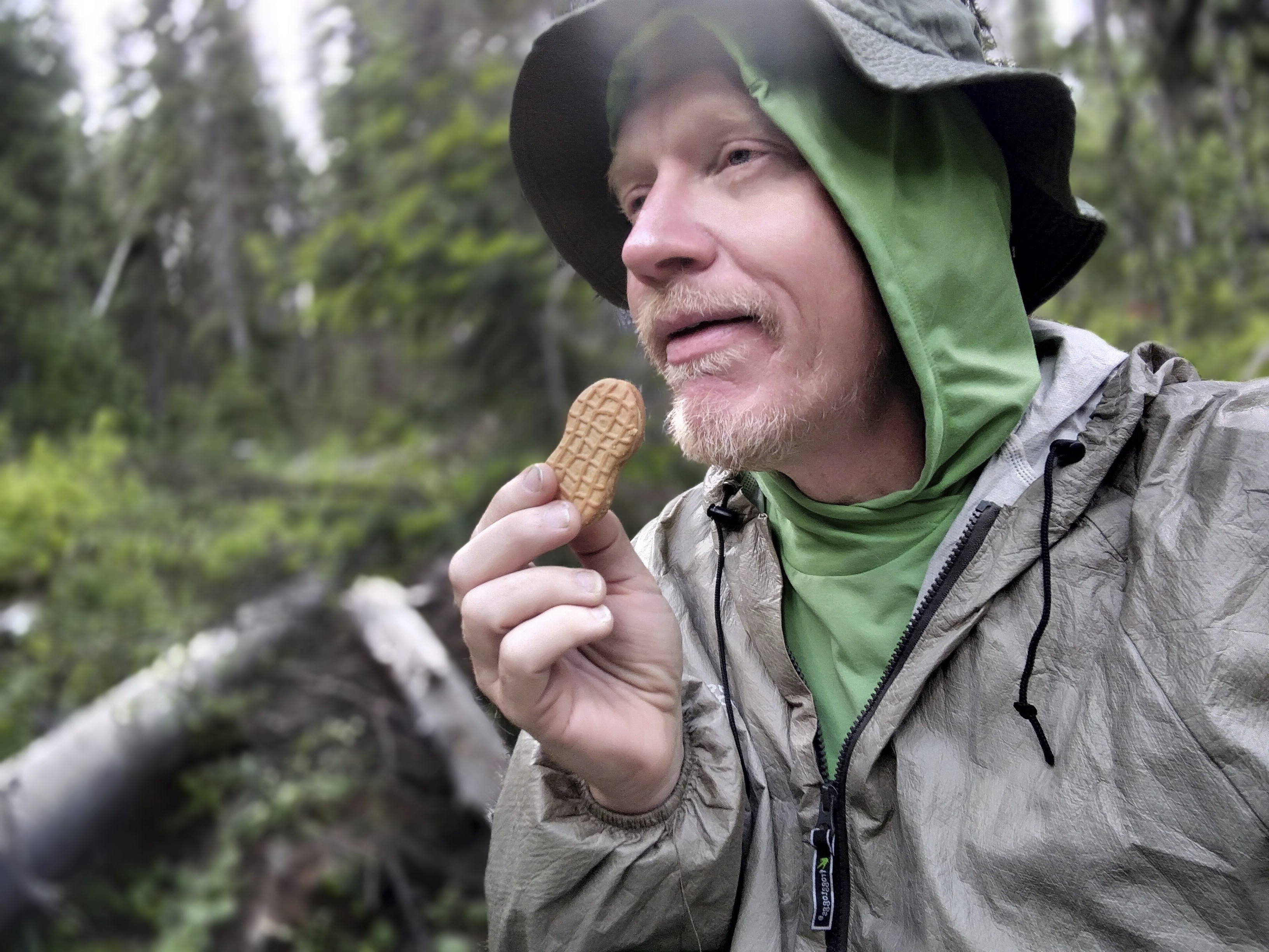
Hamming it up for the camera. I wanted to indicate the sublime joy these
calorie-rich cookies brought me.
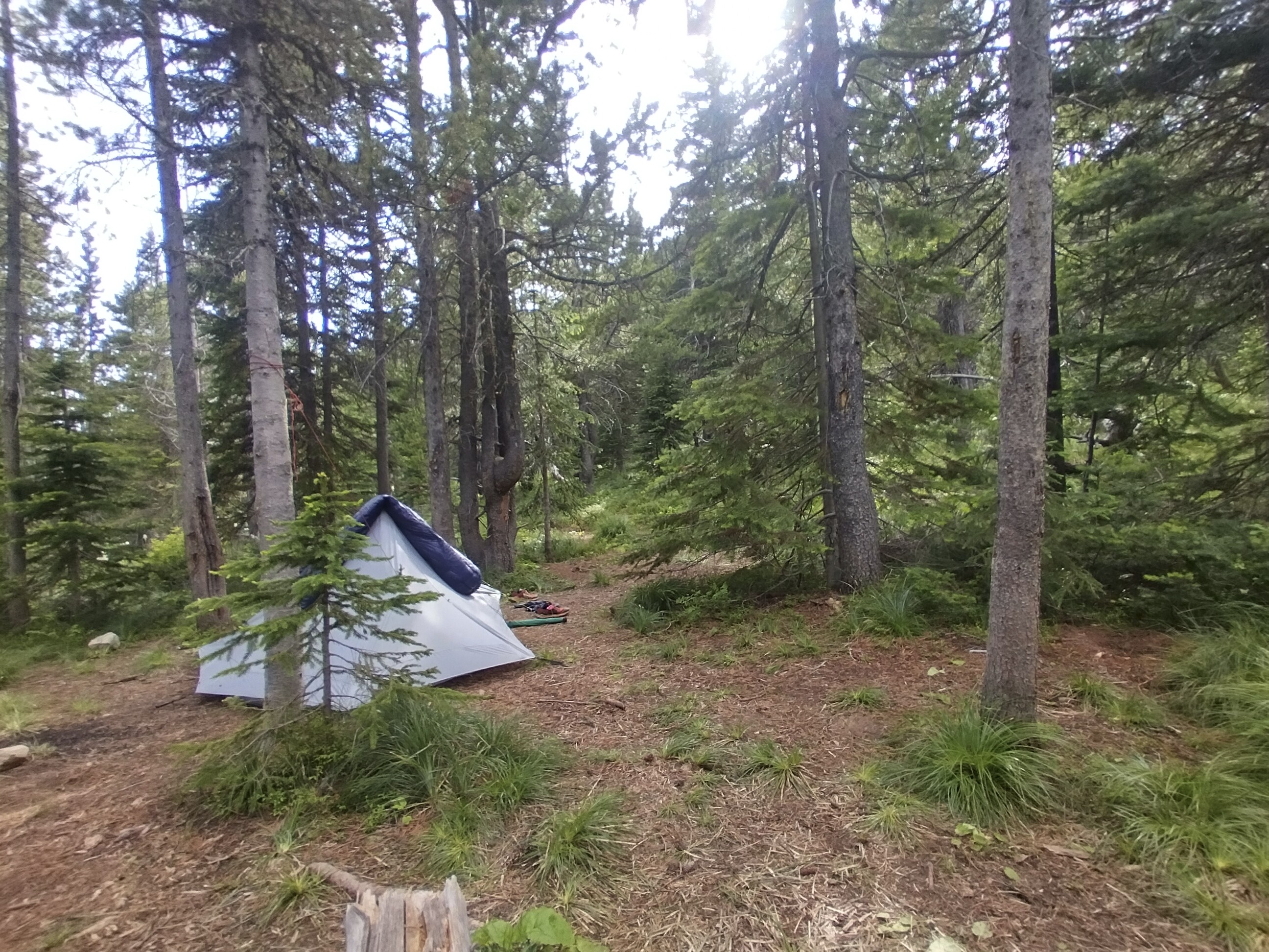
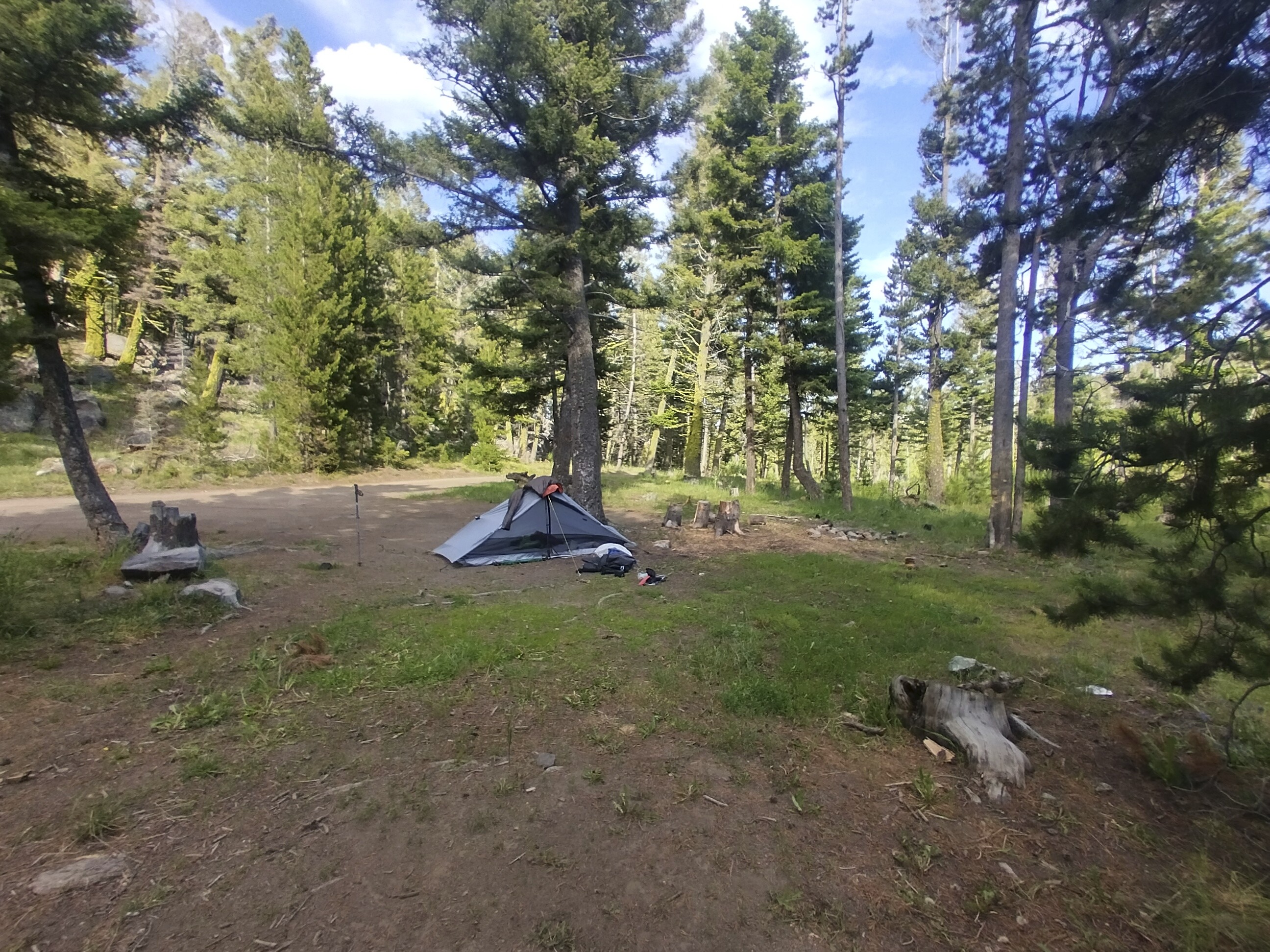
It was starting to rain again and I was unsure about where to camp. There was a big climb coming up, but I was tired out. I decided to camp right at the base of the climb if I could find a flat spot. Happily I did, but it was right by the trail. This worried me a little bit. I know the bears use the trails at night. If I'm right next to it, maybe I'll be an object of curiosity. I spent many minutes wondering if an open rain-fly or closed fly would be better in that case. Would the bear fear the unknown behind the gray screen of the tent? Or would my snoring drive him into rough contact with me?
You really just have to put it out of your mind and sleep with the trust of a child. But the bear spray is always next to me.
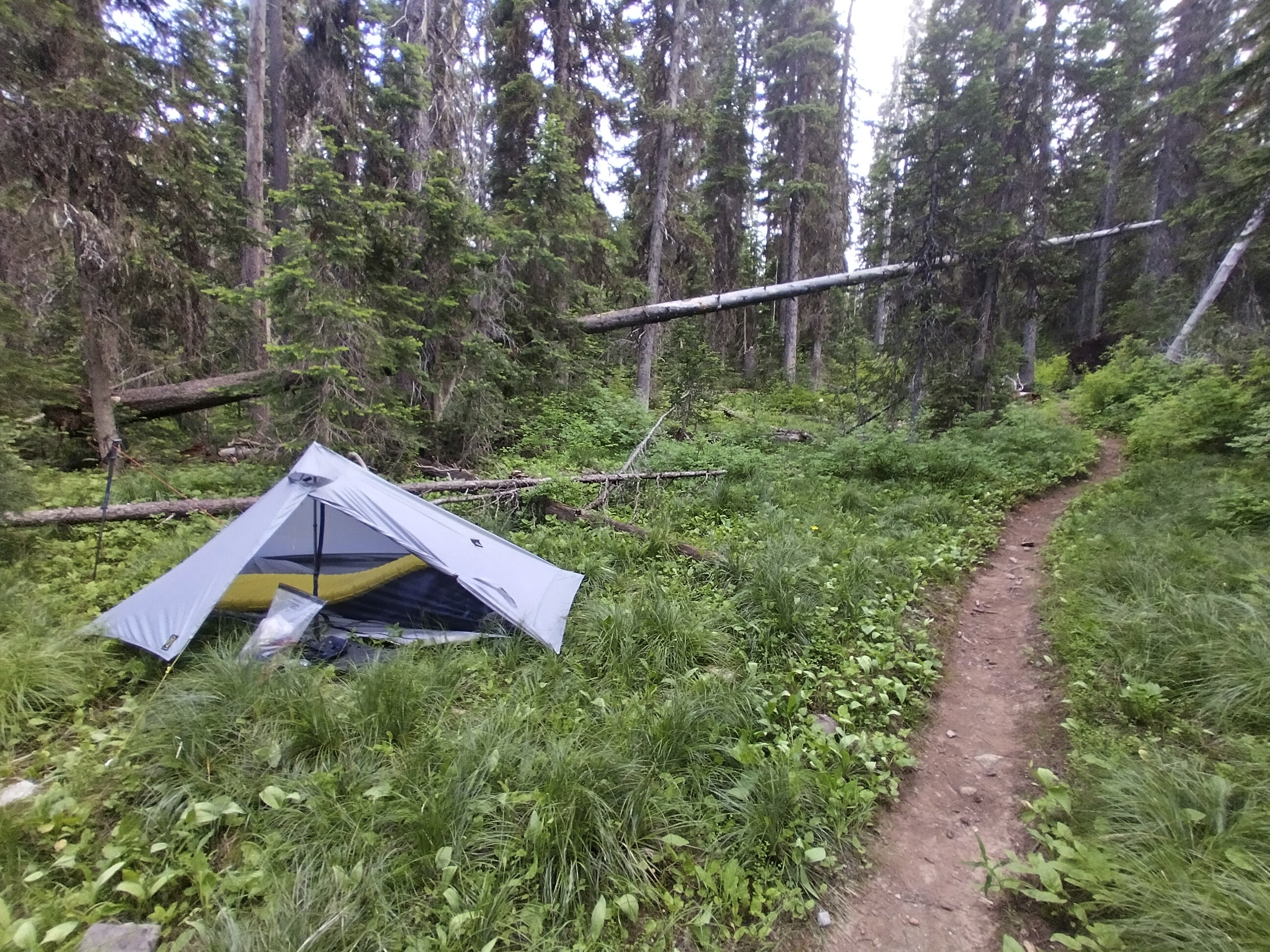
My camp right by the trail.
I was glad I stopped because it began raining hard just after. A few hikers passed by as I drifted off to sleep.
July 5, Day 95
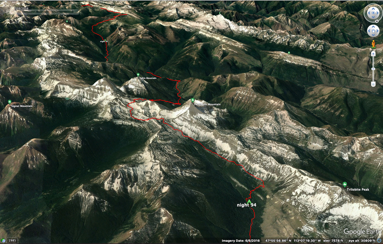
19.7 miles, 3750 feet elevation gain.
The steady switchbacks warmed me up, though the wet grass meant my feet were soaked after only 10 minutes in dry socks. One difficulty with a lightweight single-wall tent is that stuffing it into the pack means the whole thing becomes wet. If you have a rainfly, then at least the inner tent can remain reasonably dry. I was glad for the capacious mesh pocket on my pack for such wet mornings, as it meant that I wouldn't have to put the wet tent into the pack body. Constant thinking about moisture is the name of the game!
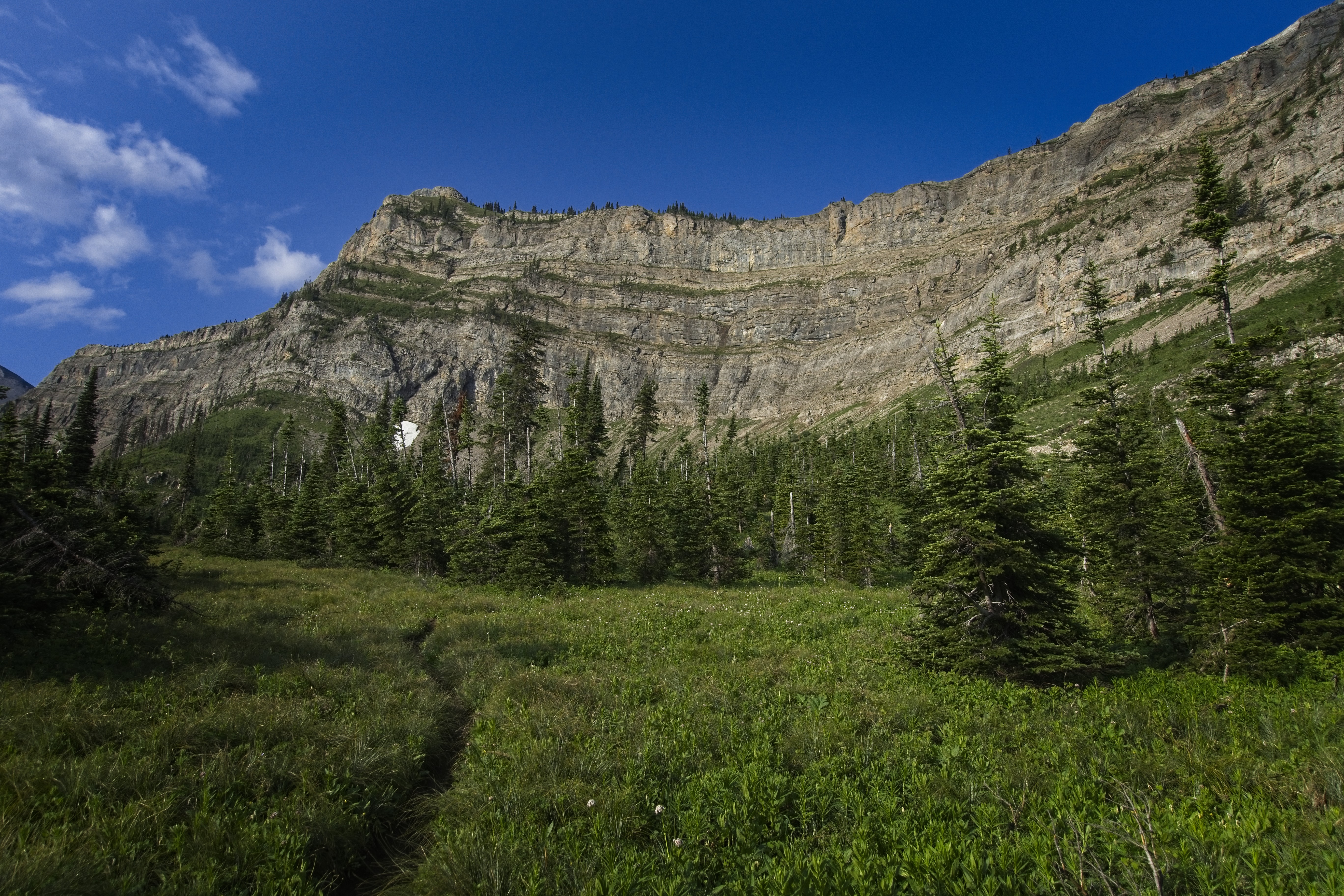
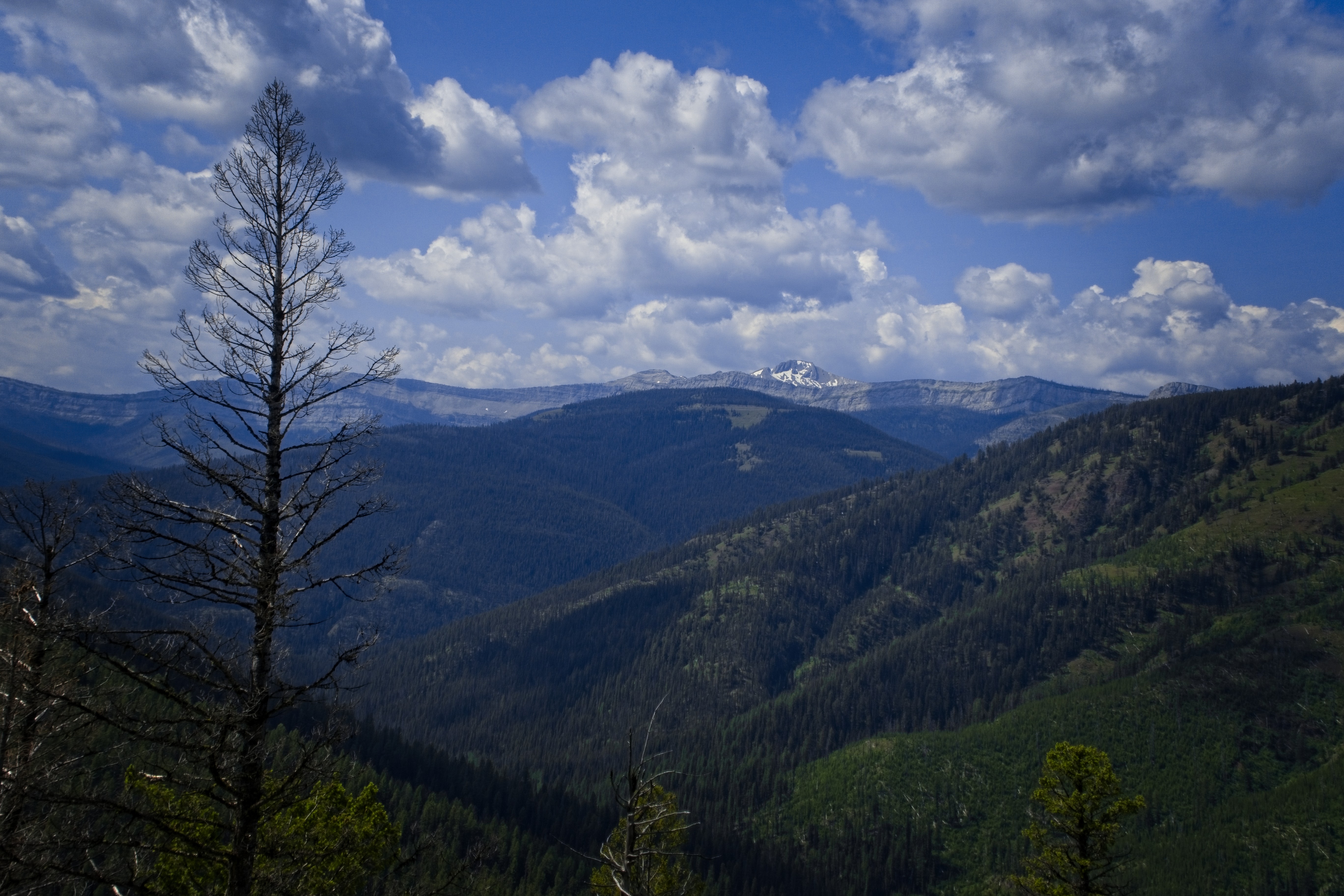
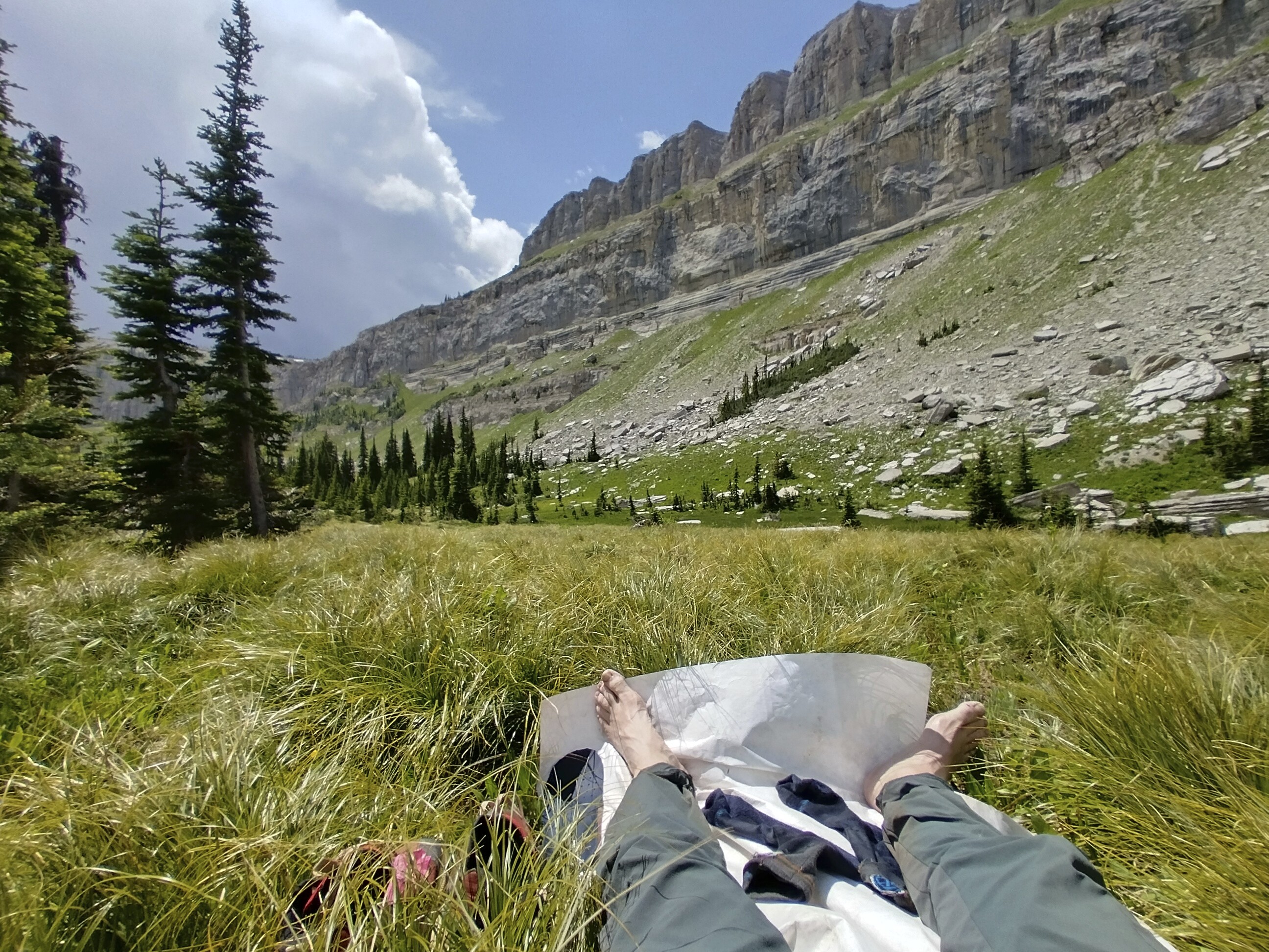
I popped out into a meadow with cliffs of the Trilobite Range above. There was even some fresh snow. I wondered where Cory spent the night. If he was up high he might have been snowed and rained on.
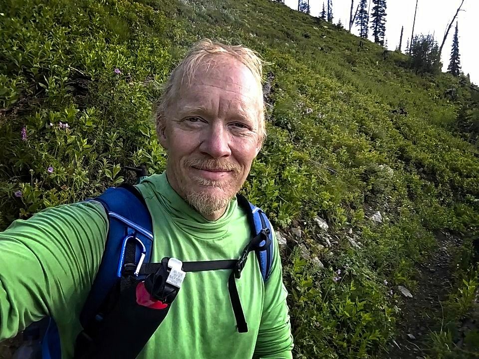
Self portrait under the Trilobite cliffs.
It felt great to be above the trees for a while and let the sun dry me off. I passed a little tarn and continued under the northeast flank of Pentagon Mountain. Then on to Dean Lake where I munched second breakfast. Generally I had something to eat at every stop during the day. First stop, oatmeal. Second stop, some kind of clif bar. Third might be lunchtime already, but often it was a kind of third breakfast. Last year, I usually went 2 hours between stops, but somehow this time it was closer to an hour between stops. Getting older!
I made it up to Switchback Pass and put my tent in a tree to dry. It's possible to take a side trail here over a flank of Kevan Mountain and hook up with the official line on the other side of that peak. Nah! I was content to go down (and down and down) along the East Fork of Pentagon Creek. This was a full 3000 foot descent. In the distance I saw the Chinese Wall with a snowy peak amidships.
Pentagon Mountain to the south.
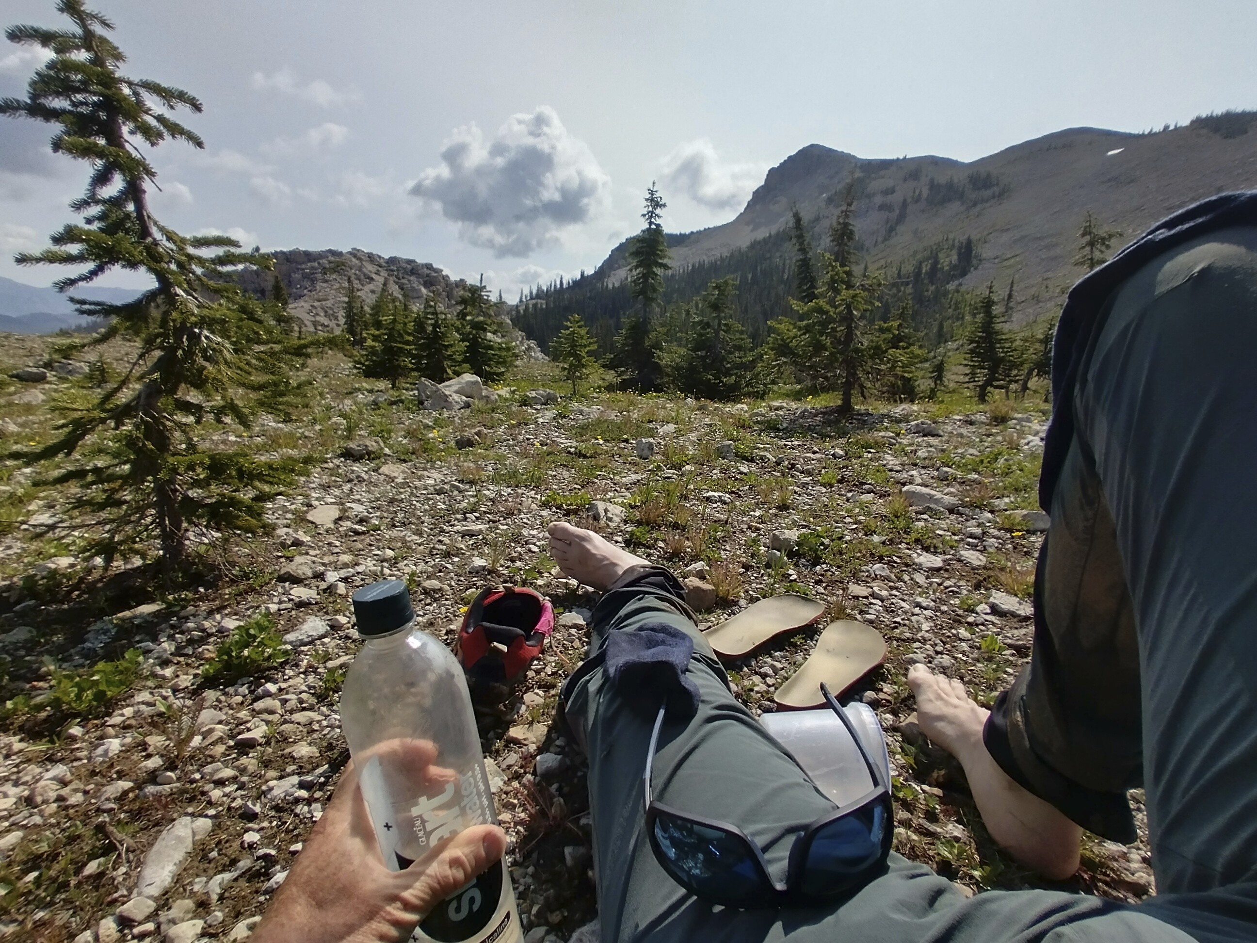
Sitting around at Switchback Pass.
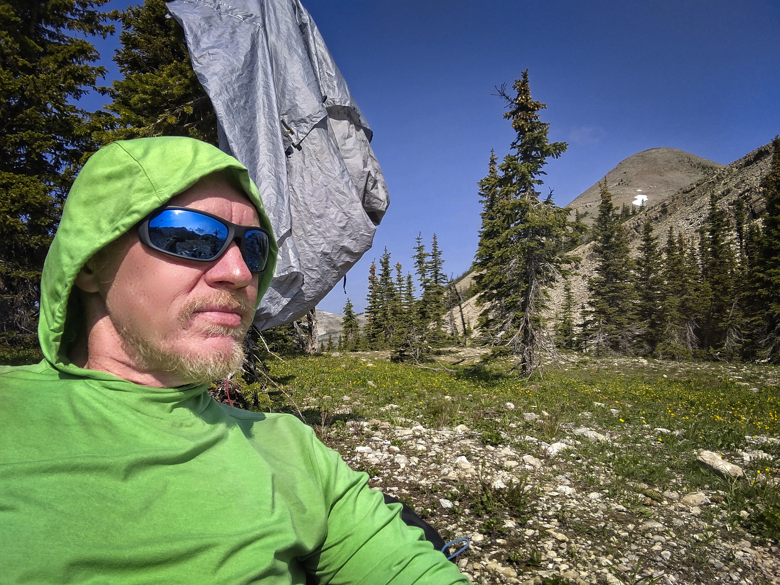
Note the tent drying in a tree -- very important!
A view out to the Chinese Wall, a problem for tomorrow.
Once down, the trail crossed to the west side of the creek and maintained a pleasant and level height above the river for over a mile. I enjoyed this stretch. No downed trees, no wet brush...just nice walking. It dropped down to the Pentagon Ranger Cabin where some hikers were drying gear. I rested a moment then forded Pentagon Creek and came into the Spotted Bear drainage. It also had a fine trail that stayed high, this time on the east side of the creek, mostly.
I was getting tired and looking for a flat place to camp. I wanted to stop before climbing up to Spotted Bear Pass. It also looked like it was going to rain, and I hate setting the tent up in rain. I found the flat area, big enough for several tents, though someone was already camping there. As I approached I said "hiker coming in!" and heard a friendly voice say "come on down" from inside the largish yellow tent. I was camping by "Rocketlama," an interesting woman from Portland, Oregon who writes a web-comic and drives a truck to make a living. She said it's an expensive city but wouldn't want to live anywhere else. She'll never be able to afford a house. Actually her story was a little bit sad...of the "I want to...but I can't" variety. Heck, we all get stuck in loops like that.
But Rocketlama was also cheerful and funny. She thought she might have to end her hike early due to an injury, either at the Benchmark Ranch or Helena at the latest. I advised her to go on to Helena if she could, thinking that it would cheer her up to ensure that her return to the trail later would be easier. But really the injury is in charge, too.
Here is her website. I like people who are all sensitive-like and overthink things. I feel seen, lol.
July 6, Day 96
21 miles, 3920 feet elevation gain.
I tried to get up quietly so as not to disturb Rocketlama but I called out a soft see ya later as I left and she said bye. As usual, my socks and pants were sloshing after an hour in the brush. The trail gradually mounted the east valley wall and rounded slowly up to the pass. I was excited to be here. How often had I wondered about this place in the months before! It represented a place deep in the Bob, but also a point more than halfway through. It marked the re-joining of the Red Line (the official trail) and the ending of the Spotted Bear Alternate. In theory, I could run into Cory anytime along in here, though I figured I'd be almost a day ahead of him. However I didn't rule out him pulling a double-day with a kind of magnet in front of him! So I looked around for my red-shirted friend, though he was nowhere in sight.
My diary indicates I thought a bear was off in the brush about 30 feet away from me somewhere during this morning, but now I don't remember that. Huh!
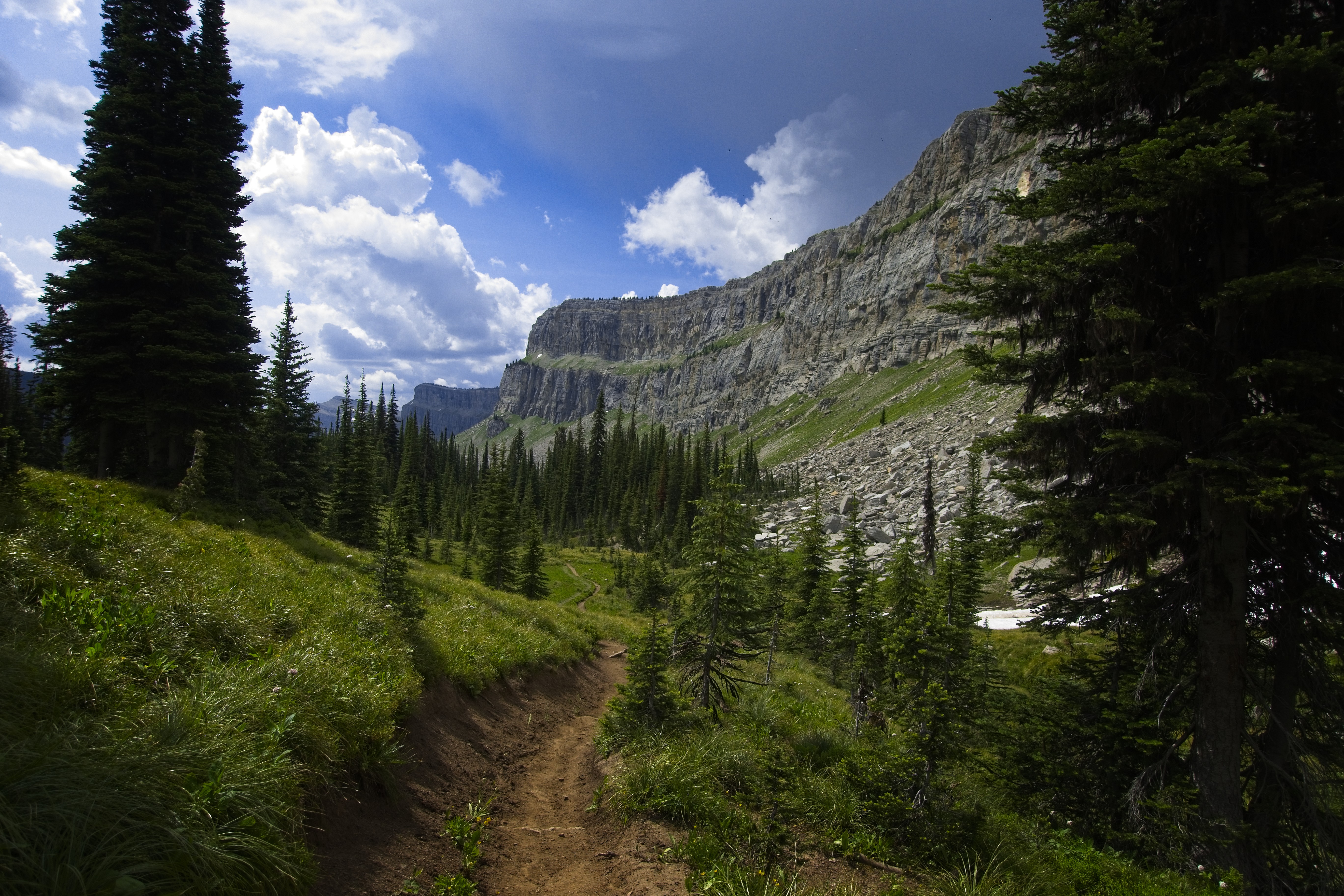
Walking south under the Chinese Wall.
I saw that rare thing in the Bob, the sun, as I climbed above the pass on a few switchbacks up burned forest slopes. I came to a lake (called My Lake, kind of like "My Documents" in Windows), then climbed and descended a notch east of Larch Hill. I took a wrong turn here, following a track that led west up to Larch Hill Pass, which would take you to the Chinese Wall High Route. I thought about taking that variation but the possibility of snow up there disuaded me. Also, I thought the glory of the Wall must come in part from it towering above you, rather than walking on top of it. I traveled cross-country to rejoin the trail, finding myself peeved at the end of the bushwhack when I soaked my shoes and socks again in a marsh. Dag-nabbit! My feet were suffering in the constant damp, though realistically I still had three days of water-sloshing travel.
But the wall was in front of me, stretching for about 5 miles. Immediately things got interesting. Storm was brewing just behind me...the clouds back there were far darker than I wanted to admit, and it was still early. In fact, the Wall turned out to be a kind of race. The storm was moving south, and I'd often be at the edge of it, alternately thrusting forward on the trail under spattering big drops of rain, and making the most of hot rays of sun.
I'd stop for a while and take off my shoes, only to be chased away by a gust of wind bringing the smell of rain, hard on my tail.
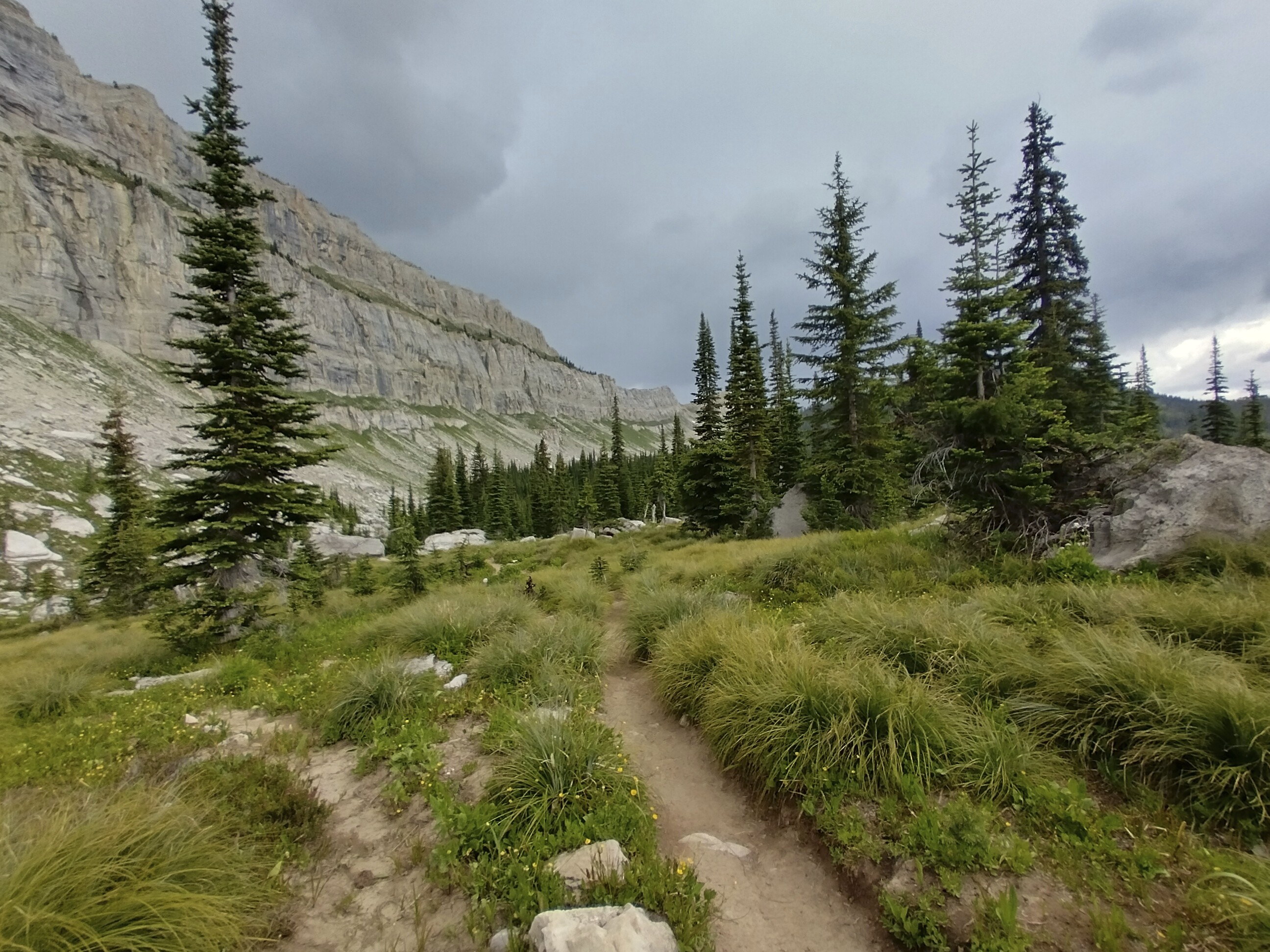
Looking behind me to the chasing storm.
Enjoying the sun to the south. Always on the edge, I was!
Eventually I climbed to a pass under Cliff Mountain. I took the interesting detour to an overlook hard under the steep cliffs of the wall. There was a great view back over the trail. Funny though, the pictures didn't make my short list of pictures for this report (I've got about 450 "3+ stars" pictures, out of more than 2000).
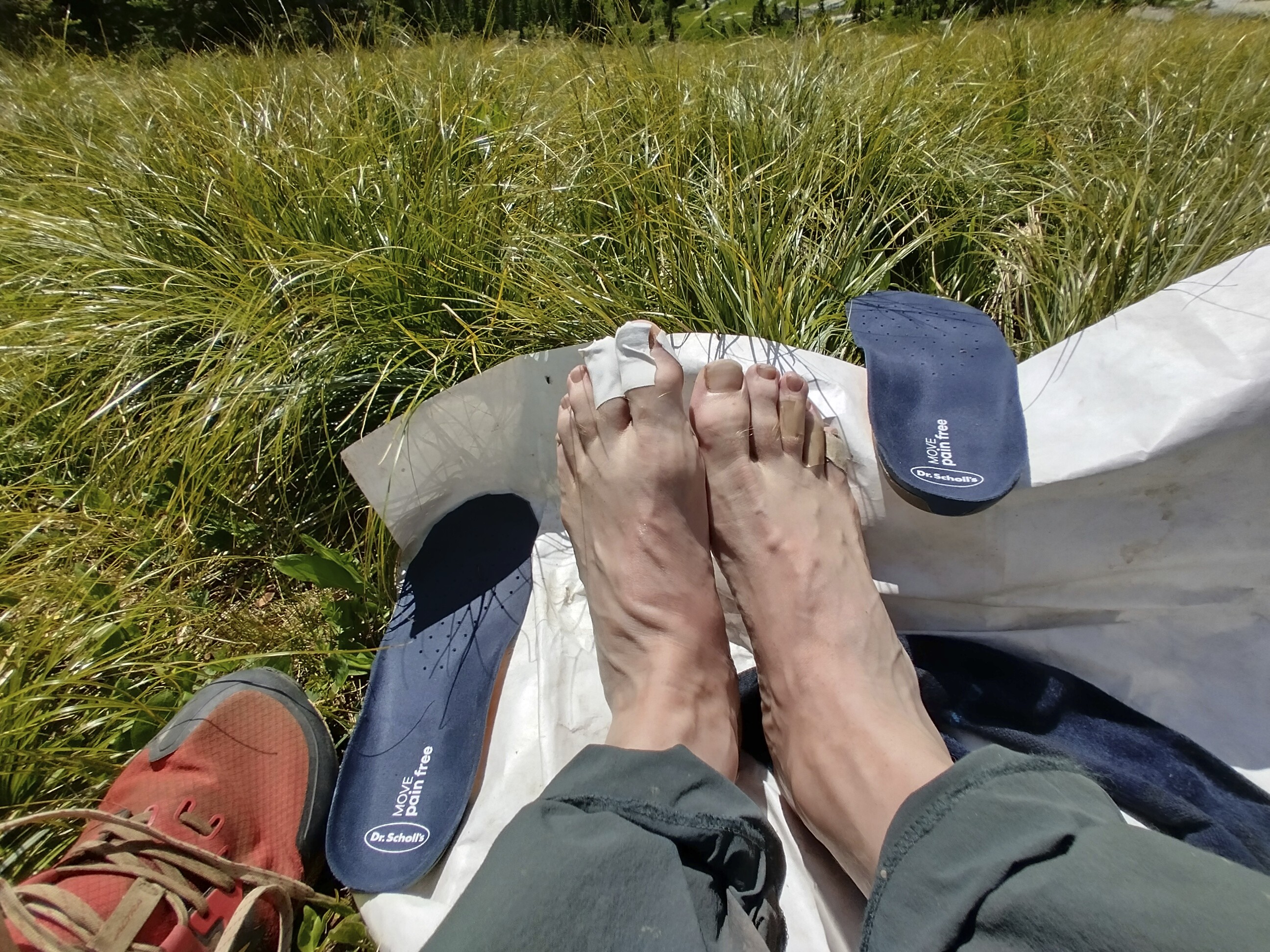
My poor feet, coursing with blood vessels, now seeking to be dry as much
as possible!
I zoomed happily down into Burnt Creek, a tight little valley coming down from the high country. There had also been storm clouds to the south, almost black with rain. As I descended though, they happily dispersed. After a rest at a campground before another steep drop in the valley, I met some hikers coming up who had been rained on hard.
I walked a few more miles to the south, keen to reach the Benchmark Ranch the next day where my sister had sent a food box. I was out of Nutter Butters, and the tortillas were running low. Despite comments in my app that the campsite I chose was awash in horse dung, I found it to be a clean enough place. I had it to myself and saw no one through the evening. In fact, aside from the wet hikers heading up Burnt Creek, I hadn't seen anyone all day. It just shows how large this country is. The Chinese Wall is probably the most famous geological formation in the wilderness, but it's still big enough to have it to yourself.
My pleasant horse camp beside the trail.
July 7, Day 97
18.7 miles, 1585 feet elevation gain.
Wow, I was really moving this morning. So eager to reach the Ranch, I was trotting at times. With an empty food bag, my pack is only about 11 or 12 pounds (6-7 kilos).
The Sun River has many oxbows, and the trail often stays above the
valley floor. Something I appreciated as it meant drier feet!
After about 10 miles I had to stop and rest. I was moving fast. A guy named Mikey came by. He was a ranger, but also an avid hiker, so he was out backpacking on his days off. His district is in the Bob, although off to the west where the valleys are even wetter and more rugged than what I've seen so far. He said that some seasons, only one person comes into the district. Maintaining the trails in there is very difficult work, but he loves it.
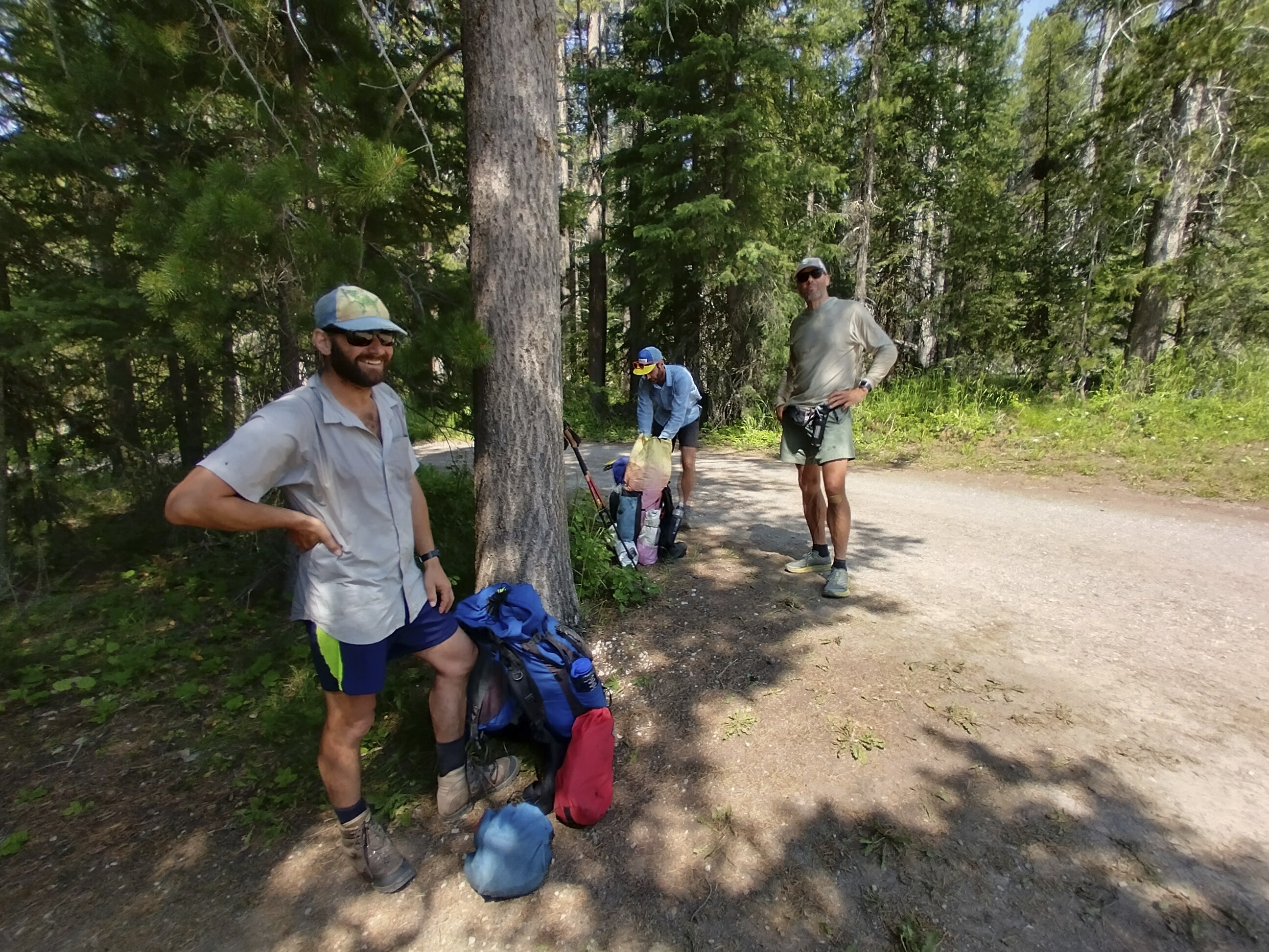
Mikey along with "Walk it Off" and "Ed Beard," a couple of guys I camped with back
in Many Glacier.
Mikey went on by, but I realized that if I caught him at the trailhead, he could give me a ride the few miles to the Benchmark Ranch. Oh boy! So I hurried on and found him talking with Walk it Off. My jaw dropped open when I came to a river near the parking lot to find a BRIDGE. I hadn't seen a bridge over a river in a week!
Mikey piled all of us into his Subaru. He dropped off Walk it Off and Ed Beard at the Straight Creek Trailhead, saving them about a mile of road walking. I'd come back here after getting my box. He let me out another couple miles up the road at the ranch. What a great guy, it was fantastic to meet and speak with him, someone who loves where he is and what he does.
At the ranch I opened the bear box to find my food resupply. Yay! Inside the house, the owners let me charge my phone for five bucks. I stepped back outside and chatted with Ted and Annie, a couple doing the trail together. Ted had some fish tattoos on him, and is an artist and fisherman.
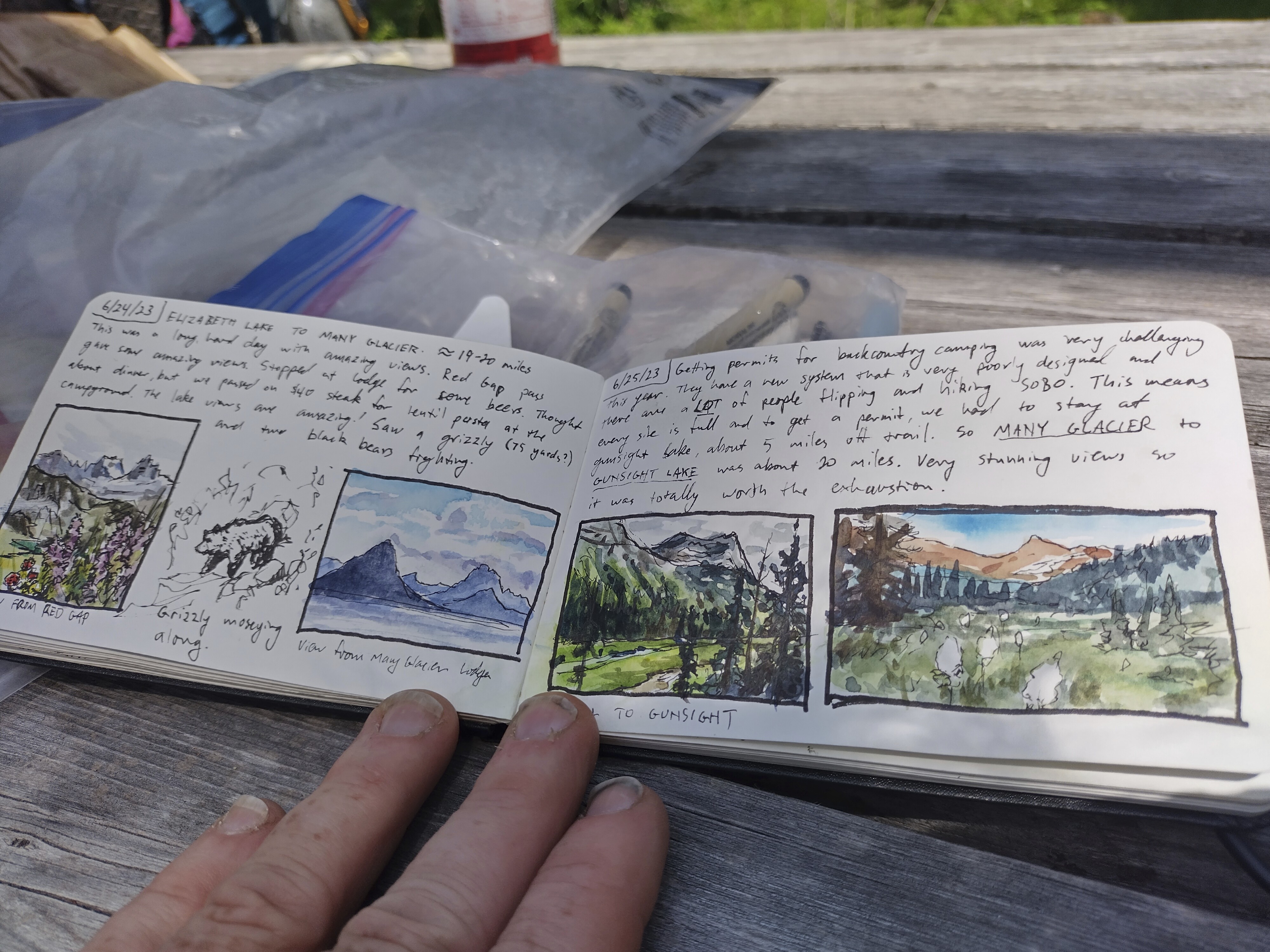
Ted's beautiful and inspiring diary. He had a portable watercolor kit to
make these drawings. Really the coolest thing I saw on the trail, aside
from the mountains.
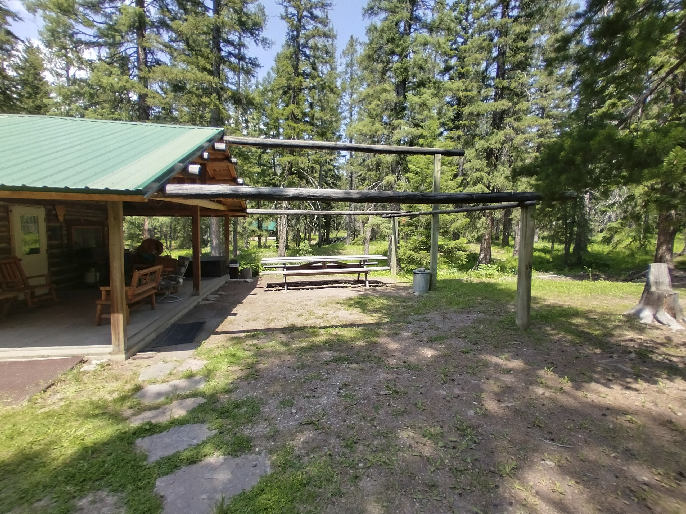
The Benchmark Wilderness Ranch, an oasis! Water, resupply, power, and a
picnic table!
I ate some food and waited a while for the phone to charge but then, well, it was time to get going. I said goodbye and started walking north on the hot and dusty road.
When a truck came by, I stuck out my thumb almost involuntarily. Sure, I want to walk every mile with my own two feet...but the truth is, I contain worlds, only some of which I know!
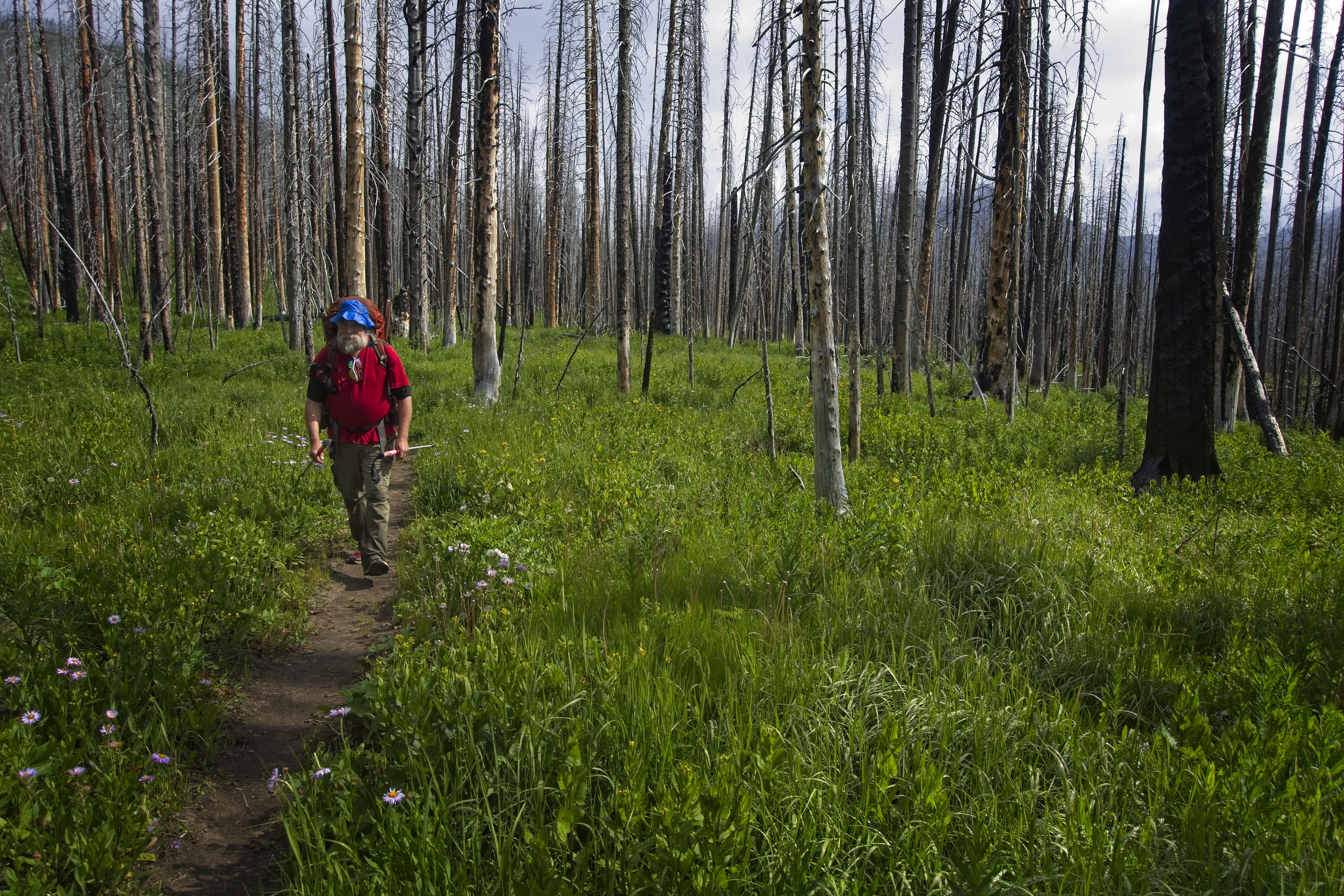
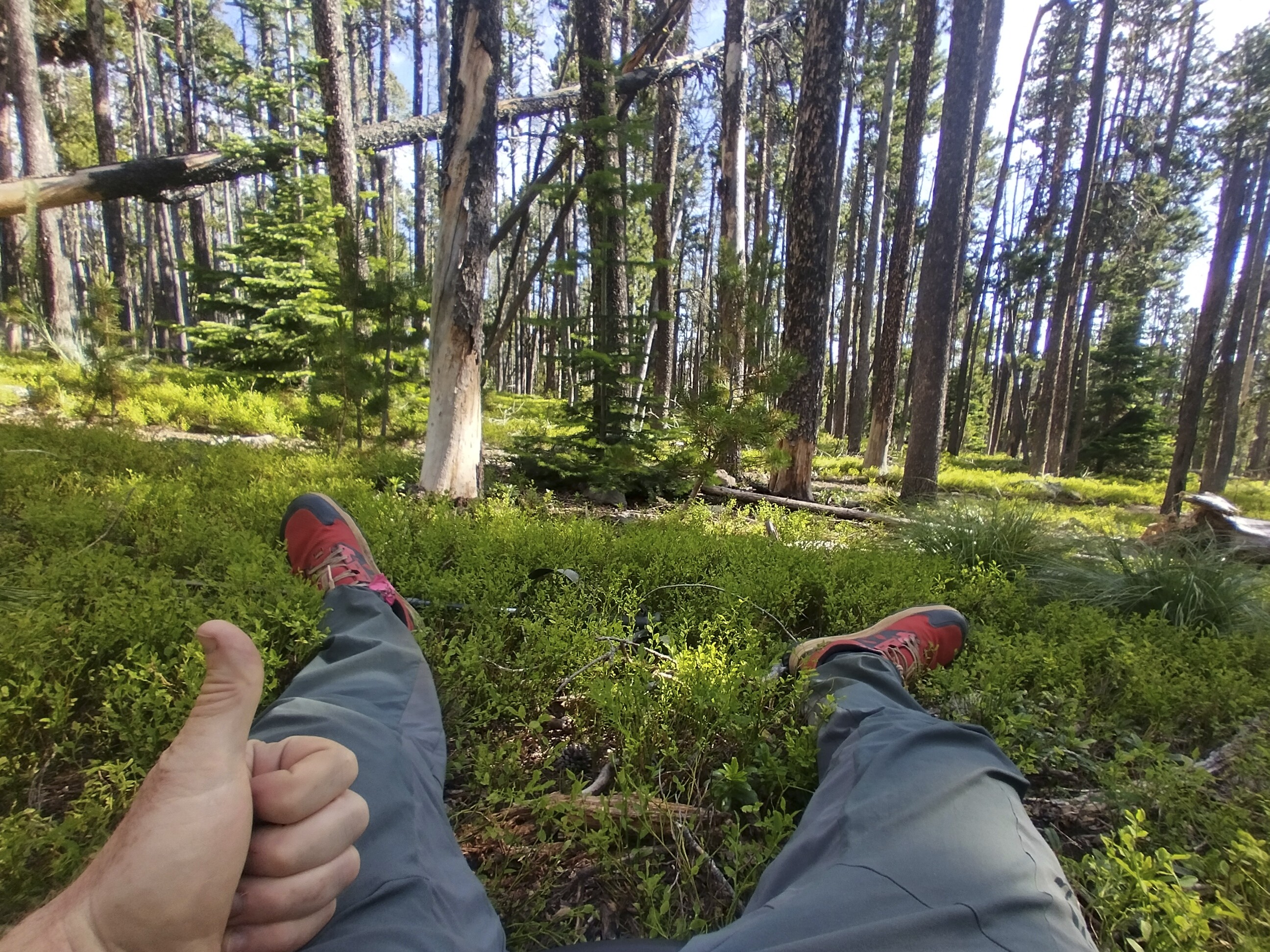
Pano-rama near camp at the junction of Straight Creek and Elbow Creek.
Notice all the dead trees on the ground. Could you imagine RUNNING in
that to get away from a bear? You simply can't move with any speed unless
you have a trail in this kind of forest.
I walked south on good trail for about 7 miles in sometimes burned forest. I entered the Scapegoat Wilderness. I was out of the Bob! Though, to be sure, still in the Bob Marshall Wilderness COMPLEX!
There was a little campground on the other side of the creek, but I didn't want to end the day with wet shoes and socks. They were dry and dang it, I liked it that way. I picked my way into a flat meadow with tall grass and dead trees laying around and set up my tent. I heard voices on the other side of the river, and fell asleep to the sound of rushing water. No bears.
My camp at the junction of Straight and Elbow Creeks.
July 8, Day 98
20 miles, 3755 feet elevation gain.
This would be an easier day, at least until the climb at the end. I just had to travel south for a long, long ways to reach the southern end of the Scapegoat Wilderness. Lots of burned forest in here. On the upside I could see more Chinese Wall style cliffs, always running north-south, mostly on my right.
Let's call this one the Mongolian Wall, how 'bout it?
Peaks and burnt forest
I saw a tent up on a hillside at the relatively late hour of 9 am, with a hiker eating their breakpfast. Walk it Off, Ed Beard and I alternately ran into each other at different times. I didn't see anyone else from the gaggle of hikers I knew.
I crossed the river multiple times. I somehow missed a forest service cabin that I hoped to sit on the porch of. In the burned forest, the trail was hot and buggy. I was ready to get away from river crossings and into that fabled central Montana country that was more like ranchland. Also, I wouldns't have bears on my mind all the time. What a luxury that would be!
Intact forest as the day closes
I started climbing up into a forest, which was a relief after the hot river valley bottom. As far as I could tell, after crossing the Dearborn River (famous from "A River Runs Through It"), I was done with that wet business. Good!
A rather haunting forest
The 1000 foot climb and the 20 mile mark wore me out. I decided to camp right at the pass in a little campsite, thinking it might start raining at any minute (it did, but only sprinkles). I ate my dinner, hung the food bag in a tree, and settled in for the night. Twice hikers walked by. Other people really like to travel pretty late!
Popping out to a pass and camp.
My camp for the night, had it to myself.
July 9, Day 99
22.2 miles, 6000 feet elevation gain.
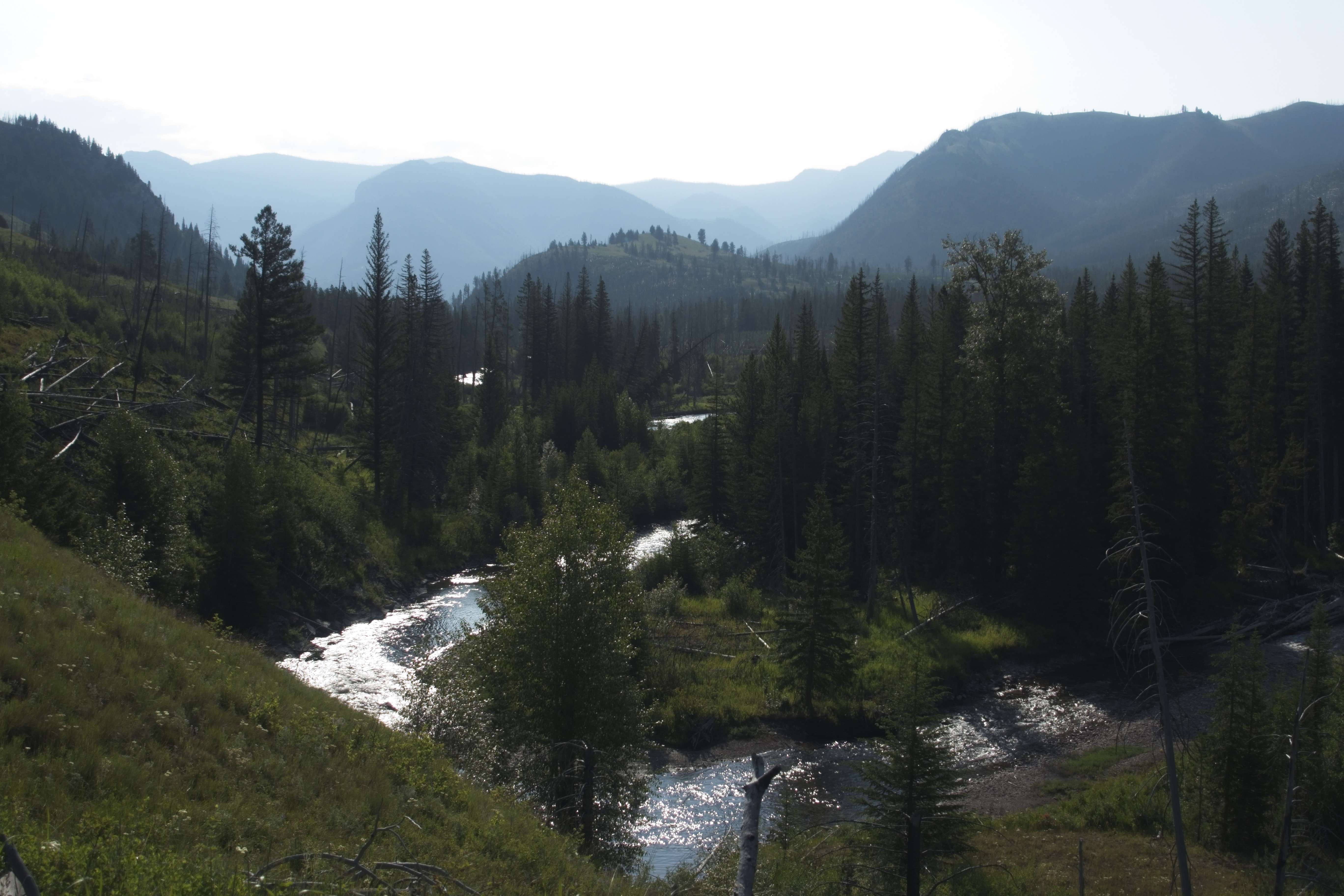
One of the toughest days on the trail, but highly scenic!
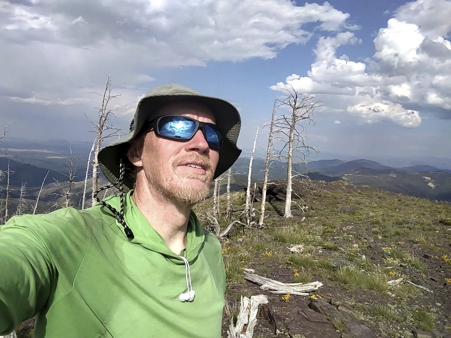
As I left camp, I passed a scenic overlook and saw a hiker getting up from their bivy sack where they must have enjoyed the sunrise a bit before. It was cold and clear, but I had switchbacks to warm me up.
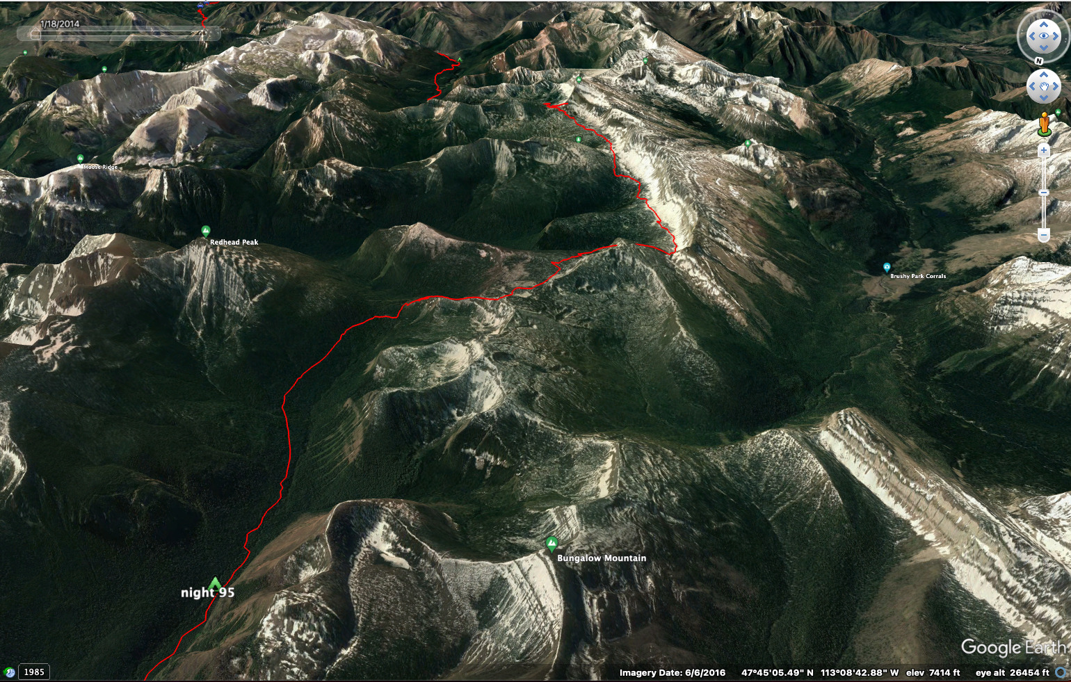
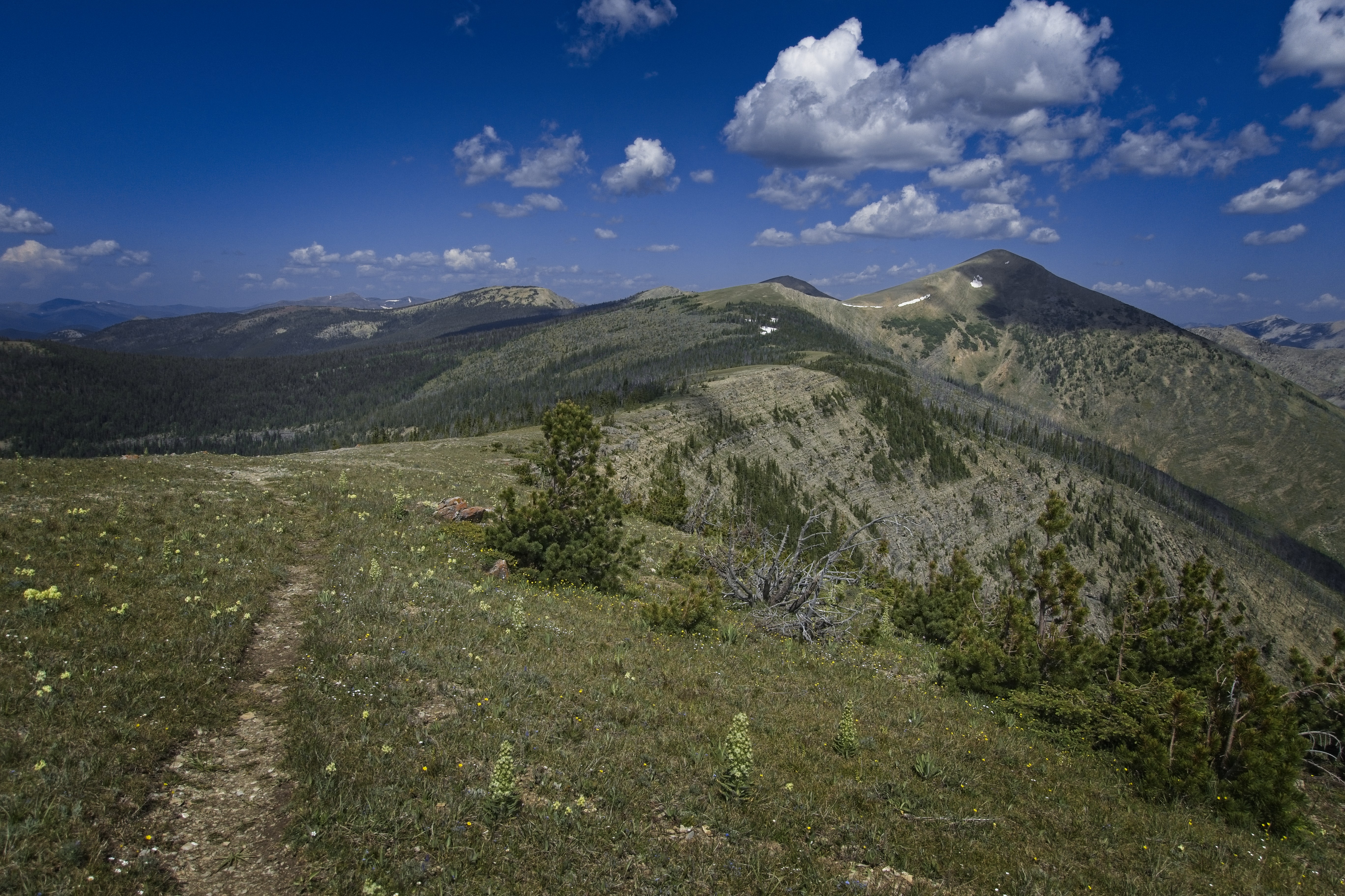
I'd be following the spine of the divide all day. What a punishing series of ups and downs it became! I wouldn't see country like this again until one day from the Wyoming border, on the Sky Rim Trail which is the northwestern boundary of Yellowstone (the park actually stretches a bit into Montana). But I'm getting ahead of myself.
However...gee, what is there to say? The views were huge...sprawling valleys radiating out from my position in every direction. Rain squalls, shadows and sun on the landscape for miles around. Lingering runnels of snow. Elk and deer always moving away from me somewhere in the distance. Pikas and marmots.
Fearful prayers to NOT make me go all the way up and over that peak ahead. And sometimes...prayer granted, but not always!
I circled above Bighorn Lake in alpine country, admiring the steep cliffs above the lake with snow gullies harrowing down. I dropped down to a lake on the other side of a pass to get water, resting for a while on a rock and coming back to my pack in the trees to see it absolutely covered in mosquitoes. Strange! But I'm glad they didn't bother me sitting out in the sun. Hmm.
The unnamed Peak 7676 above the pass where I camped. Look closely on
the right and you'll see the camper sitting on his yellow pad.
Howdy!
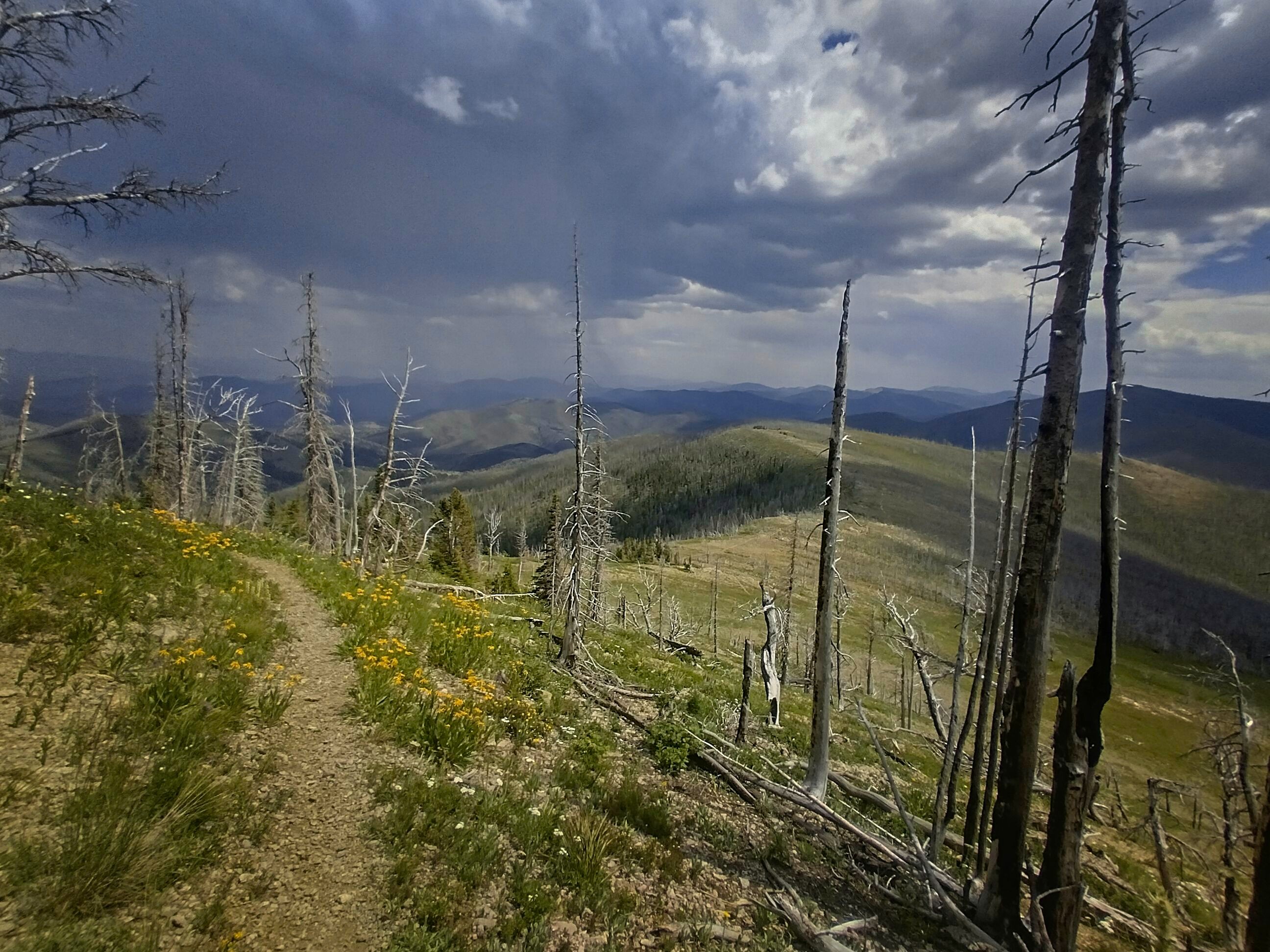
Here the trail mercifully goes off to the right just above the burned
forest.
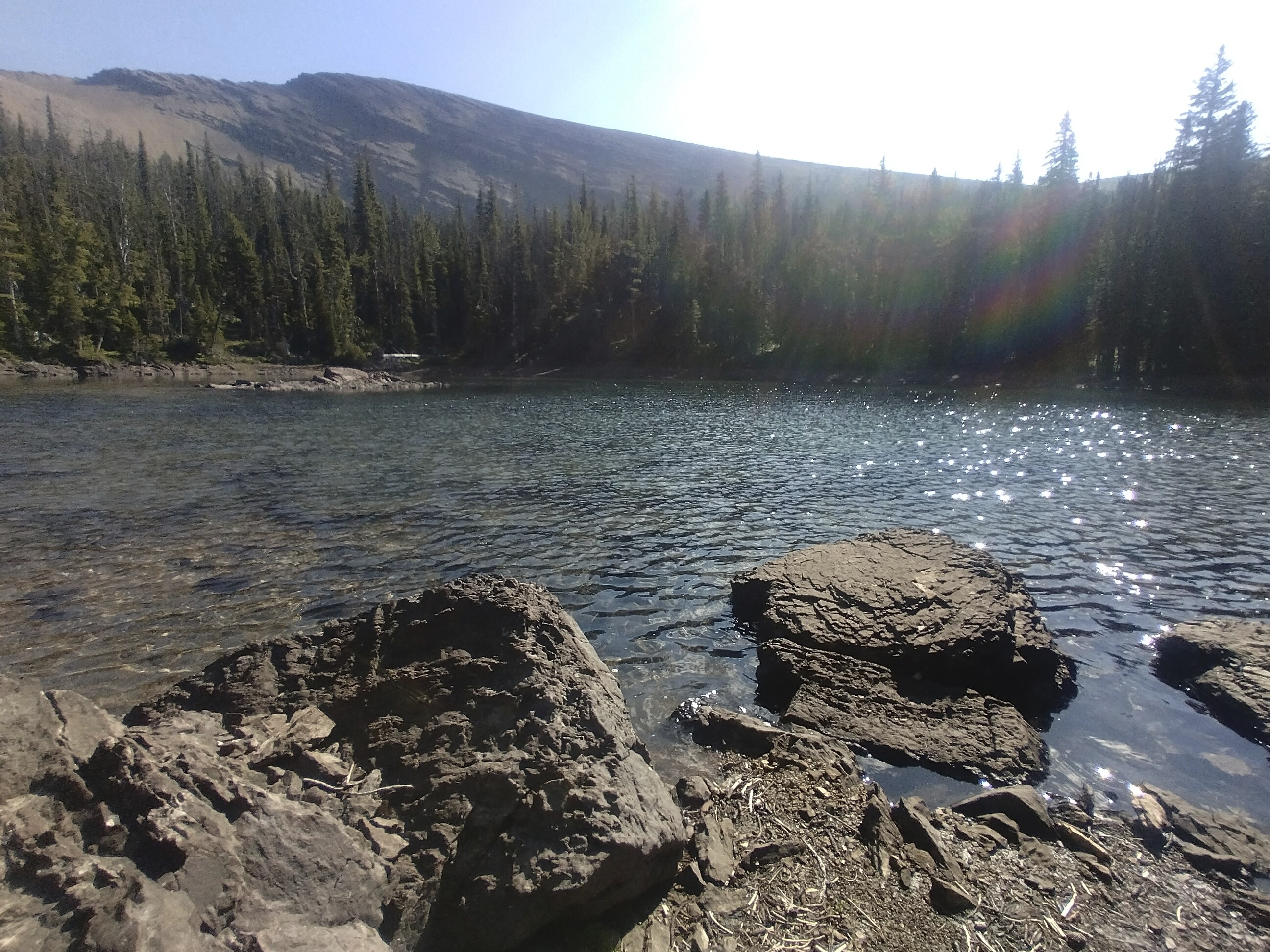
The unnamed lake where I got some water.
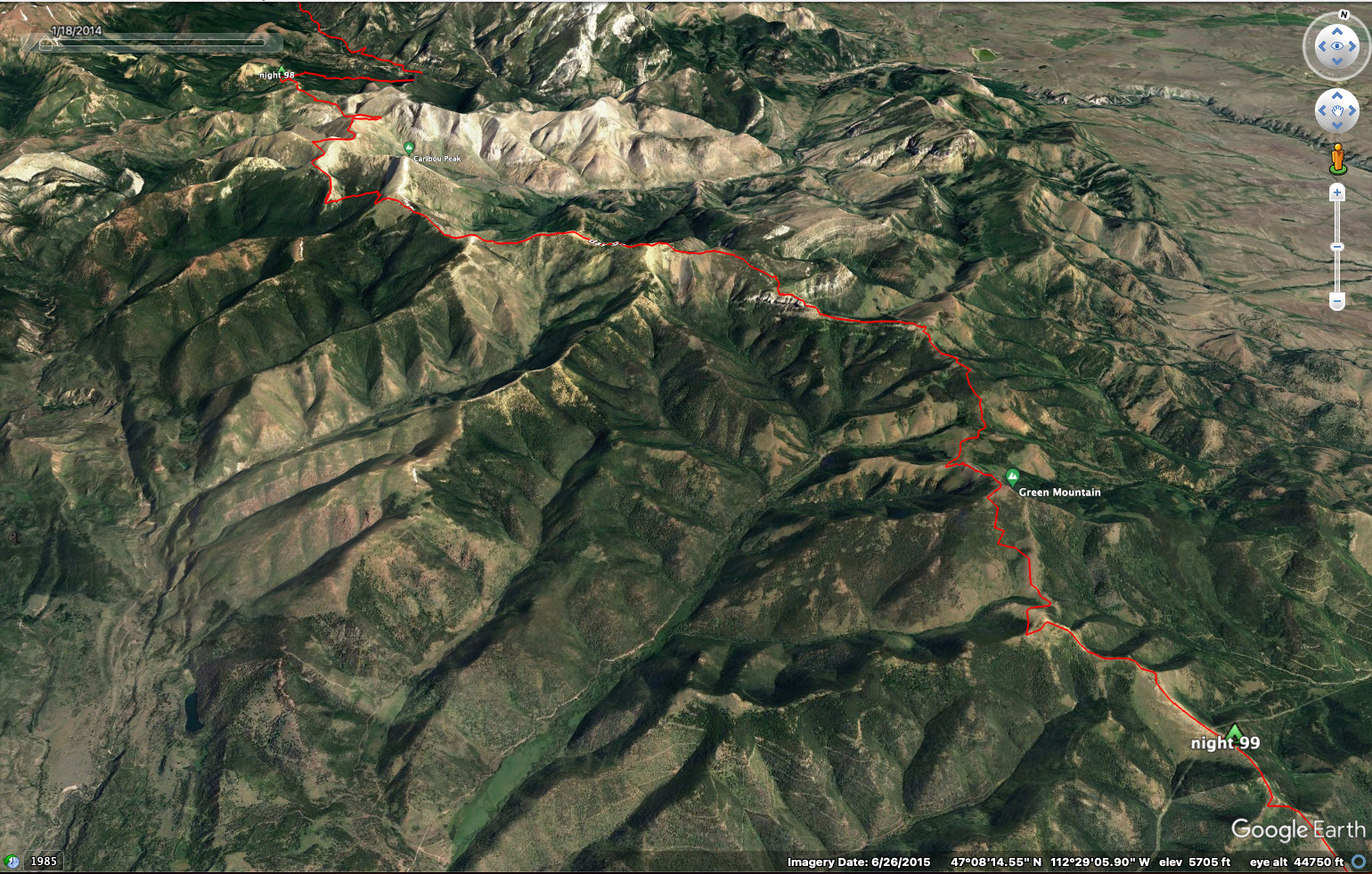
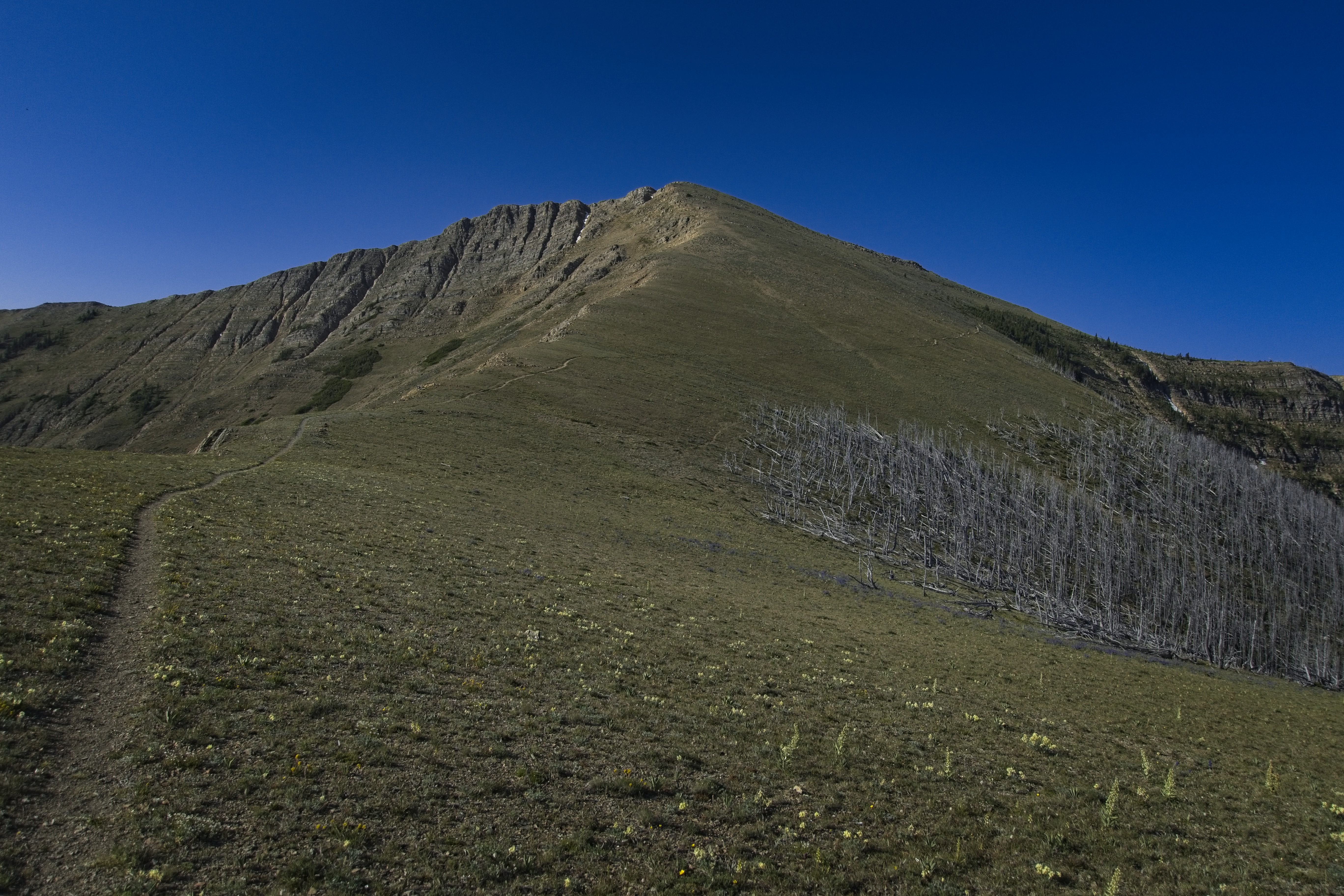
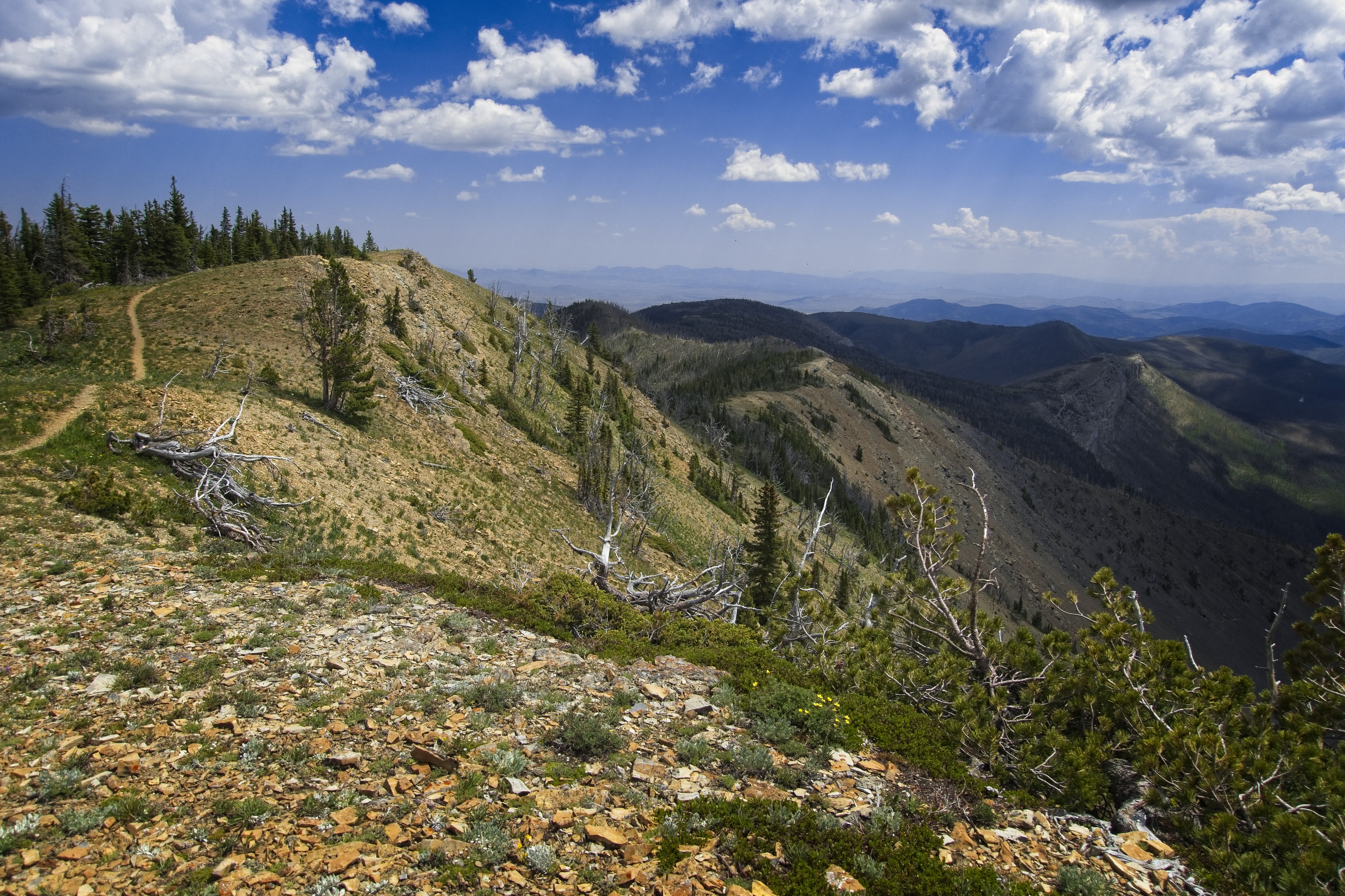
By the time I hit a junction up on the crest with a trail down to Falls Creek, I was worn out. I sat and rested in a dusty burnt zone, noting that a brown bag of tent stakes had been left here where it blended in perfectly with the dirt. I saw pretty fresh bear sign which made me nervous because the trail was so narrow on the ridge that I wouldn't want to meet a bear for fear that not even he could easily avoid me. Finally, after Red Mountain, the terrain widened out and descended quite painfully to Lewis and Clark Pass.
I lay down here totally exhausted, but very thirsty. To get water, I'd have to climb over Green Mountain and hope that an intermittant spring on the other side was running. I set off in the early evening very, very slowly. Interestingly, this climb became very peaceful and beautiful. I could see a road in the far distance. I was approaching civilization, even if I would only have it nearby, it felt nice.
And I'd had dry feet all day which was a real plus! I had texted a bit with my sister Tamara, who lives in Alaska nowadays. I'd had to stop because storm clouds were approaching the ridge before Red Mountain and I needed to get up and over before they broke.
I made it over Green Mountain and gulped down water at the spring. My goal was to reach a yurt maintained by a team of geologists, who kept it open in the summer for hikers.
After a few more miles walking, including a detour I came up with to avoid climbing over a subpeak, I reached the yurt. "Please be open!" I prayed. Also..."please be empty!"
Both prayers were granted! I went inside and marveled at the cots, chairs and table and guestbook. I would sleep here tonight, very happy to be under a roof for the first time in 9 days. Yeah!
Actually I didn't have the BEST sleep, but it was nice anyway.
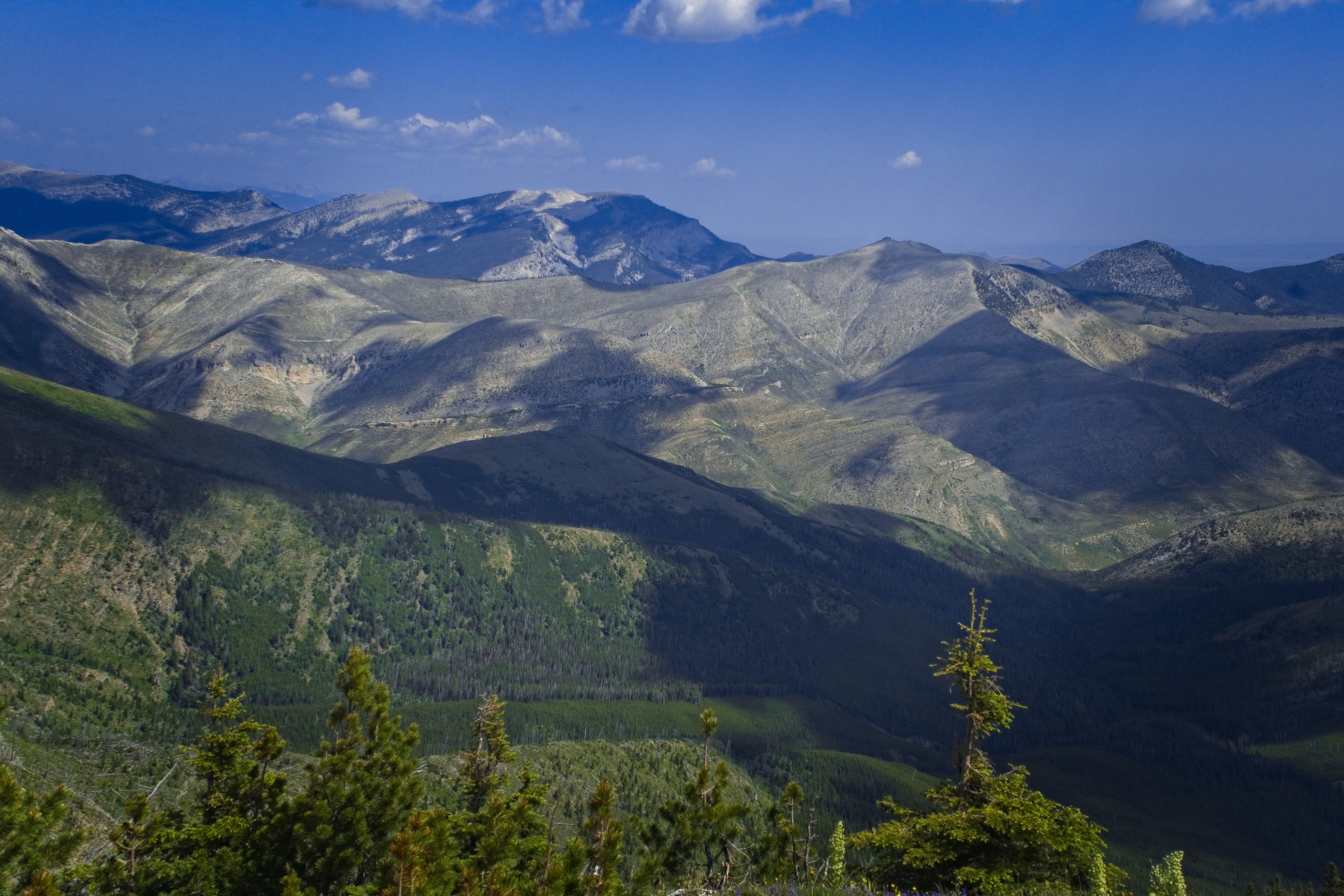
Crest country
Up and down the ridges...
The trail and ridge go east for a good ways.
Looking down to Lewis and Clark Pass.
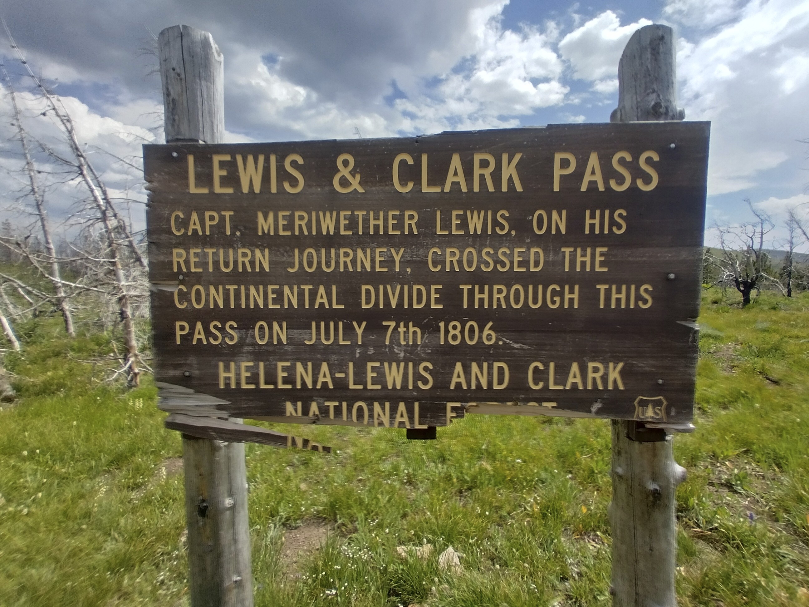
You have to read Undaunted Courage...great book!
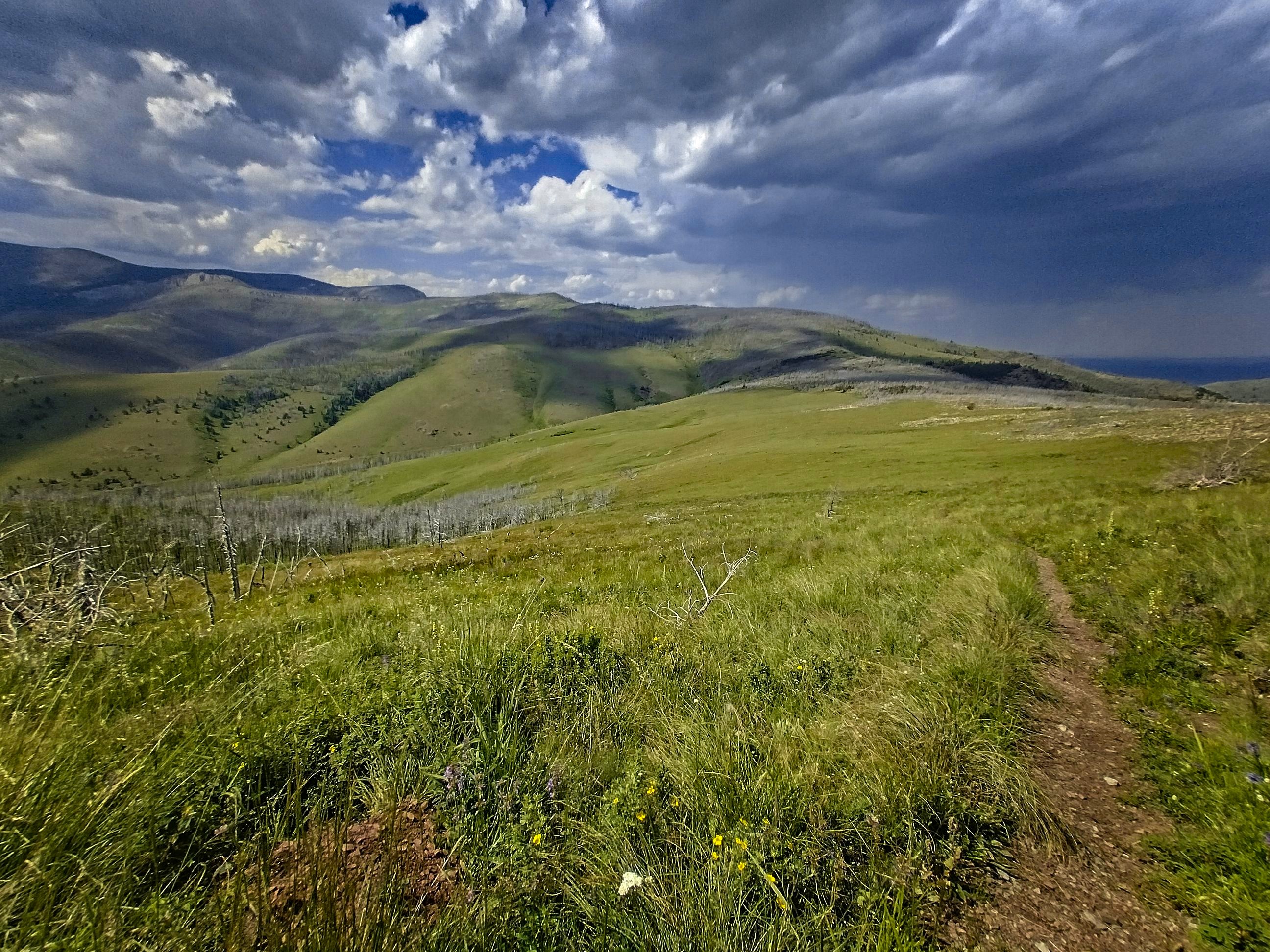
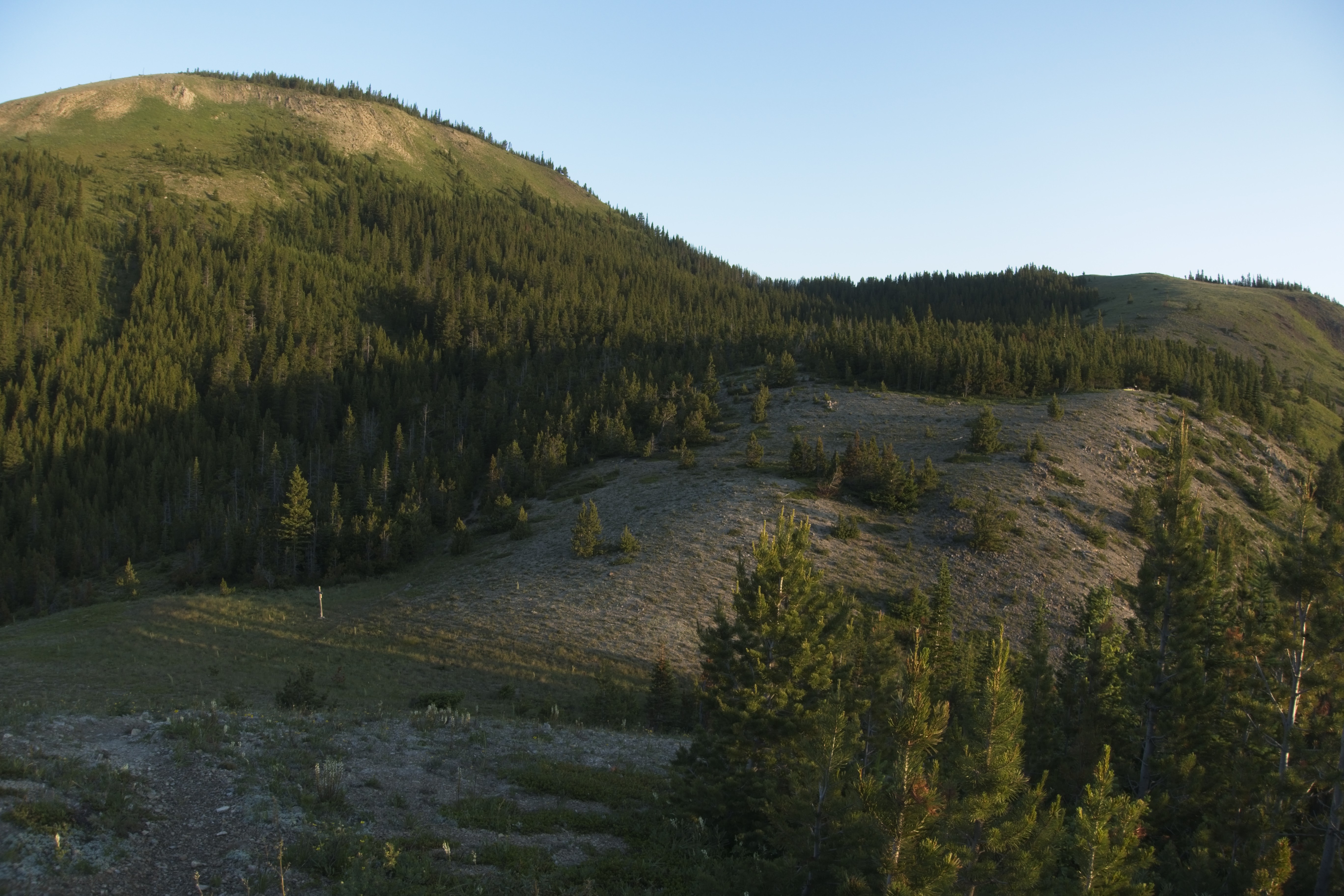
The beautiful climb up Green Mountain (this is looking back north).
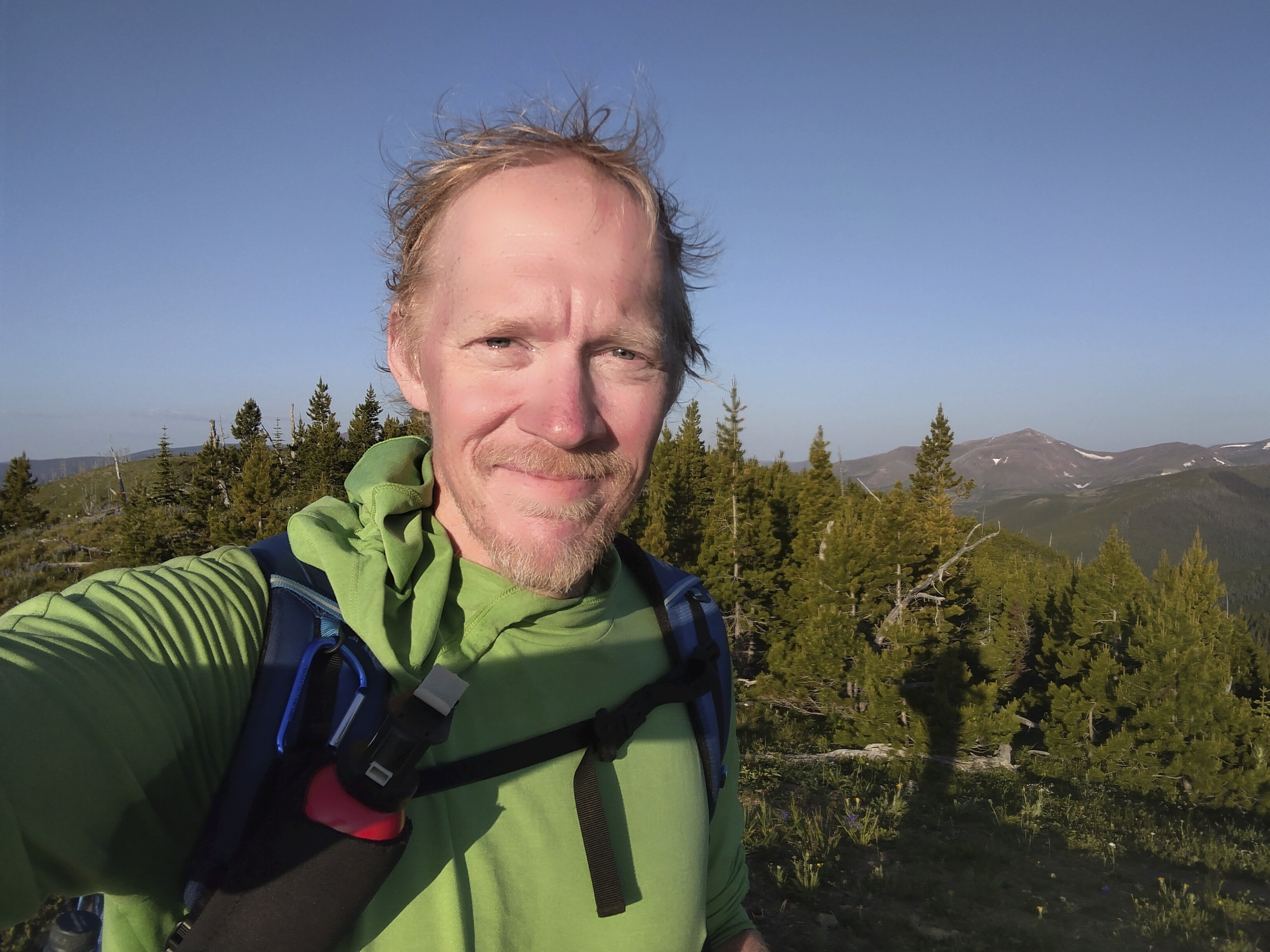
Me on the Green Mountain summit.
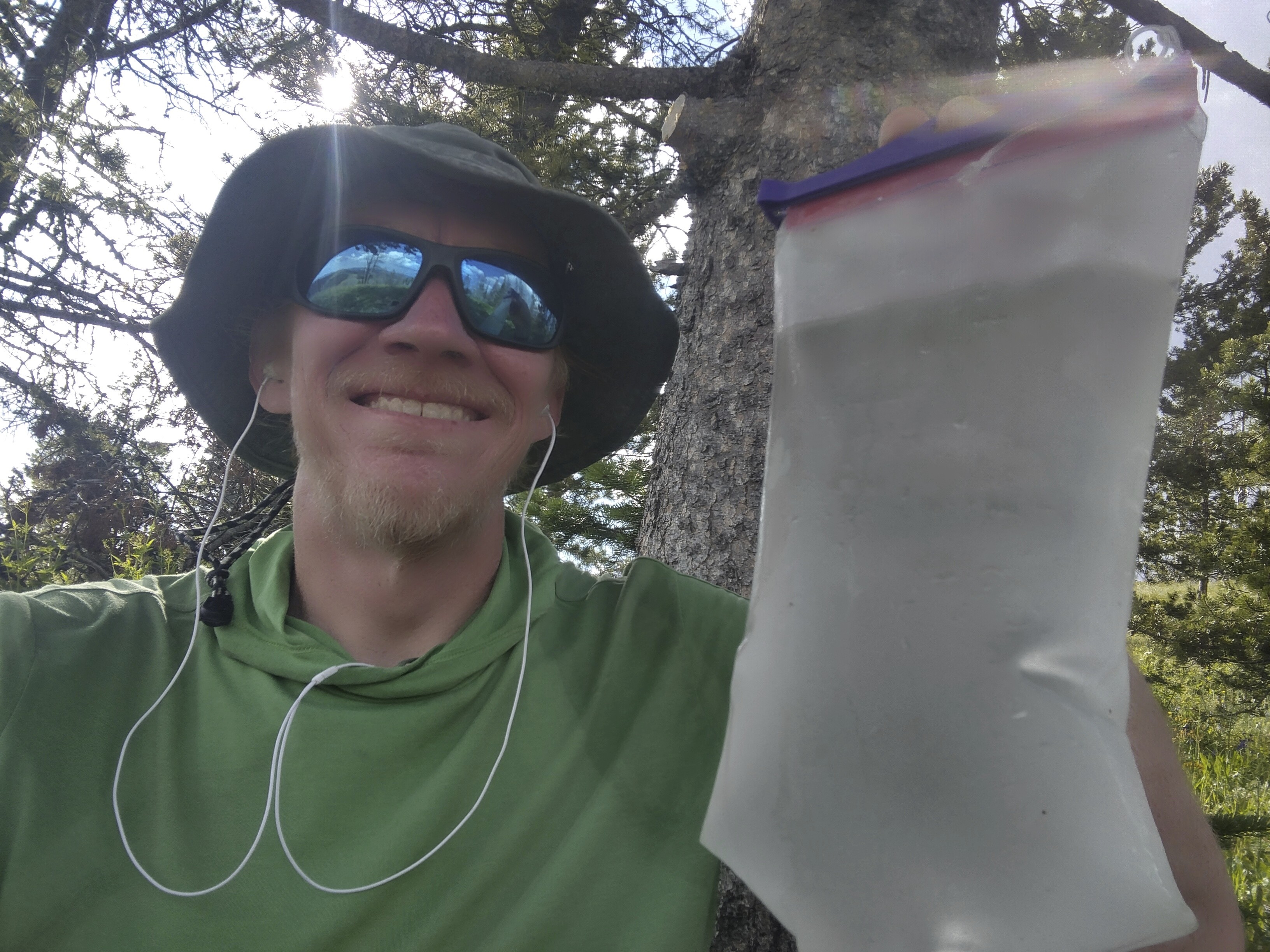
So happy for WATER!

The Yurt and my home for the night
July 10, Day 100
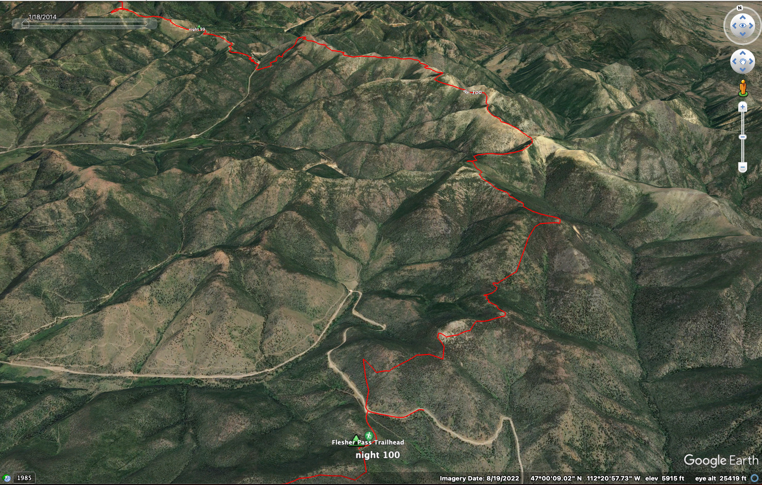
17 miles, 4300 feet elevation gain.
I was quite tired this morning and got a late start. But only a few miles would get me to Rogers Pass, a real milestone. Turns out that the coldest temperature ever recorded in the continental USA was right here!
I walked down the road to a campground and enjoyed an ordinary bathroom for a touch of civilization. Ahh! Then I started hiking very tiredly uphill again, stopping for water because I knew it would be dry up on the crest.
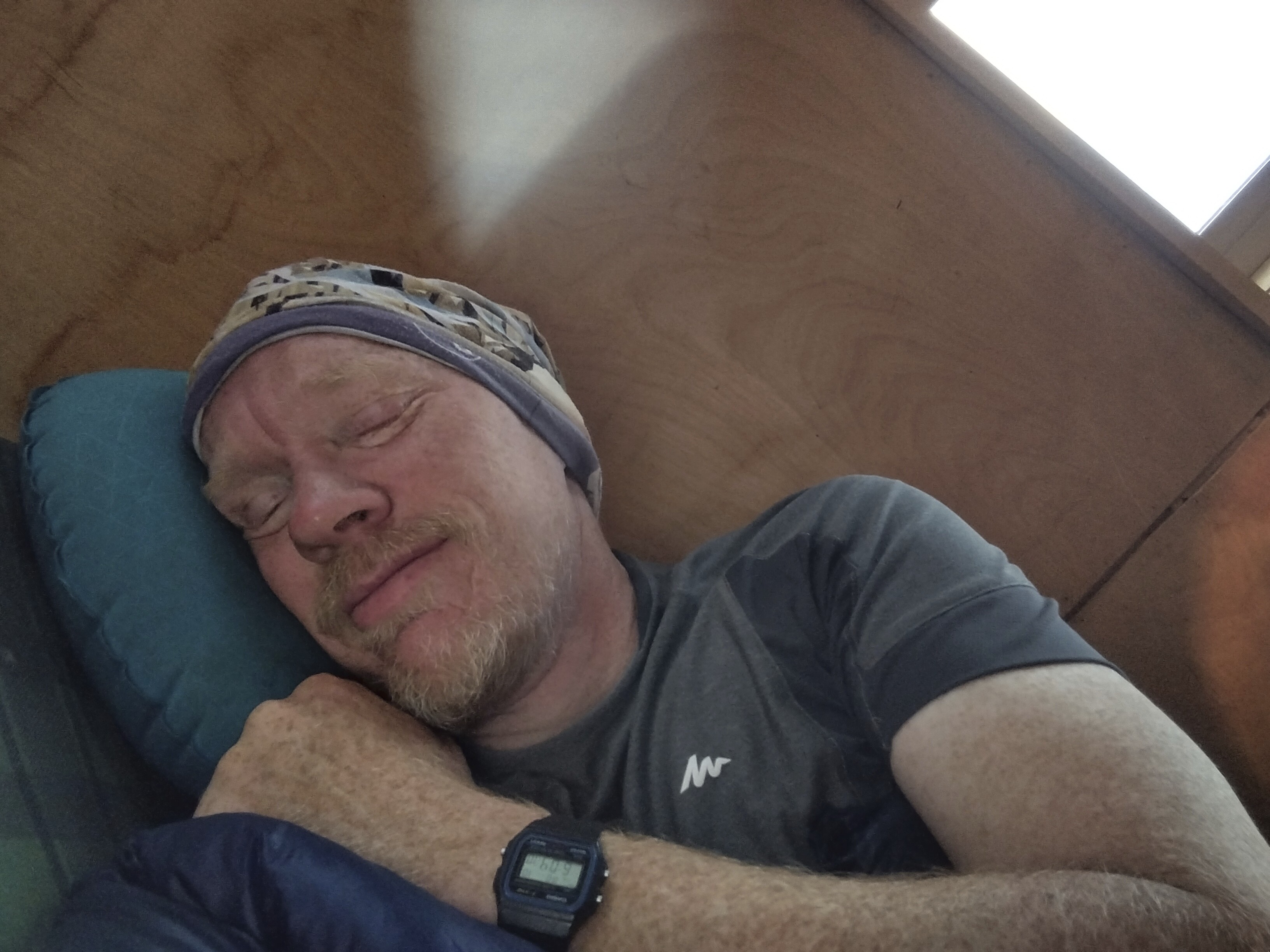
Enjoying sleeping in an extra hour in the morning.
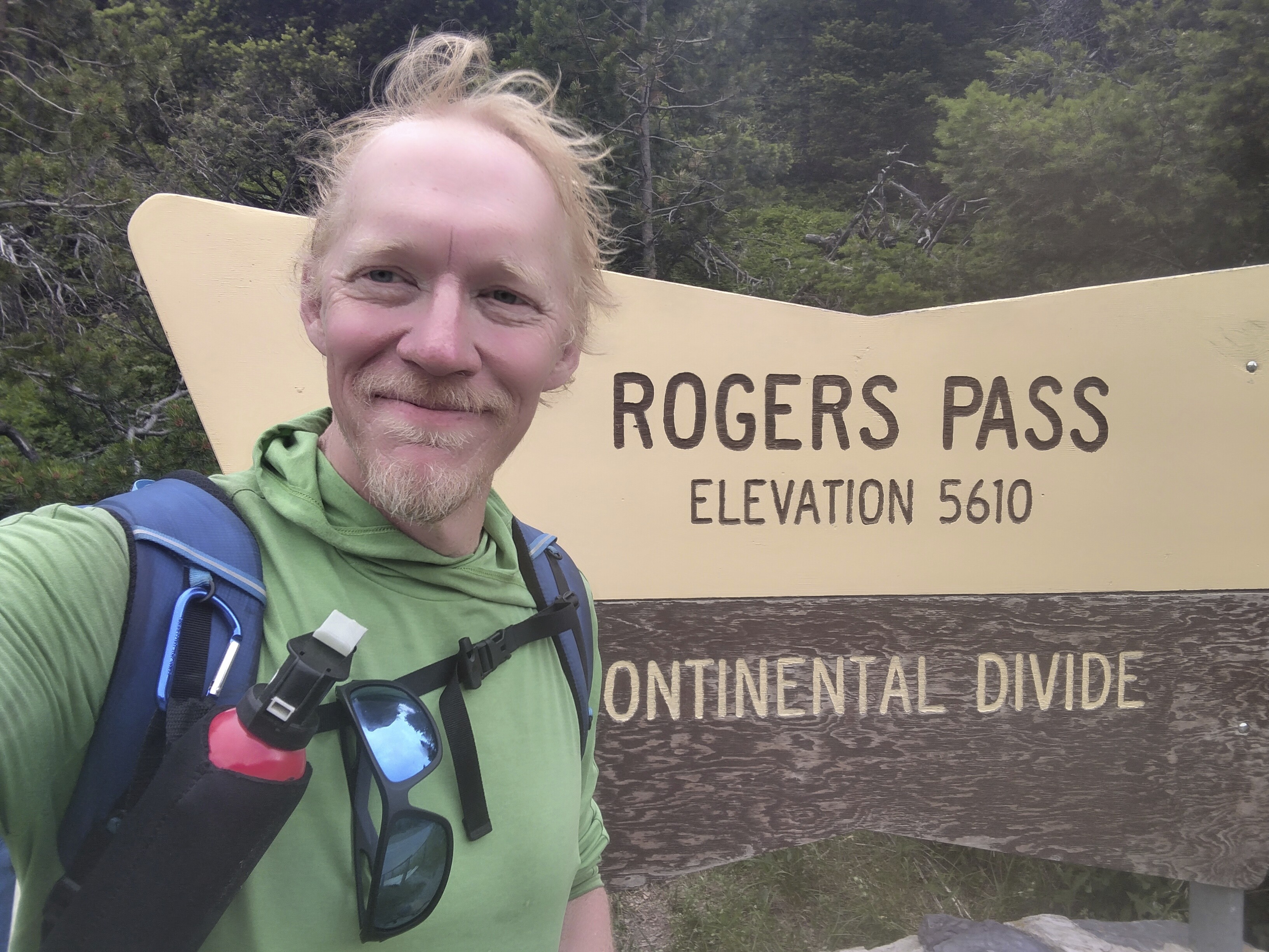
At Rogers Pass.
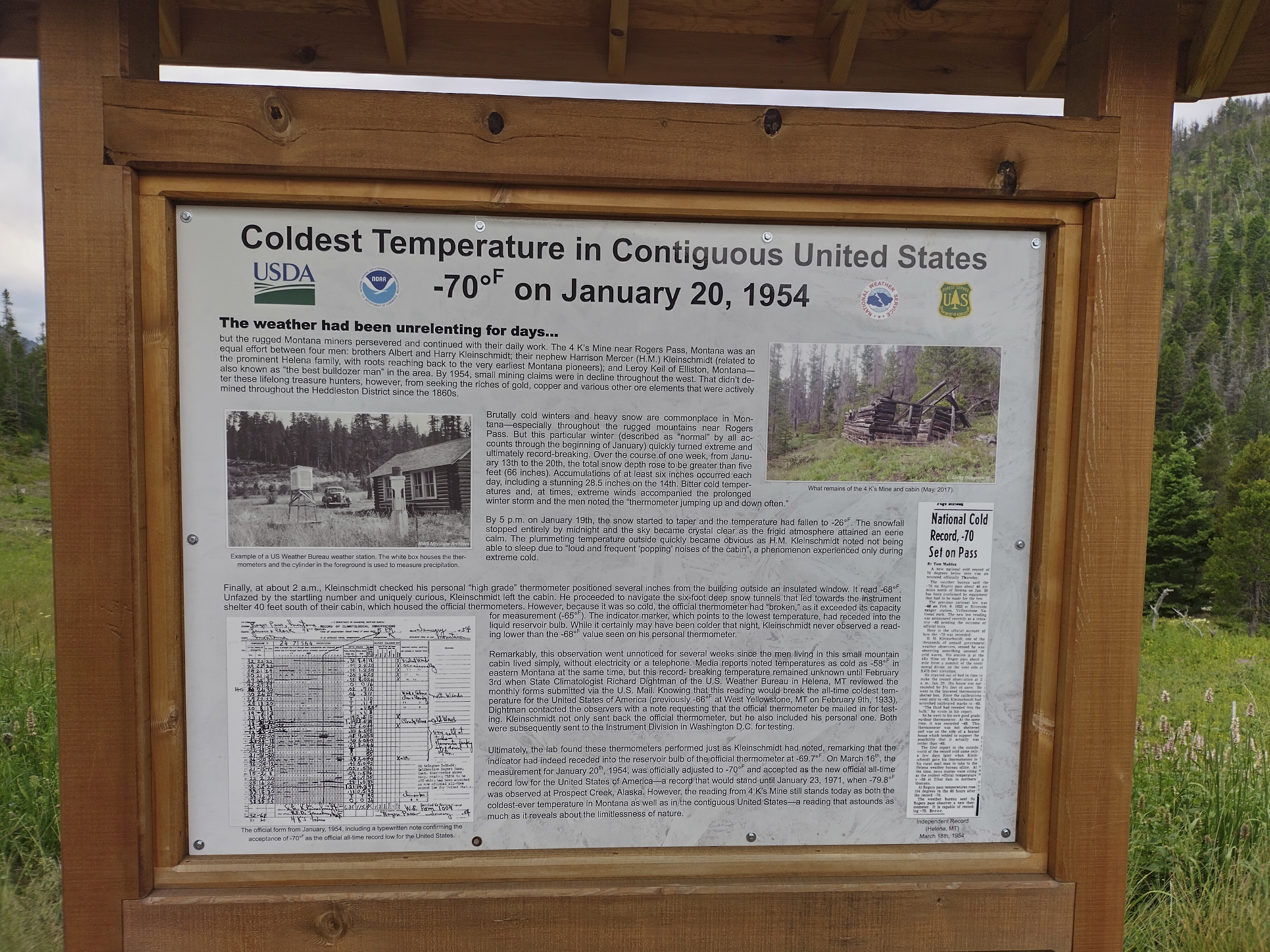
The coldest temperature, -70!
I had a long walk to Flesher Pass. It was high country again, though not quite as scenic as the day before. I saw a huge elk at one point. At another point, I decided to rest in some shade but was attacked by every kind of bug: mosquitoes, flies, horseflies, bees and ants! I devised a strategy to get my shoes and socks back on with a minimum of damage. The main thing was PREVENT THE HORSEFLIES FROM BITING!
I walked a fair bit this day with my umbrella against the sun, but I noticed that it attracted horseflies, who would land on the back side of my upper arm where I couldn't see them, and BITE. Really infuriating. I reasoned that the umbrella cast a larger shadow, much like a horse. And a horse is an ideal victim, though their tails can be expertly wielded.
A couple of hikers passed me in both directions. In truth, this day was hot and tiring. Not one of my favorites. Only at the end of the day did things look up. I decided I'd sleep at the Flesher Pass Campground. Two hikers, Mike and Heather, who were cousins, came by about a mile from the campground. I was sitting, quite relaxed for a change because the wind drove the horseflies away. They were really worried about a storm and continued on ahead, but I was extremely chill.
Later I caught up with them and chatted for a while. We walked a half mile down the highway to get water for the night. As I walked back, a sudden rain squall and gusts of wind damaged my umbrella. At the same moment a deer ran skittishly right in front of me on the road. Wow.

High country, but also hot and with plenty of horseflies.
As I cursed my bad luck (I'd had this Six Moons Design hiking umbrella for 6 years, and it had been through a lot), a truck pulled up on the hill leading to the campground and a man got out. He introduced himself and said he was doing trail magic!
Well, heck yeah!
It was the first such thing I'd seen so far. He gave me a soft drink and a bottle of water. He told me about the cross-country travel he does to hunt. Heather and Mike came up and we enjoyed ourselves for a good while. Since no other hikers were coming he packed up his cooler and waved goodbye. He was on his way to visit friends, and it was just our lucky day.
At the campground Wrecking Ball and her crew were hanging around. It was nice to see them again, though they were surprised to see me since they travel much faster. It was all made clear when they related that they'd left the trail at Roger's Pass for a few days at her moms house, where they went to concerts. Then I learned the wisdom of simply staying on the trail. If you are slow like me, you still keep up with the fast people because you simply don't leave the hiking grounds!
Cory had tried to convey that wisdom to me earlier, and now I saw it was true. I also met a young man named "Bear" with a knife around his neck. He said he was stalked by a mountain lion in California.
I went to sleep, eager to reach a strange little outfitters hut the next day where I could (hopefully) buy new shoes and get some snacks, as my food was running low. The mozzerella sticks had not survived in the heat from Oklahoma, so I was a bit low on food.
White Claw trail magic.
July 11, Day 101
20.3 miles, 2750 feet elevation gain.
What is the nice thing about a campground? A bathroom! Also a picnic table to sit on and eat breakfast. The sky was clear and it was time to walk the forested crest southwest. I had about 11 miles to reach Stemple Pass where the outfitter business perched on a hill on the south side of the pass.
It was a pleasant morning walk.
The forest was quite lovely today. No horseflies!
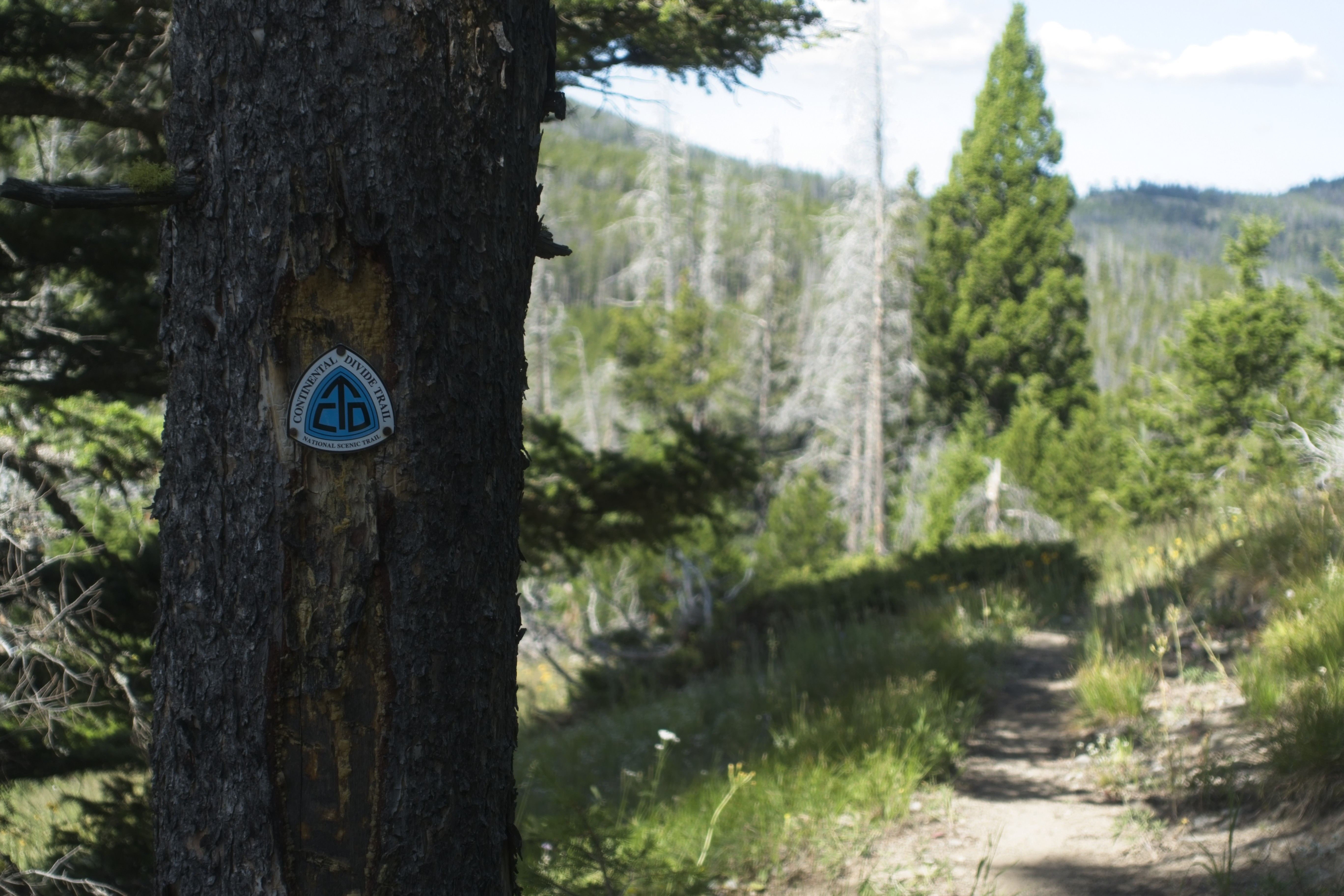
The occasional CDT sign on a tree.
The great wilderness was behind me. A patchwork of roads appeared on both sides of the crest here and there. The amount of bear sign was dramatically reduced. "I think I made it through," I couldn't help thinking. In some ways I was fatalistic, knowing that if a bear encounter happened in the Bob it was going to depend entirely on two personalities: mine and the bears. That makes for a rather lonely psychological atmosphere. I wouldn't feel that so strongly if Cory was nearby. It's amazing how much another person alters the relationship between you and the forest. I was glad for company when I had it, but I also liked that very different feeling that solitude engenders, even if it's a bit darker.
Always in the trees in this part of Montana...
I invented a shortcut to avoid a final hill before Stemple Pass, walking a broad dirt road. I probably saved a mile, but alas, the horseflies found me. Dag nabbit!
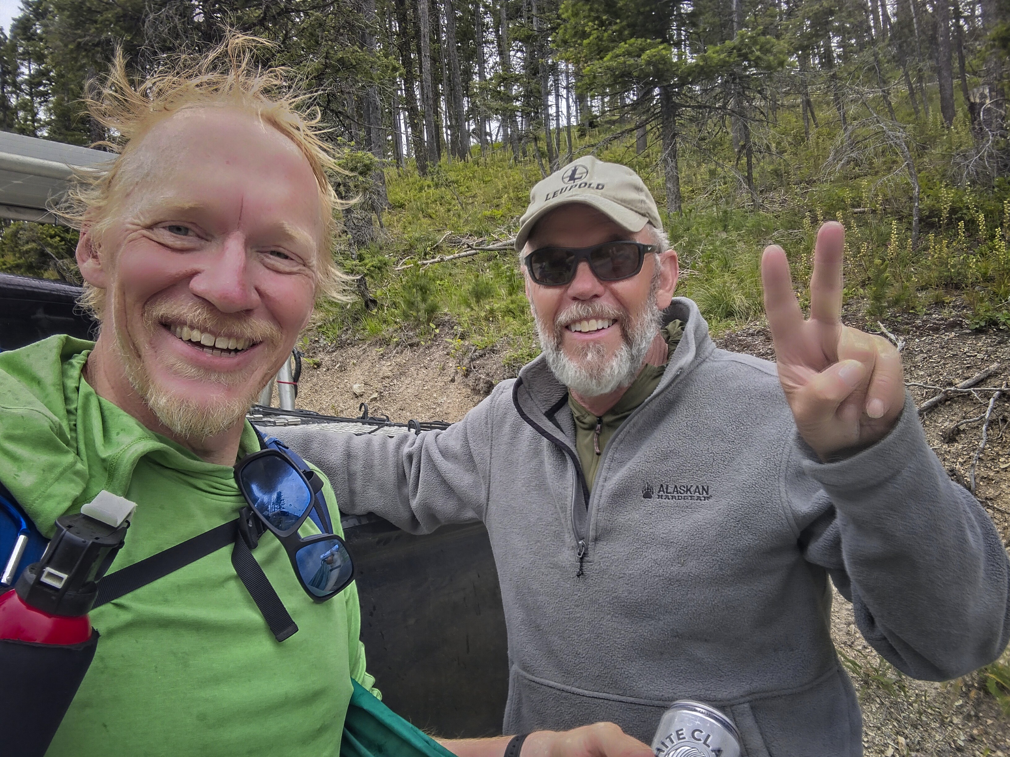
I had some amazing luck though, because right as I arrived at the pass a truck with a camper top came along. The occupant rolled down the window. He was a skinny old guy with a long beard. In the passenger seat was Edwin the mountain climber from the Netherlands! They asked me if I'd like to come down to town with them.
"Sure!" I said, overjoyed.
Because I didn't have enough cash to buy the shoes and food I wanted to get, and I didn't have "Venmo," the app the outfitter would accept for payment. I only had "PayPal," but that wasn't sufficient. I didn't think I'd be able to install Venmo because I don't live in the USA. So I really would need cash if I wanted to buy anything.
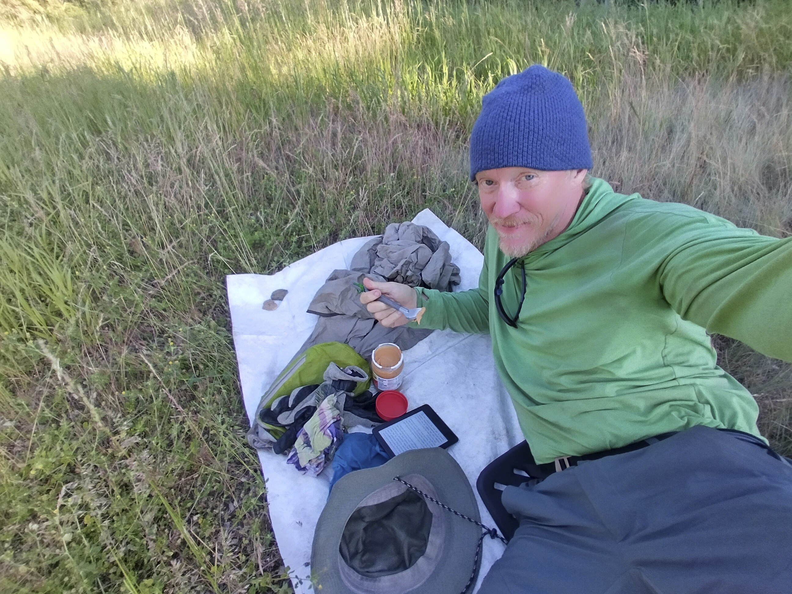
Thusly, I found myself at a convenience store looking at a rack of pasteries trying to decide what to eat after 10 days in the backcountry. I settled on chocolate milk and a handful of donuts. What am I, 9 years old? Well, my stomach is!
I got money and we drove back up, me enjoying my place banging around in the truck bed as we headed back up the hill. We got to the store and found Mike and Heather sitting at a picnic bench, eager to buy some things. Later, Ted and Annie would walk up, too.
The store was amazing. He really had everything. I bought a pair of Lone Peak Fives, which had higher quality in my opnion than the Sixes or Sevens. I also bought some tortillas to supplement the peanut butter I'd picked up at the store in town. Awesome. I had enough food to make it to Helena.
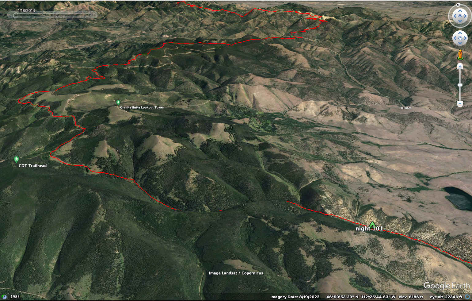
I left triumphantly on my new shoes which felt so, so good. Like walking on air. And the travel was easy (I decided to follow the road on the west side of the mountain). The road and trail briefly met up again, then separated. I stayed low, not really keen to visit the Granite Butte Lookout. And then I happily took an alternate route that meant I'd be off the main trail for about a day, dropping 2000 feet down into a valley. The crest wended its way "pointlessly" up and down a waterless way for many miles.
For somebody eager to hike the CDT, I sure am keen on alternates, aren't I? Well, yes. It's a change of pace and usually easier. And roads are a nice change, too, at least for a while. No more staring at your feet all the time to make sure you don't trip. You can keep your head up and look around. I am, in the end, somewhat lazy.
Also it was fun to leave the crest and see a different kind of country. The crest is a certain kind of country. But down in the valley it got warmer, and although I didn't see people, I sensed they were around more often. A handful of guys on motorcycles came by, doing their own variation of the trail. They expressed amazement that I was walking it.
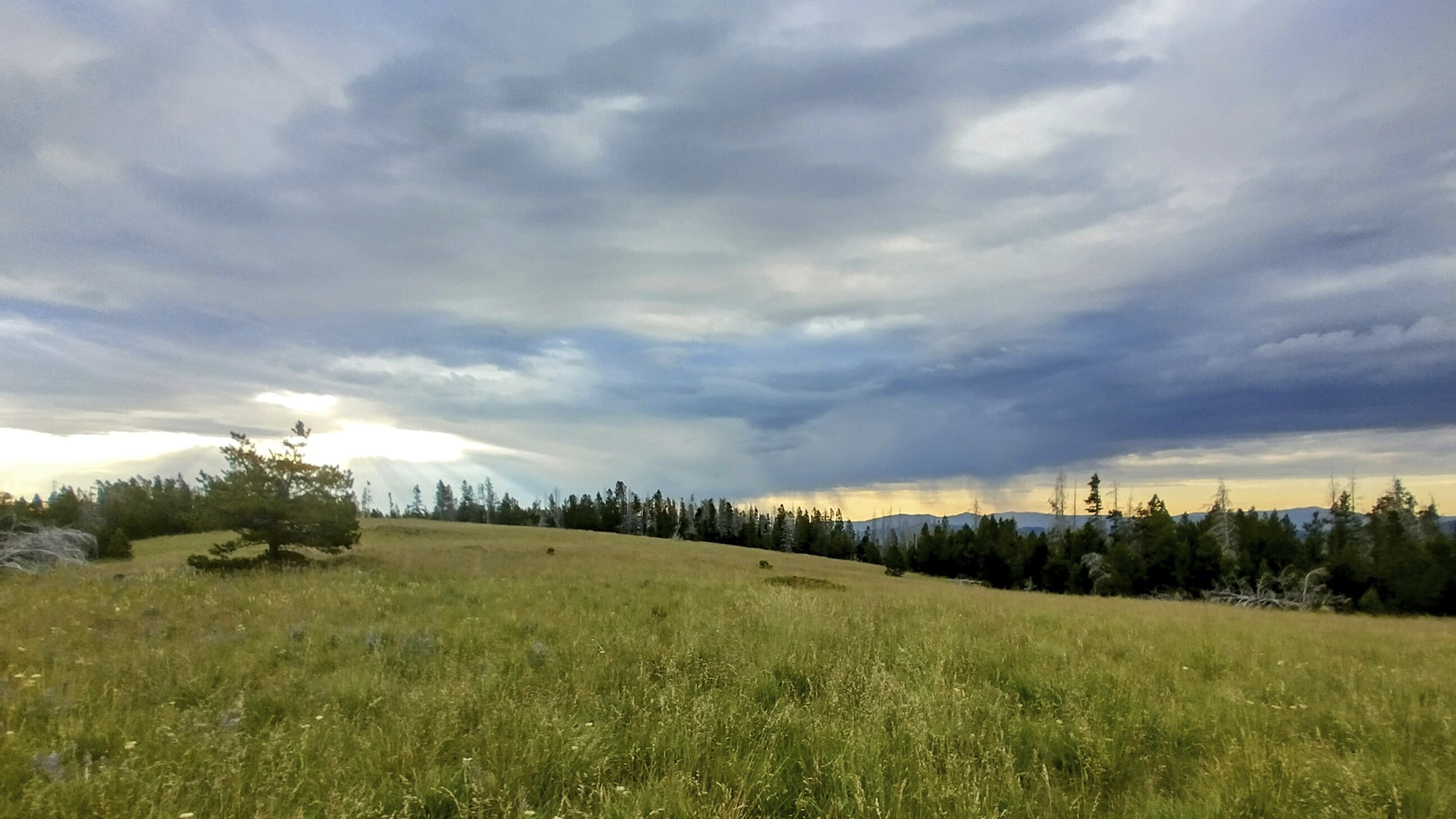
I had a bit of stress trying to figure out where to camp. If you get too close to where people are, private property signs emerge and you'd be unable to camp. If you are further away, fine, but you need a flat spot for a tent, ideally off the road, which is not always easy to find. I reached a meadow in the early evening and decided this would be the place. I hadn't seen any other vehicles on the road since the motorcyclists, and in fact no one would come by all night as far as I know.
Down the road was a kind of hostel/ranch where a commenter on the FarOut app said hikers were welcome to stay. But I didn't know how far down the road it was. I might even pass it, and then I'd be in "no mans land," unable to camp amid all the private fields. So I played it safe and set up my tent in the tall grasses of the meadow. A deer came by as I settled down to sleep.
End of the day, the view from my campsite.
Eating dinner, my 20 miles done.
July 12, Day 102
22.3 miles, 3146 feet elevation gain.
I awoke with a burning desire to reach Helena. But it would be about 28 miles. Let's see if it can be done! At least a fair bit of it is road-walking with the variant I've taken down in the valley...
Before long I came to this interesting hostel where hikers and bikers are welcome. But a kind of "gatekeeper" young woman came out front and met me as I passed by.
"Good morning, I hear this is a friendly place for hikers!" I said.
"Well, for bikers, actually." She related how the married couple who ran the place met when he rode by on his bike of the CDT many years before. There were little welcome signs and tiny cabins spread around the grounds. It seemed really cool. I would have LOVED a cup of coffee, but the young woman guarded the gate carefully.
"Well, see you later," I said, but she didn't reply. Very strange. Perhaps a bad hiker came through and ruined everyones opinion of hikers? There are so many things I'll never understand. Oh well. I walked the rest of the way down the valley, then turned right on a road to climb back up to the crest. I'd seen comments about angry property owners and uncertain tresspassing, so I was a bit worried as I climbed back into forest from open country. I was hiking along Lost Horse Creek.
I passed a few buildings but saw no people. Eventually I hiked up a very steep Four-wheel-drive road called Towsley Gulch. There were old mines and vigorous private property signs, but as far as I could tell, I was always on the road, even though it looked like a washed out trail at times.
Eventually I made it up to the divide again, which I gaily walked across, directly down into Dog Creek on the other side. Nope! Not gonna stick to the crest!
Somewhere in here I saw Mike and Heather again, probably getting water from Dog Creek. I was listening to music a lot and dreaming of town.
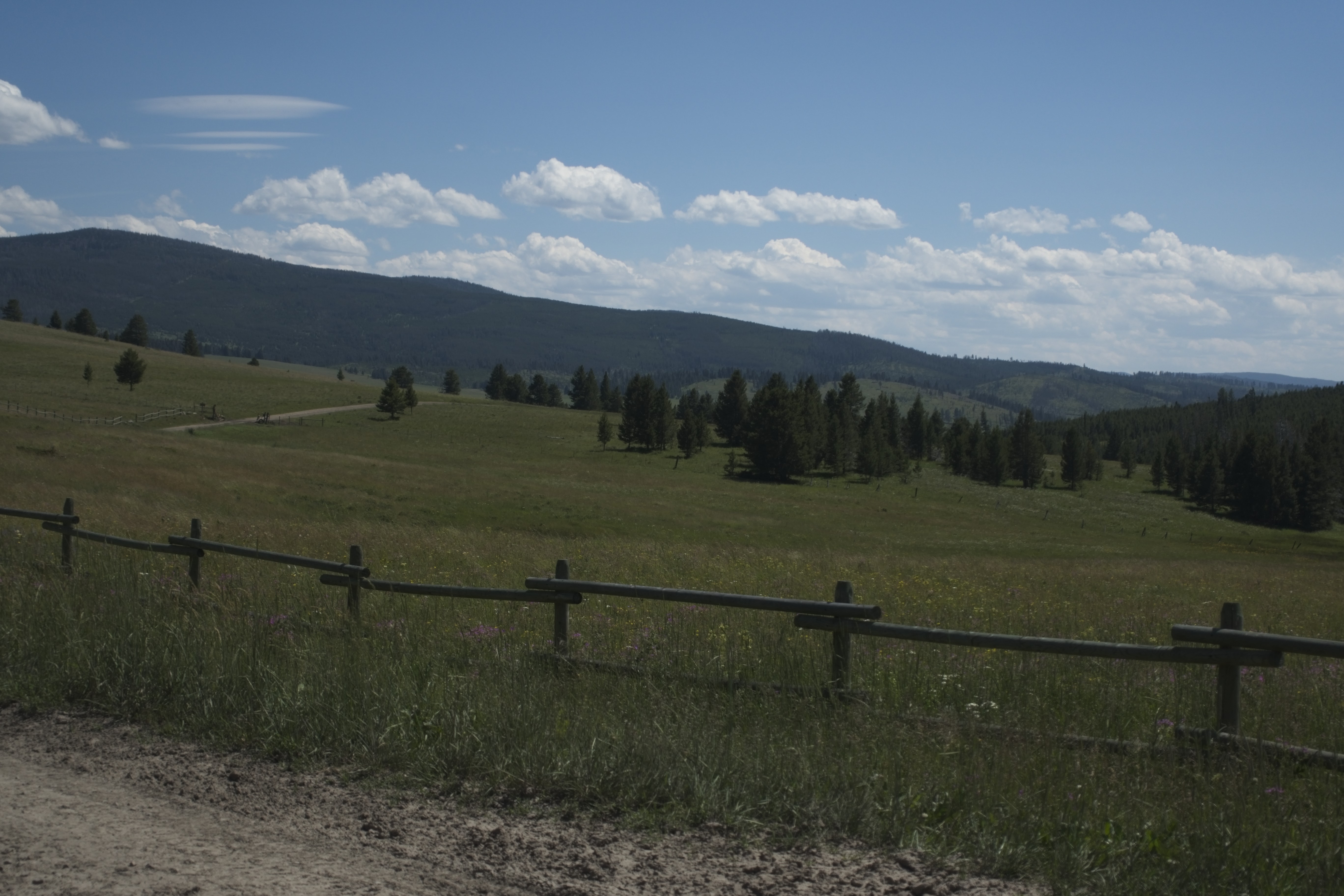
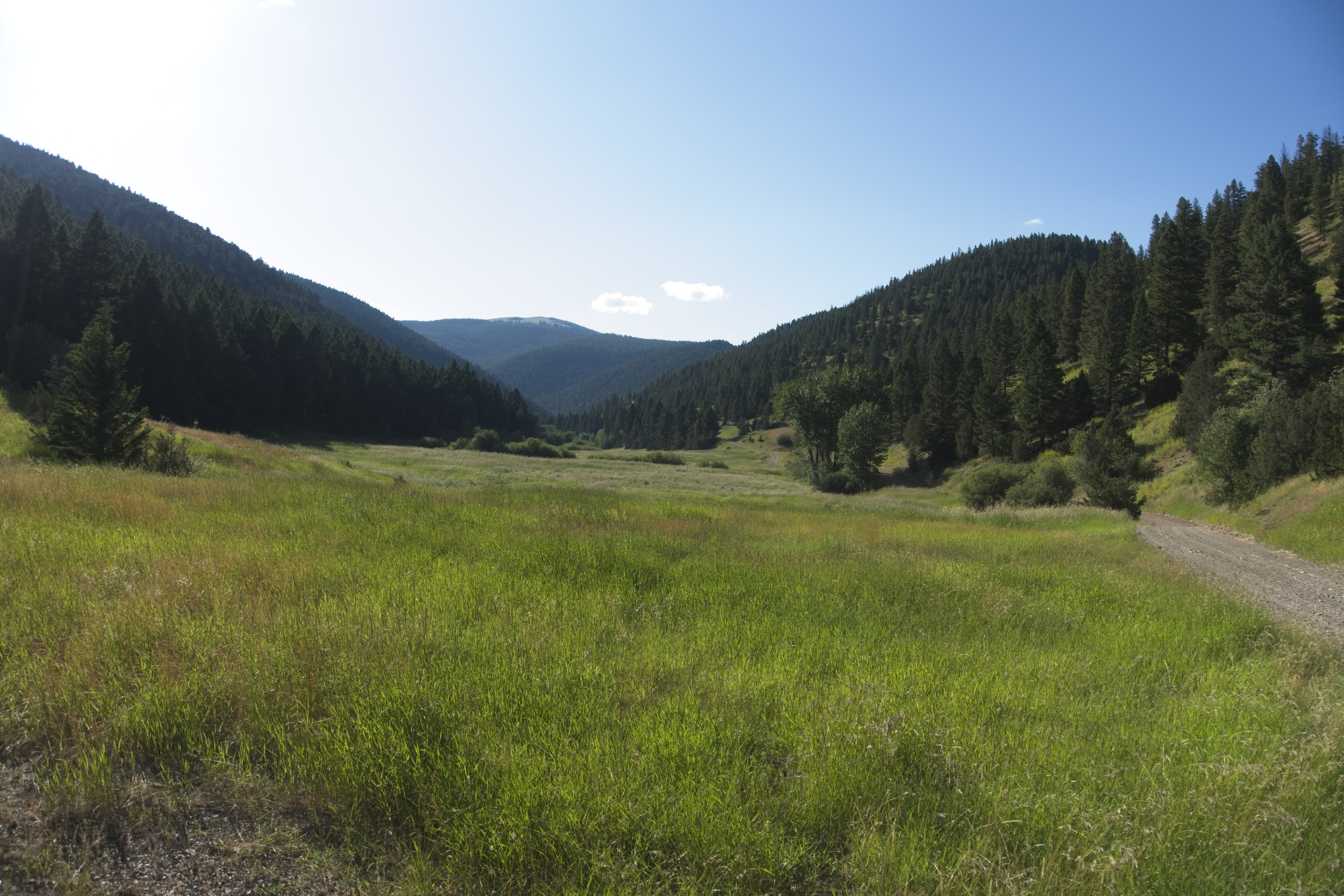
Country not far from Mullan Pass in the afternoon.
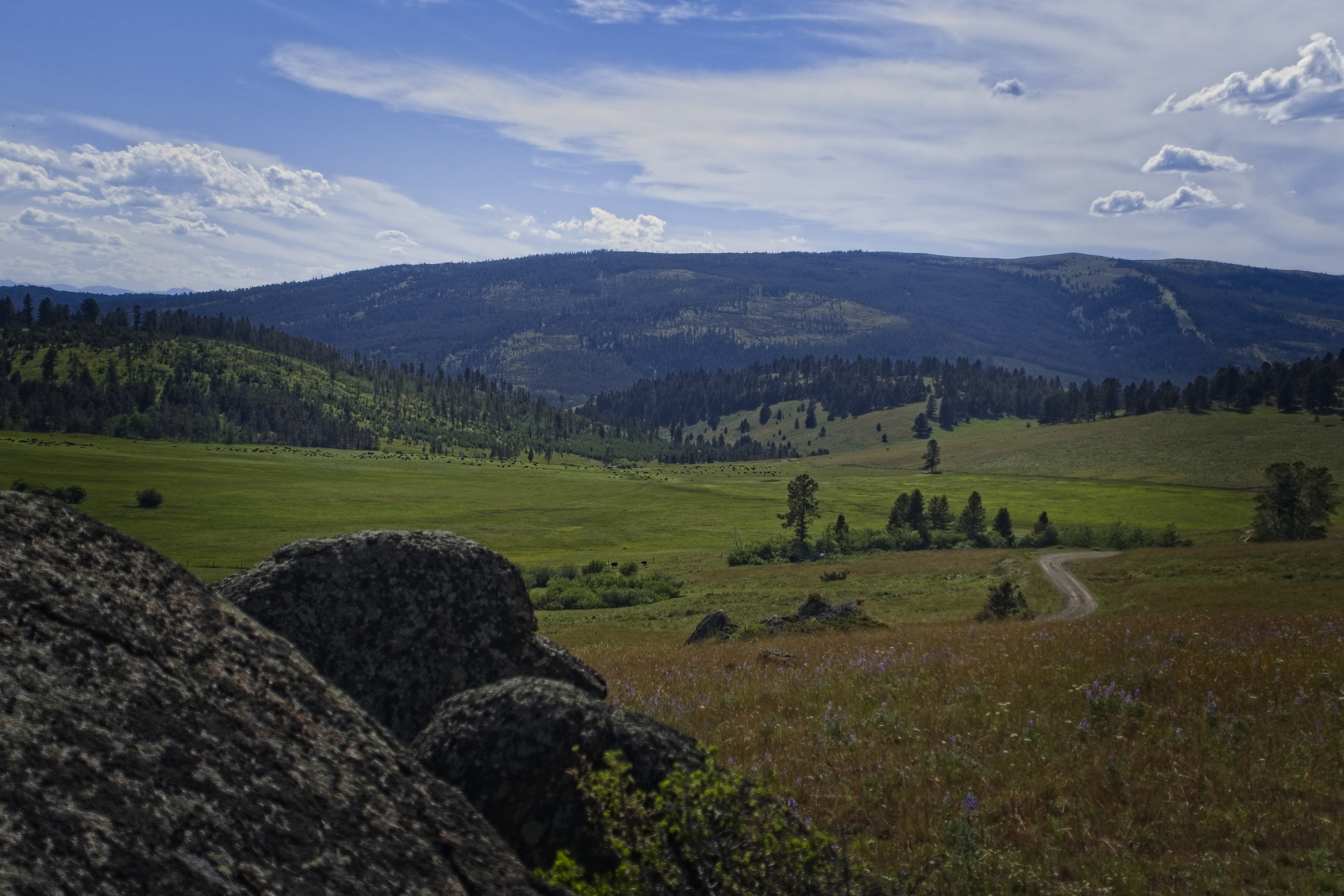
This area of Montana is quite scenic. It looks like the Montana of
western movies.
After another couple of hours I met the divide again at Mullan Pass. This time I finally had to stick to the trail, but only because of private property! I wanted to just hike across a meadow and avoid an upsy-downsy forest on the other side of a hill. But there was a fence. And these people aren't gun-control enthusiasts! Therefore I'll give them their full and due respect :).
This was the most tiring part of the day, winding around in a rocky, brushy forest. But it was scenic, too. I didn't realize it at the time, but looking at the map now reveals I was hiking on top of a railroad tunnel called the Mullan Tunnel. I climbed tiredly up the other side of the forested gulch and popped out in the open at Priest Pass.
Can I make it another 6 miles?
Ugh. No. I'm absolutely bushed. I hobbled a quarter mile down the road on the east side of that pass to find a campsite. I set up my tent. I ate dinner. I lay down and didn't move.
My camp at Priest Pass.
July 13, Day 103
5.7 miles, 1300 feet elevation gain.
In the morning, the prospect of climbing 1300 feet up a hill wasn't nearly so bad as the night before. Still, I creakily ascended, seeing no one.
There was a radio tower on top, giving me cell reception, and the views were excellent.
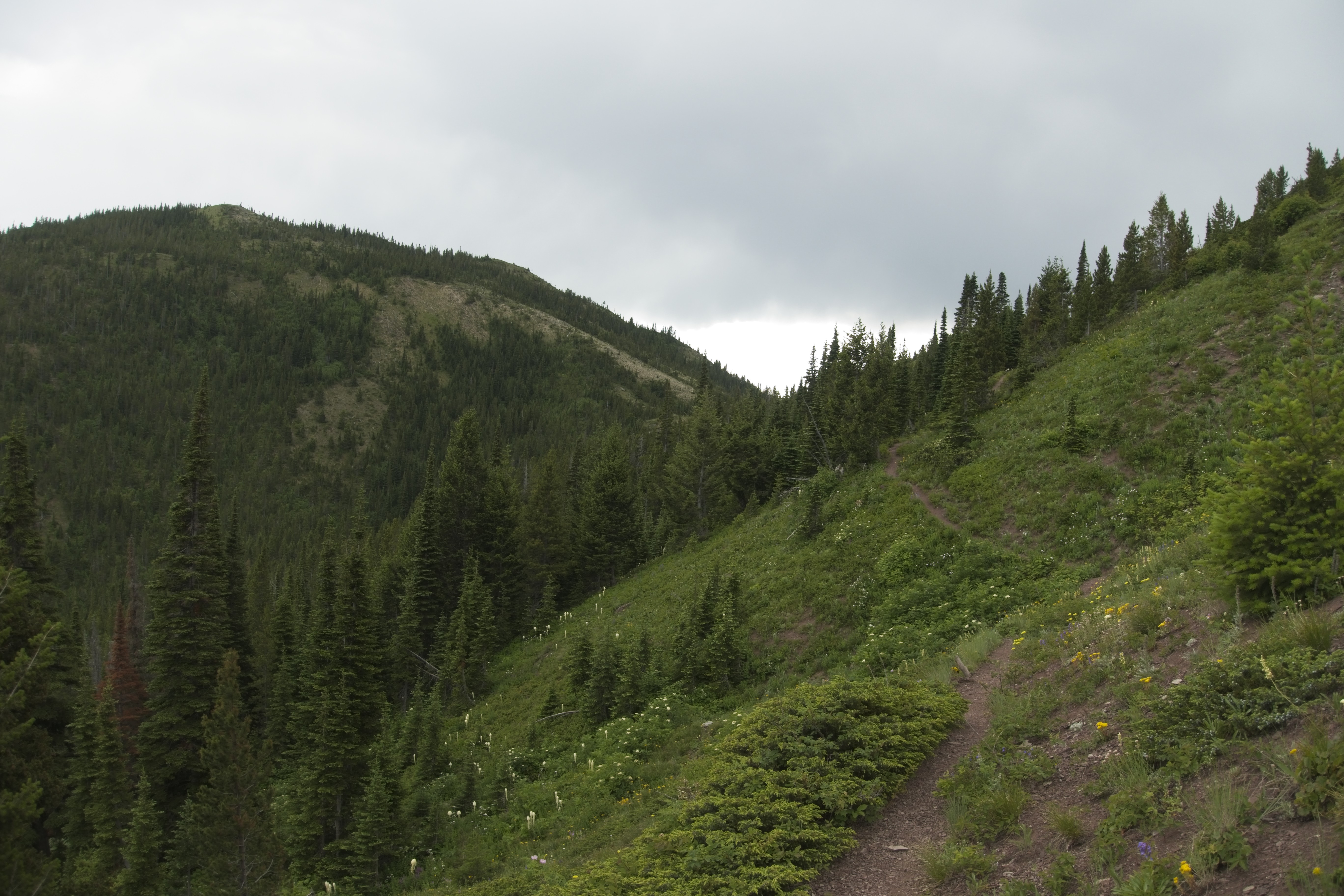
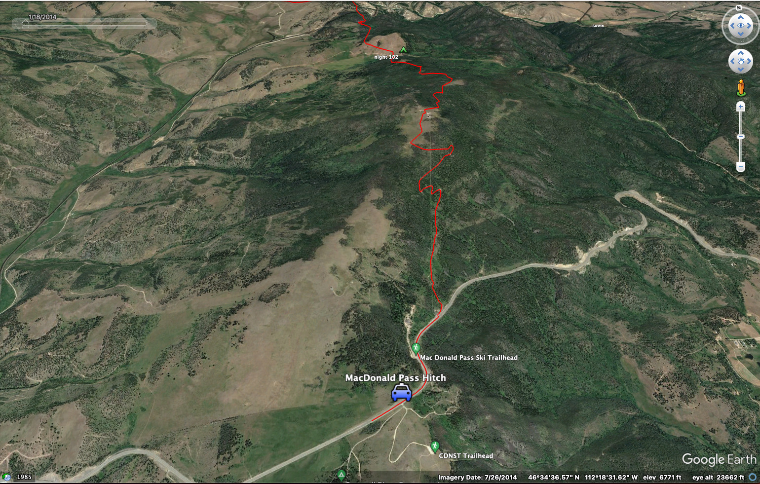
The country on the hill above MacDonald Pass.
Looking off east towards Helena.
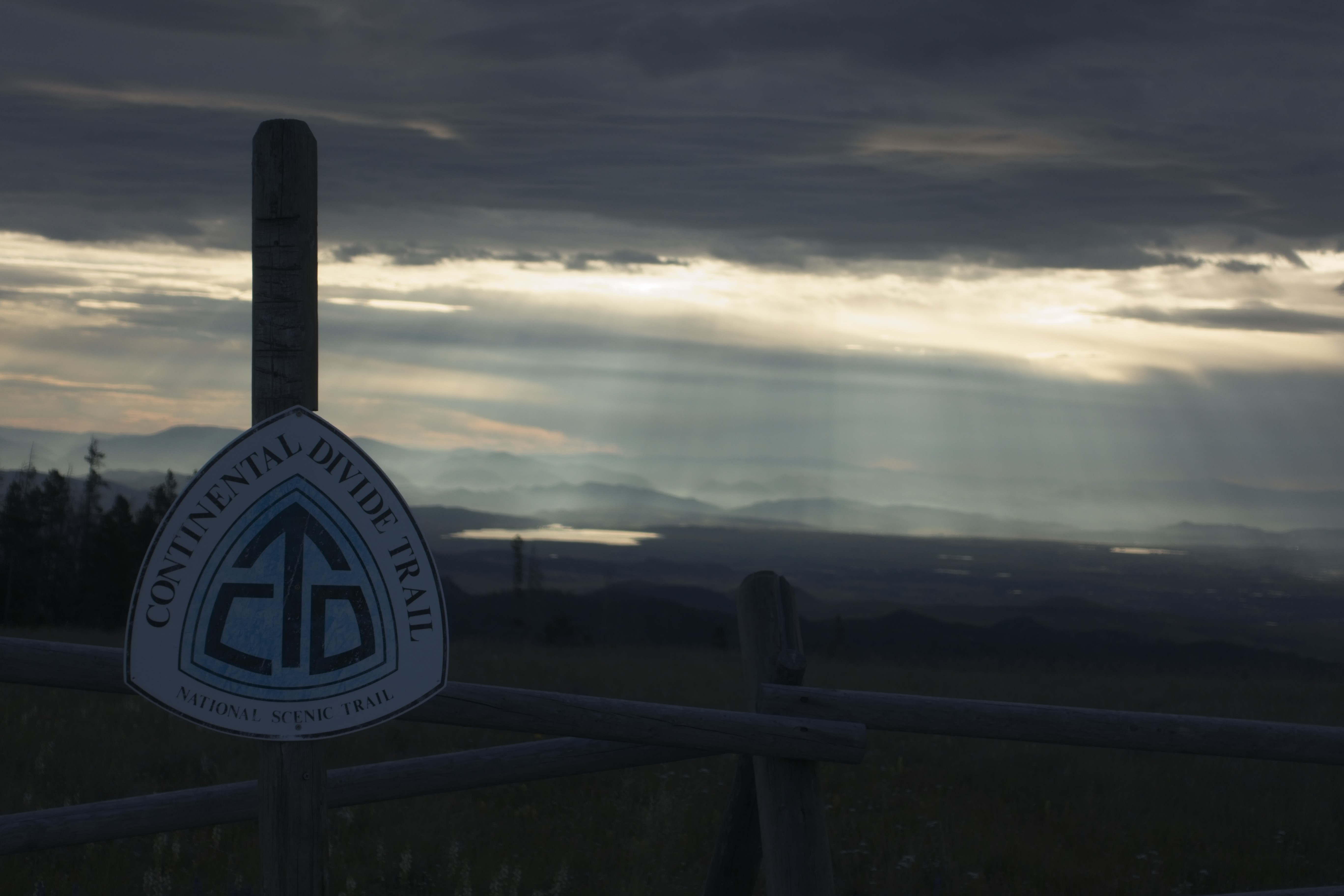
Same, but with CDT sign.
I hiked happily down, finally coming out about a mile west of the pass. I had plenty of energy, so I hiked right to the pass for "completeness." I simply wanted to stand there.
However, hitching didn't go well. I tried for about 30 minutes, with no luck. Finally I found a phone number for a shuttle driver and called it. The phone only worked if I stood on a rock and faced east. She agreed to come in 30 minutes.
However, she never did. After a scratchy conversation it turned out that she only went down below to the place where the trail emerges. I tried to convey that I'm at the pass PROPER. I don't know if she understood.
Rather heartbroken, I felt my rest time in Helena dwindling away as the cars drove pass and my attempt at a shuttle had failed.
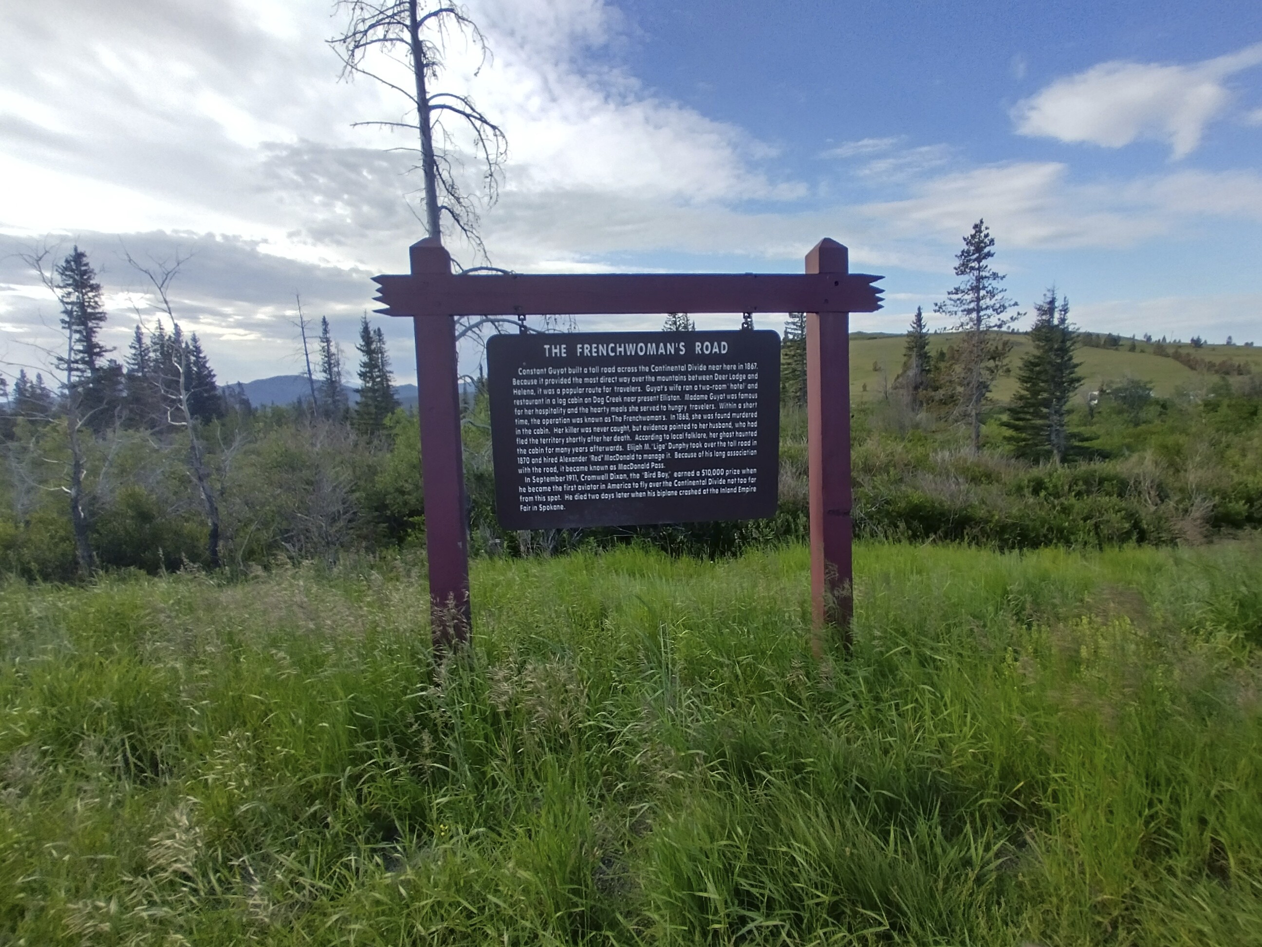
Interesting story about the murdered frenchwoman haunting her cabin.
But eventually a car pulled up. It was the shuttle driver! She finally put two and two together. Hmm...here is a man who insists he is at the pass...but I WENT to the place NEAR the pass where the CDT comes out and he wasn't there! He calls me back and I can barely understand him, but I do hear the words MAC-something PASS. Finally I think...why don't I go to the pass and look for him.
And so she found me. Sigh.
I got dropped off in front of a coffee shop downtown. I really liked this place and hung out for a couple of hours.
Mike and Heather appeared there and we chatted awhile. She had some kind of discount on hotels as a former corporate officer, so they stole away soon enough. I found a motel nearby and sent Cory an email about where I was.
And so ended a very long stretch of the CDT. There was a real difference in isolation from East Glacier Village to Helena. Now it was time for a rest day...
To go forward to days 104 and after, click here.