CDT - Helena to Bozeman
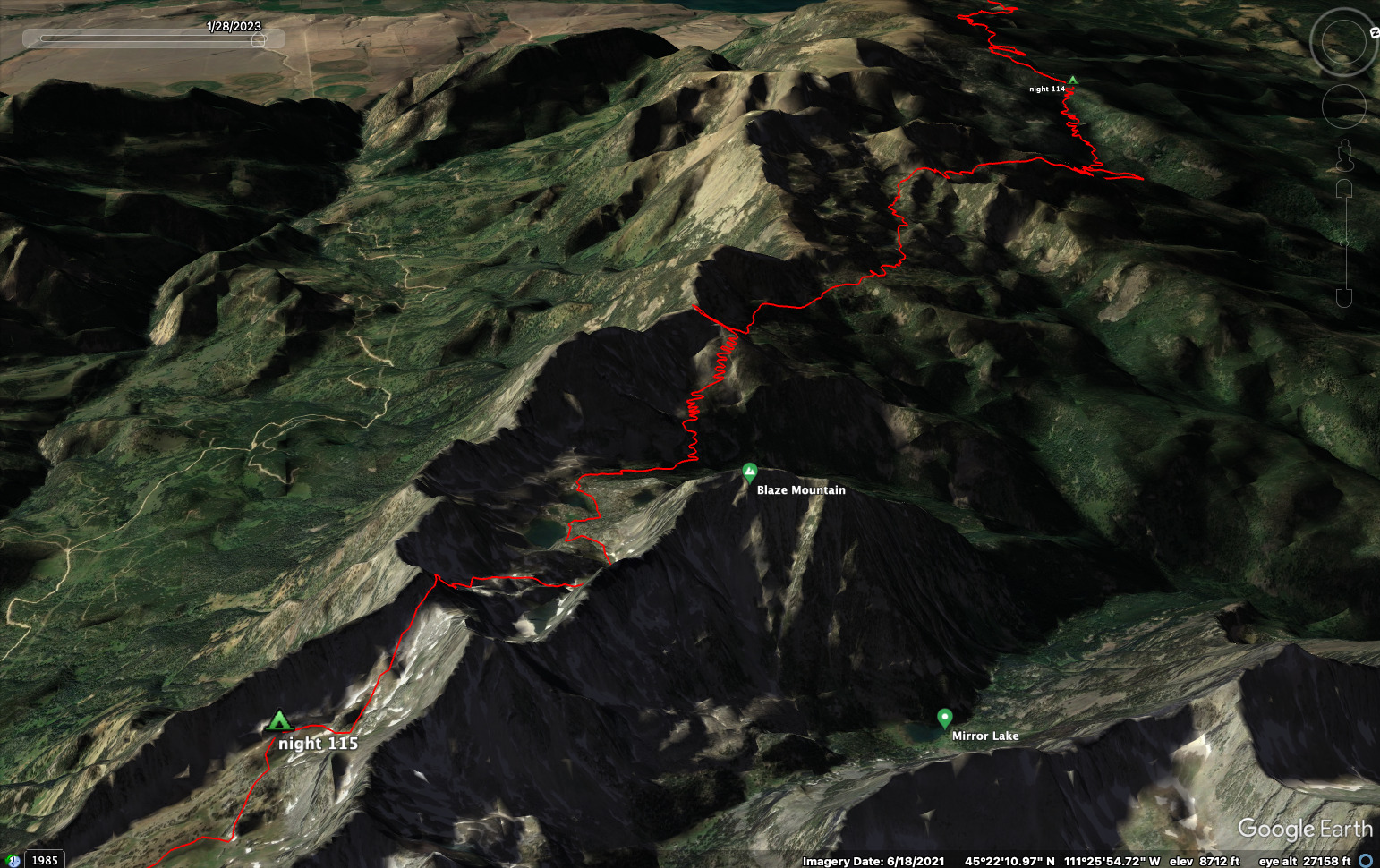
Friends: CoryLocation: Helena, CDT Night 105, CDT Night 106, CDT Night 107, Butte, CDT Night 109, Whitehall, CDT Night 111, CDT Night 112, CDT Night 113, CDT Night 114, CDT Night 115, Big Sky, Bozeman
Elevation gain: 10974m = 1505m + 888m + 971m + 26m + 850m + 177m + 1270m + 1826m + 399m + 1447m + 1479m + 136m
To go back to days 104 and before, click here.
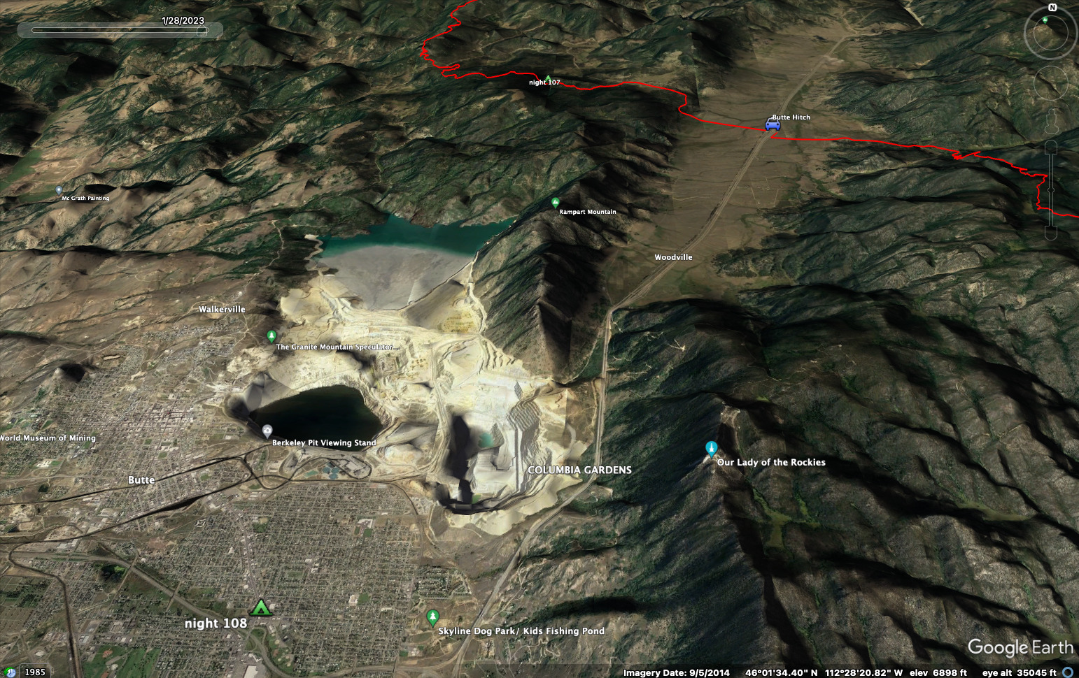
First, 65 miles from the CDT detour (trail was closed for the summer) to Butte.
Then back to the highway for the walk to Whitehall and across the Tobacco Root
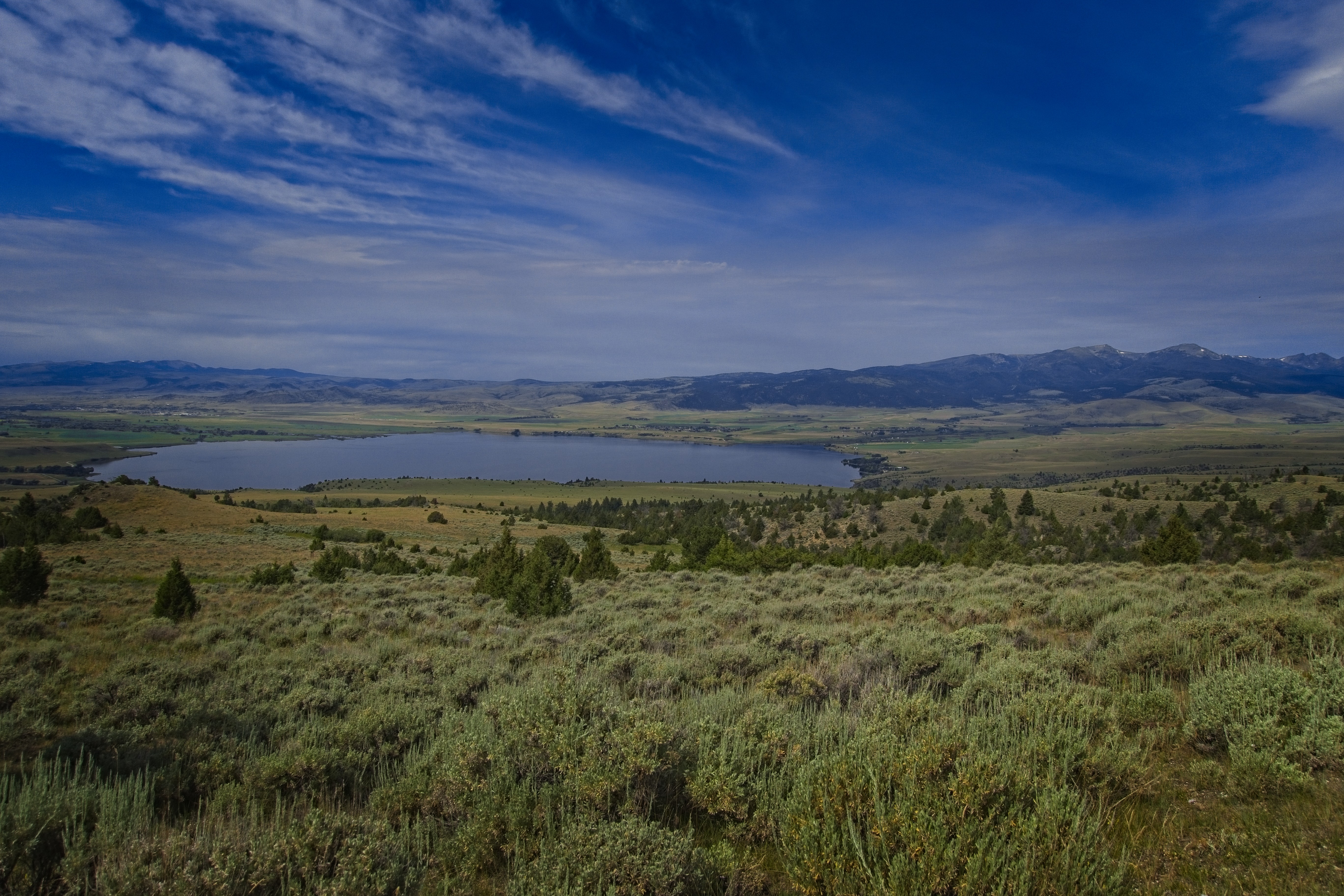
Mountains for 104 miles until a hitch to Ennis for supplies and camp.
Finally a scanty 32 miles from Ennis Lake to Big Sky, where Robert took us to his place in Bozeman.
191.4 miles, 36,000 feet elevation gain for this section. Two discontinuities: first, we couldn't start at MacDonald Pass when leaving Helena. Second, we got tired of road walking so our hitch to Ennis began a few miles before hitting the main road. The next day we started at the main road to make our way to Bozeman.
The text below refers to the same events as the blog entries:
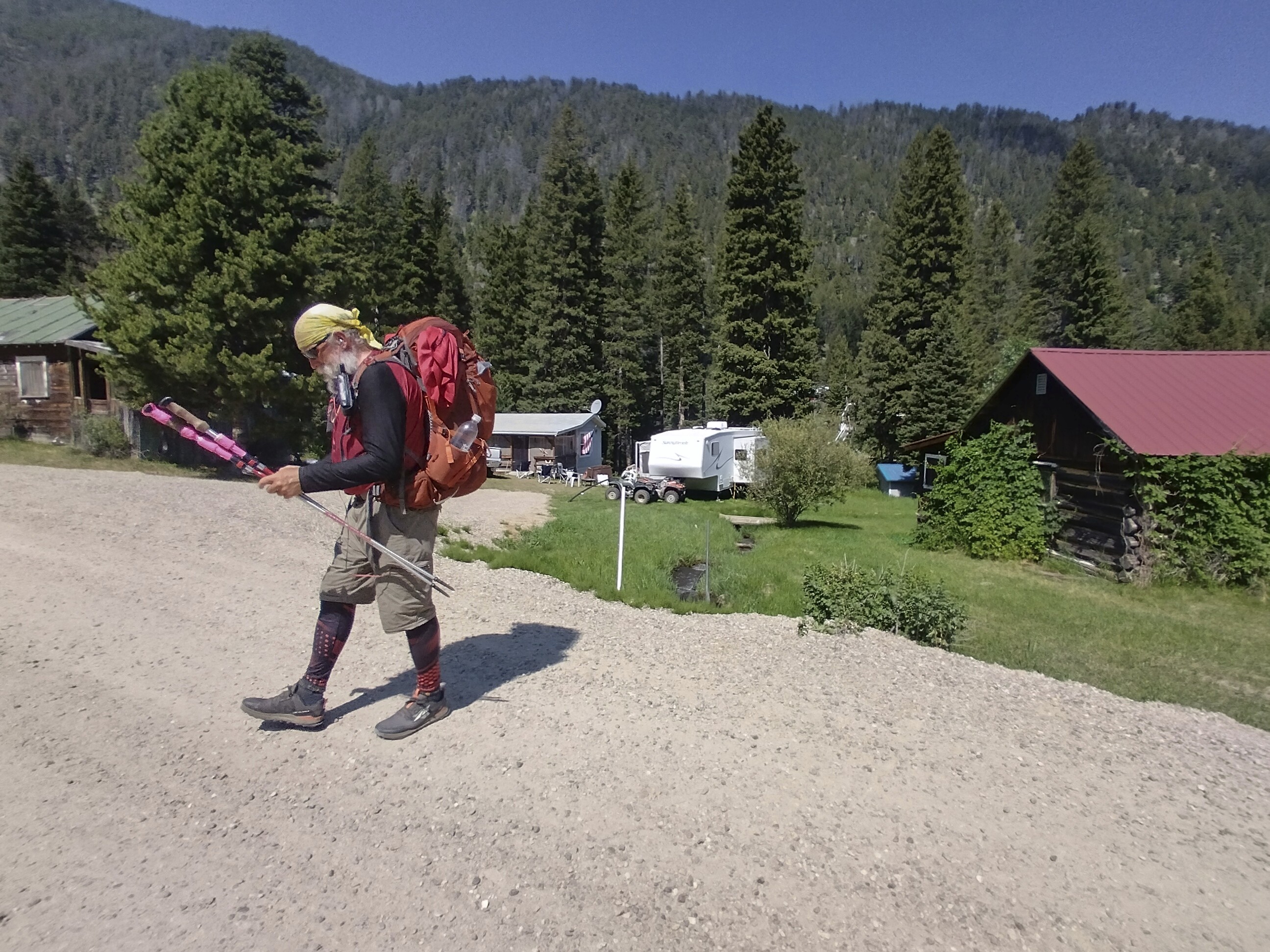
In Helena I went into Fire Tower Coffee Shop and didn't come out again for hours, having a great breakfast and coffee, and numerous conversations. First with Mike and Heather, then an unusual young lady named Rachel who studied religion. I once met a very interesting man on the internet, a yogi, as he said. And I think he might live around here and play the violin.
I booked a room at the Budget Inn Express just up the street. After this I walked east to Walmart (I think) to buy the next leg of supplies. Then I settled in with cigars and beer from the "Man Store" across the street. Wonderful.
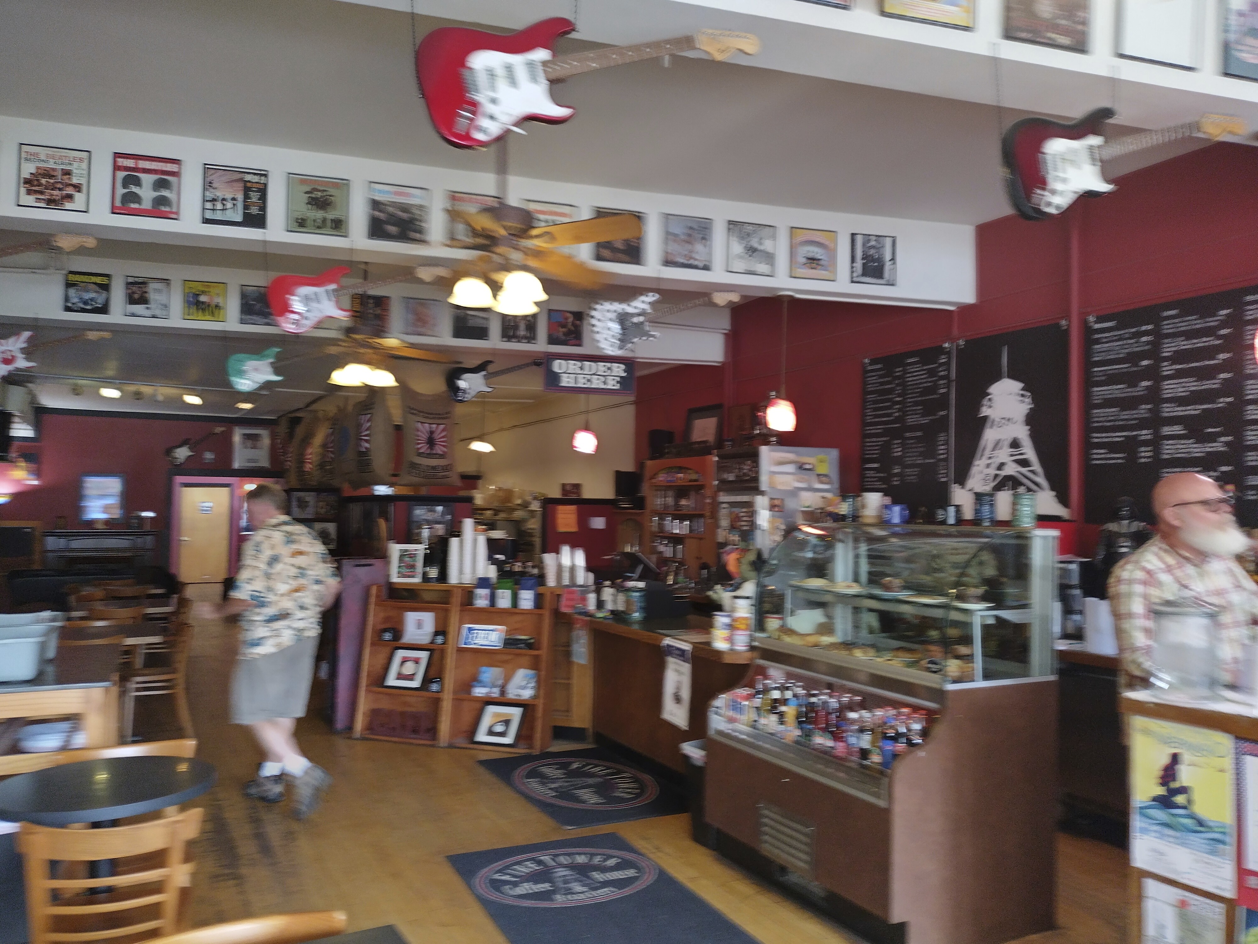
Inside Fire Tower Coffee, where I had a great breakfast the day of arrival
and long talks with cool peoples.
I met a very interesting guy from New Mexico named Michael
and we spent 2 hours chatting
about life and philosophy at a park bench downtown. So much fun.
The next day I dedicated myself to sleeping in then stuffing myself again at Fire Tower. In the afternoon, Cory arrived in town! I was a real idiot... he could have shared a room with me. But he got himself a room. I bought beer for the crew (me, Cory, a guy who hiked out with us the next day and Rachel). I told them to do what I was going to do: drink the beer and settle in for a nice nap!
I also went to the library at one point to type in a blog entry. Me and Cory went out to a steak restaurant for dinner, kind of a fancy place. That was great, too.
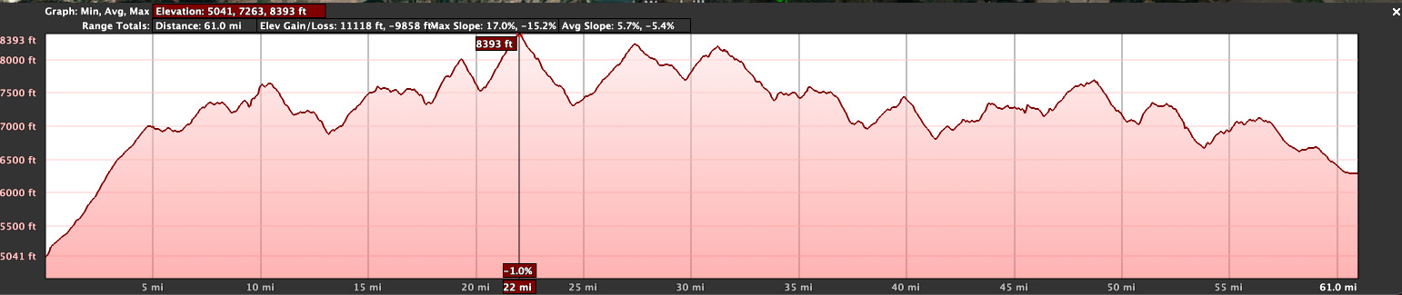
July 15, Day 105
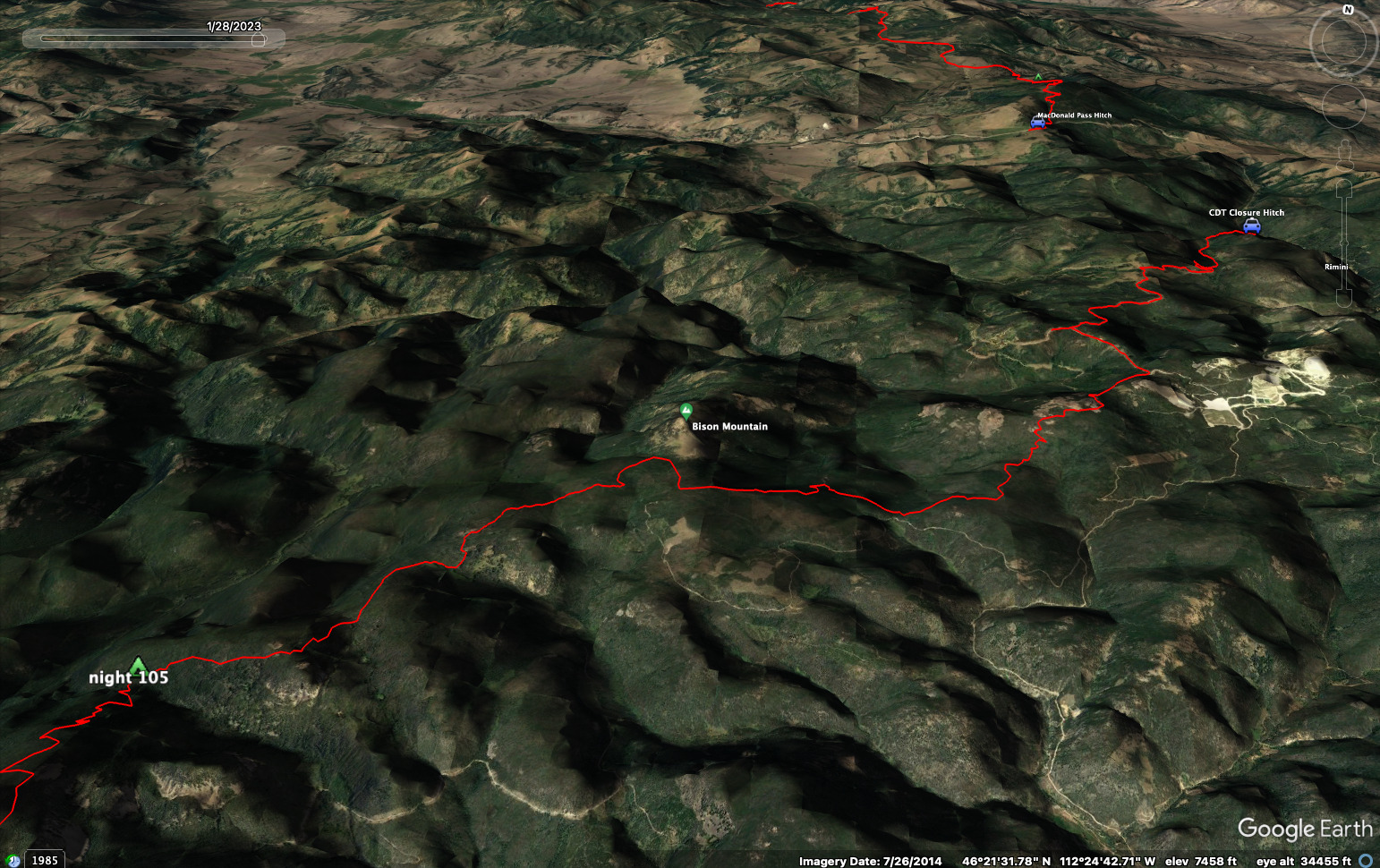
21 miles, 4940 feet elevation gain.
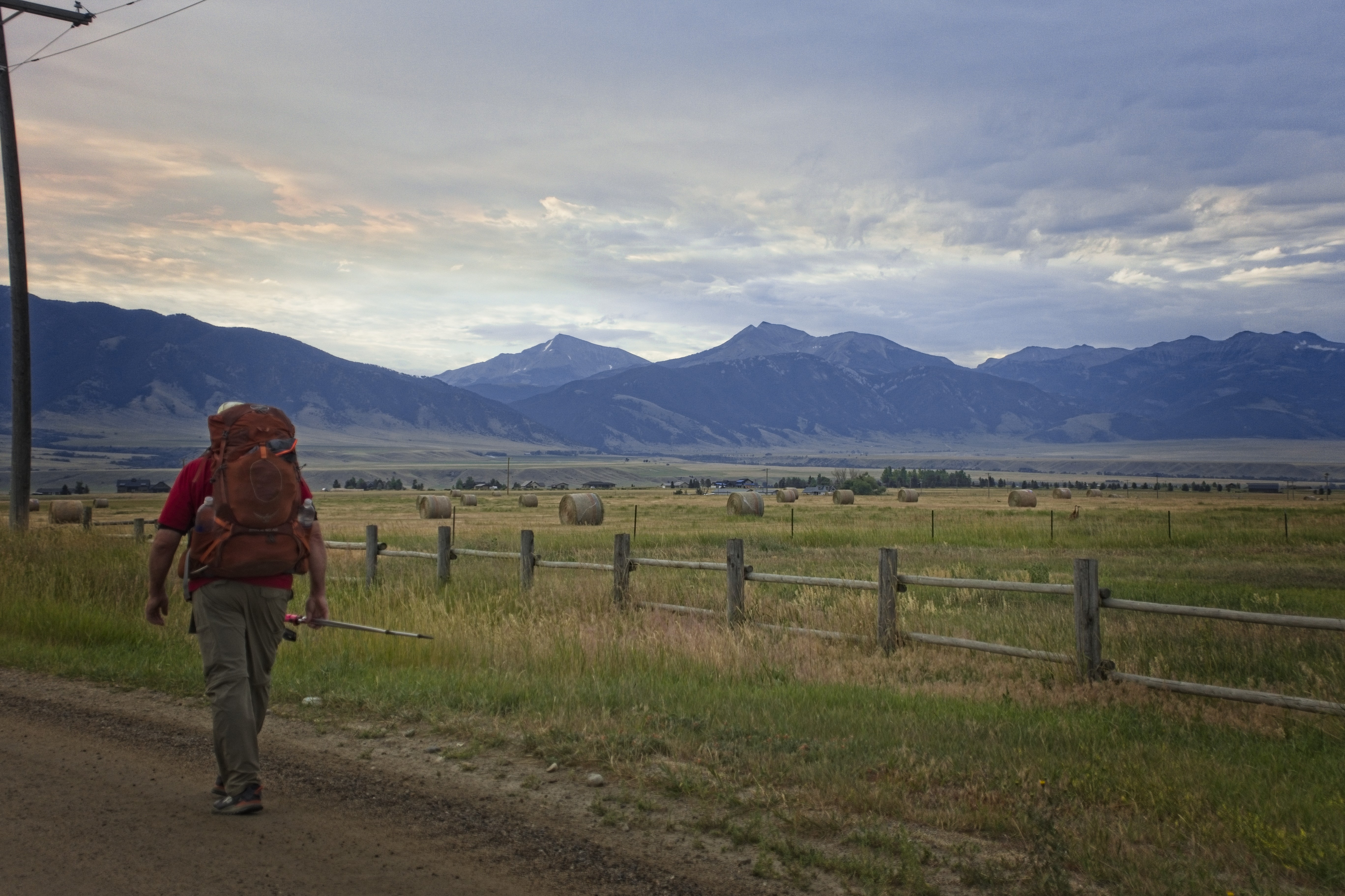
Well, it's time to get going. The three of us split the cost of a shuttle back to the trail. A big stretch was closed on the south side of MacDonald Pass, so we had to make a detour. I didn't complain when our driver drove us a few miles south passed the Moose Creek Campground to a road junction, saving us a few miles of walking!
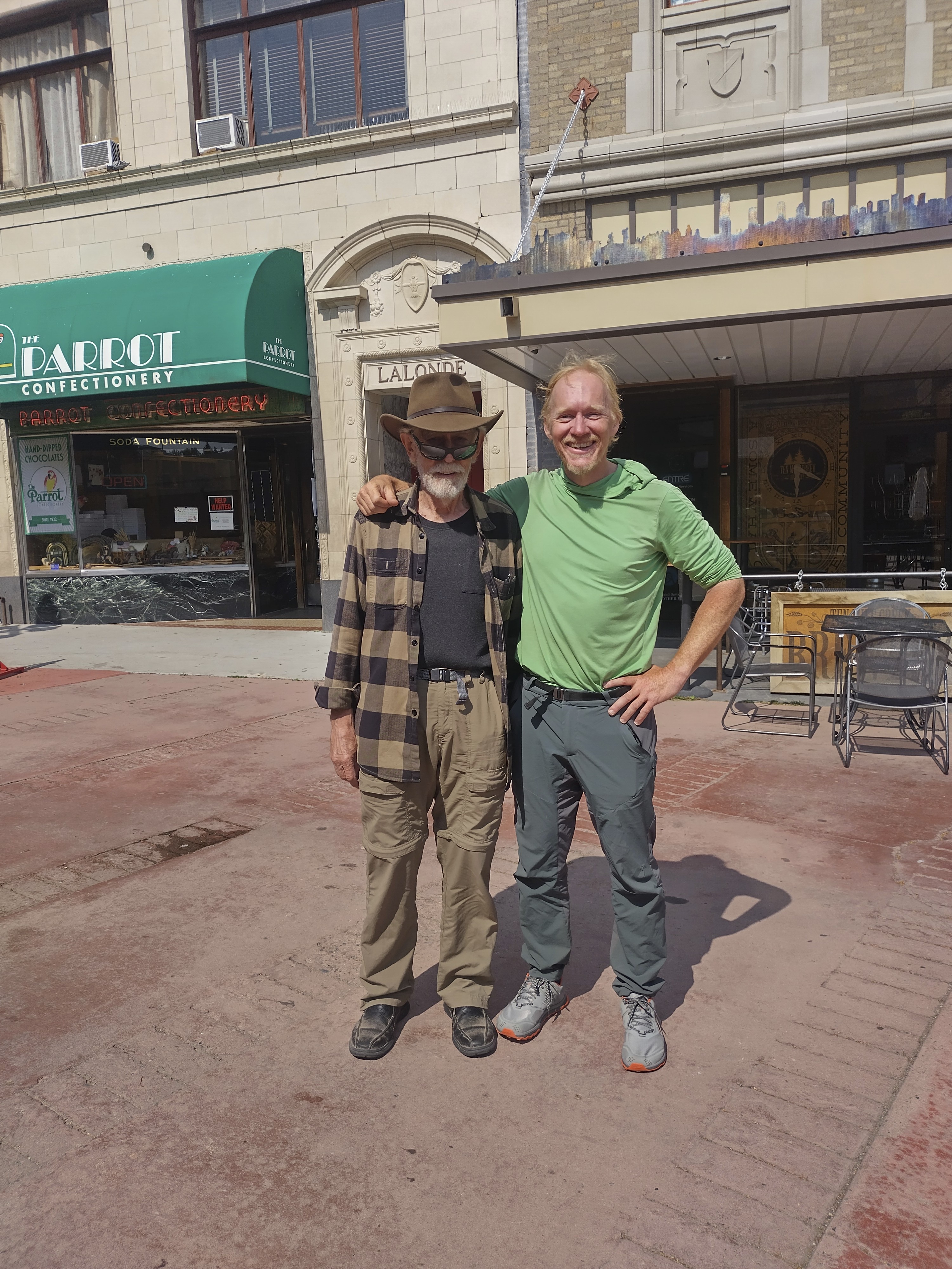
We got out and our third guy took off running, essentially. Cory and I never saw him again. I don't blame him...we can be weary company. He and I compared notes on the prior 11 or so days we walked separately. He'd met Rocketlama, she of the web-comic, as she departed the mountains at the Benchmark Ranch. He'd also run into Dragonsky and various other folks we knew.
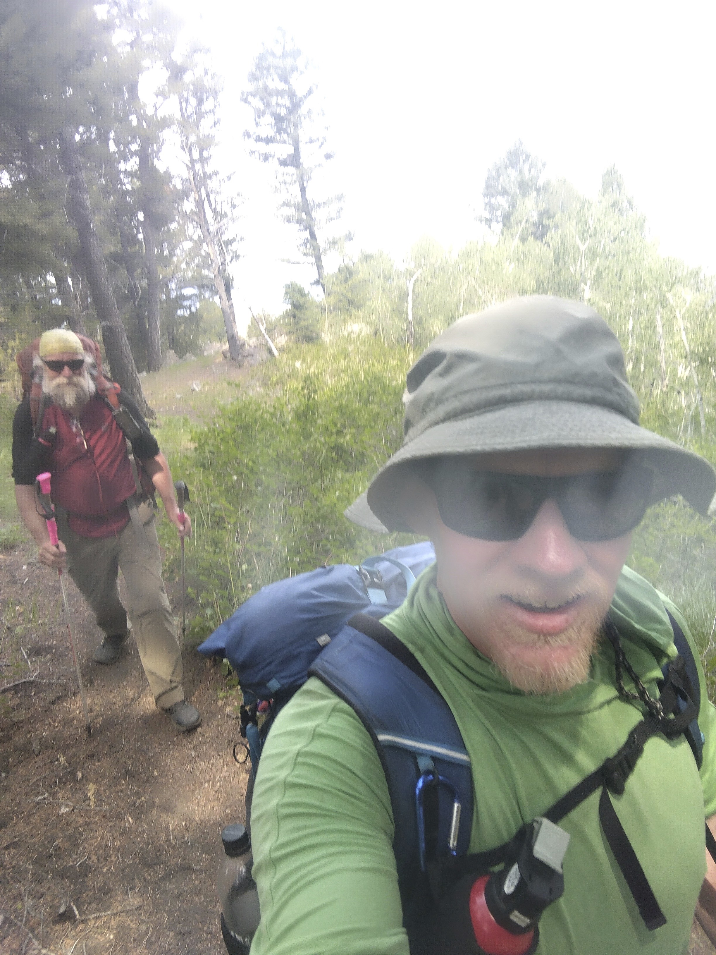
My only picture of the day, here shown is Cory on the left and a frenchman
who camped with us that evening.
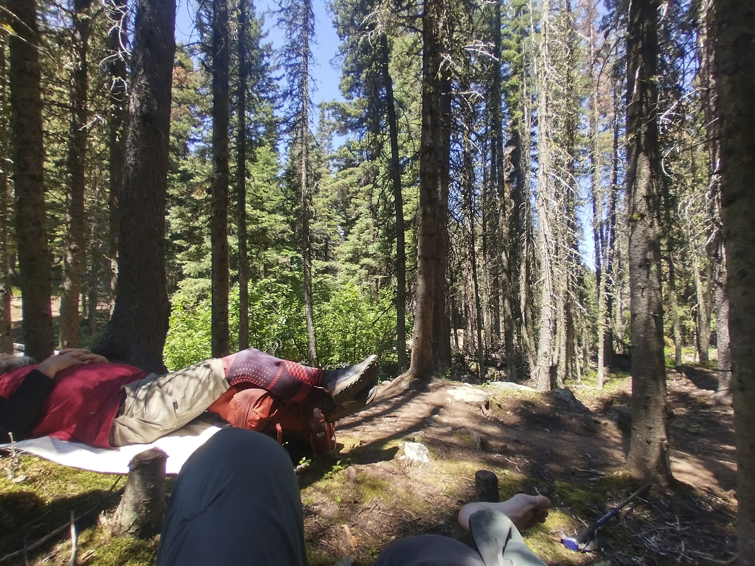
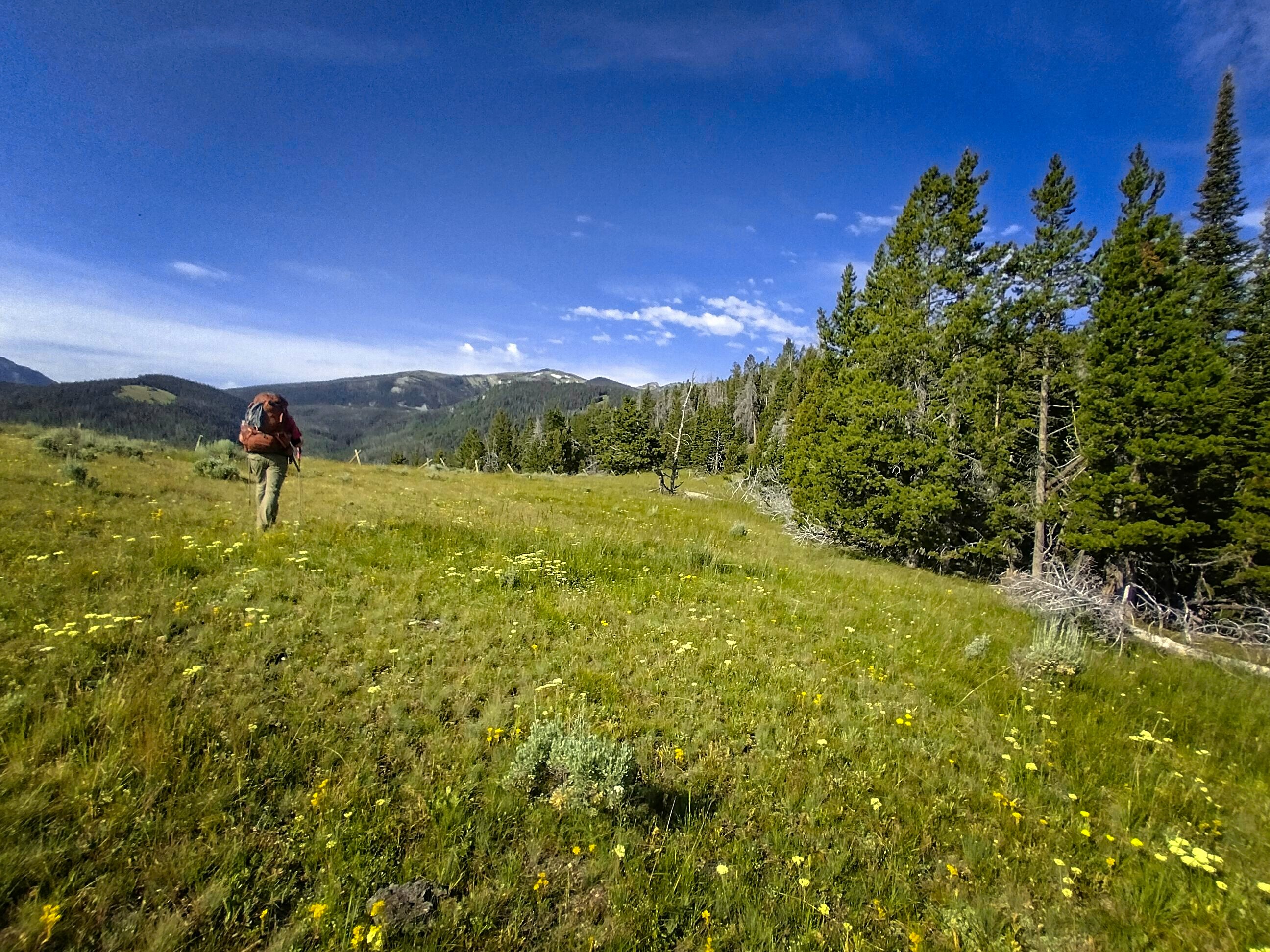
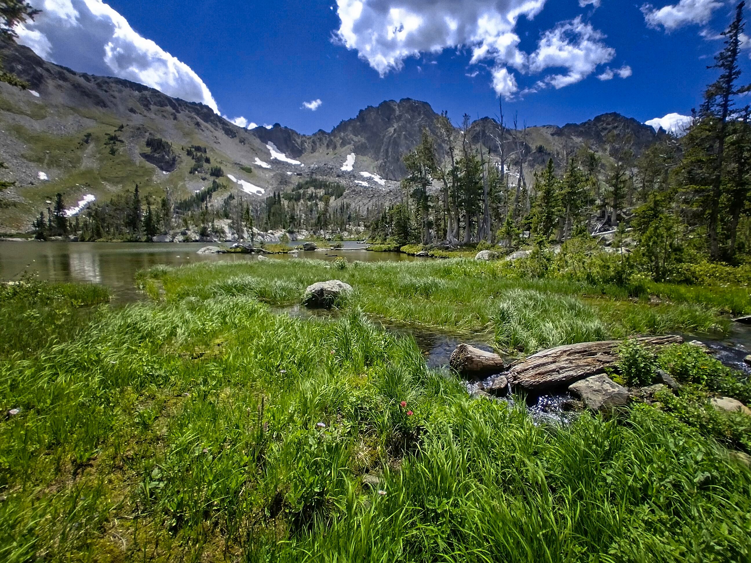
We got in our 21 miles and came to a saddle just north of Thunderbolt Mountain with a little camping area. Good enough for the day! We'd had good weather and pleasant walking. I don't remember any horseflies, though there were some mosquitoes.
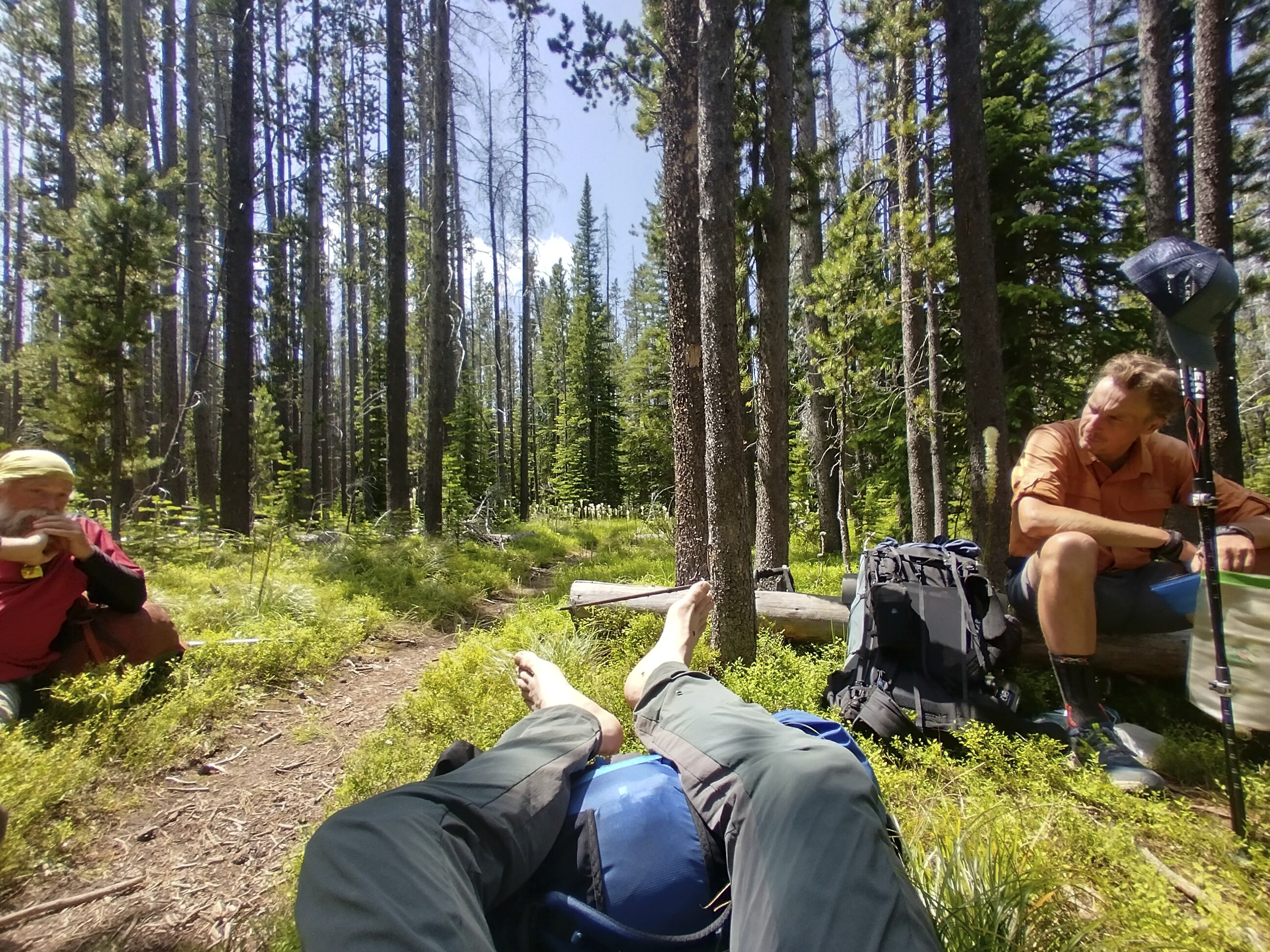
July 16, Day 106
19 miles, 2915 feet elevation gain.
The day began with a hike mostly up Thunderbolt Mountain though it mercifully veered off below the summit. Then a long journey off to the west around another peak. We came up to some rocky ground above the trees for a few minutes, that was nice. Mostly though, it was reasonably pleasant forest. Very little bear sign in this country, though occasionally we ran into someone who said they were around.
Cory and I on this warm, fine, long day.
We continued talking about an idea we got in the Bob: "Strawberry Creek Radio," a station that might have existed out there, run from a mountaintop by an odd group of loggers, founded in 1922 and going strong until 1943 when it suddenly went off the air. But on some nights, with a shortwave radio, you can still pick it up. The rowdy singing of an old loggers tune, "the Men of Strawberry Creek," followed by a godly address by one Father O'Conahan. After this, news from the twisted and rainy valleys, and the remote logging operations west of the Chinese Wall. Notes on births, deaths, and then the recipe corner, hosted by Mrs Pierce, recently widowed. Yes, you can still hear it. They're out there, the men of Strawberry Creek. Perhaps they were always there...
We'd mime various scenes that might have occured. One that always tickled me was when Father O'Conahan shared visions received in contemplative prayer. They were always eerily true, but softly pooh-poohed by the radio hosts. "Oh come now Father, it can't get that bad!" they'd say. He'd said ridiculous things like "and the sodomites will march under a flag of their own design," and "small children will be placed on their laps, and they will be dressed as womenfolk."
Poor Father O'Conahan...probably nipping a bit too much of the Eucharist wine, hmm, kay?
Anyway, this radio station was the right mix of whimsical, plausible, inspiring and ridiculous by turns which made it a fun toy for the trail. I'm still thinking about mocking up some broadcasts...
Also in here we met Maarten, a skinny feller from the Netherlands. He was resting by his backpack and we walked up to join him in a shade patch. We'd stick together over the next few days, camping for the night at Champion Pass, then again near the road, and then we'd hitch into Butte together. Turns out he is an atheist communist who genuflects before mother earth (ie, climate change as existential threat...this is how the atheist sneaks a god back in). Why, he and I filled the woods with the fire of our very much opposite convictions!
To be entirely truthful, I think the pretty woods were a bit boring, and he and I were happy to exercise our brains a little bit trying to get one up on each other. Cory knew it was impossible, so he motored along and mostly ignored us. Nobody changes their worldview because of the addition of one more "fact." It does happen...but once it happens in one life, there are strong antibodies preventing any kind of return. I lost a dear friend in recent years because he and I gradually crossed the ideological spectrum as we knew each other. In a span of 7 years, he moved from conservative to liberal, whereas I went the opposite direction. Now, when he hears me speak, he can only hear the strained voice of his prior convictions. He imagines them robotically coming out of my mouth. But my conservatism is not his. To be fair, I'm probably doing the same thing to his voice.
Anyway, the country was filling with dirt roads and tracks. We reached Champion Pass in the early evening and I didn't want to walk another step, having seen our mileage reach the big 2-0. We set up on the side of the dirt road and ate dinner, talking of many things.
July 17, Day 107
20 miles, 3190 feet elevation gain.
Today the pretty-but-boring woods got a bit prettier and less boring. I was reminded of walks in Markt Schwaben, where I live.
Maarten and Cory on the trail.
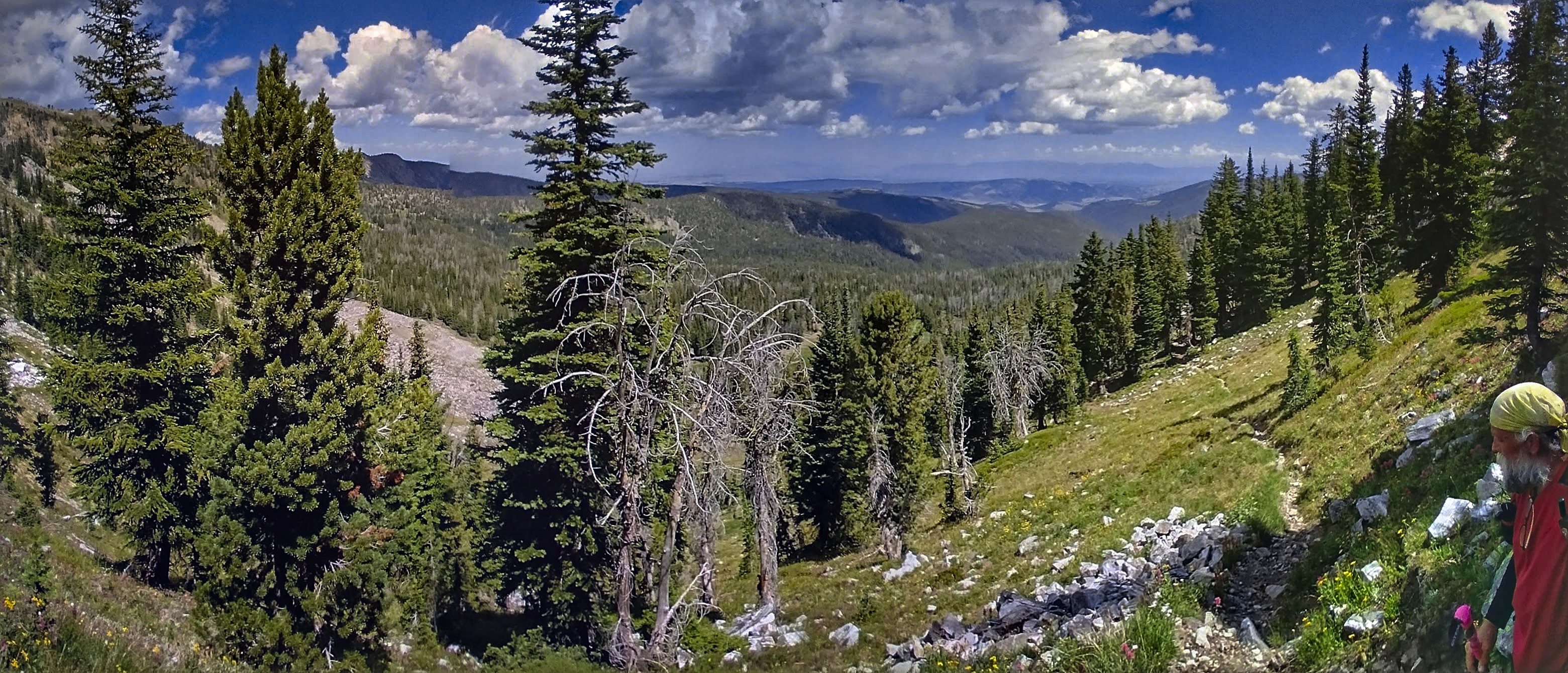
A panorama from Cory with me and Maarten.
With apologies for the excessive processing, this scene of Maarten
walking south reminded me of home, which I spent the day missing.
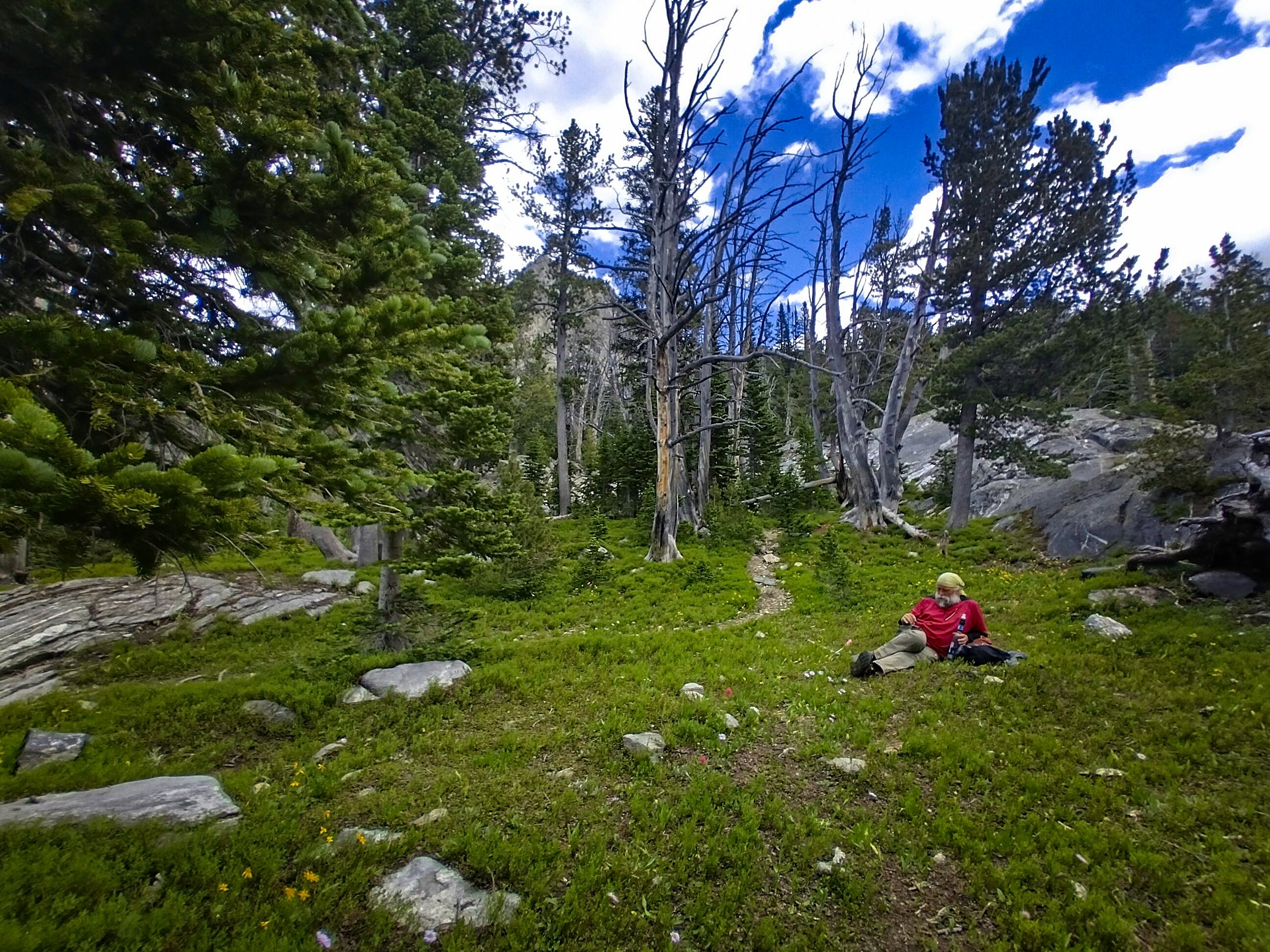
Home...I missed home! This was the first day of a noticeable melancholic mood which would strike with increasing frequency over the next month. With the glories of Glacier National Park over and done with, I had trouble holding enthusiasm for the trip. Sure, the Wind Rivers were coming up, and I even found the idea of the Basin mysterious. But "just get it done" is not the strongest of motivating impulses. It's an impulse, sure. And one I made the decision to respect. Though, at times, I chafed under the rule of my own decision.
So, happily Maarten was there to distract me. At one point, we left Cory behind, vigorously arguing and hiking at the same time. It was quite fun. By the time it was evening we were all joking about strange men in cars creeping around these woods to assault us, because we read some comments about that happening. Of course, that is a serious thing...but we were a bit crazy and ready for town. We hit our 20 miles, and camped at the last possibility, leaving a short 4 mile walk to town in the morning. It was a nice campsite and a fun evening.
July 18, Day 108
4.2 miles, 85 feet elevation gain.
The day began beautifully...with trail magic!
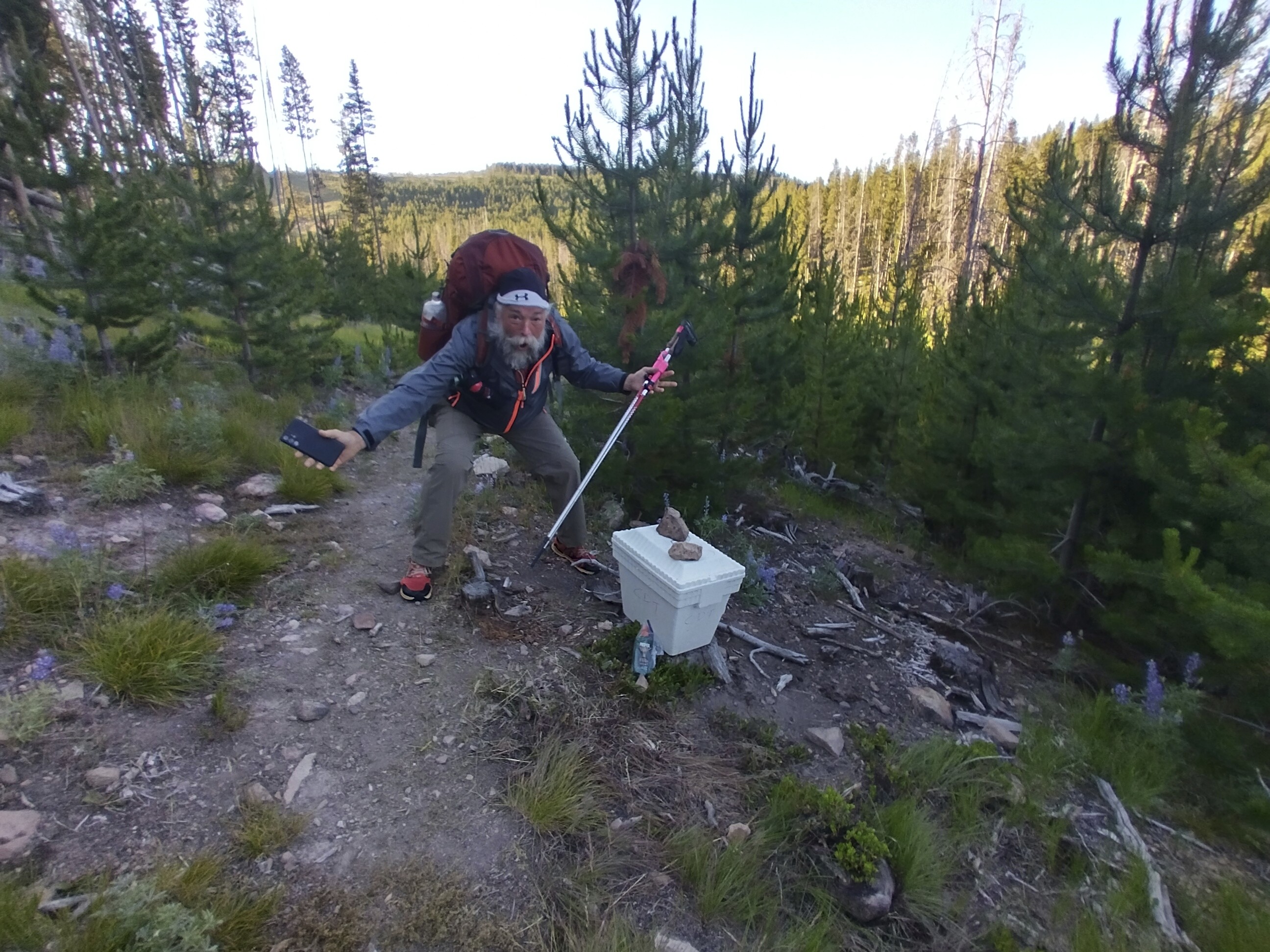
Cory expresses surprise at a cooler along the trail...what could be inside?
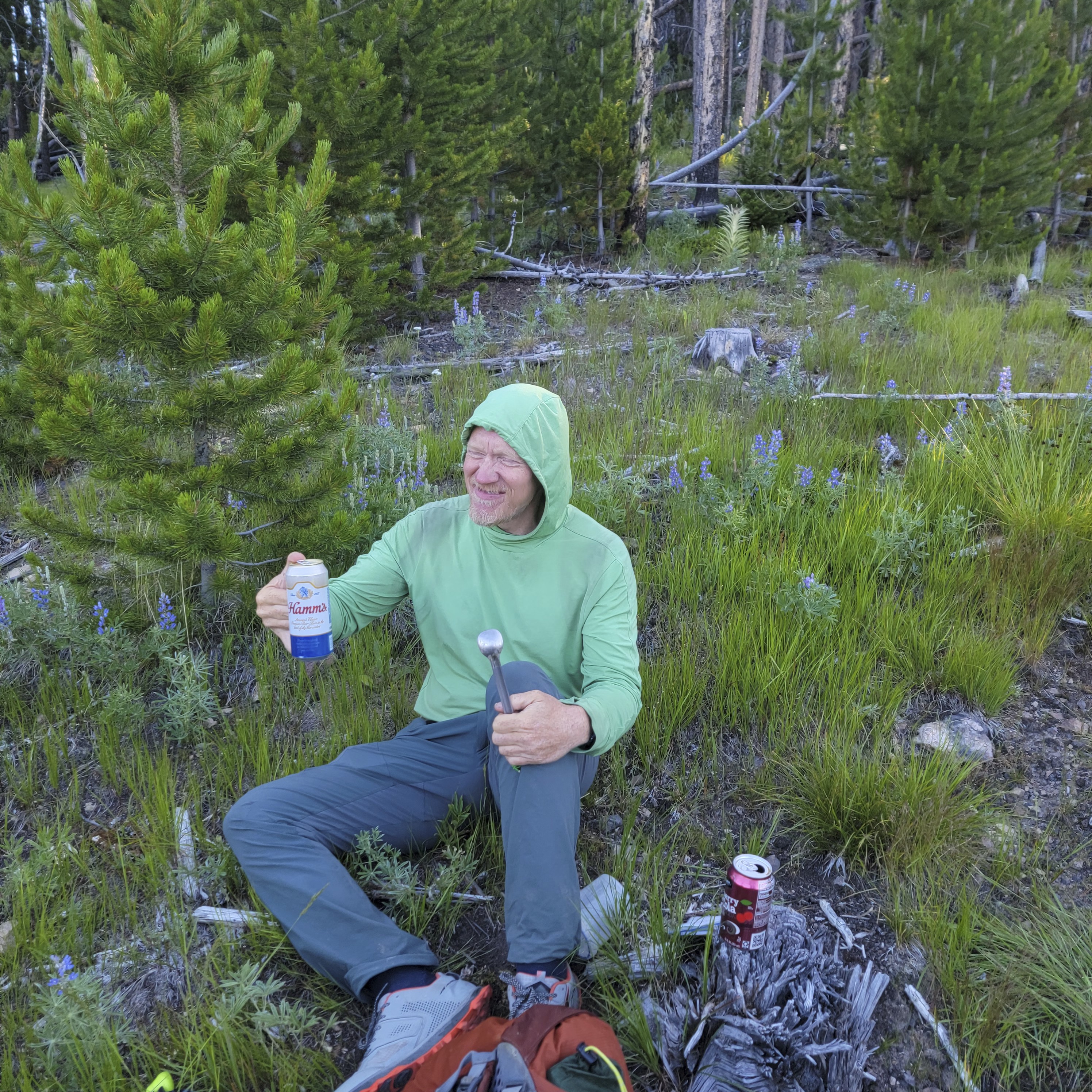
Beer and soft drinks, that's what! Here I drink a "Hamm's" beer for breakfast.
Ahh!
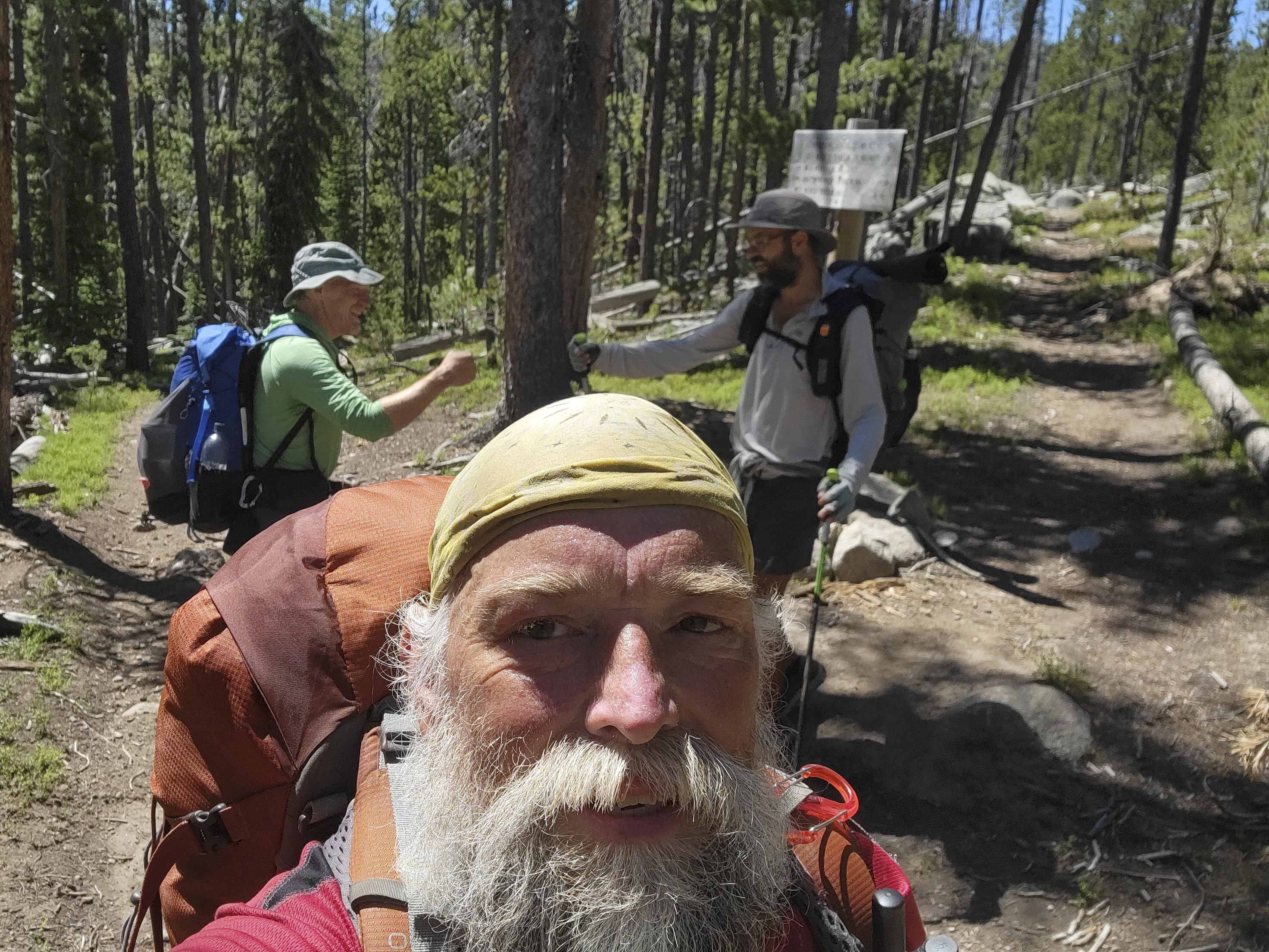
Michael and Maarten walk to the highway.
We stood only for a moment at the road intersection by the freeway overpass and a car pulled up. A nice lady asked if we needed a ride to Butte. Did we! Wow, that was the fastest ride I've ever gotten. She and her husband had worked for many years in the mining industry. She often checked for hikers at this time of year, and that was why she got off the freeway to roll by. Amazing.
This meant we'd have a full day for chores in Butte, and we'd get a good rest.
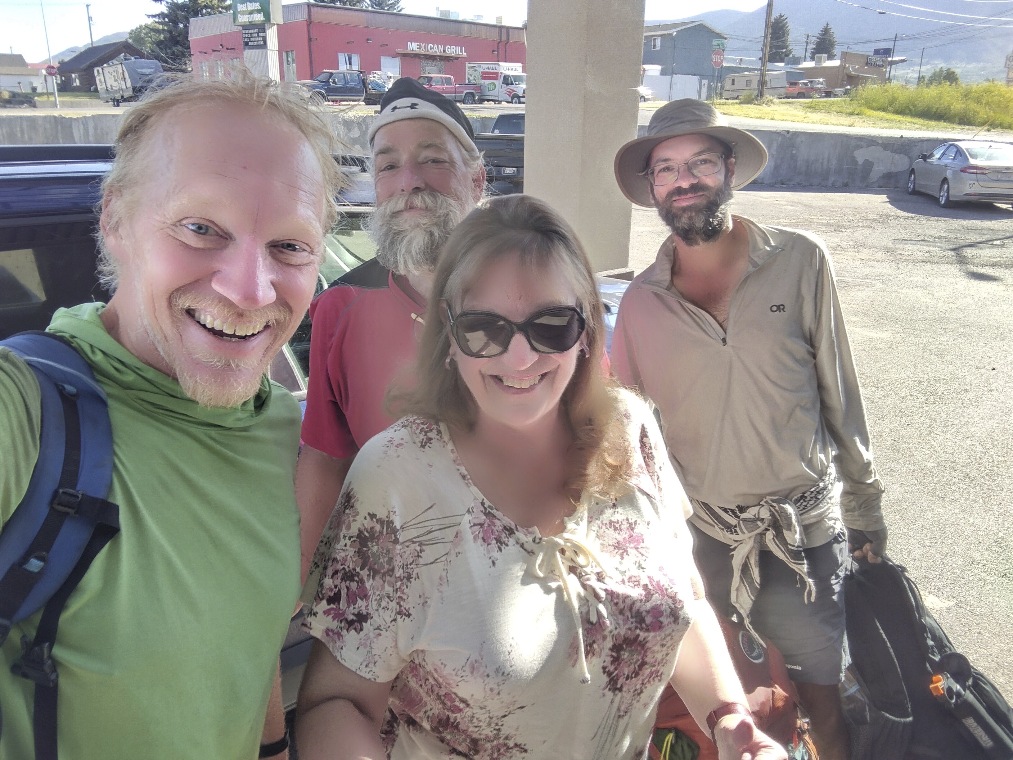
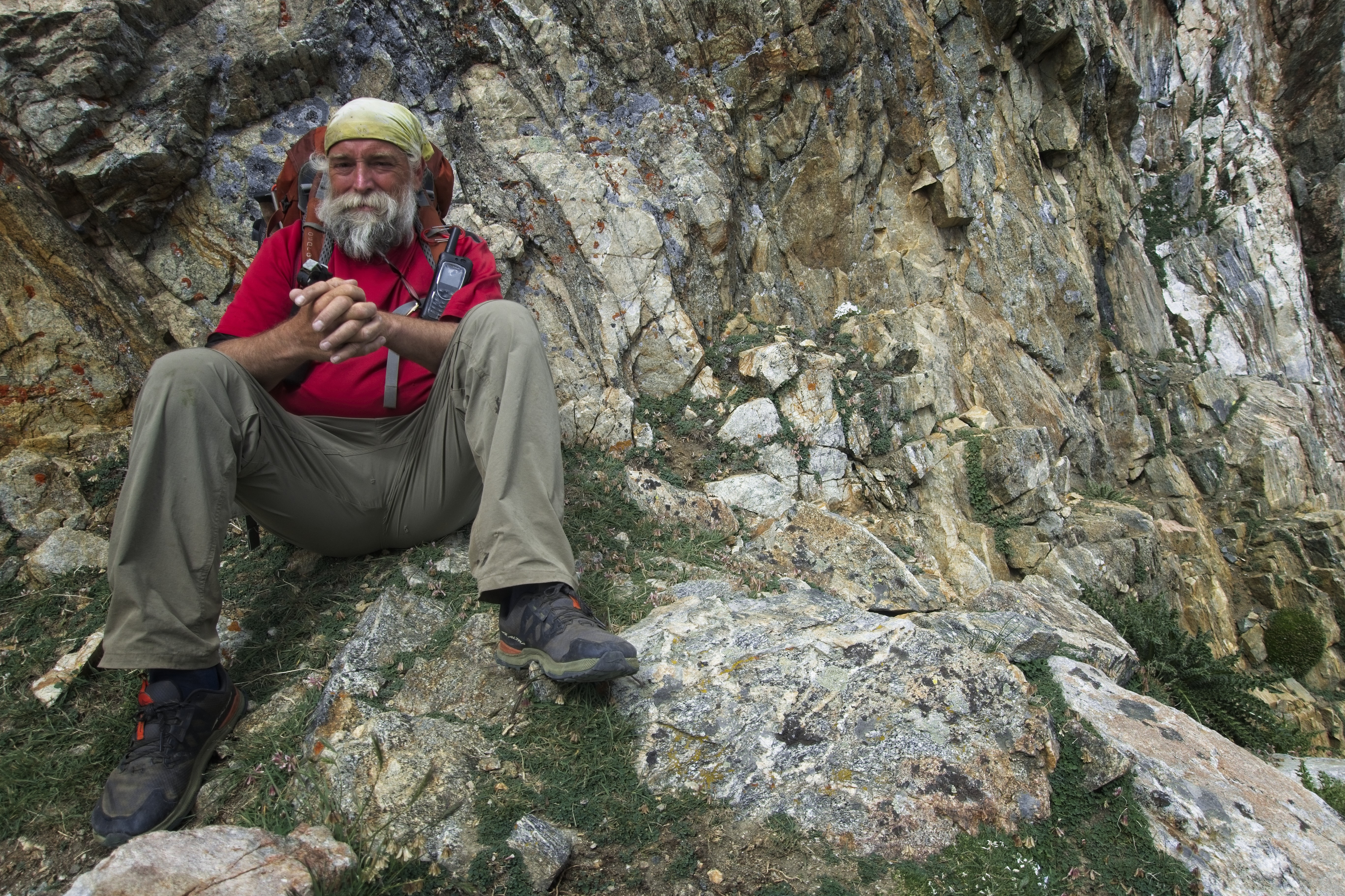
Our lovely and wonderful driver.
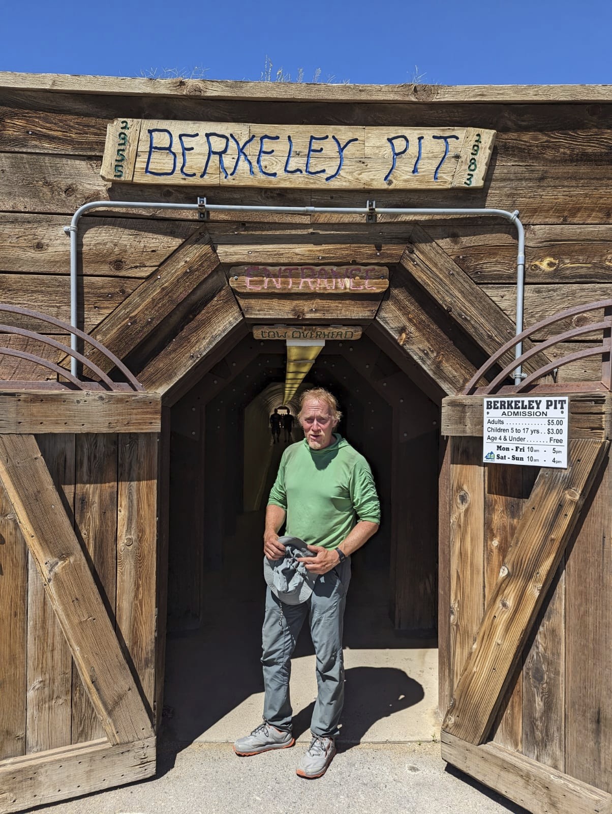
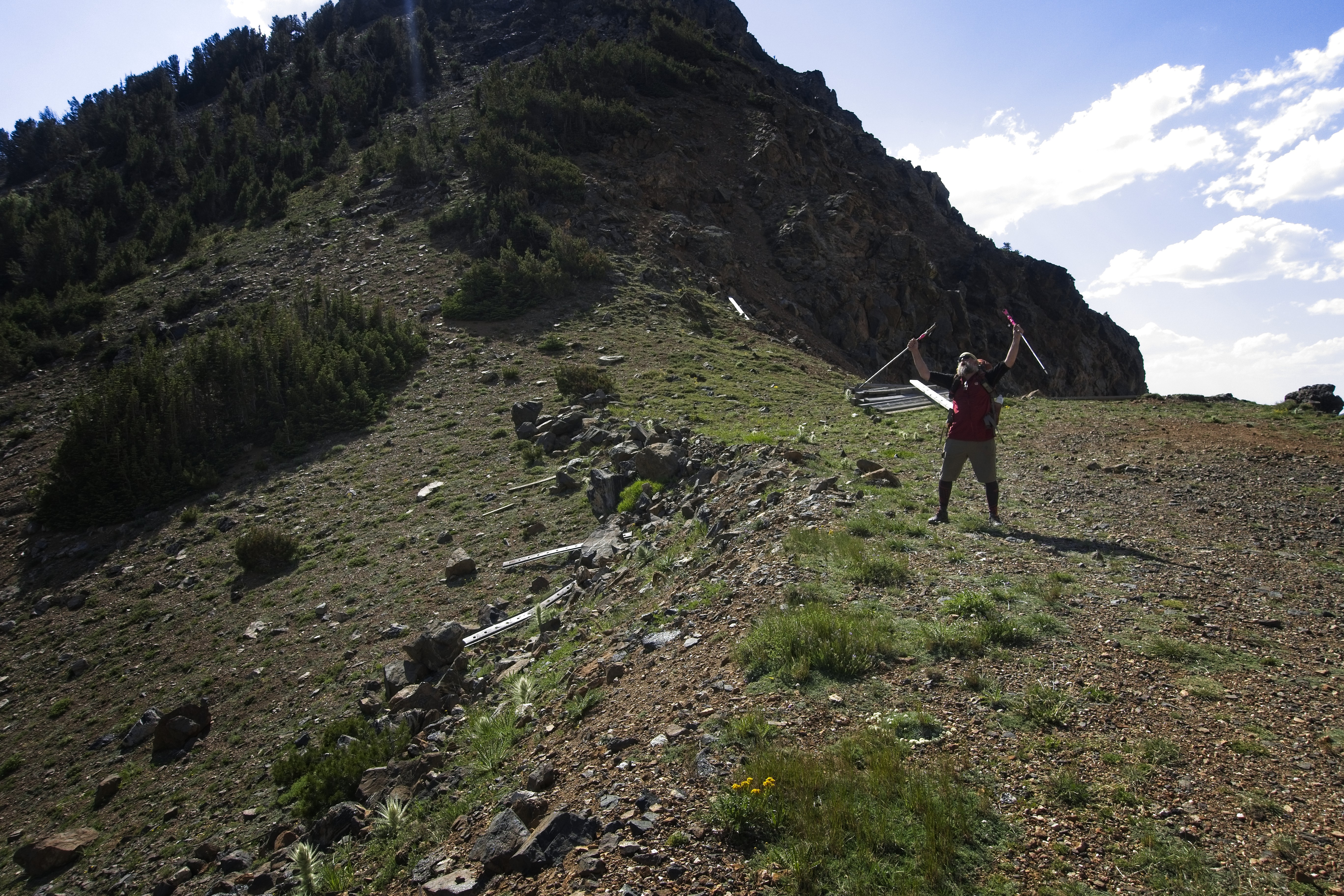
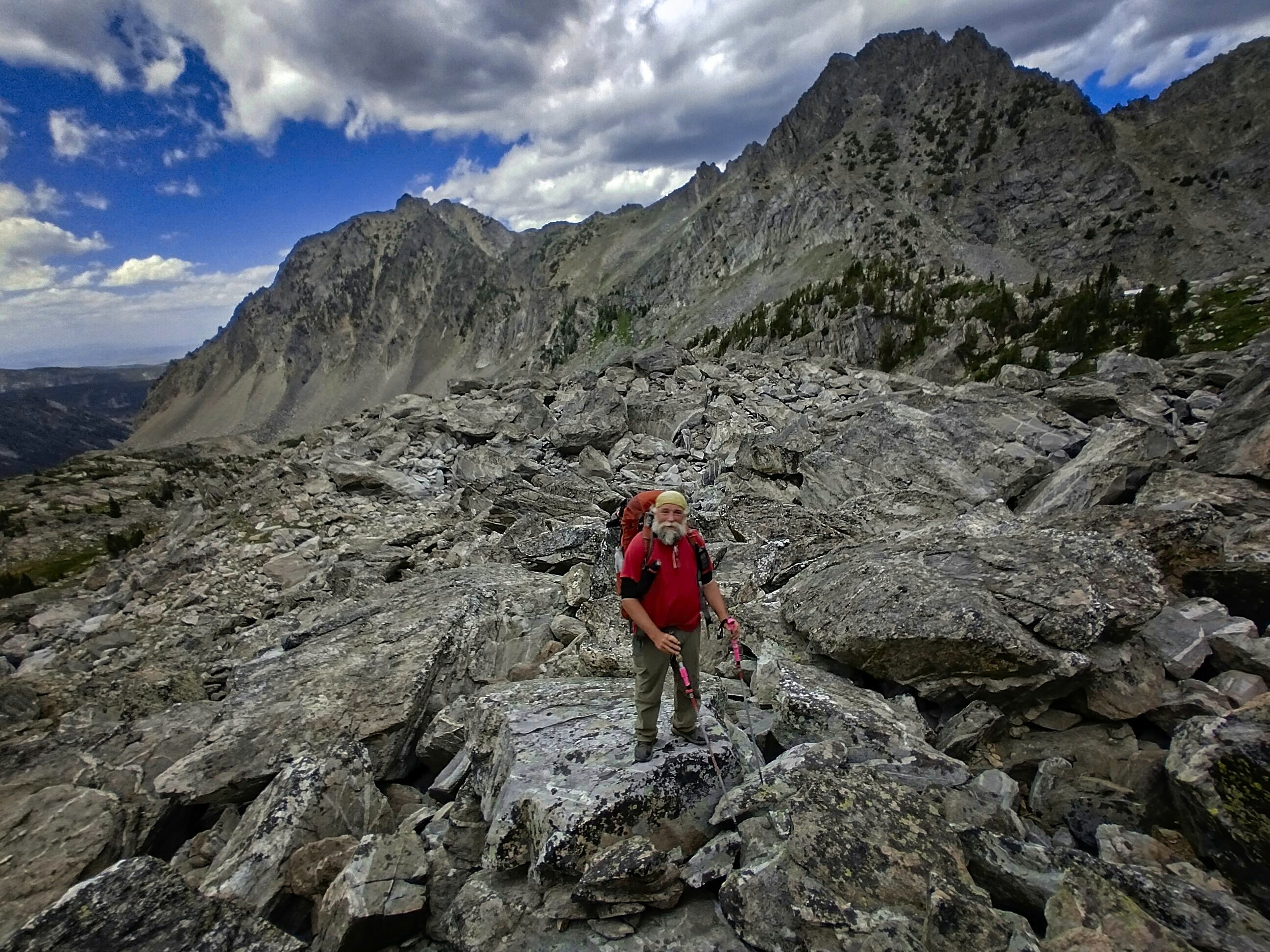
Me at the Berkeley Pit, looking hardscrabble.
However, we chose the wrong hotel, the Ramada Inn. We weren't allowed to check in until 4 pm, and no early check-in allowed! Drat, we'd already paid for it on the internet...
So Maarten and I went out on the town for a bit after taking care of resupply. Cory and I only needed 2 days of food, because we'd be in Whitehall after that time on the Big Sky Cutoff. Though Cory bought some new shoes, too.
Me and Maarten went to see the new Raiders of the Lost Ark movie, which I found reasonably good. I also loved the popcorn, covered in chemical butter flavor.
After this, we took an Uber to the Berkeley Pit, which was interesting. By my lights, we created the pit in order to build our technological society. And now it has to be drained and monitored forever. Is it worth it? Yes, I think so. Sorry I don't have some edgy opinion about it.
Back at the room we got a pizza and various other delicacies, and slept well after a shower. Good times!
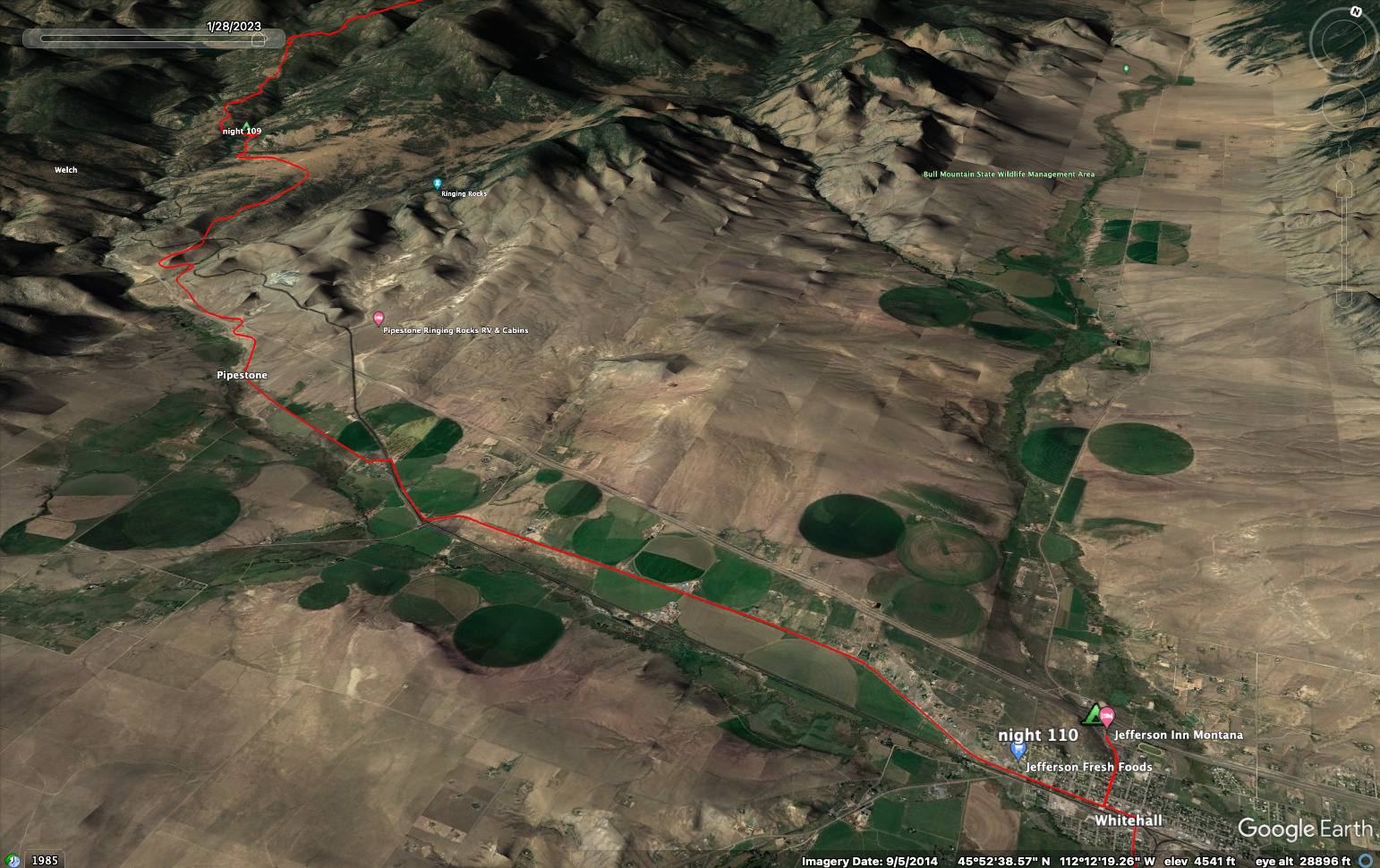
July 19, Day 109
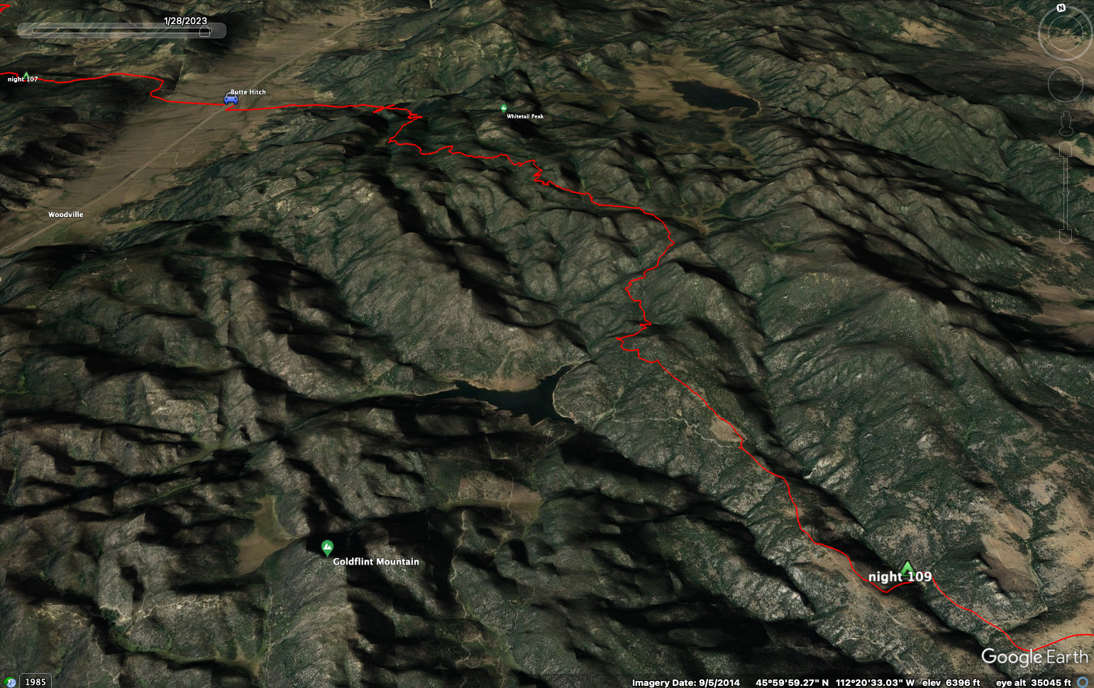
19.5 miles, 2800 feet elevation gain.
I guess we were walking by 9 am. This time our Uber driver was the husband of the Uber driver from yesterday. He said he met Harrison Ford once, when he was a butcher at Safeway behind the meat counter. Ford was really nice and came behind the counter to take a picture with the man. Neat!
We headed up into the woods. Sure enough, Maarten and I got to talking as we do. But we couldn't expend the whole day arguing with each other. He was bound for the monument to "Our Lady" who looks over the town (this is an interesting and beautiful thing), where he'd sleep before continuing along the official CDT around Butte and off to the west. By noon we'd said our goodbyes.
Here we're staging our world-historic arguments while Cory looks
apprehensive.
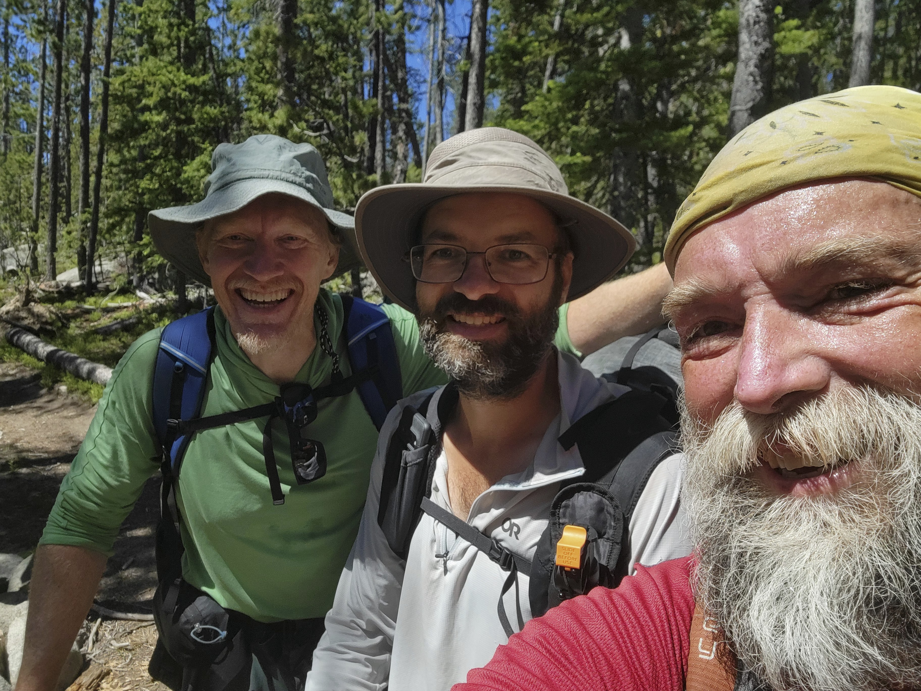
Nonetheless, we part as friends!
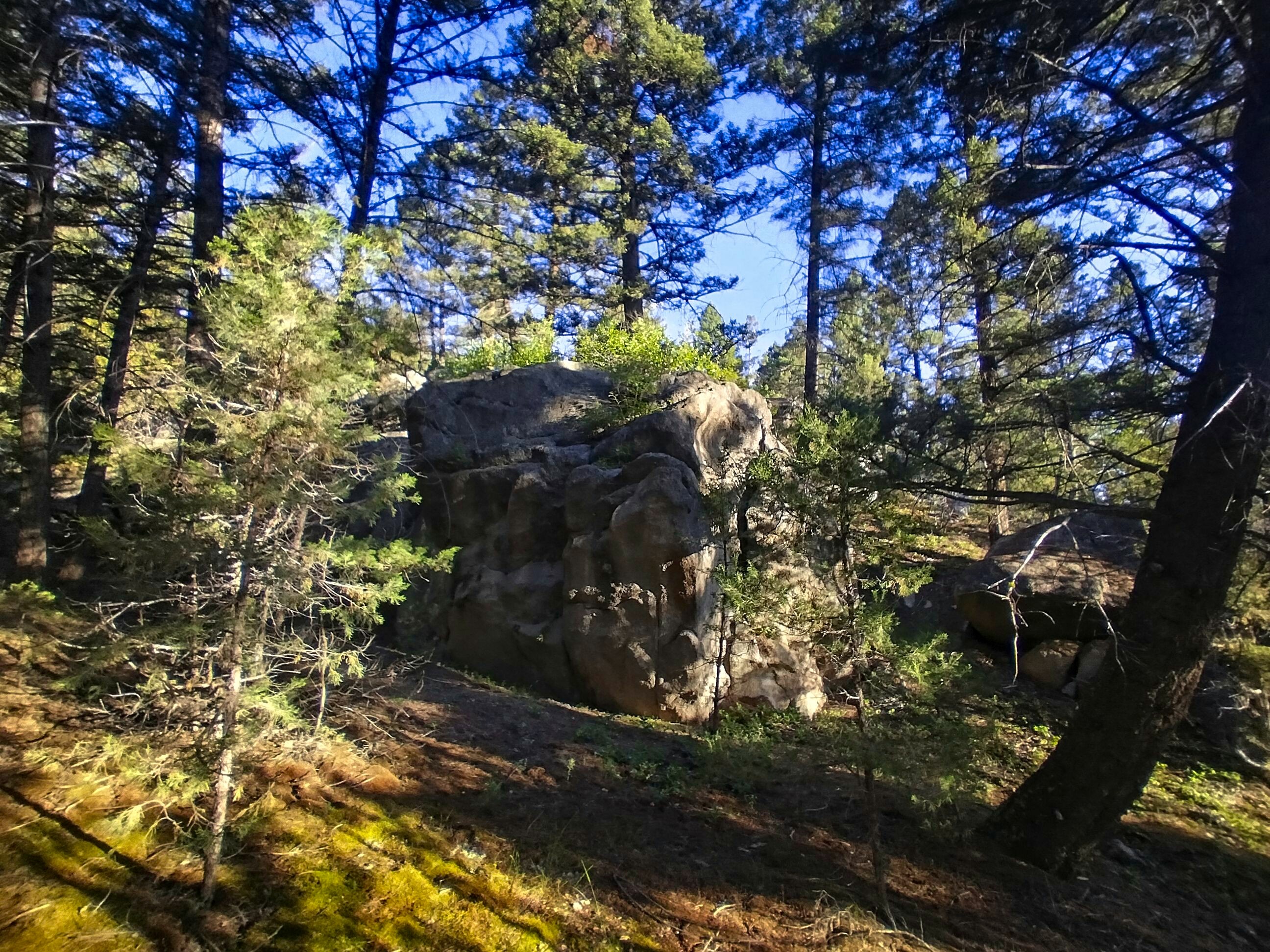
As Maarten climbed up to a crest, we wended our way up and down through a forest. As Robert, my friend in Bozeman had told me, we'd see more granite outcroppings in the landscape. This was true, and we sometimes rested on a granite knob or boulder. We saw Delmoe Lake below us and I navigated a complex shortcut (to a shortcut) that saved a bit of up and down.
As evening came, we faced that old problem of coming out of mountains and down to civilization -- where is the last free place to sleep with water? I think we made a pretty good choice at about 20 miles...a flat spot beside the road and creek, and from which we were able to encourage the cows to move on. They seemed to find people stressful, and left. One or two vehicles came by at dusk, but it was quiet beyond that.
July 20, Day 110
14.3 miles, 580 feet elevation gain.
The day began with some bouldering once we were ready to leave camp.
The Camp Boulder, on which we put three increasingly difficult lines.
Cory and I were missing the old climbing world, so we got to work on this thing. There were some tough moves, but we made it up three times. This was a nice break because face it, it can get monotonous walking across a whole state, or several of 'em!
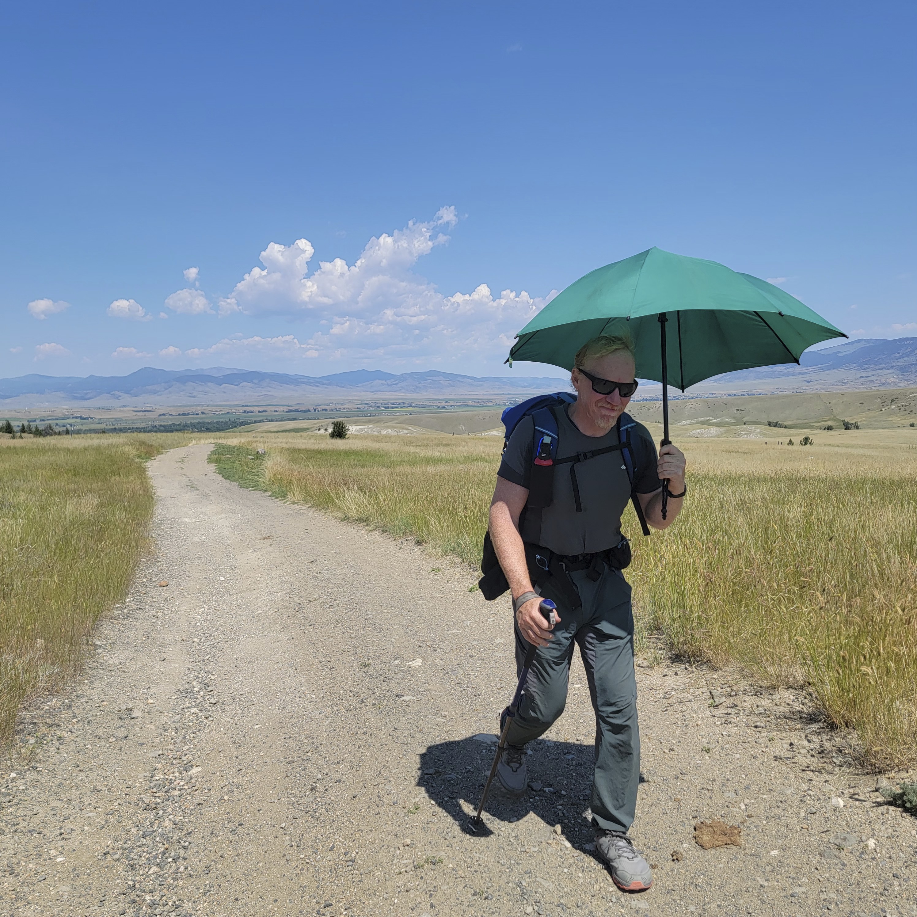
We got down to the interstate, good ol' I-90. After a rest underneath, we set out in the sun for the long walk east to Whitehall. I deployed my umbrella, which paid for itself just on the service provided this day. Because it was hot out here.
We got to town and went shopping. I bought a bunch of watermelon slices which we enjoyed at a shady park bench. We walked to our hotel and set up to enjoy the evening.
Cory taught me to sew. Here I'm repairing a hole in my pants pocket.
A huge hailstorm came along, soaking the clothing Cory put out to dry. I smoked a cigar outside, but somehow made myself sick. Ugh...it was no fun at all. But within an hour I was better. We watched some tv show and fell asleep.
The next day, we'd face the Tobacco Root Mountains.
July 21, Day 111
21.2 miles, 4170 feet elevation gain.
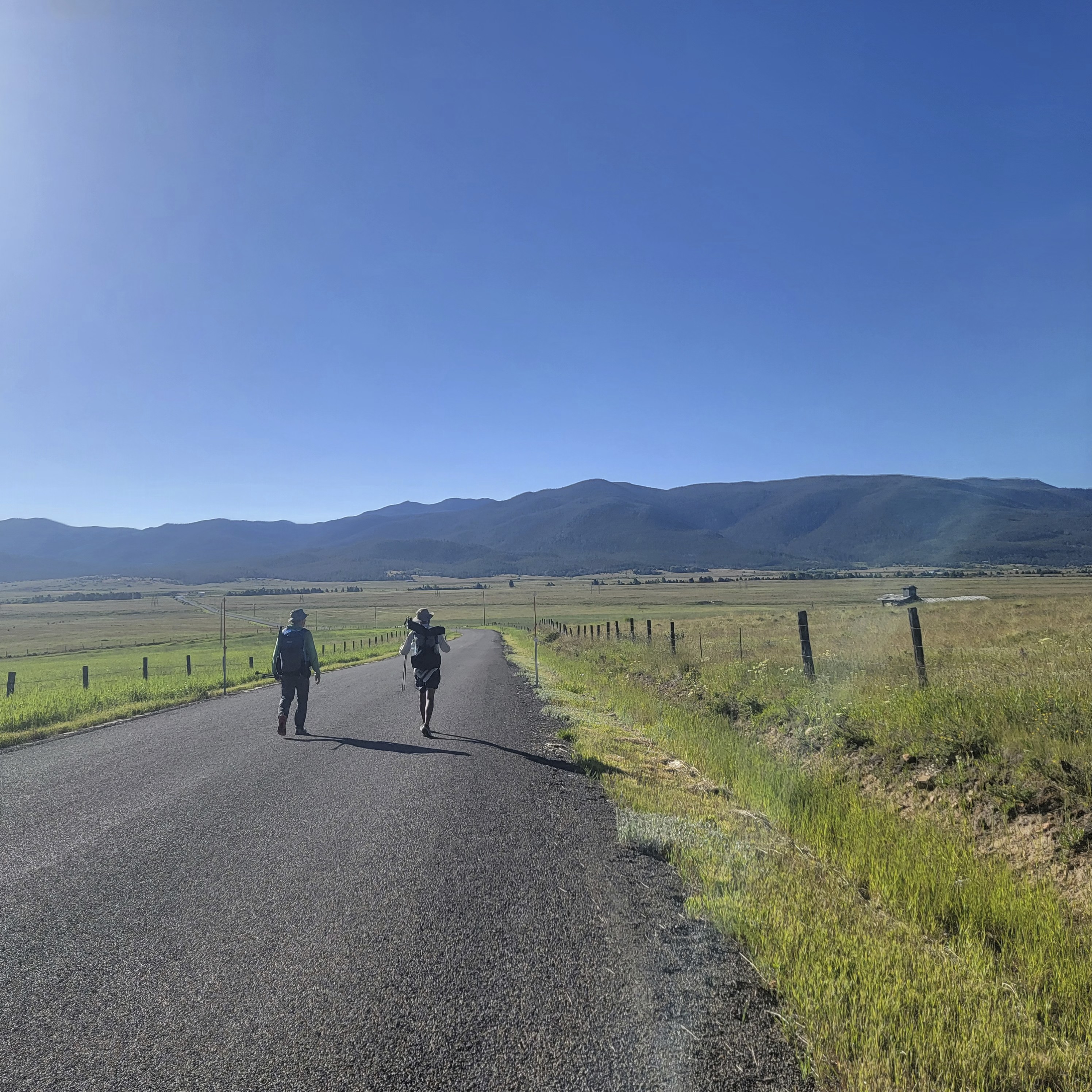
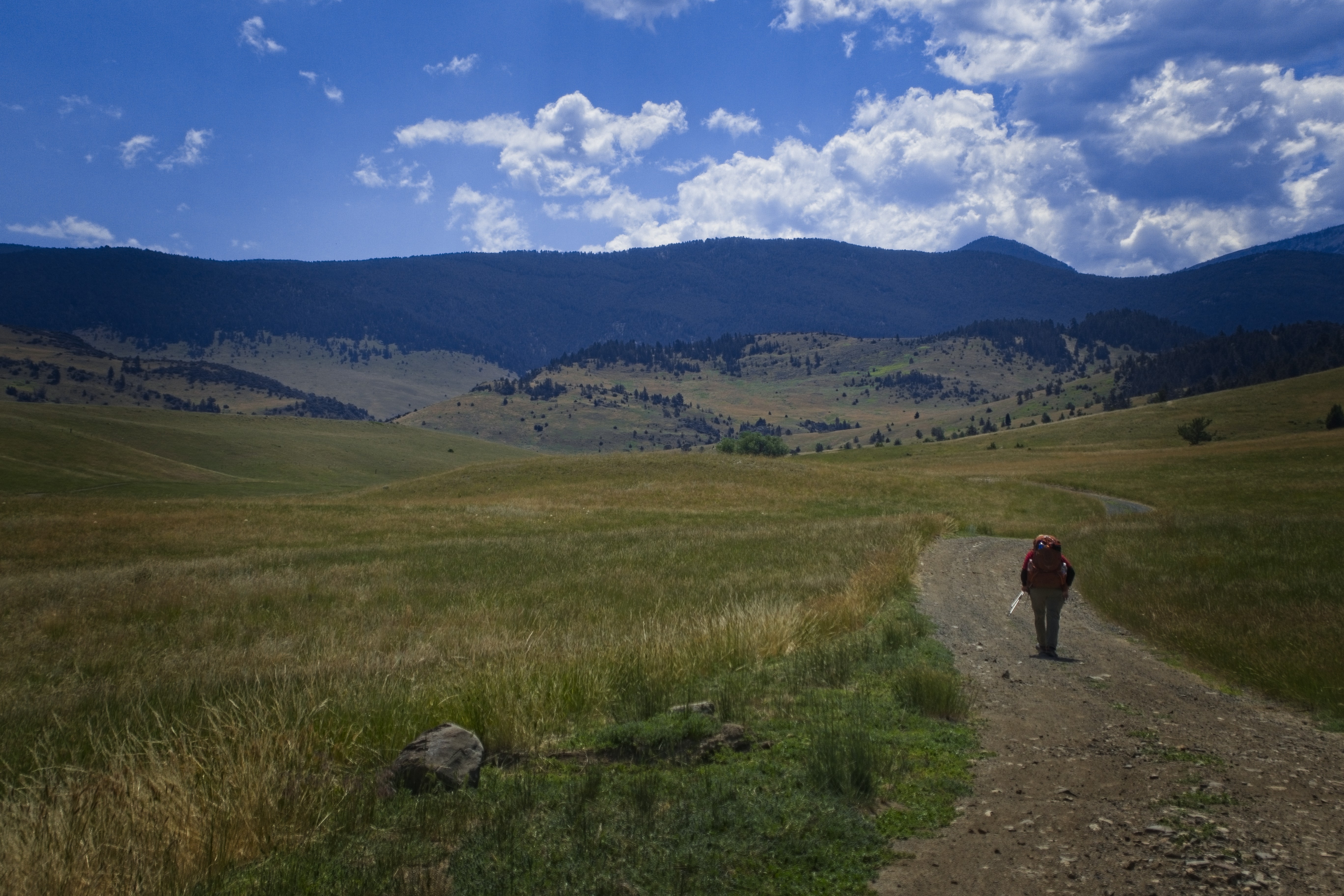
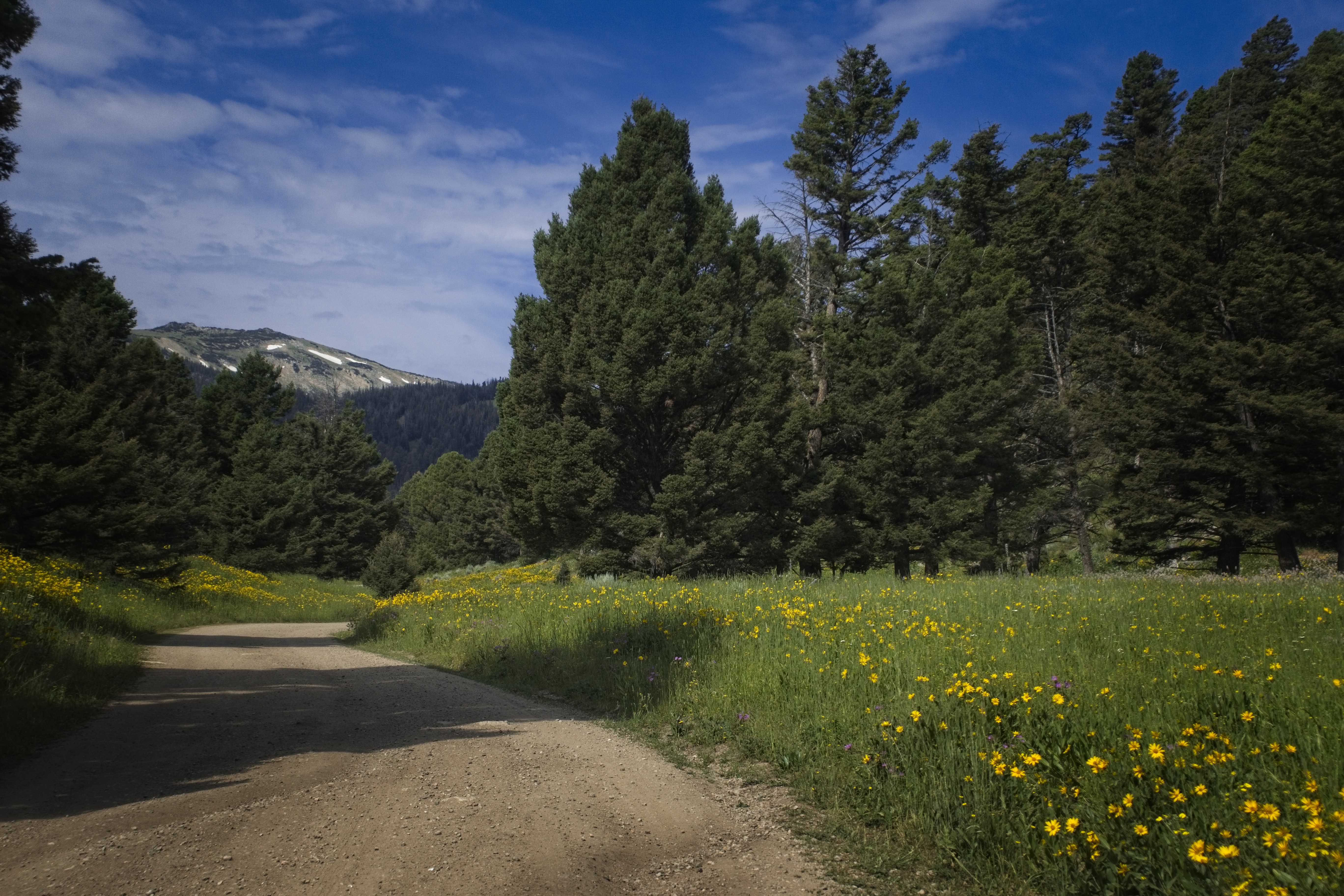
Cory and I set out. It reminded me a bit of the kind of training walks I did in Germany...many flat miles walking on pavement. Whitehall is on a plain, and the mountains are fairly distant. Plus, the pattern of land ownership meant a series of right angle in the road and hours of walking first east, then west, when we just wanted to go south.
A couple of cute dogs followed us for a good long while. Finally, their owner drove up and loaded them into a truck to stop their adventuring with us. Later, a guy drove by in a truck and said we could get some water from the hose in front of the next house (his place). That was really nice.
Our doggo friends.
Michael at the point where the road comes near the river on the east.
Beating the heat with intelligence!
Finally though, we got onto a dirt road and climbed a hill, stopping for a while under a shade tree. After this, we really entered the mountains, walking along a brushy canyon creek with open grass slopes all around. Then the mountain walls narrowed and we were in timber, following a faint trail up to a minor pass. We descended into Perry Canyon, then turned into a narrow valley with Five Trough Spring. Here we climbed extensively and I remember a nice rest at the top of the pass.
On the way down, the trail traversed a long ways south, but our map indicated we should just go steeply straight down. However there wasn't really a trail there, although there was evidence that mountain bikers had been on this steep slope. The trail kept arcing away to the southeast, and we started to think we were on some variation that might take us to the first of several passes we'd planned for the next day. But, alas, finally it turned decisively down into the valley (none of this was marked on any map).
We reached the bottom of Mill Canyon at a kind of wide spot or campground. Set up the tents, enjoyed our dinner and settled in for sleep.
Cory doesn't mind the great burning orb in the sky.
Cory leads the way to the pass.
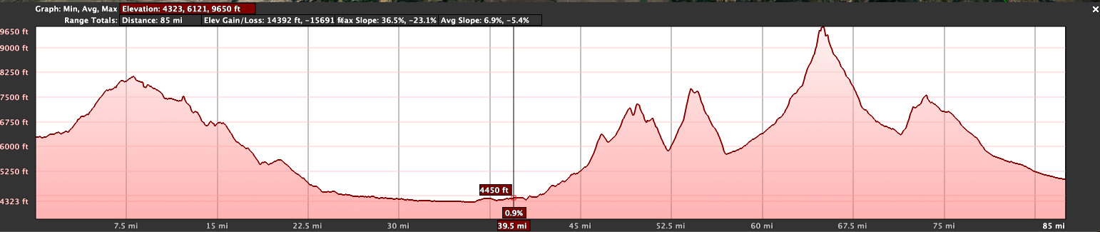
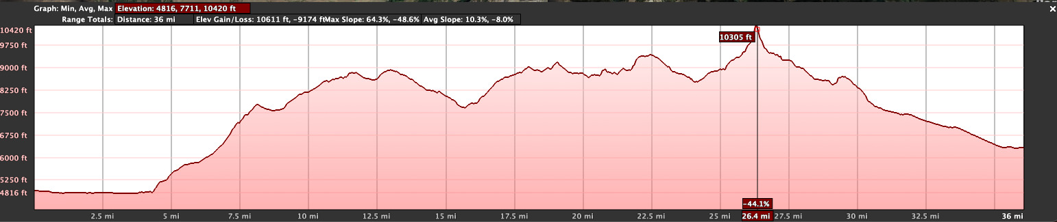
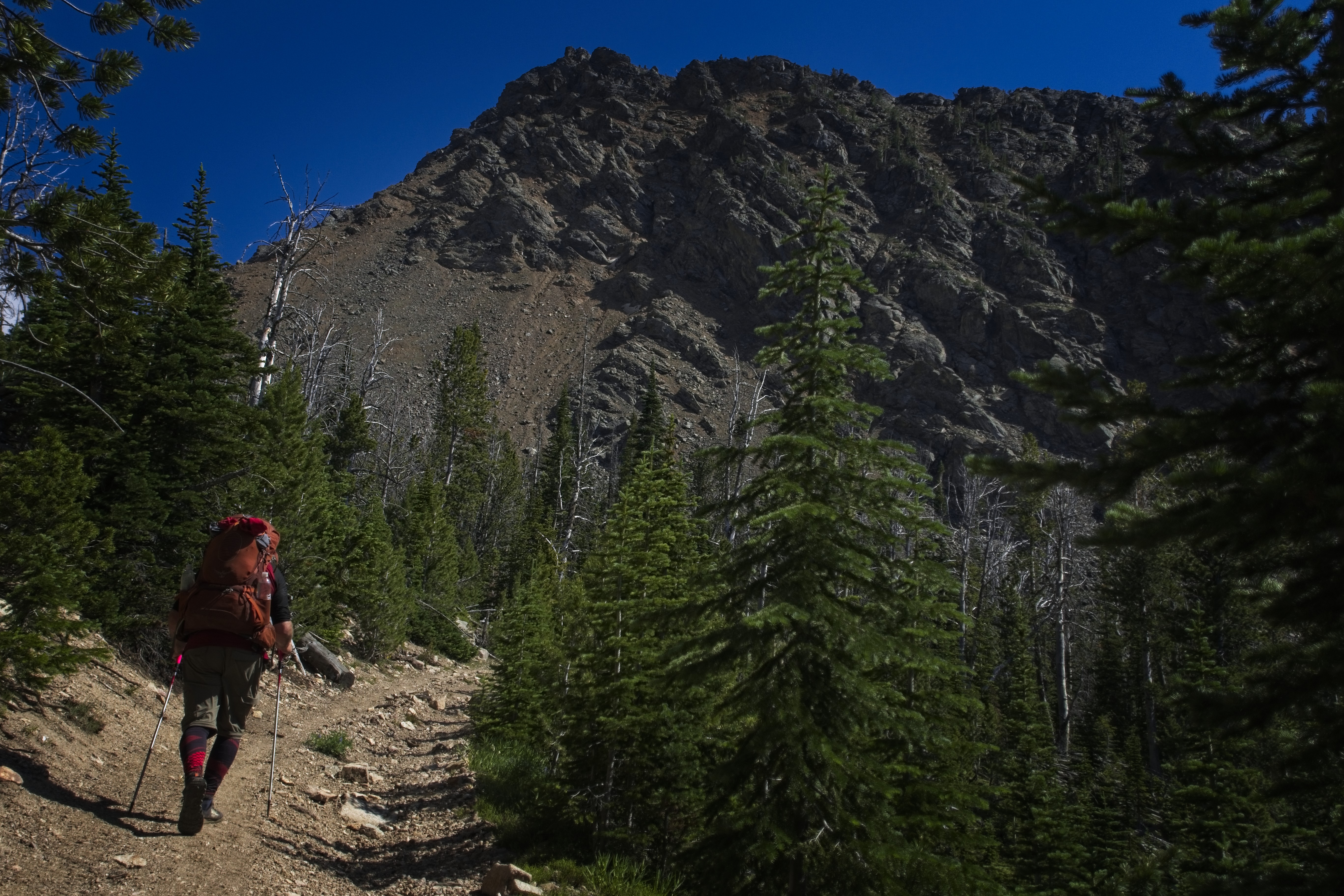
July 22, Day 112
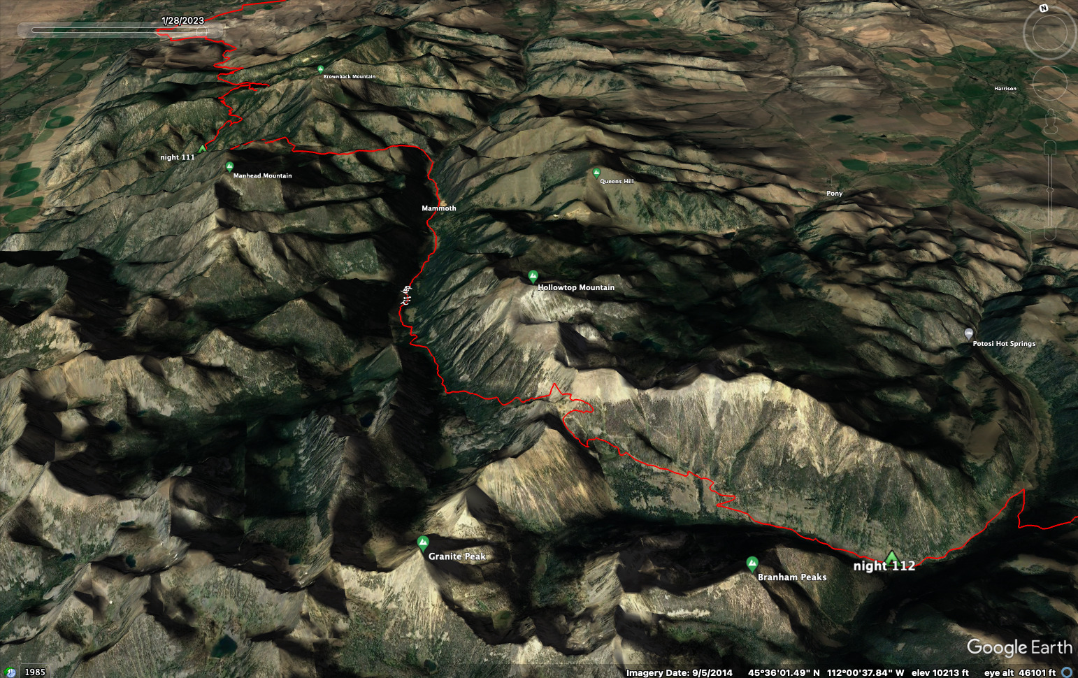
18.1 miles, 6000 feet elevation gain.
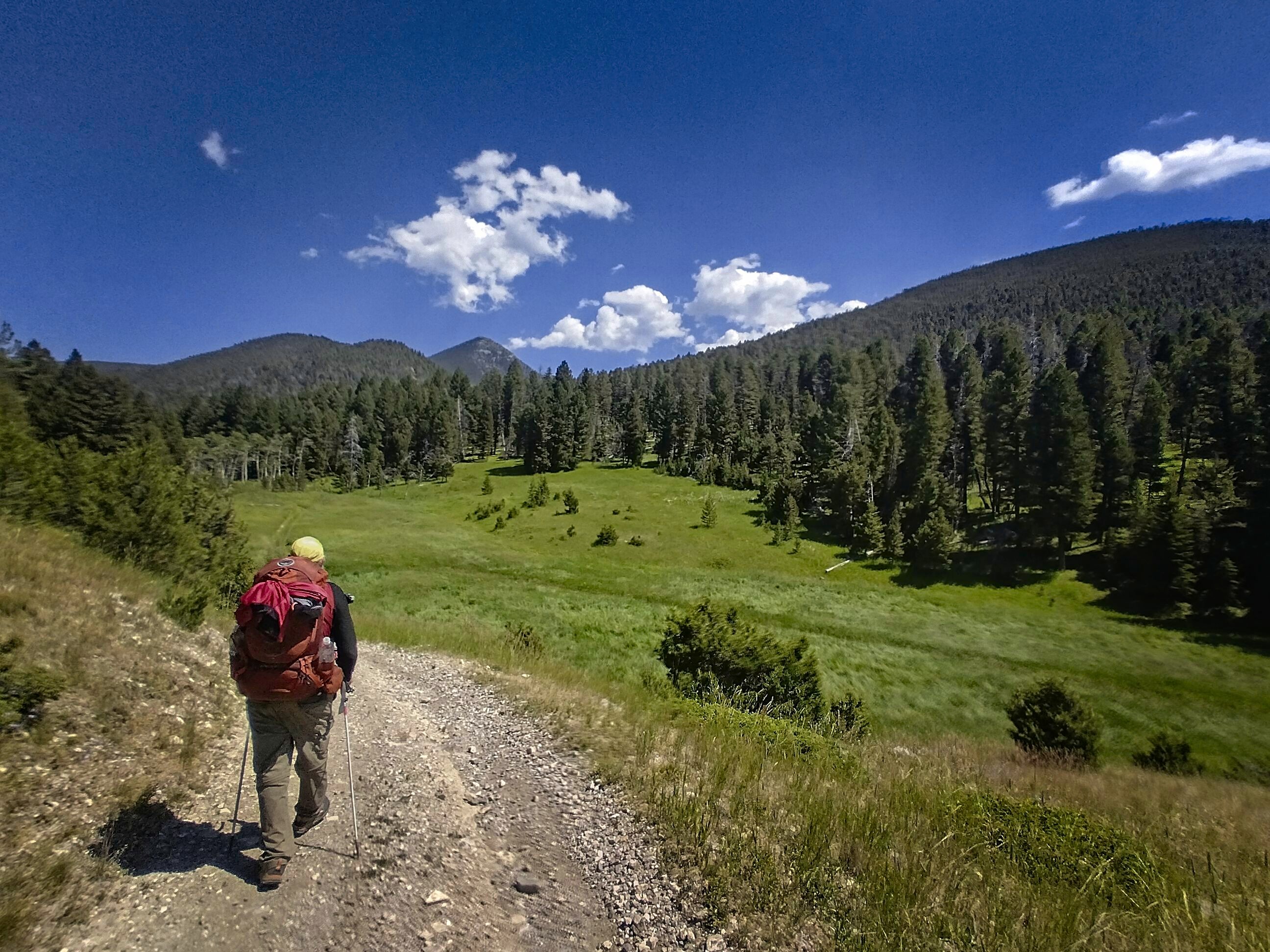
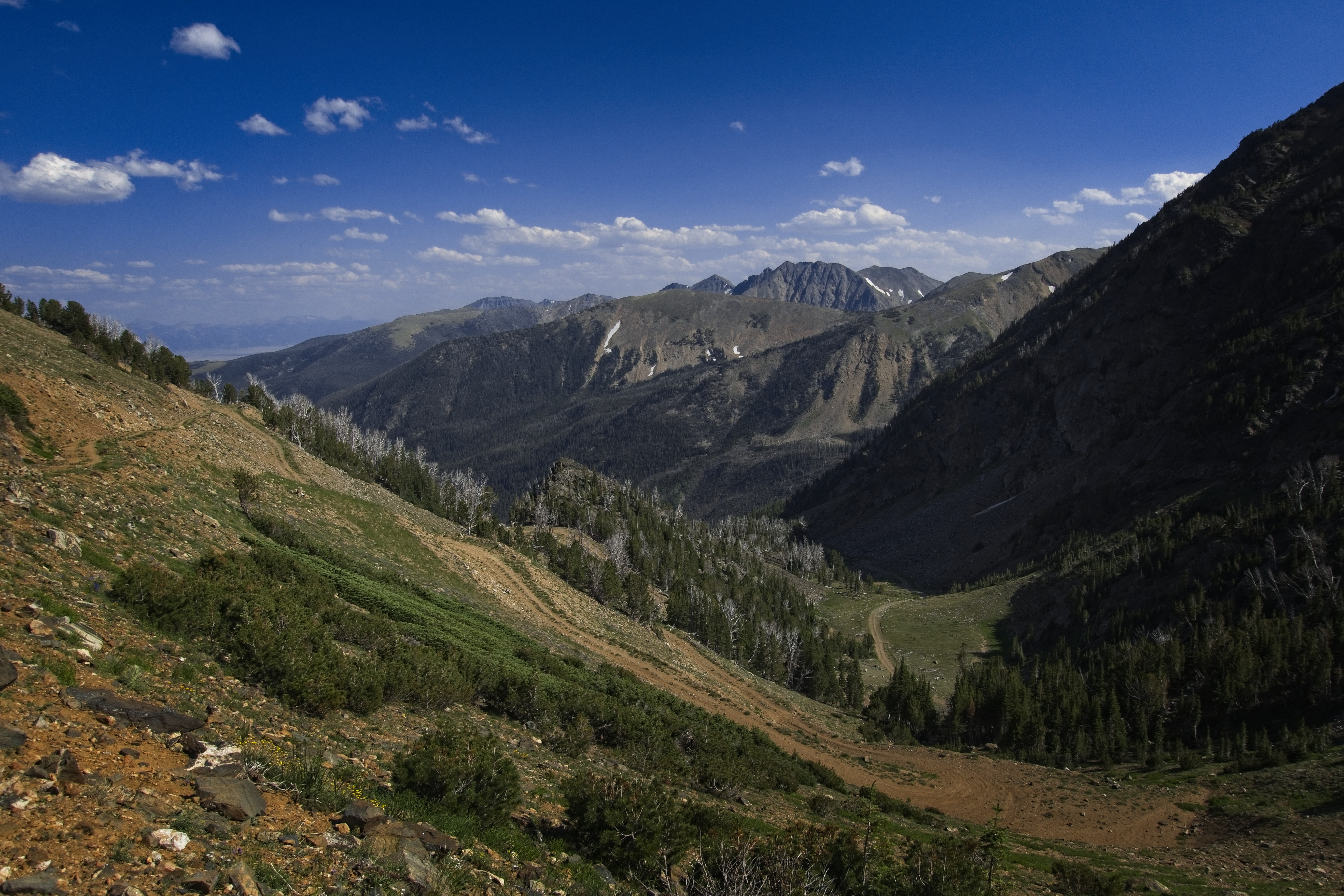
The day began with a climb of about 1600 feet to an unnamed pass near Rock Creek Lake. So far, we'd seen no one in these mountains. We popped out of deep forest into a subalpine mix of meadow, stream and small trees. The view of mountains to the south became impressive. We weren't bound for that country, exactly. We turned east and down along Rock Creek to reach the trunk valley of the Boulder River. Along in here we were surprised by a dirt-biker. He was surprised too, he said he never saw any hikers in here.
Later, Robert would tell us these mountains are a "Redneck Paradise," because most of the recreation ("wreck-reation") that takes place is motorized. That seemed to be true! Anyway, nice fella though.
It was hot and I was tired as we finished the descent to the Boulder River. Now we walked up valley for miles to reach the settlement of Mammoth. It's an interesting little town, supposedly a corporation. Okay. I guess some of the people here are active miners. I was hopeful for some picnic table with ice-cold lemonade or something, but there was nothing like that. We could see high peaks ahead of us, but wow, they were a long ways up valley. So in the hottest part of the day we steamed up the road, which finally narrowed and disappeared.
Cory in Mammoth, Montana.
Resting in the forest south of Mammoth. Shade was worth something on this
hot day.
Cory heads to the unnamed pass of the day.
Michael approaches the pass, Mammoth off behind him in the valley.
Behind a cabin we found a steep dirt track that led to high country. On our left, on the slopes of Horse Mountain we saw industrial mining debries. Even, in an alpine meadow, a bulldozer and broken down mobile home. From our camp this morning at 6000 feet, we'd climbed to 8000, descended again, and now would hit 9500. So at the top of the pass we were glad to have cracked the spine of the Tobacco Roots, but eager to get down the other side and find a place to lie down.
The country was scenic for a good ways, but then there was an annoying road with big "ankle-breaker" rocks in it. We rested right before an especially steep set of switchbacks, drinking water from a stream as we sat in the shade. A hiker was walking up from below, but we gracefully missed each other when he took steep switchbacks on the road, and we walked straight down a faint path in grass on the other side of the stream.
Hallelujah!
Our country to the south. We'll bend off to the east and leave these
mountains.
There was a campground down-valley and we made for that. We were in South Willow Creek. We arrived at the campground and found an empty place among some trucks and campers. It was a good place. Though, at 2 in the morning someone drove up and appeared to be confused by our tents without any cars nearby. Finally they settled down and the headlights crazily playing off our tent walls stopped. Why does that always seem to happen at campgrounds? Who are these folks who apparently drive all night then arrive in the early hours of the morning somewhere confused? Oh well, can't complain at the price of free.
Campground for the night.
July 23, Day 113
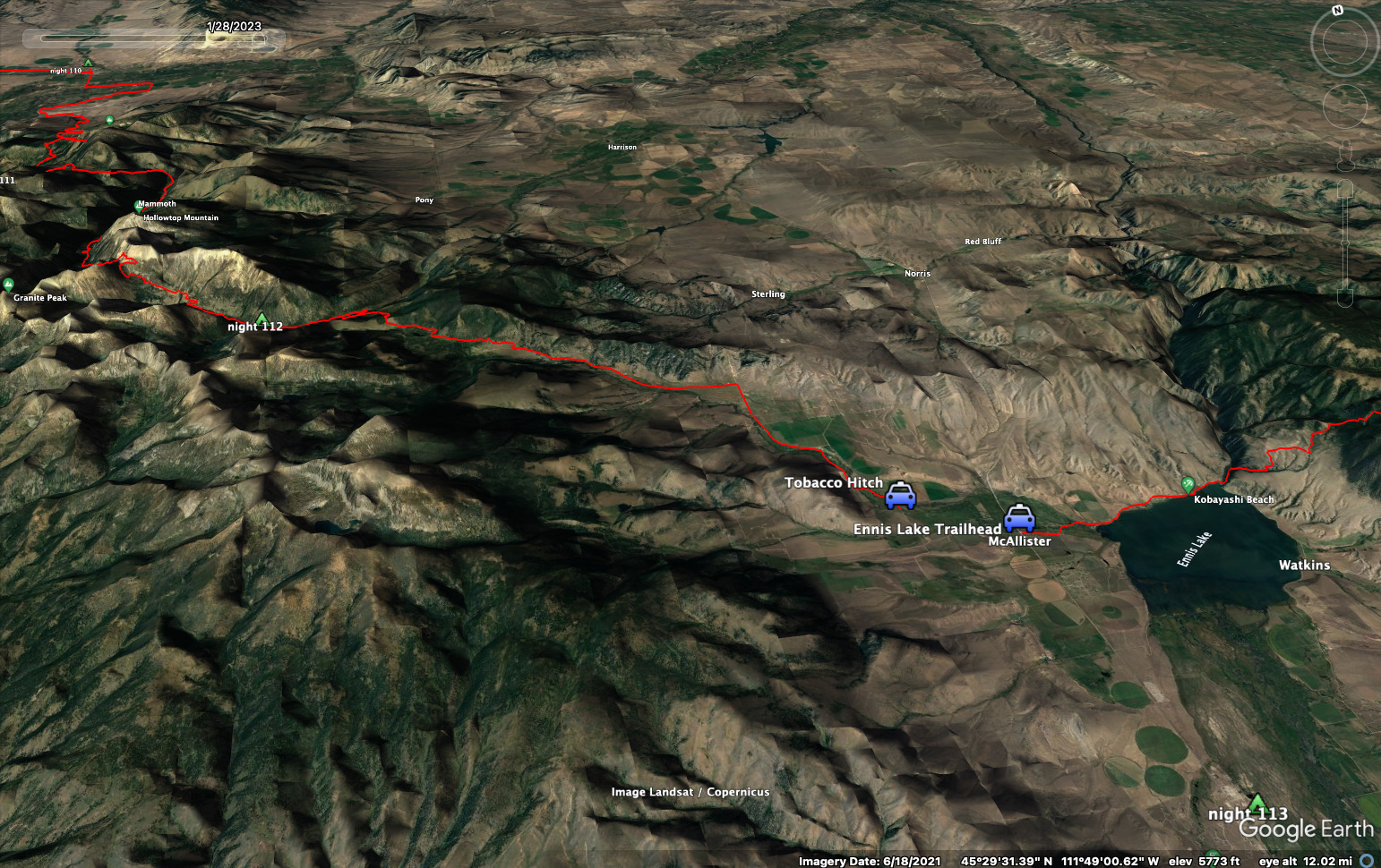
16.4 miles, 1300 feet elevation gain.
We walked downvally to about 6400 feet elevation, then crossed the river and powered up to a low arm of the south ridge for about 1000 feet of climbing. Here, we had advice that we could ignore the long sweeping forest service road and follow "cow paths" over the arm for a direct descent to the Sureshot Lakes on the other side. This mostly worked, though we had to climb over, under and through several big blowdowns. But we finally came out. Below, I saw someone kayaking on the lake. "Look, hippees!" I said, happy to have discovered some non-motorized wreck-reation.
Cory walks on the arm above Sureshot Lake.
From this point it would be a long roadwalk to the trunk road of the great plain between ranges. We settled in for it with music, podcasts, etc. We chatted with a couple going to kayak at the lakes. Further down-valley there were some interesting cliffs on the north side that looked perfect for rock climbing. There was also a proud American flag drapped across a cliff. Interesting! I love to see people NOT consumed by guilt and self-hatred for breathing. I think the cities these days just exude that atmosphere.
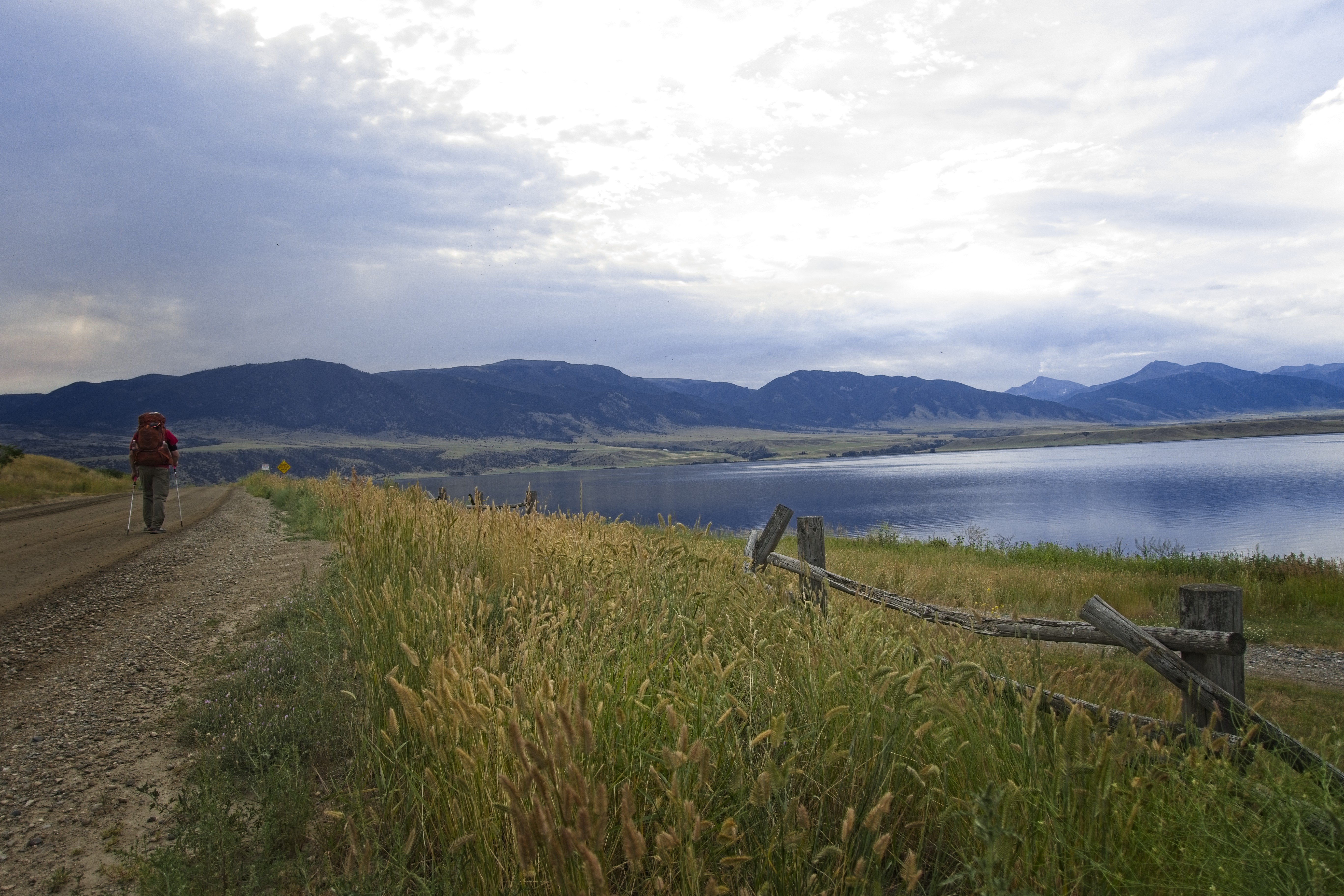
We came out of the mountains and walked south along North Meadow Creek. Here, a few miles from the highway, the car with the kayaking couple came along. I impulsively stuck out my thumb. It was just too hot. And we needed a hitch to Ennis anyway for food. Technically, we should have walked all the way to the highway, but how about preserving a little space for enjoyment? We were lying on the side of the road in a patch of shade when they arrived.
Much road country in mountains.
Thanks to the existing relationship, they happily packed us in the car and drove us to the supermarket in Ennis. Nice!
Once there, we met several hikers hiding in the shade of the Dollar Store. We talked about hitching and the different routes to take in this short-cut section before rejoining the CDT. Cory and I would get to Big Sky along the north side of Ennis Lake and the Spanish Peaks. But others would take a more direct southerly route. Also, we wanted to reach Mammoth, Wyoming with a more northerly route that let us explore Yellowstone more, while others would walk a highway directly south to meet the red-line at West Yellowstone. We were, contrarily, happy to avoid that area because of the recent death that closed the CDT in that area. A woman was jogging and surprised a mother grizzly. Later in the summer, that grizzly would be killed because it was involved in several incidents.
If you wonder how officials know if a particular bear did this or that, my conversation with the trail angel back at Flesher Pass was enlightening. He often traveled with biologists in the backcountry and they were constantly gathering hair fibres from fences and trees. They used these hairs (actually the DNA from the hair) to identify and track the movement of individual bears. They became relaxed around bears that they "knew" from their constant data missions, but were highly cautious if they didn't know the bear. So, it's possible to get a pretty detailed picture of the movement of a bear, even though the bear covers huge distances. Essentially, teams of people are interested and crunching data all the time!
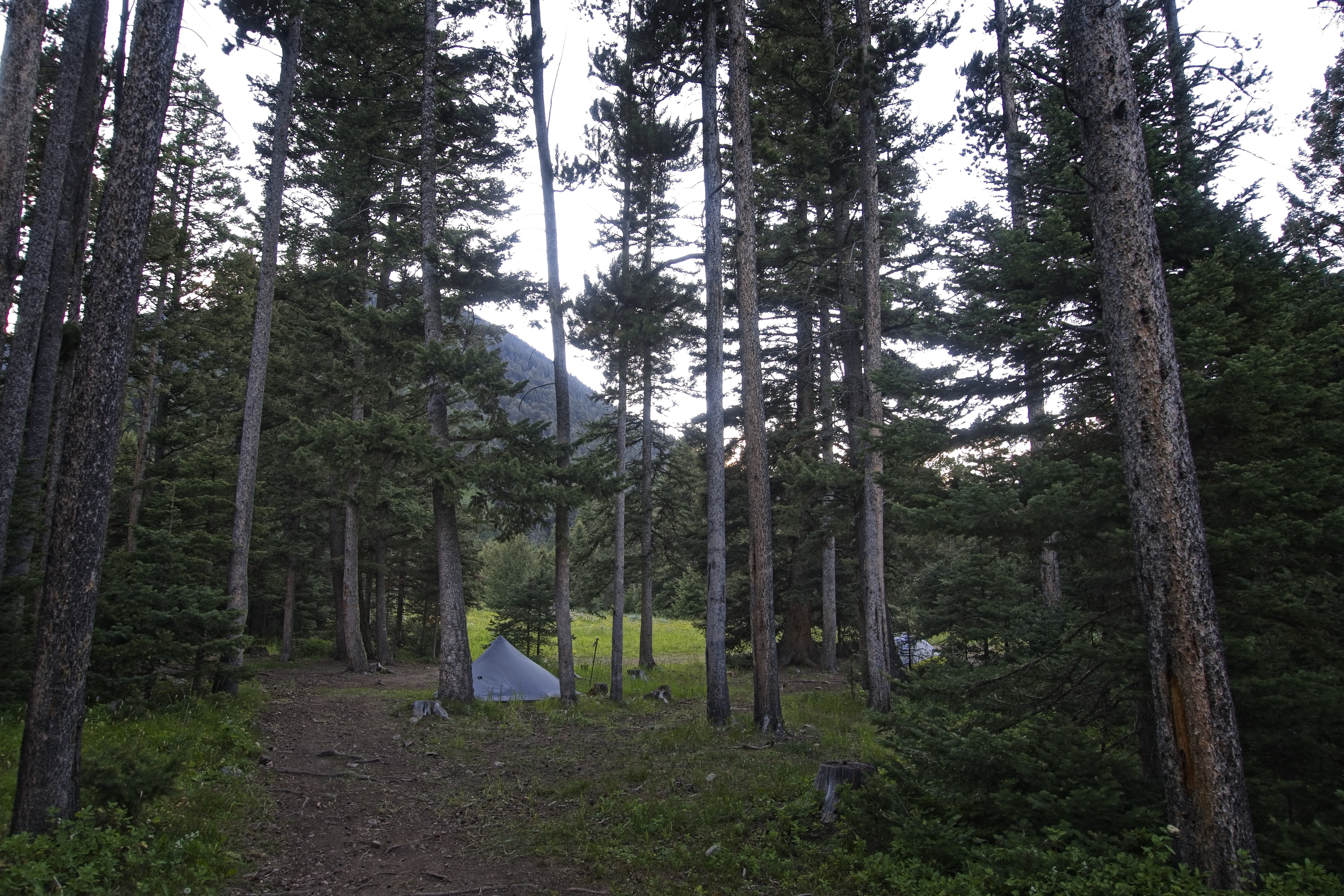
We got our food then looked for a place to stay. Should we hitch back north to the Ennis Lake Trailhead where we'd keep hiking, or was there a motel or campground? Cory struck up a conversation with some locals who offered to drive us to the campground just north, and that made it easy. "Let's go!" We hopped in a crowded truck with a dog and were let out after a few minutes. We were given a place to set our tents, and we dedicated the afternoon to laundry, shower, powering devices, eating and drinking.
There was a huge thunderstorm in the early evening. But it passed on and we could sit at our picnic table again. Beautiful and dramatic clouds at the start of that storm...
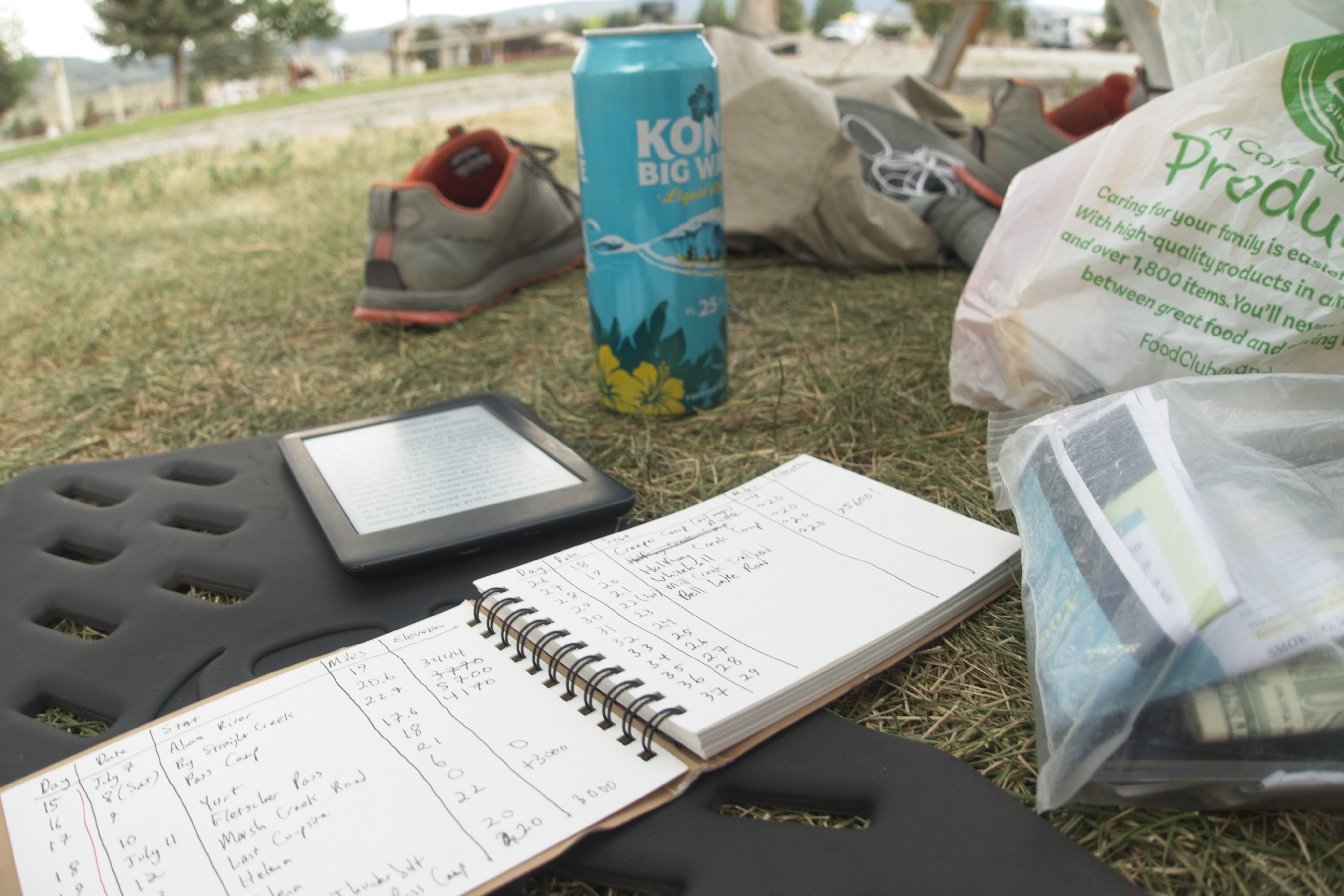
Campsite relaxation, adding up the miles...
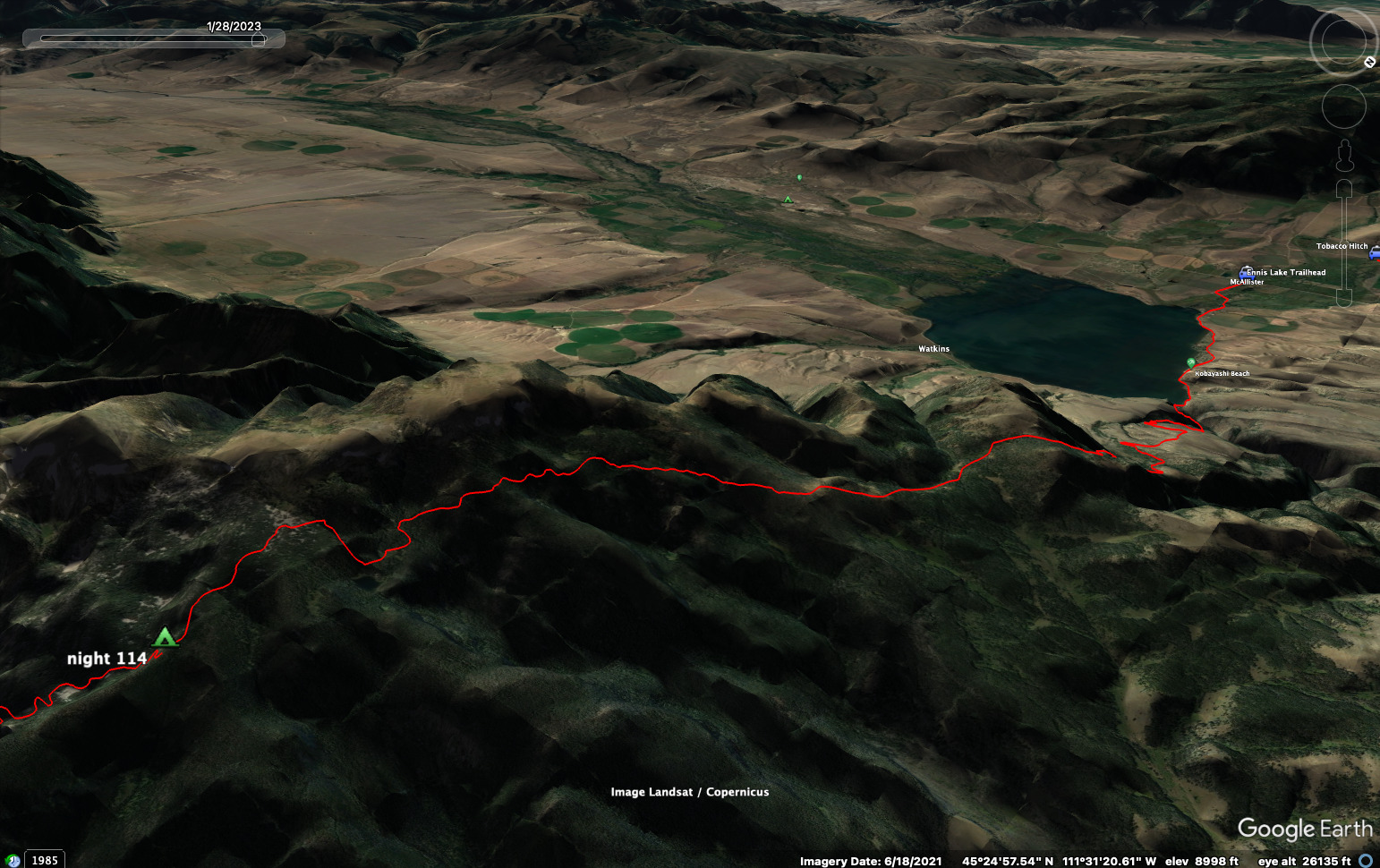
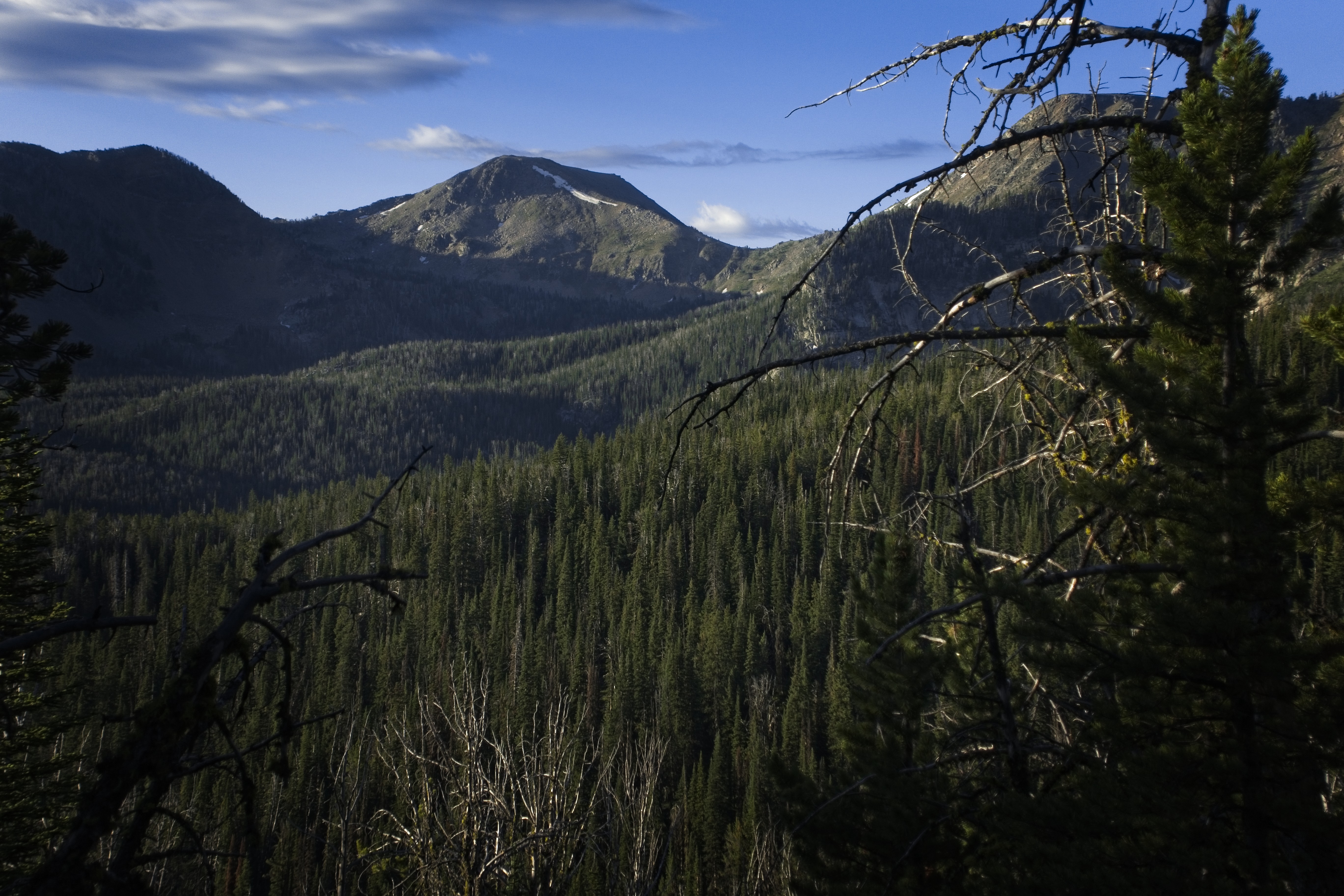
July 24, Day 114
14.3 miles, 4750 feet elevation gain.
Cory and I slept an extra hour after the wine and beer the night before. Ah! Still, we were up and out there early, looking to hitch a ride north to the Ennis Lake Trailhead. After only a few minutes a guy came along in a big truck. He was from Missouri, so he and Cory had a lot in common. But he was very happy to live out here -- said he'd never go back!
Cory walks to the lake.
A similar shot.
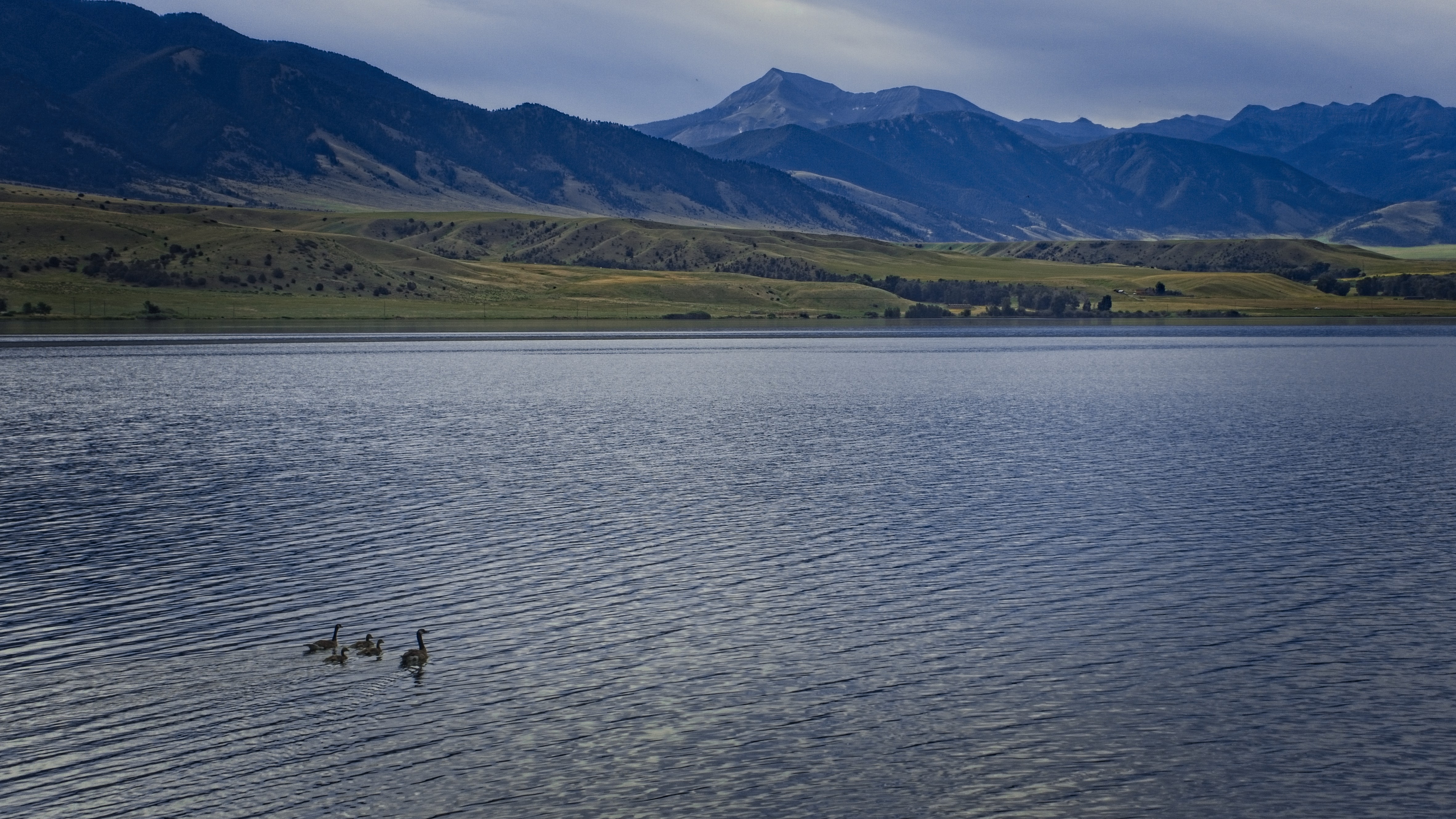
Ducks on the lake.
He dropped us off and we walked a road along the north side of the lake for several miles with pretty views of the mountains. We came to a bridge, then walked north a half mile or so. An interesting fella came along in a 1940s vehicle. He was also dressed in clothing from the time. Very interesting!
We started hiking steeply up a trail that brought us to a high, scrubby plateau. It was getting pretty hot and we were glad to get back into the forests, this time, of the Spanish Peaks.
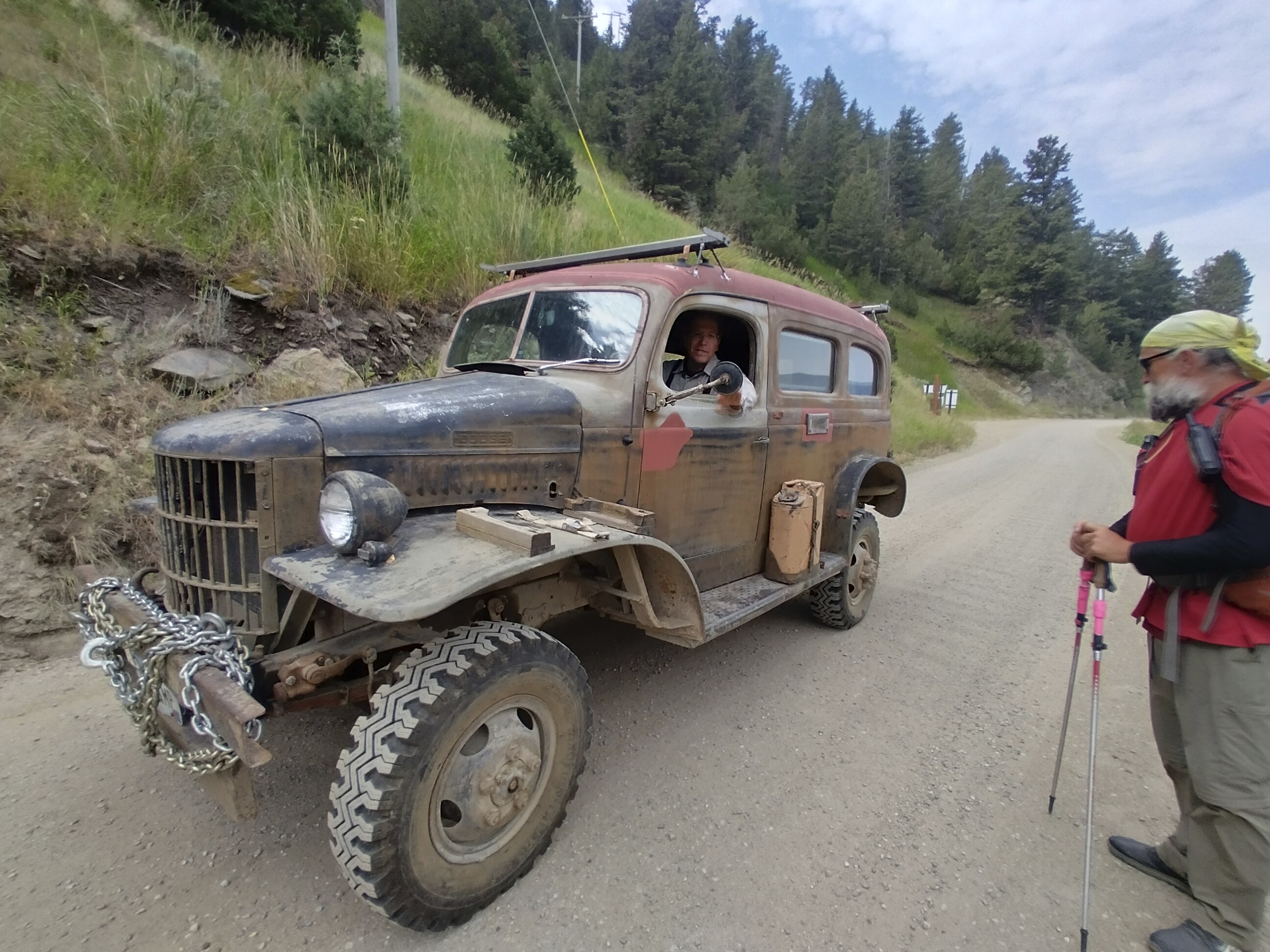
A very interesting vehicle and driver.
Looking down on Ennis Lake from the plateau. The Tobacco Root Mountains
are behind.
Our map at this point broke up into different variants people had taken. We stayed on the main line, though there were two sections described as cross country travel through light forest. We managed to complete both of these, though the second cross country section was quite long.
It eventually brought us to an abandoned hunting camp. Perhaps this was a big deal at some other time of the year. There were all these high poles, rustic tables and such. But weeds and tall grass grew up between everything so it also seemed long forgotten.
After this interesting side-show (we sat at the tables for a rest), we climbed again into higher country. Clouds were building and we started getting sprinkling rain. We could see snow in the trees beyond. This made sense because we were walking under the northern slopes of crags. Though it is July 24!
Somewhere along the way in the mid-level forests.
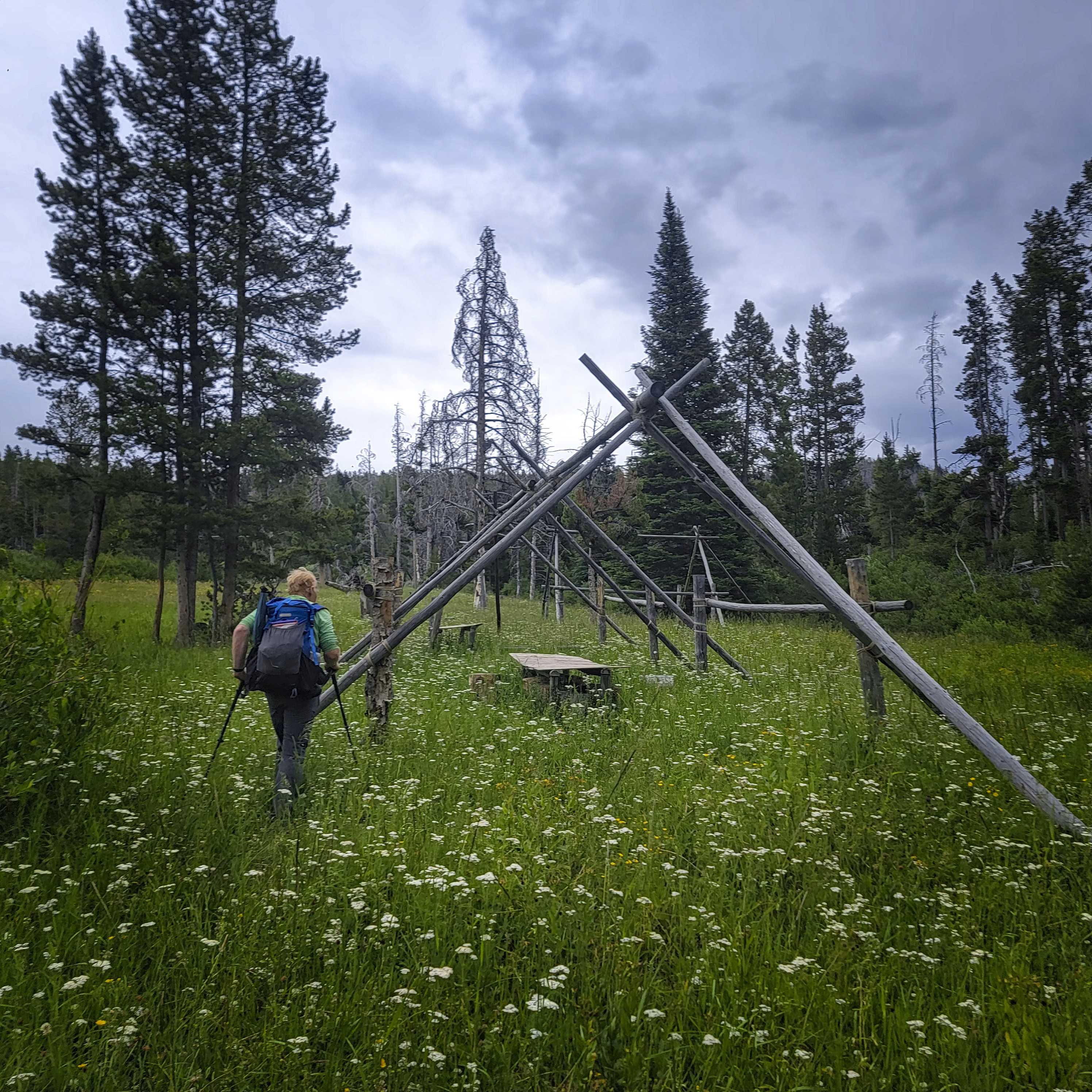
Michael approaches the strange hunters camp.
The last miles were pretty hard. I was very tired of the up and down. Even though we only did 14 miles, I was beat when we reached an area with a few flat places to camp right before a steep descent into a valley. Not wanting to set up the tent in pouring rain, I lobbied for a stop here.
We had a few minutes to eat, but the mosquitoes were pretty bad and soon forced us into tents. Overall it was a good day but the last part was tough.
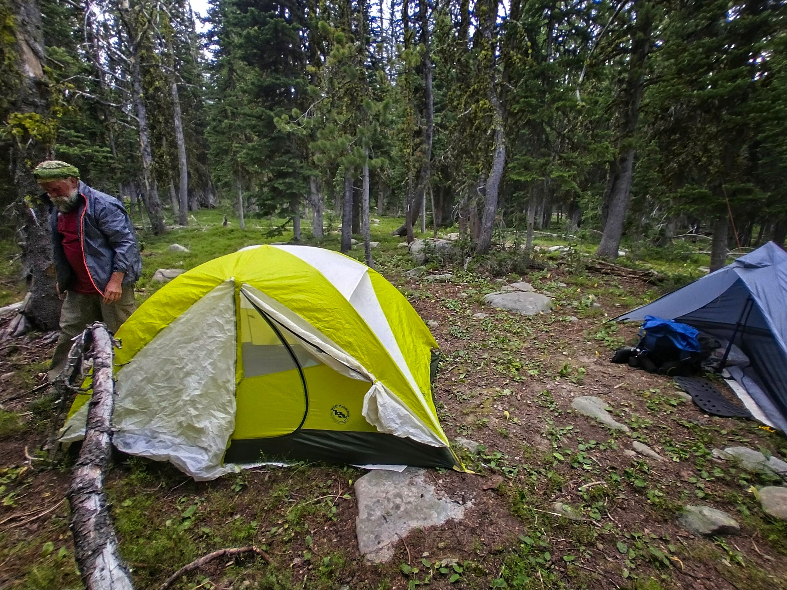
Tired hikers prepare for bed.
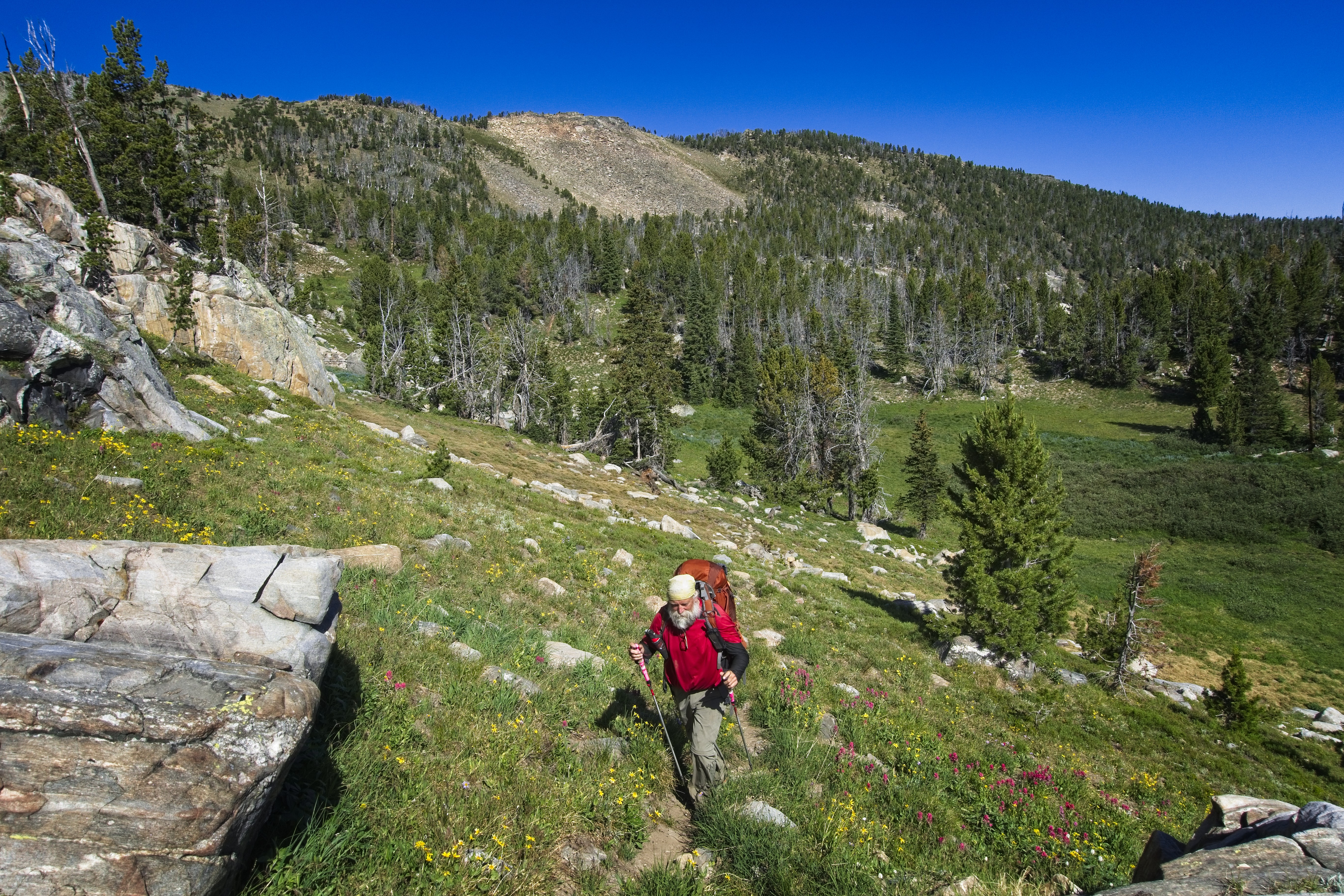
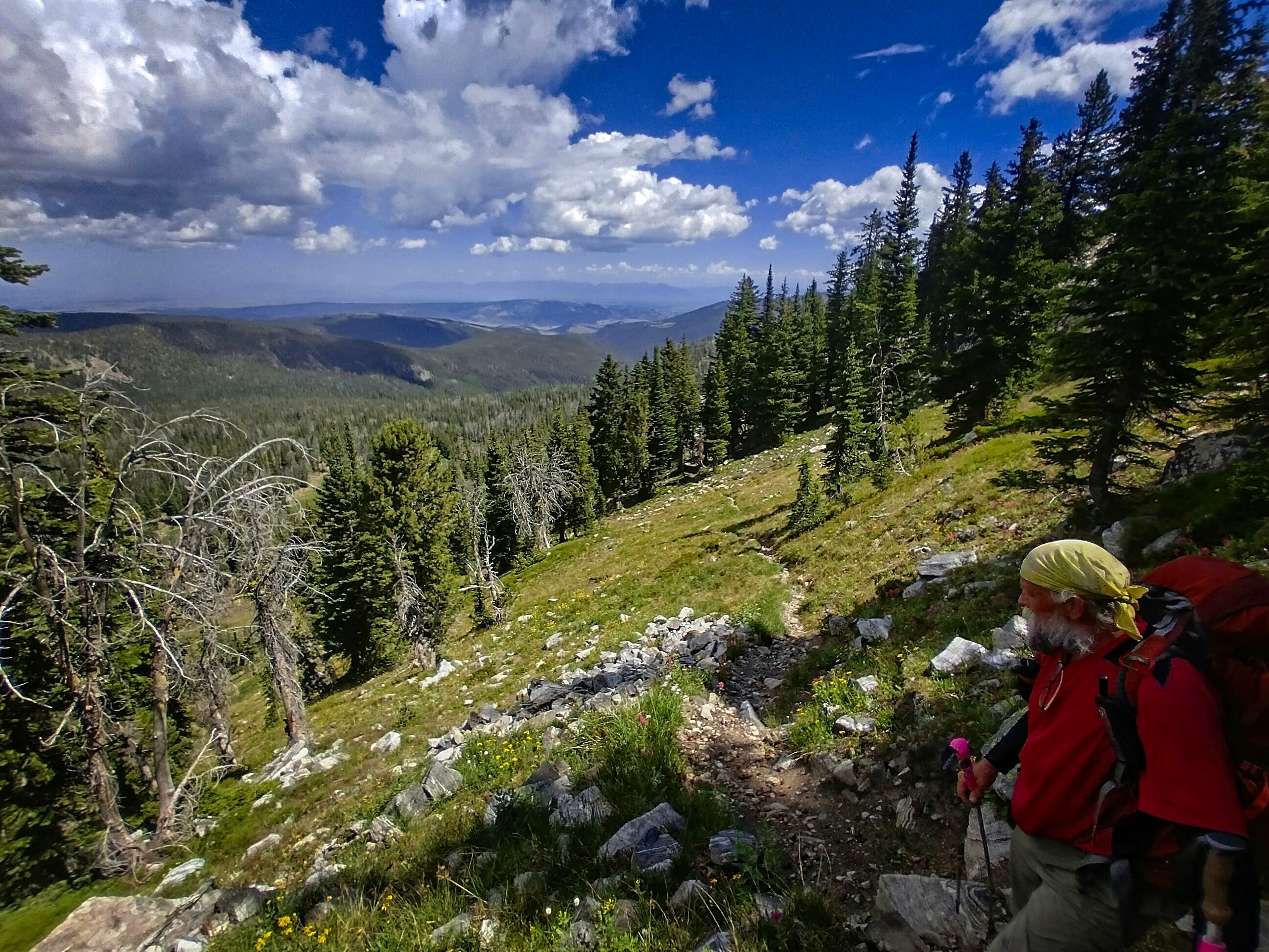
July 25, Day 115
13.7 miles, 4850 feet elevation gain.
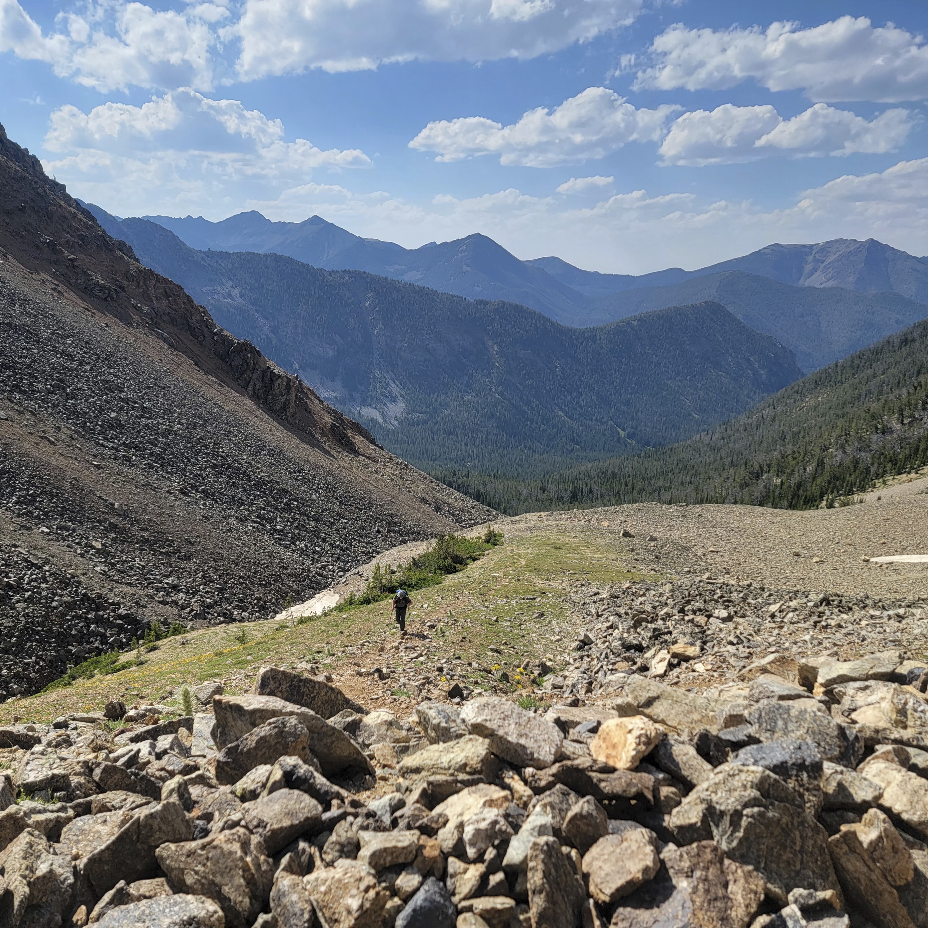
This turned out to be one of the most beautiful days. A lot of work too, and some risk. But I'll get to that.
We dropped down into a tight valley with two rivers, Alder Creek and the North Fork of Spanish Creek, both of which we crossed on good trail. From here we started climbing. There was a section with many long switchbacks where something changed in me. I was feeling really beat down by the trail, lately. Lots of road walking and too much forest with no views.
We were coming up to a section I'd studied long before. Supposedly there was a way to drop down into this beautiful place called Beehive Basin from a high, alpine pass. But on the map drawn by other hikers doing this alternate route it said "not recommended."
I ended up looking around online for information on this unnamed high pass. It seemed that climbers did know it and use it to climb a peak on the north side. I wrote to a climber on summitpost.org who had knowledge of the area, but never got a reply. This didn't bother me too much. I thought that if there isn't too much snow, it must be possible. Robert also offered some positive words about it.
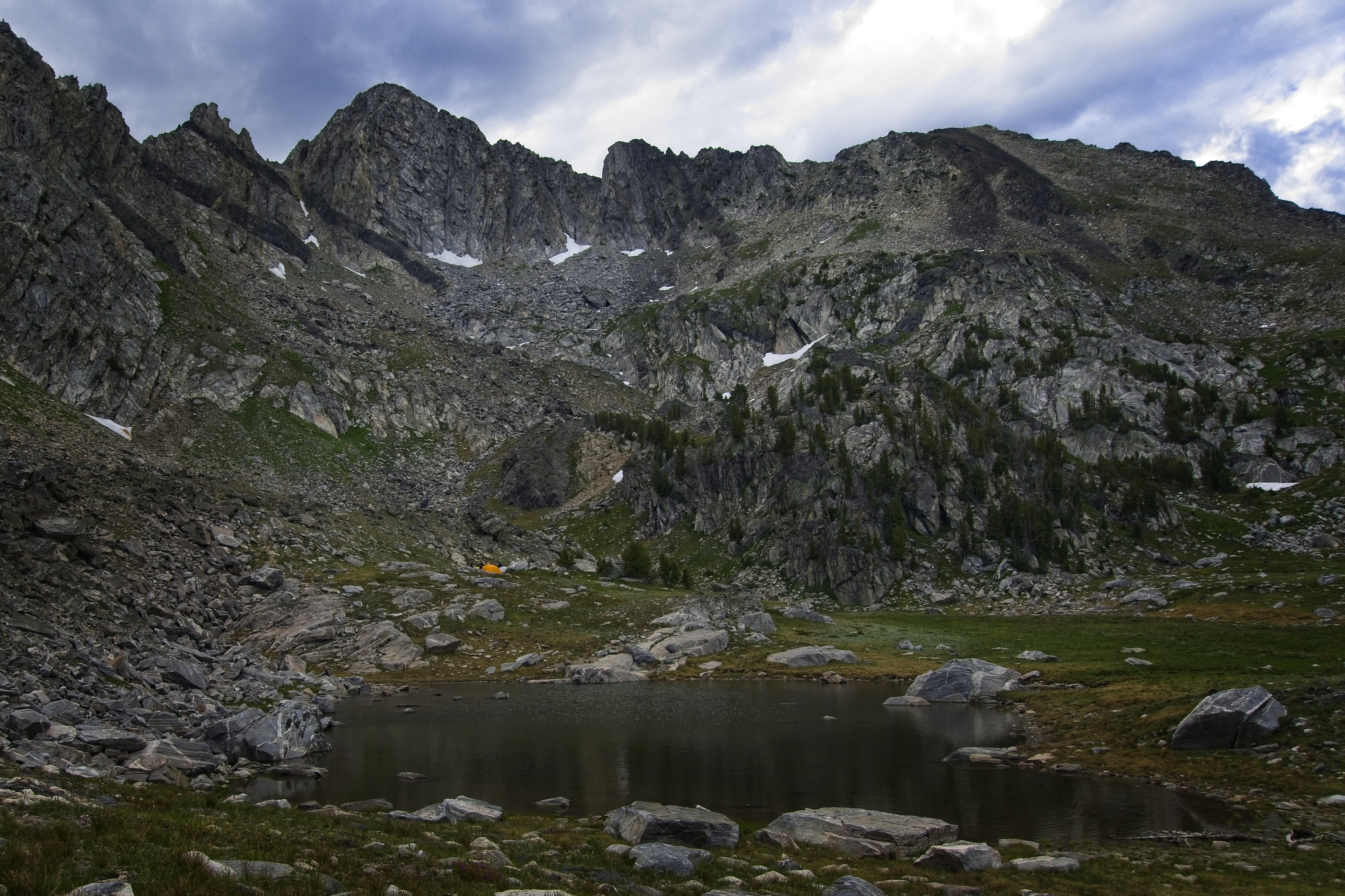
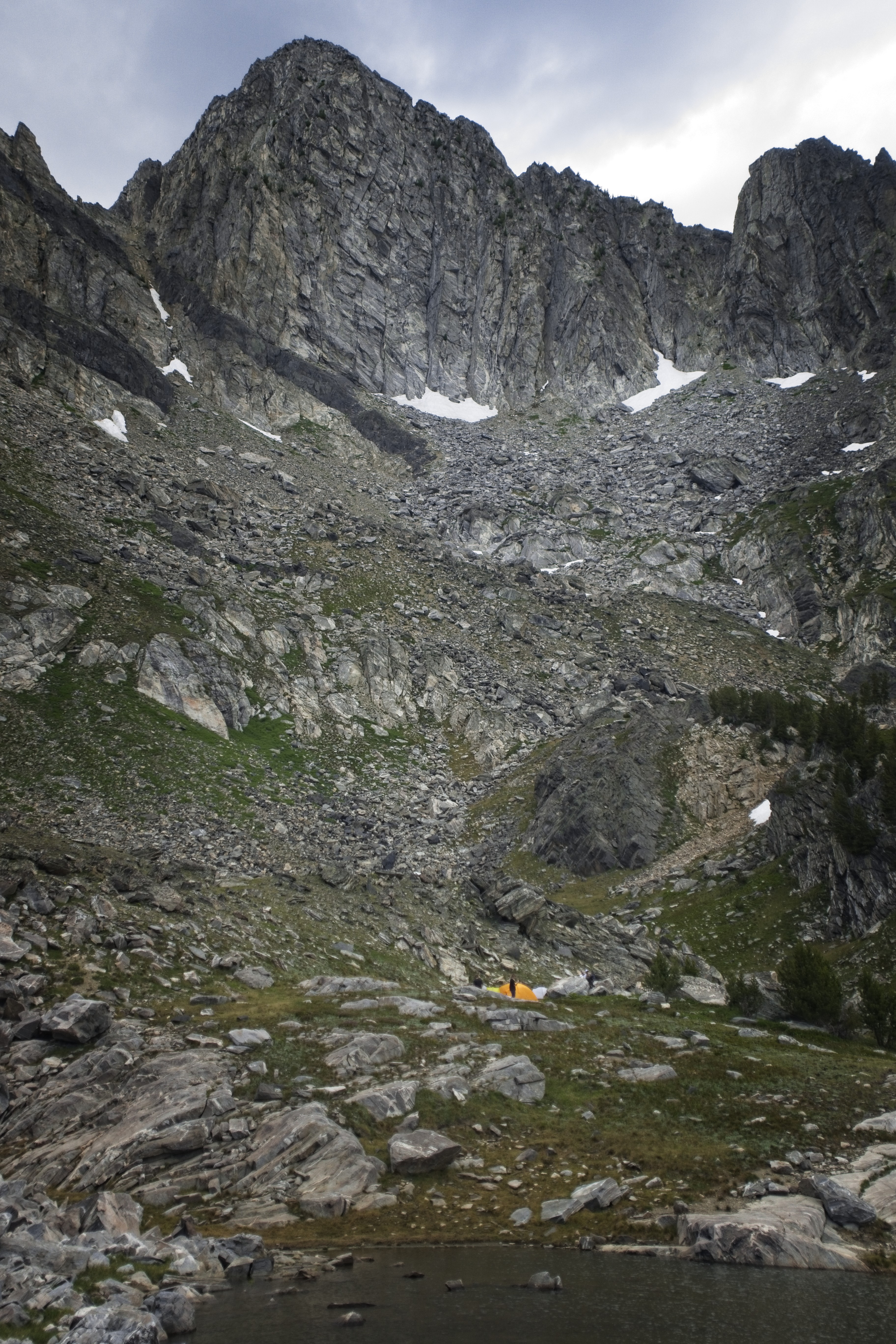
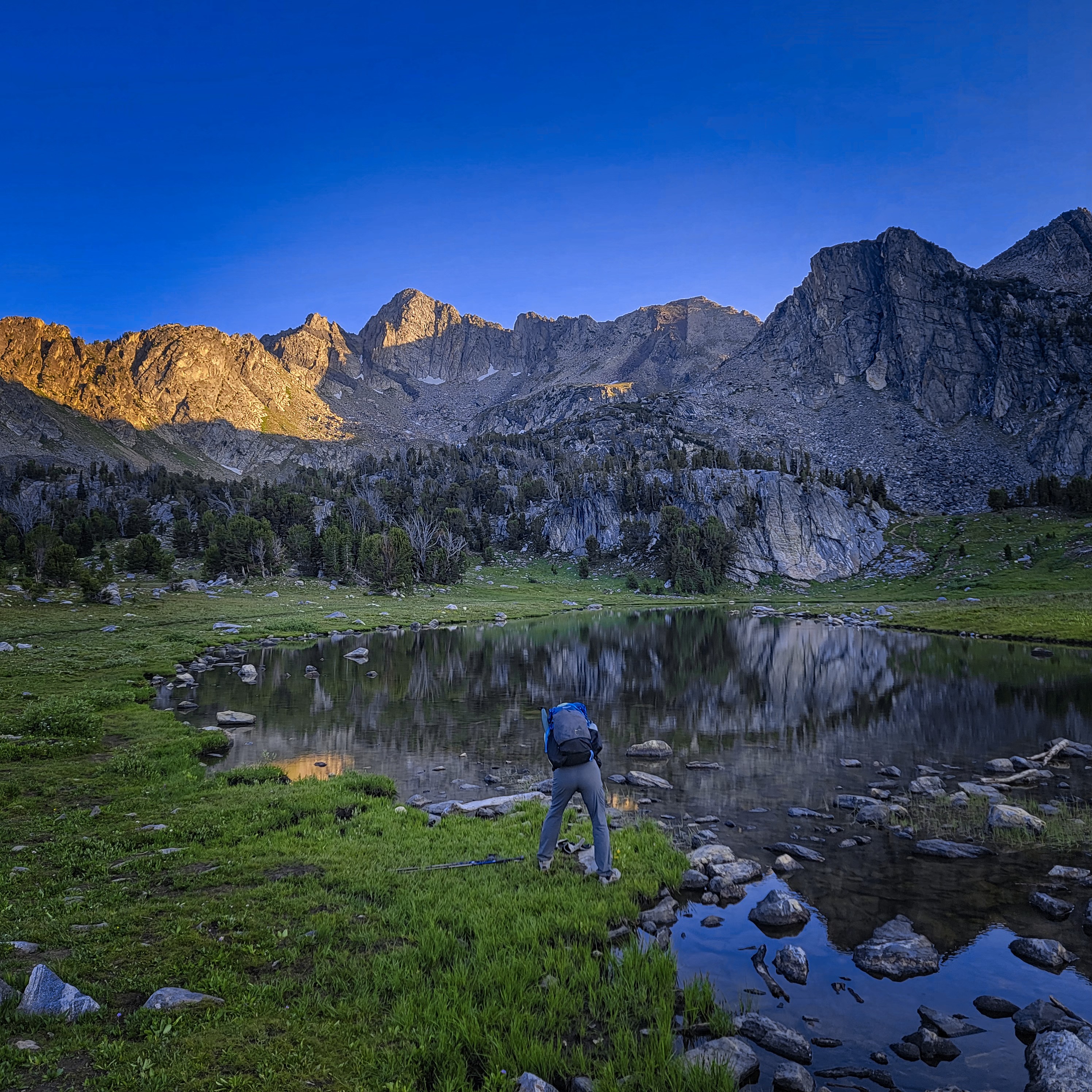
Views dropping down from our ridge camp.
Cory in one of the high basins.
Heading up to the notch in the ridge.
However, feeling weak and beaten down as I did, I thought it might be better for us to just go around this obstacle, dropping down into a valley then reclimbing on the other side. We'd also miss the beautiful Beehive Basin if we did that, but it would certainly work and not bring any stress.
Cory was ready for either, certainly. He's not one to complain but I think the road-walking in this section wasn't his favorite thing either. Also, I'd at first been keen on a great big trip into the Absaroka Wilderness in central Yellowstone, but had moderated my stance there over the last weeks, preferring instead to head as close to south as possible after reaching Mammoth. As often happens, the thirst for adventure abates somewhat as the terrain gets closer. Frankly, it's enough work just making it through each day out here, and energy is limited.
So, with these rather depressing concerns floating in the air around us, I felt a sudden fresh wind. I thought: let's make a stand here. We'll complete our alpine cross country adventure in these mountains. What did we come out here for, anyway?
Spirits lifting, I hiked faster up the hill. I hadn't really exposed all of these thoughts to Cory. But it was a good time to introduce a new idea, because the sun was out and we entered a beautiful north-side basin with burbling streams, boulders and small timberline trees. We were above Little Brother and Little Sister Lakes. We continued into the next basin, passing Second Lower Falls Creek Lake, then the Jerome Rock Lakes, finally Upper Falls Creek Lake.
A panorama in the same place. Funny, this felt a lot steeper than it looks!
A view over to Beehive Peak and the Spanish Lakes (not really visible).
The alpine country from the lower Spanish Lake.
Gradually getting up there...here we're at some lake outlet.
After this point we had to make a decision: would we go for our alpine journey or take the trail down into the South Fork of Spanish Creek? One big worry I had was how much time all the cross country travel would take. But I was happy to see on one map that we should have trail as far as the lower Spanish Lake. Awesome!
Cory said okay, and we started traversing another pretty basin. Finally though, at Lake Solitude we had to climb an extremely steep trail up to a pass on the main ridge. Boah, I had to go so slowly on this.
Cory had a problem: he couldn't find his wallet. He'd decided that if we got cell service he'd try making a phone call about it. So, happily, at this scenic crest he was able to do that. He got a message that his wallet had been found! He'd dropped it when we rested at the bridge at Ennis Lake the day before. So that was some awesome news that somehow resonated with the decision to do something bigger.
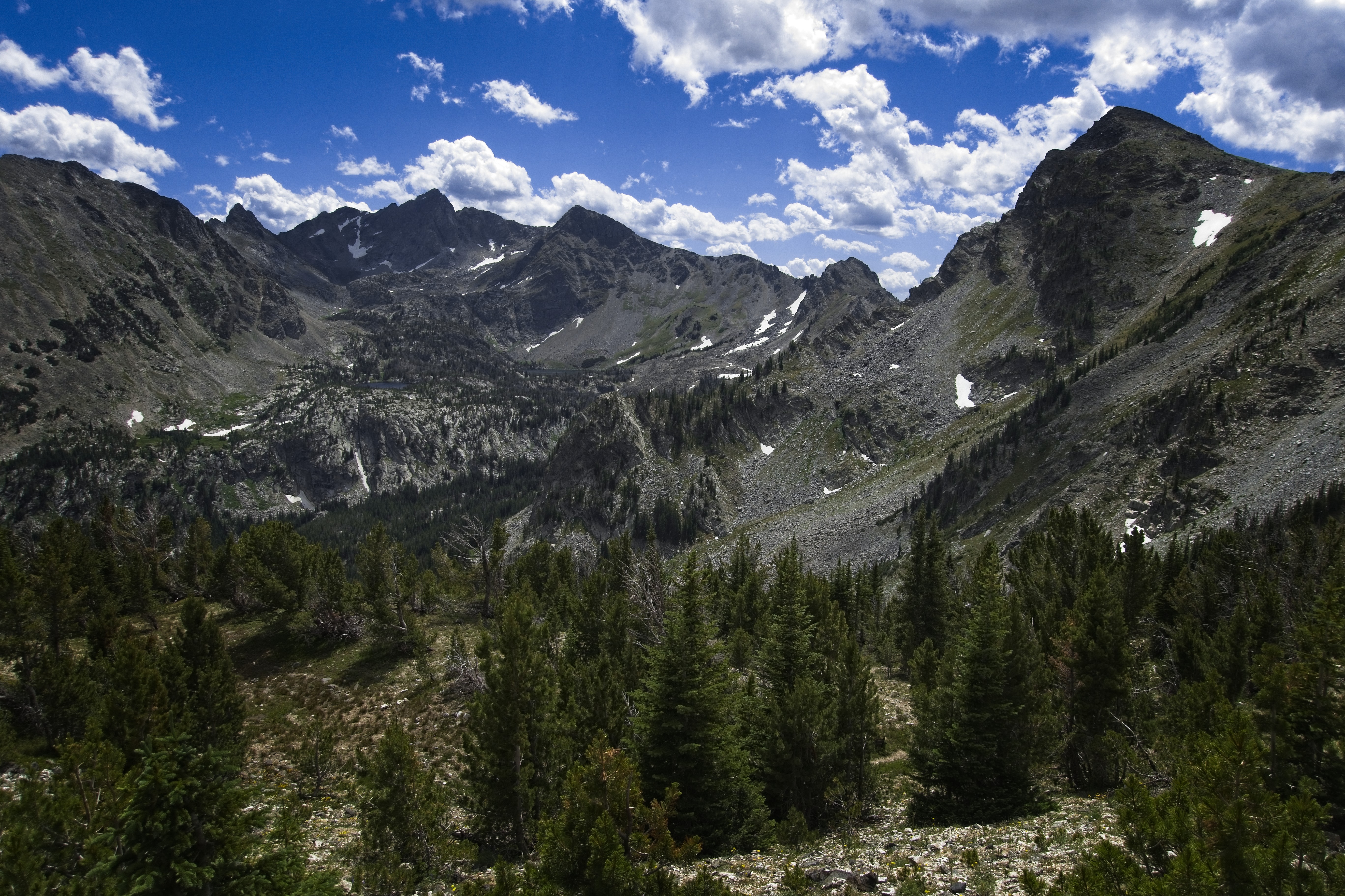
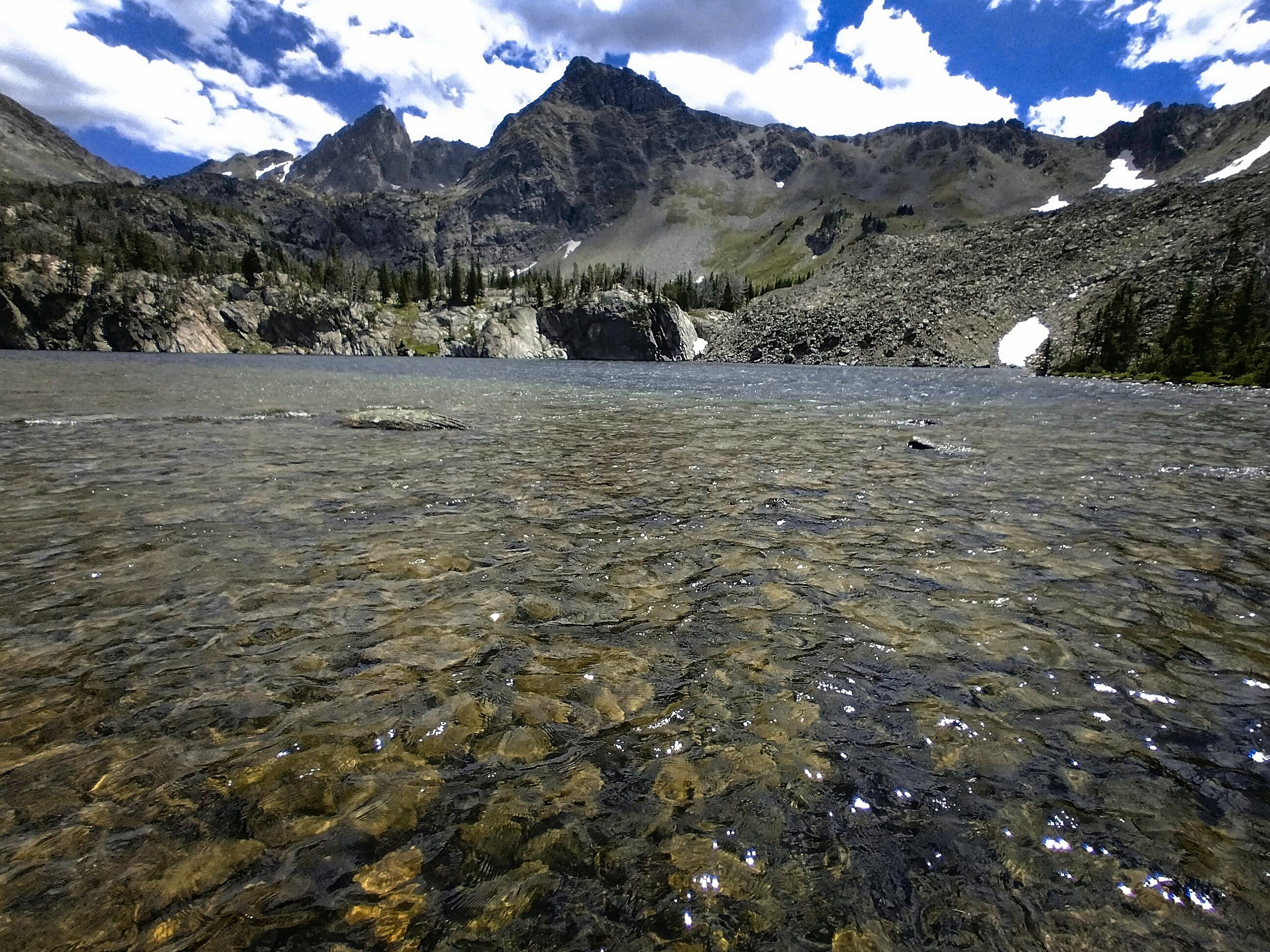
We traversed around a corner from the broad notch on the ridge and met with a stunning sight: the gorgeous alpine basin of the Spanish Lakes below us, with high crags above them. Our idea was to go through those, somehow. We only saw granite walls. Gulp.
The views just wouldn't quit.
Cory contemplating the uncertain way ahead.
Michael in the boulderfield below the steep talus.
Again, perhaps climbing unnecessarily.
As Cory joked later, I took off practically running. I was keen to discover if anything might stand in our way. In the worst case, we could still descend the river north of the lakes and meet the sad forest trail. I very much didn't want to do that. Somehow this made me hurry, at least for a while, haha...
We dropped back into big timber on the other side of an impressive buttress skirted right at it's base on heather and snow-patches. Then started climbing again to the lowest lake.
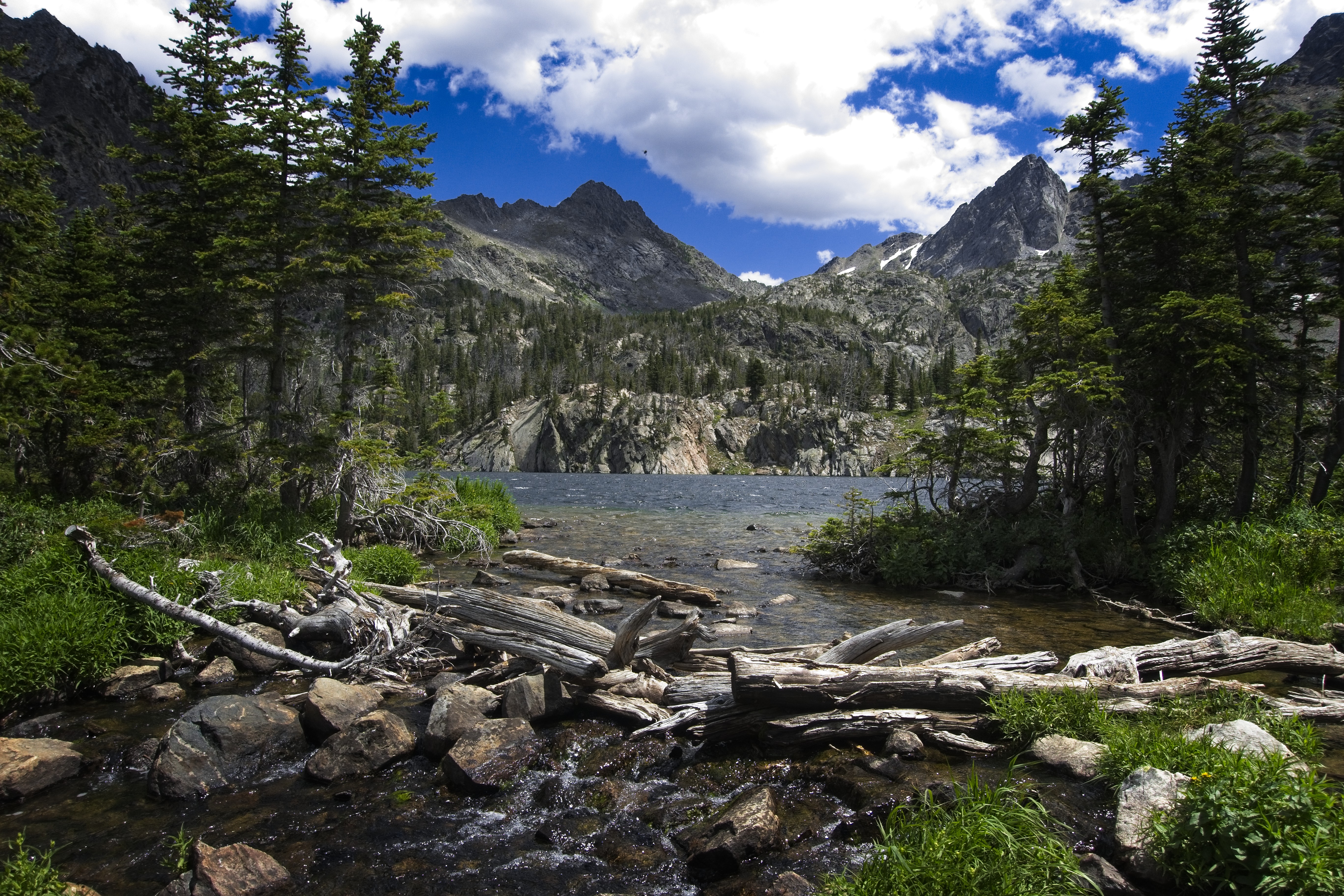
What a beautiful sight. There was a camp here with an American flag, and the smell of a cook fire. We didn't see anyone though. We traversed the north side of the lake on brushy trail. After a rest we pieced together bits of trail and cross-country travel to reach the northern shore of the biggest lake. I was happy for every bit of trail here.
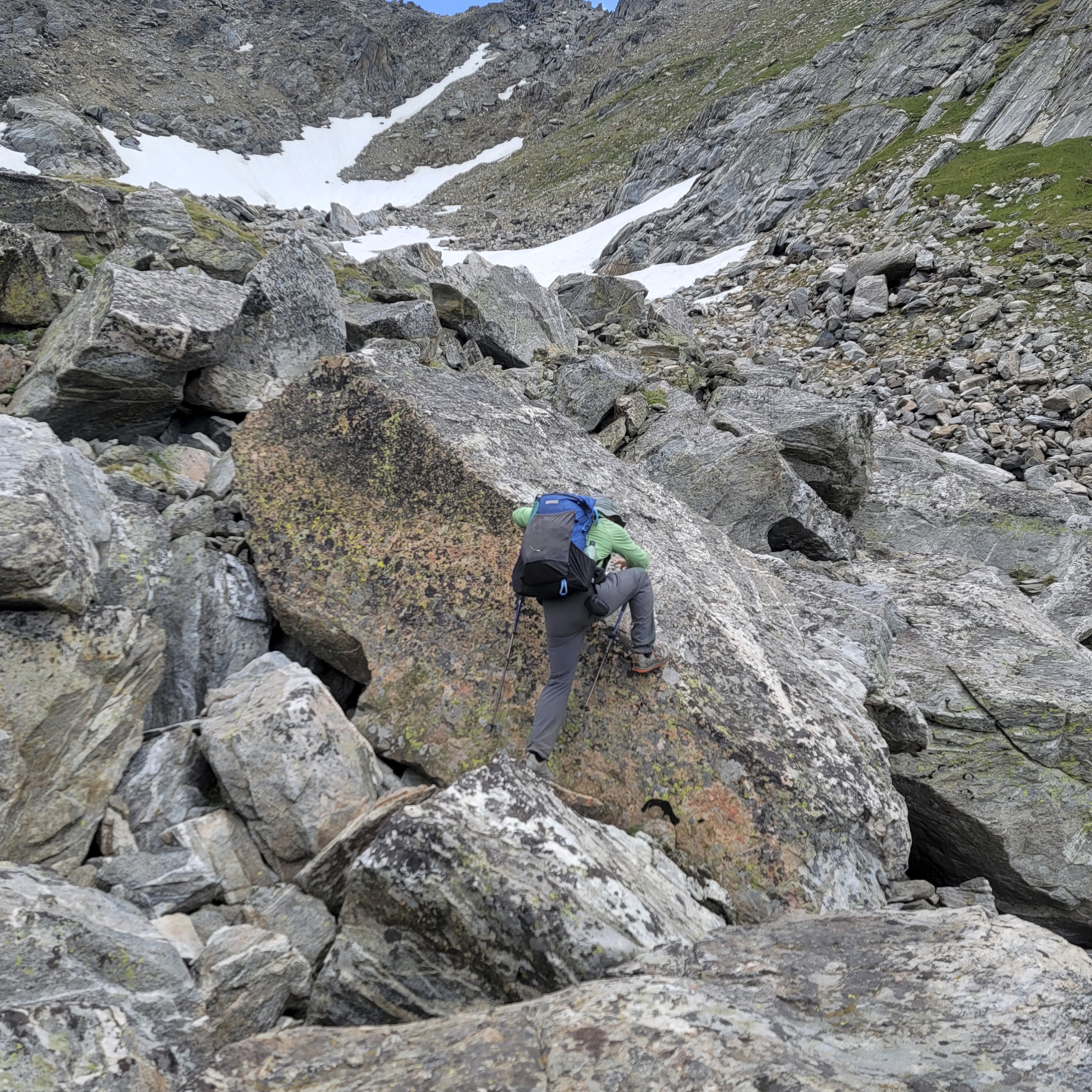
Then we followed a stream up from this lake, thankfully there was a boot path ground into this steep heather and scree. We came into a hanging valley with easy travel. Gradually we saw what we needed to do. From a distance we'd mis-interpreted the correct gully to take. From the broad valley we traced our line, up the lowest angle scree, boulders and snowfields to get in position on the scree slopes below our pass.
Soon we were busy with this work, quite enjoying ourselves chosing the right line. This is such a fun activity...quite different from the "grind-it-out" of much long distance hiking. Finally we reached the point where we had to go straight up.
Cory in the talus-world.

Cory as the talus steepens.
Looking down into Beehive Basin.
Cory at the little pass.
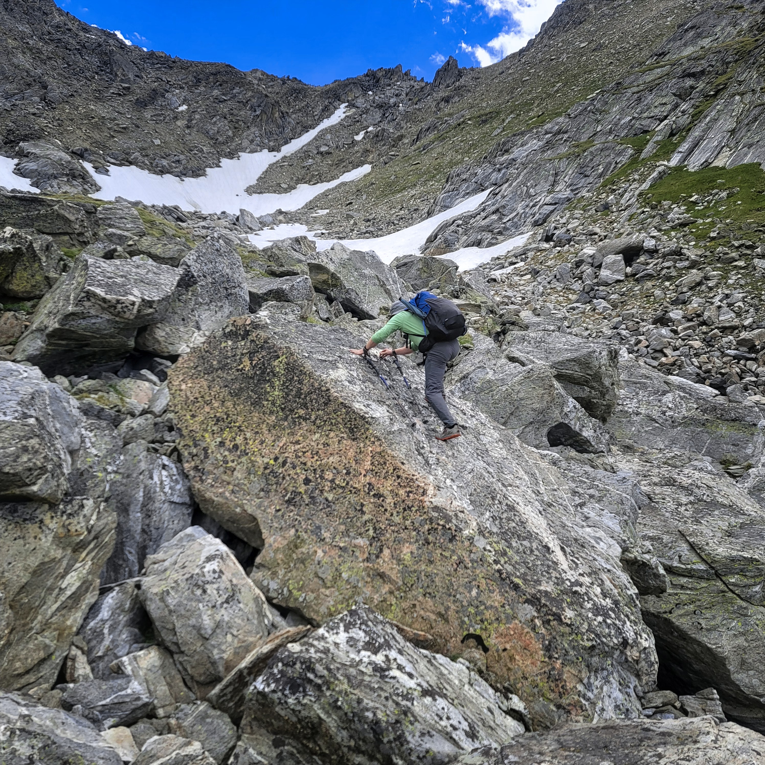
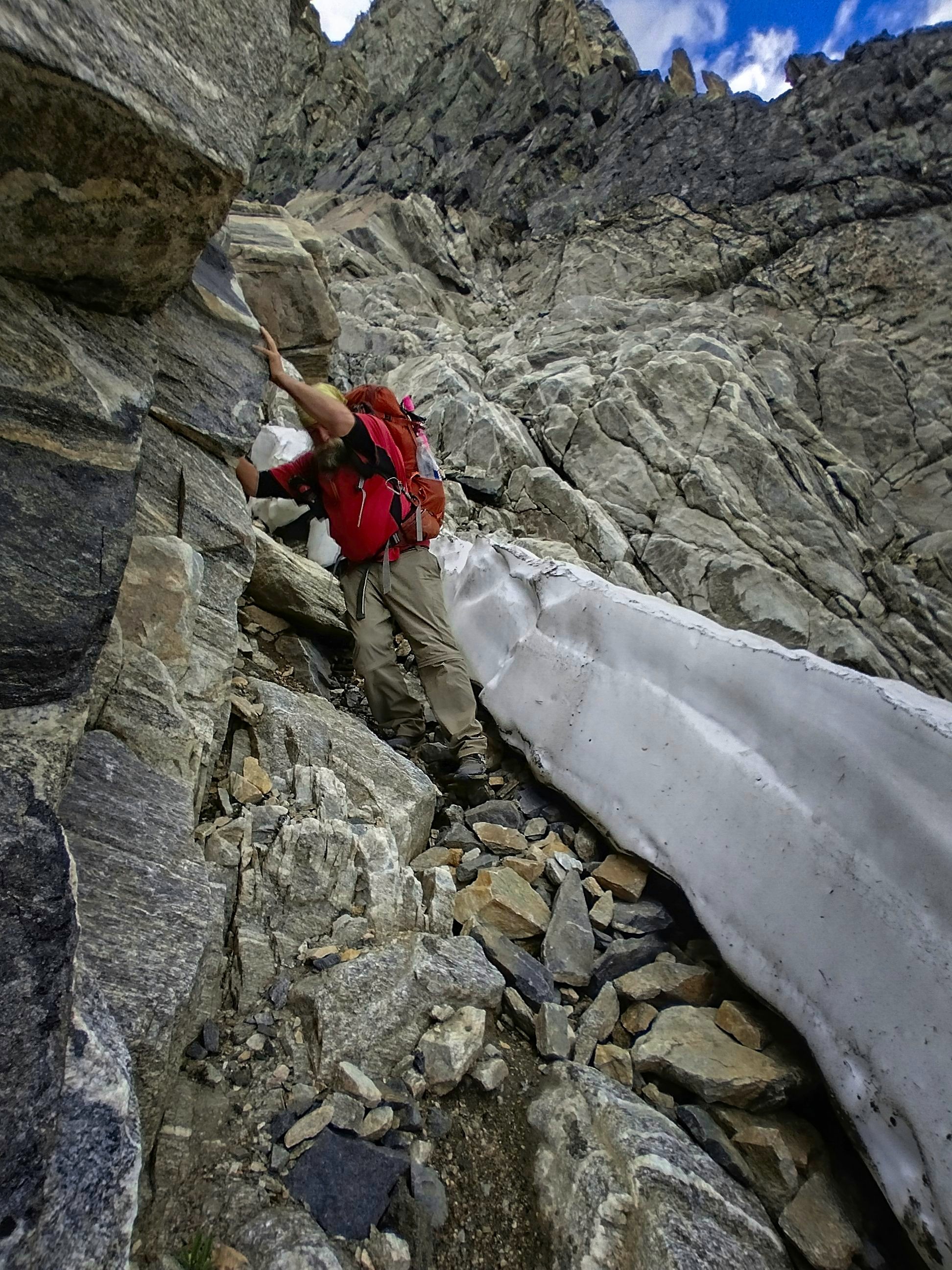
We set to it, side by side in case the shifting talus were to let go at one point. They were biggish, dark granite blocks, which made deep grinding noises settling under our weight. As we climbed, walls closed in and we had trickier ground above...steep dirt alternating with little rock scrambles. The ground broke up into steep and shallow gullies and we had to pick a line.
At this point I went to have a quick look to the left right into the central slot, which didn't seem appealing below. To my happy surprise, it had become a kind of highway to the notch, at least compared with the steepening terrain we were on now. Cory came over and we made our way up this slot, again, side-by-side when possible.
And suddenly...we had done it! We sat at the tiny notch and were quite pleased.
Only one thing to do: get down. I thought this side should be easier. For one thing, it faced south-east whereas the way up faced northwest.
Hmm. We had no snow on the way up, but we could already see chunks of snow down below us on the south side. Okay...
We resolved to go slowly and carefully, staying near each other so that any falling rocks wouldn't have a chance to bean the one below. There were scruffy hints of trail, always leading out and around a buttress, because the central slot continually became a nightmarish wither of dirt and smooth rock. The buttresses were nice because they offered solid, incut edges for hands and feet, but worryingly, required an increasing number of "climbing" moves as we descended.
"Surely this is the hardest part!" I kept thinking. In fact, the hardest climbing moves were in about the middle. In the lower half, we faced increasing contact with rock hard snow, and had to venture from one side of the gully to the other. This part was the most tiring.
Finishing the descent. This is the easy part!

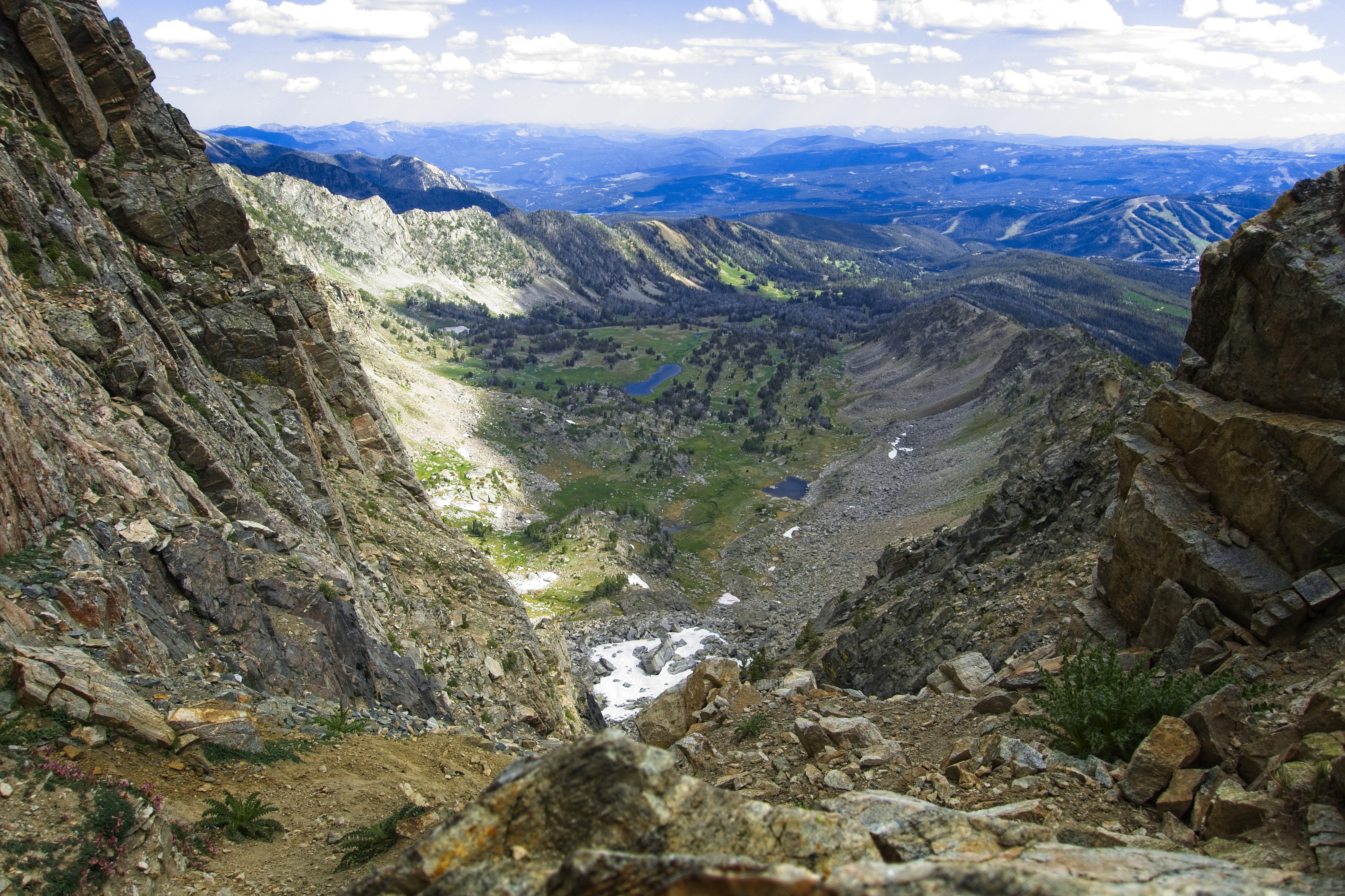
Looking out to Big Sky...
Beehive Peak and our notch on the left by the black bands.
I was glad Cory had climbing experience...it's an absolute must. At one point I thought he was about to be unbalanced by his pack and I said rather sharply to hold on. Clearly, we were on serious terrain. In tennis shoes. With multiday packs.
Hmm. Okay.
Finally though, we were almost down. The release of tension was great. Lots of whooping and doing a play-by-play of the different moves. Whew!
The last several hundred feet down to camp were triumphant. Wow...we did it. We did something hard, uncertain. It felt good.
Same, with the tent of the three young men visible.
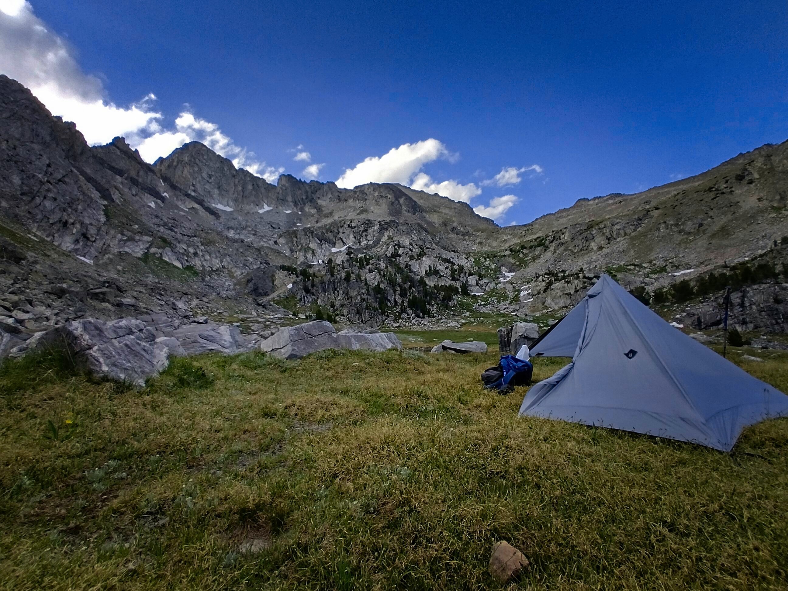
My tent in Beehive Basin.
And strangely...it had an effect that lasted the rest of the trail for me. That is, I felt content. Like...we're on an adventure. And not just a "grind-it-out" adventure, but one which required some careful thought and exposure to risk. I know the bears are a risk. But for me...not really the right kind.
Is it possible to have a "risk preference?" I guess I have one. Cory, who continually grew stronger as we hiked, outstripping my abilities by a mile, nonetheless asserted that on days like this when I see a peak to climb, I'm pretty strong. He's right, and it's just evidence that my character still needs a lot of work: I'd rather be motivated primarily by duty, than by some entirely personal enthusiasm. But so it is, at this time, in this world!
We set up our camp with a view back to our difficult descent. I made a drawing of it as we sat by our tents and ate. Three young guys were camping at a little tarn a little ways away. I slept happily here.
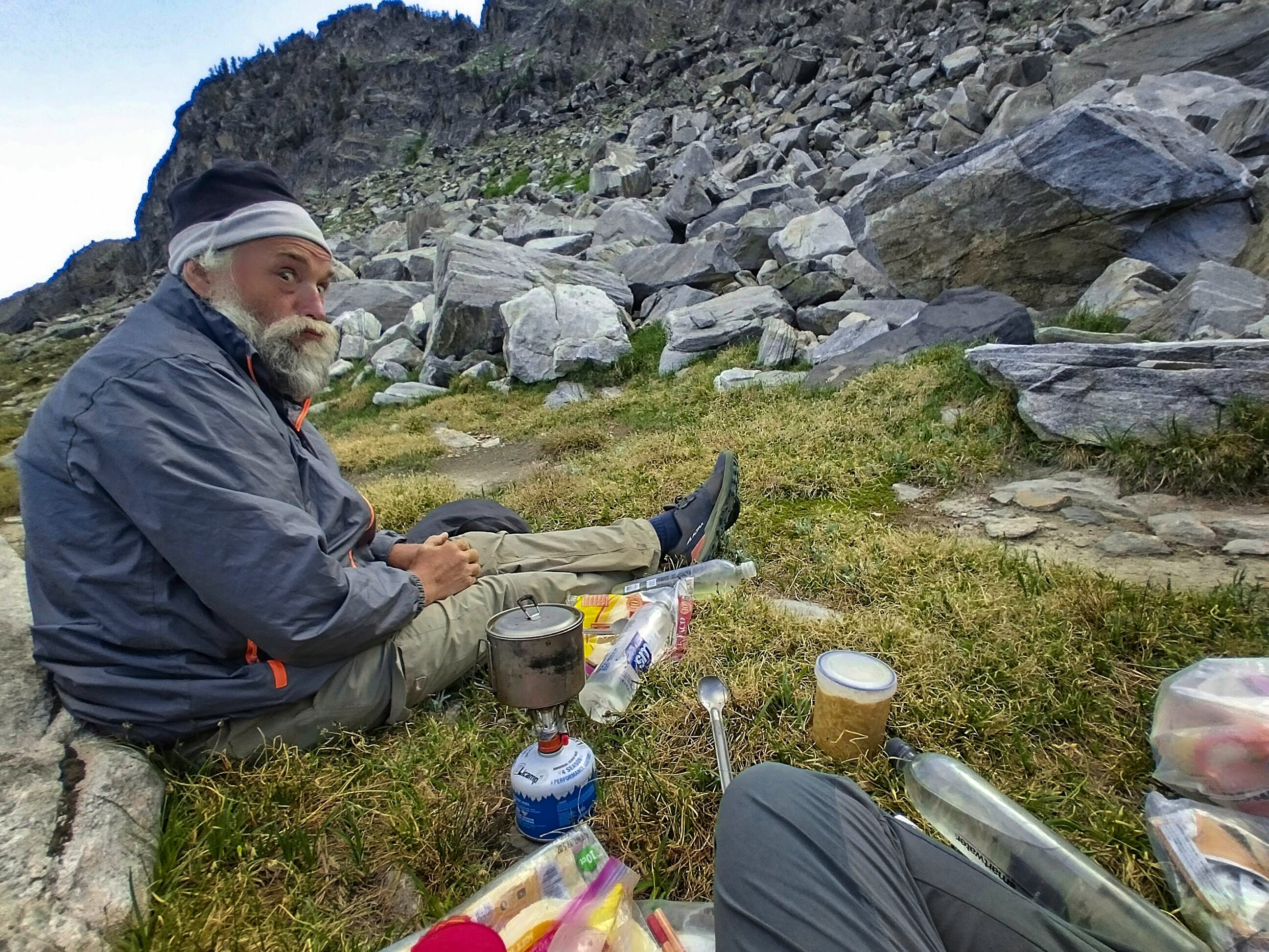
Cory hamming it up at dinnertime.
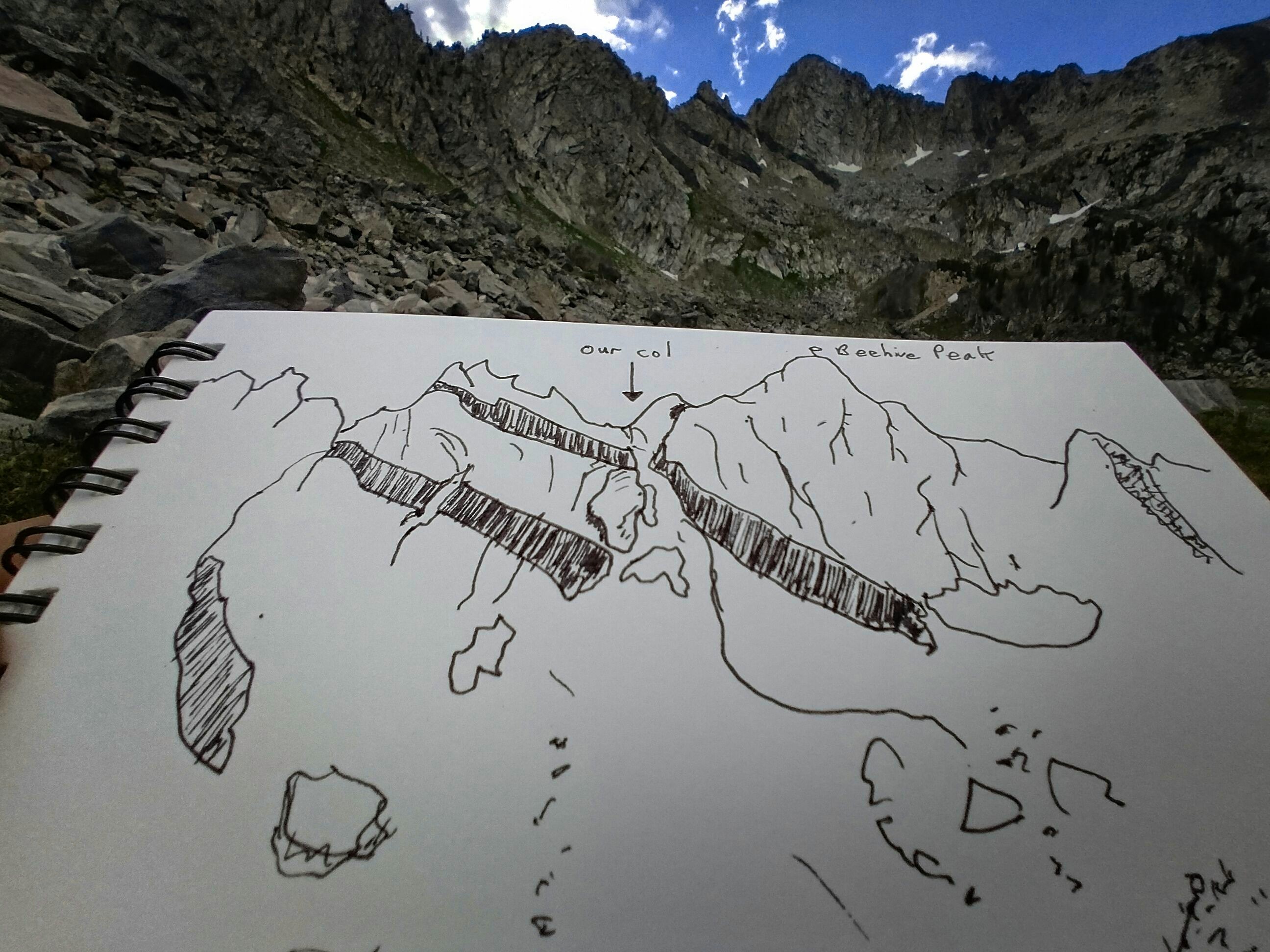
My little drawing of our triumph.
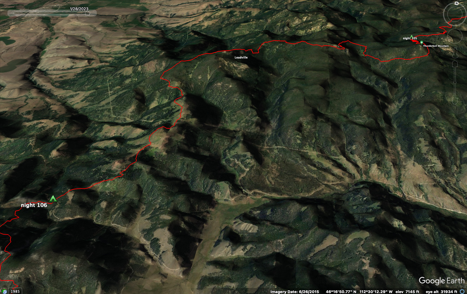
July 26, Day 116
9.5 miles, 450 feet elevation gain.
We only had to get down to town. I was able to contact Robert the day before at the high notch, and he'd come get us at lunchtime. We had to descend several thousand feet over 10 miles, no big deal...
I was glad to have several maps though, because we needed to take a rather strange steep trail not marked on the map into the North Fork West Fork of the Gallatin River (that name is correct!). Finding this trail took some effort. We'd come down the beautiful basin to some roads where mansions were being constructed for American royalty.
We got down to the river and the miles passed easily. Finally a dirt road led down to hot open country and the highway.
Goodbye Beehive Basin.
We walked this rather unpleasant road (bad shoulder) for more than an hour, then stumbled into town. There was a coffee shop where we set to eating everything they had. We met the three young men here from camp the night before, and chatted with some other people too.
Then Robert arrived! He whisked us away to Bozeman for a fantastic visit with Julie as well as Mark, Roberts good friend who had also moved out here and become, along with Robert, an expert climber of the region.
Robert really saved us from an enormous expense, too. The only hotels in Big Sky cost over $200 per night. That would have been no fun! Plus we learned so much about the region in this visit. I'll have more about it in the next report.
To go forward to days 117 and after, click here.