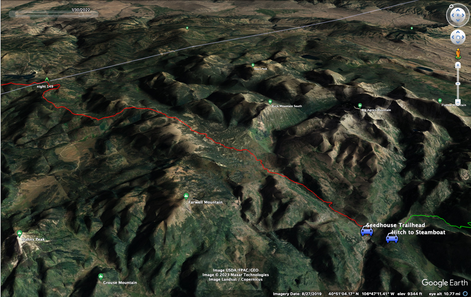
CDT - Rawlins to Steamboat Springs
Friends: Only God!Location: Rawlins, CDT Rawlins Slackpack Trailhead, CDT Night 147, Battle Pass, CDT Night 149, CDT Night 150, Seedhouse Trailhead, Steamboat Springs
Elevation gain: 4176m = 168m + 0m + 880m + 1347m + 928m + 853m
To go back to days 144 and before, click here.
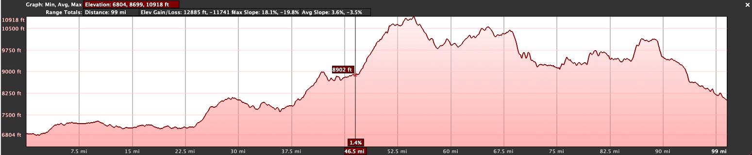
102.3 miles, 13,700 feet elevation gain for the section.
The text below refers to the same events as the blog entries:
I'd become a rest-taking machine! Wyoming became pretty "restful" once we reached Dubois. A zero-day there, then another in Pinedale. And now Rawlins. This made sense for me because I'd given myself until September 22 before I needed to be back in Germany. Cory and I were a great team, making good time.
However, at this point it was clear that Cory needed to get a move on to make it through Colorado before the snow starts. And once I reach the Seedhouse Campground, just 20 miles south of the Colorado border, I'll need to begin a season of travel to pick up the missing section in New Mexico as well as the missing section around Winter Park in Colorado. So I can't walk along with him anymore. Therefore, he decided not to take a rest in Rawlins, but push on to Steamboat Springs. In fact, he'd probably just resupply there and move on (that place is very expensive), not taking a full day rest until Grand Lake or beyond.
In the evening we smoked a pipe and said our goodbyes, for now anyway! He's threatened to come to Germany, as he's got a friend that he hiked the Appalachian Trail with over here. Well, he's got another friend in Bavaria, too.
The hostel we stayed at was run by an interesting lady named Kate. Here you can see a video of her with her interesting trailer and pet goat. There was a bunk room, a kitchen and bathroom. Also, the place was a laundrymat, which we really needed! (called the WashBoard). The owner is a woman named Christine with a lot of character. Kate and Christine had a partnership between the hostel and the laundry. And indeed, there was a friendly pet goat walking around! (Update: the partnership sadly dissolved, Kate has a sad story about it).
August 24, Day 145
13.3 miles and 550 feet elevation gain.
Cory and another hiker headed out from the bunk room early in the morning. He loaded up with a big pack, carrying enough food to reach Steamboat without stopping at Encampment, reachable via hitch from Battle Pass.
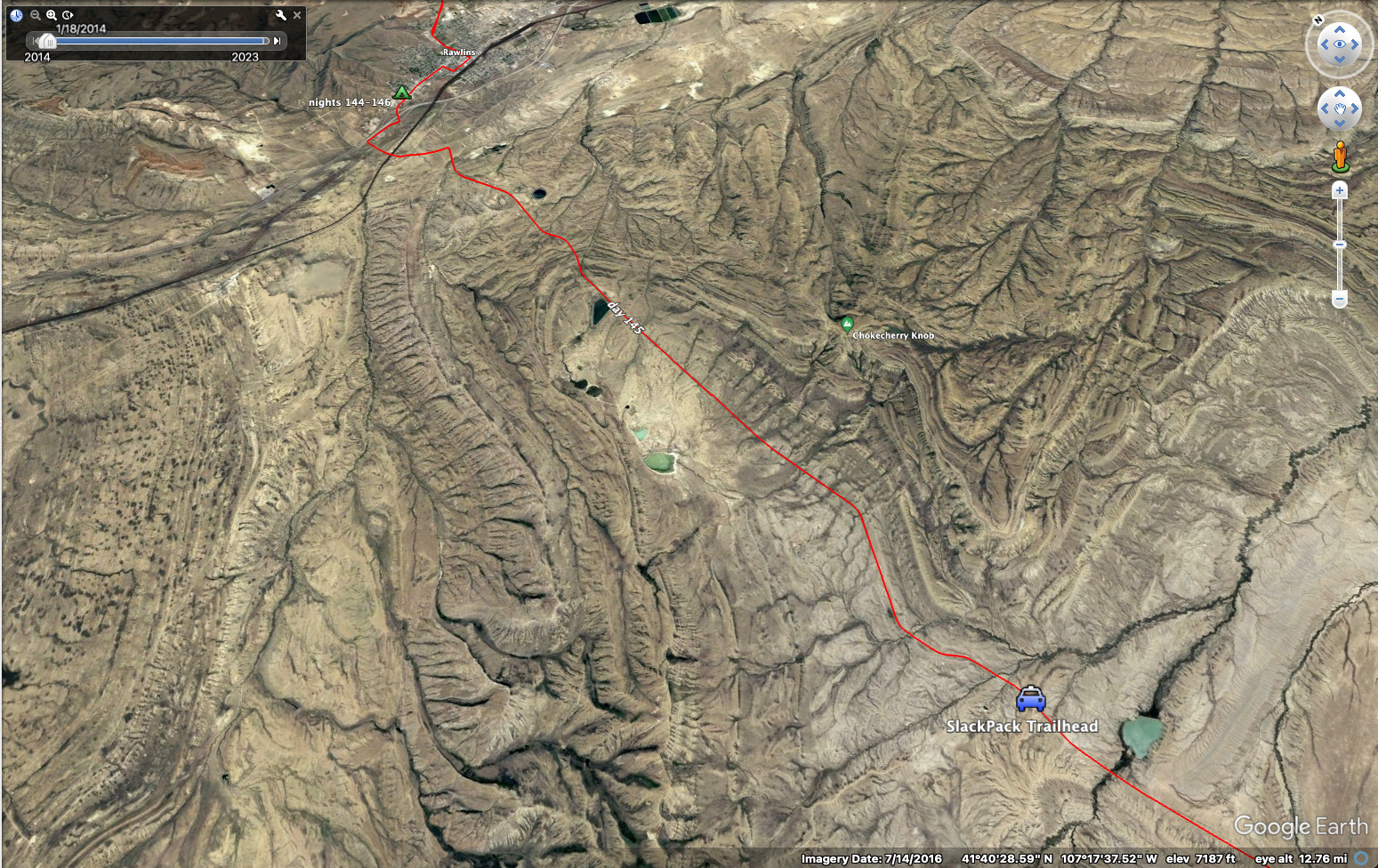
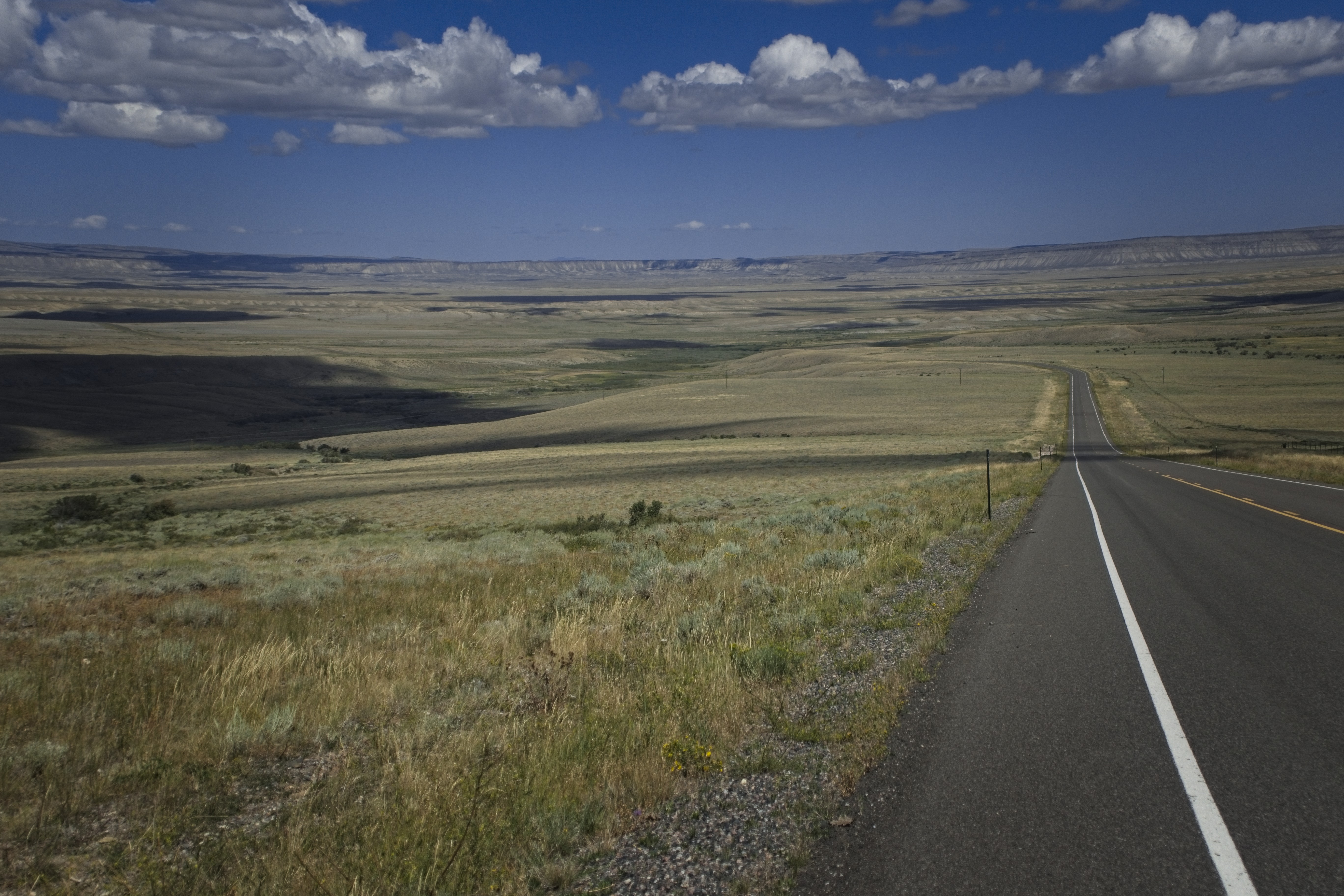
I slept until I could get breakfast at the cafe. Afterwards, I asked Christine for a ride 13 miles south so I could walk back to town. I decided to take the road alternate down to the mountains, since the trail either parallels it or swings way out west then back east in a way that felt pointless to me. Plus, many were taking the road and we knew it had some water caches. If I could break up the 35 mile road walk into a nice half day today, then have my rest day tomorrow, then there would just be 22 more miles to walk the day after. It seemed like a great plan to me.
Christine told me about life in the area. She moved here from Hawaii, young and pregnant. She eventually married and misses her husband, now passed away. She said the mindset of the town is "please God, give us one more boom and we promise we'll be more responsible about it!" She thought the world of Kate, and it was clear that both of them were dreaming of the possibilities that her coming to town might unfold, for the business and for life.
At a fork in the road, where the redline comes very close, Christine dropped me off. I set to walking back north, enjoying having the sun at my back. This is generally more pleasant. Though in general my experience has been clear: walk south on the CDT. You'll have way fewer snow problems. When I think about the snowy difficulties of the Southern San Juans, as beautiful as they were, I'd say it's far better to make that walk when the snow is gone.
But when snow isn't a factor, walking north is nice. I was listening to many podcasts about Catholicism, or by catholics. I was reading St. Augustine's "Confessions," also G. K. Chesterton. Also Peter Kreefts summary of St. Thomas of Aquinas "Summa Theologica."
The catholic intellectual tradition is a serious draw. I also liked the "Pints with Aquinas" podcast and Matt Fradd's stand against pornography. And I devoured every Peter Kreeft interview I could find, that man is a national treasure.
I was also listening to the audiobook version of Thomas Sowell's incredible book "Intellectuals and Society". There are so many quotable passages.
It was a beautiful walk. It reminded me of training walks back home. This is really wonderful country. I wouldn't change a thing.
I rested by the train tracks near town, then finished walking in and repaired to a steakhouse for dinner.
August 25, Day 146
My Rawlins zero day!
A nice Denny's style breakfast at the cafe west of the WashBoard. But later in the afternoon I went to the coffee shop of the first day (called Mukwano's). I had a long talk with the young man behind the counter and he shared a beautiful artwork he'd won a prize for.
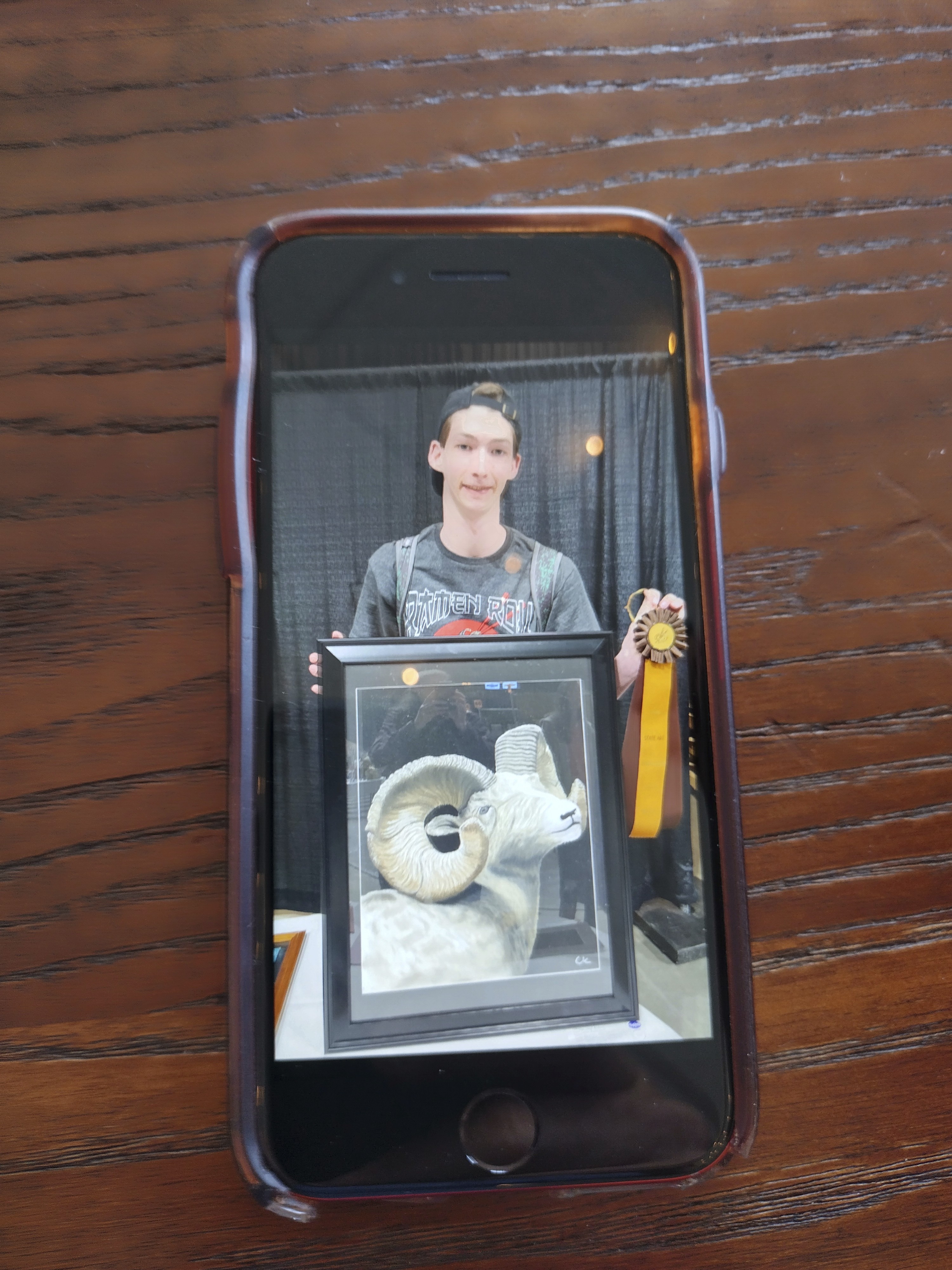
This amazing artist worked at the coffee shop. He won a prize for
his painting of a ram. He explained to me how he took it from initial
vision to completion. Wonderful.
Another thru-hiker was here, Cory and I had passed her in the desert. Nice talk with her too, and then a young lady who showed me pictures of a pretty canyon in Colorado on a hike with her boyfriend. Dang, Rawlins was just a place of many conversations with many people!
There is a town shuttle, and I took it out to Walmart on the east side of town. I didn't like the driver very much, but the passengers were nice.
I hung out in the hostel in the evening chatting with two Canadians doing the trail, named Shamrock and Scraps. They'd also done the Great Divide up there and an interesting route through the middle of Vancouver Island. A very cool couple.
August 26, Day 147
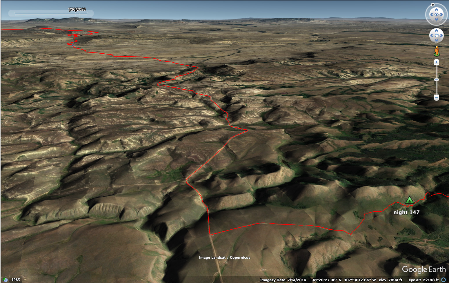
26.7 miles and 2890 feet elevation gain.
Christine drove me out to the same place she dropped me off before.
I enjoyed reading in Thomas Sowell's book an idea of two basic worldviews on life: the "Anointed Ones" and the "Pessimistic View." The anointed ones believe we are the only ones coming to rescue us (to use one of their favorite phrases), so we need to remake the world according to our elite's designs. We come from caves and will go on to the stars, and we were worse in the caves and we'll be angelic once we reach the stars. This view creates governments with top-down control and rule by elite.
The Pessimistic View, on the other hand, expresses the idea that human beings are both special and flawed at the same time. In the "caves" of the past were men and women equal and beyond us in moral intelligence, as well as brutes. And in the future it will be the same. What we call "civilization" is fragile, and can be destroyed easily. We should be humble about our abilities to predict and control the world. We can and should do some of that, but always with humility. The humility is expressed in the concept of a free market of ideas and goods, recognizing that any one of us may go badly wrong in our thought, but some may come to wisdom. If it is wise, then it will be shared and gradually taken up.
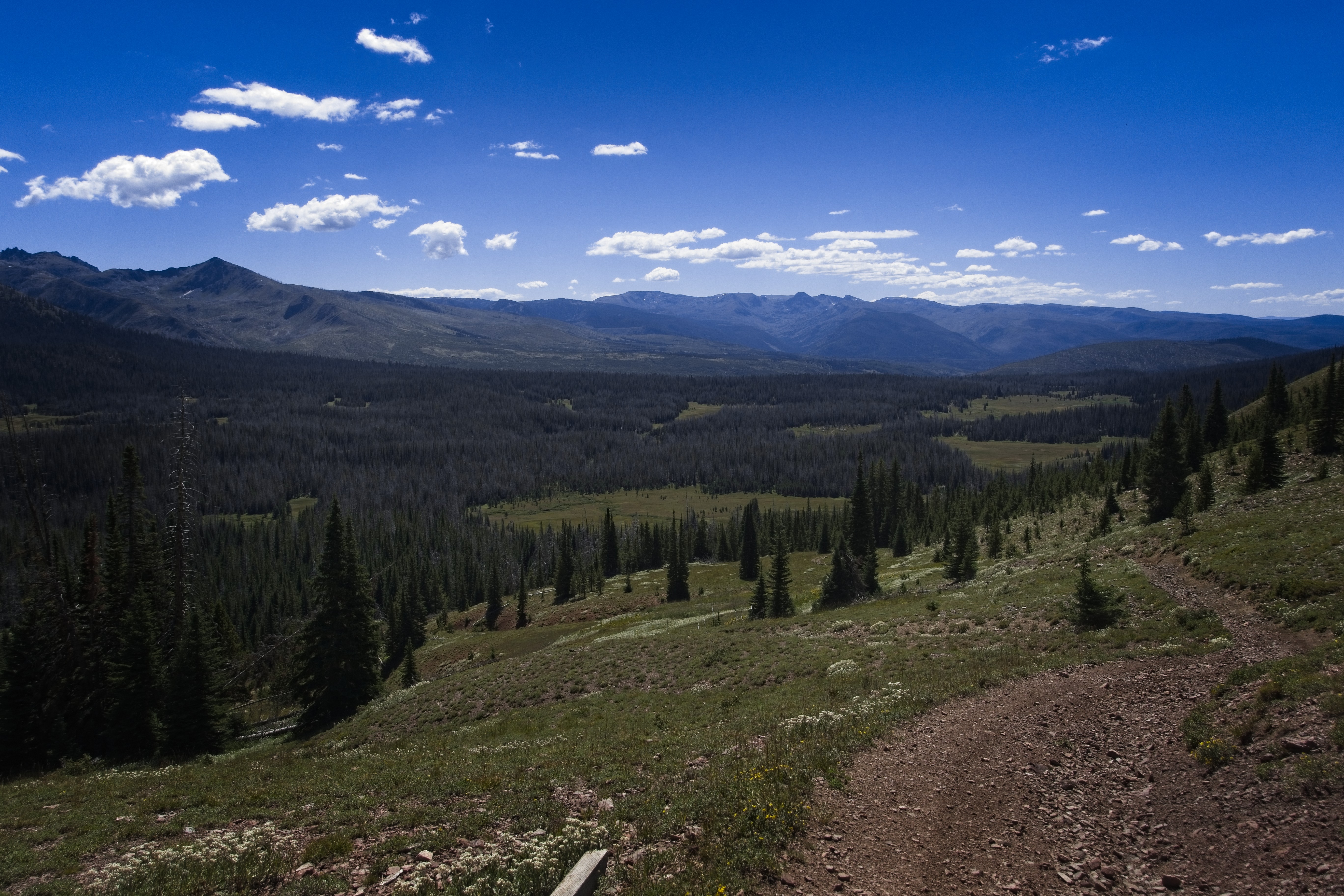
Gorgeous, long road, looking back north in this picture.
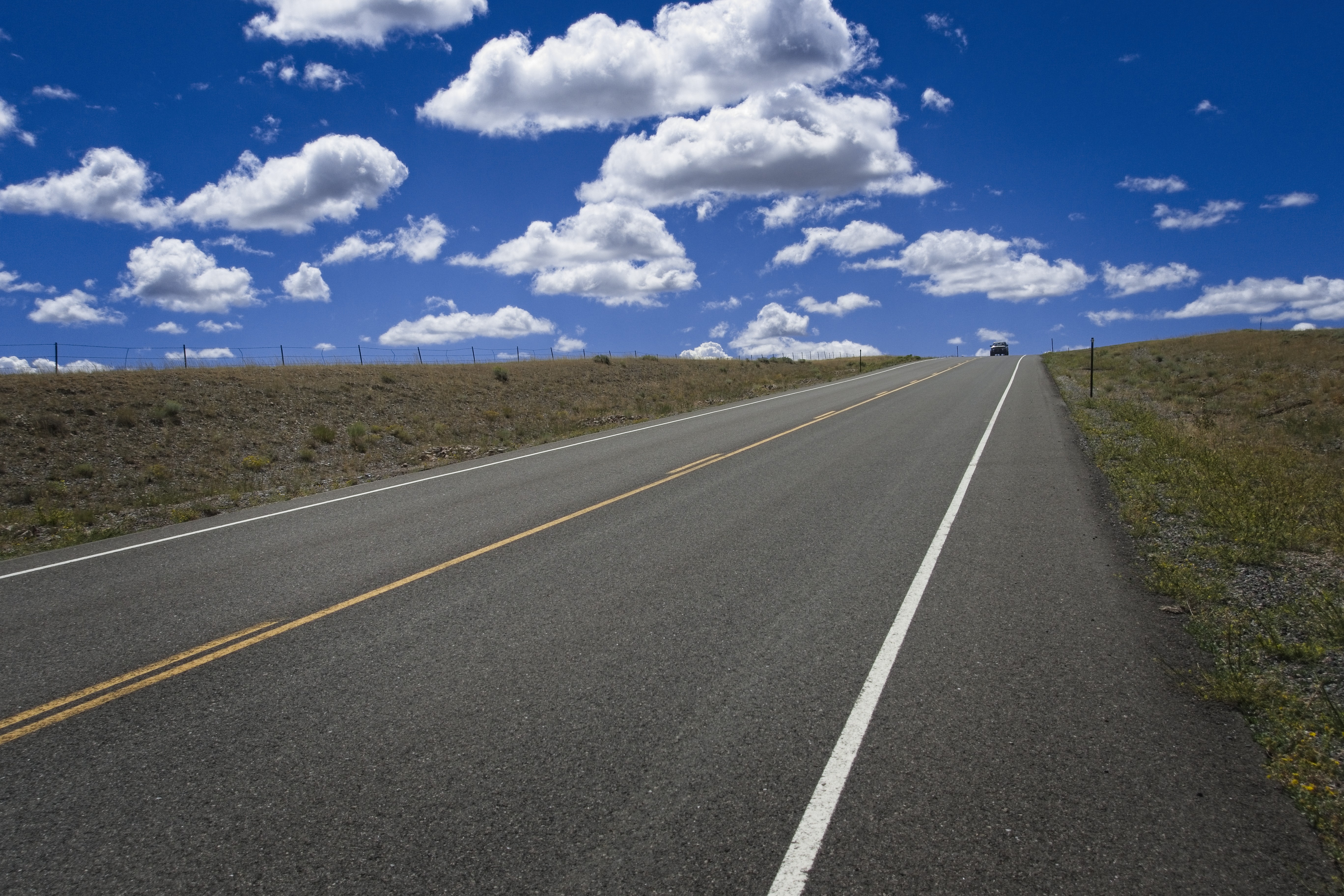
A friendly road too, a man stopped and gave me some water.
Note that this view is actually quite positive over the long run. When the elites see their ideas fail, they begin to think catastrophically and are full of "doom and gloom." When the pessimist (in regard to what men are capable of) sees a failing, he keeps walking, considering the why and how of the failure, and that if we should try again in this or that, how to do it differently.
The annoited ones seem to be planning mass suicide if Donald Trump wins the election. The pessimist however, is unphased. Maybe he doesn't understand why that particular man won the election, but somebody else did. He'll continue operating in his sphere of influence for the good. I've kind of had enough of the "hothouses" the elite create. They establish idols and worship them. It's very boring. I'm sympathetic to the idea that a modern problem is an overproduction of elites...of their opinions, flogged endlessly. Of their roles and programs, their time-wasting ideas about education.
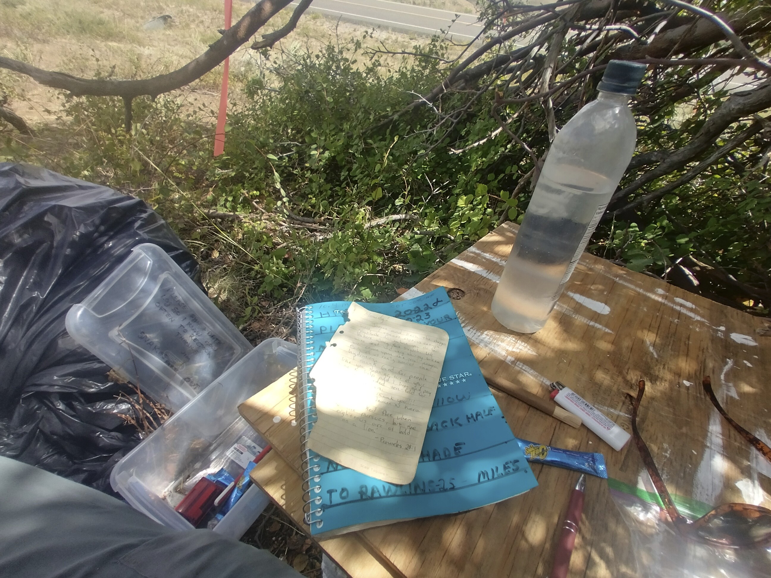
At the helpful water cache, reading and drinking.
A man brought a thru-hiker to a trail (I guess they decided to skip both the "redline" and the road too), stopped and gave me a bottle of water, then told me that a cache up ahead was fully stocked. Fantastic!
I ran into a few other hikers out here too. Nice conversations.
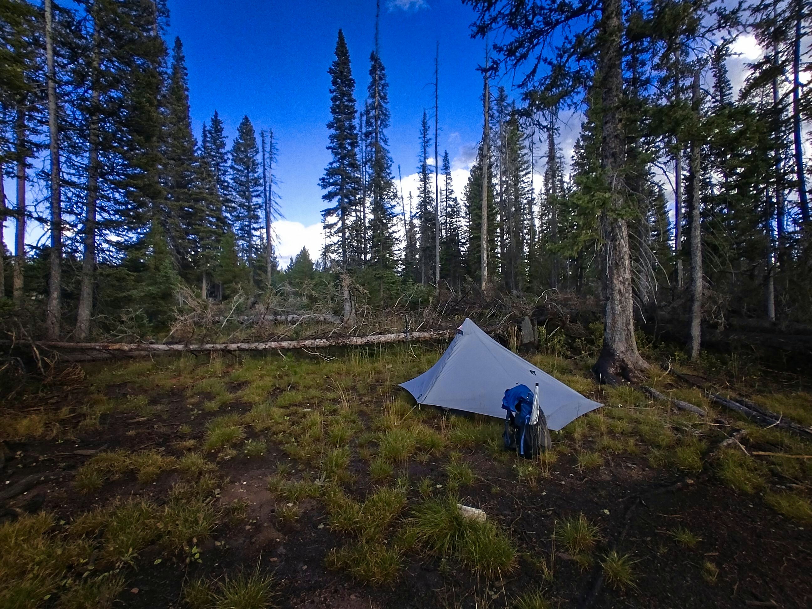
My camp for the night.
Finally as the sun went down I was able to turn left off the road and onto a dirt road leading up into the mountains. I climbed a bit, then came to a side trail with a beaver pond where I could get some water. Getting down to the pond was tricky, there were many brambles and steep slopes. Once there, I walked over the beaver's dam and got some cold water. The beaver got me back though, because I punched through a trap door and soaked one of my feet. "Dag nabbit!" I cried, but only the loons heard me (and a chuckling beaver nearby).
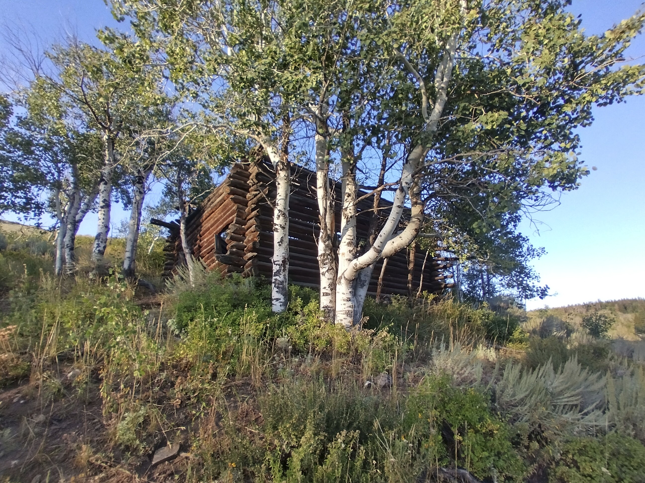
I set up my tent by an abandoned cabin above the beaver pond, and slept like a grateful baby.
August 27, Day 148
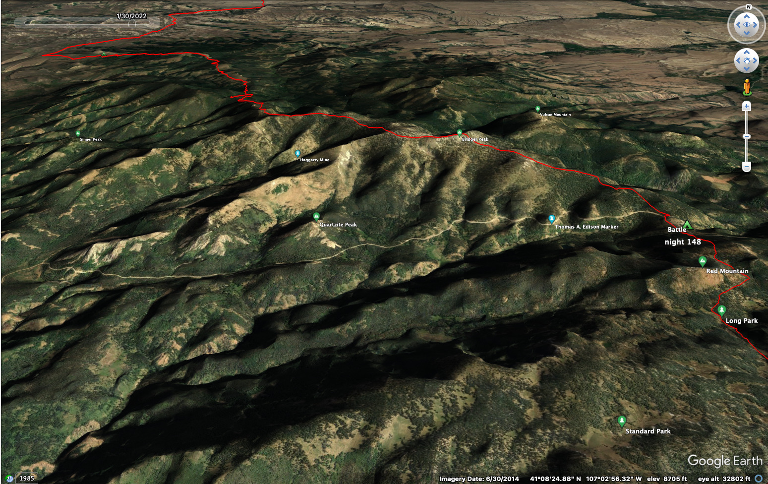
20.6 miles and 4420 feet elevation gain.
Today offered a mix of trail and roads climbing into the mountains. The weather was good, not too hot under the trees anyway, and by the time I was in the open a lot more I was above 10,000 feet and the temperature was cooler.
It was fun seeing the sere Basin recede into the haze, and peaks of Colorado appearing. I did see quite a bit of bear scat on the trail and ridge crest a bit north of Bridger Peak. Enough that it got me shouting out to the bears again like the old days in Montana.
A bit further on I was in a zone of 4-wheel-drive tracks sidehilling a mountain in forest below the crest. Pretty thirsty in here. Two couples came by in a 4-wheel-drive vehicle, bouncing slowly down the trail. The women in the back offered me an ice cold bottle of water. Thanks!
Up on Bridger Peak there was a radio tower. I skirted the very top (jaded), and made for a broad meadow looking out south towards Battle Pass and Colorado.
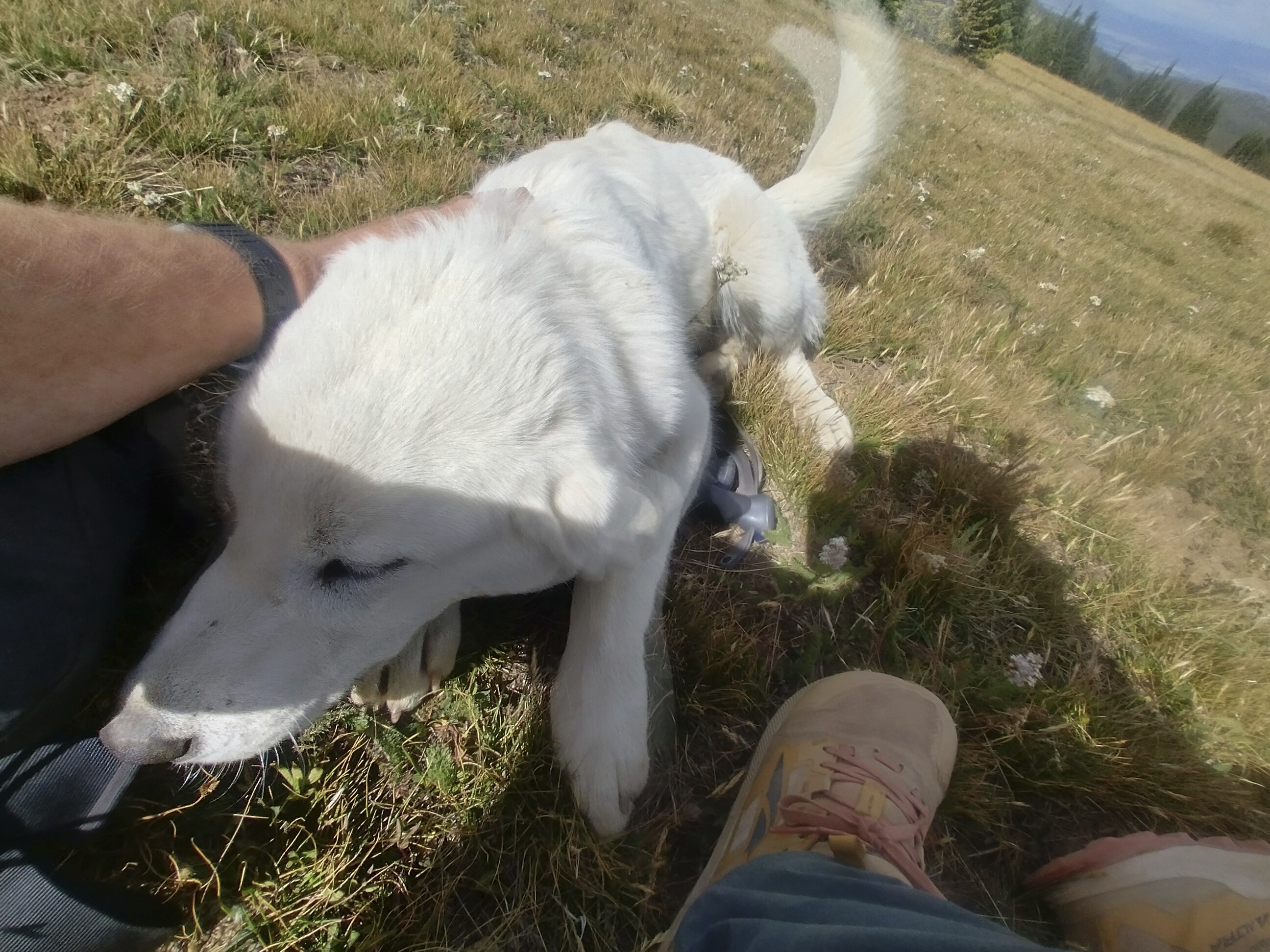
A sheepherders dog kept me company on Bridger Peak.
A friendly dog came over for some love. I never saw the sheep-herder, but in the next days, and even in New Mexico later, I'd hear about them. These guys speak no english and generally come from South America or Eastern Europe. I saw a nicely painted "gypsy" cart that someone could sleep in for a season.
Later, a day-hiker came by. She said that her family used to own this land, and she still comes up here now and then. She said she remembered when they built that gypsy cart, when she was a little girl.
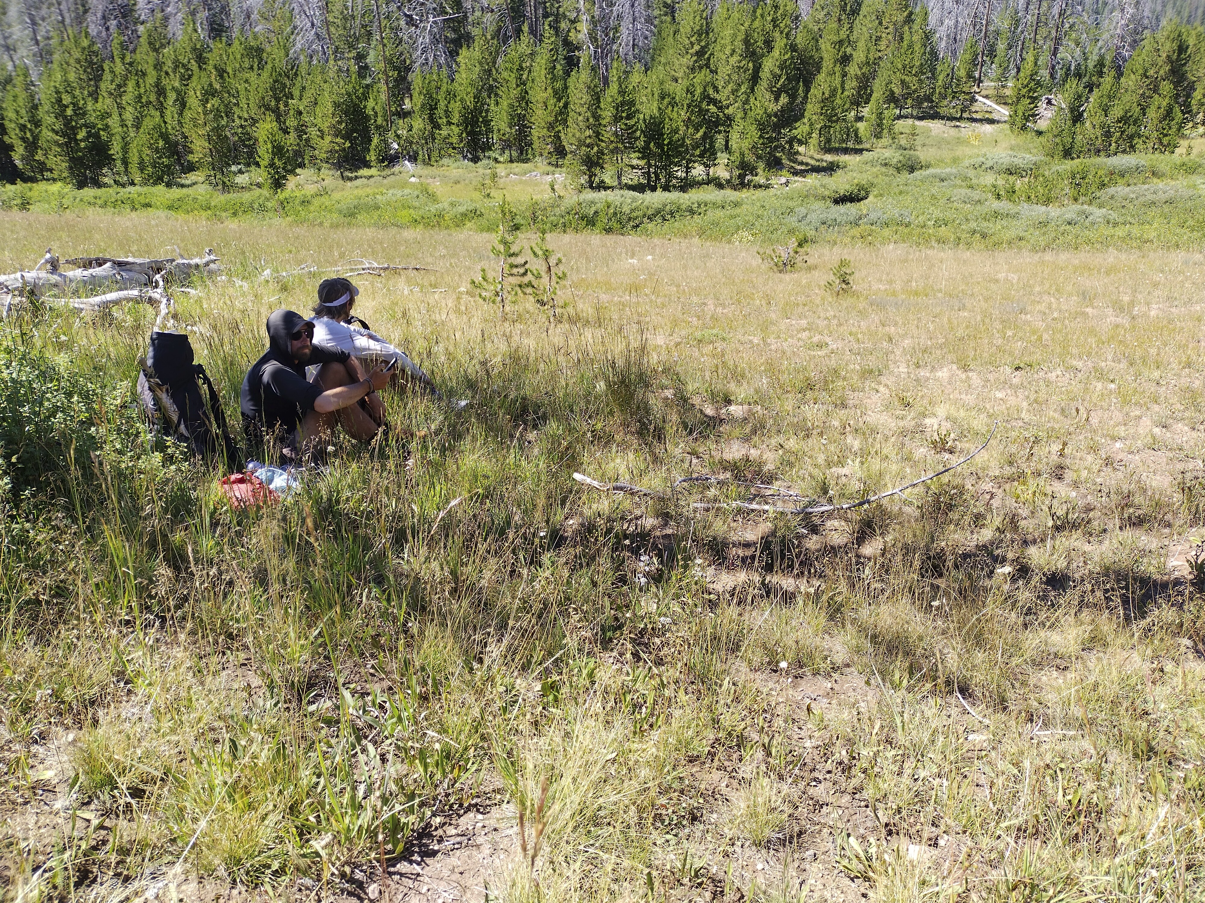
Two thru-hikers, Ghost and his friend (I forgot his trail name, darn it), arrived and we all sat in the early evening, admiring the view and petting the dog.
My humble camp at Battle Pass. Restroom nearby!
Finally I started down. I reached Battle Pass after a few miles and decided to camp here because there was a flat place in the forest, and a restroom. Neat!
August 28, Day 149
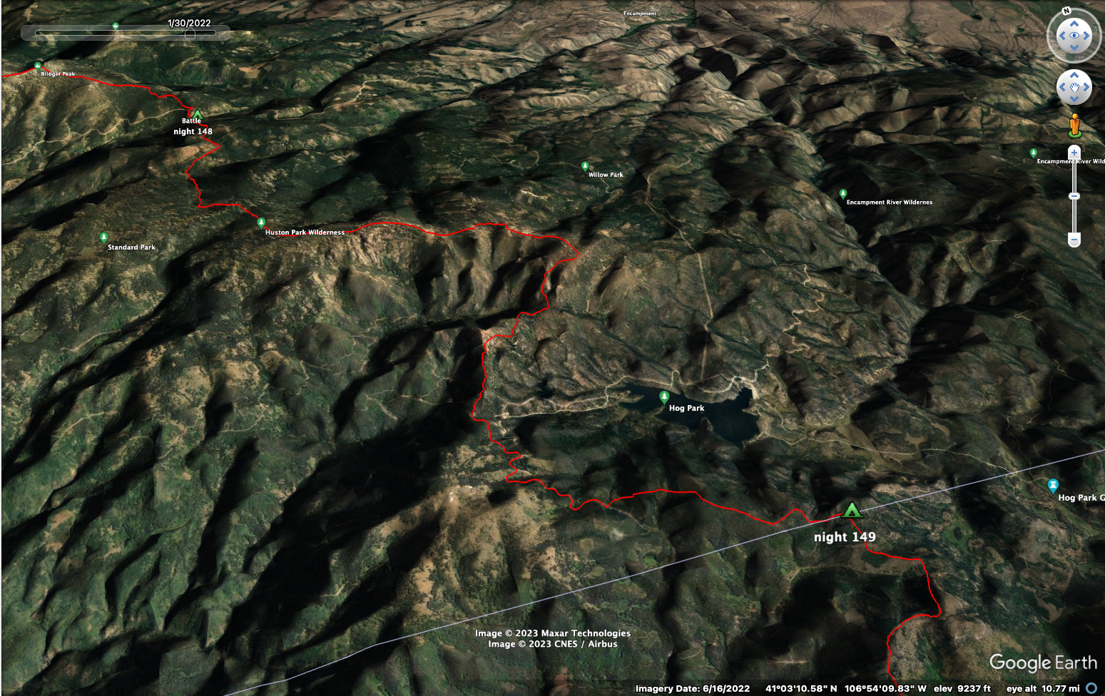
20 miles and 3040 feet elevation gain.
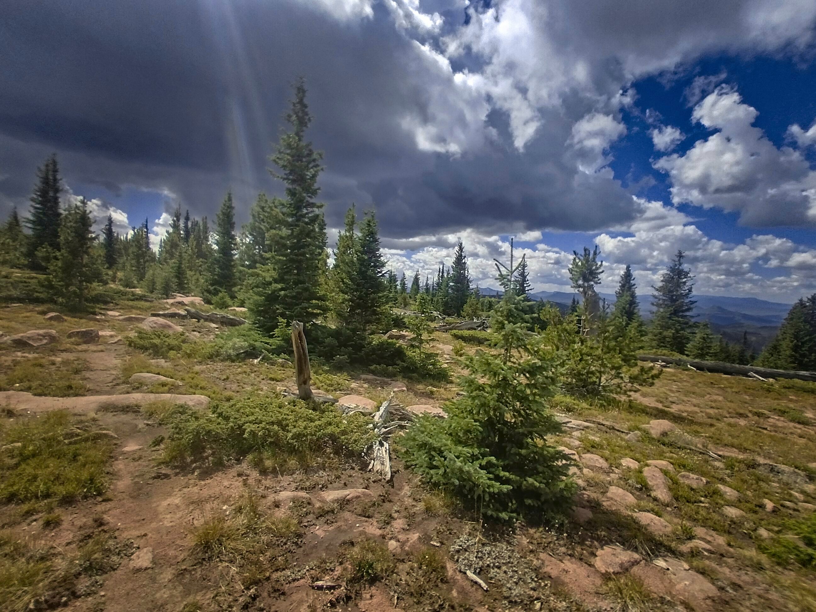
I left Battle Pass to the south, first checking for trail magic in a box beside the trail head. Nothing interesting. Then I entered a series of parks. Green open space with creeks burbling, surrounded by trees through which the trail wended. My feet were wet, but it was a nice reminder that I was back in the mountains.
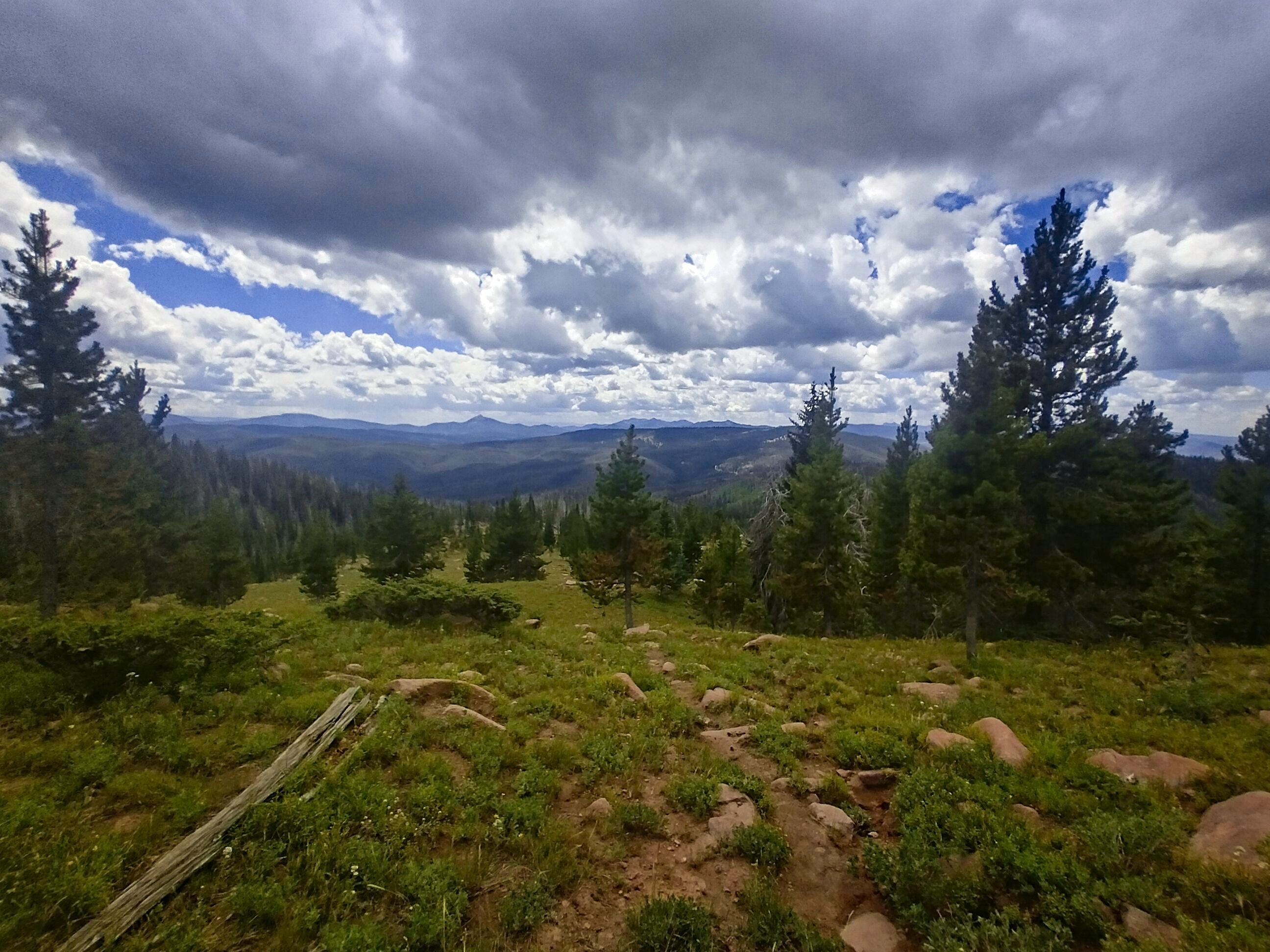
Clouds gathered as the day warmed. I was in high country of trees and rocky outcrops, slowly swinging east, south then back west above the large peaceful-looking Hog Park Reservoir. I hoped to get back down in the trees before the storm broke. It was more pleasant walking in forest when those come...
A storm approaches on the crest.
The way into Colorado leads down...temporarily!
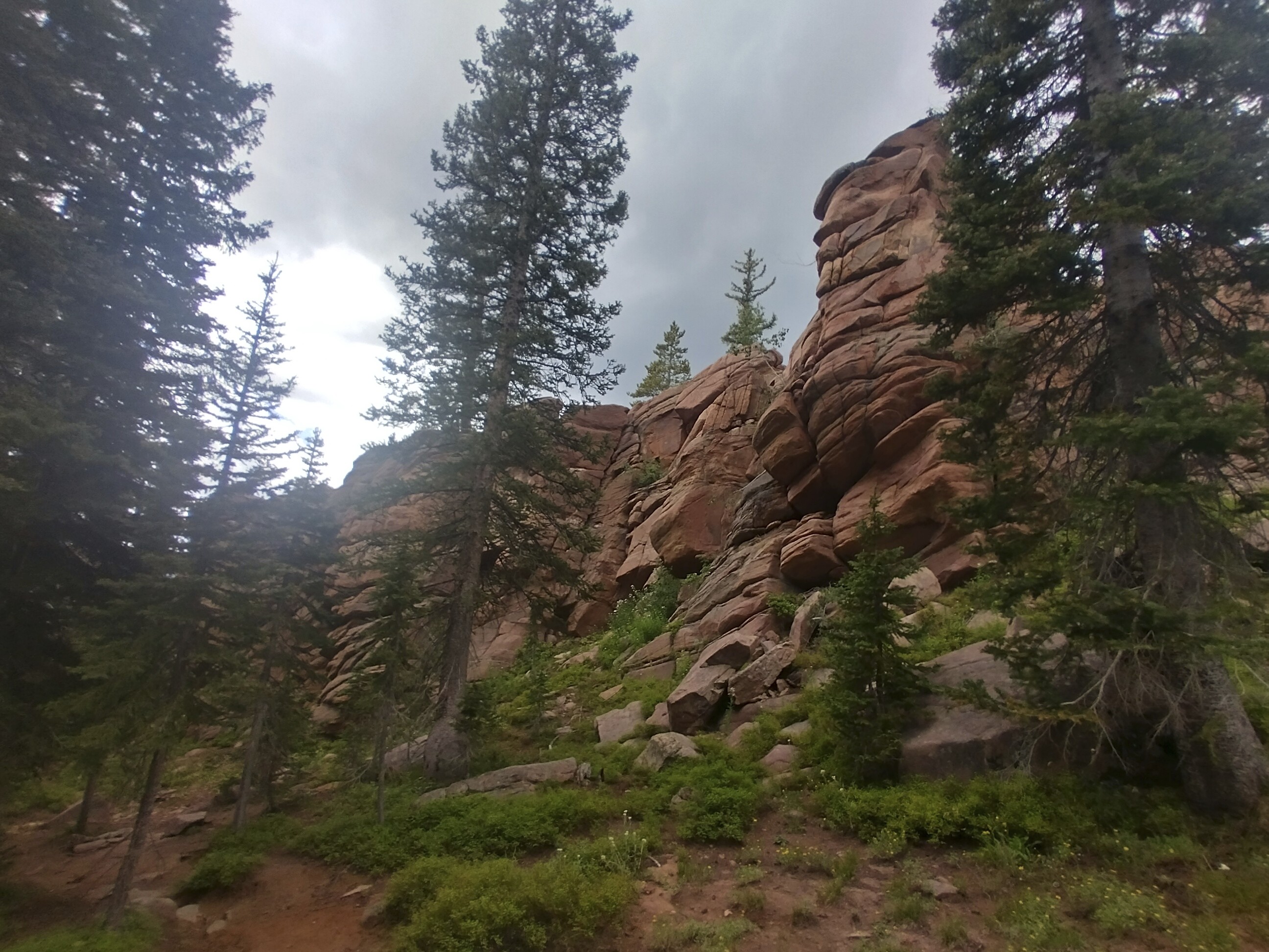
Very interesting cliffs coming down from Peak 10466 at the terminus of an
eastward swing of the trail.
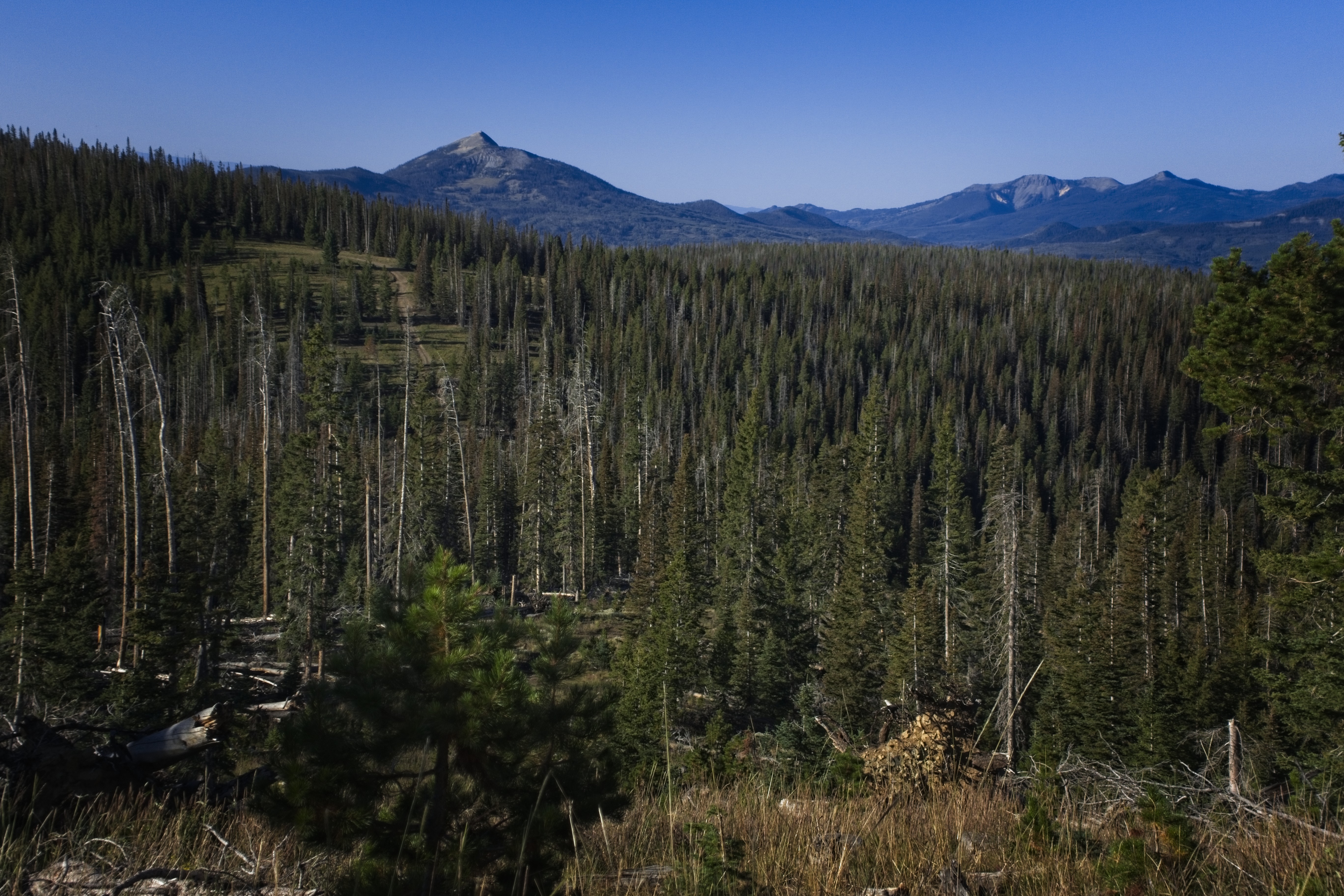
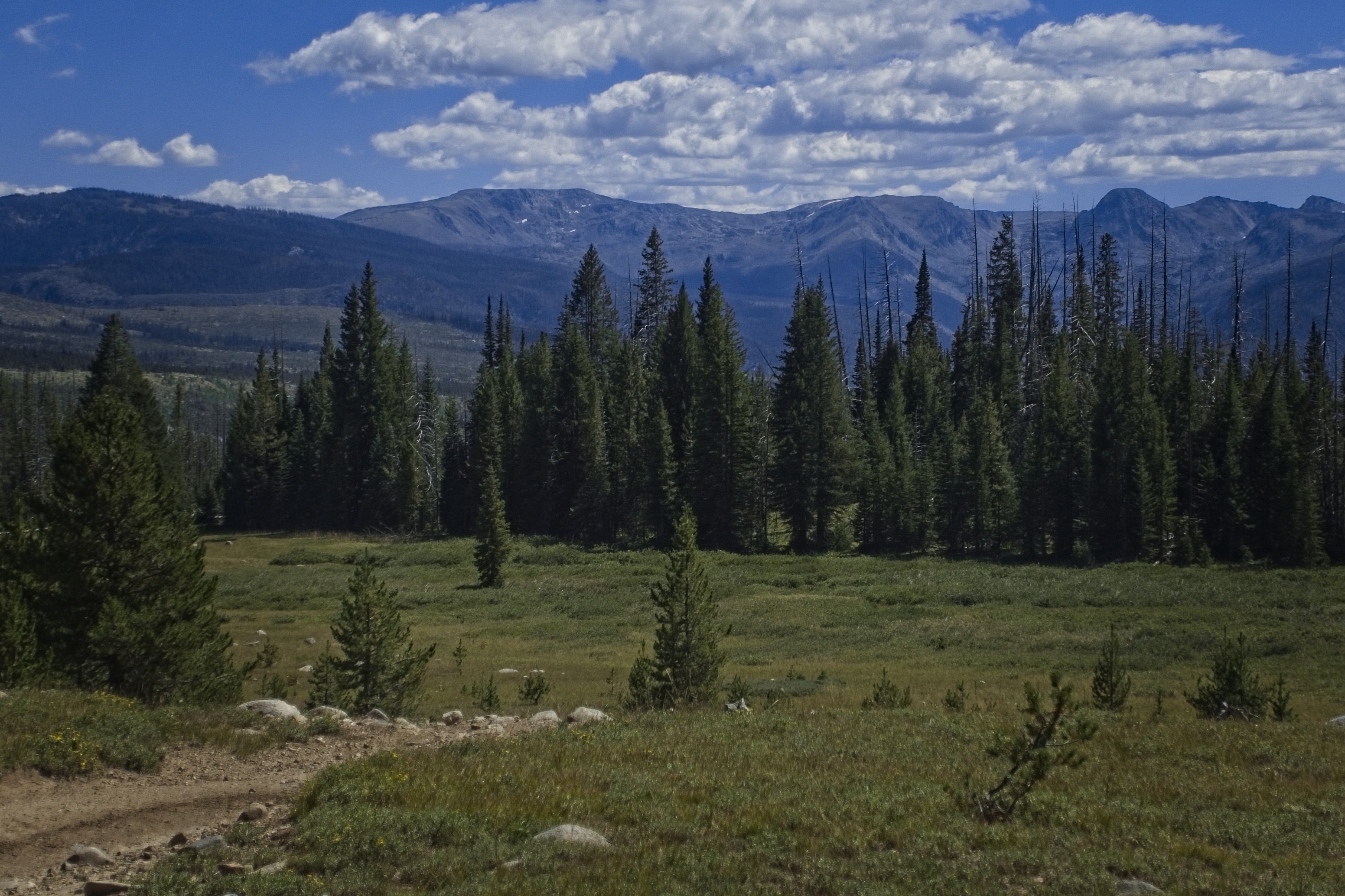
I hiked down past interesting cliffs, then journeyed on narrow trail in dense young forest on the south sides of several peaks. Eventually I was on a hogback ridge and came to a sunny dirt parking lot. I was in the Medicine Bow National Forest. Tonight, just over the border I'd be sleeping in the Routt National Forest...for the first time since July 2022.
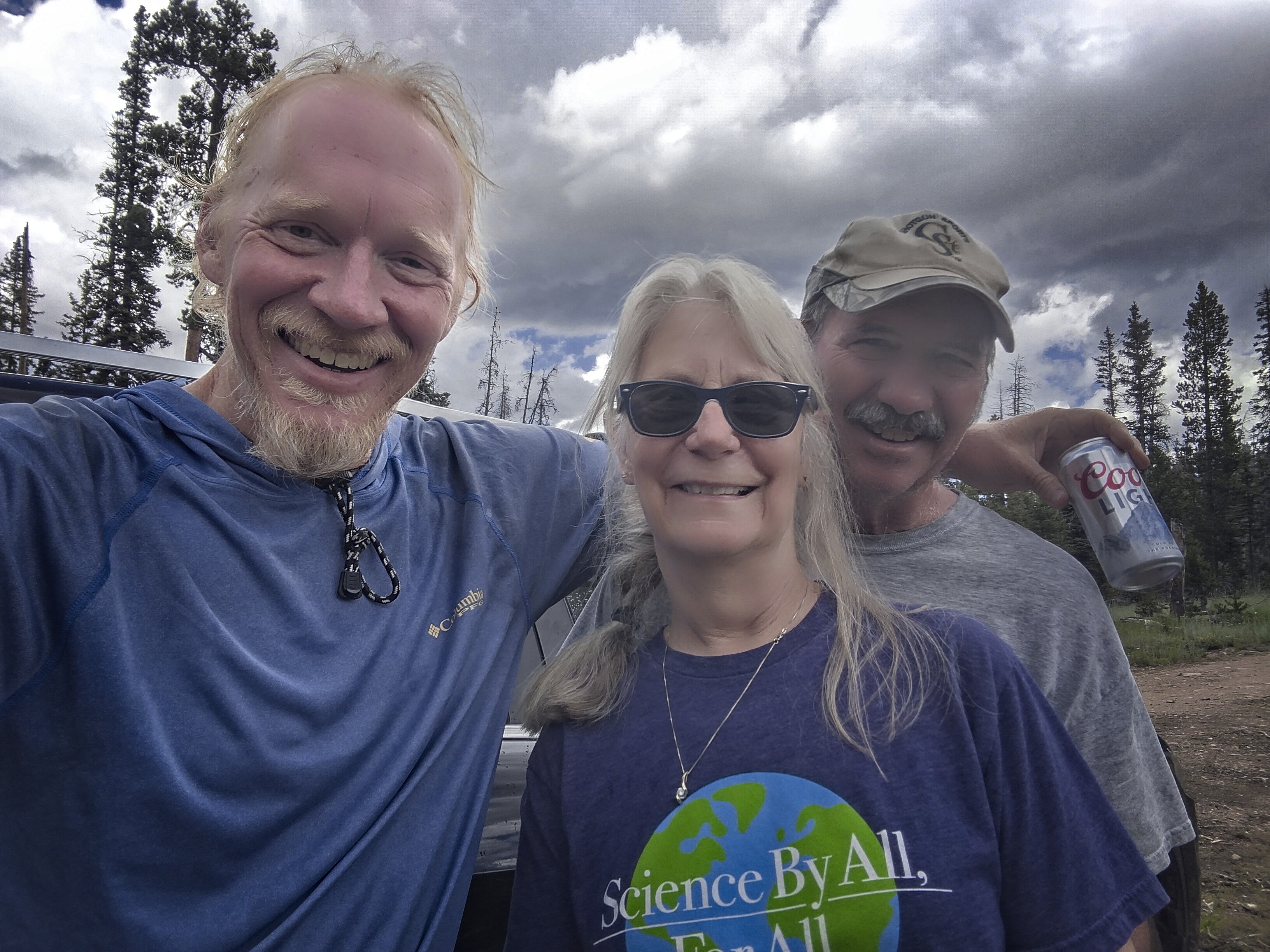
I rested awhile at a shady place then got ready to walk. But just then, a couple drove up in a sport utility vehicle. They saw that I was a thru-hiker and asked if I wanted a beer or a Coke. "A beer!" I answered, very happy to take the edge off the last miles of the day!
Trail magic at a road junction above Hog Park Reservoir.
We talked for a while. I was hoping someone else would show up to make their trip here worth it. But no one did. They were camping down at the Reservoir, and drove back there with a wave. Cool folks.
I had the choice of a 1000 foot climb up a peak then back to the road I was on or...just walk the road. Easy choice!
I listened to Thomas Sowells masterpiece of logic, erudition, and dare I say it, compassion. After an hour and a half it started raining pretty good. I turned off the road onto trail going east. Big machines were logging in the trees, and the clear cut was right near the trail.
I saw Ghost in here, he was waiting for his friend who went over the peak, while he'd taken the road like me.
Under the cover of trees at the edge of the clear cut, I took a break and organized for heavy rain, with jacket and umbrella at the ready. Then I walked a few miles as it sprinkled and rained by turn. I was on something the USGS maps call the "Fireline Trail."
The terrain became kind of scrubby, with many downed trees, young trees growing up and sharp rocks here and there. Where was I?
The Colorado border, baby!
How long have I dreamed of this place...
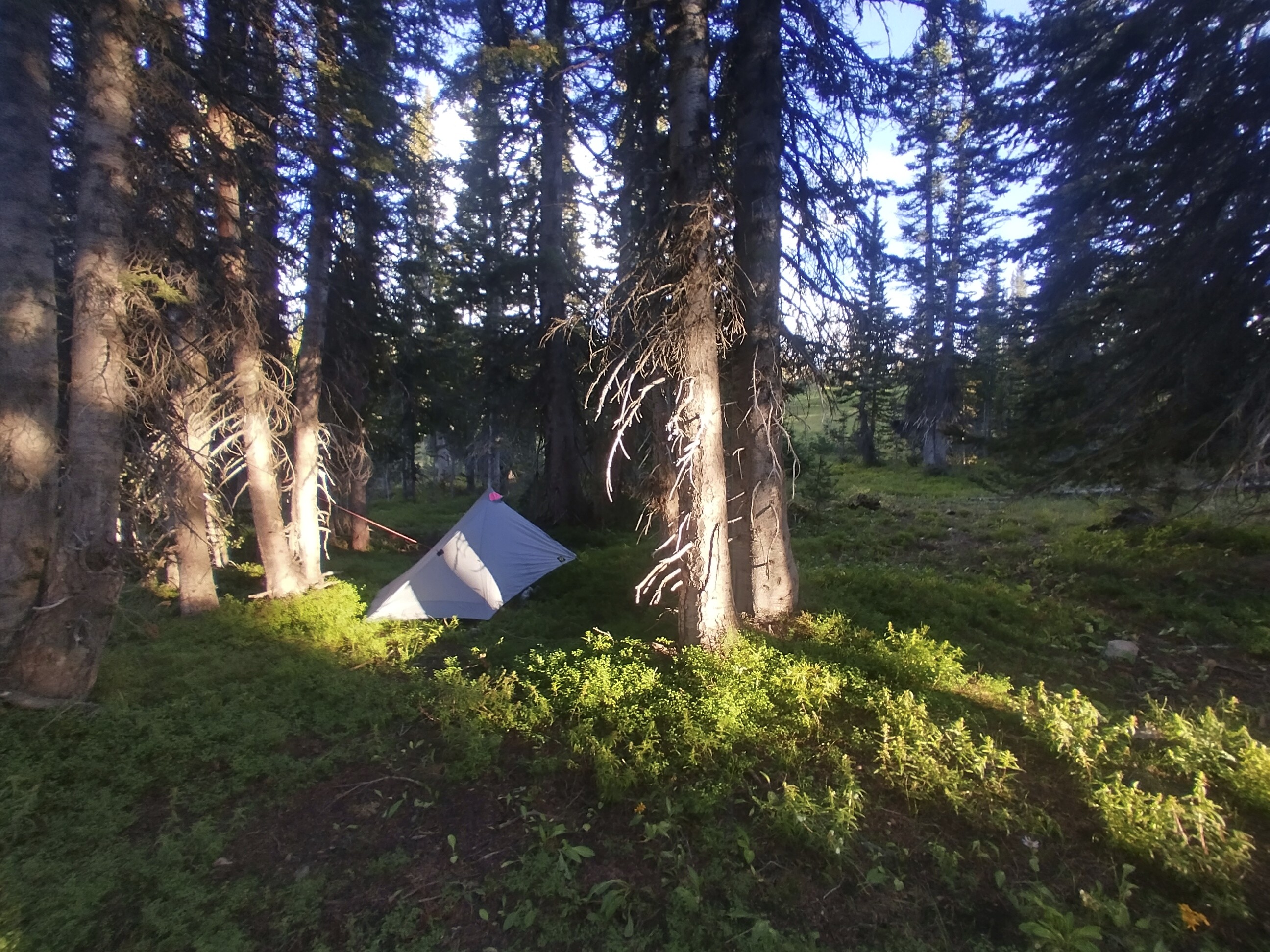
For now I didn't hang out, I just wanted to put up the tent while it wasn't raining hard. I walked about 3 minutes further on, then found a campsite. I set up, then heard voices back at the border. The rain had stopped. I went back there and chatted with Ghost and his friend. They took a picture of me here, and kept hiking, planning to sleep some miles up the trail.
My camp just inside Colorado.
I came back to my camp, ate dinner and smoked a cigar outside. Very happy to have completed this milestone.
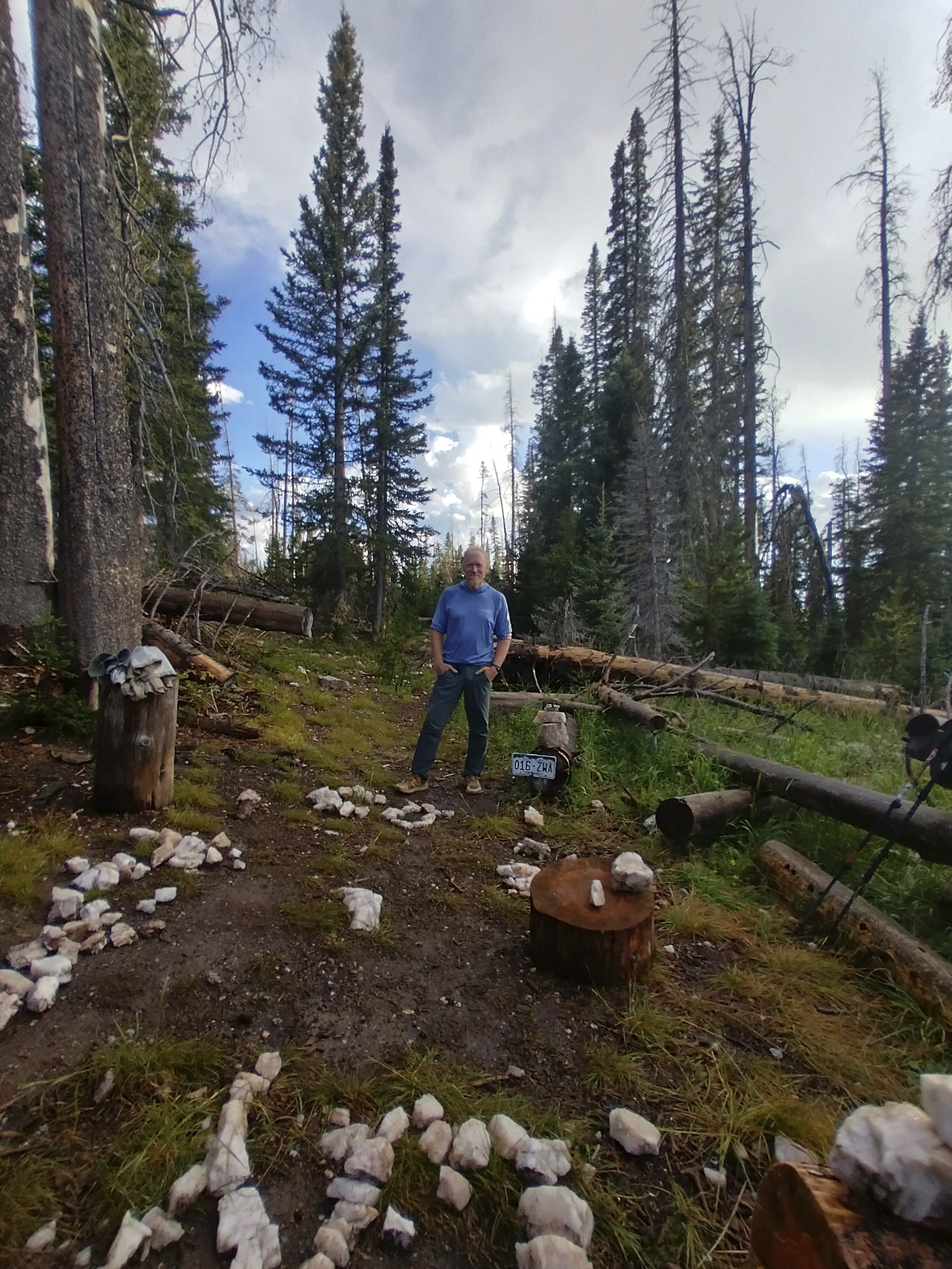
Two guys got a picture of me at the Colorado border.
August 29, Day 150
21.6 miles and 2800 feet elevation gain.
It would be a big day, but the last day in connecting the Canadian border to where I left off last year. I had no worries about hitching a ride from the Seedhouse Campground to Steamboat, though I probably should have considered that the high season was over. But I'll get to that later!
The trail swings down and up on the crest, heading south.
The morning was made difficult by a trail that climbed up and down and up again. It followed a sinewy ridge which twisted off to the west, then back east again. No switchbacks, just a line taking you up one side of a bump and down the other. I saw Ghost and his buddy often. A hiker named Lavendar and I made a rough plan to hitch out to Steamboat together if we arrived at Seedhouse together. That didn't end up working out, but hopefully they made it out okay.
Into the valley I last saw in 2022...
Ghost and X (forgot his trail name!). We had a long talk here.
We came gradually down from high country into a gorgeous parkland. Ghost had a fly fishing rod and set up to catch some fish, while his friend and I and Lavendar rested in a small patch of shade on the south side of the river. This must have been at the crossing of Trail Creek above Diamond Park.
The last miles to the Seedhouse Campground.
The final journey was hot and somewhat tiring. But I started moving quickly as I approached the scant buildings and road of the Seedhouse Campground. Somehow I thought it would be a momentous place. Who would greet me in triumph?!
Haha, no one. I wandered around on the road and saw no cars, no campers. Wow. What a difference from the bustling location of mid-July. I started to fear how I might make it to town. Suddenly a car came up and I stuck out my thumb rather desperately. "Oh please oh please!" was my thinking...
A kind couple were driving. They heard my story of the long hike and agreed to give me a ride down the road to the Clark Store. Last year I'd gotten a hitch from there after buying some snacks. That sounded great. But by the time we got to talking, they were happy to take me another 20 minutes further down to Steamboat Springs.
Okay that was incredibly kind. Man...I just was so lucky because of the kindness of people who went out of their way for me.
Friendly people will help you out, and you'll be amazed every time.
To go forward to days 153 and after, click here.